Waiteshill Plantation

Wood, Forest in Gloucestershire Stroud

England

Waiteshill Plantation

The lane to Edgeworth
The lane to Edgeworth Credit: David Purchase

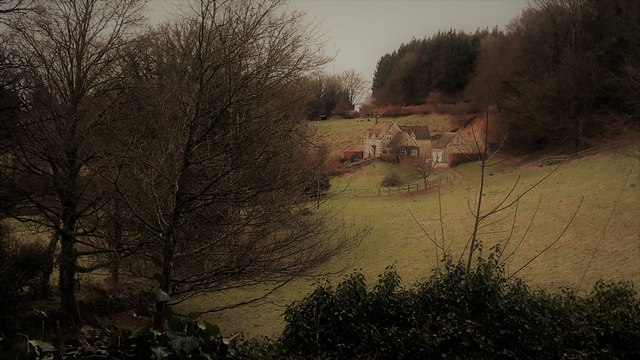
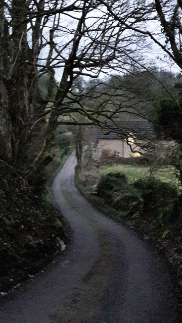
Waiteshill Plantation is a picturesque woodland area located in the county of Gloucestershire, England. Situated near the village of Waiteshill, the plantation covers a vast expanse of approximately 500 acres, making it one of the largest woodlands in the region.

The plantation is primarily made up of oak and beech trees, with a diverse range of other species also present, including ash, birch, and hazel. The dense canopy of these trees creates a serene and tranquil atmosphere, making it a popular destination for nature enthusiasts and hikers alike.

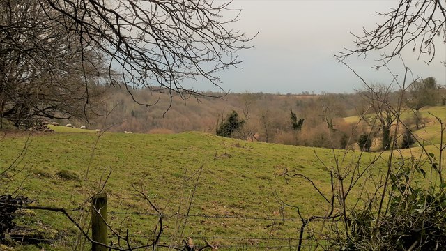
Waiteshill Plantation is home to a rich variety of wildlife, with numerous species of birds, mammals, and insects thriving within its boundaries. Visitors may catch a glimpse of woodland creatures such as deer, badgers, and foxes, as well as a wide array of bird species, including woodpeckers, owls, and various songbirds.

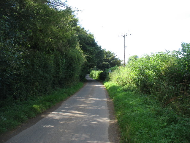
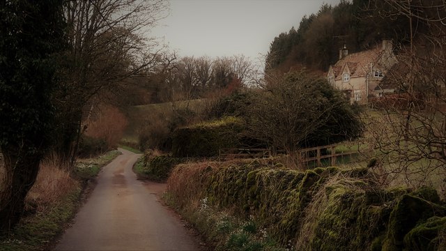
The woodland is crisscrossed by a network of well-maintained footpaths, providing visitors with the opportunity to explore the plantation's natural beauty. The paths wind through the trees, offering breathtaking views and ample opportunities for peaceful walks or invigorating hikes.

In addition to its natural attractions, Waiteshill Plantation also serves as an important site for conservation efforts. The woodland is managed sustainably, ensuring the preservation of its ecological balance and promoting biodiversity.

Overall, Waiteshill Plantation is a haven for nature lovers, offering a serene escape from the hustle and bustle of everyday life. Whether it's a leisurely stroll or an immersive exploration, this woodland provides an enchanting experience for visitors of all ages.

If you have any feedback on the listing, please let us know in the comments section below.

Waiteshill Plantation Images

Images are sourced within 2km of 51.767634/-2.081683 or Grid Reference SO9407. Thanks to Geograph Open Source API. All images are credited.

The lane to Edgeworth
Edgeworth, the valley from the top of School Lane School Lane connects the two clusters of Edgeworth through a steep combe.
Edgeworth, the valley from the top of School Lane
School Lane connects the two clusters of Edgeworth through a steep combe.
Pastures at Edgeworth Looking from School Lane to the far hillside of the upper Frome valley.
Pastures at Edgeworth
Looking from School Lane to the far hillside of the upper Frome valley.
School Lane, Edgeworth
School Lane, Edgeworth Looking north from close to the church and manor house end of the lane.
School Lane, Edgeworth
Looking north from close to the church and manor house end of the lane.
Edgeworth Manor The west front, facing the church, dates from the end of the nineteenth century.
Edgeworth Manor
The west front, facing the church, dates from the end of the nineteenth century.
St Mary's church, Edgeworth
St Mary, Edgeworth St Mary's has a Saxon and Norman nave and was drastically restored in 1869-72 with a rood screen added in 1885.
St Mary, Edgeworth
St Mary's has a Saxon and Norman nave and was drastically restored in 1869-72 with a rood screen added in 1885.
Rood screen and loft in St Mary's, Edgeworth Dating from 1885, the deeply cusped tracery echoes the stone chancel rere-arches of 1872.
Rood screen and loft in St Mary's, Edgeworth
Dating from 1885, the deeply cusped tracery echoes the stone chancel rere-arches of 1872.
Chancel at St Mary, Edgeworth The Victorian east window sits above a tiny Norman slit window with 1957 stained glass by the local artist Edward Payne.  All the chancel windows have rere-arches, as do the sedilia, piscina on the right.  A formidable Victorian performance, but what a pity that it extended to scraping the walls.
Chancel at St Mary, Edgeworth
The Victorian east window sits above a tiny Norman slit window with 1957 stained glass by the local artist Edward Payne. All the chancel windows have rere-arches, as do the sedilia, piscina on the right. A formidable Victorian performance, but what a pity that it extended to scraping the walls.
Cusping in St Mary's Two windows, an altar rail and a rood screen all decorated the same way.
Cusping in St Mary's
Two windows, an altar rail and a rood screen all decorated the same way.
Mediaeval stained glass in the chancel of St Mary's Edgeworth
Nave bench ends in St Mary's, Edgeworth From the restoration of 1869-72.  They are labelled with names of estate properties, allocating where the estate staff were to sit.  The elongated poppy heads are an individual touch.
Nave bench ends in St Mary's, Edgeworth
From the restoration of 1869-72. They are labelled with names of estate properties, allocating where the estate staff were to sit. The elongated poppy heads are an individual touch.
Pews in St Mary's, Edgeworth
The Garden at Miserden: Garden requisites defying gravity on the tearoom wall
The Garden at Miserden: Entrance to the walled garden
The Garden at Miserden: Mixed borders
The Garden at Miserden: Mixed borders and Edwin Lutyens part designed topiary beyond
Show me another place!

Waiteshill Plantation is located at Grid Ref: SO9407 (Lat: 51.767634, Lng: -2.081683)

Administrative County: Gloucestershire

District: Stroud

Police Authority: Gloucestershire

What 3 Words

///mobile.steeped.blunders. Near Chalford, Gloucestershire

Related Wikis

Miserden War Memorial

Miserden War Memorial is a First World War memorial in the village of Miserden, near Stroud, in Gloucestershire, south-western England. The memorial, designed...

Edgeworth, Gloucestershire

Edgeworth is a small village and civil parish in the English county of Gloucestershire. It is located east of Stroud, west of Cirencester and south of...

Miserden Castle

Miserden Castle was a castle near the village of Miserden in Gloucestershire, England. The castle is a large motte and bailey Norman castle, built before...

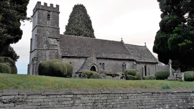
Church of St Mary, Edgeworth

The Anglican Church of St Mary at Edgeworth in the Cotswold District of Gloucestershire, England was built in 11th century. It is a grade I listed building...

Edgeworth Manor

Edgeworth Manor is a Grade II* listed country house in Edgeworth, Gloucestershire, England. It was mentioned in the Domesday Book, when it was held by...

Miserden

Miserden is a village and civil parish in Stroud District, Gloucestershire, England, 4 miles north east of Stroud. The parish includes Whiteway Colony...

Juniper Hill, Edgeworth

Juniper Hill, Edgeworth (SO928058 and SO928064) is an 11.25-hectare (27.8-acre) biological Site of Special Scientific Interest in Gloucestershire, notified...

Winstone

Winstone is a village and civil parish in the English county of Gloucestershire. The population taken at the 2011 census was 270.Winstone forms part of...

Nearby Amenities

Located within 500m of 51.767634,-2.081683
Ashcombe Bottom
Is In: Gloucestershire, England, UK
Is In Parish: Edgeworth
Place: locality
Lat/Long: 51.7651384/-2.0876756
Power: pole
Lat/Long: 51.7712417/-2.0775225
Power: pole
Lat/Long: 51.7713537/-2.0792901
Power: pole
Lat/Long: 51.7714227/-2.0804689
Natural: spring
Lat/Long: 51.7715811/-2.0822054
Power: pole
Lat/Long: 51.769728/-2.0873901
Power: pole
Lat/Long: 51.7691675/-2.0871375
Power: pole
Lat/Long: 51.7674362/-2.0867185
Power: pole
Lat/Long: 51.7667155/-2.0865336
Natural: spring
Lat/Long: 51.7682062/-2.08488
The data included in this document is from www.openstreetmap.org. The data is made available under ODbL.

Have you been to Waiteshill Plantation?

Leave your review of Waiteshill Plantation below (or comments, questions and feedback).