Turn Slack Clough

Valley in Lancashire

England

Turn Slack Clough

Ross Ices - old ice cream sign
Ross Ices - old ice cream sign Credit: michael ely

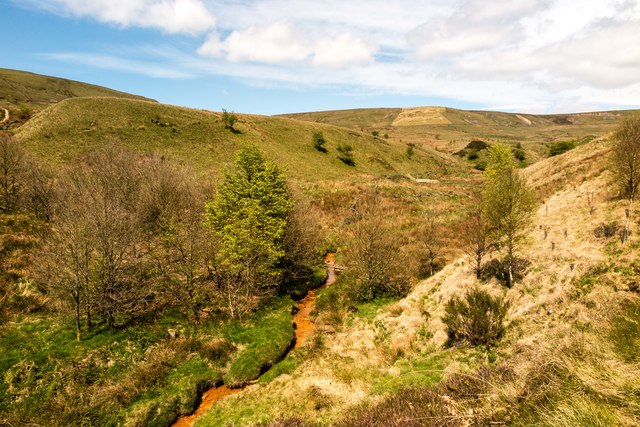
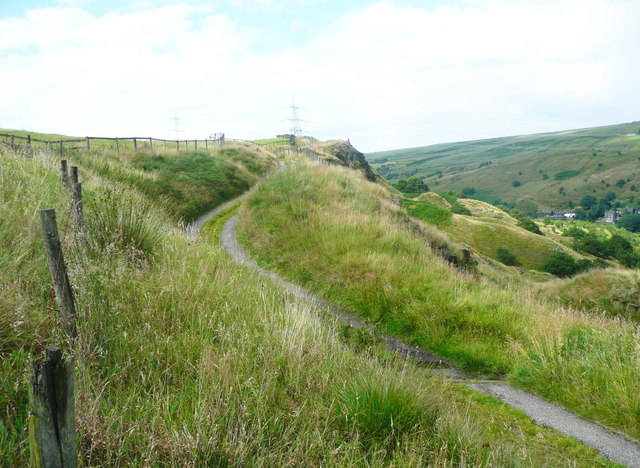
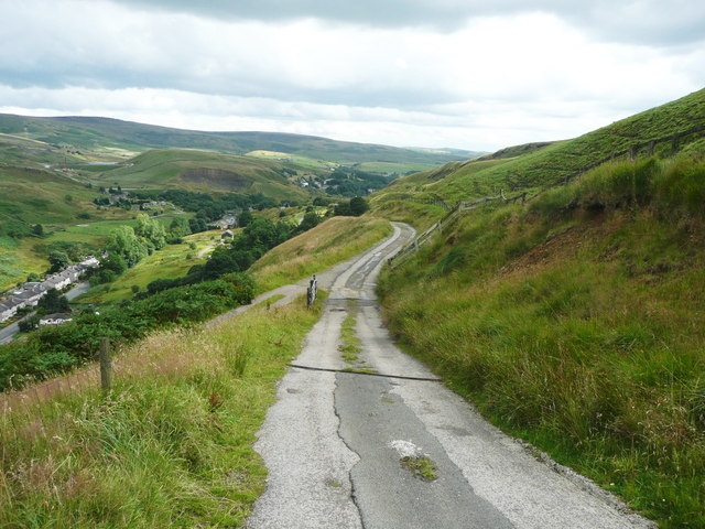
Turn Slack Clough is a picturesque valley located in the county of Lancashire, England. Nestled in the rugged Pennine Hills, this tranquil valley is renowned for its natural beauty and rich history.

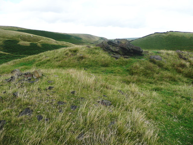
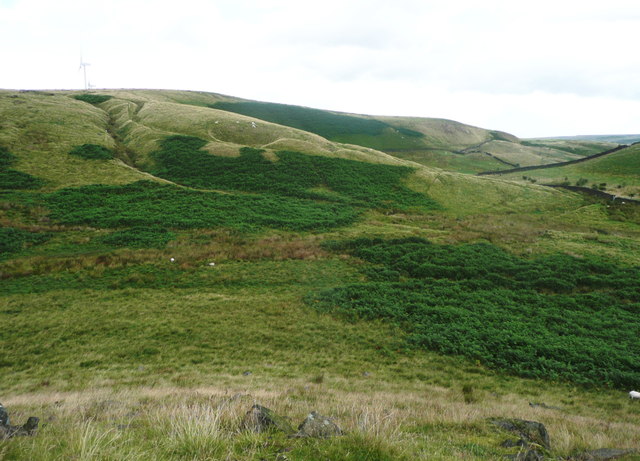
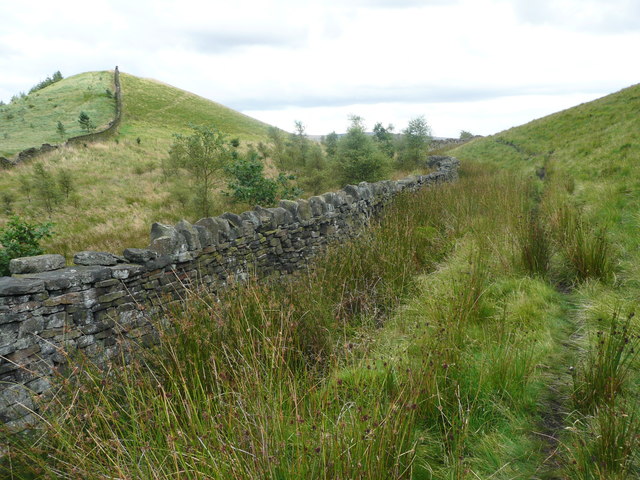
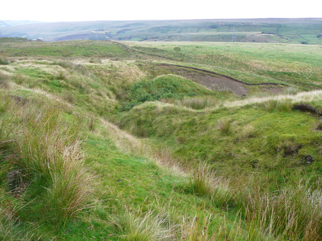
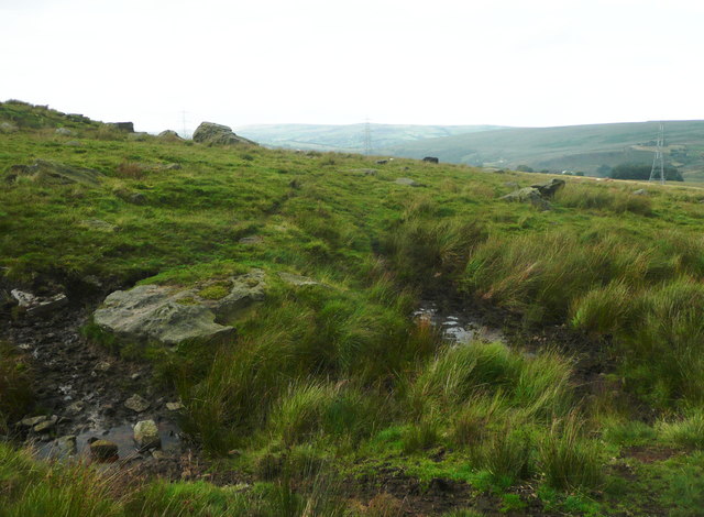
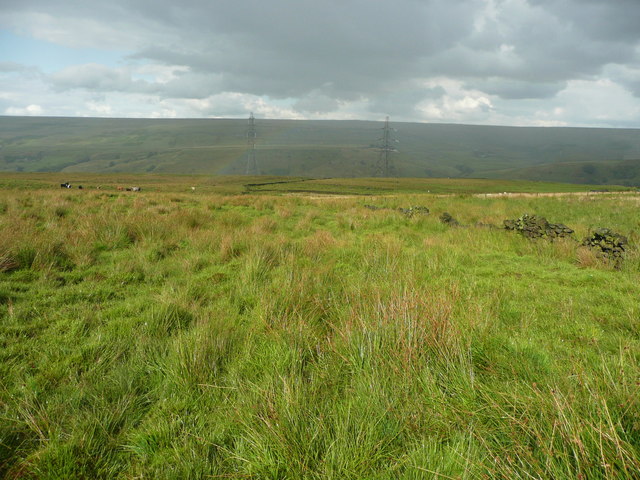
The valley is characterized by its steep slopes, dense woodland, and meandering streams, which create a diverse and vibrant ecosystem. The area is teeming with wildlife, including various bird species, small mammals, and rare plant species that thrive in the lush surroundings.

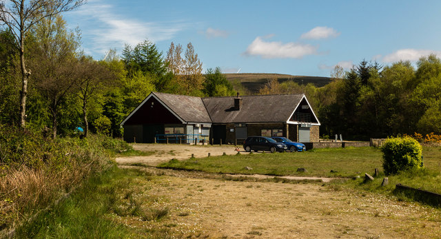
Turn Slack Clough is a popular destination for outdoor enthusiasts and nature lovers. The valley offers numerous walking trails and hiking routes, allowing visitors to explore its enchanting landscapes and breathtaking views. The peaceful ambiance of the valley provides the perfect escape from the hustle and bustle of city life, attracting visitors who seek serenity and solitude.

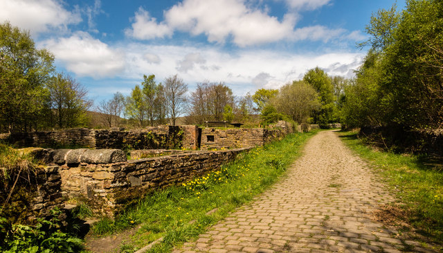
In addition to its natural beauty, Turn Slack Clough also holds historical significance. The valley has been inhabited for centuries, with evidence of human presence dating back to the Roman era. Ruins of old mills and farmsteads can still be found in the area, serving as a reminder of Lancashire's industrial heritage.

Overall, Turn Slack Clough, Lancashire is a hidden gem that offers a harmonious blend of natural splendor and historical charm. Whether you are an avid hiker, a wildlife enthusiast, or simply seeking a peaceful retreat, this valley is sure to captivate your senses and leave you with lasting memories.

If you have any feedback on the listing, please let us know in the comments section below.

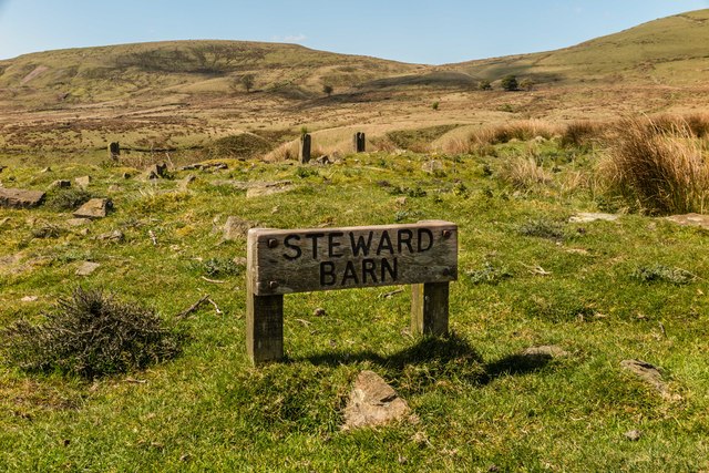
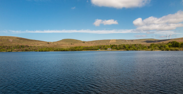
Turn Slack Clough Images

Images are sourced within 2km of 53.6648/-2.1136631 or Grid Reference SD9218. Thanks to Geograph Open Source API. All images are credited.

Ross Ices - old ice cream sign
Shore Moor Crook Hill Wind Farm on Shore Moor.
Shore Moor
Crook Hill Wind Farm on Shore Moor.
Watergrove History Wall, greater (northern) part The Watergrove History Wall, situated on the east side of Watergrove Reservoir at the southern end of the reservoir, includes several date stones from Watergrove village buildings and surrounding farmsteads that were demolished during the construction of Rochdale Corporation's Watergrove Reservoir in the 1930s.

The image is a composite of 18 photographs produced using Microsoft's ICE (Image Composite Editor) software.

The wall is approximately 170 ft long; this image is the northern 110 ft part.  The wall is divided by adjacent fencing.

The 60 ft lesser (southern) part of the wall is illustrated in the Geograph:

                  <a title="https://www.geograph.org.uk/photo/5163265" href="https://www.geograph.org.uk/photo/5163265">Link</a>
Watergrove History Wall, greater (northern) part
The Watergrove History Wall, situated on the east side of Watergrove Reservoir at the southern end of the reservoir, includes several date stones from Watergrove village buildings and surrounding farmsteads that were demolished during the construction of Rochdale Corporation's Watergrove Reservoir in the 1930s. The image is a composite of 18 photographs produced using Microsoft's ICE (Image Composite Editor) software. The wall is approximately 170 ft long; this image is the northern 110 ft part. The wall is divided by adjacent fencing. The 60 ft lesser (southern) part of the wall is illustrated in the Geograph: Link
Watergrove History Wall, lesser (southern) part The Watergrove History Wall, situated on the east side of Watergrove Reservoir at the southern end of the reservoir, includes several date stones from Watergrove village buildings and surrounding farmsteads that were demolished during the construction of Rochdale Corporation's Watergrove Reservoir in the 1930s.

The image is a composite of 6 photographs produced using Microsoft's ICE (Image Composite Editor) software.

The wall is approximately 170 ft long; this image is the southern 60 ft part.  The wall is divided by adjacent fencing.

The 110 ft greater (northern) part of the wall is illustrated in the Geograph:

       <a title="https://www.geograph.org.uk/photo/5163240" href="https://www.geograph.org.uk/photo/5163240">Link</a>
Watergrove History Wall, lesser (southern) part
The Watergrove History Wall, situated on the east side of Watergrove Reservoir at the southern end of the reservoir, includes several date stones from Watergrove village buildings and surrounding farmsteads that were demolished during the construction of Rochdale Corporation's Watergrove Reservoir in the 1930s. The image is a composite of 6 photographs produced using Microsoft's ICE (Image Composite Editor) software. The wall is approximately 170 ft long; this image is the southern 60 ft part. The wall is divided by adjacent fencing. The 110 ft greater (northern) part of the wall is illustrated in the Geograph: Link
Steward Barn The remains of Steward Barn above Watergrove Reservoir.
Steward Barn
The remains of Steward Barn above Watergrove Reservoir.
Higher Slack Brook Higher Slack Brook above Watergrove Reservoir.
Higher Slack Brook
Higher Slack Brook above Watergrove Reservoir.
Watergrove Reservoir Sailing Club House at Watergrove Reservoir.
Watergrove Reservoir
Sailing Club House at Watergrove Reservoir.
Ramsden Road Remains of the Little Town farmstead alongside Ramsden Road.
Ramsden Road
Remains of the Little Town farmstead alongside Ramsden Road.
Watergrove Reservoir View looking across Watergrove Reservoir from the dam.
Watergrove Reservoir
View looking across Watergrove Reservoir from the dam.
Recreation Ground, Calderbrook
The summit of Cuckoo Hill, Littleborough A nice little hill, without a spot height on the map, but a little over 325m.
The summit of Cuckoo Hill, Littleborough
A nice little hill, without a spot height on the map, but a little over 325m.
View from Cuckoo Hill, Littleborough A path climbs up Allenden Hill, which is 50m higher than Cuckoo Hill, but does not have a proper summit.
View from Cuckoo Hill, Littleborough
A path climbs up Allenden Hill, which is 50m higher than Cuckoo Hill, but does not have a proper summit.
Path along the edge of the moor, Littleborough The area on the left side of the hill is Pasture House Plantation, although there are not many trees at present. It is part of what used to be Calderbrook Moor but was enclosed by 1850.
Path along the edge of the moor, Littleborough
The area on the left side of the hill is Pasture House Plantation, although there are not many trees at present. It is part of what used to be Calderbrook Moor but was enclosed by 1850.
The infant Owler Clough, next to the Rochdale Way
The Rochdale Way crossing a stream near Ferny Hill This is where the rain started, banishing thoughts of taking photographs of the rocks.
The Rochdale Way crossing a stream near Ferny Hill
This is where the rain started, banishing thoughts of taking photographs of the rocks.
Not quite on the Rochdale Way, Walsden After passing the Ferny Hill rocks I lost the footpath, so headed for the intake wall and picked my way through the rushes. The shower of rain has finished here and is crossing the valley in the distance.
Not quite on the Rochdale Way, Walsden
After passing the Ferny Hill rocks I lost the footpath, so headed for the intake wall and picked my way through the rushes. The shower of rain has finished here and is crossing the valley in the distance.
The Pennine Bridleway and Reddyshaw Scout, Walsden A 'scout' is the top of a very steep hillside, giving a view over the valley. The lumpy hills below might be spoil from the construction of the railway tunnel.
The Pennine Bridleway and Reddyshaw Scout, Walsden
A 'scout' is the top of a very steep hillside, giving a view over the valley. The lumpy hills below might be spoil from the construction of the railway tunnel.
The Pennine Bridleway joining the driveway to Reddyshore Farm, Walsden The bridleway on Reddyshaw Scout Gate comes in from the left, and from the junction the driveway is an adopted highway, at least as far as the Rochdale boundary.
The Pennine Bridleway joining the driveway to Reddyshore Farm, Walsden
The bridleway on Reddyshaw Scout Gate comes in from the left, and from the junction the driveway is an adopted highway, at least as far as the Rochdale boundary.
Show me another place!

Turn Slack Clough is located at Grid Ref: SD9218 (Lat: 53.6648, Lng: -2.1136631)

Unitary Authority: Rochdale

Police Authority: Greater Manchester

What 3 Words

///being.focal.lonely. Near Wardle, Manchester

Related Wikis

Watergrove Reservoir

Watergrove Reservoir is a reservoir close to Wardle in the Metropolitan Borough of Rochdale, within Greater Manchester, England. Rochdale Corporation...

Calderbrook

Calderbrook ( KAWL-dər-bruuk) is a village within the Metropolitan Borough of Rochdale, in Greater Manchester, England. It was originally part of the township...

Summit Tunnel fire

The Summit Tunnel fire occurred on 20 December 1984, when a dangerous goods train caught fire while passing through the Summit Tunnel on the railway line...

Greenvale Brook

Greenvale Brook is a watercourse in Greater Manchester and a tributary of the River Roch. == Tributaries == Lydgate Brook Castle Brook Red Brook Lead Mine...

Nearby Amenities

Located within 500m of 53.6648,-2.1136631
Ford: yes
Lat/Long: 53.664948/-2.1200483
Ford: yes
Lat/Long: 53.6646824/-2.1203629
Ford: yes
Lat/Long: 53.6684552/-2.1129975
Ford: yes
Lat/Long: 53.6655525/-2.1147829
Ford: yes
Lat/Long: 53.6648858/-2.1200101
Ford: yes
Lat/Long: 53.660986/-2.1114693
The data included in this document is from www.openstreetmap.org. The data is made available under ODbL.

Have you been to Turn Slack Clough?

Leave your review of Turn Slack Clough below (or comments, questions and feedback).