Stansfield Hill

Hill, Mountain in Lancashire

England

Stansfield Hill

Ross Ices - old ice cream sign
Ross Ices - old ice cream sign Credit: michael ely

Stansfield Hill, located in the county of Lancashire, is a picturesque hill and natural landmark that offers stunning views of the surrounding countryside. Situated in the northern part of England, Stansfield Hill is part of the South Pennines, a range of hills and moorland that stretches across Lancashire and West Yorkshire.

Rising to an elevation of approximately 1,200 feet (366 meters), Stansfield Hill is a prominent feature in the landscape, dominating the nearby towns and villages. The hill is characterized by its gentle slopes, covered in lush green grass and scattered with heather, providing a vibrant and colorful display during the summer months.

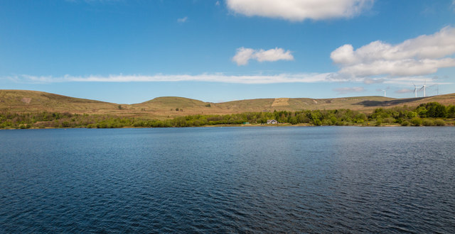
The summit of Stansfield Hill provides an excellent vantage point, offering panoramic views of the rolling hills, valleys, and small towns that make up the Lancashire countryside. On a clear day, it is possible to see as far as the Lancashire coast and the Irish Sea.

The hill is a popular destination for hikers, walkers, and nature enthusiasts, with several well-marked trails and footpaths that lead to the summit. The surrounding area is rich in wildlife, including various species of birds, mammals, and plant life, making it an ideal spot for birdwatching and nature photography.

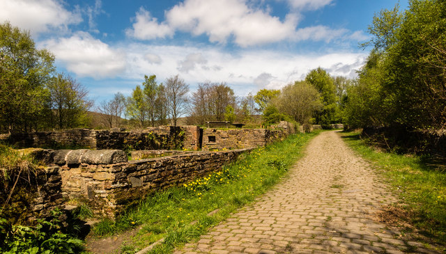
Stansfield Hill also holds historical significance, with evidence of human activity dating back to prehistoric times. Archaeological discoveries have revealed the presence of ancient settlements and burial sites, providing insights into the region's early inhabitants.

Overall, Stansfield Hill is a captivating natural landmark in Lancashire, offering a combination of stunning views, outdoor recreational opportunities, and glimpses into the area's rich history.

If you have any feedback on the listing, please let us know in the comments section below.

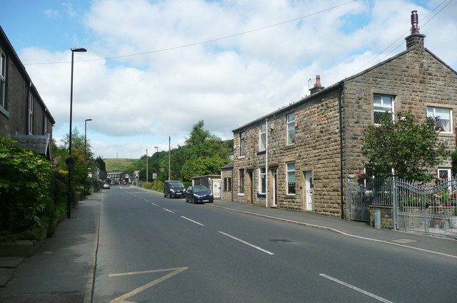
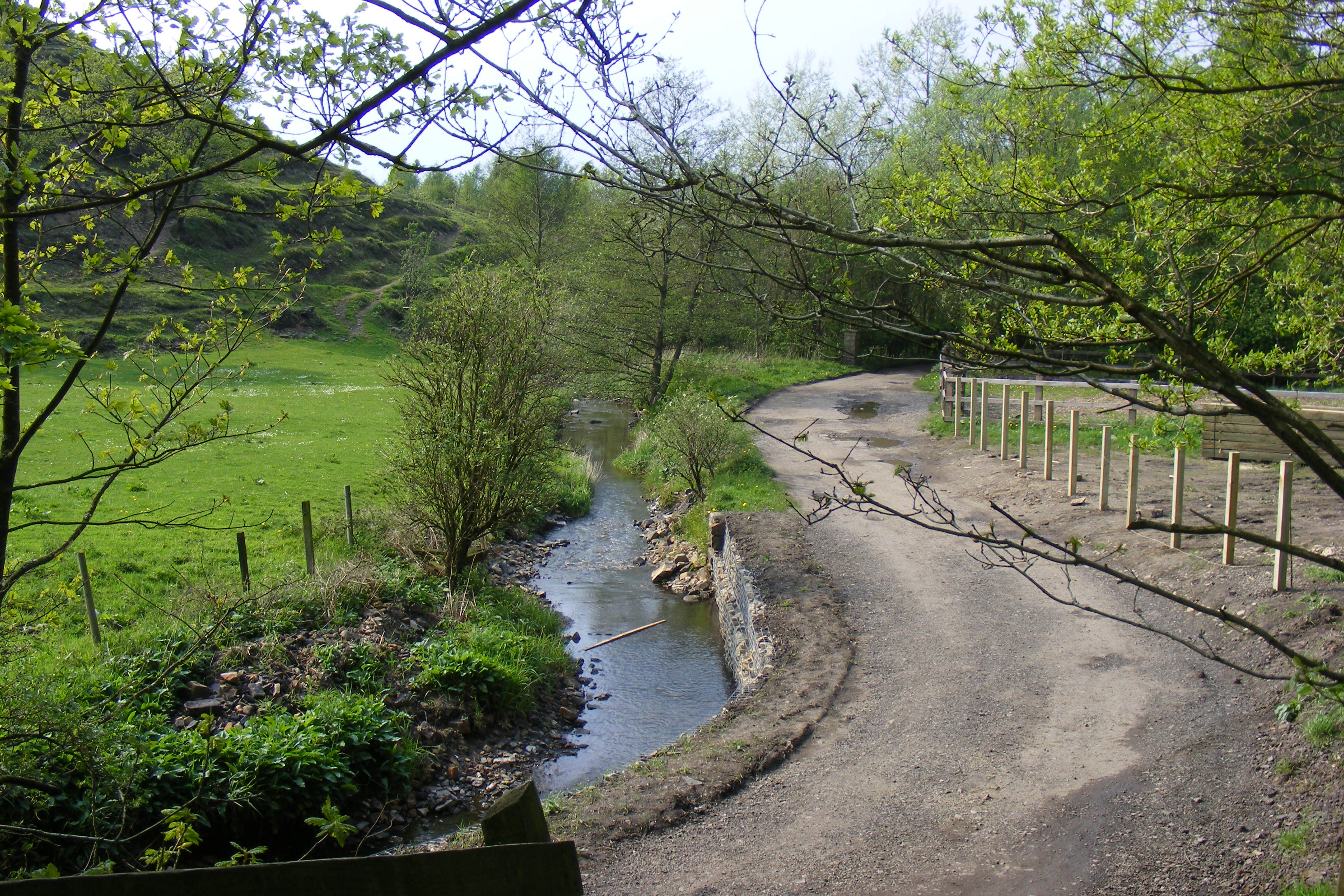
Stansfield Hill Images

Images are sourced within 2km of 53.659656/-2.1076267 or Grid Reference SD9218. Thanks to Geograph Open Source API. All images are credited.

Ross Ices - old ice cream sign
Car in the Rochdale Canal Just below Sladen Lock. Makes a change from seeing supermarket trolleys.
Car in the Rochdale Canal
Just below Sladen Lock. Makes a change from seeing supermarket trolleys.
Red car in Rochdale Canal Just below Sladen Lock (between Summit and Littleborough) on a very windy day.
Red car in Rochdale Canal
Just below Sladen Lock (between Summit and Littleborough) on a very windy day.
Shore Moor Crook Hill Wind Farm on Shore Moor.
Shore Moor
Crook Hill Wind Farm on Shore Moor.
A58 Church Street, Littleborough
Watergrove History Wall, greater (northern) part The Watergrove History Wall, situated on the east side of Watergrove Reservoir at the southern end of the reservoir, includes several date stones from Watergrove village buildings and surrounding farmsteads that were demolished during the construction of Rochdale Corporation's Watergrove Reservoir in the 1930s.

The image is a composite of 18 photographs produced using Microsoft's ICE (Image Composite Editor) software.

The wall is approximately 170 ft long; this image is the northern 110 ft part.  The wall is divided by adjacent fencing.

The 60 ft lesser (southern) part of the wall is illustrated in the Geograph:

                  <a title="https://www.geograph.org.uk/photo/5163265" href="https://www.geograph.org.uk/photo/5163265">Link</a>
Watergrove History Wall, greater (northern) part
The Watergrove History Wall, situated on the east side of Watergrove Reservoir at the southern end of the reservoir, includes several date stones from Watergrove village buildings and surrounding farmsteads that were demolished during the construction of Rochdale Corporation's Watergrove Reservoir in the 1930s. The image is a composite of 18 photographs produced using Microsoft's ICE (Image Composite Editor) software. The wall is approximately 170 ft long; this image is the northern 110 ft part. The wall is divided by adjacent fencing. The 60 ft lesser (southern) part of the wall is illustrated in the Geograph: Link
Watergrove History Wall, lesser (southern) part The Watergrove History Wall, situated on the east side of Watergrove Reservoir at the southern end of the reservoir, includes several date stones from Watergrove village buildings and surrounding farmsteads that were demolished during the construction of Rochdale Corporation's Watergrove Reservoir in the 1930s.

The image is a composite of 6 photographs produced using Microsoft's ICE (Image Composite Editor) software.

The wall is approximately 170 ft long; this image is the southern 60 ft part.  The wall is divided by adjacent fencing.

The 110 ft greater (northern) part of the wall is illustrated in the Geograph:

       <a title="https://www.geograph.org.uk/photo/5163240" href="https://www.geograph.org.uk/photo/5163240">Link</a>
Watergrove History Wall, lesser (southern) part
The Watergrove History Wall, situated on the east side of Watergrove Reservoir at the southern end of the reservoir, includes several date stones from Watergrove village buildings and surrounding farmsteads that were demolished during the construction of Rochdale Corporation's Watergrove Reservoir in the 1930s. The image is a composite of 6 photographs produced using Microsoft's ICE (Image Composite Editor) software. The wall is approximately 170 ft long; this image is the southern 60 ft part. The wall is divided by adjacent fencing. The 110 ft greater (northern) part of the wall is illustrated in the Geograph: Link
Watergrove Reservoir Sailing Club House at Watergrove Reservoir.
Watergrove Reservoir
Sailing Club House at Watergrove Reservoir.
Ramsden Road Remains of the Little Town farmstead alongside Ramsden Road.
Ramsden Road
Remains of the Little Town farmstead alongside Ramsden Road.
Watergrove Reservoir View looking across Watergrove Reservoir from the dam.
Watergrove Reservoir
View looking across Watergrove Reservoir from the dam.
Todmorden Road, Summit, with quarry in the distance The Pennine Bridleway goes left just before the pub. Summit Quarry is a big gash on the far hillside. It started as clay pits for a brickworks.
Todmorden Road, Summit, with quarry in the distance
The Pennine Bridleway goes left just before the pub. Summit Quarry is a big gash on the far hillside. It started as clay pits for a brickworks.
Lock on the Rochdale Canal at Chelburn Bridge, Summit The sign states that this is the West Summit Lock, No.37.
Lock on the Rochdale Canal at Chelburn Bridge, Summit
The sign states that this is the West Summit Lock, No.37.
Entrance to Summit Quarry This started as a clay pit for a brickworks, but there is rock-climbing on gritstone cliffs, so evidently stone has been quarried here. There is also woodland (A 'Woodland Welcome' wood).
Entrance to Summit Quarry
This started as a clay pit for a brickworks, but there is rock-climbing on gritstone cliffs, so evidently stone has been quarried here. There is also woodland (A 'Woodland Welcome' wood).
The Pennine Bridleway climbing away from Summit
The junction of Barnes Meadows with Todmorden Road, Calderbrook The road name looks modern, and a look at the 1:2500 map on 1893 shows only a track. The 1910 edition shows the road, without a name, only as far as the newly built school. Calderbrook Terrace also appears on that map.
The junction of Barnes Meadows with Todmorden Road, Calderbrook
The road name looks modern, and a look at the 1:2500 map on 1893 shows only a track. The 1910 edition shows the road, without a name, only as far as the newly built school. Calderbrook Terrace also appears on that map.
Church of England primary School. Calderbrook. Littleborough This first appears on the 1910 edition of the 1:2500 map.
Church of England primary School. Calderbrook. Littleborough
This first appears on the 1910 edition of the 1:2500 map.
Todmorden Road (A6033) Summit, Littleborough
The Summit Inn, Summit, Littleborough
Show me another place!

Stansfield Hill is located at Grid Ref: SD9218 (Lat: 53.659656, Lng: -2.1076267)

Unitary Authority: Rochdale

Police Authority: Greater Manchester

What 3 Words

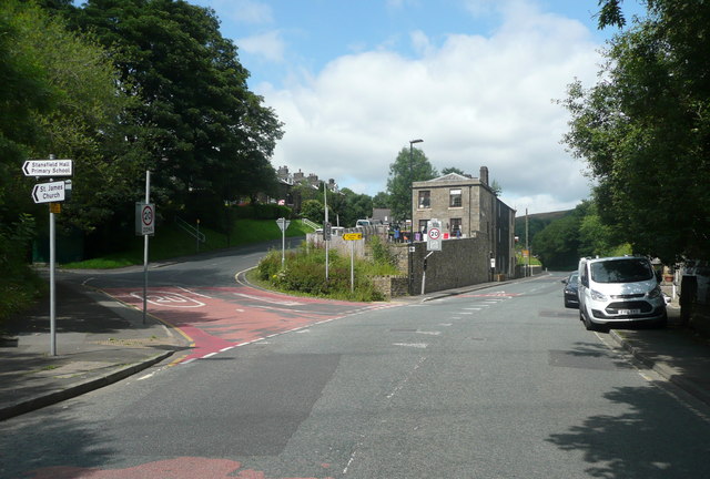
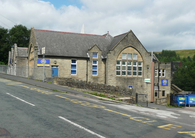
///improving.sleepy.hungry. Near Littleborough, Manchester

Related Wikis

Calderbrook

Calderbrook ( KAWL-dər-bruuk) is a village within the Metropolitan Borough of Rochdale, in Greater Manchester, England. It was originally part of the township...

Greenvale Brook

Greenvale Brook is a watercourse in Greater Manchester and a tributary of the River Roch. == Tributaries == Lydgate Brook Castle Brook Red Brook Lead Mine...

Town House Brook

Town House Brook is a watercourse in Greater Manchester and a tributary of the River Roch. == Tributaries == Long Clough Brook Turn Slack Brook Blue Pot...

Littleborough, Greater Manchester

Littleborough ( LIT-əl-bər-ə) is a town in the Metropolitan Borough of Rochdale, Greater Manchester, England, in the upper Roch Valley by the foothills...

Ealees Brook

Ealees Brook is a water course in Greater Manchester named after the Ealees area of Littleborough. It flows northwards from the Ealees Valley to the River...

Watergrove Reservoir

Watergrove Reservoir is a reservoir close to Wardle in the Metropolitan Borough of Rochdale, within Greater Manchester, England. Rochdale Corporation...

Littleborough railway station

Littleborough railway station serves the town of Littleborough in the Metropolitan Borough of Rochdale, Greater Manchester, England. It lies on the Calder...

Wardle, Greater Manchester

Wardle (; pop. 7,092) is a village near Littleborough within the Metropolitan Borough of Rochdale, in Greater Manchester, England. It lies amongst the...

Nearby Amenities

Located within 500m of 53.659656,-2.1076267
Power: tower
Lat/Long: 53.6574224/-2.1012937
Power: tower
Lat/Long: 53.6578476/-2.1080327
Power: tower
Lat/Long: 53.656815/-2.1134393
Barrier: swing_gate
Lat/Long: 53.6581279/-2.114557
Ford: yes
Lat/Long: 53.660986/-2.1114693
The data included in this document is from www.openstreetmap.org. The data is made available under ODbL.

Have you been to Stansfield Hill?

Leave your review of Stansfield Hill below (or comments, questions and feedback).