Mellings Clough

Valley in Lancashire

England

Mellings Clough

Astronomy Centre off Bacup Road The even skyline watershed extends to Freeholds Top in this view
Astronomy Centre off Bacup Road Credit: Kevin Waterhouse

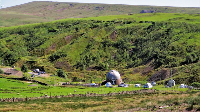
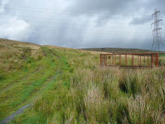
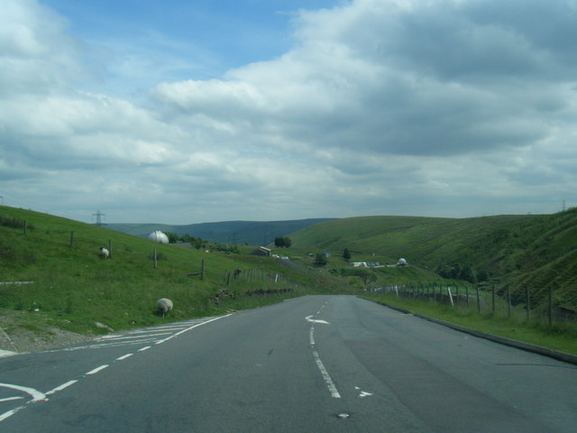
Mellings Clough is a picturesque valley located in Lancashire, England. This hidden gem is known for its stunning natural beauty and tranquil atmosphere. Nestled between rolling hills and lush greenery, it offers a peaceful retreat for nature enthusiasts and hikers alike.

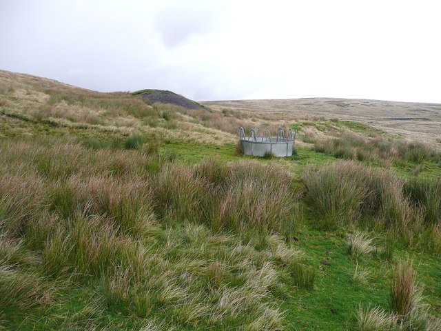
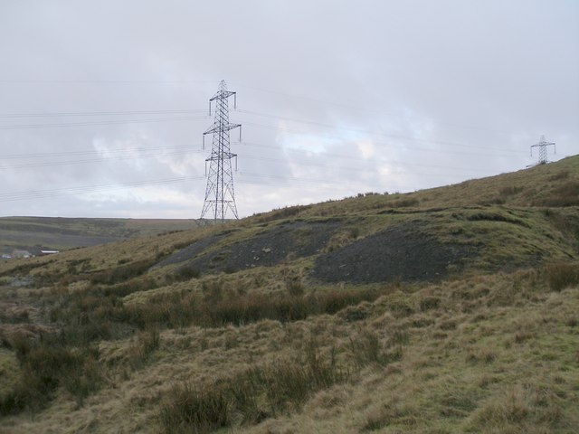
The valley is situated within the larger Forest of Bowland Area of Outstanding Natural Beauty, which is known for its unspoiled landscapes and diverse wildlife. Mellings Clough is characterized by its meandering stream, which runs through the heart of the valley, adding to its charm and serenity.

The area is home to a variety of plant and animal species, making it a haven for wildlife lovers. Visitors can spot birds such as buzzards, owls, and kingfishers, as well as mammals like foxes, rabbits, and deer. The valley's rich biodiversity is supported by its diverse habitat, including woodlands, meadows, and wetlands.

For outdoor enthusiasts, Mellings Clough offers numerous walking trails and paths, providing opportunities to explore the valley's natural wonders. The valley is also a popular spot for picnics and family outings, with designated areas for relaxation and enjoying the scenic views.

Mellings Clough, with its untouched beauty and peaceful ambiance, is a destination that allows visitors to escape the hustle and bustle of everyday life and immerse themselves in the tranquility of nature. Whether it's a leisurely stroll along the stream or a more challenging hike up the surrounding hills, this valley has something to offer for everyone seeking solace in nature.

If you have any feedback on the listing, please let us know in the comments section below.

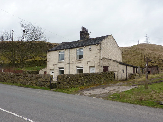
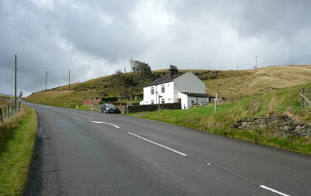
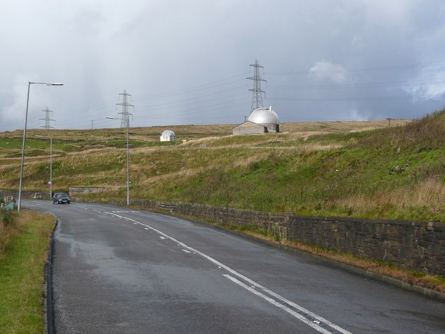
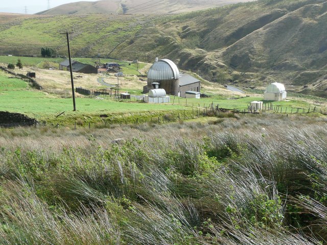
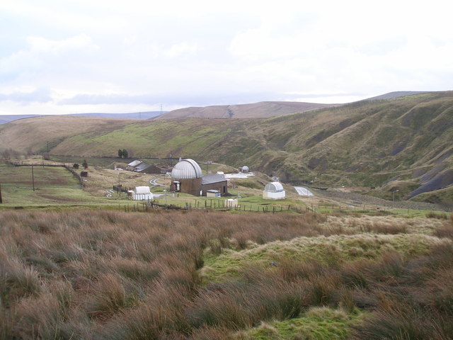
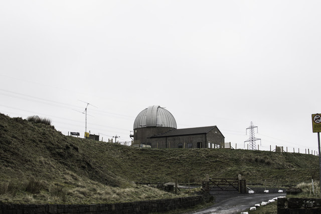
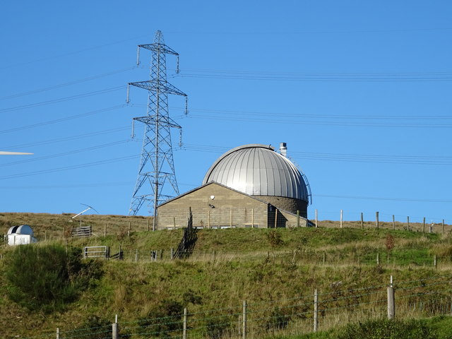
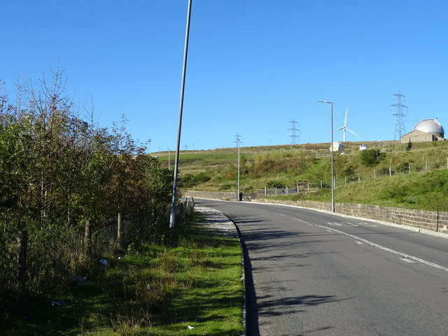
Mellings Clough Images

Images are sourced within 2km of 53.711324/-2.1298786 or Grid Reference SD9123. Thanks to Geograph Open Source API. All images are credited.

Astronomy Centre off Bacup Road The even skyline watershed extends to Freeholds Top in this view
Astronomy Centre off Bacup Road
The even skyline watershed extends to Freeholds Top in this view
The Astronomy Centre, Bacup Road, Todmorden <span class="nowrap"><a title="http://www.astronomycentre.org.uk/" rel="nofollow ugc noopener" href="http://www.astronomycentre.org.uk/">Link</a><img style="margin-left:2px;" alt="External link" title="External link - shift click to open in new window" src="https://s1.geograph.org.uk/img/external.png" width="10" height="10"/></span>
The Astronomy Centre, Bacup Road, Todmorden
New plantation opposite the observatory, Bacup Road
Bacup Road at the observatory
Nos 606 & 608 Bacup Road, Todmorden
Cottages on the A681 Bacup Road, Todmoden This pair of cottages marks the start of a bridleway which goes to Flower Scar Road.
Cottages on the A681 Bacup Road, Todmoden
This pair of cottages marks the start of a bridleway which goes to Flower Scar Road.
The A681 Bacup Road, Todmoden The road as it passes the Astronomy Centre.
The A681 Bacup Road, Todmoden
The road as it passes the Astronomy Centre.
The Astronomy Centre, Todmorden
Woodlands View, off A681 Bacup Road, Todmorden This is a bridleway on a private road to two houses and the Astronomy Centre.
Woodlands View, off A681 Bacup Road, Todmorden
This is a bridleway on a private road to two houses and the Astronomy Centre.
Mine track and bridleway, Todmoden Here the bridleway forks off invisibly to the right, whilst the cart track ends at a spoil heap.
Mine track and bridleway, Todmoden
Here the bridleway forks off invisibly to the right, whilst the cart track ends at a spoil heap.
Spoil heap and feeding  station, Todmoden Moor This is the end of the cart track in <a href="https://www.geograph.org.uk/photo/2638422">SD8924 : Mine track and bridleway, Todmoden</a>, but a faint path can be followed to the right to a fenced trial hole site.
Spoil heap and feeding station, Todmoden Moor
This is the end of the cart track in SD8924 : Mine track and bridleway, Todmoden, but a faint path can be followed to the right to a fenced trial hole site.
Old mine workings by the Todmorden Centenary Way
Astronomy Centre near Todmorden
Astronomy centre
Astronomy centre
A681 Bacup Road nears The Astronomy Centre
Astronomy Centre Off Bacup Road - run by volunteers, and is open to the public.
Astronomy Centre
Off Bacup Road - run by volunteers, and is open to the public.
Bacup Road (A681) Looking north west. Astronomy centre on the right.
Bacup Road (A681)
Looking north west. Astronomy centre on the right.
A681 towards Bacup Looking north west.
A681 towards Bacup
Looking north west.
Show me another place!

Mellings Clough is located at Grid Ref: SD9123 (Lat: 53.711324, Lng: -2.1298786)

Unitary Authority: Calderdale

Police Authority: West Yorkshire

What 3 Words

///protests.half.bullion. Near Todmorden, West Yorkshire

Related Wikis

Dobroyd Castle

Dobroyd Castle is an important historic building above the town of Todmorden, West Yorkshire, England. It was built for John Fielden, local mill owner...
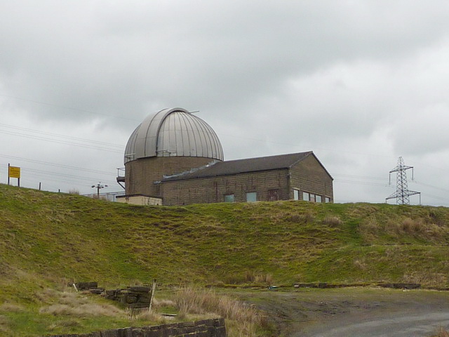
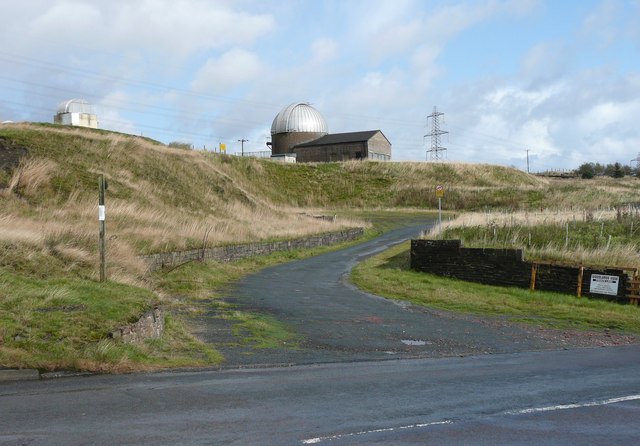
Astronomy Centre

The Astronomy Centre, also known as the Amateur Astronomy Centre, is an astronomical observatory located in northern England which is run by experienced...

Todmorden War Memorial

Todmorden War Memorial is a war memorial located in Todmorden, West Yorkshire, England. The memorial is in the garden of remembrance in Centre Vale Park...

Todmorden High School

Todmorden High School is a comprehensive school in the town of Todmorden, Calderdale LEA, West Yorkshire, England. == Admissions == Todmorden High School...

Nearby Amenities

Located within 500m of 53.711324,-2.1298786
Bus Stop
Bacup Road
Bus: yes
Local Ref: 45018972
Naptan AtcoCode: 450018972
Naptan Bearing: E
Naptan CommonName: Bacup Road
Naptan Indicator: Stop 45018972
Naptan PlusbusZoneRef: LEEDS
Naptan ShortCommonName: Gorpley Wood
Naptan Street: Bacup Road
Naptan Verified: no
Public Transport: platform
Source: naptan_import
Lat/Long: 53.7092895/-2.1257472
Bus Stop
Bacup Road Clough Foot
Bus: yes
Local Ref: 45018973
Naptan AtcoCode: 450018973
Naptan Bearing: NW
Naptan CommonName: Bacup Road Clough Foot
Naptan Indicator: Stop 45018973
Naptan PlusbusZoneRef: LEEDS
Naptan ShortCommonName: Mellings Clough
Naptan Street: Bacup Road
Naptan Verified: no
Public Transport: platform
Source: naptan_import
Lat/Long: 53.7096892/-2.1302329
Bus Stop
Bacup Road
Bus: yes
Local Ref: 45018974
Naptan AtcoCode: 450018974
Naptan Bearing: SE
Naptan CommonName: Bacup Road
Naptan Indicator: Stop 45018974
Naptan PlusbusZoneRef: LEEDS
Naptan ShortCommonName: Mellings Clough
Naptan Street: Bacup Road
Naptan Verified: no
Public Transport: platform
Source: naptan_import
Lat/Long: 53.7098867/-2.1305062
Bacup Road
Local Ref: 45050716
Naptan AtcoCode: 450050716
Naptan Bearing: W
Naptan BusStopType: CUS
Naptan CommonName: Bacup Road
Naptan Indicator: Stop 45050716
Naptan PlusbusZoneRef: LEEDS
Naptan ShortCommonName: Gorpley Wood
Naptan Street: Bacup Road
Naptan Verified: no
Source: naptan_import
Lat/Long: 53.7091996/-2.1257924
Barrier: stile
Lat/Long: 53.7111878/-2.1324617
Ford: stepping_stones
Lat/Long: 53.7105639/-2.130527
Parking
Lat/Long: 53.7083802/-2.1247459
The data included in this document is from www.openstreetmap.org. The data is made available under ODbL.

Have you been to Mellings Clough?

Leave your review of Mellings Clough below (or comments, questions and feedback).