Royley Clough

Valley in Lancashire

England

Royley Clough

Tandle Hill War memorial atop Tandle Hill.
Tandle Hill Credit: Peter McDermott

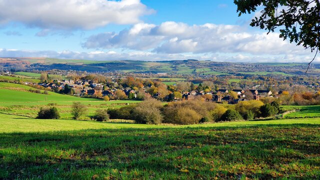
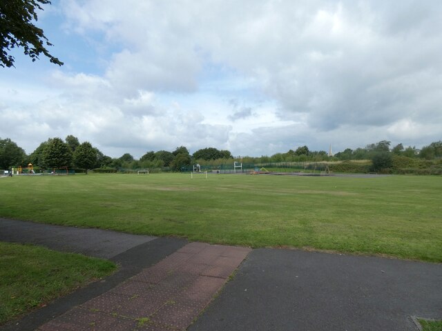
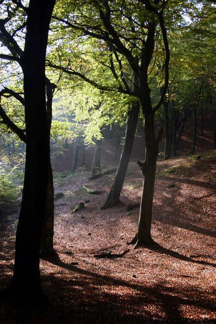
Royley Clough is a picturesque valley located in the county of Lancashire, England. Nestled within the Pennines, this charming valley offers breathtaking views and a tranquil atmosphere, making it a popular destination for nature enthusiasts and hikers.

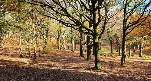
The valley is renowned for its stunning natural beauty, with rolling hills, lush green meadows, and a meandering stream that runs through it. The landscape is dotted with ancient woodlands, providing a diverse habitat for a variety of flora and fauna. Visitors to Royley Clough can expect to encounter a wide range of bird species, such as the common buzzard and kestrel, as well as rabbits, foxes, and occasionally even deer.

The valley is crisscrossed by numerous walking trails, allowing visitors to explore its hidden gems. The Royley Clough Circular Walk is a popular choice, taking hikers on a scenic route through the valley and up to the nearby Rooley Moor. Along the way, walkers can enjoy panoramic views of the surrounding countryside and may even stumble upon remnants of the area's industrial past, such as abandoned quarries and mills.

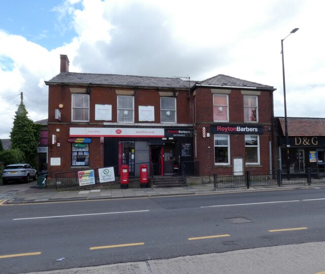
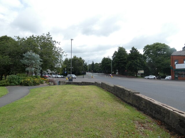
Royley Clough is also home to several quaint villages, where visitors can find charming pubs and local shops. These villages offer a glimpse into the area's rich history and provide an opportunity to experience traditional Lancashire hospitality.

Overall, Royley Clough is a hidden gem in Lancashire, offering a peaceful retreat from the hustle and bustle of city life. Its natural beauty, diverse wildlife, and scenic walking trails make it a must-visit destination for nature lovers and those seeking a tranquil escape.

If you have any feedback on the listing, please let us know in the comments section below.

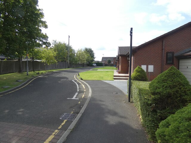
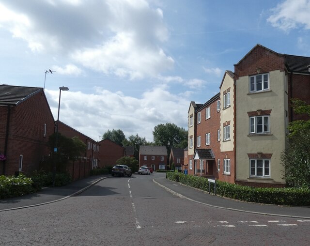
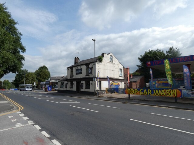
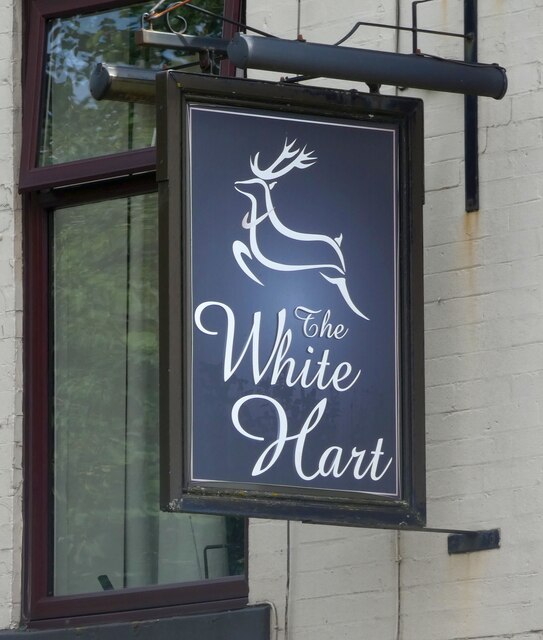
Royley Clough Images

Images are sourced within 2km of 53.563582/-2.1407631 or Grid Reference SD9007. Thanks to Geograph Open Source API. All images are credited.

Tandle Hill War memorial atop Tandle Hill.
Tandle Hill
War memorial atop Tandle Hill.
Hanging Chadder View looking towards Hanging Chadder seen from Tindle Hill.
Hanging Chadder
View looking towards Hanging Chadder seen from Tindle Hill.
Tandle Hill Country Park
Royton Post Office 
With Royton Barbers next door.
Royton Post Office
With Royton Barbers next door.
Rochdale Road, Royton 
The A671 through Royton. On the right is the former Royton Town Hall. Next to it is the Carnegie Library. Surprisingly neither building is listed. The Town Hall dates from 1880 and was the home of Royton Urban District Council from 1894 until 1974 when Oldham Metropolitan Borough Council took over. Both buildings are currently undergoing restoration work.
Rochdale Road, Royton
The A671 through Royton. On the right is the former Royton Town Hall. Next to it is the Carnegie Library. Surprisingly neither building is listed. The Town Hall dates from 1880 and was the home of Royton Urban District Council from 1894 until 1974 when Oldham Metropolitan Borough Council took over. Both buildings are currently undergoing restoration work.
Duke of Edinburgh A Craft Union Free House.

<a href="https://www.geograph.org.uk/photo/7220865">SD9107 : Sign of the Duke of Edinburgh</a>.
Duke of Edinburgh
A Craft Union Free House. SD9107 : Sign of the Duke of Edinburgh.
Sign of the Duke of Edinburgh Sign for the Duke of Edinburgh <a href="https://www.geograph.org.uk/photo/7220858">SD9107 : Duke of Edinburgh</a>.
Sign of the Duke of Edinburgh
Sign for the Duke of Edinburgh SD9107 : Duke of Edinburgh.
Railway Hotel, Royton A J W Lees pub on the corner of Oldham Road and High Barn Street. Originally it was called the Railway Hotel but as it presumably no longer lets room it is known simply as The Railway <a href="https://www.geograph.org.uk/photo/7221754">SD9207 : Sign of The Railway</a>.
Railway Hotel, Royton
A J W Lees pub on the corner of Oldham Road and High Barn Street. Originally it was called the Railway Hotel but as it presumably no longer lets room it is known simply as The Railway SD9207 : Sign of The Railway.
Sign of The Railway Sign for the J W Lees pub, originally the Railway Hotel <a href="https://www.geograph.org.uk/photo/7221750">SD9207 : Railway Hotel, Royton</a> but now known simply as The Railway.
Sign of The Railway
Sign for the J W Lees pub, originally the Railway Hotel SD9207 : Railway Hotel, Royton but now known simply as The Railway.
Oldham Road The A671 out of Royton.
Oldham Road
The A671 out of Royton.
Playing fields off Broadway
A663 Broadway 

The A663 towards Shaw crossing the A671 from Oldham to Rochdale.
A663 Broadway
The A663 towards Shaw crossing the A671 from Oldham to Rochdale.
A663 Broadway 
The A663 towards Chadderton from the slip road off  the A671.
A663 Broadway
The A663 towards Chadderton from the slip road off the A671.
St Anne's Royton 
The Grade II* listed <span class="nowrap"><a title="https://historicengland.org.uk/listing/the-list/list-entry/1356418?section=official-list-entry" rel="nofollow ugc noopener" href="https://historicengland.org.uk/listing/the-list/list-entry/1356418?section=official-list-entry">Link</a><img style="margin-left:2px;" alt="External link" title="External link - shift click to open in new window" src="https://s1.geograph.org.uk/img/external.png" width="10" height="10"/></span> dates from 1908-09 with tower added in 1926-27.
St Anne's Royton
The Grade II* listed LinkExternal link dates from 1908-09 with tower added in 1926-27.
Verity Close Off St Anne's Avenue.
Verity Close
Off St Anne's Avenue.
Windmill Close Off Jones Street.
Windmill Close
Off Jones Street.
White Hart, Oldham Road, Royton Between a bus stop and a car wash on the A671.

<a href="https://www.geograph.org.uk/photo/7250518">SD9206 : Sign of The White Hart</a>.
White Hart, Oldham Road, Royton
Between a bus stop and a car wash on the A671. SD9206 : Sign of The White Hart.
Sign of The White Hart Sign for The White Hart <a href="https://www.geograph.org.uk/photo/7250513">SD9206 : White Hart, Oldham Road, Royton</a>.
Sign of The White Hart
Sign for The White Hart SD9206 : White Hart, Oldham Road, Royton.
Show me another place!

Royley Clough is located at Grid Ref: SD9007 (Lat: 53.563582, Lng: -2.1407631)

Unitary Authority: Oldham

Police Authority: Greater Manchester

What 3 Words

///mime.movie.teeth. Near Royton, Manchester

Related Wikis

Thorp Mill, Royton

Thorp Mill, Royton was built by Ralph Taylor at Thorp Clough in 1764. This is reputed to be the first cotton mill in Lancashire to be powered by water...

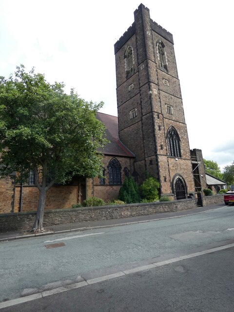
St Matthew's Church, Chadderton

The Parish Church of St. Matthew is the Church of England parish church for Chadderton in Greater Manchester, England. It forms part of the Diocese of...

Oldham Academy North

The Oldham Academy North (TOAN) is a mixed gender secondary school with academy status for 11- to 16-year-olds located in the Royton area of Oldham, Greater...

North Chadderton School

North Chadderton School is a mixed gender secondary school and sixth form, located in Chadderton, in the Metropolitan Borough of Oldham, Greater Manchester...

Healds Green

Healds Green is a hamlet in the Metropolitan Borough of Oldham, Greater Manchester, England. It is in Chadderton's semi rural northern area, just to the...
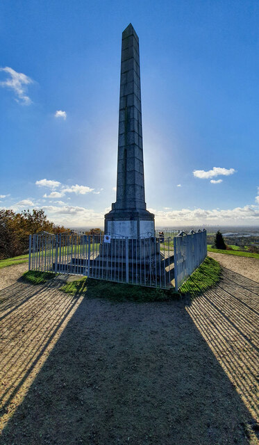
Tandle Hill

Tandle Hill Country Park is a country park in Royton, Greater Manchester, England. It consists of approximately 110 acres (45 ha), a combination of beech...

Boundary Park

Boundary Park is a football stadium in Oldham, Greater Manchester, England. Its name originates from the fact that it lies at the northwestern extremity...
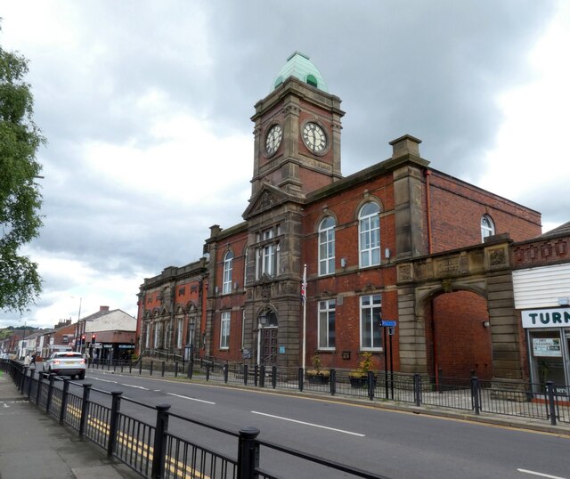
Royton Town Hall

Royton Town Hall is a municipal building in Rochdale Road, Royton, Greater Manchester, England. The town hall was the headquarters of Royton Urban District...

Nearby Amenities

Located within 500m of 53.563582,-2.1407631
Haggate
Is In: Royton, Oldham, Greater Manchester, England, UK
Place: suburb
Source: npe
Lat/Long: 53.5638835/-2.1349058
Bus Stop
Royton, Middleton Road / near Lea View
Bus: yes
Naptan AtcoCode: 1800ED02431
Naptan Bearing: W
Naptan CommonName: Middleton Road/Lea View
Naptan Indicator: Royley House
Naptan Landmark: ROYLEY HOUSE
Naptan NaptanCode: manajwjm
Naptan PlusbusZoneRef: MNCRPIC
Naptan ShortCommonName: Lea View
Naptan Street: MIDDLETON ROAD
Naptan Verified: no
Network: TfGM
Operator: TfGM
Public Transport: platform
Source: naptan_import
Lat/Long: 53.5626692/-2.1344763
Bus Stop
Royley, Middleton Road / opposite Stottfield
Bus: yes
Naptan AtcoCode: 1800ED02441
Naptan Bearing: NE
Naptan CommonName: Middleton Road/Stottfield
Naptan Indicator: Opp House 2
Naptan Landmark: OPP HOUSE 2
Naptan NaptanCode: manajwjp
Naptan PlusbusZoneRef: MNCRPIC
Naptan ShortCommonName: Stottfield
Naptan Street: MIDDLETON ROAD
Naptan Verified: no
Network: TfGM
Operator: TfGM
Public Transport: platform
Source: naptan_import
Lat/Long: 53.563003/-2.1371694
Bus Stop
Royley, Middleton Road / near Stottfield
Bus: yes
Naptan AtcoCode: 1800ED02451
Naptan Bearing: SW
Naptan CommonName: Middleton Road/Stottfield
Naptan Indicator: O/s House 372
Naptan Landmark: HOUSE 372
Naptan NaptanCode: manajwjt
Naptan PlusbusZoneRef: MNCRPIC
Naptan ShortCommonName: Stottfield
Naptan Street: MIDDLETON ROAD
Naptan Verified: no
Network: TfGM
Operator: TfGM
Public Transport: platform
Source: naptan_import
Lat/Long: 53.5628362/-2.1377984
Bus Stop
Street Bridge, Street Bridge Road / near Bridleway
Bus: yes
Naptan AtcoCode: 1800ED02461
Naptan Bearing: NE
Naptan CommonName: Streetbridge Road/Bridleway
Naptan Indicator: Royton Auto
Naptan Landmark: ROYTON AUTO
Naptan NaptanCode: manajwjw
Naptan PlusbusZoneRef: MNCRPIC
Naptan ShortCommonName: Bridleway
Naptan Street: STREETBRIDGE
Naptan Verified: no
Network: TfGM
Operator: TfGM
Public Transport: platform
Source: naptan_import
Lat/Long: 53.5613198/-2.1432285
Bus Stop
Streetbridge Road/Bridleway
Bus: yes
Naptan AtcoCode: 1800ED02471
Naptan Bearing: SW
Naptan CommonName: Streetbridge Road/Bridleway
Naptan Indicator: Birchinlee Mill
Naptan Landmark: BIRCHINLEE MILL
Naptan NaptanCode: manajwma
Naptan PlusbusZoneRef: MNCRPIC
Naptan ShortCommonName: Bridleway
Naptan Street: STREETBRIDGE
Naptan Verified: no
Network: TfGM
Public Transport: platform
Source: naptan_import
Lat/Long: 53.5611399/-2.1433487
Bus Stop
Street Bridge, Streetbridge Road / opposite Cinder Hill Lane
Bus: yes
Naptan AtcoCode: 1800ED02481
Naptan Bearing: SW
Naptan CommonName: Streetbridge Road/A627M
Naptan Indicator: Under Mway Bdge
Naptan Landmark: MOTORWAY BRIDGE
Naptan NaptanCode: manajwmd
Naptan PlusbusZoneRef: MNCRPIC
Naptan ShortCommonName: A627M
Naptan Street: STREETBRIDGE
Naptan Verified: no
Network: TfGM
Operator: TfGM
Public Transport: platform
Source: naptan_import
Lat/Long: 53.560005/-2.1452772
Bus Stop
Street Bridge, Street Bridge Road / opposite A627M
Bus: yes
Naptan AtcoCode: 1800ED02491
Naptan Bearing: NE
Naptan CommonName: Streetbridge Road/A627M
Naptan Indicator: Horton Arms
Naptan Landmark: MOTORWAY BRIDGE
Naptan NaptanCode: manajwmg
Naptan PlusbusZoneRef: MNCRPIC
Naptan ShortCommonName: A627M
Naptan Street: STREETBRIDGE
Naptan Verified: no
Network: TfGM
Operator: TfGM
Public Transport: platform
Source: naptan_import
Lat/Long: 53.5604201/-2.1448508
Turning Circle
Lat/Long: 53.5614292/-2.1378677
Turning Circle
Lat/Long: 53.5614426/-2.1387847
Pets at Home
Brand: Pets at Home
Brand Wikidata: Q7179258
Brand Wikipedia: en:Pets at Home
Shop: pet
Website: https://community.petsathome.com/store/oldham/
Lat/Long: 53.5591875/-2.1394504
Generator Method: photovoltaic
Generator Output Electricity: yes
Generator Source: solar
Generator Type: solar_photovoltaic_panel
Location: roof
Power: generator
Lat/Long: 53.5636196/-2.1370005
Bus Stop
Street Bridge, Street Bridge Road / opposite Bridleway
Bus: yes
Network: TfGM
Operator: TfGM
Public Transport: platform
Lat/Long: 53.561194/-2.1432257
The data included in this document is from www.openstreetmap.org. The data is made available under ODbL.

Have you been to Royley Clough?

Leave your review of Royley Clough below (or comments, questions and feedback).