Cinder Hill

Hill, Mountain in Lancashire

England

Cinder Hill

Tandle Hill War memorial atop Tandle Hill.
Tandle Hill Credit: Peter McDermott

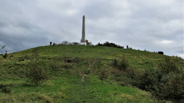
Cinder Hill is a small hill located in Lancashire, England. Situated on the outskirts of the town of Blackburn, it is part of the larger Pennine Hills, a range known for its picturesque landscapes and natural beauty.

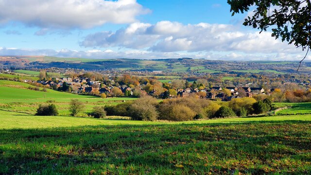
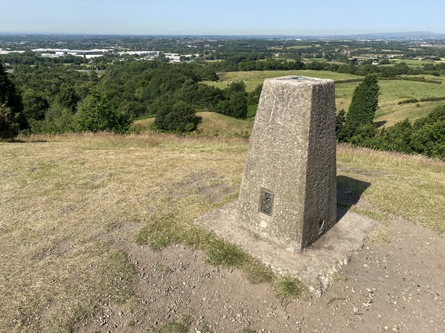
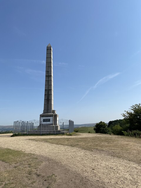
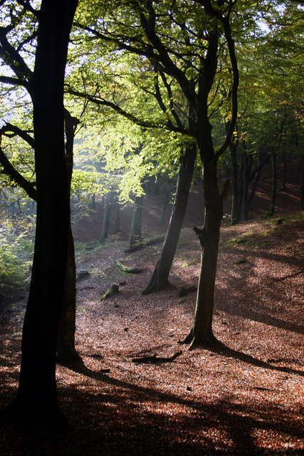
At an elevation of approximately 327 meters (1,073 feet), Cinder Hill offers stunning panoramic views of the surrounding countryside. The hill is predominantly covered in heather, grasses, and scattered shrubs, creating a rugged and wild appearance. The terrain consists of rocky outcrops and steep slopes, making it a popular destination for hikers and nature enthusiasts.

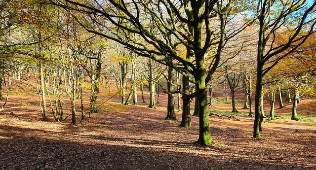
Cinder Hill is home to a diverse range of flora and fauna. The heather moorland provides a habitat for several bird species, including grouse, curlew, and lapwing. Visitors may also spot foxes, rabbits, and other small mammals that inhabit the area. The hill is particularly known for its vibrant display of heather blooms during the late summer, attracting photographers and nature lovers alike.

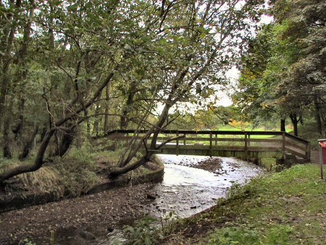
Access to Cinder Hill is relatively easy, with footpaths leading to the summit from nearby villages and towns. The hill is also a popular spot for paragliding and hang gliding enthusiasts, who take advantage of the hill's favorable wind conditions.

Overall, Cinder Hill offers a serene and natural escape from the bustling towns and cities of Lancashire. Its rugged beauty, diverse wildlife, and panoramic views make it an attractive destination for outdoor enthusiasts and those seeking a peaceful retreat in the heart of nature.

If you have any feedback on the listing, please let us know in the comments section below.
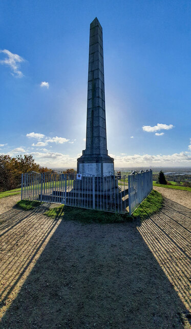
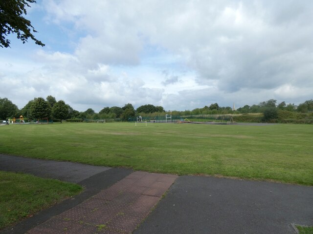
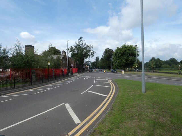
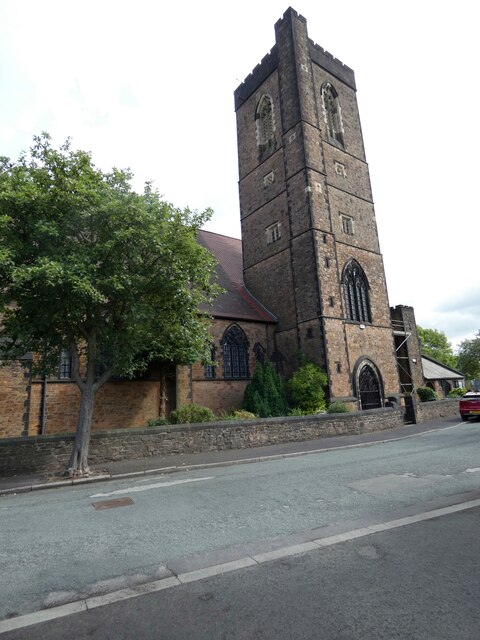
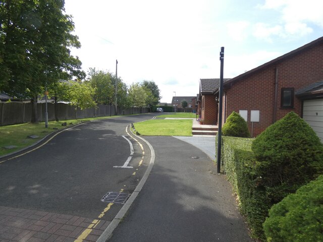
Cinder Hill Images

Images are sourced within 2km of 53.564792/-2.1507017 or Grid Reference SD9007. Thanks to Geograph Open Source API. All images are credited.

Tandle Hill War memorial atop Tandle Hill.
Tandle Hill
War memorial atop Tandle Hill.
Hanging Chadder View looking towards Hanging Chadder seen from Tindle Hill.
Hanging Chadder
View looking towards Hanging Chadder seen from Tindle Hill.
Tandle Hill Country Park
Royton Post Office 
With Royton Barbers next door.
Royton Post Office
With Royton Barbers next door.
Rochdale Road, Royton 
The A671 through Royton. On the right is the former Royton Town Hall. Next to it is the Carnegie Library. Surprisingly neither building is listed. The Town Hall dates from 1880 and was the home of Royton Urban District Council from 1894 until 1974 when Oldham Metropolitan Borough Council took over. Both buildings are currently undergoing restoration work.
Rochdale Road, Royton
The A671 through Royton. On the right is the former Royton Town Hall. Next to it is the Carnegie Library. Surprisingly neither building is listed. The Town Hall dates from 1880 and was the home of Royton Urban District Council from 1894 until 1974 when Oldham Metropolitan Borough Council took over. Both buildings are currently undergoing restoration work.
Duke of Edinburgh A Craft Union Free House.

<a href="https://www.geograph.org.uk/photo/7220865">SD9107 : Sign of the Duke of Edinburgh</a>.
Duke of Edinburgh
A Craft Union Free House. SD9107 : Sign of the Duke of Edinburgh.
Sign of the Duke of Edinburgh Sign for the Duke of Edinburgh <a href="https://www.geograph.org.uk/photo/7220858">SD9107 : Duke of Edinburgh</a>.
Sign of the Duke of Edinburgh
Sign for the Duke of Edinburgh SD9107 : Duke of Edinburgh.
Railway Hotel, Royton A J W Lees pub on the corner of Oldham Road and High Barn Street. Originally it was called the Railway Hotel but as it presumably no longer lets room it is known simply as The Railway <a href="https://www.geograph.org.uk/photo/7221754">SD9207 : Sign of The Railway</a>.
Railway Hotel, Royton
A J W Lees pub on the corner of Oldham Road and High Barn Street. Originally it was called the Railway Hotel but as it presumably no longer lets room it is known simply as The Railway SD9207 : Sign of The Railway.
Sign of The Railway Sign for the J W Lees pub, originally the Railway Hotel <a href="https://www.geograph.org.uk/photo/7221750">SD9207 : Railway Hotel, Royton</a> but now known simply as The Railway.
Sign of The Railway
Sign for the J W Lees pub, originally the Railway Hotel SD9207 : Railway Hotel, Royton but now known simply as The Railway.
Oldham Road The A671 out of Royton.
Oldham Road
The A671 out of Royton.
Playing fields off Broadway
A663 Broadway 
The A663 towards Chadderton from the slip road off  the A671.
A663 Broadway
The A663 towards Chadderton from the slip road off the A671.
St Anne's Royton 
The Grade II* listed <span class="nowrap"><a title="https://historicengland.org.uk/listing/the-list/list-entry/1356418?section=official-list-entry" rel="nofollow ugc noopener" href="https://historicengland.org.uk/listing/the-list/list-entry/1356418?section=official-list-entry">Link</a><img style="margin-left:2px;" alt="External link" title="External link - shift click to open in new window" src="https://s1.geograph.org.uk/img/external.png" width="10" height="10"/></span> dates from 1908-09 with tower added in 1926-27.
St Anne's Royton
The Grade II* listed LinkExternal link dates from 1908-09 with tower added in 1926-27.
Verity Close Off St Anne's Avenue.
Verity Close
Off St Anne's Avenue.
Windmill Close Off Jones Street.
Windmill Close
Off Jones Street.
Tandle Hill With the war memorial viewed from the path from Thornham Fold
Tandle Hill
With the war memorial viewed from the path from Thornham Fold
Tandle Hill Trig Point Flush Bracket S2792
Tandle Hill War Memorial Inscription - TANDLE HILL/ PARK AND WOODS/ THESE GROUNDS ARE THE GIFT OF/ NORRIS BRADBURY ESQ. J.P./ OF TYNWALD MOUNT/ SHAW ROAD,/ ROYTON/ AS/ A THANK OFFERING FOR PEACE/ AFTER THE/ GREAT EUROPEAN WAR/ 1914 - 1919/ 6TH SEPR. 1919

<span class="nowrap"><a title="https://www.iwm.org.uk/memorials/item/memorial/44962" rel="nofollow ugc noopener" href="https://www.iwm.org.uk/memorials/item/memorial/44962">Link</a><img style="margin-left:2px;" alt="External link" title="External link - shift click to open in new window" src="https://s1.geograph.org.uk/img/external.png" width="10" height="10"/></span>
Tandle Hill War Memorial
Inscription - TANDLE HILL/ PARK AND WOODS/ THESE GROUNDS ARE THE GIFT OF/ NORRIS BRADBURY ESQ. J.P./ OF TYNWALD MOUNT/ SHAW ROAD,/ ROYTON/ AS/ A THANK OFFERING FOR PEACE/ AFTER THE/ GREAT EUROPEAN WAR/ 1914 - 1919/ 6TH SEPR. 1919 LinkExternal link
Show me another place!

Cinder Hill is located at Grid Ref: SD9007 (Lat: 53.564792, Lng: -2.1507017)

Unitary Authority: Oldham

Police Authority: Greater Manchester

What 3 Words

///spring.follow.enter. Near Royton, Manchester

Related Wikis

Healds Green

Healds Green is a hamlet in the Metropolitan Borough of Oldham, Greater Manchester, England. It is in Chadderton's semi rural northern area, just to the...

North Chadderton School

North Chadderton School is a mixed gender secondary school and sixth form, located in Chadderton, in the Metropolitan Borough of Oldham, Greater Manchester...

St Matthew's Church, Chadderton

The Parish Church of St. Matthew is the Church of England parish church for Chadderton in Greater Manchester, England. It forms part of the Diocese of...

Thorp Mill, Royton

Thorp Mill, Royton was built by Ralph Taylor at Thorp Clough in 1764. This is reputed to be the first cotton mill in Lancashire to be powered by water...

Tandle Hill

Tandle Hill Country Park is a country park in Royton, Greater Manchester, England. It consists of approximately 110 acres (45 ha), a combination of beech...

Chadderton Hall Park

Chadderton Hall Park is a park in Chadderton, in the Metropolitan Borough of Oldham, Greater Manchester, England. Its roots stretch back to the 13th century...

Chadderton Park

Chadderton Park is a suburban area of Chadderton in the Metropolitan Borough of Oldham, Greater Manchester. It is located a little under one mile to the...

Oldham Academy North

The Oldham Academy North (TOAN) is a mixed gender secondary school with academy status for 11- to 16-year-olds located in the Royton area of Oldham, Greater...

Nearby Amenities

Located within 500m of 53.564792,-2.1507017
Power: tower
Lat/Long: 53.5680196/-2.1480958
Power: tower
Lat/Long: 53.5671785/-2.1521272
Power: tower
Lat/Long: 53.5662292/-2.1567862
Barrier: stile
Lat/Long: 53.563321/-2.1542125
Barrier: stile
Stile: stepover
Lat/Long: 53.5648933/-2.1569153
Barrier: stile
Dog Gate: yes
Stile: stepover
Lat/Long: 53.5632639/-2.1553856
The data included in this document is from www.openstreetmap.org. The data is made available under ODbL.

Have you been to Cinder Hill?

Leave your review of Cinder Hill below (or comments, questions and feedback).