Aller Cleugh

Valley in Durham

England

Aller Cleugh

Grazing pasture at Newhouse Pastures This is an area of level pasture adjacent to the Weardale Way.
Grazing pasture at Newhouse Pastures Credit: Clive Nicholson

Aller Cleugh, Durham, also known as Allercleugh, is a small valley located in County Durham, England. Situated in the Pennines, it lies approximately 7 miles southwest of the city of Durham.

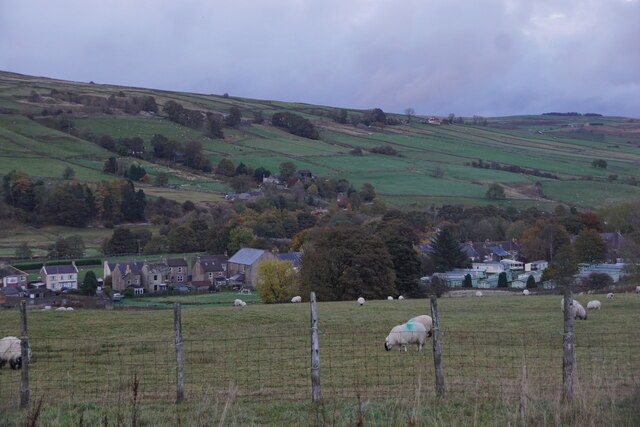
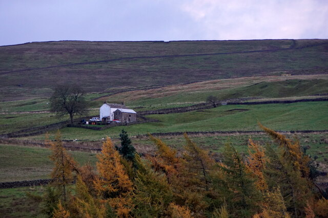
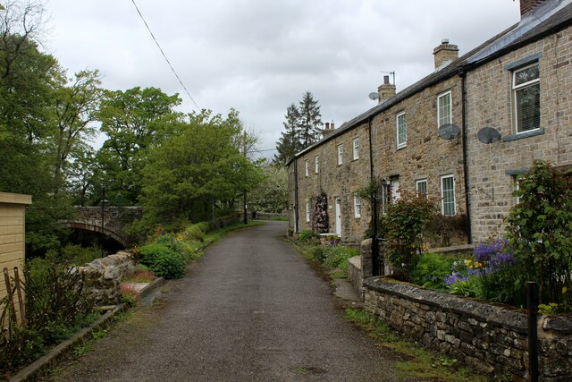
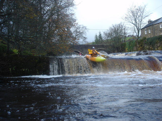
The valley is known for its picturesque beauty, with rolling green hills and a meandering stream running through it. The surrounding landscape is largely rural, characterized by farmland and scattered clusters of houses.

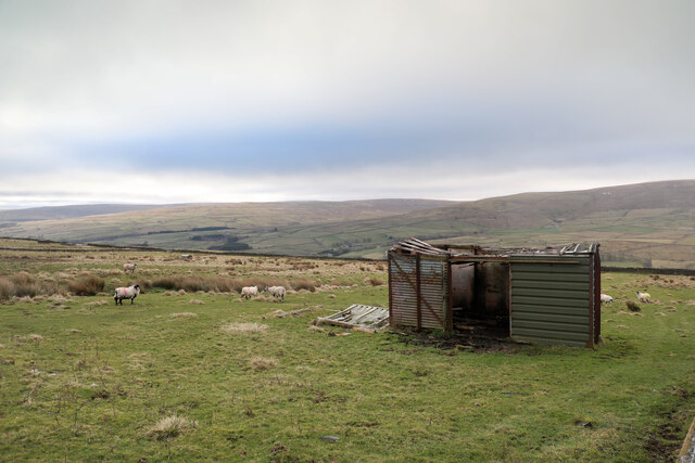
Aller Cleugh has a rich history, dating back to medieval times. It is believed to have been settled by the Anglo-Saxons and was mentioned in the Domesday Book of 1086. Over the years, the area has been primarily agricultural, with farming and sheep rearing being the main economic activities.

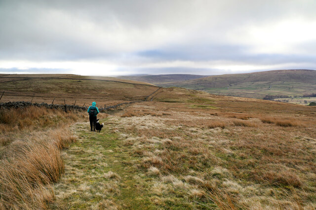
Today, Aller Cleugh remains a peaceful and idyllic location, attracting visitors who appreciate its natural charm and tranquility. The valley offers opportunities for hiking and walking, with several scenic trails that showcase the beauty of the surrounding countryside. It is also a popular spot for wildlife enthusiasts, as the area is home to a variety of bird species and other small animals.

While Aller Cleugh is not a bustling tourist destination, it provides a peaceful retreat for those seeking a break from the hustle and bustle of city life. Its unspoiled natural beauty and historical significance make it a hidden gem in the Durham countryside.

If you have any feedback on the listing, please let us know in the comments section below.

Aller Cleugh Images

Images are sourced within 2km of 54.749426/-2.1996625 or Grid Reference NY8739. Thanks to Geograph Open Source API. All images are credited.

Grazing pasture at Newhouse Pastures This is an area of level pasture adjacent to the Weardale Way.
Grazing pasture at Newhouse Pastures
This is an area of level pasture adjacent to the Weardale Way.
Farmland west of St John's Chapel
Farm west of St John's Chapel
Bridleway over Carr Brow Moor From Middlehope Bank (the minor road from Rookhope to Ireshopeburn) the bridleway gives good walking down towards Levelgate Sike and up over the shoulder of Bleak Laws on Carr Brow Moor. Just beyond the horizon, it passes through a gate and becomes a more substantial track, rather cut up by big tractor tyres, making the descent into Weardale a bit more wearing than the pleasant going on the moor.
Bridleway over Carr Brow Moor
From Middlehope Bank (the minor road from Rookhope to Ireshopeburn) the bridleway gives good walking down towards Levelgate Sike and up over the shoulder of Bleak Laws on Carr Brow Moor. Just beyond the horizon, it passes through a gate and becomes a more substantial track, rather cut up by big tractor tyres, making the descent into Weardale a bit more wearing than the pleasant going on the moor.
Not much shelter left This disused railway goods van shell has been here long enough to be mapped by the OS, but in that time, the weather has done it no good at all. With parts of the roof falling in, and part blown off, it may provide shelter from the wind for a few sheep, but certainly won't keep the rain or snow off. One panel seems to have been replaced by corrugated iron, but it looks as though the owner has decided that further repair is pointless. One hopes that on its final demise, it is removed and metal parts suitably recycled, not left here to rust and rot away completely.
Not much shelter left
This disused railway goods van shell has been here long enough to be mapped by the OS, but in that time, the weather has done it no good at all. With parts of the roof falling in, and part blown off, it may provide shelter from the wind for a few sheep, but certainly won't keep the rain or snow off. One panel seems to have been replaced by corrugated iron, but it looks as though the owner has decided that further repair is pointless. One hopes that on its final demise, it is removed and metal parts suitably recycled, not left here to rust and rot away completely.
River Wear near Waterside Farm
Newfield The property at Newfield seen along its access road high on the northern side of Weardale.
Newfield
The property at Newfield seen along its access road high on the northern side of Weardale.
Trees on grazing land at West Blackdene Several deciduous trees in the field which has rough grazing; it's south of a minor road in Weardale.
Chapel Fell is the moorland hill in the distance.
Trees on grazing land at West Blackdene
Several deciduous trees in the field which has rough grazing; it's south of a minor road in Weardale. Chapel Fell is the moorland hill in the distance.
Trees in valley of Elmford Cleugh Elmford Cleugh is a tributary of the River Wear descending on the north side of the valley.
Trees in valley of Elmford Cleugh
Elmford Cleugh is a tributary of the River Wear descending on the north side of the valley.
Head of the River Wear The point where Killhope Burn and Burnhope Burn meet to become the River Wear - at the aptly named village of Wearhead.
Head of the River Wear
The point where Killhope Burn and Burnhope Burn meet to become the River Wear - at the aptly named village of Wearhead.
Wearhead The A689 running through the small village of Wearhead
Wearhead
The A689 running through the small village of Wearhead
West Blackdene Small community near Ireshopeburn in Weardale
West Blackdene
Small community near Ireshopeburn in Weardale
Weardale Way between Wearhead and West Blackdene Riverside path in pastures beside the Wear
Weardale Way between Wearhead and West Blackdene
Riverside path in pastures beside the Wear
River Wear at West Blackdene The Weardale Way crosses the river at this point, to reach West Blackdene
River Wear at West Blackdene
The Weardale Way crosses the river at this point, to reach West Blackdene
On the Weardale Way opposite Iresburnhope The long distance footpath on the banks of the Wear, opposite the small village of Iresburnhope
On the Weardale Way opposite Iresburnhope
The long distance footpath on the banks of the Wear, opposite the small village of Iresburnhope
Newhouse Pasture Green pasture on the valley floor of Weardale
Newhouse Pasture
Green pasture on the valley floor of Weardale
Footbridge across the River Wear A 77 mile route following the River Wear from the sea at the Lindesfarne Memorial, Sunderland to the headwaters in the east Pennines, keeping as close as is possible to the river. It visits Lumley Castle, Durham (where the Castle and Cathedral forms a World Heritage Site), Bishop Auckland and Stanhope. After Stanhope the Way makes a northward loop to Rookhope to take in part of a tributary, Rookhope Burn.
Footbridge across the River Wear
A 77 mile route following the River Wear from the sea at the Lindesfarne Memorial, Sunderland to the headwaters in the east Pennines, keeping as close as is possible to the river. It visits Lumley Castle, Durham (where the Castle and Cathedral forms a World Heritage Site), Bishop Auckland and Stanhope. After Stanhope the Way makes a northward loop to Rookhope to take in part of a tributary, Rookhope Burn.
Show me another place!

Aller Cleugh is located at Grid Ref: NY8739 (Lat: 54.749426, Lng: -2.1996625)

Unitary Authority: County Durham

Police Authority: Durham

What 3 Words

///settle.exits.sued. Near Stanhope, Co. Durham

Related Wikis

West Blackdene

West Blackdene is a village in the civil parish of Stanhope, in County Durham, England. It is situated to the north of the River Wear, opposite Ireshopeburn...

Ireshopeburn

Ireshopeburn ( EYE-sup-burn ) is a village in the civil parish of Stanhope, in County Durham, England. It is situated on the south side of Weardale, between...

Wearhead railway station

Wearhead railway station served the village of Wearhead, County Durham, England, from 1895 to 1961 on the Weardale Railway. == History == The station opened...

New House, County Durham

New House or Newhouse is a hamlet in the civil parish of Stanhope, in County Durham, England. It lies on the north side of the River Wear, opposite Ireshopeburn...

Nearby Amenities

Located within 500m of 54.749426,-2.1996625
Historic: mine
Mineral: lead
Source: OS_OpenData_StreetView
Lat/Long: 54.7501023/-2.194174
Barrier: stile
Lat/Long: 54.7484911/-2.2056102
Power: pole
Lat/Long: 54.7480285/-2.205753
Power: pole
Lat/Long: 54.7474156/-2.206627
High Barns
Place: locality
Source Name: OS_OpenData_StreetView
Lat/Long: 54.7455711/-2.197322
The data included in this document is from www.openstreetmap.org. The data is made available under ODbL.

Have you been to Aller Cleugh?

Leave your review of Aller Cleugh below (or comments, questions and feedback).