Snail Bed Cleugh

Valley in Durham

England

Snail Bed Cleugh

Grazing pasture at Newhouse Pastures This is an area of level pasture adjacent to the Weardale Way.
Grazing pasture at Newhouse Pastures Credit: Clive Nicholson

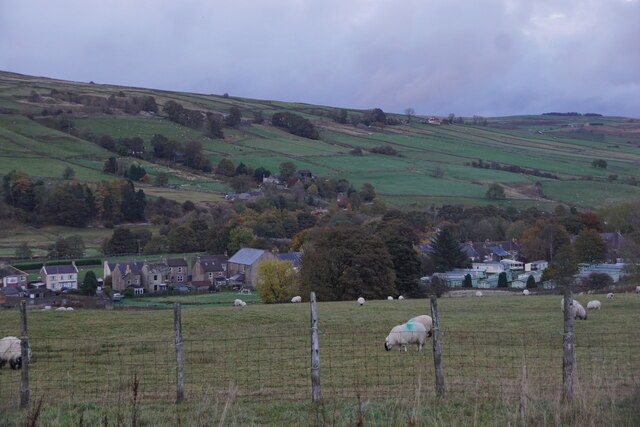
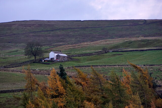
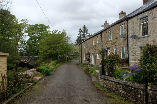
Snail Bed Cleugh is a small valley located in the county of Durham, England. Nestled within the beautiful landscape of the North Pennines Area of Outstanding Natural Beauty, this picturesque valley offers a tranquil escape from the hustle and bustle of city life.

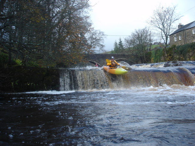
The valley takes its name from Snail Bed Cleugh Burn, a small river that runs through it. This babbling brook is known for its crystal-clear waters and is home to a variety of wildlife, including brown trout and otters. The river winds its way through the valley, creating a series of cascades and pools that add to the area's natural charm.

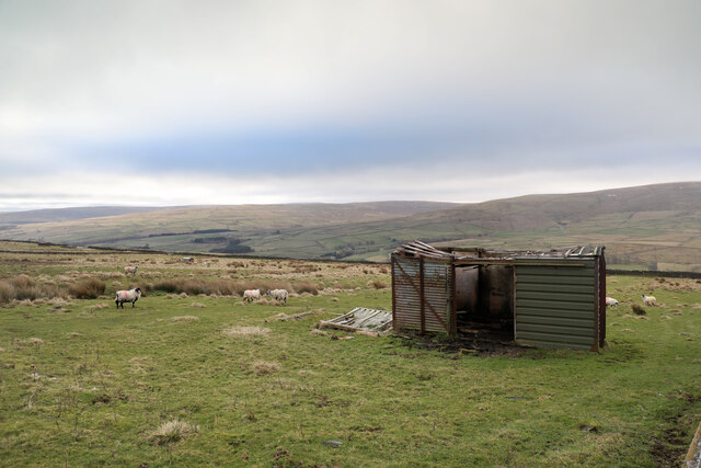
Surrounded by rolling hills and lush greenery, Snail Bed Cleugh offers breathtaking views in every direction. The valley is covered in a patchwork of fields, meadows, and woodlands, providing a haven for wildflowers and a rich diversity of plant and animal species.

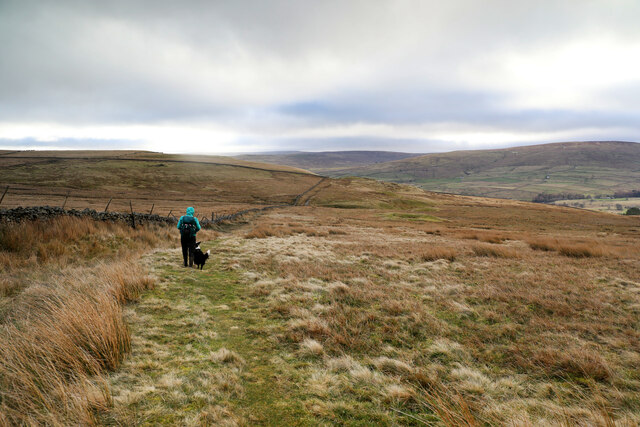
Visitors to Snail Bed Cleugh can explore the area on foot along the network of walking trails that crisscross the valley. These paths lead hikers through ancient woodlands, over quaint stone bridges, and up to panoramic viewpoints offering sweeping vistas of the surrounding countryside.

For those seeking a peaceful retreat or a place to connect with nature, Snail Bed Cleugh provides a serene and idyllic setting. Whether you wish to admire the flora and fauna, enjoy a picnic by the river, or simply take a leisurely stroll, this hidden gem in Durham is a haven of natural beauty waiting to be discovered.

If you have any feedback on the listing, please let us know in the comments section below.

Snail Bed Cleugh Images

Images are sourced within 2km of 54.746403/-2.1905289 or Grid Reference NY8739. Thanks to Geograph Open Source API. All images are credited.

Grazing pasture at Newhouse Pastures This is an area of level pasture adjacent to the Weardale Way.
Grazing pasture at Newhouse Pastures
This is an area of level pasture adjacent to the Weardale Way.
Embankment on the former Bishop Auckland to Wearhead branch line Similar view in image <a href="https://www.geograph.org.uk/photo/6117873">NY8837 : Low embankment on the former Bishop Auckland to Wearhead branch line</a> but a different season.
Embankment on the former Bishop Auckland to Wearhead branch line
Embankment on the former Bishop Auckland to Wearhead branch The disused line embankment between Daddry Shield and St. John's Chapel.
Embankment on the former Bishop Auckland to Wearhead branch
The disused line embankment between Daddry Shield and St. John's Chapel.
Small waterfall on the River Wear upstream of Daddry Shield bridge
Farmland west of St John's Chapel
Farm west of St John's Chapel
Bridleway over Carr Brow Moor From Middlehope Bank (the minor road from Rookhope to Ireshopeburn) the bridleway gives good walking down towards Levelgate Sike and up over the shoulder of Bleak Laws on Carr Brow Moor. Just beyond the horizon, it passes through a gate and becomes a more substantial track, rather cut up by big tractor tyres, making the descent into Weardale a bit more wearing than the pleasant going on the moor.
Bridleway over Carr Brow Moor
From Middlehope Bank (the minor road from Rookhope to Ireshopeburn) the bridleway gives good walking down towards Levelgate Sike and up over the shoulder of Bleak Laws on Carr Brow Moor. Just beyond the horizon, it passes through a gate and becomes a more substantial track, rather cut up by big tractor tyres, making the descent into Weardale a bit more wearing than the pleasant going on the moor.
Not much shelter left This disused railway goods van shell has been here long enough to be mapped by the OS, but in that time, the weather has done it no good at all. With parts of the roof falling in, and part blown off, it may provide shelter from the wind for a few sheep, but certainly won't keep the rain or snow off. One panel seems to have been replaced by corrugated iron, but it looks as though the owner has decided that further repair is pointless. One hopes that on its final demise, it is removed and metal parts suitably recycled, not left here to rust and rot away completely.
Not much shelter left
This disused railway goods van shell has been here long enough to be mapped by the OS, but in that time, the weather has done it no good at all. With parts of the roof falling in, and part blown off, it may provide shelter from the wind for a few sheep, but certainly won't keep the rain or snow off. One panel seems to have been replaced by corrugated iron, but it looks as though the owner has decided that further repair is pointless. One hopes that on its final demise, it is removed and metal parts suitably recycled, not left here to rust and rot away completely.
River Wear near Waterside Farm
Snow-covered field with trees beyond A winter view from the car park at the east end of the village of St John's Chapel beside the farmers' market. A spring time image from the same location can be seen here - <a title="https://www.geograph.org.uk/photo/5378377" href="https://www.geograph.org.uk/photo/5378377">Link</a> .
Snow-covered field with trees beyond
A winter view from the car park at the east end of the village of St John's Chapel beside the farmers' market. A spring time image from the same location can be seen here - Link .
Newfield The property at Newfield seen along its access road high on the northern side of Weardale.
Newfield
The property at Newfield seen along its access road high on the northern side of Weardale.
Three methods of crossing Huntshield Ford at St John's Chapel where in addition to the ford there's a footbridge and stepping stones.
Three methods of crossing
Huntshield Ford at St John's Chapel where in addition to the ford there's a footbridge and stepping stones.
River Wear upstream from Huntshield Ford Low water in the river would almost allow a dry shod crossing of the concrete roadway, but there are stepping stones to use and a footbridge immediately behind the camera position.
River Wear upstream from Huntshield Ford
Low water in the river would almost allow a dry shod crossing of the concrete roadway, but there are stepping stones to use and a footbridge immediately behind the camera position.
River Wear upstream near Daddry Shield Extensive areas of stones and boulders are exposed due to the low water level in the river in this view from the Weardale Way on its south side.
[Note: as this image upload was made, (28 April 2022), 1:50 000 OS mapping, depending on how it was accessed on the Geograph website showed the route of the Weardale Way on different sides of the river at the location.]
River Wear upstream near Daddry Shield
Extensive areas of stones and boulders are exposed due to the low water level in the river in this view from the Weardale Way on its south side. [Note: as this image upload was made, (28 April 2022), 1:50 000 OS mapping, depending on how it was accessed on the Geograph website showed the route of the Weardale Way on different sides of the river at the location.]
Trees on grazing land at West Blackdene Several deciduous trees in the field which has rough grazing; it's south of a minor road in Weardale.
Chapel Fell is the moorland hill in the distance.
Trees on grazing land at West Blackdene
Several deciduous trees in the field which has rough grazing; it's south of a minor road in Weardale. Chapel Fell is the moorland hill in the distance.
Trees in valley of Elmford Cleugh Elmford Cleugh is a tributary of the River Wear descending on the north side of the valley.
Trees in valley of Elmford Cleugh
Elmford Cleugh is a tributary of the River Wear descending on the north side of the valley.
West Blackdene Small community near Ireshopeburn in Weardale
West Blackdene
Small community near Ireshopeburn in Weardale
Show me another place!

Snail Bed Cleugh is located at Grid Ref: NY8739 (Lat: 54.746403, Lng: -2.1905289)

Unitary Authority: County Durham

Police Authority: Durham

What 3 Words

///anchovies.secondly.hints. Near Stanhope, Co. Durham

Related Wikis

East Blackdene

East Blackdene is a hamlet in the civil parish of Stanhope, in County Durham, England. It is situated to the north of the River Wear, on the opposite side...

West Blackdene

West Blackdene is a village in the civil parish of Stanhope, in County Durham, England. It is situated to the north of the River Wear, opposite Ireshopeburn...

Ireshopeburn

Ireshopeburn ( EYE-sup-burn ) is a village in the civil parish of Stanhope, in County Durham, England. It is situated on the south side of Weardale, between...

St John's Chapel, County Durham

St John's Chapel is a village in the civil parish of Stanhope, in County Durham, England. It is situated in Weardale, on the south side of the River Wear...

Nearby Amenities

Located within 500m of 54.746403,-2.1905289
Historic: mine
Mineral: lead
Source: OS_OpenData_StreetView
Lat/Long: 54.7501023/-2.194174
Power: pole
Lat/Long: 54.7422458/-2.1892677
Power: pole
Lat/Long: 54.7427368/-2.1902884
Power: pole
Lat/Long: 54.7432065/-2.1913228
Power: pole
Lat/Long: 54.7433314/-2.1924927
Power: pole
Lat/Long: 54.7434586/-2.1937044
Power: pole
Lat/Long: 54.7435834/-2.194863
Power: pole
Lat/Long: 54.7436948/-2.1959481
Barrier: stile
Foot: yes
Stile: squeezer
Lat/Long: 54.7423383/-2.1904853
Barrier: entrance
Lat/Long: 54.7479692/-2.188181
Sunny Bank (Farm)
Place: farm
Source: OS_OpenData_StreetView
Lat/Long: 54.7440554/-2.1893209
Middle Blackdene
Place: hamlet
Source Name: OS_OpenData_StreetView
Lat/Long: 54.7427998/-2.1921721
Barrier: entrance
Lat/Long: 54.7478451/-2.1909017
High Barns
Place: locality
Source Name: OS_OpenData_StreetView
Lat/Long: 54.7455711/-2.197322
Power: pole
Transformer: distribution
Lat/Long: 54.7433664/-2.1924873
Power: pole
Lat/Long: 54.7436997/-2.1921399
Power: pole
Lat/Long: 54.7440354/-2.1919119
Power: pole
Lat/Long: 54.7441222/-2.1906188
Power: pole
Lat/Long: 54.7442109/-2.190437
Power: pole
Lat/Long: 54.7446898/-2.1895063
Power: pole
Lat/Long: 54.7450575/-2.1890165
Power: pole
Lat/Long: 54.7454045/-2.1884936
Power: pole
Lat/Long: 54.7433685/-2.1923821
Power: pole
Lat/Long: 54.7442475/-2.1917304
Power: pole
Lat/Long: 54.7451831/-2.1877353
The data included in this document is from www.openstreetmap.org. The data is made available under ODbL.

Have you been to Snail Bed Cleugh?

Leave your review of Snail Bed Cleugh below (or comments, questions and feedback).