Hale House Clough

Valley in Lancashire Burnley

England

Hale House Clough

WWII Lancashire: Ghost Signs of the Home Front  (22) -
Emergency Water Supply, Hand Bridge, Todmorden Road, Burnley

"EWS Hatch"

A rare EWS sign of metal on the bridge over the River Calder. "EWS Hatch" may refer to a facility to obtain an emergency supply of water from the river (below the bridge).

<a href="https://www.geograph.org.uk/photo/6945367">SD8432 : WWII Lancashire: Ghost Signs of the Home Front  (23)</a>
WWII Lancashire: Ghost Signs of the Home Front (22) Credit: Mike Searle

Hale House Clough is a picturesque valley located in the county of Lancashire, England. Situated near the town of Rawtenstall, this enchanting natural landscape is a popular destination for nature enthusiasts and hikers alike.

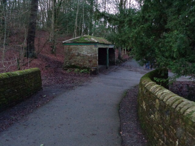
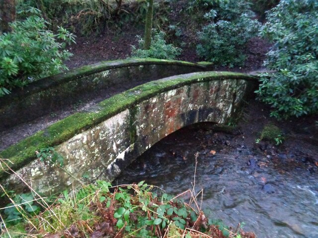
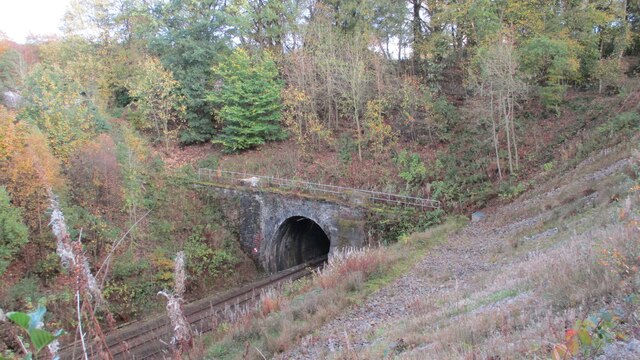
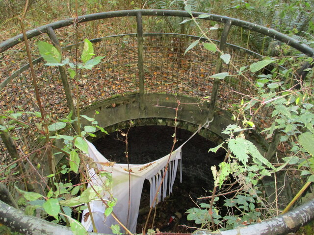
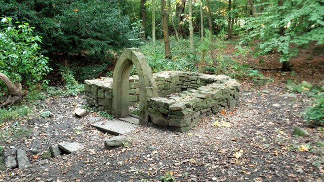
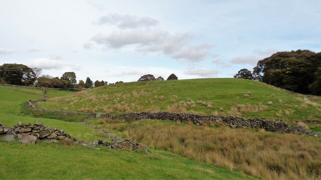
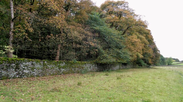
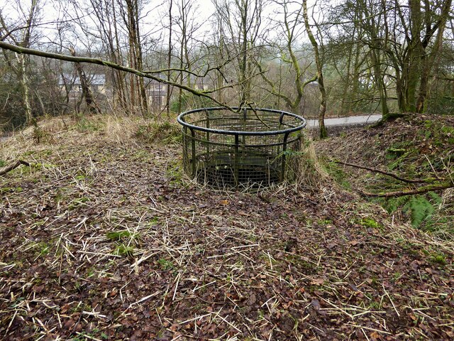
The valley is characterized by its rolling hills, dense woodlands, and vibrant flora and fauna. It is traversed by a meandering stream, which adds to the tranquility and charm of the area. The valley is also home to a variety of wildlife, including deer, rabbits, and a rich array of bird species.

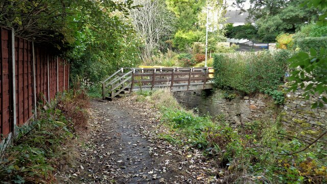
Hale House Clough offers a range of outdoor activities for visitors to enjoy. There are numerous walking trails that wind through the valley, providing breathtaking views of the surrounding countryside. The trails cater to all levels of fitness and are well-maintained, ensuring a safe and enjoyable experience for all.

The valley is also a haven for photography enthusiasts, as it provides ample opportunities to capture stunning shots of the natural beauty on display. Whether it's the vibrant autumn foliage, the cascading waterfalls, or the peaceful meadows, Hale House Clough offers a plethora of picturesque scenes to capture.

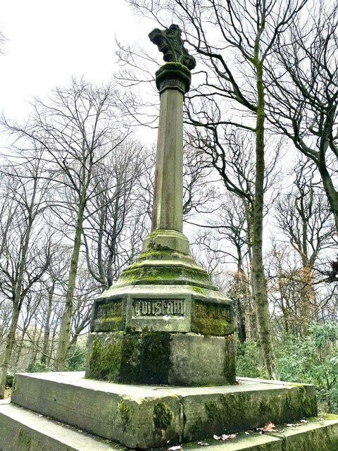
In addition to its natural attractions, the valley is steeped in history. Hale House, a Grade II listed building, dates back to the 17th century and is a prominent feature of the area. Its picturesque architecture and idyllic setting make it a popular subject for artists and photographers.

Overall, Hale House Clough is a hidden gem in Lancashire, offering a tranquil escape from the hustle and bustle of daily life. Its stunning natural beauty, diverse wildlife, and rich history make it a must-visit destination for nature lovers and history enthusiasts alike.

If you have any feedback on the listing, please let us know in the comments section below.

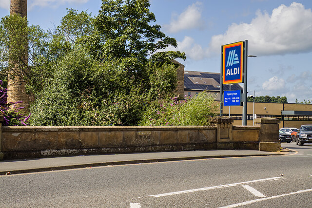
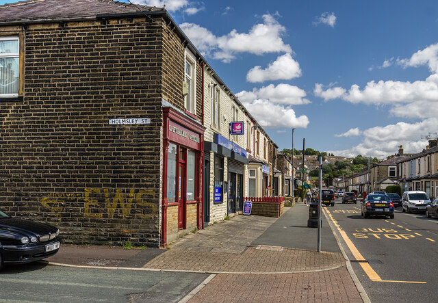
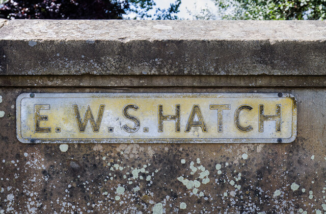
Hale House Clough Images

Images are sourced within 2km of 53.771231/-2.2158775 or Grid Reference SD8530. Thanks to Geograph Open Source API. All images are credited.

WWII Lancashire: Ghost Signs of the Home Front  (22) -
Emergency Water Supply, Hand Bridge, Todmorden Road, Burnley

"EWS Hatch"

A rare EWS sign of metal on the bridge over the River Calder. "EWS Hatch" may refer to a facility to obtain an emergency supply of water from the river (below the bridge).

<a href="https://www.geograph.org.uk/photo/6945367">SD8432 : WWII Lancashire: Ghost Signs of the Home Front  (23)</a>
WWII Lancashire: Ghost Signs of the Home Front (22)
- Emergency Water Supply, Hand Bridge, Todmorden Road, Burnley "EWS Hatch" A rare EWS sign of metal on the bridge over the River Calder. "EWS Hatch" may refer to a facility to obtain an emergency supply of water from the river (below the bridge). SD8432 : WWII Lancashire: Ghost Signs of the Home Front (23)
WWII Lancashire: Ghost Signs of the Home Front  (24) -
Emergency Water Supply, Holmsley Street, at junction with Lyndhurst Road, Burnley

"EWS 100 yds"

<a href="https://www.geograph.org.uk/photo/6945363">SD8432 : WWII Lancashire: Ghost Signs of the Home Front  (25)</a>
WWII Lancashire: Ghost Signs of the Home Front (24)
- Emergency Water Supply, Holmsley Street, at junction with Lyndhurst Road, Burnley "EWS 100 yds" SD8432 : WWII Lancashire: Ghost Signs of the Home Front (25)
WWII Lancashire: Ghost Signs of the Home Front  (25) -
Emergency Water Supply, Holmsley Street, at junction with Lyndhurst Road, Burnley

"EWS 100 yds"

                              *********
START: <a href="https://www.geograph.org.uk/photo/6944970">SJ8498 : WWII Lancashire: Ghost Signs of the Home Front  (1)</a>
WWII Lancashire: Ghost Signs of the Home Front (25)
- Emergency Water Supply, Holmsley Street, at junction with Lyndhurst Road, Burnley "EWS 100 yds" ********* START: SJ8498 : WWII Lancashire: Ghost Signs of the Home Front (1)
WWII Lancashire: Ghost Signs of the Home Front  (23) -
Emergency Water Supply,  Hand Bridge, Todmorden Road, Burnley

"EWS Hatch"

<a href="https://www.geograph.org.uk/photo/6945359">SD8432 : WWII Lancashire: Ghost Signs of the Home Front  (24)</a>
WWII Lancashire: Ghost Signs of the Home Front (23)
- Emergency Water Supply, Hand Bridge, Todmorden Road, Burnley "EWS Hatch" SD8432 : WWII Lancashire: Ghost Signs of the Home Front (24)
Old Wayside Cross in Tiwneley Park, Burnley Foldys' Cross, an old market cross base in a new cross. Moved to the intersection of footpaths leading towards Todmorden road in Towneley Park, 300 metres southwest of Towneley Hall in Burnley. Grade II Listed <span class="nowrap"><a title="https://historicengland.org.uk/listing/the-list/list-entry/1247301" rel="nofollow ugc noopener" href="https://historicengland.org.uk/listing/the-list/list-entry/1247301">Link</a><img style="margin-left:2px;" alt="External link" title="External link - shift click to open in new window" src="https://s1.geograph.org.uk/img/external.png" width="10" height="10"/></span>. See also <a title="https://www.geograph.org.uk/photo/3569776" href="https://www.geograph.org.uk/photo/3569776">Link</a> and <a title="https://www.geograph.org.uk/photo/1133733" href="https://www.geograph.org.uk/photo/1133733">Link</a>.

Milestone Society National ID: LABU_BUR03
Old Wayside Cross in Tiwneley Park, Burnley
Foldys' Cross, an old market cross base in a new cross. Moved to the intersection of footpaths leading towards Todmorden road in Towneley Park, 300 metres southwest of Towneley Hall in Burnley. Grade II Listed LinkExternal link. See also Link and Link. Milestone Society National ID: LABU_BUR03
Towneley Hall The north east frontage
Towneley Hall
The north east frontage
Park Shelters At Boggart Bridge in Towneley Park Wilderness
Park Shelters
At Boggart Bridge in Towneley Park Wilderness
Ornamental Footbridge In the Wilderness of Towneley Park over Copy Clough
Ornamental Footbridge
In the Wilderness of Towneley Park over Copy Clough
Towneley Railway Tunnel The north portal
Towneley Railway Tunnel
The north portal
Beehive Coke Oven The charging hole decorated for Halloween
Beehive Coke Oven
The charging hole decorated for Halloween
Burnley - Handbridge Mill Historic (1891) cotton mill with a landmark chimney - seen here from the north stand at Turf Moor.
Burnley - Handbridge Mill
Historic (1891) cotton mill with a landmark chimney - seen here from the north stand at Turf Moor.
Burnley Way Footbridge Crosses the River Calder to give access to Park Road
Burnley Way Footbridge
Crosses the River Calder to give access to Park Road
Rustic Pavilion For the football fields in Towneley Park
Rustic Pavilion
For the football fields in Towneley Park
Monk's Well In Thanet Lee Wood on the Towneley Estate. Whilst it contains a stone trough, the construction around it is believed to be a re-created Gothick folly.
Monk's Well
In Thanet Lee Wood on the Towneley Estate. Whilst it contains a stone trough, the construction around it is believed to be a re-created Gothick folly.
Round Hill There are earthworks marked on the OS map for the hill. There are surface stones visible in that area. More remarkable are the large monoliths built into the field walls around this area and perhaps they had been in the earthworks in times past.
Round Hill
There are earthworks marked on the OS map for the hill. There are surface stones visible in that area. More remarkable are the large monoliths built into the field walls around this area and perhaps they had been in the earthworks in times past.
Estate Walling to Ormerod House The substantial walling encloses the River Brun within the private estate, so this path along the valley has no view of the river.
Estate Walling to Ormerod House
The substantial walling encloses the River Brun within the private estate, so this path along the valley has no view of the river.
New Housing (The Calders) Off Red Lees Road and causing the diversion of public footpaths
New Housing (The Calders)
Off Red Lees Road and causing the diversion of public footpaths
Modern railings on Beehive Coke Oven The railings are around the charging hole of a preserved historic beehive coke oven. There are many remains on this hillside of the banks of ovens and tramways that served them, but only one beehive oven appears complete.
Modern railings on Beehive Coke Oven
The railings are around the charging hole of a preserved historic beehive coke oven. There are many remains on this hillside of the banks of ovens and tramways that served them, but only one beehive oven appears complete.
Show me another place!

Hale House Clough is located at Grid Ref: SD8530 (Lat: 53.771231, Lng: -2.2158775)

Administrative County: Lancashire

District: Burnley

Police Authority: Lancashire

What 3 Words

///tiger.basket.edits. Near Burnley, Lancashire

Related Wikis

Towneley Park

Towneley Park is owned and managed by Burnley Borough Council and is the largest and most popular park in Burnley, Lancashire, England. The main entrance...

Cliviger

Cliviger is a civil parish in the Borough of Burnley, in Lancashire, England. It is situated to the southeast of Burnley, and northwest of Todmorden....

Towneley Colliery

Towneley Colliery or Towneley Desmesne was a coal mine on the Burnley Coalfield in Burnley, Lancashire, England. Sunk in the late 1860s, it was linked...

Unity College, Burnley

Unity College is a mixed 11-16 comprehensive school in Burnley, Lancashire, England. == History == === Former school === Towneley High School originally...

Towneley railway station

Towneley railway station was a station in Lancashire which served Burnley Wood and the nearby Towneley Hall on the eastern edge of Burnley. Opened on 12...

Singing Ringing Tree (sculpture)

The Singing Ringing Tree is a wind powered sound sculpture resembling a tree set in the landscape of the Pennine hill range overlooking Burnley, in Lancashire...

Burnley Wood

Burnley Wood is a district and former electoral ward of Burnley, Lancashire. In broad terms the area lies between Parliament Street in the north and Hufling...

Fother Royd Wood

Fother Royd Wood is a woodland in Lancashire, England, near Worsthorne. It covers a total area of 1.03 hectares (2.55 acres). It is owned and managed by...

Related Videos

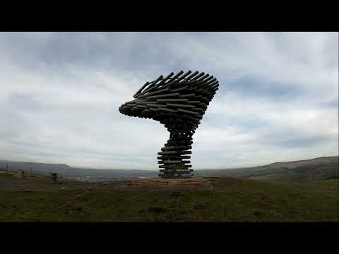
Singing Ringing Tree Hike

The Singing Ringing Tree located in Burnley England. The sculpture is a strange place it has a very strange sound when the wind ...

Walking to Turf Moor Football Ground and Burnley Town Centre

Today we're in Burnley, in the north of England, to take a walk along the Leeds & Liverpool canal to have a look at Turf Moor, the ...

Walking Around Turf Moor

We went for a walk along the Leeds & Liverpool Canal, then around the outside of Burnley FC's stadium, Turf Moor, before ...

Nearby Amenities

Located within 500m of 53.771231,-2.2158775
Turning Circle
Lat/Long: 53.7684881/-2.2105629
Offshoots
Description: Offshoots Permaculture Project
Lat/Long: 53.7735213/-2.2207159
Burnley War Memorial
HE Ref: 1247303
Artist Name: Walter Gilbert & Louis Weingartner
Heritage: 2
Heritage Operator: Historic England
Historic: heritage
Listed Status: Grade II*
Material: stone
Memorial: war_memorial
Operator: Burnley Borough Council
Start Date: 1926
Website: https://historicengland.org.uk/listing/the-list/list-entry/1247303
Lat/Long: 53.7738614/-2.220802
The data included in this document is from www.openstreetmap.org. The data is made available under ODbL.

Have you been to Hale House Clough?

Leave your review of Hale House Clough below (or comments, questions and feedback).