Hole House Clough

Valley in Lancashire Burnley

England

Hole House Clough

Old Wayside Cross in Tiwneley Park, Burnley Foldys' Cross, an old market cross base in a new cross. Moved to the intersection of footpaths leading towards Todmorden road in Towneley Park, 300 metres southwest of Towneley Hall in Burnley. Grade II Listed <span class="nowrap"><a title="https://historicengland.org.uk/listing/the-list/list-entry/1247301" rel="nofollow ugc noopener" href="https://historicengland.org.uk/listing/the-list/list-entry/1247301">Link</a><img style="margin-left:2px;" alt="External link" title="External link - shift click to open in new window" src="https://s1.geograph.org.uk/img/external.png" width="10" height="10"/></span>. See also <a title="https://www.geograph.org.uk/photo/3569776" href="https://www.geograph.org.uk/photo/3569776">Link</a> and <a title="https://www.geograph.org.uk/photo/1133733" href="https://www.geograph.org.uk/photo/1133733">Link</a>.

Milestone Society National ID: LABU_BUR03
Old Wayside Cross in Tiwneley Park, Burnley Credit: Lee Rob

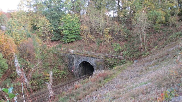
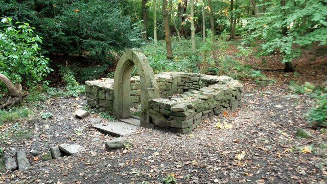
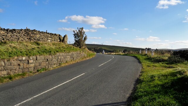
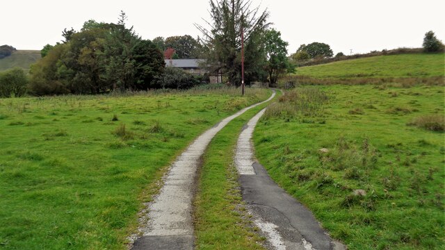
Hole House Clough is a picturesque valley located in Lancashire, England. Situated amidst the stunning countryside, it offers visitors a serene and tranquil experience in the heart of nature. The valley is renowned for its breathtaking landscapes, lush greenery, and diverse wildlife.

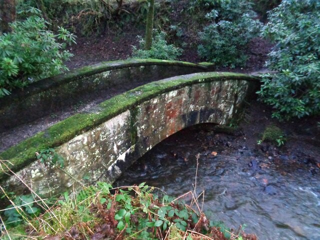
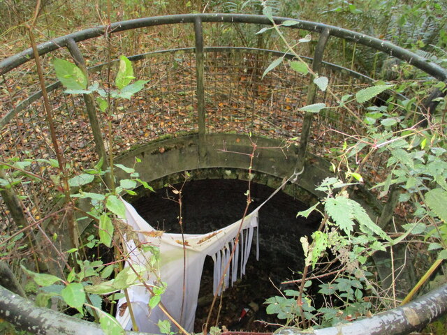
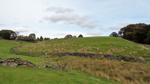
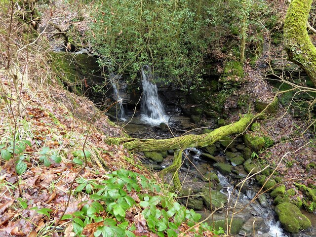
Nestled between rolling hills, Hole House Clough boasts a meandering stream that flows through its heart. The gentle sound of the water adds to the peaceful ambiance of the area. The valley is also home to a variety of plant species, including ancient oak trees, wildflowers, and ferns, creating a rich tapestry of colors throughout the seasons.

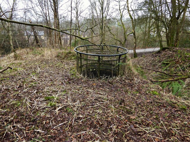
Nature enthusiasts flock to Hole House Clough for its abundant wildlife. Visitors can spot a plethora of bird species, such as buzzards, kestrels, and woodpeckers, making it a haven for birdwatching enthusiasts. Additionally, the valley is home to mammals like rabbits, foxes, and badgers, providing ample opportunities for animal sightings.

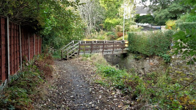
For those seeking outdoor activities, Hole House Clough offers numerous walking trails that wind through its enchanting landscape. Hikers can explore the valley's hidden nooks and crannies, discovering hidden waterfalls and panoramic viewpoints along the way.

Overall, Hole House Clough is a picturesque and peaceful valley in Lancashire, offering a sanctuary for nature lovers and a haven for those seeking solace in the beauty of the natural world.

If you have any feedback on the listing, please let us know in the comments section below.

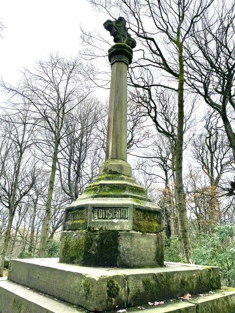
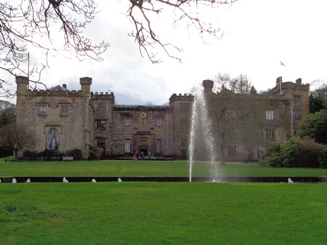
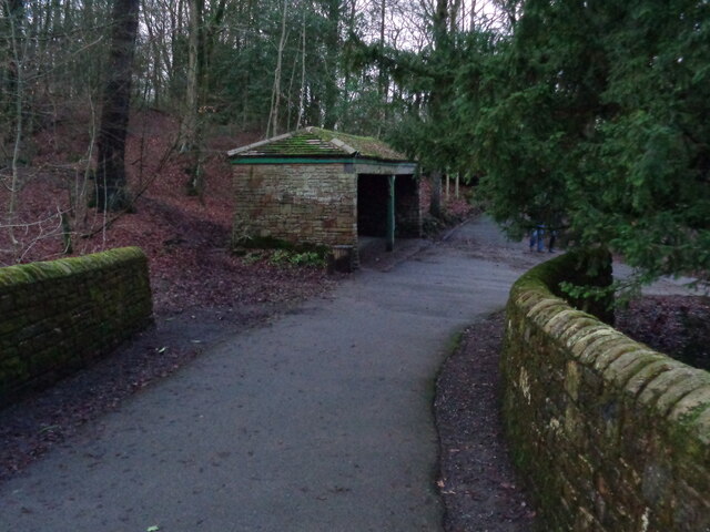
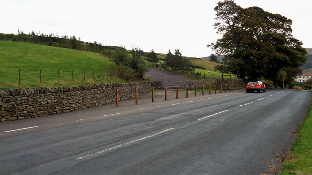
Hole House Clough Images

Images are sourced within 2km of 53.766018/-2.2158811 or Grid Reference SD8529. Thanks to Geograph Open Source API. All images are credited.

Old Wayside Cross in Tiwneley Park, Burnley Foldys' Cross, an old market cross base in a new cross. Moved to the intersection of footpaths leading towards Todmorden road in Towneley Park, 300 metres southwest of Towneley Hall in Burnley. Grade II Listed <span class="nowrap"><a title="https://historicengland.org.uk/listing/the-list/list-entry/1247301" rel="nofollow ugc noopener" href="https://historicengland.org.uk/listing/the-list/list-entry/1247301">Link</a><img style="margin-left:2px;" alt="External link" title="External link - shift click to open in new window" src="https://s1.geograph.org.uk/img/external.png" width="10" height="10"/></span>. See also <a title="https://www.geograph.org.uk/photo/3569776" href="https://www.geograph.org.uk/photo/3569776">Link</a> and <a title="https://www.geograph.org.uk/photo/1133733" href="https://www.geograph.org.uk/photo/1133733">Link</a>.

Milestone Society National ID: LABU_BUR03
Old Wayside Cross in Tiwneley Park, Burnley
Foldys' Cross, an old market cross base in a new cross. Moved to the intersection of footpaths leading towards Todmorden road in Towneley Park, 300 metres southwest of Towneley Hall in Burnley. Grade II Listed LinkExternal link. See also Link and Link. Milestone Society National ID: LABU_BUR03
Towneley Hall The north east frontage
Towneley Hall
The north east frontage
Park Shelters At Boggart Bridge in Towneley Park Wilderness
Park Shelters
At Boggart Bridge in Towneley Park Wilderness
Ornamental Footbridge In the Wilderness of Towneley Park over Copy Clough
Ornamental Footbridge
In the Wilderness of Towneley Park over Copy Clough
Towneley Railway Tunnel The north portal
Towneley Railway Tunnel
The north portal
Beehive Coke Oven The charging hole decorated for Halloween
Beehive Coke Oven
The charging hole decorated for Halloween
Burnley Way Footbridge Crosses the River Calder to give access to Park Road
Burnley Way Footbridge
Crosses the River Calder to give access to Park Road
Rustic Pavilion For the football fields in Towneley Park
Rustic Pavilion
For the football fields in Towneley Park
Monk's Well In Thanet Lee Wood on the Towneley Estate. Whilst it contains a stone trough, the construction around it is believed to be a re-created Gothick folly.
Monk's Well
In Thanet Lee Wood on the Towneley Estate. Whilst it contains a stone trough, the construction around it is believed to be a re-created Gothick folly.
The Long Causeway at Stump Cross The way marking stone known as Stump Cross is at the top of the roadside embankment on the bend. This stone has not been dressed unlike the Mount Cross which is further along this ancient route
The Long Causeway at Stump Cross
The way marking stone known as Stump Cross is at the top of the roadside embankment on the bend. This stone has not been dressed unlike the Mount Cross which is further along this ancient route
Round Hill There are earthworks marked on the OS map for the hill. There are surface stones visible in that area. More remarkable are the large monoliths built into the field walls around this area and perhaps they had been in the earthworks in times past.
Round Hill
There are earthworks marked on the OS map for the hill. There are surface stones visible in that area. More remarkable are the large monoliths built into the field walls around this area and perhaps they had been in the earthworks in times past.
New Housing (The Calders) Off Red Lees Road and causing the diversion of public footpaths
New Housing (The Calders)
Off Red Lees Road and causing the diversion of public footpaths
Modern railings on Beehive Coke Oven The railings are around the charging hole of a preserved historic beehive coke oven. There are many remains on this hillside of the banks of ovens and tramways that served them, but only one beehive oven appears complete.
Modern railings on Beehive Coke Oven
The railings are around the charging hole of a preserved historic beehive coke oven. There are many remains on this hillside of the banks of ovens and tramways that served them, but only one beehive oven appears complete.
Waterfall on unnamed stream Paths are being renewed in this area which is the northern boundary of the former Towneley Colliery & Brickworks site (now largely replaced by the housing of The Kilns)
Waterfall on unnamed stream
Paths are being renewed in this area which is the northern boundary of the former Towneley Colliery & Brickworks site (now largely replaced by the housing of The Kilns)
The Singing Ringing Tree One of East Lancashire's Panopticons
The Singing Ringing Tree
One of East Lancashire's Panopticons
The Singing Ringing Tree One of East Lancashire's Panopticons, but I do not think the view is better from on top of the structure
The Singing Ringing Tree
One of East Lancashire's Panopticons, but I do not think the view is better from on top of the structure
Coal Clough Wind Farm Access Road Leads off Red Lees Road at Overtown for those long loads up to The Long Causeway
Coal Clough Wind Farm Access Road
Leads off Red Lees Road at Overtown for those long loads up to The Long Causeway
Honey Holme Lane Approaching Honey Holme after crossing the River Calder
Honey Holme Lane
Approaching Honey Holme after crossing the River Calder
Show me another place!

Hole House Clough is located at Grid Ref: SD8529 (Lat: 53.766018, Lng: -2.2158811)

Administrative County: Lancashire

District: Burnley

Police Authority: Lancashire

What 3 Words

///choice.herb.waters. Near Burnley, Lancashire

Related Wikis

Cliviger

Cliviger is a civil parish in the Borough of Burnley, in Lancashire, England. It is situated to the southeast of Burnley, and northwest of Todmorden....

Towneley Park

Towneley Park is owned and managed by Burnley Borough Council and is the largest and most popular park in Burnley, Lancashire, England. The main entrance...

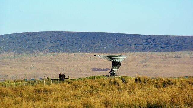
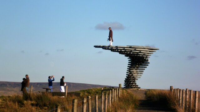
Singing Ringing Tree (sculpture)

The Singing Ringing Tree is a wind powered sound sculpture resembling a tree set in the landscape of the Pennine hill range overlooking Burnley, in Lancashire...

Towneley Colliery

Towneley Colliery or Towneley Desmesne was a coal mine on the Burnley Coalfield in Burnley, Lancashire, England. Sunk in the late 1860s, it was linked...

Unity College, Burnley

Unity College is a mixed 11-16 comprehensive school in Burnley, Lancashire, England. == History == === Former school === Towneley High School originally...

Towneley railway station

Towneley railway station was a station in Lancashire which served Burnley Wood and the nearby Towneley Hall on the eastern edge of Burnley. Opened on 12...

Burnley Wood

Burnley Wood is a district and former electoral ward of Burnley, Lancashire. In broad terms the area lies between Parliament Street in the north and Hufling...

Holme railway station (Lancashire)

Holme railway station served Holme Chapel on the Copy Pit line. The station closed in July 1930 and the line now serves as a non-stop route between Hebden...

Nearby Amenities

Located within 500m of 53.766018,-2.2158811
Fuel
Monarch Garage
Lat/Long: 53.7660127/-2.2086955
Turning Circle
Lat/Long: 53.7684881/-2.2105629
Turning Circle
Lat/Long: 53.7667554/-2.2086222
Turning Circle
Lat/Long: 53.7679176/-2.2095186
Barrier: swing_gate
Lat/Long: 53.76302/-2.2102617
Entrance: yes
Lat/Long: 53.7620046/-2.2141464
Barrier: stile
Lat/Long: 53.7650436/-2.2126879
Entrance: yes
Lat/Long: 53.7653058/-2.2127983
Railway: crossing
Lat/Long: 53.7660759/-2.210987
Railway: crossing
Lat/Long: 53.7661121/-2.2109581
The data included in this document is from www.openstreetmap.org. The data is made available under ODbL.

Have you been to Hole House Clough?

Leave your review of Hole House Clough below (or comments, questions and feedback).