Acre Bottom

Valley in Lancashire

England

Acre Bottom

A56, Peel Tower in the distance
A56, Peel Tower in the distance Credit: thejackrustles

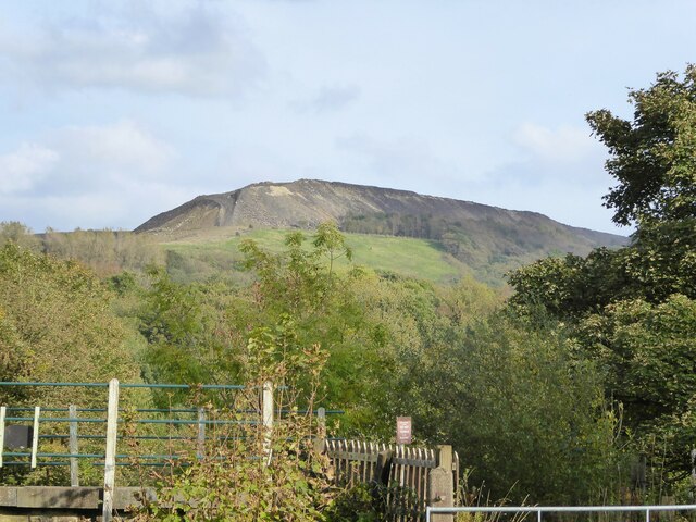
Acre Bottom is a picturesque valley located in Lancashire, England. Nestled in the heart of the Ribble Valley, this area is renowned for its natural beauty and captivating landscapes. It is situated near the charming village of Whalley and is easily accessible from nearby towns and cities.

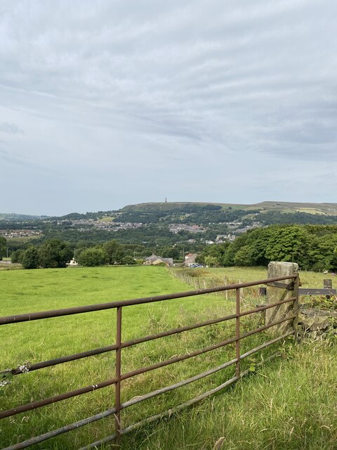
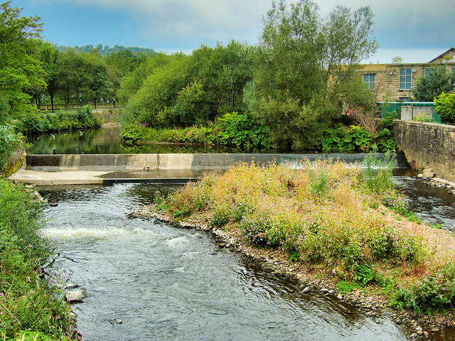
The valley is characterized by rolling hills, lush green fields, and meandering rivers. It is surrounded by dense woodlands and offers breathtaking views of the Lancashire countryside. Acre Bottom is a haven for wildlife enthusiasts, as it is home to a diverse range of flora and fauna. The valley boasts a rich biodiversity, with various species of birds, mammals, and plants thriving in its ecosystem.

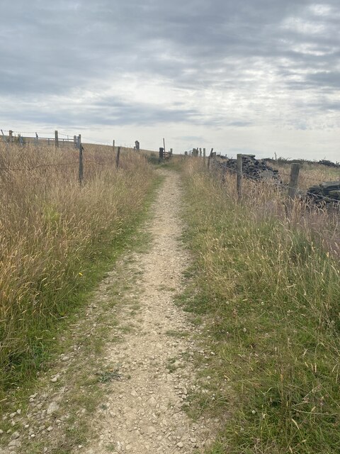
The peaceful and tranquil atmosphere of Acre Bottom makes it an ideal spot for outdoor activities and leisurely walks. There are several walking trails and footpaths that wind through the valley, allowing visitors to explore its natural wonders. The river that flows through the valley is also a popular spot for fishing enthusiasts.

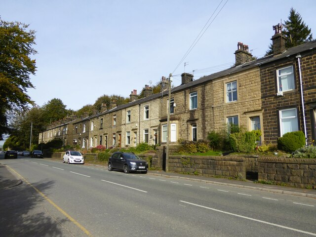
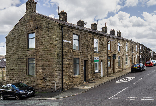
In addition to its natural beauty, Acre Bottom has historical significance as well. It is dotted with remnants of old mills and farmhouses, showcasing a glimpse into the region's industrial past. The valley also has a close-knit community, with a few small settlements scattered throughout its expanse.

Overall, Acre Bottom in Lancashire offers a serene and idyllic retreat for nature lovers and those seeking a peaceful escape from the hustle and bustle of everyday life.

If you have any feedback on the listing, please let us know in the comments section below.
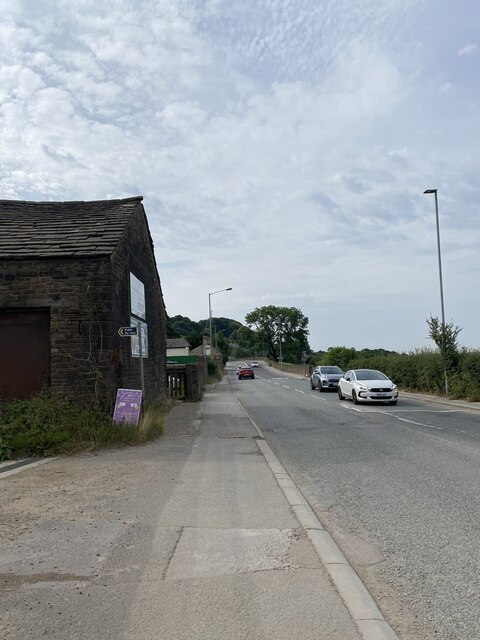
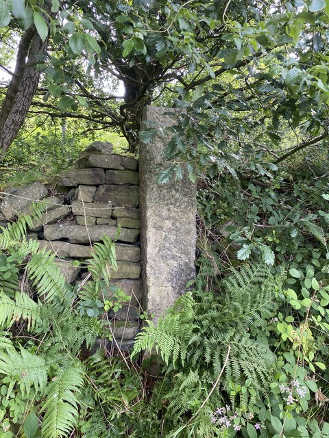
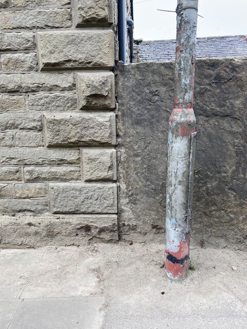
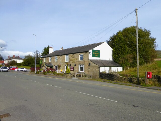
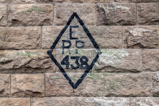
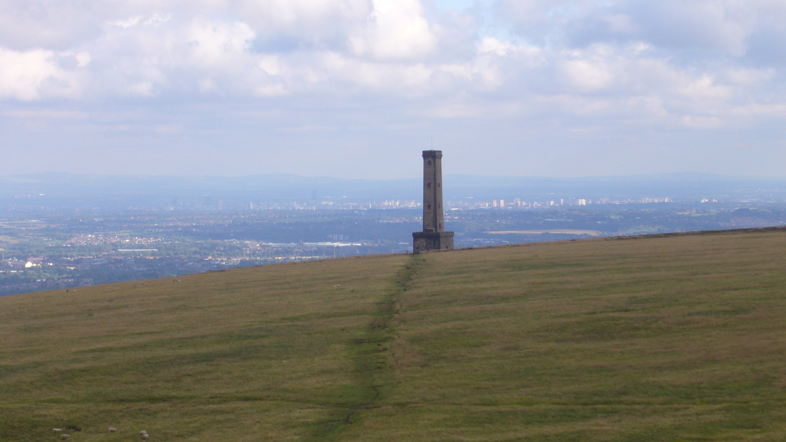
Acre Bottom Images

Images are sourced within 2km of 53.645618/-2.3118209 or Grid Reference SD7916. Thanks to Geograph Open Source API. All images are credited.

A56, Peel Tower in the distance
OS Cut Mark - Ramsbottom, Whitelow Road Right of Way <span class="nowrap"><a title="https://www.bench-marks.org.uk/bm94166" rel="nofollow ugc noopener" href="https://www.bench-marks.org.uk/bm94166">Link</a><img style="margin-left:2px;" alt="External link" title="External link - shift click to open in new window" src="https://s1.geograph.org.uk/img/external.png" width="10" height="10"/></span>
OS Cut Mark - Ramsbottom, Whitelow Road Right of Way
Location of OS Cut Mark - Ramsbottom, Whitelow Road Right of Way
Lovely views
Lovely views
Right of way to Harden Moor A bit bumpy for my liking
Right of way to Harden Moor
A bit bumpy for my liking
Right of way to Harden Moor
Harden Moor Trig Point Flush Bracket S4553 Even trig pillars need shade in this heat!
Harden Moor Trig Point Flush Bracket S4553
Even trig pillars need shade in this heat!
Views North East from Harden Moor
Cut Mark - Ramsbottom, Eagle and Child Public House <span class="nowrap"><a title="https://www.bench-marks.org.uk/bm49380" rel="nofollow ugc noopener" href="https://www.bench-marks.org.uk/bm49380">Link</a><img style="margin-left:2px;" alt="External link" title="External link - shift click to open in new window" src="https://s1.geograph.org.uk/img/external.png" width="10" height="10"/></span>
Cut Mark - Ramsbottom, Eagle and Child Public House
Location of Cut Mark - Ramsbottom, Eagle and Child Public House
Fletcher Bank Quarry above Ramsbottom View from Holcombe Hill on the path to Peel Tower. Scout Moor windfarm is on the skyline
Fletcher Bank Quarry above Ramsbottom
View from Holcombe Hill on the path to Peel Tower. Scout Moor windfarm is on the skyline
Quarry spoil heap An active quarry looming above the Irwell Valley
Quarry spoil heap
An active quarry looming above the Irwell Valley
Terrace housing On Whalley Road
Terrace housing
On Whalley Road
Duckworth Arms On Whalley Road between Shuttleworth and Edenfield
Duckworth Arms
On Whalley Road between Shuttleworth and Edenfield
WWII Lancashire: Ghost Signs of the Home Front  (20) -
Emergency Rendezvous Point, Rostron Road, Ramsbottom, at junction with Victoria Street

"ERP 438" looks remarkably fresh, most probably repainted.

Emergency Rendezvous Points (ERP) were designated places in the locality for the coordination of ARP and emergency services during civil emergencies, particularly for those services arriving from outside the area. The signs appear in a variety of designs, but most are diamond shapes framing the ERP locality number.

<a href="https://www.geograph.org.uk/photo/6945322">SD7816 : WWII Lancashire: Ghost Signs of the Home Front  (21)</a>
WWII Lancashire: Ghost Signs of the Home Front (20)
- Emergency Rendezvous Point, Rostron Road, Ramsbottom, at junction with Victoria Street "ERP 438" looks remarkably fresh, most probably repainted. Emergency Rendezvous Points (ERP) were designated places in the locality for the coordination of ARP and emergency services during civil emergencies, particularly for those services arriving from outside the area. The signs appear in a variety of designs, but most are diamond shapes framing the ERP locality number. SD7816 : WWII Lancashire: Ghost Signs of the Home Front (21)
WWII Lancashire: Ghost Signs of the Home Front  (21) -
Emergency Rendezvous Point, Rostron Road, Ramsbottom, at junction with Victoria Street

"ERP 438"

Emergency Rendezvous Points (ERP) were designated places in the locality for the coordination of ARP and emergency services during civil emergencies, particularly for those services arriving from outside the area. The signs appear in a variety of designs, but most are diamond shapes framing the ERP locality number.

<a href="https://www.geograph.org.uk/photo/6945337">SD8432 : WWII Lancashire: Ghost Signs of the Home Front  (22)</a>
WWII Lancashire: Ghost Signs of the Home Front (21)
- Emergency Rendezvous Point, Rostron Road, Ramsbottom, at junction with Victoria Street "ERP 438" Emergency Rendezvous Points (ERP) were designated places in the locality for the coordination of ARP and emergency services during civil emergencies, particularly for those services arriving from outside the area. The signs appear in a variety of designs, but most are diamond shapes framing the ERP locality number. SD8432 : WWII Lancashire: Ghost Signs of the Home Front (22)
River Irwell, Ramsbottom Weir Photographed from the Ramsbottom Bridge at Peel Brow. The channel at the left is the old mill stream which served the (now demolished) Holcombe Paper Mill.
River Irwell, Ramsbottom Weir
Photographed from the Ramsbottom Bridge at Peel Brow. The channel at the left is the old mill stream which served the (now demolished) Holcombe Paper Mill.
Show me another place!

Acre Bottom is located at Grid Ref: SD7916 (Lat: 53.645618, Lng: -2.3118209)

Unitary Authority: Bury

Police Authority: Greater Manchester

What 3 Words

///names.breezy.something. Near Ramsbottom, Manchester

Related Wikis

Ramsbottom United F.C.

Ramsbottom United Football Club are an English football club based in Ramsbottom, Greater Manchester. Nicknamed "The Rams", they currently compete in the...

Ramsbottom railway station

Ramsbottom railway station is a heritage station serving the town of Ramsbottom in Greater Manchester, England. == History == The station was built by...

Ramsbottom

Ramsbottom is a market town in the Metropolitan Borough of Bury, Greater Manchester, England. The population at the 2011 census was 17,872.Historically...

Holcombe, Greater Manchester

Holcombe is a village in Ramsbottom ward, Metropolitan Borough of Bury, in Greater Manchester, England. It is situated south of Haslingden, east of Edgworth...

Nearby Amenities

Located within 500m of 53.645618,-2.3118209
Created By: YahooApplet 1.0
Lat/Long: 53.6474197/-2.3187051
Created By: YahooApplet 1.0
Lat/Long: 53.6463195/-2.3187909
Created By: YahooApplet 1.0
Lat/Long: 53.6460078/-2.3189948
Created By: YahooApplet 1.0
Lat/Long: 53.6457089/-2.3191986
Ramsbottom
Naptan AtcoCode: 940GZZELRAM
Operator: East Lancashire Railway Preservatoion Society
Public Transport: station
Railway: station
Train: yes
Usage: tourism
Wikidata: Q7290149
Lat/Long: 53.6473535/-2.3146606
Created By: YahooApplet 1.0
Lat/Long: 53.6477097/-2.3141024
Created By: YahooApplet 1.0
Lat/Long: 53.6475825/-2.3134372
Created By: YahooApplet 1.0
Lat/Long: 53.6475125/-2.3129652
Created By: YahooApplet 1.0
Lat/Long: 53.6477287/-2.3122463
Created By: YahooApplet 1.0
Lat/Long: 53.64722/-2.3107336
Created By: YahooApplet 1.0
Lat/Long: 53.6469529/-2.3105083
Created By: YahooApplet 1.0
Lat/Long: 53.6466476/-2.3102829
Created By: YahooApplet 1.0
Lat/Long: 53.6463869/-2.3101006
Created By: YahooApplet 1.0
Lat/Long: 53.6457382/-2.3092101
Created By: YahooApplet 1.0
Lat/Long: 53.6456364/-2.3069034
Created By: YahooApplet 1.0
Lat/Long: 53.6453947/-2.3057661
Created By: YahooApplet 1.0
Lat/Long: 53.6450895/-2.3046503
Created By: YahooApplet 1.0
Lat/Long: 53.6474807/-2.3098967
Created By: YahooApplet 1.0
Lat/Long: 53.6474553/-2.3090062
Created By: YahooApplet 1.0
Lat/Long: 53.647445/-2.3068608
Ramsbottom
Place: town
Wikidata: Q2736093
Wikipedia: en:Ramsbottom
Lat/Long: 53.648383/-2.315696
Created By: YahooApplet 1.0
Lat/Long: 53.6497121/-2.3137112
Created By: YahooApplet 1.0
Lat/Long: 53.6491525/-2.313797
Created By: YahooApplet 1.0
Lat/Long: 53.6486437/-2.3139043
Created By: YahooApplet 1.0
Lat/Long: 53.6481858/-2.3138399
Created By: YahooApplet 1.0
Lat/Long: 53.6477661/-2.3131962
Created By: YahooApplet 1.0
Lat/Long: 53.6471429/-2.3119946
Created By: YahooApplet 1.0
Lat/Long: 53.6467104/-2.3115225
Created By: YahooApplet 1.0
Lat/Long: 53.6462271/-2.3112864
Created By: YahooApplet 1.0
Lat/Long: 53.6457946/-2.3112221
Created By: YahooApplet 1.0
Lat/Long: 53.6449806/-2.3114152
Created By: YahooApplet 1.0
Lat/Long: 53.644599/-2.3117156
Created By: YahooApplet 1.0
Lat/Long: 53.6443191/-2.3124881
Created By: YahooApplet 1.0
Lat/Long: 53.6441919/-2.3151274
Created By: YahooApplet 1.0
Lat/Long: 53.6440774/-2.315814
Created By: YahooApplet 1.0
Lat/Long: 53.6439248/-2.3163075
Created By: YahooApplet 1.0
Lat/Long: 53.6416478/-2.3141618
Created By: YahooApplet 1.0
Lat/Long: 53.6415334/-2.3136468
Created By: YahooApplet 1.0
Lat/Long: 53.6413044/-2.3133035
Pub
The Railway
Addr City: Bury
Addr Housenumber: 2
Addr Postcode: BL0 9AQ
Addr Street: Bridge Street
Addr Suburb: Ramsbottom
Fhrs Id: 722003
Source Addr: FHRS Open Data
Lat/Long: 53.6478384/-2.3151943
Bus Stop
Bridge St/St Paul's Church (Stop D)
Bus: yes
Local Ref: D
Naptan AtcoCode: 1800NC01451
Naptan Bearing: W
Naptan CommonName: Bridge St/St Paul's Church (Stop D)
Naptan Indicator: Stop D
Naptan Landmark: SHOPS 36/38
Naptan NaptanCode: mandmgpm
Naptan PlusbusZoneRef: MNCRPIC
Naptan ShortCommonName: St Paul's Church
Naptan Street: BRIDGE STREET
Naptan Verified: no
Network: TfGM
Public Transport: platform
Source: naptan_import
Lat/Long: 53.6481667/-2.3164854
Bus Stop
Bury New Road/Manchester Road
Bus: yes
Naptan AtcoCode: 1800NC08711
Naptan Bearing: E
Naptan CommonName: Bury New Road/Manchester Road
Naptan Indicator: O/s House 87
Naptan Landmark: HOUSE 87
Naptan NaptanCode: mandpdpa
Naptan PlusbusZoneRef: MNCRPIC
Naptan ShortCommonName: Manchester Road
Naptan Street: BURY NEW ROAD
Naptan Verified: no
Network: TfGM
Public Transport: platform
Source: naptan_import
Lat/Long: 53.6450793/-2.304315
Bus Stop
Eliza Street/Bury New Road
Bus: yes
Naptan AtcoCode: 1800NC08721
Naptan Bearing: S
Naptan CommonName: Eliza Street/Bury New Road
Naptan Indicator: Nr House 47
Naptan Landmark: NR HOUSE 47
Naptan NaptanCode: mandpdpd
Naptan Notes: INDICATOR AMENDED
Naptan PlusbusZoneRef: MNCRPIC
Naptan ShortCommonName: Bury New Road
Naptan Street: ELIZA STREET
Naptan Verified: no
Network: TfGM
Public Transport: platform
Source: naptan_import
Lat/Long: 53.6458243/-2.3082233
Bus Stop
Eliza Street/Bury New Road
Bus: yes
Naptan AtcoCode: 1800NC08731
Naptan Bearing: N
Naptan CommonName: Eliza Street/Bury New Road
Naptan Indicator: West House Opp
Naptan Landmark: WEST HOUSE OPP
Naptan NaptanCode: mandpdpg
Naptan PlusbusZoneRef: MNCRPIC
Naptan ShortCommonName: Bury New Road
Naptan Street: ELIZA STREET
Naptan Verified: no
Network: TfGM
Public Transport: platform
Source: naptan_import
Lat/Long: 53.6460035/-2.3084515
Bus Stop
Eliza Street/Peel Brow
Bus: yes
Naptan AtcoCode: 1800NC08741
Naptan Bearing: S
Naptan CommonName: Eliza Street/Peel Brow
Naptan Indicator: O/s House 1
Naptan Landmark: O/S HOUSE 1
Naptan NaptanCode: mandpdpj
Naptan PlusbusZoneRef: MNCRPIC
Naptan ShortCommonName: Peel Brow
Naptan Street: ELIZA STREET
Naptan Verified: no
Network: TfGM
Public Transport: platform
Source: naptan_import
Lat/Long: 53.6471352/-2.3087775
Bus Stop
Eliza Street/Peel Brow
Bus: yes
Naptan AtcoCode: 1800NC08751
Naptan Bearing: N
Naptan CommonName: Eliza Street/Peel Brow
Naptan Indicator: Adjacent to house 78
Naptan Landmark: ADJ HOUSE 78
Naptan NaptanCode: mandpdpm
Naptan Notes: STOP MOVED
Naptan PlusbusZoneRef: MNCRPIC
Naptan ShortCommonName: Peel Brow
Naptan Street: ELIZA STREET
Naptan Verified: no
Network: TfGM
Public Transport: platform
Source: naptan_import
Lat/Long: 53.6473503/-2.3090211
Bus Stop
Peel Brow/Kenyon Street
Bus: yes
Naptan AtcoCode: 1800NC08761
Naptan Bearing: W
Naptan CommonName: Peel Brow/Kenyon Street
Naptan Indicator: Good Samartn Op
Naptan Landmark: GOOD SAMARTN OP
Naptan NaptanCode: mandpdpt
Naptan PlusbusZoneRef: MNCRPIC
Naptan ShortCommonName: Kenyon Street
Naptan Street: PEEL BROW
Naptan Verified: no
Network: TfGM
Public Transport: platform
Source: naptan_import
Lat/Long: 53.6476751/-2.3120037
Bus Stop
Peel Brow/Kenyon Street
Bus: yes
Naptan AtcoCode: 1800NC08771
Naptan Bearing: E
Naptan CommonName: Peel Brow/Kenyon Street
Naptan Indicator: Good Samaritan
Naptan Landmark: GOOD SAMARITAN
Naptan NaptanCode: mandpdpw
Naptan PlusbusZoneRef: MNCRPIC
Naptan ShortCommonName: Kenyon Street
Naptan Street: PEEL BROW
Naptan Verified: no
Network: TfGM
Public Transport: platform
Source: naptan_import
Lat/Long: 53.6477299/-2.3116713
Bus Stop
Bridge St/East Lancs Railway (Stop E)
Bus: yes
Local Ref: E
Naptan AtcoCode: 1800NC08781
Naptan Bearing: E
Naptan CommonName: Bridge St/East Lancs Railway (Stop E)
Naptan Indicator: Stop E
Naptan Landmark: NATWEST BANK
Naptan NaptanCode: mandpdta
Naptan PlusbusZoneRef: MNCRPIC
Naptan ShortCommonName: East Lancs Railwy
Naptan Street: BRIDGE STREET
Naptan Verified: no
Network: TfGM
Public Transport: platform
Source: naptan_import
Lat/Long: 53.6480609/-2.3155506
Bus Stop
Bridge Street/East Lancs Railway
Bus: yes
Naptan AtcoCode: 1800NC08791
Naptan Bearing: W
Naptan CommonName: Bridge Street/East Lancs Railway
Naptan Indicator: Op Church
Naptan Landmark: OP CHURCH
Naptan NaptanCode: mandpdtd
Naptan PlusbusZoneRef: MNCRPIC
Naptan ShortCommonName: East Lancs Railwy
Naptan Street: BRIDGE STREET
Naptan Verified: no
Network: TfGM
Public Transport: platform
Source: naptan_import
Lat/Long: 53.6476399/-2.3140271
Bus Stop
Bolton Street/Kay Brow
Bus: yes
Naptan AtcoCode: 1800NC07221
Naptan Bearing: NE
Naptan CommonName: Bolton Street/Kay Brow
Naptan Indicator: Embankment
Naptan Landmark: HOUSE 132
Naptan NaptanCode: mandpawd
Naptan PlusbusZoneRef: MNCRPIC
Naptan ShortCommonName: Kay Brow
Naptan Street: BOLTON STREET
Naptan Verified: no
Network: TfGM
Public Transport: platform
Source: naptan_import
Lat/Long: 53.6457234/-2.3192959
Bus Stop
Bolton Street/Cross Street
Bus: yes
Naptan AtcoCode: 1800NC07231
Naptan Bearing: S
Naptan CommonName: Bolton Street/Cross Street
Naptan Indicator: Baptist Chapel
Naptan Landmark: BAPTIST CHAPEL
Naptan NaptanCode: mandpawg
Naptan PlusbusZoneRef: MNCRPIC
Naptan ShortCommonName: Cross Street
Naptan Street: BOLTON STREET
Naptan Verified: no
Network: TfGM
Public Transport: platform
Source: naptan_import
Lat/Long: 53.64746/-2.3186131
Bus Stop
Peel Brow/M66
Bus: yes
Naptan AtcoCode: 1800NC07411
Naptan Bearing: E
Naptan CommonName: Peel Brow/M66
Naptan Indicator: Motorway Bridge
Naptan Landmark: MOTORWAY BRIDGE
Naptan NaptanCode: mantgwtd
Naptan PlusbusZoneRef: MNCRPIC
Naptan ShortCommonName: M66
Naptan Street: PEEL BROW
Naptan Verified: no
Network: TfGM
Public Transport: platform
Source: naptan_import
Lat/Long: 53.6475018/-2.3060117
Bus Stop
Peel Brow/M66
Bus: yes
Naptan AtcoCode: 1800NC50001
Naptan Bearing: W
Naptan CommonName: Peel Brow/M66
Naptan Indicator: Motorway Bridge
Naptan Landmark: MOTORWAY BRIDGE
Naptan NaptanCode: mandtwma
Naptan PlusbusZoneRef: MNCRPIC
Naptan ShortCommonName: M66
Naptan Street: PEEL BROW
Naptan Verified: no
Network: TfGM
Public Transport: platform
Source: naptan_import
Lat/Long: 53.6474029/-2.3060261
Place Of Worship
Ramsbottom Evangelical Church
Religion: christian
Lat/Long: 53.6479723/-2.3147641
Pub
Hearth of the Ram
Addr City: Bury
Addr Housenumber: 13
Addr Postcode: BL0 0AA
Addr Street: Peel Brow
Addr Suburb: Ramsbottom
Fhrs Id: 365152
Lat/Long: 53.6478054/-2.3119484
Bar
Lounge
Addr City: Bury
Addr Housenumber: 2
Addr Postcode: BL0 9FN
Addr Street: Prince Street
Addr Suburb: Ramsbottom
Fhrs Id: 133825
Source Addr: FHRS Open Data
Lat/Long: 53.6478911/-2.31717
Historic: memorial
Lat/Long: 53.648314/-2.3161503
Railway: level_crossing
Lat/Long: 53.6478075/-2.3145832
Ramsbottom Cricket Club
Sport: cricket
Lat/Long: 53.645754/-2.3134911
Velvet
Shop: yes
Lat/Long: 53.6481128/-2.3154287
Railway: switch
Lat/Long: 53.6482786/-2.3144087
Traffic Signals
Railway: level_crossing
Lat/Long: 53.6477989/-2.3145378
Railway: buffer_stop
Lat/Long: 53.6482421/-2.3143172
Railway: switch
Lat/Long: 53.6494238/-2.3139834
Railway: switch
Lat/Long: 53.6489452/-2.3142086
Railway: switch
Lat/Long: 53.6452571/-2.3146571
Mannings
Addr City: Bury
Addr Housenumber: 60
Addr Postcode: BL0 9AG
Addr Street: Bridge Street
Addr Suburb: Ramsbottom
Fhrs Id: 91438
Shop: bakery
Source Addr: FHRS Open Data
Lat/Long: 53.6483527/-2.3173465
Pub
The Oaks
Brewery: Thwaites
Food: yes
Old Name: Royal Oak
Operator: Thwaites
Lat/Long: 53.6485397/-2.3174434
Post Office
Ramsbottom Post Office
Addr City: Bury
Addr Postcode: BL0 9AA
Addr Suburb: Ramsbottom
Brand: Post Office
Brand Wikidata: Q1783168
Ref Pol Id: 5620
Lat/Long: 53.6475031/-2.3164031
Post Box
Post Box Design: reproduction_penfold
Post Box Type: pillar
Ref: BL0 126
Royal Cypher: VR
Royal Cypher Wikidata: Q33102356
Lat/Long: 53.6481437/-2.315841
Shop: confectionery
Lat/Long: 53.6480484/-2.316085
Bury Hospice
Name En: Bury Hospice
Shop: clothes
Lat/Long: 53.6484594/-2.3176449
Cafe
DRINC
Addr City: Bury
Addr Housenumber: 9
Addr Postcode: BL0 9AB
Addr Street: Bridge Street
Addr Suburb: Ramsbottom
Cuisine: coffee_shop
Fhrs Id: 940237
Lat/Long: 53.6480005/-2.3149075
Betfred
Brand: Betfred
Brand Wikidata: Q4897425
Shop: bookmaker
Lat/Long: 53.648056/-2.3151802
Cafe
The Cultured Bean
Addr City: Bury
Addr Housenumber: 9E
Addr Postcode: BL0 9AB
Addr Street: Bridge Street
Addr Suburb: Ramsbottom
Fhrs Id: 101264
Source Addr: FHRS Open Data
Lat/Long: 53.6480338/-2.3150695
Booth King Partnership Limited
Building: yes
Lat/Long: 53.6480194/-2.3149848
Charging Station
Ramsbottom Car Park - Prince Street
Brand: Be Ev
Charge: 0.25 GBP/kWh
Fee: yes
Network: Be Ev
Operator: Be Ev
Ref: BVFGM0007
Lat/Long: 53.6471794/-2.3175049
Velvet womens wear
Shop: yes
Lat/Long: 53.648289/-2.317164
Hushmoon
Shop: clothes
Lat/Long: 53.6482558/-2.3170052
Bleakholt Charity Shop
Shop: charity
Lat/Long: 53.6481866/-2.3167904
Restaurant
Taylors Fish and Chips
Addr City: Bury
Addr Housenumber: 30
Addr Postcode: BL0 9AQ
Addr Street: Bridge Street
Addr Suburb: Ramsbottom
Fhrs Id: 86600
Source Addr: FHRS Open Data
Lat/Long: 53.6480703/-2.3161973
Entwistles Deli
Addr City: Bury
Addr Housenumber: 34
Addr Postcode: BL0 9AQ
Addr Street: Bridge Street
Addr Suburb: Ramsbottom
Fhrs Id: 90107
Shop: deli
Source Addr: FHRS Open Data
Lat/Long: 53.6481007/-2.3163001
Fast Food
Pizza Nova
Addr City: Bury
Addr Housenumber: 36
Addr Postcode: BL0 9AQ
Addr Street: Bridge Street
Addr Suburb: Ramsbottom
Brand: Pizza Nova
Brand Wikidata: Q7199971
Cuisine: pizza
Fhrs Id: 421562
Source Addr: FHRS Open Data
Takeaway: yes
Lat/Long: 53.648134/-2.3164728
Bar
The Ram
Lat/Long: 53.6481423/-2.3165662
Shop: hardware
Lat/Long: 53.6481727/-2.3166643
Shop: dry_cleaning
Lat/Long: 53.6481893/-2.3167344
Alternative Arrangements
Shop: florist
Lat/Long: 53.6478793/-2.3153474
Murrays
Shop: clothes
Lat/Long: 53.6480011/-2.3158938
Tourism: gallery
Lat/Long: 53.6484412/-2.3170753
Memories Antiques
Shop: antiques
Lat/Long: 53.6485077/-2.3172667
Atm
Lat/Long: 53.6472865/-2.3158437
Defibrillator
Defibrillator Location: In yellow locked box, on south east wall of Nuttall park ranger base.
Emergency: defibrillator
Indoor: no
Operator: North West Ambulance
Ref: CPAD467
Lat/Long: 53.6425756/-2.3109398
The data included in this document is from www.openstreetmap.org. The data is made available under ODbL.

Have you been to Acre Bottom?

Leave your review of Acre Bottom below (or comments, questions and feedback).