Crow Lumb Wood

Wood, Forest in Lancashire

England

Crow Lumb Wood

A56, Peel Tower in the distance
A56, Peel Tower in the distance Credit: thejackrustles

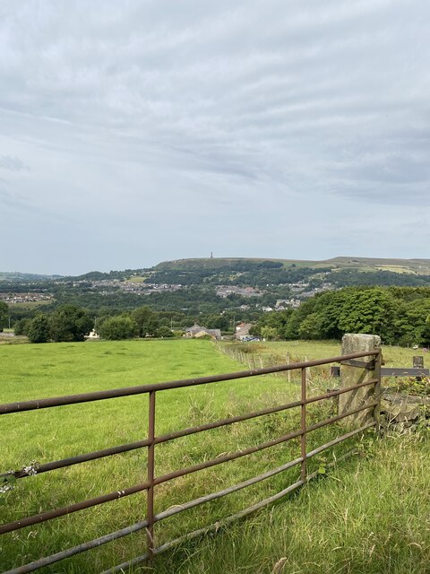
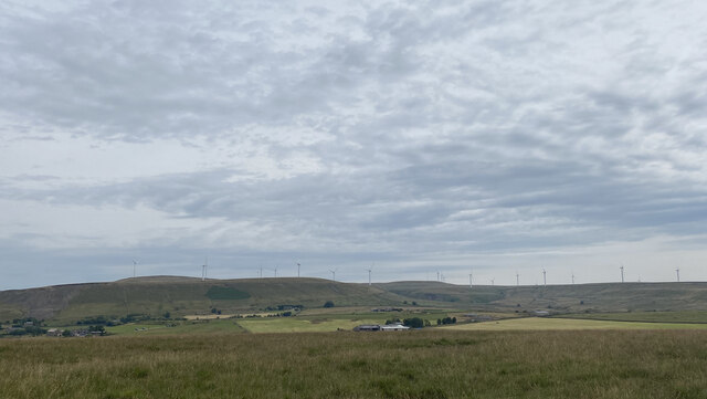
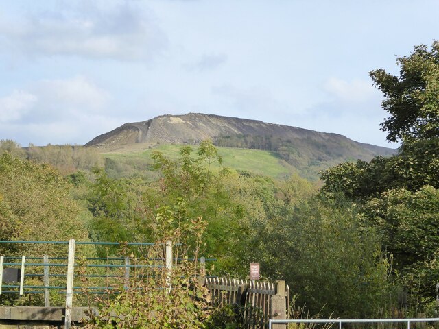
Crow Lumb Wood is a picturesque forest located in the county of Lancashire, England. Covering an area of approximately 500 acres, this woodland is renowned for its natural beauty and diverse range of flora and fauna. Situated in the south of the county, near the village of Lumb, it is easily accessible for both locals and tourists alike.

The wood is predominantly composed of deciduous trees such as oak, beech, and birch, which create a stunning canopy that changes with the seasons. In the spring, the forest floor is carpeted with bluebells and other wildflowers, creating a vibrant display of colors. During the autumn months, the foliage transforms into a stunning array of reds, oranges, and yellows, attracting visitors from far and wide to witness this spectacle.

Crow Lumb Wood is not only a haven for nature enthusiasts but also provides a habitat for a variety of wildlife. The forest is home to a diverse range of bird species, including woodpeckers, owls, and various songbirds. Additionally, small mammals such as squirrels, rabbits, and badgers can frequently be spotted amongst the trees.

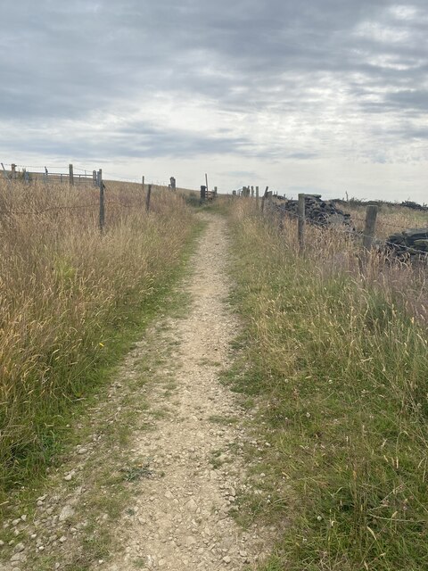
The woodland offers numerous walking trails and paths, allowing visitors to explore its stunning surroundings at their leisure. These trails cater to all abilities, making it an ideal destination for families and individuals seeking a peaceful retreat in nature. Furthermore, the wood provides a perfect backdrop for activities such as picnicking, photography, and nature study.

Overall, Crow Lumb Wood is a captivating natural gem in Lancashire, offering a tranquil escape from the hustle and bustle of everyday life. Its stunning scenery, abundant wildlife, and peaceful ambiance make it a must-visit destination for nature lovers and outdoor enthusiasts.

If you have any feedback on the listing, please let us know in the comments section below.

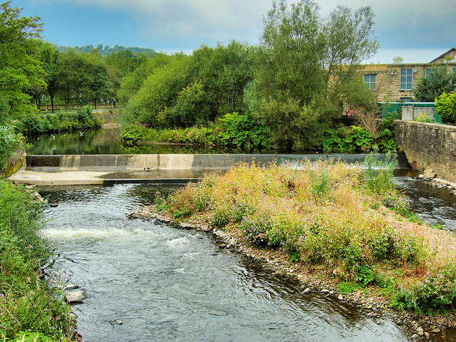
Crow Lumb Wood Images

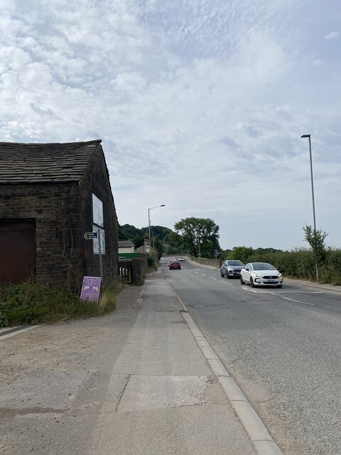
Images are sourced within 2km of 53.641514/-2.3171299 or Grid Reference SD7916. Thanks to Geograph Open Source API. All images are credited.

A56, Peel Tower in the distance
OS Cut Mark - Ramsbottom, Whitelow Road Right of Way <span class="nowrap"><a title="https://www.bench-marks.org.uk/bm94166" rel="nofollow ugc noopener" href="https://www.bench-marks.org.uk/bm94166">Link</a><img style="margin-left:2px;" alt="External link" title="External link - shift click to open in new window" src="https://s1.geograph.org.uk/img/external.png" width="10" height="10"/></span>
OS Cut Mark - Ramsbottom, Whitelow Road Right of Way
Location of OS Cut Mark - Ramsbottom, Whitelow Road Right of Way
Lovely views
Lovely views
Right of way to Harden Moor A bit bumpy for my liking
Right of way to Harden Moor
A bit bumpy for my liking
Right of way to Harden Moor
Harden Moor Trig Point Flush Bracket S4553 Even trig pillars need shade in this heat!
Harden Moor Trig Point Flush Bracket S4553
Even trig pillars need shade in this heat!
Views North East from Harden Moor
Cut Mark - Ramsbottom, Eagle and Child Public House <span class="nowrap"><a title="https://www.bench-marks.org.uk/bm49380" rel="nofollow ugc noopener" href="https://www.bench-marks.org.uk/bm49380">Link</a><img style="margin-left:2px;" alt="External link" title="External link - shift click to open in new window" src="https://s1.geograph.org.uk/img/external.png" width="10" height="10"/></span>
Cut Mark - Ramsbottom, Eagle and Child Public House
Location of Cut Mark - Ramsbottom, Eagle and Child Public House
Fletcher Bank Quarry above Ramsbottom View from Holcombe Hill on the path to Peel Tower. Scout Moor windfarm is on the skyline
Fletcher Bank Quarry above Ramsbottom
View from Holcombe Hill on the path to Peel Tower. Scout Moor windfarm is on the skyline
Quarry spoil heap An active quarry looming above the Irwell Valley
Quarry spoil heap
An active quarry looming above the Irwell Valley
Terrace housing On Whalley Road
Terrace housing
On Whalley Road
WWII Lancashire: Ghost Signs of the Home Front  (20) -
Emergency Rendezvous Point, Rostron Road, Ramsbottom, at junction with Victoria Street

"ERP 438" looks remarkably fresh, most probably repainted.

Emergency Rendezvous Points (ERP) were designated places in the locality for the coordination of ARP and emergency services during civil emergencies, particularly for those services arriving from outside the area. The signs appear in a variety of designs, but most are diamond shapes framing the ERP locality number.

<a href="https://www.geograph.org.uk/photo/6945322">SD7816 : WWII Lancashire: Ghost Signs of the Home Front  (21)</a>
WWII Lancashire: Ghost Signs of the Home Front (20)
- Emergency Rendezvous Point, Rostron Road, Ramsbottom, at junction with Victoria Street "ERP 438" looks remarkably fresh, most probably repainted. Emergency Rendezvous Points (ERP) were designated places in the locality for the coordination of ARP and emergency services during civil emergencies, particularly for those services arriving from outside the area. The signs appear in a variety of designs, but most are diamond shapes framing the ERP locality number. SD7816 : WWII Lancashire: Ghost Signs of the Home Front (21)
WWII Lancashire: Ghost Signs of the Home Front  (21) -
Emergency Rendezvous Point, Rostron Road, Ramsbottom, at junction with Victoria Street

"ERP 438"

Emergency Rendezvous Points (ERP) were designated places in the locality for the coordination of ARP and emergency services during civil emergencies, particularly for those services arriving from outside the area. The signs appear in a variety of designs, but most are diamond shapes framing the ERP locality number.

<a href="https://www.geograph.org.uk/photo/6945337">SD8432 : WWII Lancashire: Ghost Signs of the Home Front  (22)</a>
WWII Lancashire: Ghost Signs of the Home Front (21)
- Emergency Rendezvous Point, Rostron Road, Ramsbottom, at junction with Victoria Street "ERP 438" Emergency Rendezvous Points (ERP) were designated places in the locality for the coordination of ARP and emergency services during civil emergencies, particularly for those services arriving from outside the area. The signs appear in a variety of designs, but most are diamond shapes framing the ERP locality number. SD8432 : WWII Lancashire: Ghost Signs of the Home Front (22)
River Irwell, Ramsbottom Weir Photographed from the Ramsbottom Bridge at Peel Brow. The channel at the left is the old mill stream which served the (now demolished) Holcombe Paper Mill.
River Irwell, Ramsbottom Weir
Photographed from the Ramsbottom Bridge at Peel Brow. The channel at the left is the old mill stream which served the (now demolished) Holcombe Paper Mill.
Brooksbottom Viaduct The Brooksbottom viaduct carries the East Lancashire Railway over the River Irwell and the surrounding valley. The viaduct, seen here from Waterside Road, was constructed in 1845.

Here, preserved former British Railways Bulleid 7P5FA 4-6-2 ‘West Country’ class locomotive number 34092 ‘City of Wells’ is crossing the viaduct with an East Lancashire Railway passenger train on the journey from Bury to Rawtenstall.
Brooksbottom Viaduct
The Brooksbottom viaduct carries the East Lancashire Railway over the River Irwell and the surrounding valley. The viaduct, seen here from Waterside Road, was constructed in 1845. Here, preserved former British Railways Bulleid 7P5FA 4-6-2 ‘West Country’ class locomotive number 34092 ‘City of Wells’ is crossing the viaduct with an East Lancashire Railway passenger train on the journey from Bury to Rawtenstall.
Show me another place!

Crow Lumb Wood is located at Grid Ref: SD7916 (Lat: 53.641514, Lng: -2.3171299)

Unitary Authority: Bury

Police Authority: Greater Manchester

What 3 Words

///reinstate.majority.attending. Near Ramsbottom, Manchester

Related Wikis

Ramsbottom United F.C.

Ramsbottom United Football Club are an English football club based in Ramsbottom, Greater Manchester. Nicknamed "The Rams", they currently compete in the...

Holcombe, Greater Manchester

Holcombe is a village in Ramsbottom ward, Metropolitan Borough of Bury, in Greater Manchester, England. It is situated south of Haslingden, east of Edgworth...

Ramsbottom railway station

Ramsbottom railway station is a heritage station serving the town of Ramsbottom in Greater Manchester, England. == History == The station was built by...

Ramsbottom

Ramsbottom is a market town in the Metropolitan Borough of Bury, Greater Manchester, England. The population at the 2011 census was 17,872.Historically...

Nearby Amenities

Located within 500m of 53.641514,-2.3171299
Created By: YahooApplet 1.0
Lat/Long: 53.6457089/-2.3191986
Created By: YahooApplet 1.0
Lat/Long: 53.6435275/-2.3215482
Traffic Signals
Created By: YahooApplet 1.0
Lat/Long: 53.6429042/-2.3223422
Created By: YahooApplet 1.0
Lat/Long: 53.6422809/-2.3231039
Created By: YahooApplet 1.0
Lat/Long: 53.6415749/-2.3240159
Created By: YahooApplet 1.0
Lat/Long: 53.644599/-2.3117156
Created By: YahooApplet 1.0
Lat/Long: 53.6443191/-2.3124881
Created By: YahooApplet 1.0
Lat/Long: 53.6441919/-2.3151274
Created By: YahooApplet 1.0
Lat/Long: 53.6440774/-2.315814
Created By: YahooApplet 1.0
Lat/Long: 53.6439248/-2.3163075
Created By: YahooApplet 1.0
Lat/Long: 53.6416478/-2.3141618
Created By: YahooApplet 1.0
Lat/Long: 53.6415334/-2.3136468
Created By: YahooApplet 1.0
Lat/Long: 53.6413044/-2.3133035
Created By: YahooApplet 1.0
Lat/Long: 53.6410627/-2.3129601
Created By: YahooApplet 1.0
Lat/Long: 53.6444284/-2.3214624
Created By: YahooApplet 1.0
Lat/Long: 53.6446701/-2.3220739
Created By: YahooApplet 1.0
Lat/Long: 53.6438115/-2.3222134
Created By: YahooApplet 1.0
Lat/Long: 53.6425799/-2.321684
Created By: YahooApplet 1.0
Lat/Long: 53.6424245/-2.3213873
Created By: YahooApplet 1.0
Lat/Long: 53.6422336/-2.321044
Created By: YahooApplet 1.0
Lat/Long: 53.6378893/-2.3139844
Barrier: bollard
Lat/Long: 53.6417298/-2.3220426
Bus Stop
Bolton Street/Buchanan Street
Bus: yes
Naptan AtcoCode: 1800NC01271
Naptan Bearing: SW
Naptan CommonName: Bolton Street/Buchanan Street
Naptan Indicator: Opp House 192
Naptan Landmark: HOUSE 189
Naptan NaptanCode: mandmgpj
Naptan PlusbusZoneRef: MNCRPIC
Naptan ShortCommonName: Buchanan Street
Naptan Street: BOLTON STREET
Naptan Verified: no
Network: TfGM
Public Transport: platform
Source: naptan_import
Lat/Long: 53.6436056/-2.3213523
Bus Stop
Bolton Road West/Alfred Street
Bus: yes
Naptan AtcoCode: 1800NC07181
Naptan Bearing: NE
Naptan CommonName: Bolton Road West/Alfred Street
Naptan Indicator: O/s House 76
Naptan Landmark: HOUSE 76
Naptan NaptanCode: mandpatm
Naptan PlusbusZoneRef: MNCRPIC
Naptan ShortCommonName: Alfred Street
Naptan Street: BOLTON ROAD W
Naptan Verified: no
Network: TfGM
Public Transport: platform
Source: naptan_import
Lat/Long: 53.6412599/-2.3245865
Bus Stop
Bolton Road West/Hope Street
Bus: yes
Naptan AtcoCode: 1800NC07191
Naptan Bearing: SW
Naptan CommonName: Bolton Road West/Hope Street
Naptan Indicator: House 41
Naptan Landmark: HOUSE 41
Naptan NaptanCode: mandpatp
Naptan PlusbusZoneRef: MNCRPIC
Naptan ShortCommonName: Hope Street
Naptan Street: Bolton Road West
Naptan Verified: no
Network: TfGM
Public Transport: platform
Source: naptan_import
Lat/Long: 53.6421534/-2.323232
Bus Stop
Bolton Street/Dundee Lane
Bus: yes
Naptan AtcoCode: 1800NC07201
Naptan Bearing: NE
Naptan CommonName: Bolton Street/Dundee Lane
Naptan Indicator: Old Dun Horse
Naptan Landmark: OLD DUN HORSE
Naptan NaptanCode: mandpatw
Naptan PlusbusZoneRef: MNCRPIC
Naptan ShortCommonName: Dundee Lane
Naptan Street: BOLTON STREET
Naptan Verified: no
Network: TfGM
Public Transport: platform
Source: naptan_import
Lat/Long: 53.6430915/-2.3222433
Bus Stop
Bolton Street/Kay Brow
Bus: yes
Naptan AtcoCode: 1800NC07211
Naptan Bearing: SW
Naptan CommonName: Bolton Street/Kay Brow
Naptan Indicator: Opp House 150
Naptan Landmark: HOUSE OPP
Naptan NaptanCode: mandpawa
Naptan Notes: INDICATOR AMENDED
Naptan PlusbusZoneRef: MNCRPIC
Naptan ShortCommonName: Kay Brow
Naptan Street: BOLTON STREET
Naptan Verified: no
Network: TfGM
Public Transport: platform
Source: naptan_import
Lat/Long: 53.6451564/-2.319579
Bus Stop
Bolton Street/Kay Brow
Bus: yes
Naptan AtcoCode: 1800NC07221
Naptan Bearing: NE
Naptan CommonName: Bolton Street/Kay Brow
Naptan Indicator: Embankment
Naptan Landmark: HOUSE 132
Naptan NaptanCode: mandpawd
Naptan PlusbusZoneRef: MNCRPIC
Naptan ShortCommonName: Kay Brow
Naptan Street: BOLTON STREET
Naptan Verified: no
Network: TfGM
Public Transport: platform
Source: naptan_import
Lat/Long: 53.6457234/-2.3192959
Pub
The Masons Arms
Lat/Long: 53.6423631/-2.3226436
Bargain Booze
Shop: convenience
Lat/Long: 53.6418843/-2.3238682
Pub
The Major
Addr City: Bury
Addr Housenumber: 158-160
Addr Postcode: BL0 9JA
Addr Street: Bolton Street
Addr Suburb: Ramsbottom
Fhrs Id: 1216283
Source Addr: FHRS Open Data
Lat/Long: 53.6449737/-2.320009
Railway: switch
Lat/Long: 53.6452571/-2.3146571
Pub
Buchanan Sports & Social Club
Lat/Long: 53.6446608/-2.3221841
Post Box
Ref: BL0 124
Lat/Long: 53.6391488/-2.315841
Post Box
Ref: BL0 102
Lat/Long: 53.6433061/-2.3219136
Defibrillator
Defibrillator Location: In yellow locked box, on south east wall of Nuttall park ranger base.
Emergency: defibrillator
Indoor: no
Operator: North West Ambulance
Ref: CPAD467
Lat/Long: 53.6425756/-2.3109398
Fast Food
Kaash Indian
Addr City: Bury
Addr Housenumber: 202
Addr Postcode: BL0 9JE
Addr Street: Bolton Street
Cuisine: indian
Email: kaashindian@outlook.com
Phone: +44 1706 826689
Website: https://www.kaashtakeaway.co.uk
Lat/Long: 53.6433517/-2.3219253
The data included in this document is from www.openstreetmap.org. The data is made available under ODbL.

Have you been to Crow Lumb Wood?

Leave your review of Crow Lumb Wood below (or comments, questions and feedback).