Cairns Den

Valley in Fife

Scotland

Cairns Den

Path through Cairns Den, near St Andrews
Path through Cairns Den, near St Andrews Credit: Becky Williamson

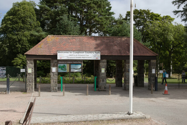
Cairns Den, Fife is a picturesque valley located in the eastern part of Scotland, known for its natural beauty and historical significance. Situated in the region of Fife, the den is nestled between rolling hills and lush greenery, offering a tranquil escape from the bustling city life.

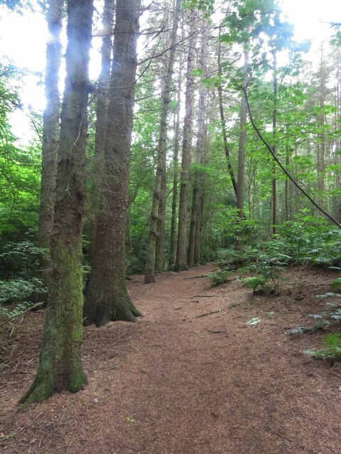
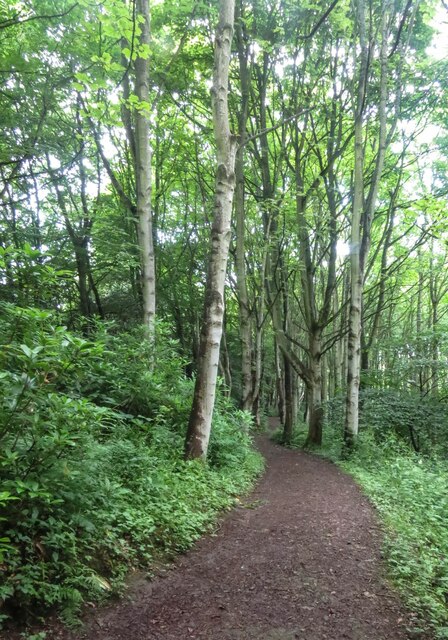
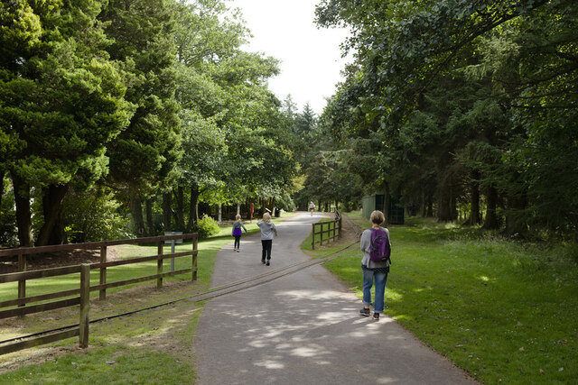
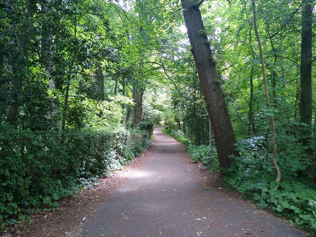
The den, also referred to as Cairns Valley, is characterized by its dense woodland, which is home to a diverse array of flora and fauna. The area is particularly renowned for its ancient oak trees, some of which are believed to be several hundred years old. The dense canopy of foliage provides a serene and sheltered environment, making it a popular spot for nature enthusiasts and hikers.

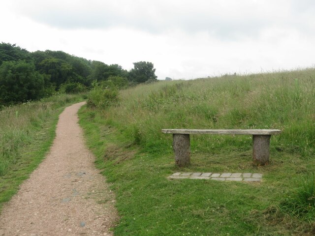
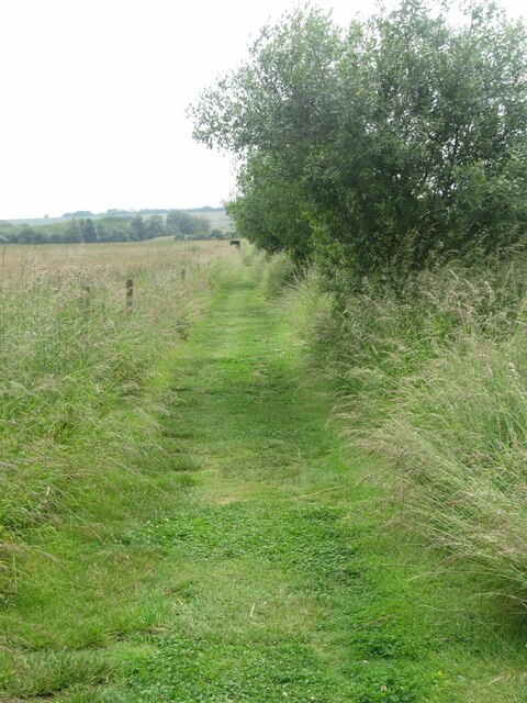
One of the main attractions of Cairns Den is the scenic walking trail that winds its way through the valley. The trail offers stunning views of the surrounding landscape, including the meandering River Leven, which flows through the valley. The river provides a habitat for various species of fish and attracts anglers from far and wide.

In addition to its natural beauty, Cairns Den also holds historical significance. The valley is home to several archaeological sites, including ancient burial cairns, which have provided valuable insights into the early human settlement in the area. These cairns, which date back thousands of years, serve as a reminder of the rich cultural heritage of the region.

Overall, Cairns Den in Fife is a hidden gem, offering a perfect blend of natural splendor and historical significance. Whether you are seeking a peaceful retreat or an opportunity to delve into Scotland's past, this valley is sure to captivate visitors with its charm and beauty.

If you have any feedback on the listing, please let us know in the comments section below.

Cairns Den Images

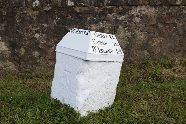
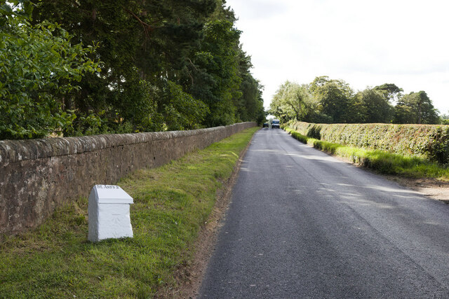
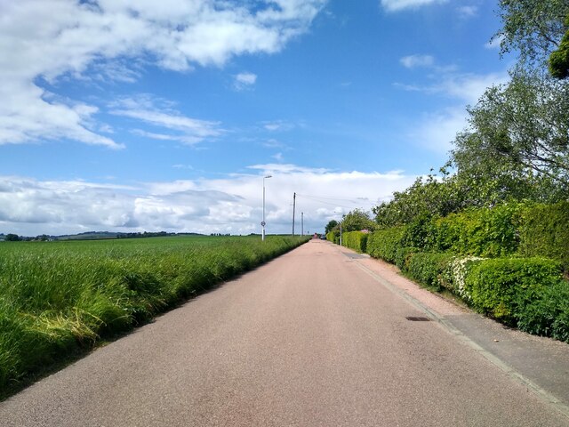
Images are sourced within 2km of 56.326028/-2.8195074 or Grid Reference NO4915. Thanks to Geograph Open Source API. All images are credited.

Path through Cairns Den, near St Andrews
Bench in Lumbo Den, Fife Pilgrim Way
Fife Pilgrim Way through Lumbo Den
Path at Cairnsmill Reservoir
Benchmark on wall, Aikman Place, St Andrews Ordnance Survey benchmark, described on database at <span class="nowrap"><a title="https://www.bench-marks.org.uk/bm138903" rel="nofollow ugc noopener" href="https://www.bench-marks.org.uk/bm138903">Link</a><img style="margin-left:2px;" alt="External link" title="External link - shift click to open in new window" src="https://s1.geograph.org.uk/img/external.png" width="10" height="10"/></span>. See also <a href="https://www.geograph.org.uk/photo/7007158">NO4915 : Wall at Aikman Place, St Andrews</a>.
Benchmark on wall, Aikman Place, St Andrews
Ordnance Survey benchmark, described on database at LinkExternal link. See also NO4915 : Wall at Aikman Place, St Andrews.
Wall at Aikman Place, St Andrews There is an Ordnance Survey benchmark on this wall. See <a href="https://www.geograph.org.uk/photo/7006851">NO4915 : Benchmark on wall, Aikman Place, St Andrews</a>.
Wall at Aikman Place, St Andrews
There is an Ordnance Survey benchmark on this wall. See NO4915 : Benchmark on wall, Aikman Place, St Andrews.
Mini roundabout on Hepburn Gardens
Hepburn Gardens At the junction with Lawhead Road East.
Hepburn Gardens
At the junction with Lawhead Road East.
Entrance, Craigtoun Country Park
Railway crossing the path in Craigtoun Country Park
Lake, Craigtoun Country Park
Cut Bench Mark, Balone Milestone Bench Mark Database: <span class="nowrap"><a title="https://www.bench-marks.org.uk/bm38207" rel="nofollow ugc noopener" href="https://www.bench-marks.org.uk/bm38207">Link</a><img style="margin-left:2px;" alt="External link" title="External link - shift click to open in new window" src="https://s1.geograph.org.uk/img/external.png" width="10" height="10"/></span>
Cut Bench Mark, Balone Milestone
Bench Mark Database: LinkExternal link
Milestone by the C65 near Balone There is a cut bench mark on the face to the left of the photograph and a closer view can be seen here: <a href="https://www.geograph.org.uk/photo/7128829">NO4815 : Cut Bench Mark, Balone Milestone</a>. An older image of the milestone missing showed it missing its metal cap at <a href="https://www.geograph.org.uk/photo/6038236">NO4815 : Old Milestone by the C65, Craigtoun, St Andrews Parish</a>.
Milestone by the C65 near Balone
There is a cut bench mark on the face to the left of the photograph and a closer view can be seen here: NO4815 : Cut Bench Mark, Balone Milestone. An older image of the milestone missing showed it missing its metal cap at NO4815 : Old Milestone by the C65, Craigtoun, St Andrews Parish.
C65 near Craigtoun Meadows Holiday Park Closer views of the milestone can be seen at <a href="https://www.geograph.org.uk/photo/7128831">NO4815 : Milestone by the C65 near Balone</a> and <a href="https://www.geograph.org.uk/photo/7128829">NO4815 : Cut Bench Mark, Balone Milestone</a>.
C65 near Craigtoun Meadows Holiday Park
Boase Wood Path through Boase Wood, seen from the western entrance.
Boase Wood
Path through Boase Wood, seen from the western entrance.
Strathkinness High Road Construction in the background.
Strathkinness High Road
Construction in the background.
Gas governor station This is a station to reduce gas pressure in the pipeline underneath, on the outskirts of St Andrews.
Gas governor station
This is a station to reduce gas pressure in the pipeline underneath, on the outskirts of St Andrews.
Frozen Pond This is the largest pond in Craigtoun Country Park, on the island is the so-called Dutch Village.
Frozen Pond
This is the largest pond in Craigtoun Country Park, on the island is the so-called Dutch Village.
Show me another place!

Cairns Den is located at Grid Ref: NO4915 (Lat: 56.326028, Lng: -2.8195074)

Unitary Authority: Fife

Police Authority: Fife

What 3 Words

///dunk.fear.dark. Near St Andrews, Fife

Related Wikis

Bogward Dovecot

Bogward Doocot is a rare early beehive-type doocot, or dovecote, in the Scottish town of St Andrews, Fife. In 1971, it was designated as a Category A listed...

Mount Melville railway station

Mount Melville railway station served the Mount Melville estate outside St Andrews, Fife, Scotland from 1887 to 1930 on the Anstruther and St Andrews Railway...

New Park School

New Park School was an independent preparatory school in St Andrews, Fife, Scotland. The school was founded in 1933 by Cuthbert Dixon, previously a teacher...

St Andrews Community Hospital

St Andrews Community Hospital is a small hospital to the south of the university town of St Andrews in Fife, Scotland. The hospital serves the town of...

Nearby Amenities

Located within 500m of 56.326028,-2.8195074
Mini Roundabout
Direction: clockwise
Lat/Long: 56.3294448/-2.8169646
Bus Stop
Windsor Gardens
Bus: yes
Public Transport: platform
Shelter: yes
Lat/Long: 56.3288681/-2.8240034
Crossing
Crossing: traffic_signals
Crossing Ref: pelican
Kerb: flush
Tactile Paving: yes
Lat/Long: 56.3280116/-2.8124142
Bus Stop
Leonard Gardens
Bus: yes
Public Transport: platform
Shelter: yes
Lat/Long: 56.3284321/-2.8228027
Bus Stop
Moir Crescent
Bus: yes
Naptan AtcoCode: 6500N0505
Naptan Bearing: SW
Naptan CommonName: Moir Crescent
Naptan Indicator: opp
Naptan NaptanCode: 34343243
Naptan Street: Canongate
Naptan Verified: no
Public Transport: platform
Lat/Long: 56.3287362/-2.8188013
Power: pole
Lat/Long: 56.3251854/-2.8158602
Power: pole
Lat/Long: 56.3247098/-2.8170026
Power: pole
Lat/Long: 56.3232625/-2.8207062
Power: pole
Lat/Long: 56.3227891/-2.8219178
Power: pole
Lat/Long: 56.3222999/-2.8231415
Power: pole
Lat/Long: 56.3260752/-2.813543
Power: pole
Lat/Long: 56.3265148/-2.8124282
Bus Stop
John Knox Road
Bus: yes
Naptan AtcoCode: 6500N0231
Naptan NaptanCode: 34343252
Public Transport: platform
Lat/Long: 56.3297098/-2.8162417
Power: pole
Lat/Long: 56.3256303/-2.8147016
Barrier: stile
Lat/Long: 56.3233658/-2.8177031
Waterway: waterfall
Lat/Long: 56.3242883/-2.8176728
Generator Method: photovoltaic
Generator Output Electricity: yes
Generator Source: solar
Generator Type: solar_photovoltaic_panel
Power: generator
Lat/Long: 56.328492/-2.8238216
Bus Stop
John Knox Road
Bus: yes
Naptan AtcoCode: 6500N0232
Naptan Bearing: NE
Naptan CommonName: John Knox Road
Naptan Indicator: opp
Naptan NaptanCode: 34343247
Naptan Street: Canongate
Naptan Verified: no
Public Transport: platform
Source: naptan;bing;naptan_compare_tool
Lat/Long: 56.3292808/-2.8175854
Bus Stop
Winram Place
Bus: yes
Naptan AtcoCode: 6500N0234
Naptan Bearing: NW
Naptan CommonName: Winram Place
Naptan Indicator: opp
Naptan NaptanCode: 34342983
Naptan Street: John Knox Road
Naptan Verified: no
Public Transport: platform
Source: naptan;bing;naptan_compare_tool
Lat/Long: 56.3279957/-2.8129678
Bus Stop
Winram Place
Bus: yes
Naptan AtcoCode: 6500N0233
Naptan Bearing: E
Naptan CommonName: Winram Place
Naptan Indicator: adj
Naptan NaptanCode: 34342984
Naptan Street: John Knox Road
Naptan Verified: no
Public Transport: platform
Source: naptan;bing;naptan_compare_tool
Lat/Long: 56.3281389/-2.8130517
Bus Stop
Cairnsden Gardens
Bus: yes
Naptan AtcoCode: 6500N0653
Naptan Bearing: NW
Naptan CommonName: Cairnsden Gardens
Naptan Indicator: adj
Naptan NaptanCode: 34347289
Naptan Street: John Knox Rd
Naptan Verified: no
Public Transport: platform
Source: naptan;bing;naptan_compare_tool
Lat/Long: 56.3289976/-2.8163528
The data included in this document is from www.openstreetmap.org. The data is made available under ODbL.

Have you been to Cairns Den?

Leave your review of Cairns Den below (or comments, questions and feedback).