Cat Cleuch

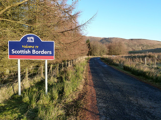
Valley in Roxburghshire

Scotland

Cat Cleuch

Track to Gorrenberry Jubilee Wood The track follows the Billhope Burn.
Track to Gorrenberry Jubilee Wood Credit: wrobison

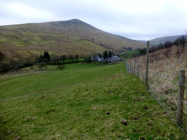
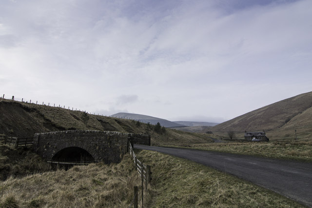
Cat Cleuch is a picturesque valley located in Roxburghshire, Scotland. Situated in the heart of the Scottish Borders, the valley is known for its stunning natural beauty and rich history. The name "Cat Cleuch" translates to "cat's ravine" in English, evoking the rugged and untamed nature of the area.

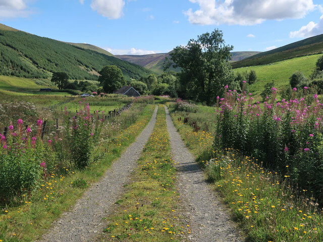
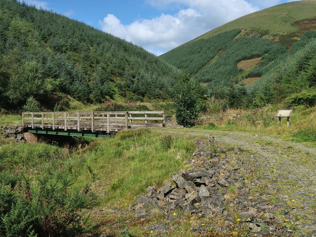
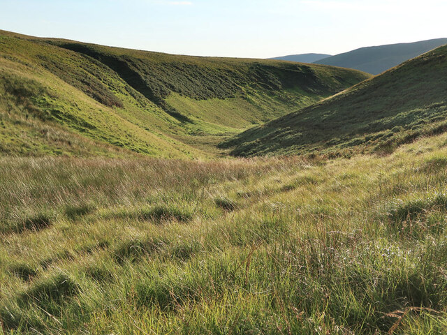
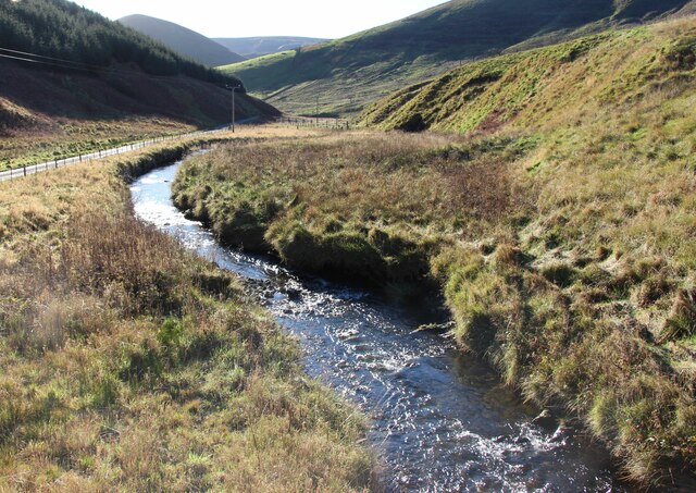
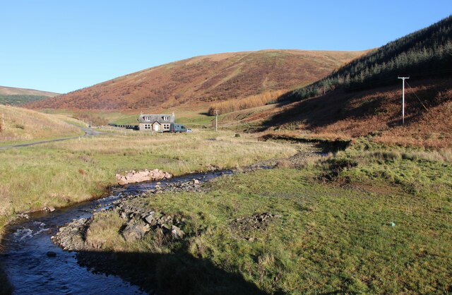
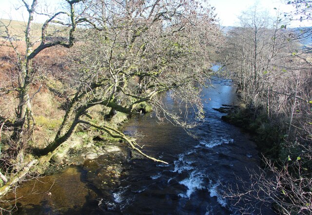
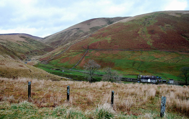
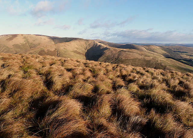
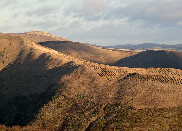
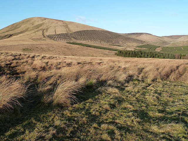
Surrounded by rolling hills and lush greenery, Cat Cleuch offers a haven for nature enthusiasts and outdoor adventurers. The valley is home to a diverse range of flora and fauna, including rare species such as red squirrels and black grouse. The crystal-clear waters of the Cat Cleuch Burn flow through the valley, creating small cascades and waterfalls along its course.

Historically, Cat Cleuch has been a site of significance. The remnants of ancient settlements and burial mounds can be found throughout the valley, indicating human occupation dating back thousands of years. The valley's strategic location near the English-Scottish border made it a site of conflict during various historical periods, particularly during the Border Reivers era.

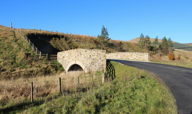
Today, Cat Cleuch attracts visitors from near and far who come to explore its natural wonders and learn about its fascinating history. Hiking and walking trails wind through the valley, providing breathtaking views and opportunities to spot wildlife. Additionally, the surrounding area offers charming villages, historic sites, and local amenities, making Cat Cleuch an ideal destination for a peaceful and immersive Scottish experience.

If you have any feedback on the listing, please let us know in the comments section below.
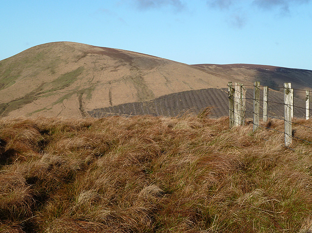
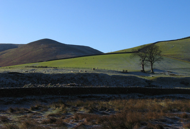
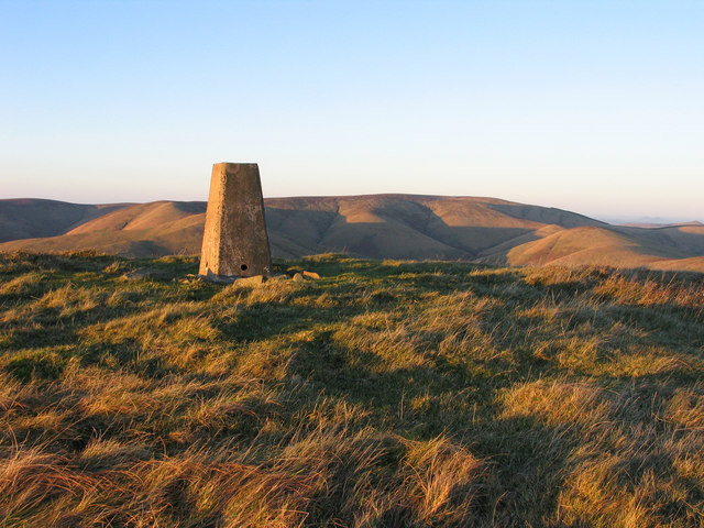
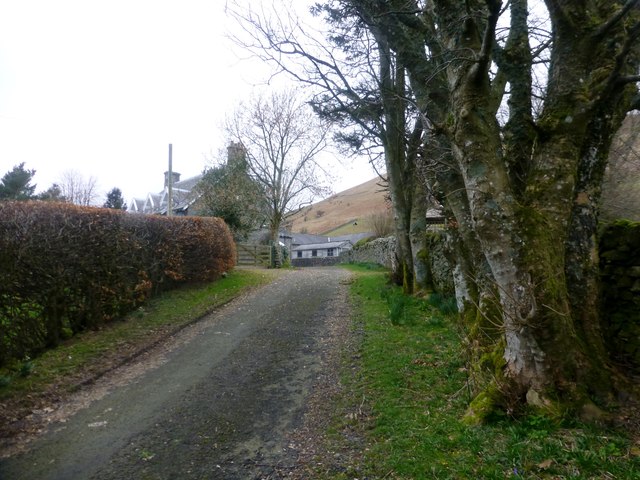
Cat Cleuch Images

Images are sourced within 2km of 55.266714/-2.8612252 or Grid Reference NY4597. Thanks to Geograph Open Source API. All images are credited.

Track to Gorrenberry Jubilee Wood The track follows the Billhope Burn.
Track to Gorrenberry Jubilee Wood
The track follows the Billhope Burn.
Bridge over the Billhope Burn At the start of the Gorrenberry Jubilee Wood. For a close up of the information board on the left see <a href="https://www.geograph.org.uk/photo/5169133">NY4498 : Gorranberry Jubilee Wood</a>.
Bridge over the Billhope Burn
At the start of the Gorrenberry Jubilee Wood. For a close up of the information board on the left see NY4498 : Gorranberry Jubilee Wood.
Valley of Kew Sike at Billhope Hass
Bridge Over Billhope Burn
Billhope Burn Road leads to Hermitage.
Billhope Burn
Road leads to Hermitage.
Billhope Burn and cottage
Hermitage Water at Gorrenberry
Billhope Burn Cottage tucked away under the slopes of Stob Fell and beside Billhope Burn.
Pretty location. Good track takes you north on to the fells to Pennygant Hill and Cauldcleugh Head,(619 m), which is classed as a Graham.
Billhope Burn
Cottage tucked away under the slopes of Stob Fell and beside Billhope Burn. Pretty location. Good track takes you north on to the fells to Pennygant Hill and Cauldcleugh Head,(619 m), which is classed as a Graham.
Rough grazing on Geordie's Hill This is near the summit of the hill looking over to Stob Fell.
Rough grazing on Geordie's Hill
This is near the summit of the hill looking over to Stob Fell.
New forestry planting on Stob-cleuch Edge This was viewed from Geordie’s Hill in early December.
New forestry planting on Stob-cleuch Edge
This was viewed from Geordie’s Hill in early December.
Carewood Rig An area of rough grazing with Tudhope Hill in the background to the left.
Carewood Rig
An area of rough grazing with Tudhope Hill in the background to the left.
Welcome to Scottish Borders This sign is by the minor road from Fiddleton at the A7 to Hermitage at the B6399. The plantation on the left is at Billhope Hass.
Welcome to Scottish Borders
This sign is by the minor road from Fiddleton at the A7 to Hermitage at the B6399. The plantation on the left is at Billhope Hass.
Geordie's Hill This is at the summit area of the hill looking over to Tudhope Hill.
Geordie's Hill
This is at the summit area of the hill looking over to Tudhope Hill.
Field beside the Twislehope Burn The field is on the foot of the east ridge of Geordie's Hill and has according to OS mapping an ancient settlement within, or partly within it. Cockplay Hill lies at the left side of the image in the valley of the Twislehope Burn.
Field beside the Twislehope Burn
The field is on the foot of the east ridge of Geordie's Hill and has according to OS mapping an ancient settlement within, or partly within it. Cockplay Hill lies at the left side of the image in the valley of the Twislehope Burn.
Summit area of Din Fell Late afternoon, autumn sunshine tinges red the summit area of Din Fell and its trig point; Cauldcleuch Head is in the distance.
Summit area of Din Fell
Late afternoon, autumn sunshine tinges red the summit area of Din Fell and its trig point; Cauldcleuch Head is in the distance.
View Of Lane To Gorrenberry Beech hedge and trees near the top of the lane to Gorrenberry.
View Of Lane To Gorrenberry
Beech hedge and trees near the top of the lane to Gorrenberry.
View Towards Din Fell A view from the bottom edge Dod Plantation towards Gorrenberry and the hill Din Fell.
View Towards Din Fell
A view from the bottom edge Dod Plantation towards Gorrenberry and the hill Din Fell.
Billhope
Billhope
Show me another place!

Cat Cleuch is located at Grid Ref: NY4597 (Lat: 55.266714, Lng: -2.8612252)

Unitary Authority: The Scottish Borders

Police Authority: The Lothians and Scottish Borders

What 3 Words

///protected.sweeper.kilowatt. Near Teviothead, Scottish Borders

Related Wikis

Dinley

Dinley is a hamlet in the Scottish Borders through which Hermitage Water flows. == Etymology == The first element, din, seems to be the Cumbric word for...

Cauldcleuch Head

Cauldcleuch Head is a hill in an unnamed range of Roxburghshire hills north of Langholm, part of the Southern Uplands of Scotland. The highest hill in...

Hermitage Castle

Hermitage Castle is a semi-ruined castle in the border region of Scotland. It is under the care of Historic Scotland. The castle has a reputation, both...

Hermitage, Scottish Borders

Hermitage is a village near Newcastleton, on the B6399, in the Scottish Borders area of Scotland. == See also == List of places in the Scottish Borders...

Nearby Amenities

Located within 500m of 55.266714,-2.8612252
Bught Shank
Place: locality
Lat/Long: 55.2665862/-2.8552814
The data included in this document is from www.openstreetmap.org. The data is made available under ODbL.

Have you been to Cat Cleuch?

Leave your review of Cat Cleuch below (or comments, questions and feedback).