Catcleuch Brae

Downs, Moorland in Roxburghshire

Scotland

Catcleuch Brae

Track to Gorrenberry Jubilee Wood The track follows the Billhope Burn.
Track to Gorrenberry Jubilee Wood Credit: wrobison

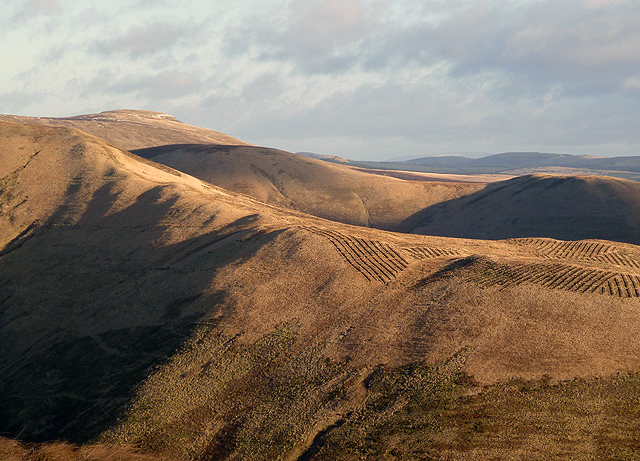
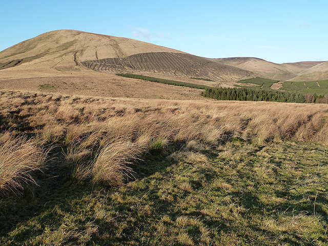
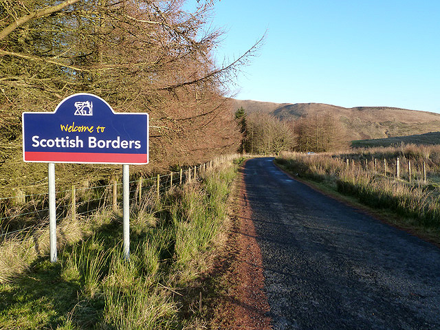
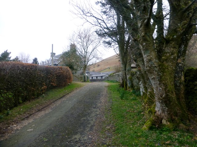
Catcleuch Brae is a captivating natural landscape situated in the picturesque region of Roxburghshire in southern Scotland. This area, known for its stunning downs and moorland, offers visitors a glimpse into the unspoiled beauty of the Scottish countryside.

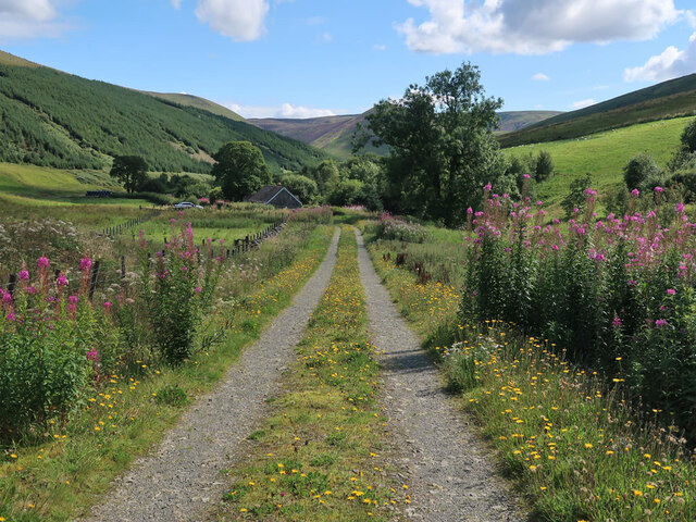
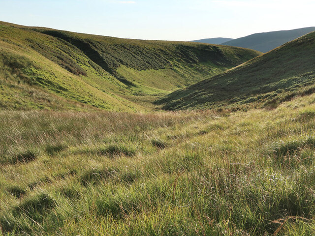
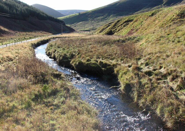
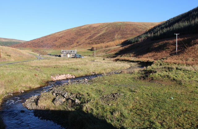
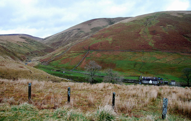
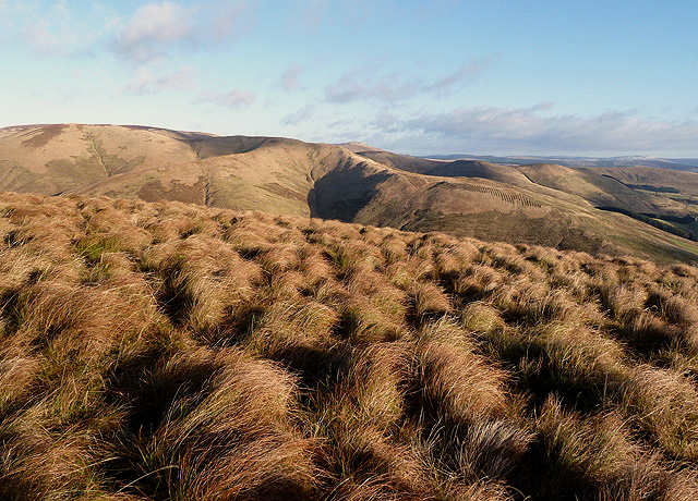
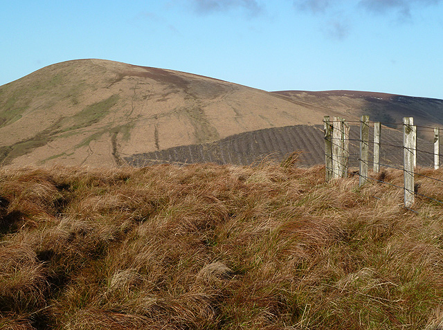
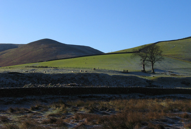
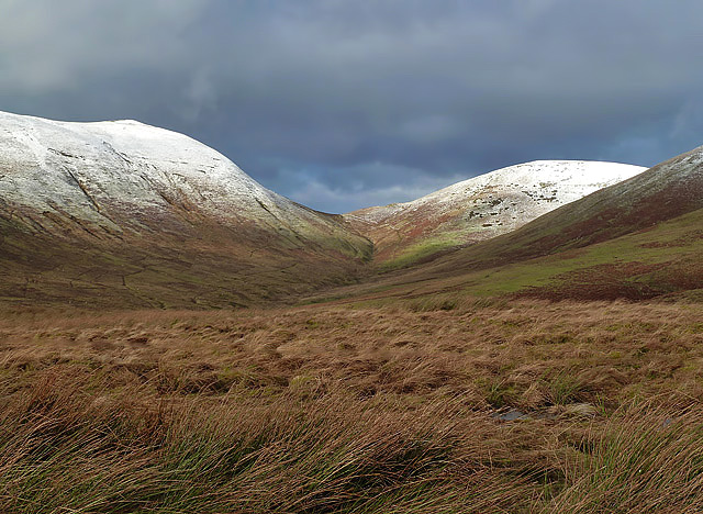
Catcleuch Brae is characterized by its undulating downs, which are covered in lush, green grasses and dotted with heather. The gentle slopes provide an ideal habitat for a variety of plant and animal species, making it a haven for nature enthusiasts and wildlife lovers. The moorland, with its distinctive peat bogs and wetland areas, further adds to the charm of this area.

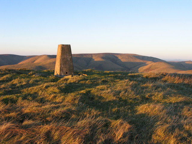
The terrain at Catcleuch Brae is a product of its geological history, with evidence of glacial activity, including moraines and drumlins. These geological features not only contribute to the unique aesthetics of the area but also offer insights into the region's past.

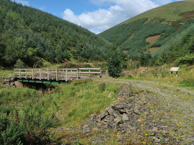
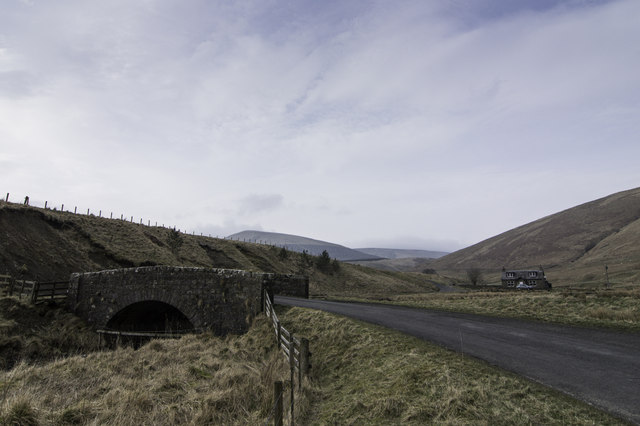
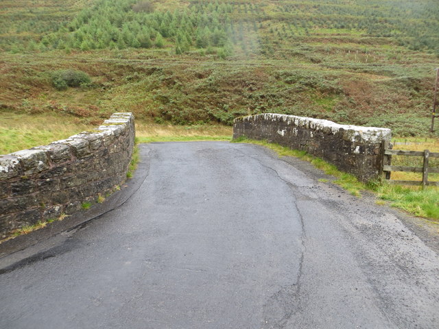
Visitors to Catcleuch Brae can explore the area through a network of walking trails that meander through the downs and moorland, allowing them to appreciate the natural beauty at their own pace. Along the way, they may encounter a diverse range of wildlife, such as red grouse, golden eagles, and red deer, adding to the allure of the experience.

The tranquility and unspoiled nature of Catcleuch Brae make it an ideal destination for those seeking a peaceful retreat or a chance to immerse themselves in the beauty of the Scottish countryside. Whether it's a leisurely walk, birdwatching, or simply enjoying the breathtaking views, Catcleuch Brae offers an unforgettable experience for nature enthusiasts and visitors alike.

If you have any feedback on the listing, please let us know in the comments section below.

Catcleuch Brae Images

Images are sourced within 2km of 55.267641/-2.8661555 or Grid Reference NY4597. Thanks to Geograph Open Source API. All images are credited.

Track to Gorrenberry Jubilee Wood The track follows the Billhope Burn.
Track to Gorrenberry Jubilee Wood
The track follows the Billhope Burn.
Bridge over the Billhope Burn At the start of the Gorrenberry Jubilee Wood. For a close up of the information board on the left see <a href="https://www.geograph.org.uk/photo/5169133">NY4498 : Gorranberry Jubilee Wood</a>.
Bridge over the Billhope Burn
At the start of the Gorrenberry Jubilee Wood. For a close up of the information board on the left see NY4498 : Gorranberry Jubilee Wood.
Valley of Kew Sike at Billhope Hass
Bridge Over Billhope Burn
Billhope Burn Road leads to Hermitage.
Billhope Burn
Road leads to Hermitage.
Billhope Burn and cottage
Billhope Burn Cottage tucked away under the slopes of Stob Fell and beside Billhope Burn.
Pretty location. Good track takes you north on to the fells to Pennygant Hill and Cauldcleugh Head,(619 m), which is classed as a Graham.
Billhope Burn
Cottage tucked away under the slopes of Stob Fell and beside Billhope Burn. Pretty location. Good track takes you north on to the fells to Pennygant Hill and Cauldcleugh Head,(619 m), which is classed as a Graham.
Rough grazing on Geordie's Hill This is near the summit of the hill looking over to Stob Fell.
Rough grazing on Geordie's Hill
This is near the summit of the hill looking over to Stob Fell.
New forestry planting on Stob-cleuch Edge This was viewed from Geordie’s Hill in early December.
New forestry planting on Stob-cleuch Edge
This was viewed from Geordie’s Hill in early December.
Carewood Rig An area of rough grazing with Tudhope Hill in the background to the left.
Carewood Rig
An area of rough grazing with Tudhope Hill in the background to the left.
Welcome to Scottish Borders This sign is by the minor road from Fiddleton at the A7 to Hermitage at the B6399. The plantation on the left is at Billhope Hass.
Welcome to Scottish Borders
This sign is by the minor road from Fiddleton at the A7 to Hermitage at the B6399. The plantation on the left is at Billhope Hass.
Geordie's Hill This is at the summit area of the hill looking over to Tudhope Hill.
Geordie's Hill
This is at the summit area of the hill looking over to Tudhope Hill.
Field beside the Twislehope Burn The field is on the foot of the east ridge of Geordie's Hill and has according to OS mapping an ancient settlement within, or partly within it. Cockplay Hill lies at the left side of the image in the valley of the Twislehope Burn.
Field beside the Twislehope Burn
The field is on the foot of the east ridge of Geordie's Hill and has according to OS mapping an ancient settlement within, or partly within it. Cockplay Hill lies at the left side of the image in the valley of the Twislehope Burn.
Summit area of Din Fell Late afternoon, autumn sunshine tinges red the summit area of Din Fell and its trig point; Cauldcleuch Head is in the distance.
Summit area of Din Fell
Late afternoon, autumn sunshine tinges red the summit area of Din Fell and its trig point; Cauldcleuch Head is in the distance.
View Of Lane To Gorrenberry Beech hedge and trees near the top of the lane to Gorrenberry.
View Of Lane To Gorrenberry
Beech hedge and trees near the top of the lane to Gorrenberry.
Billhope
Billhope
Bridge Over Billhope Burn at Billhope Looking eastward.
Bridge Over Billhope Burn at Billhope
Looking eastward.
Rough Grazing at Pyat Knowe The snow-covered hills in the background are Carlin Tooth on the left and Tudhope Little Hill on the right.
Rough Grazing at Pyat Knowe
The snow-covered hills in the background are Carlin Tooth on the left and Tudhope Little Hill on the right.
Show me another place!

Catcleuch Brae is located at Grid Ref: NY4597 (Lat: 55.267641, Lng: -2.8661555)

Unitary Authority: The Scottish Borders

Police Authority: The Lothians and Scottish Borders

What 3 Words

///haircuts.toddler.pound. Near Teviothead, Scottish Borders

Related Wikis

Dinley

Dinley is a hamlet in the Scottish Borders through which Hermitage Water flows. == Etymology == The first element, din, seems to be the Cumbric word for...

Cauldcleuch Head

Cauldcleuch Head is a hill in an unnamed range of Roxburghshire hills north of Langholm, part of the Southern Uplands of Scotland. The highest hill in...

Hermitage Castle

Hermitage Castle is a semi-ruined castle in the border region of Scotland. It is under the care of Historic Scotland. The castle has a reputation, both...

Hermitage, Scottish Borders

Hermitage is a village near Newcastleton, on the B6399, in the Scottish Borders area of Scotland. == See also == List of places in the Scottish Borders...

Hermitage Water

The Hermitage Water is a river in Liddesdale, in the Scottish Borders area of Scotland. Among its many feeder burns are Braidley Burn, Dinley Burn, Gorrenberry...

Ninestane Rig

Ninestane Rig (English: Nine Stone Ridge) is a small stone circle in Scotland near the English border. Located in Roxburghshire, near to Hermitage Castle...

Maiden Paps (Hawick)

The Maiden Paps are twin hills near Hawick, in the Scottish Borders of the south east of Scotland, so named because they have the shape of human breasts...

Unthank, Dumfries and Galloway

Unthank is a village in Dumfries and Galloway, Scotland. == References == The geographic coordinates are from the Ordnance Survey.

Nearby Amenities

Located within 500m of 55.267641,-2.8661555
Billhope
Place: hamlet
Lat/Long: 55.2688573/-2.8731391
Power: pole
Lat/Long: 55.2671265/-2.8736515
Power: pole
Lat/Long: 55.2678585/-2.873497
Power: pole
Lat/Long: 55.2687006/-2.8737107
The data included in this document is from www.openstreetmap.org. The data is made available under ODbL.

Have you been to Catcleuch Brae?

Leave your review of Catcleuch Brae below (or comments, questions and feedback).