Stob Cleuch

Valley in Roxburghshire

Scotland

Stob Cleuch

Track to Gorrenberry Jubilee Wood The track follows the Billhope Burn.
Track to Gorrenberry Jubilee Wood Credit: wrobison

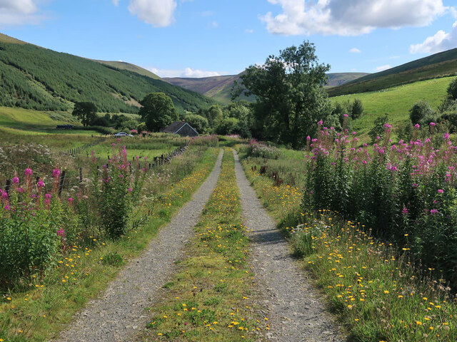
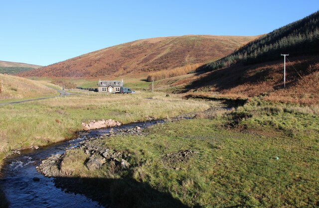
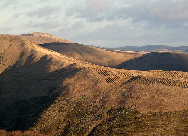
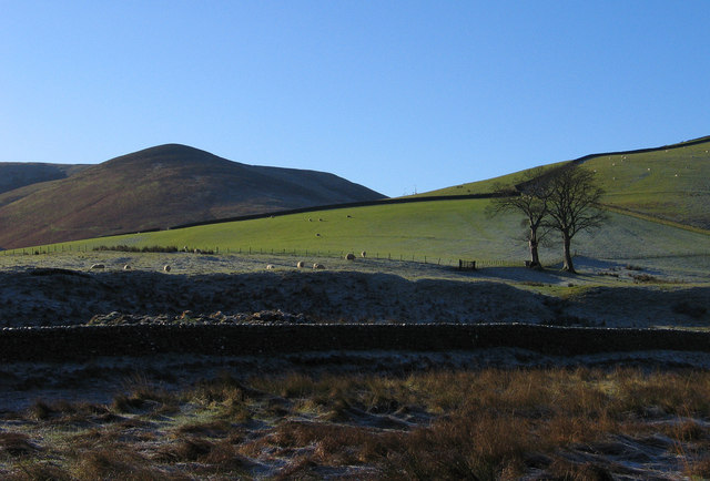
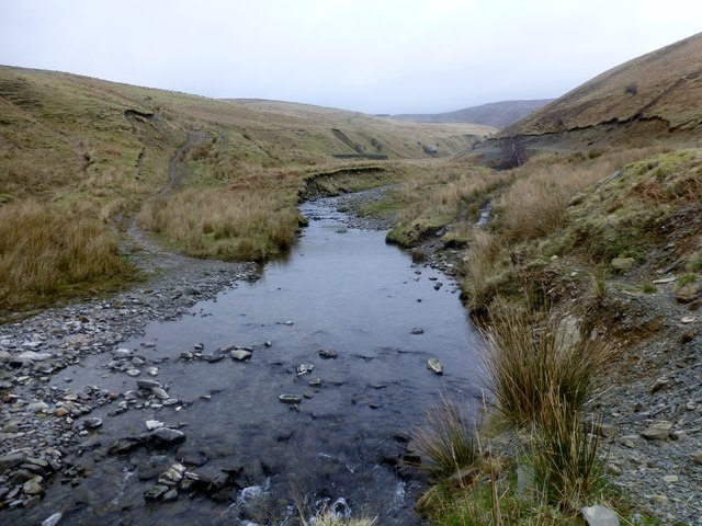
Stob Cleuch is a picturesque valley located in the county of Roxburghshire, Scotland. Situated in the southern part of the country, the valley is renowned for its stunning natural beauty and tranquil atmosphere.

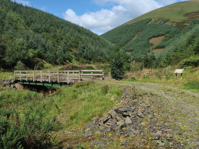
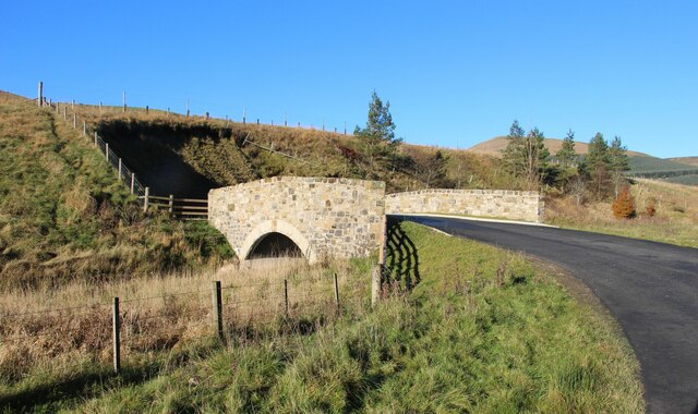
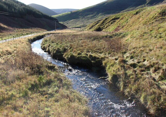
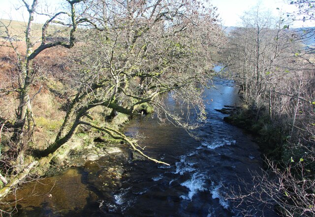
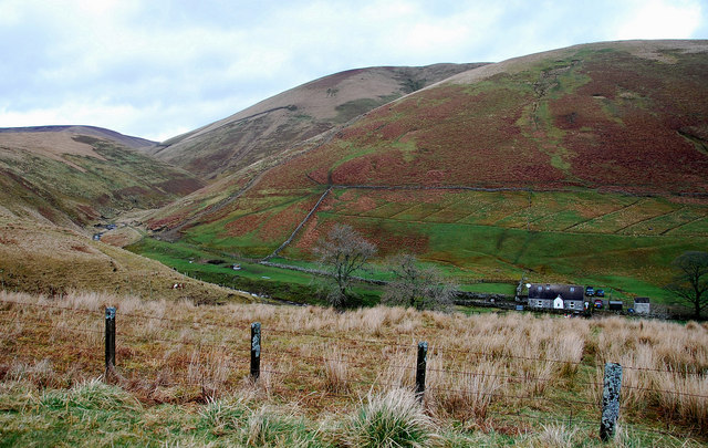
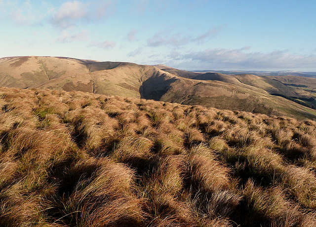
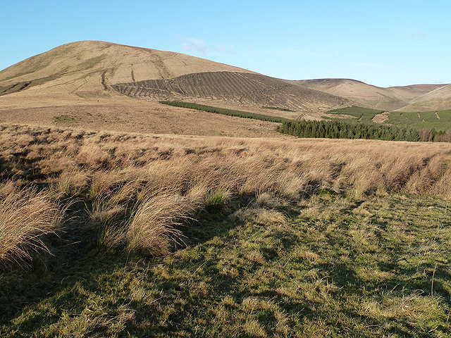
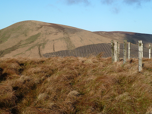
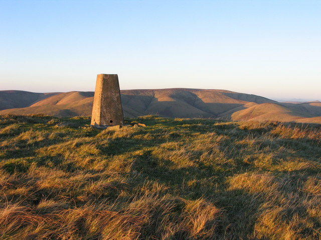
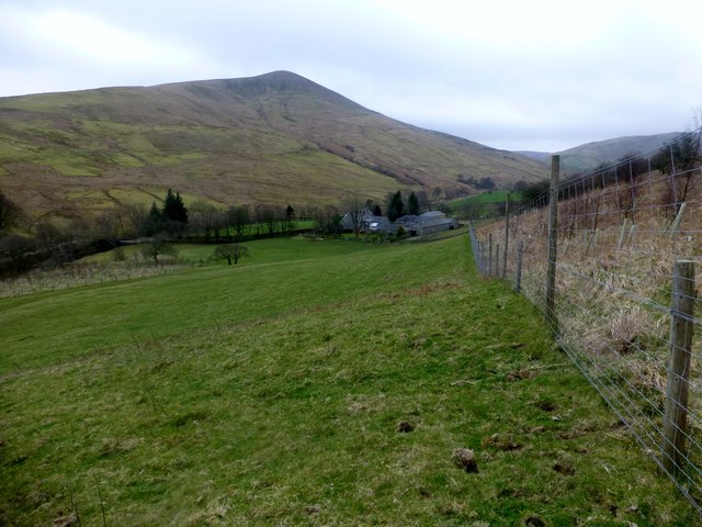
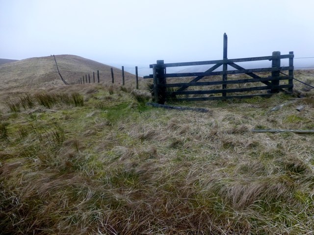
The valley is nestled between the rolling hills of the Scottish Borders, offering visitors breathtaking views of the surrounding landscapes. The terrain is characterized by lush green meadows, dense forests, and sparkling streams that meander through the valley. Stob Cleuch is also home to a variety of wildlife, including red deer, otters, and a wide array of bird species.

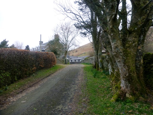
One of the standout features of Stob Cleuch is its abundance of walking trails and hiking routes. Visitors can explore the valley by following these trails, which range from easy strolls to more challenging hikes. The trails lead through ancient woodlands, where visitors can admire a rich diversity of plant life, including wildflowers and towering trees.

For those interested in history, Stob Cleuch also offers a glimpse into the past. The valley is dotted with remnants of old settlements, including stone circles and ruins of traditional Scottish farmhouses. These historical sites provide insight into the lives of the people who once called this valley home.

Overall, Stob Cleuch is a hidden gem in Roxburghshire, offering visitors a peaceful retreat in the heart of nature. Its natural beauty, diverse wildlife, and rich history make it a must-visit destination for nature enthusiasts and history buffs alike.

If you have any feedback on the listing, please let us know in the comments section below.

Stob Cleuch Images

Images are sourced within 2km of 55.270146/-2.8574907 or Grid Reference NY4597. Thanks to Geograph Open Source API. All images are credited.

Track to Gorrenberry Jubilee Wood The track follows the Billhope Burn.
Track to Gorrenberry Jubilee Wood
The track follows the Billhope Burn.
Bridge over the Billhope Burn At the start of the Gorrenberry Jubilee Wood. For a close up of the information board on the left see <a href="https://www.geograph.org.uk/photo/5169133">NY4498 : Gorranberry Jubilee Wood</a>.
Bridge over the Billhope Burn
At the start of the Gorrenberry Jubilee Wood. For a close up of the information board on the left see NY4498 : Gorranberry Jubilee Wood.
Bridge Over Billhope Burn
Billhope Burn Road leads to Hermitage.
Billhope Burn
Road leads to Hermitage.
Billhope Burn and cottage
Hermitage Water at Gorrenberry
Billhope Burn Cottage tucked away under the slopes of Stob Fell and beside Billhope Burn.
Pretty location. Good track takes you north on to the fells to Pennygant Hill and Cauldcleugh Head,(619 m), which is classed as a Graham.
Billhope Burn
Cottage tucked away under the slopes of Stob Fell and beside Billhope Burn. Pretty location. Good track takes you north on to the fells to Pennygant Hill and Cauldcleugh Head,(619 m), which is classed as a Graham.
Rough grazing on Geordie's Hill This is near the summit of the hill looking over to Stob Fell.
Rough grazing on Geordie's Hill
This is near the summit of the hill looking over to Stob Fell.
New forestry planting on Stob-cleuch Edge This was viewed from Geordie’s Hill in early December.
New forestry planting on Stob-cleuch Edge
This was viewed from Geordie’s Hill in early December.
Carewood Rig An area of rough grazing with Tudhope Hill in the background to the left.
Carewood Rig
An area of rough grazing with Tudhope Hill in the background to the left.
Welcome to Scottish Borders This sign is by the minor road from Fiddleton at the A7 to Hermitage at the B6399. The plantation on the left is at Billhope Hass.
Welcome to Scottish Borders
This sign is by the minor road from Fiddleton at the A7 to Hermitage at the B6399. The plantation on the left is at Billhope Hass.
Geordie's Hill This is at the summit area of the hill looking over to Tudhope Hill.
Geordie's Hill
This is at the summit area of the hill looking over to Tudhope Hill.
Field beside the Twislehope Burn The field is on the foot of the east ridge of Geordie's Hill and has according to OS mapping an ancient settlement within, or partly within it. Cockplay Hill lies at the left side of the image in the valley of the Twislehope Burn.
Field beside the Twislehope Burn
The field is on the foot of the east ridge of Geordie's Hill and has according to OS mapping an ancient settlement within, or partly within it. Cockplay Hill lies at the left side of the image in the valley of the Twislehope Burn.
Summit area of Din Fell Late afternoon, autumn sunshine tinges red the summit area of Din Fell and its trig point; Cauldcleuch Head is in the distance.
Summit area of Din Fell
Late afternoon, autumn sunshine tinges red the summit area of Din Fell and its trig point; Cauldcleuch Head is in the distance.
View Of Lane To Gorrenberry Beech hedge and trees near the top of the lane to Gorrenberry.
View Of Lane To Gorrenberry
Beech hedge and trees near the top of the lane to Gorrenberry.
View Towards Din Fell A view from the bottom edge Dod Plantation towards Gorrenberry and the hill Din Fell.
View Towards Din Fell
A view from the bottom edge Dod Plantation towards Gorrenberry and the hill Din Fell.
Braidley Burn We forded the Braidley Burn at this point and managed to keep or socks dry. You can make out the sheepfold on the west bank.
Braidley Burn
We forded the Braidley Burn at this point and managed to keep or socks dry. You can make out the sheepfold on the west bank.
Little Land Knowe A view along the fence towards Little Land Knowe.
Little Land Knowe
A view along the fence towards Little Land Knowe.
Show me another place!

Stob Cleuch is located at Grid Ref: NY4597 (Lat: 55.270146, Lng: -2.8574907)

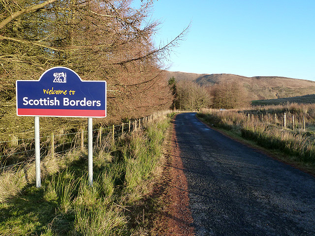
Unitary Authority: The Scottish Borders

Police Authority: The Lothians and Scottish Borders

What 3 Words

///wonderful.indulges.shoppers. Near Teviothead, Scottish Borders

Related Wikis

Dinley

Dinley is a hamlet in the Scottish Borders through which Hermitage Water flows. == Etymology == The first element, din, seems to be the Cumbric word for...

Cauldcleuch Head

Cauldcleuch Head is a hill in an unnamed range of Roxburghshire hills north of Langholm, part of the Southern Uplands of Scotland. The highest hill in...

Hermitage Castle

Hermitage Castle is a semi-ruined castle in the border region of Scotland. It is under the care of Historic Scotland. The castle has a reputation, both...

Hermitage, Scottish Borders

Hermitage is a village near Newcastleton, on the B6399, in the Scottish Borders area of Scotland. == See also == List of places in the Scottish Borders...

Nearby Amenities

Located within 500m of 55.270146,-2.8574907
Feat Shank
Place: locality
Lat/Long: 55.2702609/-2.8501394
Bught Shank
Place: locality
Lat/Long: 55.2665862/-2.8552814
The data included in this document is from www.openstreetmap.org. The data is made available under ODbL.

Have you been to Stob Cleuch?

Leave your review of Stob Cleuch below (or comments, questions and feedback).