Larrick

Settlement in Cornwall

England

Larrick

Trebullett Methodist Church
Trebullett Methodist Church Credit: Paul Barnett

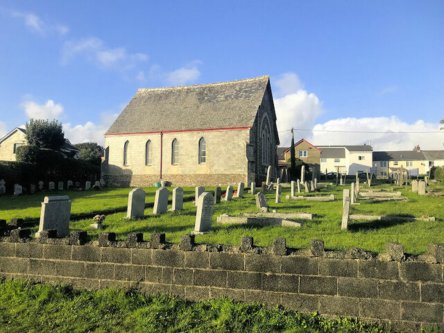
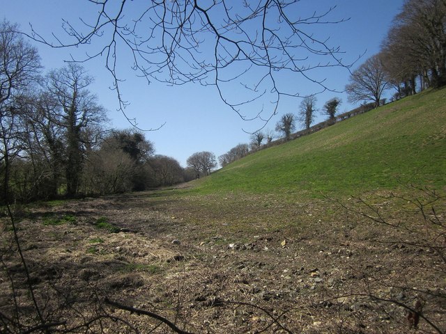
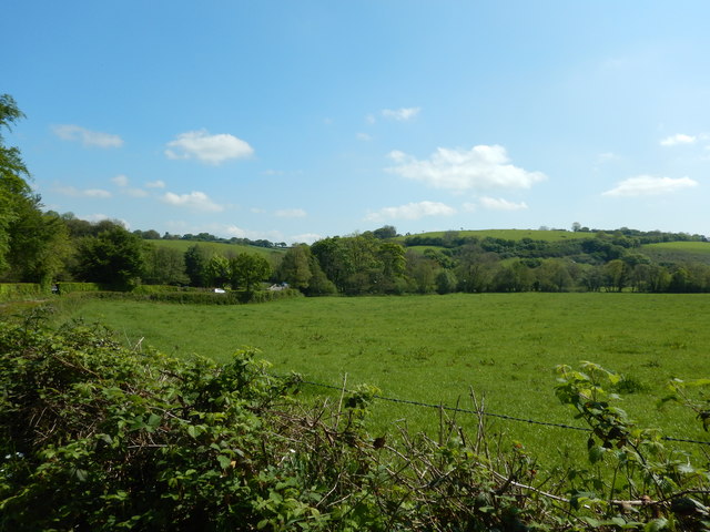
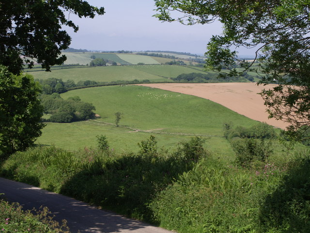
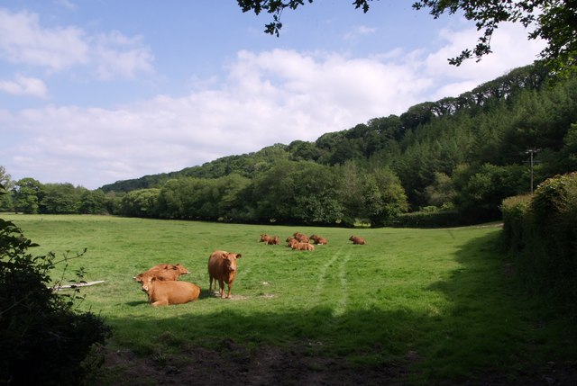
Larrick is a small village located in the county of Cornwall, England. Situated near the town of Liskeard, Larrick is known for its picturesque countryside views and peaceful atmosphere. The village is surrounded by rolling hills and lush green fields, making it an ideal destination for those looking to escape the hustle and bustle of city life.

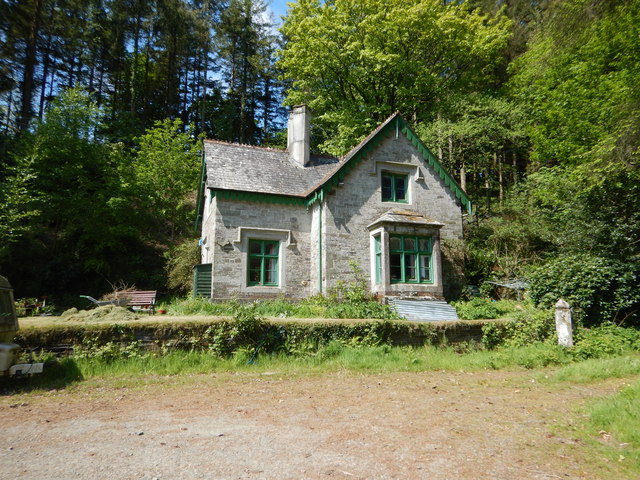
Larrick is home to a tight-knit community of residents who take pride in their village and its rich history. The village has a few amenities, including a local pub and a small convenience store, providing residents with the essentials they need without having to travel far. The village also has a primary school, making it an attractive option for families looking to settle down in a quiet and safe environment.

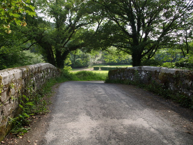
Visitors to Larrick can enjoy exploring the surrounding countryside, taking long walks along the village's winding lanes, and admiring the traditional stone cottages that line the streets. Larrick offers a true taste of rural Cornwall, with its peaceful ambiance and natural beauty.

If you have any feedback on the listing, please let us know in the comments section below.
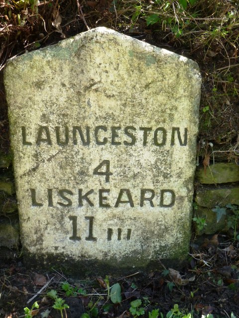
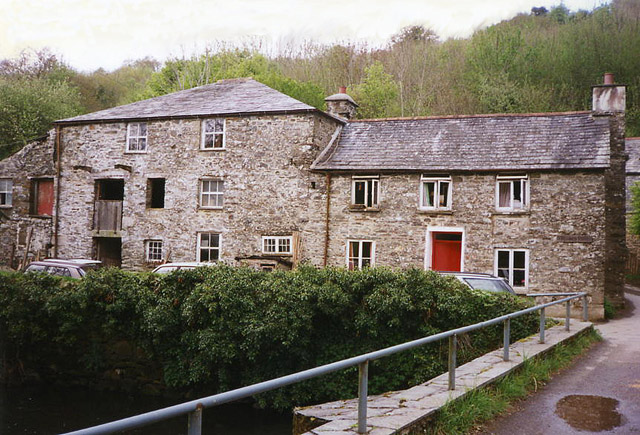
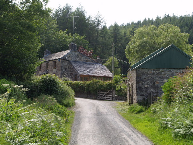
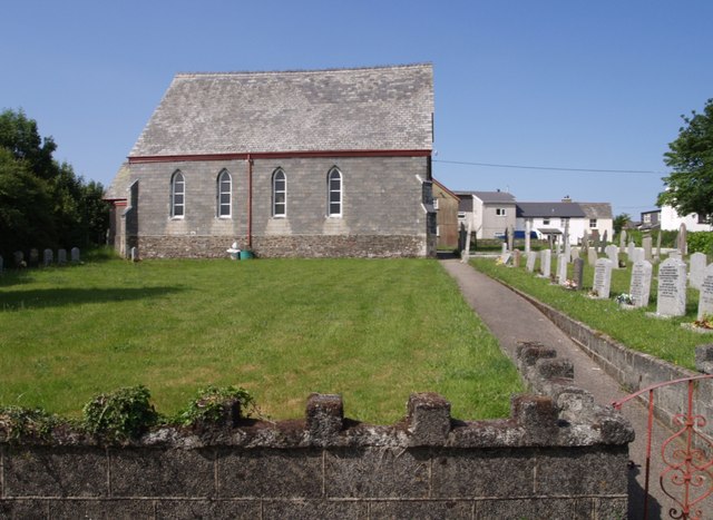
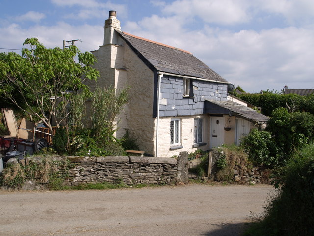
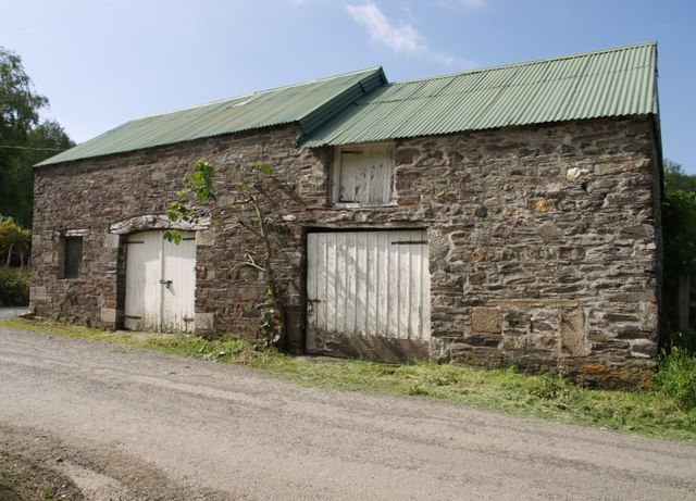
Larrick Images

Images are sourced within 2km of 50.58084/-4.389717 or Grid Reference SX3078. Thanks to Geograph Open Source API. All images are credited.

Trebullett Methodist Church
Old Direction Sign - Signpost north east of Higher Larrick, Lezant Parish No finial - 2 arms; by the UC road, in parish of Lezant (North Cornwall District), Higher Larrick, between fork in road.

To be surveyed

Milestone Society National ID: CW_SX3178.
Old Direction Sign - Signpost north east of Higher Larrick, Lezant Parish
No finial - 2 arms; by the UC road, in parish of Lezant (North Cornwall District), Higher Larrick, between fork in road. To be surveyed Milestone Society National ID: CW_SX3178.
Old Boundary Marker County Bridge Marker on the north side of the junction southwest of Trecarrell Bridge, River Inny. Linkinhorne parish. Inscribed C. The stone marks the extent of roadway adjoining the bridge that the County was obliged to maintain.

Milestone Society National ID: CW_LINKIN04br
Old Boundary Marker
County Bridge Marker on the north side of the junction southwest of Trecarrell Bridge, River Inny. Linkinhorne parish. Inscribed C. The stone marks the extent of roadway adjoining the bridge that the County was obliged to maintain. Milestone Society National ID: CW_LINKIN04br
Old Boundary Marker County Bridge Marker on the E side of the minor road 100 metres north-northeast of Trecarrell Bridge, River Inny. Lezant parish. Inscribed C. The stone marks the extent of roadway adjoining the bridge that the County was obliged to maintain.

Milestone Society National ID: CW_LEZ04br
Old Boundary Marker
County Bridge Marker on the E side of the minor road 100 metres north-northeast of Trecarrell Bridge, River Inny. Lezant parish. Inscribed C. The stone marks the extent of roadway adjoining the bridge that the County was obliged to maintain. Milestone Society National ID: CW_LEZ04br
Cattle, Newtown A further view of the cattle shown in <a href="https://www.geograph.org.uk/photo/4430459">SX2978 : Cattle, Newtown</a>.
Cattle, Newtown
A further view of the cattle shown in SX2978 : Cattle, Newtown.
Hillside near Newtown Looking up the valley of the stream mentioned in <a href="https://www.geograph.org.uk/photo/4435505">SX2978 : Lane to Newtown</a>, from the same place.
Hillside near Newtown
Looking up the valley of the stream mentioned in SX2978 : Lane to Newtown, from the same place.
Field next to River Inny near Trekelland Bridge
Trelaske Lodge Situated like a gatehouse but seems to be only a country dwelling close to the road.
Trelaske Lodge
Situated like a gatehouse but seems to be only a country dwelling close to the road.
Old Milestone by the B3254 Carved stone post by the B3254, in parish of LEWANNICK (NORTH CORNWALL District), Trelelland Bridge, opposite Lodge Cottage, on bend, set into stone wall, on East side of road. Liskeard iii stone, erected by the Local Highways Board in the 19th century. 

Inscription reads:-
LAUNCESTON
4
LISKEARD
11 iii 

Grade II Listed. List Entry Number: 1277636
<span class="nowrap"><a title="https://historicengland.org.uk/listing/the-list/list-entry/1277636" rel="nofollow ugc noopener" href="https://historicengland.org.uk/listing/the-list/list-entry/1277636">Link</a><img style="margin-left:2px;" alt="External link" title="External link - shift click to open in new window" src="https://s1.geograph.org.uk/img/external.png" width="10" height="10"/></span>

Milestone Society National ID: CW_LALK04.
Old Milestone by the B3254
Carved stone post by the B3254, in parish of LEWANNICK (NORTH CORNWALL District), Trelelland Bridge, opposite Lodge Cottage, on bend, set into stone wall, on East side of road. Liskeard iii stone, erected by the Local Highways Board in the 19th century. Inscription reads:- LAUNCESTON 4 LISKEARD 11 iii Grade II Listed. List Entry Number: 1277636 LinkExternal link Milestone Society National ID: CW_LALK04.
Old Milestone by the B3254 Carved stone post by the B3254, in parish of LEWANNICK (NORTH CORNWALL District), Trekelland Bridge, opposite Lodge Cottage, on bend, set into stone wall, on East side of road. Liskeard 'iii' stone, erected by the Local Highways Board in the 19th century. 

Inscription reads:-
LAUNCESTON
4
LISKEARD
11iii 

Grade II listed. 
List Entry Number: 1277636 <span class="nowrap"><a title="https://historicengland.org.uk/listing/the-list/list-entry/1277636" rel="nofollow ugc noopener" href="https://historicengland.org.uk/listing/the-list/list-entry/1277636">Link</a><img style="margin-left:2px;" alt="External link" title="External link - shift click to open in new window" src="https://s1.geograph.org.uk/img/external.png" width="10" height="10"/></span>

Milestone Society National ID: CW_LALK04.
Old Milestone by the B3254
Carved stone post by the B3254, in parish of LEWANNICK (NORTH CORNWALL District), Trekelland Bridge, opposite Lodge Cottage, on bend, set into stone wall, on East side of road. Liskeard 'iii' stone, erected by the Local Highways Board in the 19th century. Inscription reads:- LAUNCESTON 4 LISKEARD 11iii Grade II listed. List Entry Number: 1277636 LinkExternal link Milestone Society National ID: CW_LALK04.
Lezant: Ruses Mill A mill reached by steep lanes and once powered by a leat from the river Inny. Members of the Jasper family were millers here in the latter half of the 19th century
Lezant: Ruses Mill
A mill reached by steep lanes and once powered by a leat from the river Inny. Members of the Jasper family were millers here in the latter half of the 19th century
View across lane from Trebullett The lane is dropping from Trebullett to cross a small stream below Bottonnett. The majority of the land in view in the valley, beyond the hedge angle on the right, is in <a href="https://www.geograph.org.uk/gridref/SX3279">SX3279</a> and <a href="https://www.geograph.org.uk/gridref/SX3379">SX3379</a>.
View across lane from Trebullett
The lane is dropping from Trebullett to cross a small stream below Bottonnett. The majority of the land in view in the valley, beyond the hedge angle on the right, is in SX3279 and SX3379.
Trecarrell Bridge This bridge carries the lane from Trebullett to Tregoiffe over the River Inny.
Trecarrell Bridge
This bridge carries the lane from Trebullett to Tregoiffe over the River Inny.
Tregrove Cottage A cottage in the Inny valley, on the lane from Trebullett to Tregoiffe. In the background is Tregoiffe Wood.
Tregrove Cottage
A cottage in the Inny valley, on the lane from Trebullett to Tregoiffe. In the background is Tregoiffe Wood.
Trebullett  Methodist Church Built in 1871, the building dominates the hamlet. Seen from the car park to the south.
Trebullett Methodist Church
Built in 1871, the building dominates the hamlet. Seen from the car park to the south.
Cottage in Trebullett Pen Lee Cottage, by the church car park on the lane to Trecarrell Bridge.
Cottage in Trebullett
Pen Lee Cottage, by the church car park on the lane to Trecarrell Bridge.
Outbuilding at Tregrove Some interesting features in the fine stone building by the lane near Trecarrell Bridge, with a large wooden lintel on the left, and a hayloft door under the corrugated iron roof.
Outbuilding at Tregrove
Some interesting features in the fine stone building by the lane near Trecarrell Bridge, with a large wooden lintel on the left, and a hayloft door under the corrugated iron roof.
Cattle in Inny valley Cattle pose in a field beside the lane close to Trecarrell Bridge over the Inny. The steep (unnamed) wood in the background rises towards Kingscombe Farm.
Cattle in Inny valley
Cattle pose in a field beside the lane close to Trecarrell Bridge over the Inny. The steep (unnamed) wood in the background rises towards Kingscombe Farm.
Show me another place!

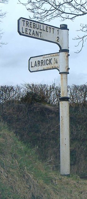
Larrick is located at Grid Ref: SX3078 (Lat: 50.58084, Lng: -4.389717)

Unitary Authority: Cornwall

Police Authority: Devon and Cornwall

What 3 Words

///sticky.sour.dispenser. Near North Hill, Cornwall

Related Wikis

Larrick

Larrick is a hamlet in the parish of Lezant (where the population of the 2011 census was included.), Cornwall, England. == References ==

Trebullett

Trebullett is a hamlet in Cornwall, England, United Kingdom. It is about one mile west of Lezant. Another hamlet, Lower Trebullett, is further south....

Lower Trebullett

Lower Trebullett is a hamlet in the parish of Lezant, Cornwall, England. == References ==

Illand

Illand is a hamlet in the parish of North Hill, Cornwall, England. == References ==

Nearby Amenities

Located within 500m of 50.58084,-4.389717
Higher Larrick
Place: hamlet
Source: OS_OpenData_StreetView
Lat/Long: 50.581059/-4.3889496
Lower Larrick
Place: hamlet
Source: OS_OpenData_StreetView
Lat/Long: 50.5781308/-4.3889281
Give Way
Lat/Long: 50.5808912/-4.3896838
Trecarrell
Description: OS trig pillar
Ele: 185.607
Man Made: survey_point
Note: Accurate location import for imagery offset calibration. Please do not move.
Ref: SS30/T41
Source: Ordnance Survey (OGL)
Survey Point: pillar
Lat/Long: 50.5816047/-4.3833994
Booth: K6
Covered: booth
Disused Amenity: telephone
Man Made: telephone_box
Lat/Long: 50.5809655/-4.3903171
Post Box
Post Box Type: lamp
Royal Cypher: EIIR
Lat/Long: 50.5808938/-4.39009
The data included in this document is from www.openstreetmap.org. The data is made available under ODbL.

Have you been to Larrick?

Leave your review of Larrick below (or comments, questions and feedback).