Higher Lerrick Common

Downs, Moorland in Cornwall

England

Higher Lerrick Common

Trebullett Methodist Church
Trebullett Methodist Church Credit: Paul Barnett

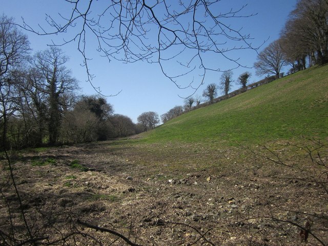
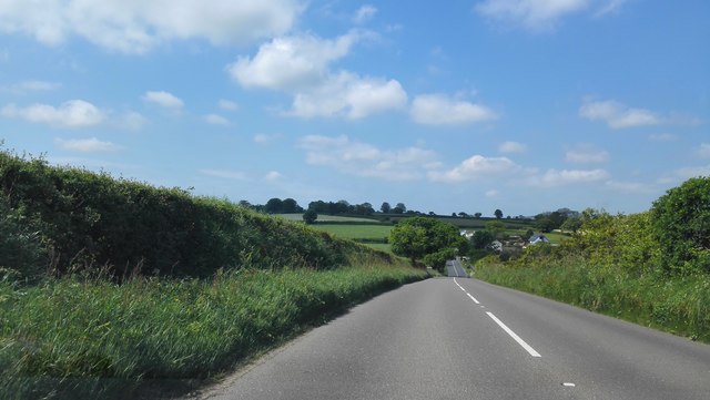
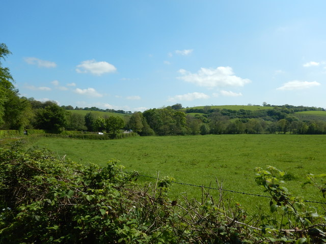
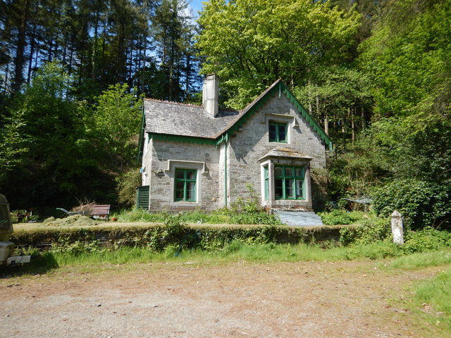
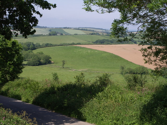
Higher Lerrick Common is a scenic area located in Cornwall, England. Situated on the Downs and Moorland, it is known for its breathtaking natural beauty and diverse wildlife. Spanning over a vast expanse of land, Higher Lerrick Common offers visitors a tranquil escape from the hustle and bustle of modern life.

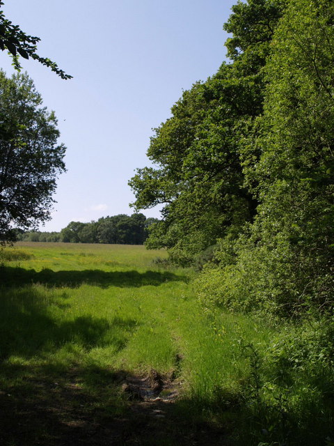
The common is characterized by rolling hills, open grasslands, and heathlands, which provide a unique habitat for a variety of plant and animal species. Visitors can expect to encounter an array of wildflowers, including vibrant purple heather and delicate orchids, as they explore the area. The common is also home to numerous bird species, such as skylarks and kestrels, which can often be spotted soaring through the skies.

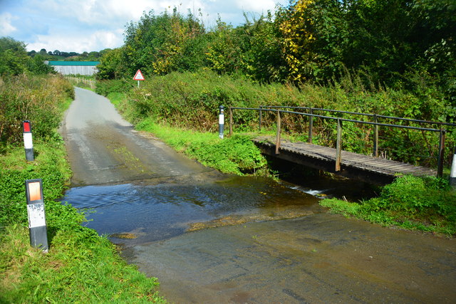
Walking trails crisscross the common, offering visitors the opportunity to fully immerse themselves in the natural surroundings. These paths wind through picturesque landscapes and provide stunning views of the surrounding countryside. The common is also intersected by a number of streams and small rivers, adding to its charm and providing a soothing soundtrack for those exploring its beauty.

Higher Lerrick Common is a popular destination for outdoor enthusiasts, offering ample opportunities for activities such as hiking, birdwatching, and photography. The unspoiled beauty of this area attracts visitors throughout the year, as it provides a peaceful retreat for individuals seeking solace in nature.

Overall, Higher Lerrick Common in Cornwall is a captivating landscape that showcases the beauty and diversity of the region's natural environment. Its idyllic scenery and abundant wildlife make it a must-visit destination for nature lovers and those seeking a serene escape.

If you have any feedback on the listing, please let us know in the comments section below.

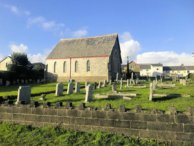
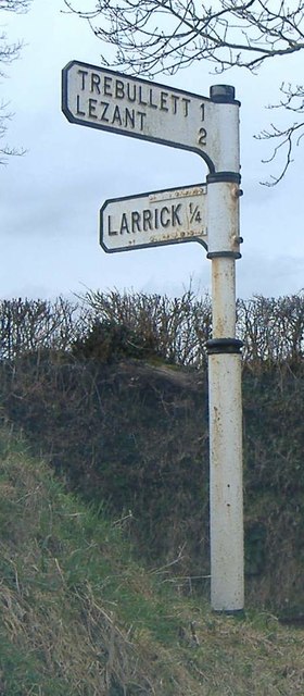
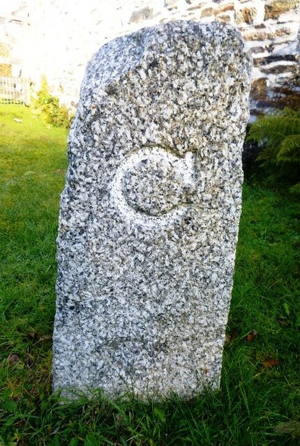
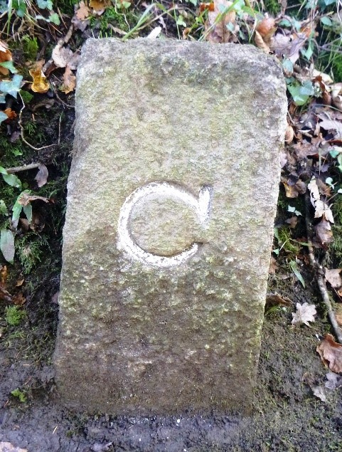
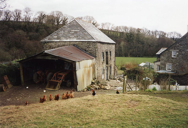
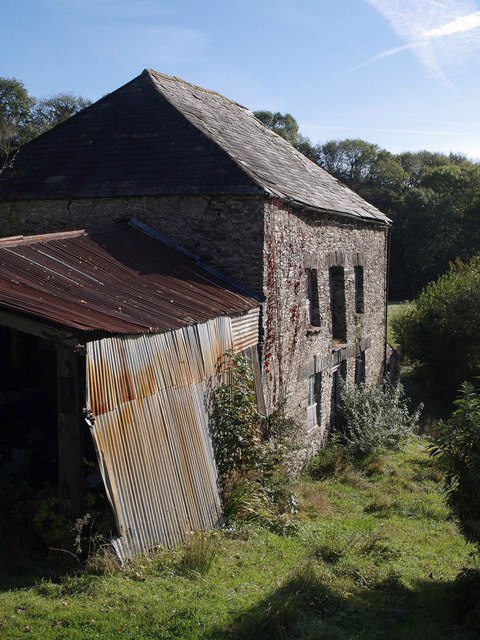
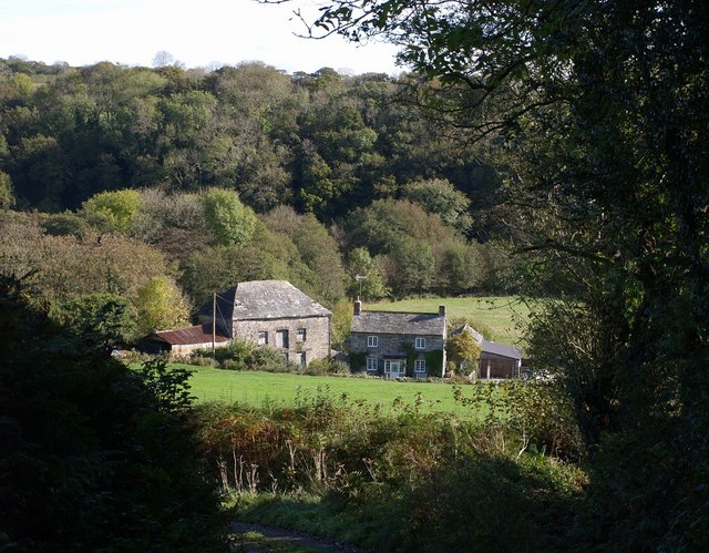
Higher Lerrick Common Images

Images are sourced within 2km of 50.58286/-4.3907937 or Grid Reference SX3078. Thanks to Geograph Open Source API. All images are credited.

Trebullett Methodist Church
Old Direction Sign - Signpost north east of Higher Larrick, Lezant Parish No finial - 2 arms; by the UC road, in parish of Lezant (North Cornwall District), Higher Larrick, between fork in road.

To be surveyed

Milestone Society National ID: CW_SX3178.
Old Direction Sign - Signpost north east of Higher Larrick, Lezant Parish
No finial - 2 arms; by the UC road, in parish of Lezant (North Cornwall District), Higher Larrick, between fork in road. To be surveyed Milestone Society National ID: CW_SX3178.
Old Boundary Marker County Bridge Marker on the north side of the junction southwest of Trecarrell Bridge, River Inny. Linkinhorne parish. Inscribed C. The stone marks the extent of roadway adjoining the bridge that the County was obliged to maintain.

Milestone Society National ID: CW_LINKIN04br
Old Boundary Marker
County Bridge Marker on the north side of the junction southwest of Trecarrell Bridge, River Inny. Linkinhorne parish. Inscribed C. The stone marks the extent of roadway adjoining the bridge that the County was obliged to maintain. Milestone Society National ID: CW_LINKIN04br
Old Boundary Marker County Bridge Marker on the E side of the minor road 100 metres north-northeast of Trecarrell Bridge, River Inny. Lezant parish. Inscribed C. The stone marks the extent of roadway adjoining the bridge that the County was obliged to maintain.

Milestone Society National ID: CW_LEZ04br
Old Boundary Marker
County Bridge Marker on the E side of the minor road 100 metres north-northeast of Trecarrell Bridge, River Inny. Lezant parish. Inscribed C. The stone marks the extent of roadway adjoining the bridge that the County was obliged to maintain. Milestone Society National ID: CW_LEZ04br
Lewannick: Trelaske Mill Private property but viewed from the lane that runs past. The long leat – well over a mile in length – that served the mill has been ploughed out but the building retains its machinery
Lewannick: Trelaske Mill
Private property but viewed from the lane that runs past. The long leat – well over a mile in length – that served the mill has been ploughed out but the building retains its machinery
Trelaske Mill Not a great deal has changed since <a href="https://www.geograph.org.uk/photo/62603">SX2980 : Lewannick: Trelaske Mill</a> was taken in March 1995.
Trelaske Mill
Not a great deal has changed since SX2980 : Lewannick: Trelaske Mill was taken in March 1995.
Trelaske Mill <a href="https://www.geograph.org.uk/photo/589557">SX2980 : Trelaske Mill</a> and the adjacent farmhouse seen from the steep lane from Trelaske House. The buildings are in the valley of the River Inny. On the eastern slope is Honiton Wood.
Trelaske Mill
SX2980 : Trelaske Mill and the adjacent farmhouse seen from the steep lane from Trelaske House. The buildings are in the valley of the River Inny. On the eastern slope is Honiton Wood.
Trekelland Ford This ford is found on a tributary of the River Inny.
Trekelland Ford
This ford is found on a tributary of the River Inny.
Cattle, Newtown A further view of the cattle shown in <a href="https://www.geograph.org.uk/photo/4430459">SX2978 : Cattle, Newtown</a>.
Cattle, Newtown
A further view of the cattle shown in SX2978 : Cattle, Newtown.
Hillside near Newtown Looking up the valley of the stream mentioned in <a href="https://www.geograph.org.uk/photo/4435505">SX2978 : Lane to Newtown</a>, from the same place.
Hillside near Newtown
Looking up the valley of the stream mentioned in SX2978 : Lane to Newtown, from the same place.
B2354 near Slipper Hill
Field next to River Inny near Trekelland Bridge
Trelaske Lodge Situated like a gatehouse but seems to be only a country dwelling close to the road.
Trelaske Lodge
Situated like a gatehouse but seems to be only a country dwelling close to the road.
Old Milestone by the B3254 Carved stone post by the B3254, in parish of LEWANNICK (NORTH CORNWALL District), Trelelland Bridge, opposite Lodge Cottage, on bend, set into stone wall, on East side of road. Liskeard iii stone, erected by the Local Highways Board in the 19th century. 

Inscription reads:-
LAUNCESTON
4
LISKEARD
11 iii 

Grade II Listed. List Entry Number: 1277636
<span class="nowrap"><a title="https://historicengland.org.uk/listing/the-list/list-entry/1277636" rel="nofollow ugc noopener" href="https://historicengland.org.uk/listing/the-list/list-entry/1277636">Link</a><img style="margin-left:2px;" alt="External link" title="External link - shift click to open in new window" src="https://s1.geograph.org.uk/img/external.png" width="10" height="10"/></span>

Milestone Society National ID: CW_LALK04.
Old Milestone by the B3254
Carved stone post by the B3254, in parish of LEWANNICK (NORTH CORNWALL District), Trelelland Bridge, opposite Lodge Cottage, on bend, set into stone wall, on East side of road. Liskeard iii stone, erected by the Local Highways Board in the 19th century. Inscription reads:- LAUNCESTON 4 LISKEARD 11 iii Grade II Listed. List Entry Number: 1277636 LinkExternal link Milestone Society National ID: CW_LALK04.
Old Milestone by the B3254 Carved stone post by the B3254, in parish of LEWANNICK (NORTH CORNWALL District), Trekelland Bridge, opposite Lodge Cottage, on bend, set into stone wall, on East side of road. Liskeard 'iii' stone, erected by the Local Highways Board in the 19th century. 

Inscription reads:-
LAUNCESTON
4
LISKEARD
11iii 

Grade II listed. 
List Entry Number: 1277636 <span class="nowrap"><a title="https://historicengland.org.uk/listing/the-list/list-entry/1277636" rel="nofollow ugc noopener" href="https://historicengland.org.uk/listing/the-list/list-entry/1277636">Link</a><img style="margin-left:2px;" alt="External link" title="External link - shift click to open in new window" src="https://s1.geograph.org.uk/img/external.png" width="10" height="10"/></span>

Milestone Society National ID: CW_LALK04.
Old Milestone by the B3254
Carved stone post by the B3254, in parish of LEWANNICK (NORTH CORNWALL District), Trekelland Bridge, opposite Lodge Cottage, on bend, set into stone wall, on East side of road. Liskeard 'iii' stone, erected by the Local Highways Board in the 19th century. Inscription reads:- LAUNCESTON 4 LISKEARD 11iii Grade II listed. List Entry Number: 1277636 LinkExternal link Milestone Society National ID: CW_LALK04.
Lezant: Ruses Mill A mill reached by steep lanes and once powered by a leat from the river Inny. Members of the Jasper family were millers here in the latter half of the 19th century
Lezant: Ruses Mill
A mill reached by steep lanes and once powered by a leat from the river Inny. Members of the Jasper family were millers here in the latter half of the 19th century
Field and trees near Trewarlett A scene beside the lane between Trewarlett Cross and Trebullett, with a small unnamed wood on the right.
Field and trees near Trewarlett
A scene beside the lane between Trewarlett Cross and Trebullett, with a small unnamed wood on the right.
View across lane from Trebullett The lane is dropping from Trebullett to cross a small stream below Bottonnett. The majority of the land in view in the valley, beyond the hedge angle on the right, is in <a href="https://www.geograph.org.uk/gridref/SX3279">SX3279</a> and <a href="https://www.geograph.org.uk/gridref/SX3379">SX3379</a>.
View across lane from Trebullett
The lane is dropping from Trebullett to cross a small stream below Bottonnett. The majority of the land in view in the valley, beyond the hedge angle on the right, is in SX3279 and SX3379.
Show me another place!

Higher Lerrick Common is located at Grid Ref: SX3078 (Lat: 50.58286, Lng: -4.3907937)

Unitary Authority: Cornwall

Police Authority: Devon and Cornwall

What 3 Words

///learn.huddling.unspoiled. Near North Hill, Cornwall

Related Wikis

Larrick

Larrick is a hamlet in the parish of Lezant (where the population of the 2011 census was included.), Cornwall, England. == References ==

Trebullett

Trebullett is a hamlet in Cornwall, England, United Kingdom. It is about one mile west of Lezant. Another hamlet, Lower Trebullett, is further south....

Lower Trebullett

Lower Trebullett is a hamlet in the parish of Lezant, Cornwall, England. == References ==

Illand

Illand is a hamlet in the parish of North Hill, Cornwall, England. == References ==

Nearby Amenities

Located within 500m of 50.58286,-4.3907937
Higher Larrick
Place: hamlet
Source: OS_OpenData_StreetView
Lat/Long: 50.581059/-4.3889496
Give Way
Lat/Long: 50.5808912/-4.3896838
Booth: K6
Covered: booth
Disused Amenity: telephone
Man Made: telephone_box
Lat/Long: 50.5809655/-4.3903171
Post Box
Post Box Type: lamp
Royal Cypher: EIIR
Lat/Long: 50.5808938/-4.39009
The data included in this document is from www.openstreetmap.org. The data is made available under ODbL.

Have you been to Higher Lerrick Common?

Leave your review of Higher Lerrick Common below (or comments, questions and feedback).