Spring-garden

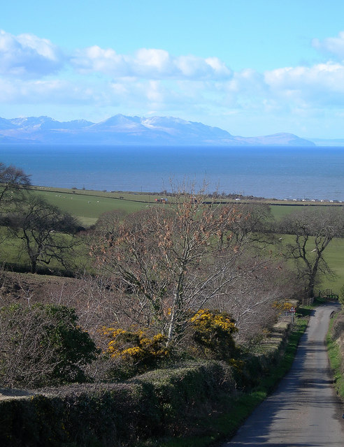
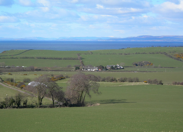
Downs, Moorland in Ayrshire

Scotland

Spring-garden

Kyleston A farm park, complete with a dromedary. Handily placed next door to a holiday camp.
Kyleston Credit: Richard Webb

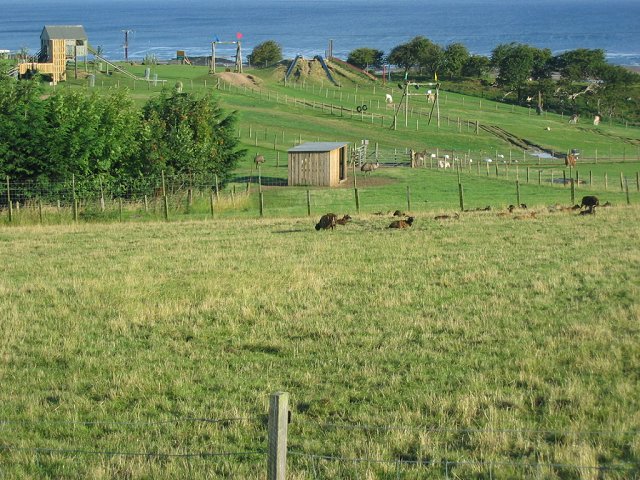
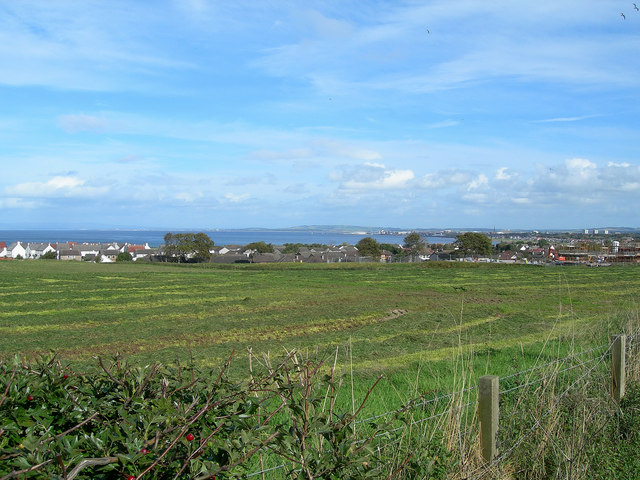
Spring-garden, Ayrshire, located in the picturesque region of Scotland, is a place of natural beauty that captivates visitors with its stunning landscapes. Nestled amidst the rolling hills of Downs and Moorland, this idyllic countryside setting offers a serene escape from the hustle and bustle of city life.

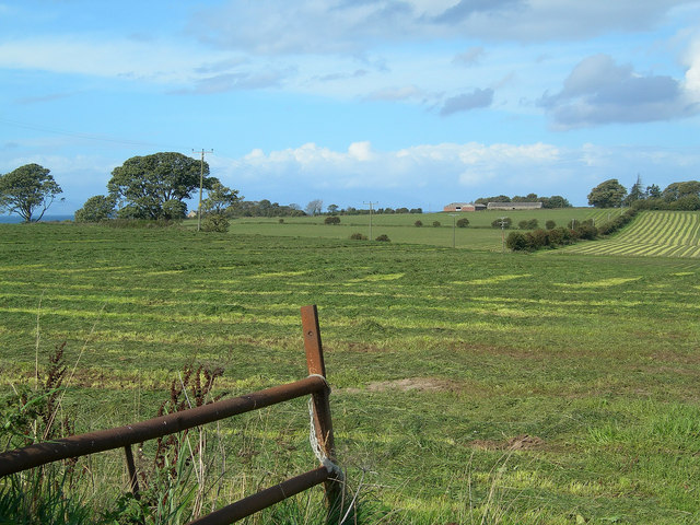
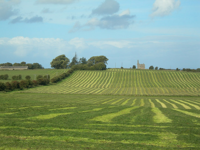
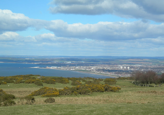
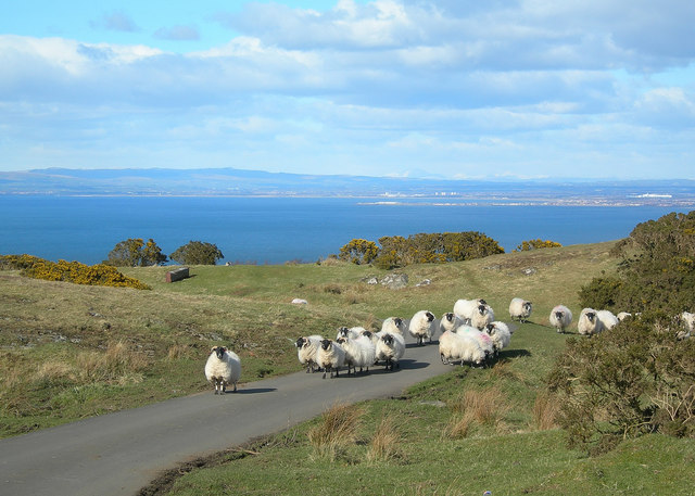
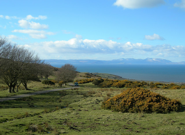
The Downs of Spring-garden present a breathtaking sight, with vast stretches of green meadows extending as far as the eye can see. These lush fields are dotted with colorful wildflowers during the spring and summer months, creating a vibrant tapestry of nature's beauty. The gentle slopes of the Downs provide a perfect spot for leisurely walks or picnics, allowing visitors to immerse themselves in the tranquility of the surroundings.

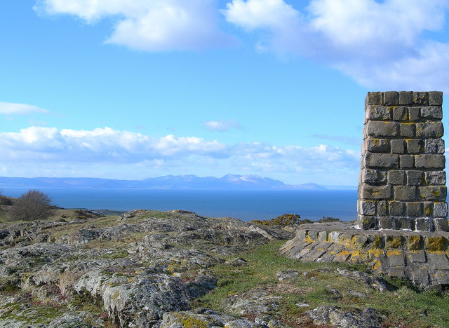
Moorland, another prominent feature of Spring-garden, is characterized by its heather-covered expanses, interspersed with rocky outcrops. The rugged terrain adds a touch of ruggedness to the landscape, offering a unique contrast to the softer beauty of the Downs. Moorland is a haven for nature enthusiasts, providing ample opportunities for hiking, birdwatching, and capturing stunning photographs.

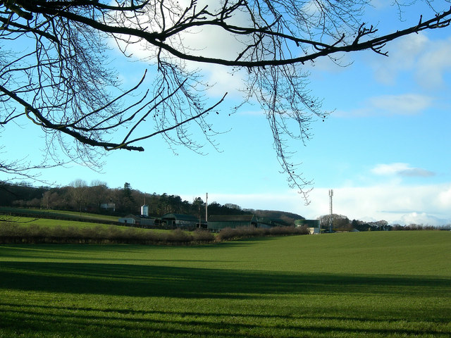
The natural beauty of Spring-garden is further enhanced by the presence of charming streams meandering through the countryside, adding a touch of serenity to the already picturesque setting. These babbling brooks not only provide a scenic backdrop but also support a diverse ecosystem of aquatic life.

Spring-garden, Ayrshire, with its breathtaking Downs and Moorland, is a haven for nature lovers and those seeking solace in the embrace of the countryside. Its stunning landscapes, abundant flora and fauna, and peaceful ambiance make it an ideal destination for those looking to reconnect with nature and indulge in the beauty of Scotland's countryside.

If you have any feedback on the listing, please let us know in the comments section below.

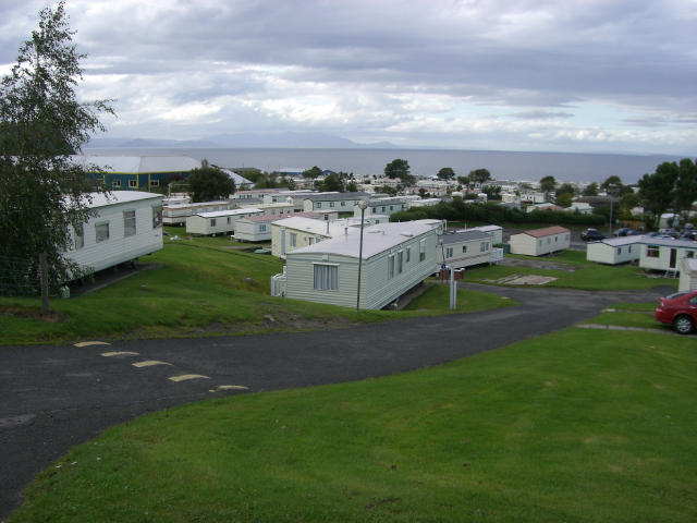
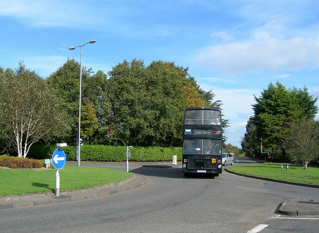
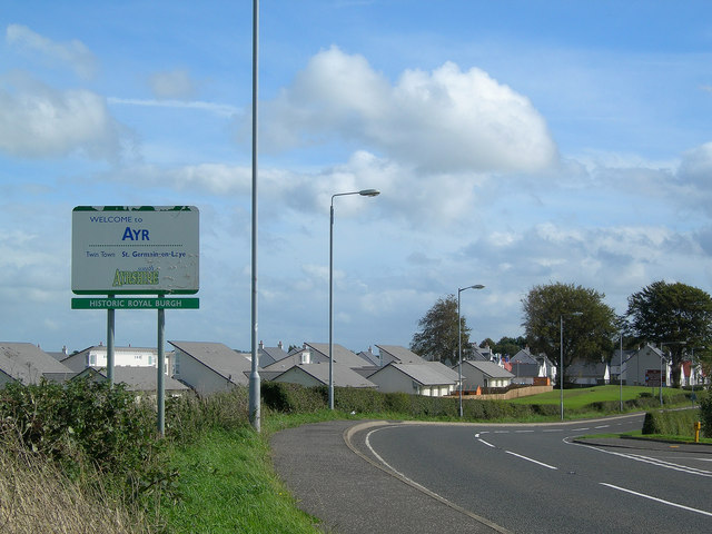
Spring-garden Images

Images are sourced within 2km of 55.428088/-4.6753623 or Grid Reference NS3018. Thanks to Geograph Open Source API. All images are credited.

Kyleston A farm park, complete with a dromedary. Handily placed next door to a holiday camp.
Kyleston
A farm park, complete with a dromedary. Handily placed next door to a holiday camp.
Sunset from the Castle We cycled up there from Ayr.
Sunset from the Castle
We cycled up there from Ayr.
Greenan castle A view looking southwest from the beach towards the remains of Greenan castle on an imposing clifftop site. The radio aerial masts on Brown Carrick Hill can be seen in the distance at right.
Greenan castle
A view looking southwest from the beach towards the remains of Greenan castle on an imposing clifftop site. The radio aerial masts on Brown Carrick Hill can be seen in the distance at right.
Craig Tara holiday park, nr. Ayr The majority of the land usage in square NS3018 is the Haven Craig Tara holiday park, the successor to Butlins Ayr. The building on the right is the main reception building.
Craig Tara holiday park, nr. Ayr
The majority of the land usage in square NS3018 is the Haven Craig Tara holiday park, the successor to Butlins Ayr. The building on the right is the main reception building.
Caravans at Craig Tara holiday park, nr. Ayr Most of the old chalets on this former Butlins site have now gone, replaced by caravans forming the current "Haven" site. Some buildings have been retained - that visible in the left middle distance is the old dining hall still in use as a restaurant facility.
Caravans at Craig Tara holiday park, nr. Ayr
Most of the old chalets on this former Butlins site have now gone, replaced by caravans forming the current "Haven" site. Some buildings have been retained - that visible in the left middle distance is the old dining hall still in use as a restaurant facility.
Longhill Avenue Roundabout The junction of Longhill Avenue, Ayr and the A719 to Dunure, showing the bus leaving for Craig Tara Holiday Park (formerly Butlin's)
Longhill Avenue Roundabout
The junction of Longhill Avenue, Ayr and the A719 to Dunure, showing the bus leaving for Craig Tara Holiday Park (formerly Butlin's)
Welcome to Ayr Entering Ayr on the A719 coast road from Dunure, where much new building has taken place recently.
Welcome to Ayr
Entering Ayr on the A719 coast road from Dunure, where much new building has taken place recently.
Doonfoot Looking across Greenan Farm land towards Doonfoot, with Ayr Bay in the background.
Doonfoot
Looking across Greenan Farm land towards Doonfoot, with Ayr Bay in the background.
Greenan Farm, near Ayr Rich coastal farmlands to the south of Ayr, showing Greenan Farm on the skyline
Greenan Farm, near Ayr
Rich coastal farmlands to the south of Ayr, showing Greenan Farm on the skyline
Greenan Farm Rich coastal farmland near Ayr, with Greenan Castle in the background
Greenan Farm
Rich coastal farmland near Ayr, with Greenan Castle in the background
Pollarded Trees Heavily pollarded trees in Longhill Avenue, Alloway. However, a later visit showed that the trees were being prepared for felling. <a href="https://www.geograph.org.uk/photo/1314514">NS3217 : Longhill Avenue.</a>
Pollarded Trees
Heavily pollarded trees in Longhill Avenue, Alloway. However, a later visit showed that the trees were being prepared for felling. NS3217 : Longhill Avenue.
Dalcrest Looking towards Dalcrest, near Newark Castle, on the northern edge of the Carrick Hills.
Dalcrest
Looking towards Dalcrest, near Newark Castle, on the northern edge of the Carrick Hills.
Ayr from Brown Carrick Hill A fine view of Ayr on a clear March afternoon.  Prominent features include, from the left: Ayr Harbour, the Pavilion, the Low Green, Ayr Beach, the 3 blocks of flats at Riverside Place.  Prestwick Airport is visible in the middle distance. For a wintry view, see <a href="https://www.geograph.org.uk/photo/6046946">NS3016 : Towards Ayr</a>
Ayr from Brown Carrick Hill
A fine view of Ayr on a clear March afternoon. Prominent features include, from the left: Ayr Harbour, the Pavilion, the Low Green, Ayr Beach, the 3 blocks of flats at Riverside Place. Prestwick Airport is visible in the middle distance. For a wintry view, see NS3016 : Towards Ayr
Sheep on the Road Black-faced sheep on the Brown Carrick Hill Road.  The first promontory in the spectacular view is Troon Harbour, with Irvine behind.  Ben Lomond and the Trossachs are visible on the skyline. The paper mill at Irvine is on the far right.
Sheep on the Road
Black-faced sheep on the Brown Carrick Hill Road. The first promontory in the spectacular view is Troon Harbour, with Irvine behind. Ben Lomond and the Trossachs are visible on the skyline. The paper mill at Irvine is on the far right.
Brown Carrick Hill Viewpoint A fine view of Arran and the Firth of Clyde on a beautiful March afternoon. For a wintry view, see <a href="https://www.geograph.org.uk/photo/6046928">NS2916 : At The Brown Carrick Viewpoint</a>
Brown Carrick Hill Viewpoint
A fine view of Arran and the Firth of Clyde on a beautiful March afternoon. For a wintry view, see NS2916 : At The Brown Carrick Viewpoint
Arran View Looking across the Firth of Clyde to Arran from the Brown Carrick Hill viewpoint on a glorious March afternoon. For a wintry view, see <a href="https://www.geograph.org.uk/photo/6046923">NS2916 : Park Here For The Viewpoint</a>
Arran View
Looking across the Firth of Clyde to Arran from the Brown Carrick Hill viewpoint on a glorious March afternoon. For a wintry view, see NS2916 : Park Here For The Viewpoint
Goat Fell View Looking across the Firth of Clyde towards Goat Fell from the Brown Carrick Hill Road on a glorious March afternoon.
Goat Fell View
Looking across the Firth of Clyde towards Goat Fell from the Brown Carrick Hill Road on a glorious March afternoon.
Largs and Largs Largs Farm is in the middle distance.  The air was so clear that it was nearly possible to see the town of Largs, in North Ayrshire.  Snow-covered highland mountains are visible on the skyline.
Largs and Largs
Largs Farm is in the middle distance. The air was so clear that it was nearly possible to see the town of Largs, in North Ayrshire. Snow-covered highland mountains are visible on the skyline.
Show me another place!

Spring-garden is located at Grid Ref: NS3018 (Lat: 55.428088, Lng: -4.6753623)

Unitary Authority: South Ayrshire

Police Authority: Ayrshire

What 3 Words

///bulge.short.encrusted. Near Ayr, South Ayrshire
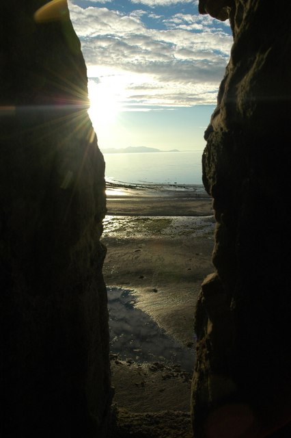
Nearby Locations

Spring-garden

Related Wikis

Heads of Ayr Holiday Camp railway station

Heads of Ayr Holiday Camp railway station was a railway station serving the holiday camp and hotel at Heads of Ayr, South Ayrshire, Scotland. The station...
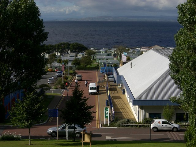
Craig Tara

Craig Tara is a holiday camp located near Ayr in South Ayrshire, Scotland. It is run by Haven Holidays, who took over and renamed the former Butlin's Ayr...

Butlin's Ayr

Butlin's Ayr was a holiday camp located near Ayr in South Ayrshire, Scotland. When originally opened in 1946, it was named Butlin's Ayr, but in 1987 was...
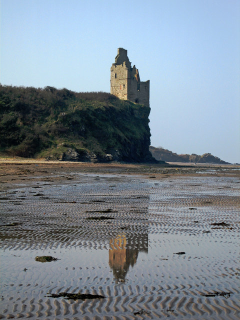
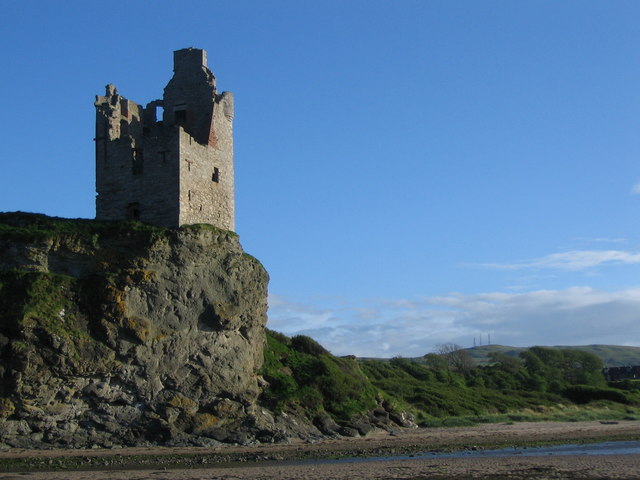
Greenan Castle

Greenan Castle is a 16th-century ruined tower house, around 2+1⁄2 miles (4 kilometres) southwest of Ayr in South Ayrshire, Scotland. Situated at the top...

Nearby Amenities

Located within 500m of 55.428088,-4.6753623
Barrier: bollard
Bicycle: yes
Foot: yes
Lat/Long: 55.4287085/-4.6677508
Place: farm
Lat/Long: 55.4281785/-4.67883
Ncn Milepost: mccoll
Sustrans Ref: MP966
Lat/Long: 55.4287653/-4.6677534
Power: pole
Lat/Long: 55.429142/-4.677845
Power: pole
Lat/Long: 55.4291709/-4.6775993
Power: pole
Lat/Long: 55.4292854/-4.6764033
Power: pole
Lat/Long: 55.4294024/-4.6750102
Power: pole
Lat/Long: 55.4295326/-4.6736125
Power: pole
Lat/Long: 55.4294721/-4.6722913
Power: pole
Lat/Long: 55.4293945/-4.6709029
Power: pole
Lat/Long: 55.4293169/-4.6695215
Power: pole
Lat/Long: 55.4292446/-4.6681238
Power: pole
Lat/Long: 55.4289145/-4.6675953
Power: pole
Lat/Long: 55.428608/-4.6746788
Power: pole
Lat/Long: 55.427786/-4.6743404
Power: pole
Lat/Long: 55.4270428/-4.6739834
Power: pole
Lat/Long: 55.4269047/-4.6739602
Power: pole
Lat/Long: 55.42628/-4.6739185
Power: pole
Lat/Long: 55.4255171/-4.6738397
Power: pole
Lat/Long: 55.4247568/-4.6737377
Power: pole
Lat/Long: 55.4239636/-4.6736798
The data included in this document is from www.openstreetmap.org. The data is made available under ODbL.

Have you been to Spring-garden?

Leave your review of Spring-garden below (or comments, questions and feedback).