Annery Bottoms

Valley in Devon Torridge

England

Annery Bottoms

Weare Giffard: Wear Mills On a leat by the river Torridge; in the 18th and 19th century barges would bring grain ‘on the top of the tide’ from Bideford. By 1889 the mill was fitted with a turbine and roller milling machinery by Henry Simon of Manchester; the turbine was appropriate as the Torridge is liable to flood. The mill has been converted to a private residence
Weare Giffard: Wear Mills Credit: Martin Bodman

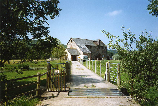
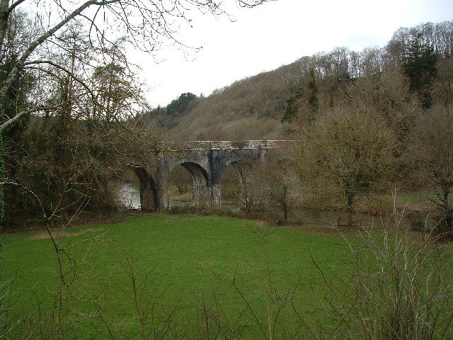
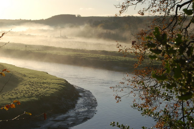
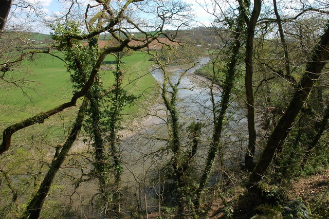
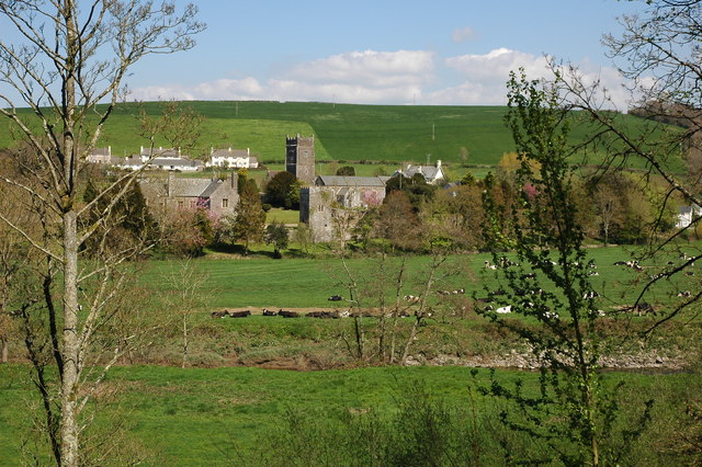
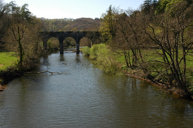
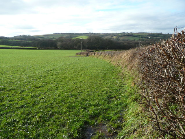
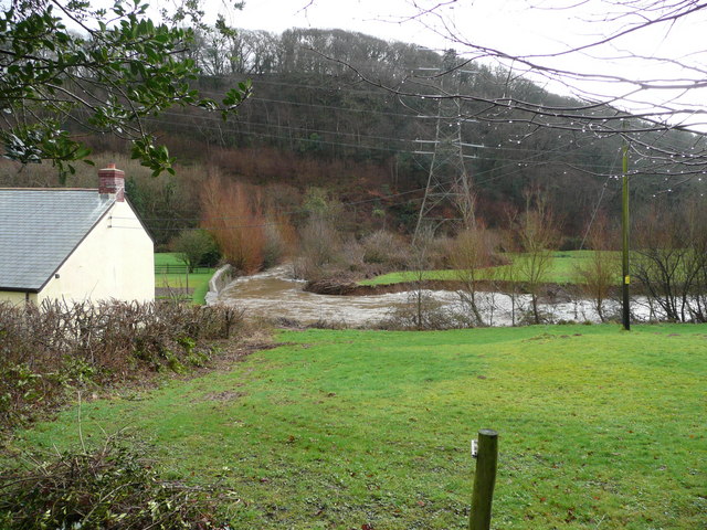
Annery Bottoms is a picturesque valley located in the county of Devon, England. Situated near the town of Great Torrington, it is renowned for its stunning natural beauty and tranquil atmosphere. The valley is nestled between rolling hills, adorned with lush green meadows and bordered by the meandering River Torridge.

Annery Bottoms is a haven for wildlife enthusiasts and nature lovers alike. The area is home to a diverse range of flora and fauna, with numerous species of birds, butterflies, and wildflowers found within its boundaries. The valley provides an ideal habitat for these creatures, with its rich biodiversity and well-preserved ecosystem.

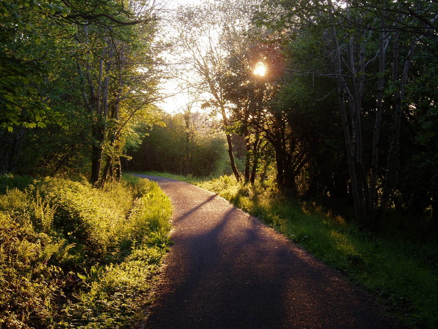
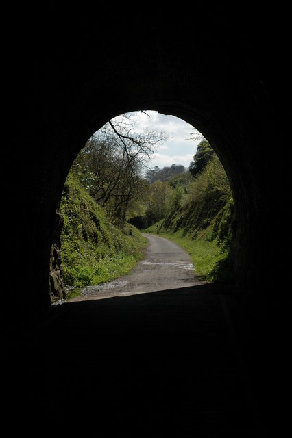
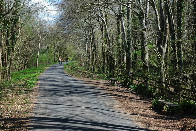
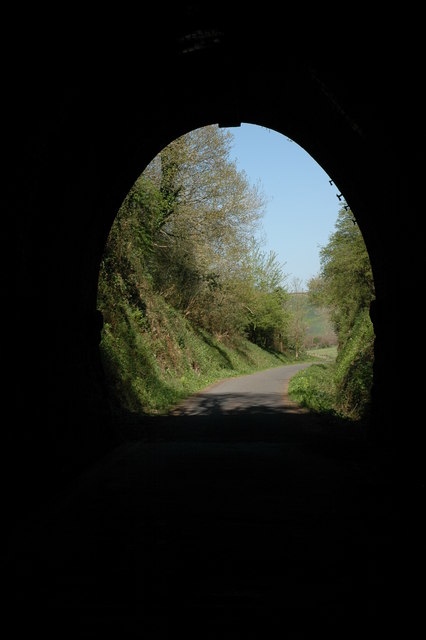
Visitors to Annery Bottoms can enjoy a variety of outdoor activities. There are several walking trails and paths that allow visitors to explore the valley at their own pace, immersing themselves in its natural beauty. The river also offers opportunities for fishing and boating, with its calm waters and abundant fish population.

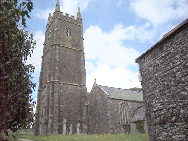
The valley is also of historical significance, with the ruins of Annery House, a 13th-century manor, located within its vicinity. The remnants of this once-grand building add an air of mystery and intrigue to the landscape, enticing history enthusiasts to delve into the past.

Overall, Annery Bottoms is a hidden gem in the Devon countryside, offering a peaceful retreat from the hustle and bustle of modern life. Its natural beauty, diverse wildlife, and historical charm make it a must-visit destination for those seeking solace in nature.

If you have any feedback on the listing, please let us know in the comments section below.

Annery Bottoms Images

Images are sourced within 2km of 50.977781/-4.19638 or Grid Reference SS4522. Thanks to Geograph Open Source API. All images are credited.

Weare Giffard: Wear Mills On a leat by the river Torridge; in the 18th and 19th century barges would bring grain ‘on the top of the tide’ from Bideford. By 1889 the mill was fitted with a turbine and roller milling machinery by Henry Simon of Manchester; the turbine was appropriate as the Torridge is liable to flood. The mill has been converted to a private residence
Weare Giffard: Wear Mills
On a leat by the river Torridge; in the 18th and 19th century barges would bring grain ‘on the top of the tide’ from Bideford. By 1889 the mill was fitted with a turbine and roller milling machinery by Henry Simon of Manchester; the turbine was appropriate as the Torridge is liable to flood. The mill has been converted to a private residence
Canal Bridge, Beam This bridge was built by Lord Rolle in 1824. Henry Williamson sited Owlery Holt, birthplace of Tarka, near to the bridge. Viewed from the Tarka Trail
Canal Bridge, Beam
This bridge was built by Lord Rolle in 1824. Henry Williamson sited Owlery Holt, birthplace of Tarka, near to the bridge. Viewed from the Tarka Trail
Tarka Trail: Landcross tunnel
Monkleigh Church Some of my BLIGHT ancestors came from here.
Monkleigh Church
Some of my BLIGHT ancestors came from here.
River Torridge near Annery Kiln View of the River Torridge from just below the Tarka Trail looking west. Annery Kiln is in the distance (partially obscured in the mist). The start of the disused Rolle Canal (to Torrington) is just below where this picture was taken from (cannot be seen in this picture).
River Torridge near Annery Kiln
View of the River Torridge from just below the Tarka Trail looking west. Annery Kiln is in the distance (partially obscured in the mist). The start of the disused Rolle Canal (to Torrington) is just below where this picture was taken from (cannot be seen in this picture).
The Tarka Trail near Weare Giffard The Tarka Trail cycle path near Weare Giffard. The path follows the route of the old Bideford - Torrington railway, the railway line closely follows the route of the Rolle Canal.
The Tarka Trail near Weare Giffard
The Tarka Trail cycle path near Weare Giffard. The path follows the route of the old Bideford - Torrington railway, the railway line closely follows the route of the Rolle Canal.
The Landcross Tunnel on the Tarka Trail View out of the northern end of the Landcross Tunnel. The former railway line is the route of the Tarka Trail and is an excellent cycleway.
The Landcross Tunnel on the Tarka Trail
View out of the northern end of the Landcross Tunnel. The former railway line is the route of the Tarka Trail and is an excellent cycleway.
The Landcross Tunnel on the Tarka Trail View out of the southern end of the Landcross Tunnel on the Tarka Trail.
The Landcross Tunnel on the Tarka Trail
View out of the southern end of the Landcross Tunnel on the Tarka Trail.
The River Torridge near Landcross The River Torridge viewed from the Tarka Trail just to the south of the Landcross Tunnel.
The River Torridge near Landcross
The River Torridge viewed from the Tarka Trail just to the south of the Landcross Tunnel.
Weare Giffard Weare Giffard viewed from the Tarka Trail across the Torridge valley, in the centre is the church of Holy Trinity.
Weare Giffard
Weare Giffard viewed from the Tarka Trail across the Torridge valley, in the centre is the church of Holy Trinity.
The Tarka Trail near Weare Giffard
The Beam Aqueduct The Beam Aqueduct crosses the River Torridge and used to carry the Rolle Canal. Today it carries the driveway to Beam House.
The Beam Aqueduct
The Beam Aqueduct crosses the River Torridge and used to carry the Rolle Canal. Today it carries the driveway to Beam House.
In the Landcross Tunnel The tunnel is cycled through on the Tarka Trail.
In the Landcross Tunnel
The tunnel is cycled through on the Tarka Trail.
Entrance to Petticombe Manor Looks a bit past its best
Entrance to Petticombe Manor
Looks a bit past its best
Gatehouse to Annery
Gatehouse to Annery
Arable land west of Monkleigh View north of the lane to Buckland. Typical Devon hedge cut wide and flat, with the road indented.
Arable land west of Monkleigh
View north of the lane to Buckland. Typical Devon hedge cut wide and flat, with the road indented.
Looking south-west Across the wooded Duntz valley with the village of Buckland Brewer on the hilltop in the distance.
Looking south-west
Across the wooded Duntz valley with the village of Buckland Brewer on the hilltop in the distance.
River Yeo near Edge Mill The bend in the river is strongly built up to protect gardens to the left and behind the house.
River Yeo near Edge Mill
The bend in the river is strongly built up to protect gardens to the left and behind the house.
Show me another place!

Annery Bottoms is located at Grid Ref: SS4522 (Lat: 50.977781, Lng: -4.19638)

Administrative County: Devon

District: Torridge

Police Authority: Devon and Cornwall

What 3 Words

///cleanest.contour.inclines. Near Bideford, Devon

Related Wikis

Annery, Monkleigh

Annery was an historic estate in the parish of Monkleigh, North Devon. It was one of the original endowments of Tavistock Abbey, founded in 961. The first...

Annery kiln

Annery kiln is a former limekiln of the estate of Annery, in the parish of Monkleigh, North Devon. It is situated on the left bank of the River Torridge...

Weare Giffard

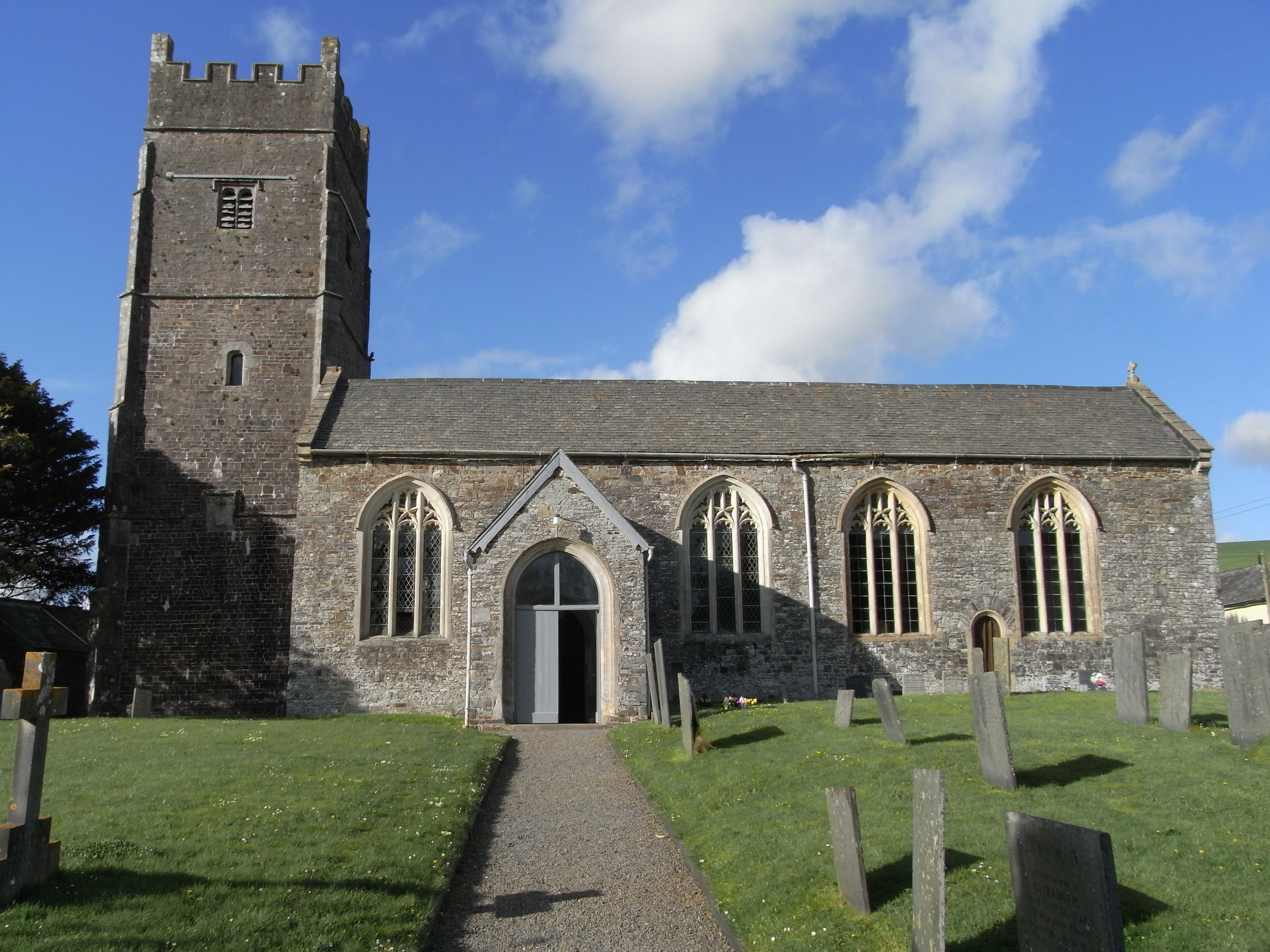
Weare Giffard is a small village, civil parish and former manor in the Torridge district, in north Devon, England. The church and manor house are situated...

Monkleigh

Monkleigh is a village, parish and former manor in north Devon, England, situated 2 1/2 miles north-west of Great Torrington and 3 1/2 miles south-east...

Landcross, Devon

Landcross is a hamlet and civil parish in the local government district of Torridge, Devon, England. The parish, which is the smallest in Devon, lies just...

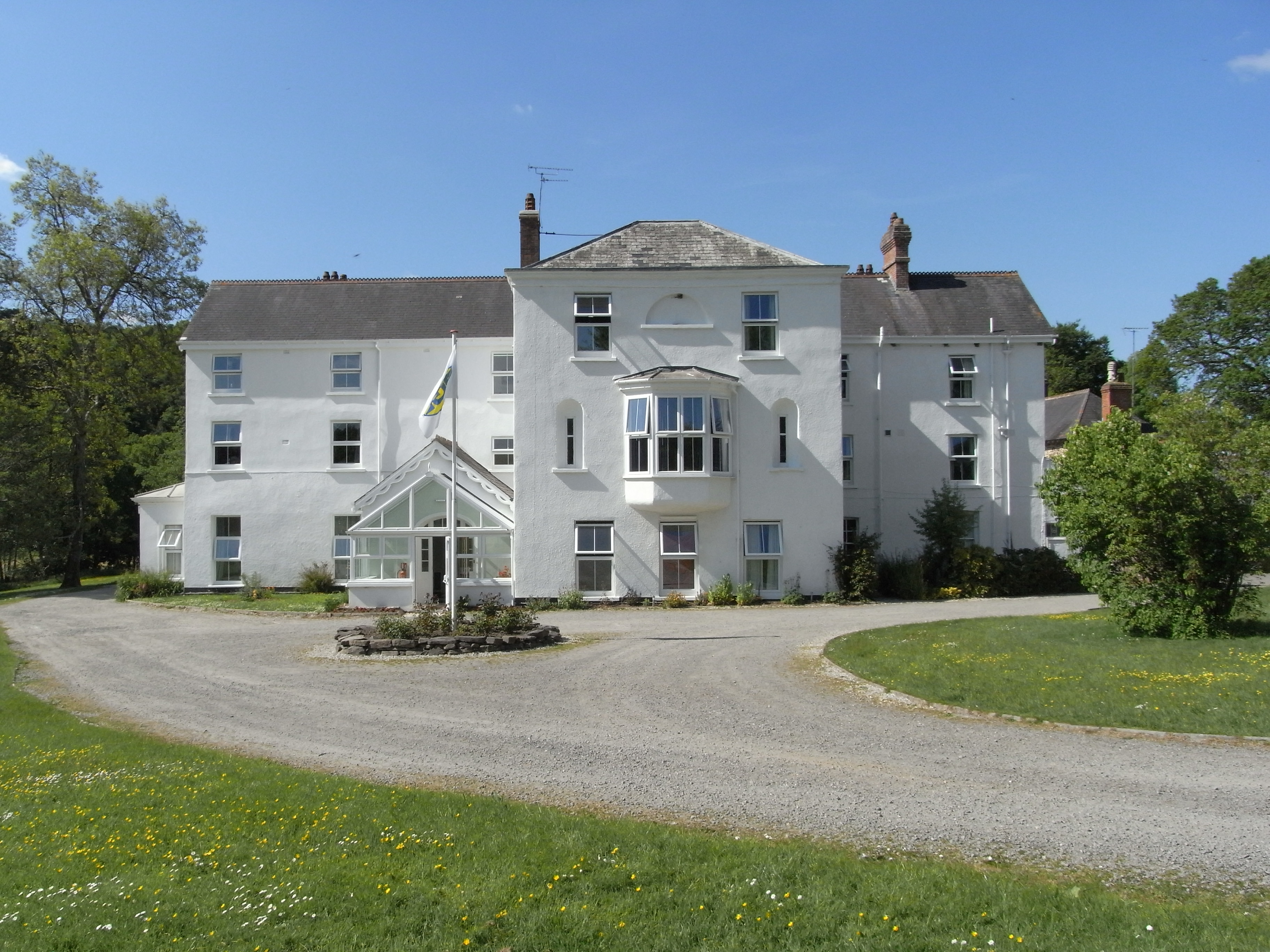
Beam, Great Torrington

Beam is an historic estate in the parish of Great Torrington, Devon, England. Beam House is situated about 1 1/2 miles north-west and downstream of that...

Littleham

Littleham is a village and civil parish in the Torridge district of north Devon in south west England, about 3 miles (4.8 km) south of Bideford. The parish...
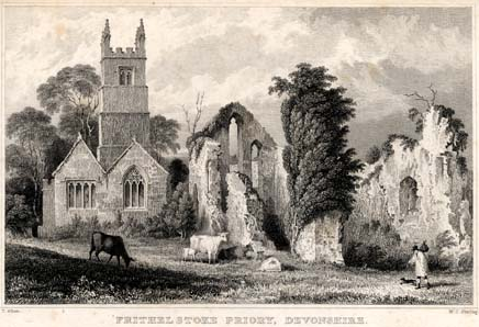
Frithelstock Priory

Frithelstock Priory was founded in about 1220 at Frithelstock, Devon, England, by Sir Robert de Beauchamp for Augustinian Canons Regular, as an indulgence...

Nearby Amenities

Located within 500m of 50.977781,-4.19638
Direction: 175
Generator Method: photovoltaic
Generator Output Electricity: yes
Generator Solar Modules: 14
Generator Source: solar
Generator Type: solar_photovoltaic_panel
Location: roof
Power: generator
Lat/Long: 50.9769007/-4.2029954
Direction: 175
Generator Method: photovoltaic
Generator Output Electricity: yes
Generator Solar Modules: 10
Generator Source: solar
Generator Type: solar_photovoltaic_panel
Location: roof
Power: generator
Lat/Long: 50.9768882/-4.2033327
Power: pole
Source: bing
Lat/Long: 50.9747544/-4.1923168
Power: pole
Source: bing
Lat/Long: 50.975207/-4.1936258
Power: pole
Source: bing
Lat/Long: 50.9756976/-4.1950594
Power: pole
Source: bing
Lat/Long: 50.9761967/-4.1965105
Power: pole
Source: bing
Lat/Long: 50.9772209/-4.2018776
Power: pole
Source: bing
Lat/Long: 50.9770326/-4.2031302
Power: pole
Source: bing
Lat/Long: 50.9768367/-4.1983598
Power: pole
Source: bing
Lat/Long: 50.9772632/-4.1996017
Power: pole
Source: bing
Lat/Long: 50.9777563/-4.201034
Power: pole
Source: bing
Lat/Long: 50.977953/-4.2016134
Power: pole
Source: bing
Lat/Long: 50.9804219/-4.1984873
Power: pole
Source: bing
Lat/Long: 50.9800141/-4.1987635
Power: pole
Source: bing
Lat/Long: 50.9792272/-4.1989861
Power: pole
Source: bing
Lat/Long: 50.9785213/-4.2007671
Power: pole
Source: bing
Lat/Long: 50.9791537/-4.1997841
Power: pole
Source: bing
Transformer: distribution
Lat/Long: 50.9796544/-4.1990183
The data included in this document is from www.openstreetmap.org. The data is made available under ODbL.

Have you been to Annery Bottoms?

Leave your review of Annery Bottoms below (or comments, questions and feedback).