1st Crinkle

Hill, Mountain in Westmorland South Lakeland

England

1st Crinkle

Rocky ground north from summit of Shelter Crags The view north from the highest point of Shelter Crags with Bow Fell the peak above the grooved cliff.
The more rounded mountains beyond are Great End and Esk Pike.
Rocky ground north from summit of Shelter Crags Credit: Trevor Littlewood

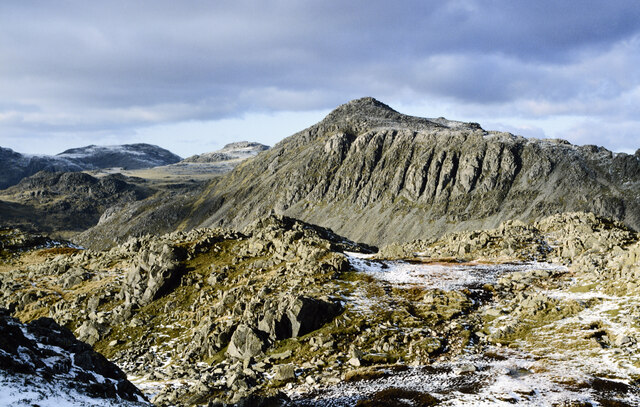
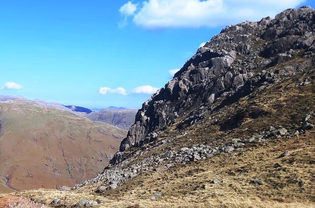
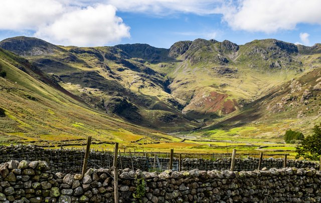
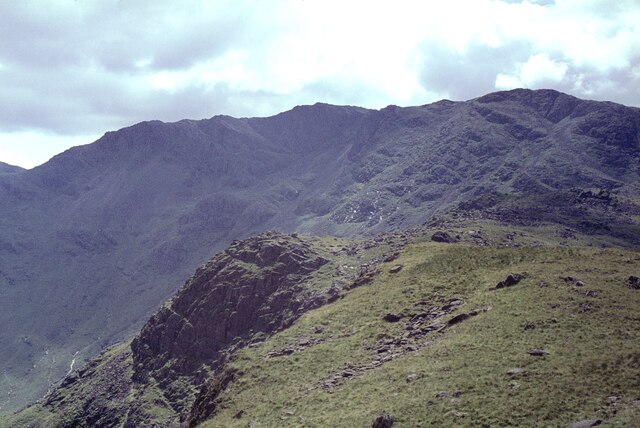
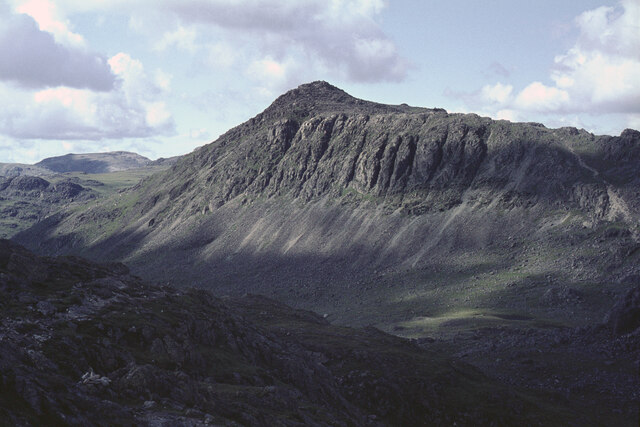
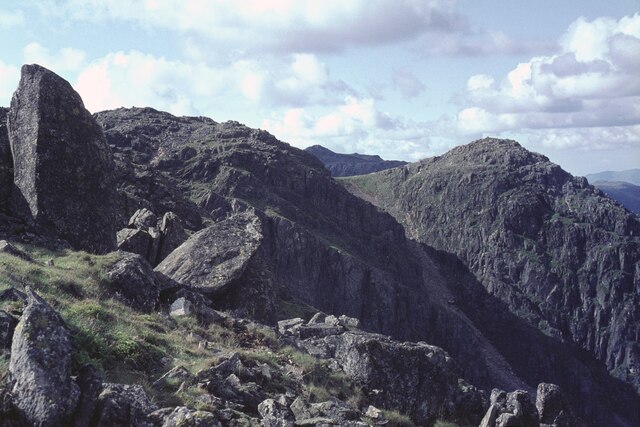
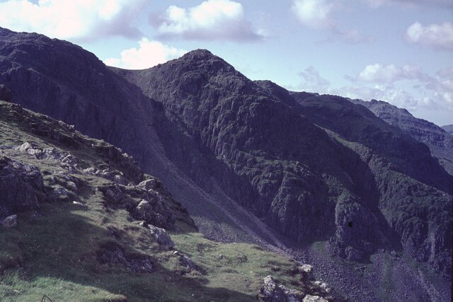
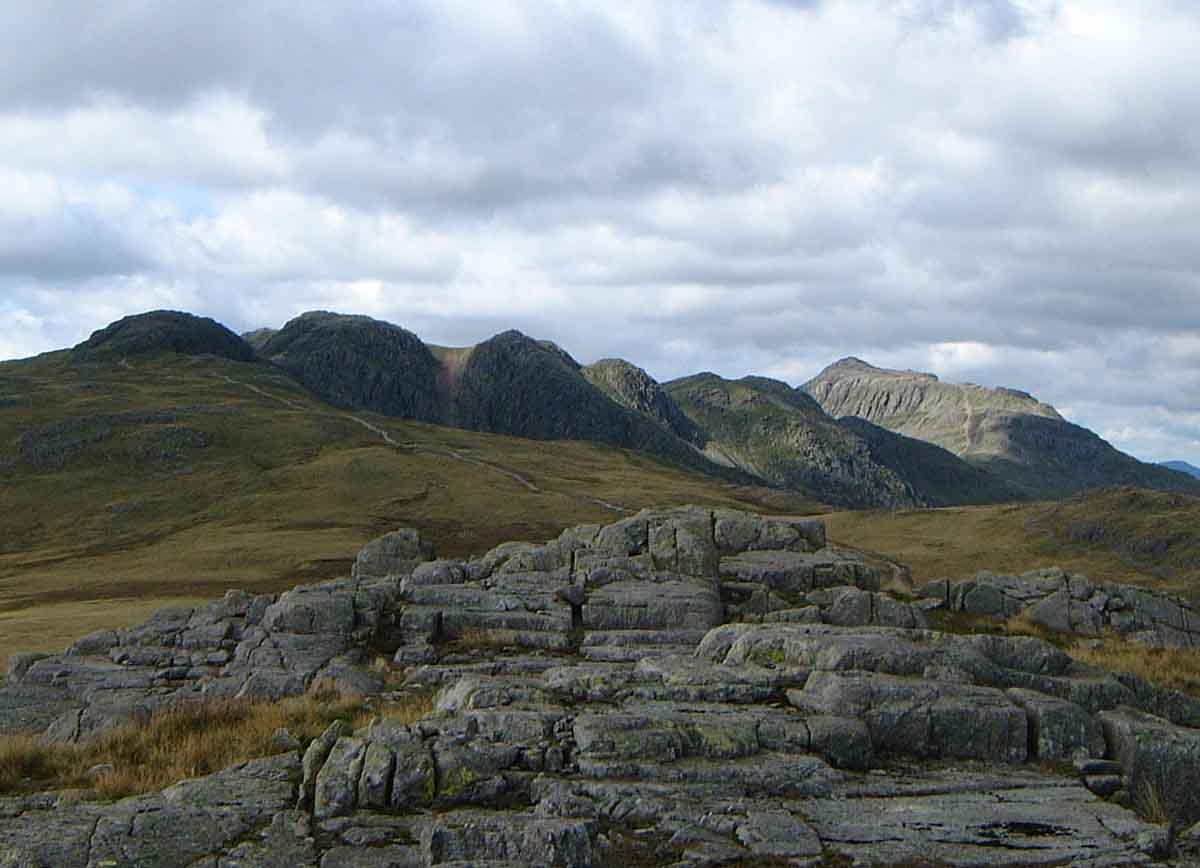
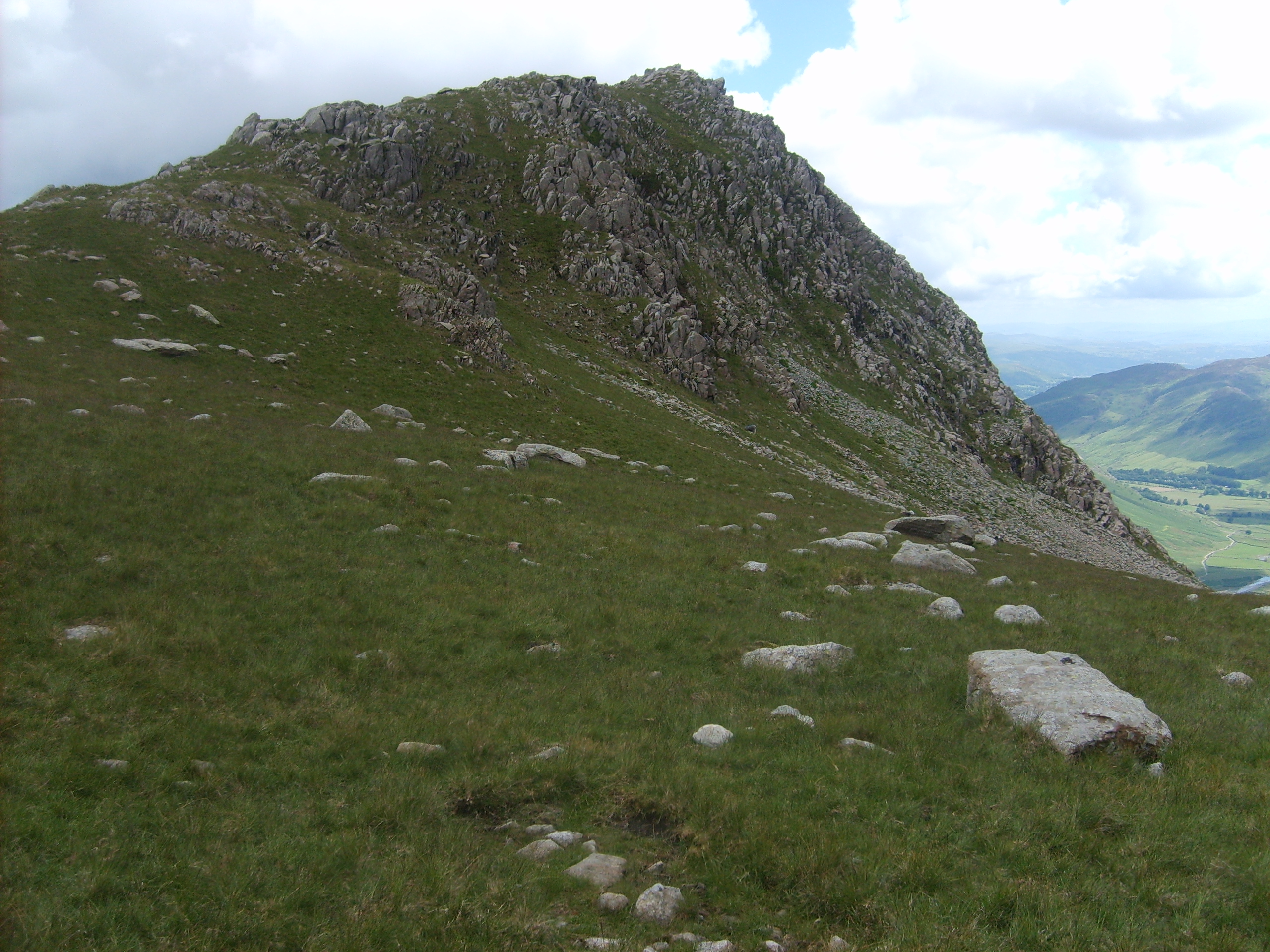
1st Crinkle, also known as Crinkle Crags, is a prominent hill located in the southern part of the Lake District National Park in Cumbria, England. This mountain stands at an elevation of 859 meters (2,818 feet) and is part of the larger Crinkle Crags range, which includes five other distinctive peaks.

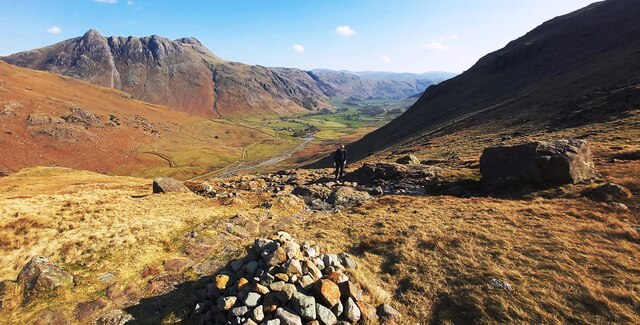
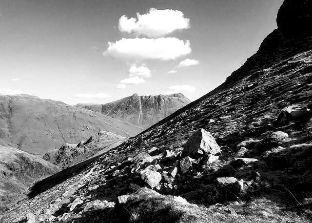
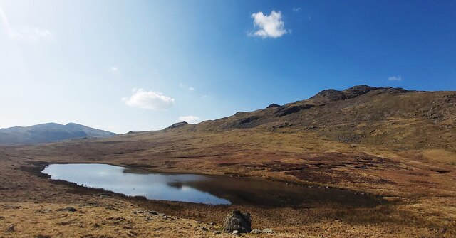
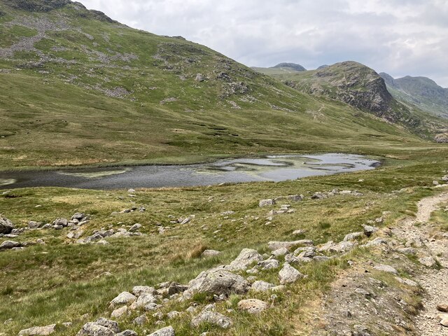
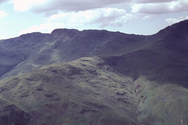
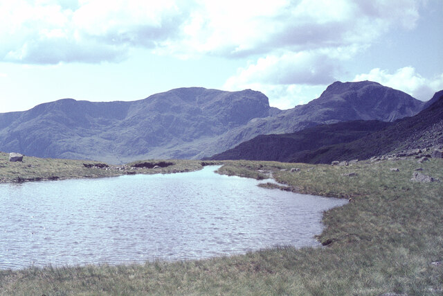
Situated in the western fells of the Lake District, 1st Crinkle offers breathtaking panoramic views of the surrounding landscape. It lies approximately 4 kilometers (2.5 miles) northwest of the popular tourist town of Ambleside and can be accessed via various hiking routes. The most common starting point is the Old Dungeon Ghyll Hotel in the village of Great Langdale.

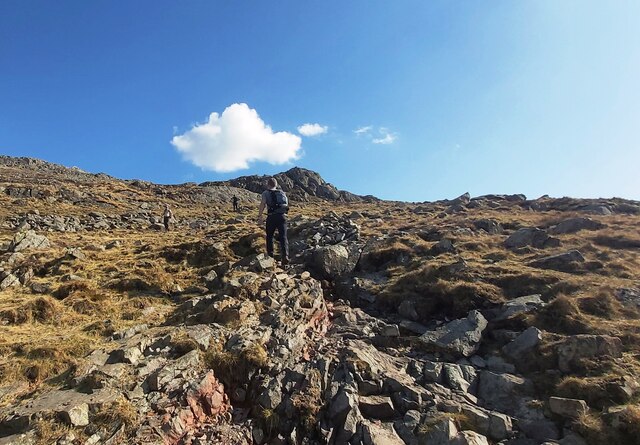
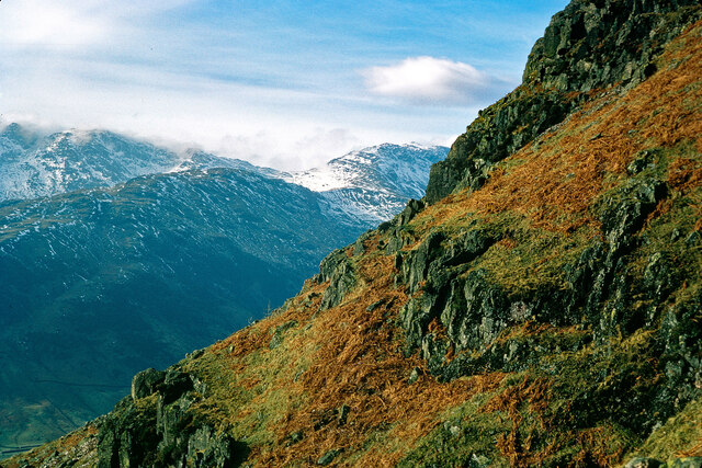
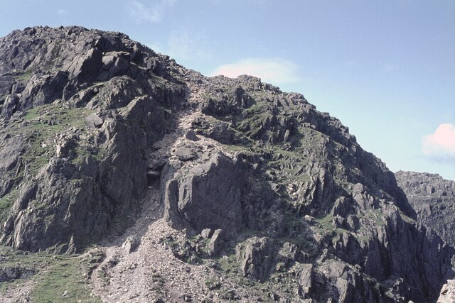
The ascent to 1st Crinkle can be challenging, as it involves steep slopes and rocky terrain. However, the effort is rewarded with stunning vistas of the neighboring peaks, valleys, and lakes. On a clear day, one can see as far as the Irish Sea and even glimpse the Isle of Man.

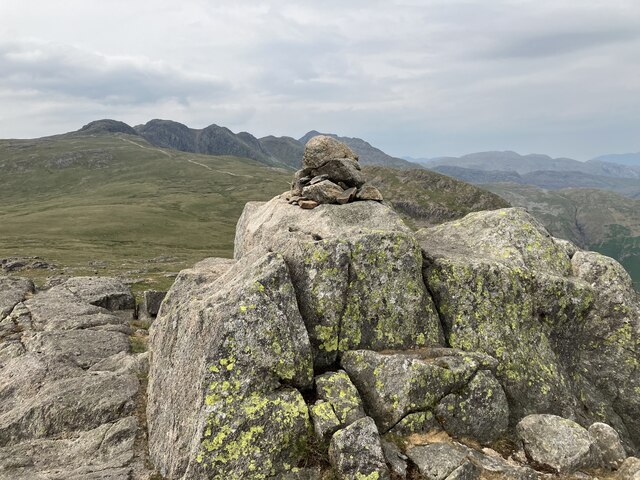
The summit of 1st Crinkle is marked by a large cairn, providing a perfect spot for hikers to rest and admire the scenery. From there, it is possible to continue along the ridge, known as the "Bad Step," which leads to the other Crinkle Crags peaks, each offering its own unique views and challenges.

1st Crinkle is a popular destination for outdoor enthusiasts, attracting hikers, climbers, and nature lovers. Its rugged beauty and tranquil surroundings make it a must-visit location for those seeking an adventure in the spectacular Lake District National Park.

If you have any feedback on the listing, please let us know in the comments section below.

1st Crinkle Images

Images are sourced within 2km of 54.430882/-3.1574282 or Grid Reference NY2504. Thanks to Geograph Open Source API. All images are credited.

Rocky ground north from summit of Shelter Crags The view north from the highest point of Shelter Crags with Bow Fell the peak above the grooved cliff.
The more rounded mountains beyond are Great End and Esk Pike.
Rocky ground north from summit of Shelter Crags
The view north from the highest point of Shelter Crags with Bow Fell the peak above the grooved cliff. The more rounded mountains beyond are Great End and Esk Pike.
View down to Oxendale
The Slopes of Brown Howe
Waterfall below Black Wars
Black Wars
Black Wars
Red Tarn
Red Tarn
Path up to Pike of Blisco
Langdale – Looking west to The Band and Bowfell The background is not in doubt.  The camera position is uncertain showing a view obtained while climbing up the side of the valley to the Langdale Pikes. I thank Ian Taylor for his great help in locating the image.
Langdale – Looking west to The Band and Bowfell
The background is not in doubt. The camera position is uncertain showing a view obtained while climbing up the side of the valley to the Langdale Pikes. I thank Ian Taylor for his great help in locating the image.
Red Tarn
Red Tarn
Cold Pike summit cairn
Crinkle Crags from Pike of Stickle The ridge ascending to the right across the image is The Band, leading to Bow Fell just out of shot. The dip on the horizon left of Bow Fell is at Three Tarns.
Crinkle Crags from Pike of Stickle
The ridge ascending to the right across the image is The Band, leading to Bow Fell just out of shot. The dip on the horizon left of Bow Fell is at Three Tarns.
Bow Fell from Rossett Pike If heading for Bow Fell from here, there is a descent of only 80m or so to Angle Tarn before the climb begins.
Bow Fell from Rossett Pike
If heading for Bow Fell from here, there is a descent of only 80m or so to Angle Tarn before the climb begins.
Bow Fell from Shelter Crags The route along the ridge from Crinkle Crags to Bow Fell was a popular one, as evidenced by the scar of the path on the right.  It remains so:  it is an obvious round from the Langdale valley.
Bow Fell from Shelter Crags
The route along the ridge from Crinkle Crags to Bow Fell was a popular one, as evidenced by the scar of the path on the right. It remains so: it is an obvious round from the Langdale valley.
At the Three Tarns From the col between Crinkle Crags and Bow Fell, looking to the Scafell range.
At the Three Tarns
From the col between Crinkle Crags and Bow Fell, looking to the Scafell range.
The 'Bad Step' on Crinkle Crags It is interesting to see that this route was already badly eroded back in 1965.

Competent scramblers will take a route immediately right of the chockstone. There is clearly an easier route to the right of the huge central slab. But mere hillwalkers, as I am, used a path on the left, out of shot.
The 'Bad Step' on Crinkle Crags
It is interesting to see that this route was already badly eroded back in 1965. Competent scramblers will take a route immediately right of the chockstone. There is clearly an easier route to the right of the huge central slab. But mere hillwalkers, as I am, used a path on the left, out of shot.
The crags on the east side of Crinkle Crags
Crinkle Crags from Great Knott
Show me another place!

1st Crinkle is located at Grid Ref: NY2504 (Lat: 54.430882, Lng: -3.1574282)

Administrative County: Cumbria

District: South Lakeland

Police Authority: Cumbria

Also known as: South Top

What 3 Words

///fees.lengthen.surface. Near Ambleside, Cumbria

Related Wikis

Nearby Amenities

Located within 500m of 54.430882,-3.1574282
Bad Step
Note: The Bad Step is a 10 foot vertical drop/climb which is generally passible with difficulty. The path/loop to the west bypasses it
Scramble: true
Tourism: viewpoint
Lat/Long: 54.4327345/-3.1590753
Long Top
Description: highest peak of Crinkle Crags
Ele: 859
Natural: peak
Lat/Long: 54.433665/-3.1598355
South Top
Ele: 834
Natural: peak
Lat/Long: 54.4308282/-3.1574239
Crinkle Crags
Note: set to locality rather than peak as it has 5 peaks with Long Top as the highest
Place: locality
Wikidata: Q8519475
Wikipedia: en:Crinkle Crags
Lat/Long: 54.4346183/-3.1584489
Great Cove
Place: locality
Lat/Long: 54.431833/-3.1557685
Mickle Door
Place: locality
Lat/Long: 54.433667/-3.1554357
Gunson Knott
Ele: 822
Natural: peak
Lat/Long: 54.43494/-3.158075
The data included in this document is from www.openstreetmap.org. The data is made available under ODbL.

Have you been to 1st Crinkle?

Leave your review of 1st Crinkle below (or comments, questions and feedback).