Great Knott
Hill, Mountain in Westmorland South Lakeland
England
Great Knott
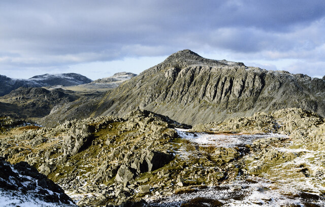
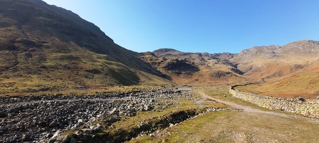
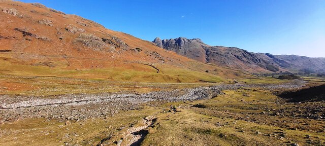
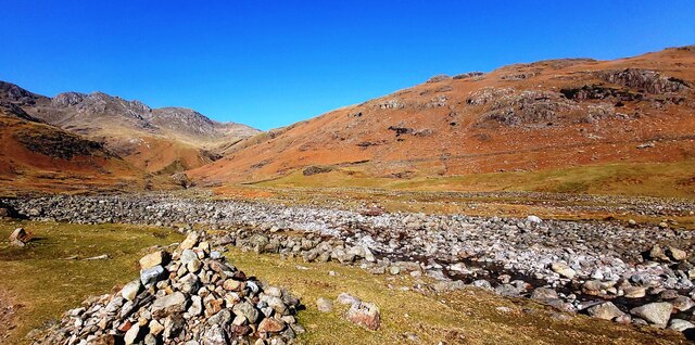
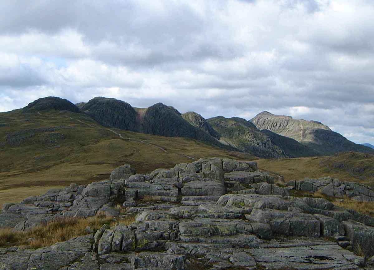
Great Knott is a prominent hill located in the county of Westmorland, in the northwestern region of England. It is situated within the Lake District National Park, an area renowned for its stunning natural beauty and picturesque landscapes. Great Knott stands at an elevation of 696 meters (2,283 feet) above sea level, making it an attractive destination for hikers and outdoor enthusiasts.
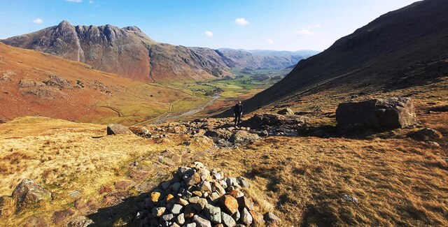
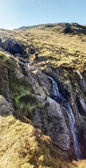
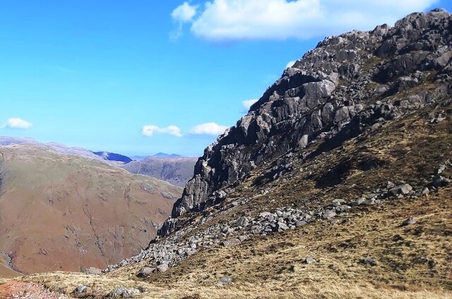
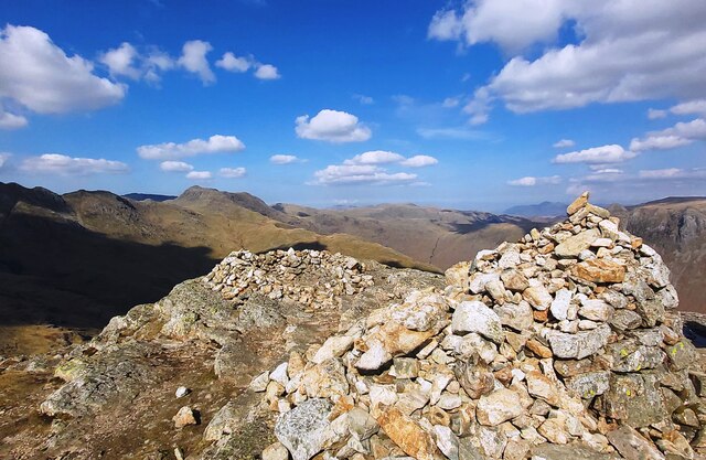
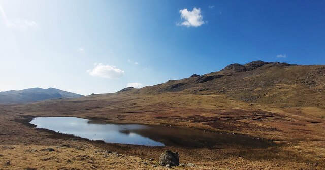
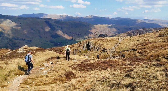
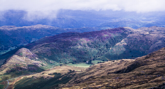
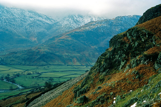
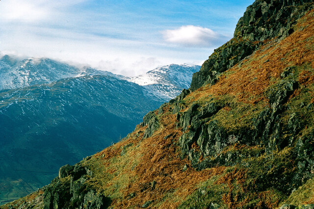
The hill offers breathtaking panoramic views of the surrounding countryside, with its slopes covered in verdant grasses and scattered with rocky outcrops. Its position within the Lake District provides visitors with the opportunity to witness the region's diverse flora and fauna, including heather moorland, oak woodlands, and a variety of wildflowers.
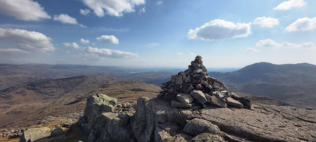
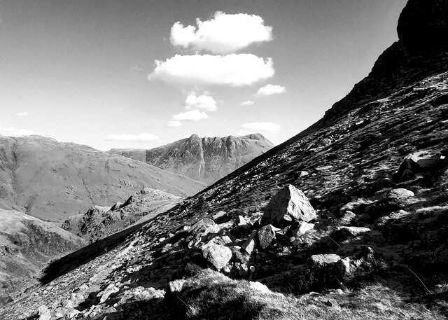
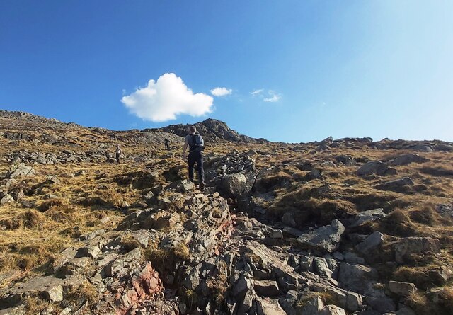
Access to Great Knott is primarily gained through walking routes, with several footpaths and trails leading to its summit. The ascent can be challenging, with steep gradients and rocky terrain, but the reward is the awe-inspiring vista at the top. On a clear day, it is possible to see the neighboring fells, such as Coniston Old Man and the Langdale Pikes, as well as the shimmering lakes that dot the landscape.
Great Knott is situated in close proximity to other popular peaks, including Crinkle Crags and Bowfell, making it an ideal starting point for longer hikes and mountain expeditions. Its location within the Lake District National Park also means that visitors can enjoy the area's numerous recreational activities, such as boating, fishing, and wildlife spotting.
Overall, Great Knott is a remarkable hill in Westmorland, offering stunning views, challenging walks, and the chance to immerse oneself in the natural splendor of the Lake District.
If you have any feedback on the listing, please let us know in the comments section below.
Great Knott Images
Images are sourced within 2km of 54.428443/-3.1427461 or Grid Reference NY2504. Thanks to Geograph Open Source API. All images are credited.


Great Knott is located at Grid Ref: NY2504 (Lat: 54.428443, Lng: -3.1427461)
Administrative County: Cumbria
District: South Lakeland
Police Authority: Cumbria
What 3 Words
///verifying.home.flame. Near Ambleside, Cumbria
Nearby Locations
Related Wikis

Cold Pike
Cold Pike is a fell in the English Lake District. It is a satellite of Crinkle Crags and stands above the Upper Duddon Valley. == Topography == When travelling...

Pike of Blisco
Pike of Blisco, or Pike o' Blisco, is a mountain in the Lake District in Cumbria, England. Located between the valleys of Great Langdale and Little Langdale...
Crinkle Crags
Crinkle Crags is a fell in the English Lake District in the county of Cumbria. It forms part of two major rings of mountains, surrounding the valleys of...

River Brathay
The Brathay is a river of north-west England. Its name comes from Old Norse and means broad river. It rises at a point 1289 feet (393 m) above sea level...
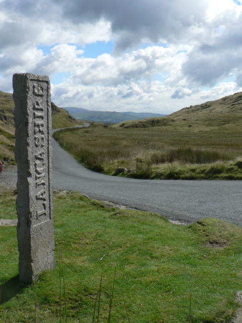
Three Shire Stone (Lake District)
The Three Shire Stone is a boundary stone that marks the location where the historic English counties of Lancashire, Cumberland and Westmorland meet. The...

Wrynose Pass
The Wrynose Pass is a mountain pass in the Lake District National Park in Cumbria, England between the Duddon Valley and Little Langdale. == Etymology... ==

Bowfell
Bowfell (named Bow Fell on Ordnance Survey maps) is a pyramid-shaped mountain lying at the heart of the English Lake District, in the Southern Fells area...

Cockley Beck
Cockley Beck is a small hamlet, situated in the Duddon Valley in Cumbria, England. Historically, the hamlet was part of Lancashire. Located today within...
Nearby Amenities
Located within 500m of 54.428443,-3.1427461Have you been to Great Knott?
Leave your review of Great Knott below (or comments, questions and feedback).