South Lee

Hill, Mountain in Inverness-shire

Scotland

South Lee

Beehive in Dun Caragarry Looking over Dun Caragarry to the mouth of Loch Euphort. The small structure at centre is a beehive chamber built within the ruin of the dun. The chamber was photographed by Erskine Beveridge, and his photo can be found facing page 163 of his book ‘North Uist’. More information on the dun, including Beveridge’s photo, can be found on the CANMORE website (CANMORE ID 10429).
Beehive in Dun Caragarry Credit: Marc Calhoun

South Lee is a prominent hill/mountain located in Inverness-shire, Scotland. Situated in the western part of the region, it forms part of the striking landscape of the Scottish Highlands. The summit of South Lee stands at an elevation of approximately 1,041 meters (3,415 feet) above sea level, making it one of the notable peaks in the area.

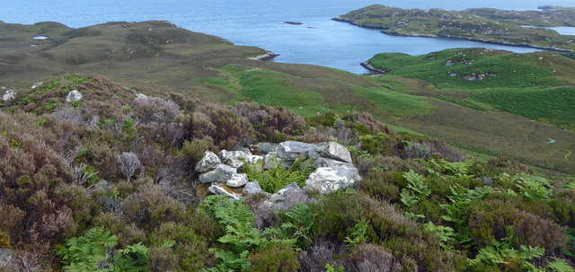
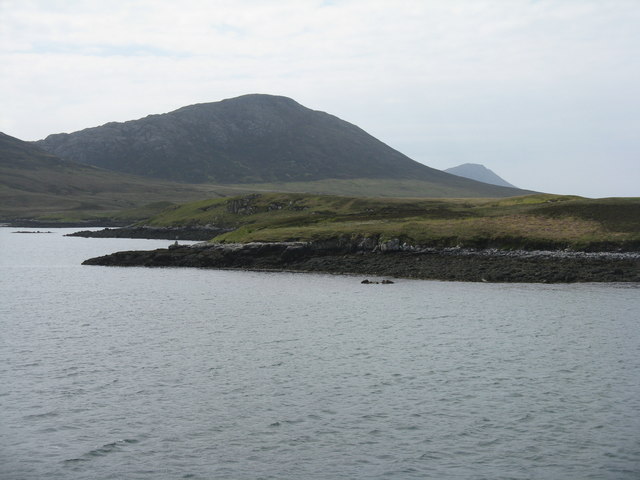
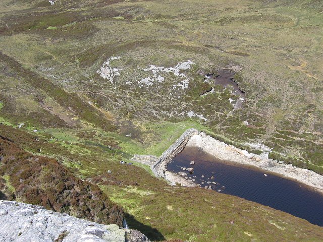
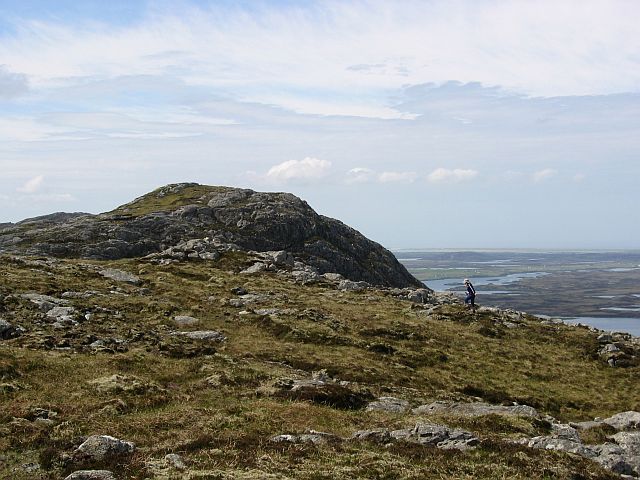
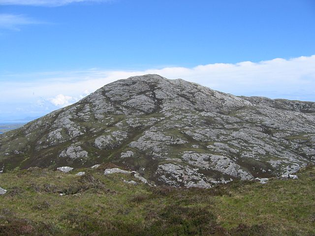
The mountain is characterized by its rugged terrain, which is typical of the Highlands. It is covered by heather, grasses, and scattered patches of woodland, providing a unique habitat for various species of flora and fauna. The slopes of South Lee are steep and can be challenging to climb, requiring a reasonable level of fitness and hiking experience.

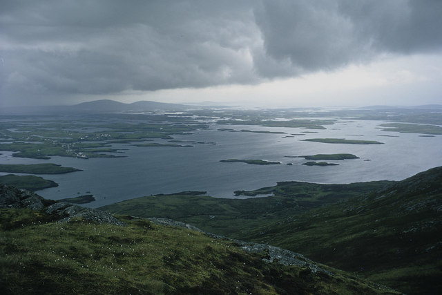
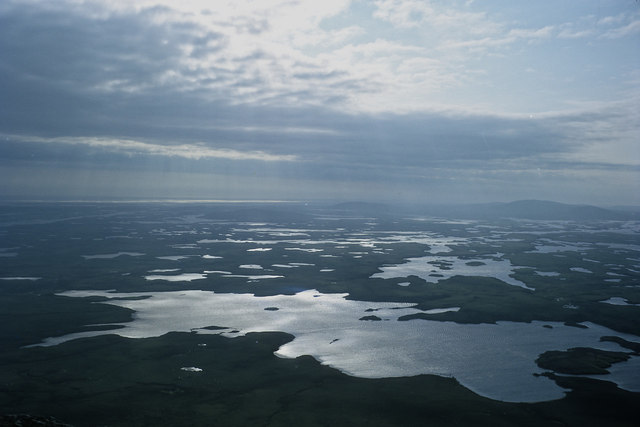
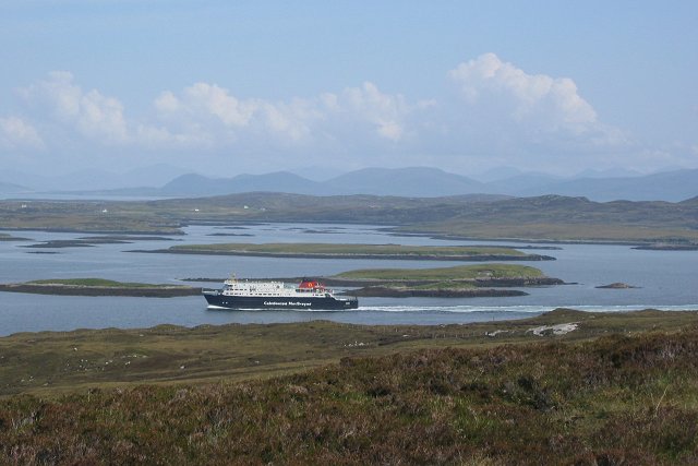
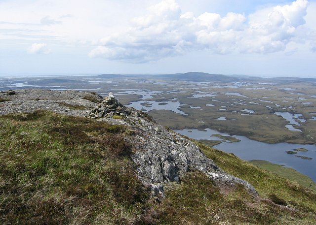
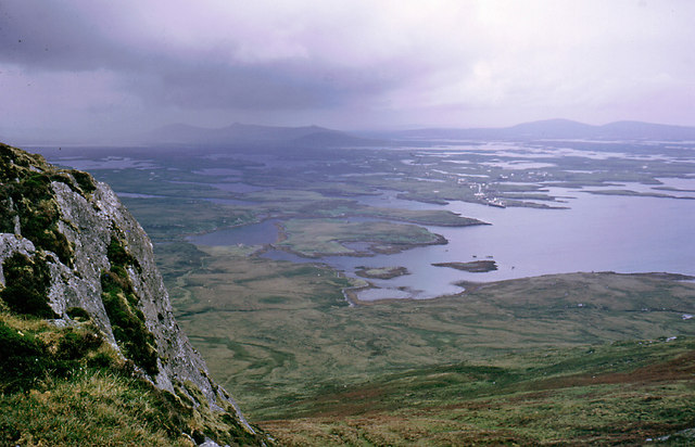
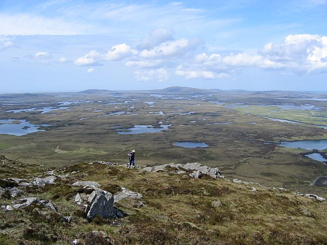
From the summit of South Lee, breathtaking panoramic views of the surrounding countryside can be enjoyed. On a clear day, one can see the sprawling glens, sparkling lochs, and distant mountain ranges that make the Highlands famous. The serene beauty of the landscape provides an ideal setting for outdoor enthusiasts, including hikers, mountaineers, and nature lovers.

South Lee is located in close proximity to other notable peaks, such as North Lee and West Lee, forming a part of the wider Lee Valley range. The area offers a range of outdoor activities, including hiking trails that cater to different skill levels. Additionally, the surrounding region provides opportunities for wildlife spotting, birdwatching, and photography.

Overall, South Lee in Inverness-shire presents a captivating natural environment, offering visitors an opportunity to immerse themselves in the stunning beauty of the Scottish Highlands.

If you have any feedback on the listing, please let us know in the comments section below.
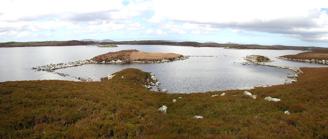
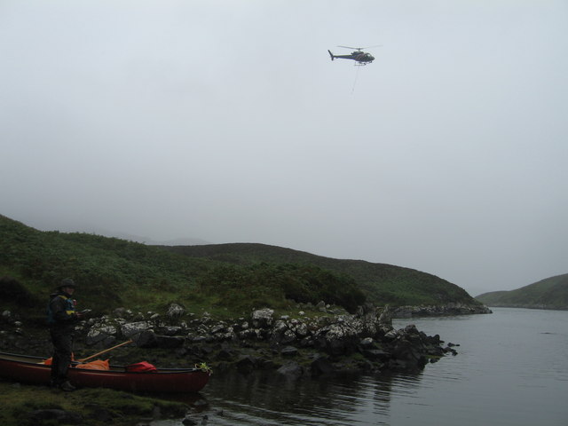
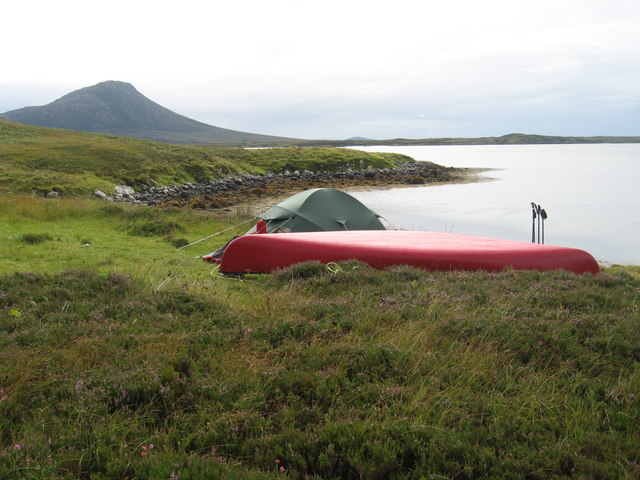
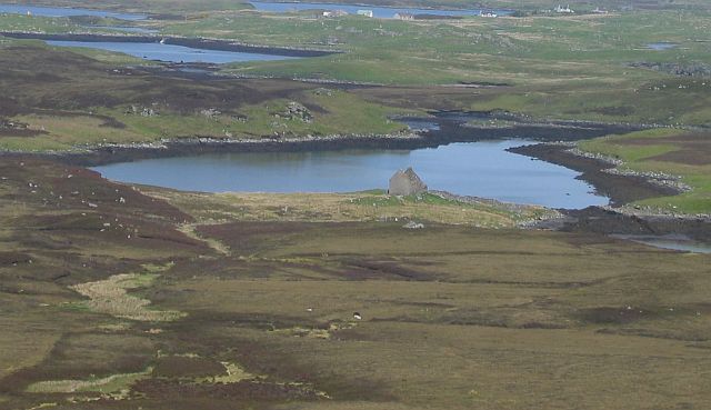
South Lee Images

Images are sourced within 2km of 57.572588/-7.1562708 or Grid Reference NF9165. Thanks to Geograph Open Source API. All images are credited.

Beehive in Dun Caragarry Looking over Dun Caragarry to the mouth of Loch Euphort. The small structure at centre is a beehive chamber built within the ruin of the dun. The chamber was photographed by Erskine Beveridge, and his photo can be found facing page 163 of his book ‘North Uist’. More information on the dun, including Beveridge’s photo, can be found on the CANMORE website (CANMORE ID 10429).
Beehive in Dun Caragarry
Looking over Dun Caragarry to the mouth of Loch Euphort. The small structure at centre is a beehive chamber built within the ruin of the dun. The chamber was photographed by Erskine Beveridge, and his photo can be found facing page 163 of his book ‘North Uist’. More information on the dun, including Beveridge’s photo, can be found on the CANMORE website (CANMORE ID 10429).
Li a Deas In English South Lee, one of the highest peaks on North Uist. Seen from the ferry for Uig leaving Lochmaddy.
Li a Deas
In English South Lee, one of the highest peaks on North Uist. Seen from the ferry for Uig leaving Lochmaddy.
Hebridean line squall, North Lee, Lochmaddy The hill was being climbed instead of sailing the coast of North Uist in a full westerly gale.
Hebridean line squall, North Lee, Lochmaddy
The hill was being climbed instead of sailing the coast of North Uist in a full westerly gale.
Loch Hundair from the side of North Lee The wet wilderness of North Uist is well appreciated from a climb up North Lee. Loch Hundair (Loch Hander) is the nearest of the many.
Loch Hundair from the side of North Lee
The wet wilderness of North Uist is well appreciated from a climb up North Lee. Loch Hundair (Loch Hander) is the nearest of the many.
Old fence and North Lee North Lee above an old fence. Peaty soil here supports a few sheep.
Old fence and North Lee
North Lee above an old fence. Peaty soil here supports a few sheep.
Ferry from North Lee. Moorland slopes of North Lee, before it gets steep and rocky. Beyond the sheep fence the ferry from Uig sails up Loch nam Madadh
Ferry from North Lee.
Moorland slopes of North Lee, before it gets steep and rocky. Beyond the sheep fence the ferry from Uig sails up Loch nam Madadh
Loch Lee Lochmaddy is surrounded by lochs, but they felt the need to build a reservoir for their water supply. Possibly for the height, the water supply being gravitational. The pipe work is exposed on the moor in places, and appears disused. Taken from the ascent of South Lee, as you can see, it's a steep hill.
Loch Lee
Lochmaddy is surrounded by lochs, but they felt the need to build a reservoir for their water supply. Possibly for the height, the water supply being gravitational. The pipe work is exposed on the moor in places, and appears disused. Taken from the ascent of South Lee, as you can see, it's a steep hill.
Summit, South Lee South Lee/Li a'Deas is one of a pair of striking hills above Lochmaddy. There is much exposed gneiss. The view shows the mixed loch and moorland scenery of North Uist.
Summit, South Lee
South Lee/Li a'Deas is one of a pair of striking hills above Lochmaddy. There is much exposed gneiss. The view shows the mixed loch and moorland scenery of North Uist.
Outcrop below a summit of North Lee North Lee was climbed from a yacht at anchor in Bagh Ard nan Madadh while sheltering from a westerly gale.
Outcrop below a summit of North Lee
North Lee was climbed from a yacht at anchor in Bagh Ard nan Madadh while sheltering from a westerly gale.
The Duns of Loch Hundair An amazing set of causewayed duns on Loch Hundair.
The Duns of Loch Hundair
An amazing set of causewayed duns on Loch Hundair.
Acairseid LI We had canoed into here from Clachan on Loch Euphort hoping to find a quiet camping spot on Loch Thundair.  However on walking over from Acairseid Li to Thundair we caught sight of a large fish farm at the South end of the loch.  This helicopter was servicing the fish farm
Acairseid LI
We had canoed into here from Clachan on Loch Euphort hoping to find a quiet camping spot on Loch Thundair. However on walking over from Acairseid Li to Thundair we caught sight of a large fish farm at the South end of the loch. This helicopter was servicing the fish farm
Camp site to the South of South Lee Lovely view South to Eaval, but the midges were awful!
Camp site to the South of South Lee
Lovely view South to Eaval, but the midges were awful!
Loch Gheornais Ruin beside the loch which is an inlet of the sea.
Loch Gheornais
Ruin beside the loch which is an inlet of the sea.
Slopes of North Lee/Li a Tuath North Uist's hills are small, scattered and usually give amazing views across the cartographer's nightmare of the interior. Classic gneiss scenery.
Slopes of North Lee/Li a Tuath
North Uist's hills are small, scattered and usually give amazing views across the cartographer's nightmare of the interior. Classic gneiss scenery.
Li a Tuath / North Lee View towards the summit.
Li a Tuath / North Lee
View towards the summit.
Li a Tuath (North Lee) View from Li a Deas (South Lee). Very rocky hills on the edge of mostly flat and waterlogged North Uist.
Li a Tuath (North Lee)
View from Li a Deas (South Lee). Very rocky hills on the edge of mostly flat and waterlogged North Uist.
Ruin and Loch nam Madadh
Fence, Loch Nam Madadh Stock fence on the south shore of Loch Nam Madadh. Traces of past arable land use are visible.
Fence, Loch Nam Madadh
Stock fence on the south shore of Loch Nam Madadh. Traces of past arable land use are visible.
Show me another place!

South Lee is located at Grid Ref: NF9165 (Lat: 57.572588, Lng: -7.1562708)

Unitary Authority: Na h-Eileanan an Iar

Police Authority: Highlands and Islands

Also known as: Lì a Deas

What 3 Words

///folks.edit.fashion. Near Lochmaddy, Na h-Eileanan Siar

Nearby Locations

South Lee Lì a Deas

Related Wikis

Taigh Chearsabhagh

Taigh Chearsabhagh is an arts centre and museum in Lochmaddy on the island of North Uist, Scotland.Taigh Chearsabhagh was built in 1741 and originally...

Lochmaddy

Lochmaddy (Scottish Gaelic: Loch nam Madadh [l̪ˠɔx nə ˈmat̪əɣ], "Loch of the Hounds") is the administrative centre of North Uist in the Outer Hebrides...

Weavers Point

Weavers Point (Scottish Gaelic: Rubha an Fhigheadair) is a headland to the north of the entrance to Loch Maddy, on the north eastern coastline of North...

Ceallasaigh Beag

Ceallasaigh Beag (or Keallasay Beg) is a low-lying island in Loch Maddy off North Uist in the Outer Hebrides of Scotland. This an area of shallow lagoons...

Loch Sgadabhagh

Loch Sgadabhagh or Loch Scadavay is a body of water on the island of North Uist, Scotland. The name may be of Old Norse derivation meaning "lake of tax...

Ceallasaigh Mòr

Ceallasaigh Mòr (or Keallasay More) is a low-lying island in Loch Maddy off North Uist in the Outer Hebrides of Scotland. This an area of shallow lagoons...

Na Fir Bhrèige

Na Fir Bhrèige (pronounced [nə fiɾʲ ˈvɾʲeːkʲə]; can be translated from Gaelic into English as "The False Men") is a set of three standing stones on the...

Flodaigh Mòr

Flodaigh Mòr (or Floddaymore) is an uninhabited island in the Outer Hebrides of Scotland. == Geography and geology == Flodaigh Mòr lies east of North Uist...

Related Videos

quick 4k drone flight around lochmaddy ferry terminal

follow me on Instagram https://www.instagram.com/hiking_and_biking/ click below to save on your electricity and gas and get £50 ...

Nearby Amenities

Located within 500m of 57.572588,-7.1562708
Lì a Deas
Corbett: no
Ele: 281
Graham: no
Marilyn: yes
Munro: no
Name En: South Lee
Name Gd: Lì a Deas
Natural: peak
Prominence: 275
Lat/Long: 57.5723853/-7.1563091
The data included in this document is from www.openstreetmap.org. The data is made available under ODbL.

Have you been to South Lee?

Leave your review of South Lee below (or comments, questions and feedback).