Guist Hill

Hill, Mountain in Norfolk Breckland

England

Guist Hill

Bintry Mill on the River Wensum
Bintry Mill on the River Wensum Credit: David Leeming

Guist Hill is a prominent geographical feature located in the county of Norfolk, England. Situated near the village of Guist, the hill stands at an elevation of approximately 84 meters (275 feet) above sea level, making it one of the highest points in the region.

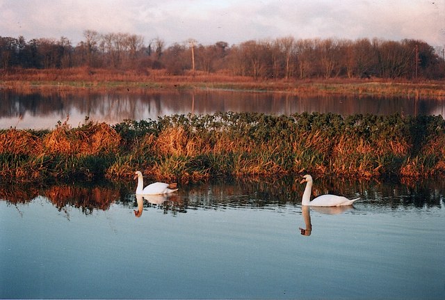
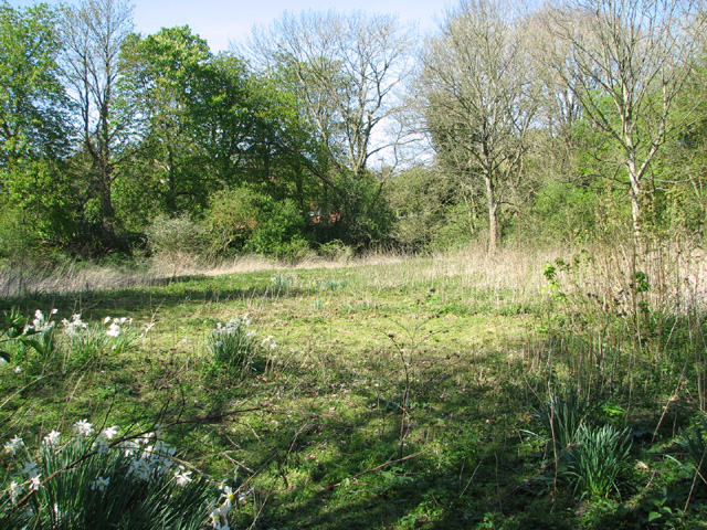
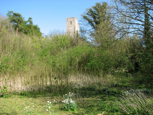
This natural landmark is characterized by its gently sloping sides, covered in lush vegetation and scattered with various types of trees, including oak and beech. These trees thrive in the well-drained soil, adding to the overall picturesque scenery. The hill offers panoramic views of the surrounding countryside, with vistas stretching across the Norfolk landscape.

Due to its elevated position, Guist Hill has become a popular destination for outdoor enthusiasts, nature lovers, and hikers. Its well-maintained footpaths and trails provide opportunities for leisurely walks or more challenging hikes, catering to a range of fitness levels. The hill's diverse flora and fauna make it an ideal habitat for a variety of wildlife, including birds, small mammals, and insects.

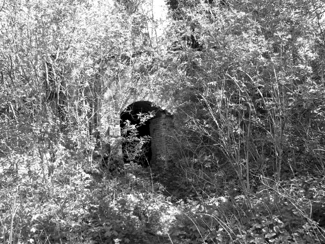
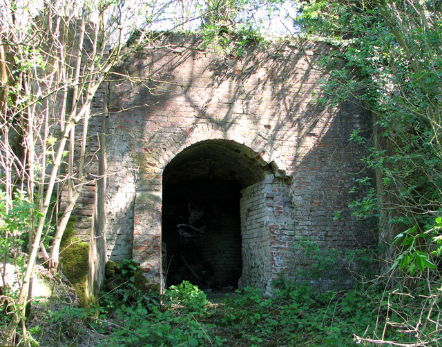
In addition to its natural beauty, Guist Hill also holds historical significance. Evidence of human activity in the area dates back to prehistoric times, with archaeological discoveries revealing the presence of ancient settlements and burial sites. The hill's strategic location has likely played a role in its historical importance, serving as a vantage point and potentially as a defensive position during various periods of conflict.

Overall, Guist Hill stands as a captivating natural and historical landmark, attracting visitors from near and far who seek to admire its stunning views, explore its trails, and immerse themselves in the rich tapestry of Norfolk's past and present.

If you have any feedback on the listing, please let us know in the comments section below.
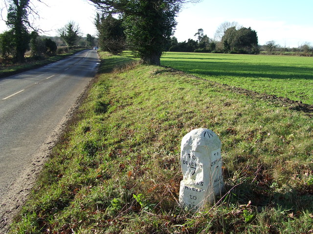
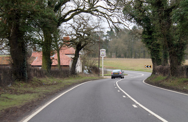
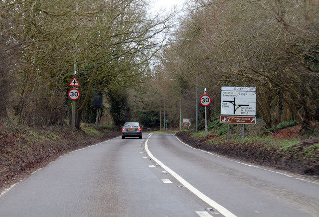
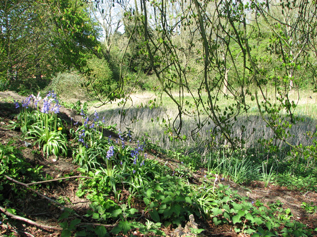
Guist Hill Images

Images are sourced within 2km of 52.794523/0.96147266 or Grid Reference TF9925. Thanks to Geograph Open Source API. All images are credited.

Bintry Mill on the River Wensum
River Wensum and floodplain above Bintry Mill
Old Milestone Old milestone on the B1110 at Guist, Norfolk. For overall view see <a title="https://www.geograph.org.uk/photo/3793140" href="https://www.geograph.org.uk/photo/3793140">Link</a>
Old Milestone
Old milestone on the B1110 at Guist, Norfolk. For overall view see Link
To Dereham 8 Old milestone on the B1110 at Guist, Norfolk. For close up view see <a title="https://www.geograph.org.uk/photo/3793138" href="https://www.geograph.org.uk/photo/3793138">Link</a>
To Dereham 8
Old milestone on the B1110 at Guist, Norfolk. For close up view see Link
Old Milestone Old milestone on the B1110 near to Guist, Norfolk. For overall view see <a title="https://www.geograph.org.uk/photo/3793143" href="https://www.geograph.org.uk/photo/3793143">Link</a>
Old Milestone
Old milestone on the B1110 near to Guist, Norfolk. For overall view see Link
To Dereham 7 Old milestone on the B1110 near to Guist, Norfolk. For close up view see <a title="https://www.geograph.org.uk/photo/3793142" href="https://www.geograph.org.uk/photo/3793142">Link</a>
To Dereham 7
Old milestone on the B1110 near to Guist, Norfolk. For close up view see Link
A1067 towards Guist Bottom
A1067 past The Ordnance Arms
A1067 at Guist Junction with B1110 ahead.
A1067 at Guist
Junction with B1110 ahead.
Bluebells growing in disused chalk pit, Guist For a wider view of this location see > <a title="https://www.geograph.org.uk/photo/3934997" href="https://www.geograph.org.uk/photo/3934997">Link</a>.
Bluebells growing in disused chalk pit, Guist
For a wider view of this location see > Link.
Disused chalk pit, Guist
Disused chalk pit, Guist The tower of St Andrew's church > <a title="https://www.geograph.org.uk/photo/2123760" href="https://www.geograph.org.uk/photo/2123760">Link</a> (in adjacent grid square) can be seen peeking over the shrubs growing along the edge of the pit.
Disused chalk pit, Guist
The tower of St Andrew's church > Link (in adjacent grid square) can be seen peeking over the shrubs growing along the edge of the pit.
Old lime kiln hiding behind young trees This disused lime kiln > <a title="https://www.geograph.org.uk/photo/3935012" href="https://www.geograph.org.uk/photo/3935012">Link</a> was built between 1814 and 1846. In 1836 Robert Whistler is recorded as a lime burner at Guist and in 1854 William Mallon, victualler at the Swan Inn, is also recorded as a lime burner.  Presumably both men worked at this kiln which is of an unusual type with a circular kiln and a funnel-shaped pot. The kiln is situated to one side of a former lime pit and short tunnel leads into it. The entrance from the pit is formed of flint faced with brick. Inside, the lime chutes remain, some still with little piles of residue, and there may be other recesses in the passage face of the pot. The site is shown as pits on a local map dating from 1785; it is first shown mentioning the kiln on a Tithe map from 1846 and still working by 1885 as shown on 6ins OS map.
Old lime kiln hiding behind young trees
This disused lime kiln > Link was built between 1814 and 1846. In 1836 Robert Whistler is recorded as a lime burner at Guist and in 1854 William Mallon, victualler at the Swan Inn, is also recorded as a lime burner. Presumably both men worked at this kiln which is of an unusual type with a circular kiln and a funnel-shaped pot. The kiln is situated to one side of a former lime pit and short tunnel leads into it. The entrance from the pit is formed of flint faced with brick. Inside, the lime chutes remain, some still with little piles of residue, and there may be other recesses in the passage face of the pot. The site is shown as pits on a local map dating from 1785; it is first shown mentioning the kiln on a Tithe map from 1846 and still working by 1885 as shown on 6ins OS map.
Entrance to old lime kiln This disused lime kiln > <a title="https://www.geograph.org.uk/photo/3935012" href="https://www.geograph.org.uk/photo/3935012">Link</a> was built between 1814 and 1846. In 1836 Robert Whistler is recorded as a lime burner at Guist and in 1854 William Mallon, victualler at the Swan Inn, is also recorded as a lime burner.  Presumably both men worked at this kiln which is of an unusual type with a circular kiln and a funnel-shaped pot. The kiln is situated to one side of a former lime pit and short tunnel leads into it. The entrance from the pit is formed of flint faced with brick. Inside, the lime chutes remain, some still with little piles of residue, and there may be other recesses in the passage face of the pot. The site is shown as pits on a local map dating from 1785; it is first shown mentioning the kiln on a Tithe map from 1846 and still working by 1885 as shown on 6ins OS map.
Entrance to old lime kiln
This disused lime kiln > Link was built between 1814 and 1846. In 1836 Robert Whistler is recorded as a lime burner at Guist and in 1854 William Mallon, victualler at the Swan Inn, is also recorded as a lime burner. Presumably both men worked at this kiln which is of an unusual type with a circular kiln and a funnel-shaped pot. The kiln is situated to one side of a former lime pit and short tunnel leads into it. The entrance from the pit is formed of flint faced with brick. Inside, the lime chutes remain, some still with little piles of residue, and there may be other recesses in the passage face of the pot. The site is shown as pits on a local map dating from 1785; it is first shown mentioning the kiln on a Tithe map from 1846 and still working by 1885 as shown on 6ins OS map.
Disused lime kiln - interior This disused lime kiln > <a title="https://www.geograph.org.uk/photo/3935009" href="https://www.geograph.org.uk/photo/3935009">Link</a> was built between 1814 and 1846. In 1836 Robert Whistler is recorded as a lime burner at Guist and in 1854 William Mallon, victualler at the Swan Inn, is also recorded as a lime burner.  Presumably both men worked at this kiln which is of an unusual type with a circular kiln and a funnel-shaped pot. The kiln is situated to one side of a former lime pit and short tunnel leads into it. The entrance from the pit is formed of flint faced with brick. Inside, the lime chutes remain, some still with little piles of residue, and there may be other recesses in the passage face of the pot. The site is shown as pits on a local map dating from 1785; it is first shown mentioning the kiln on a Tithe map from 1846 and still working by 1885 as shown on 6ins OS map.
Disused lime kiln - interior
This disused lime kiln > Link was built between 1814 and 1846. In 1836 Robert Whistler is recorded as a lime burner at Guist and in 1854 William Mallon, victualler at the Swan Inn, is also recorded as a lime burner. Presumably both men worked at this kiln which is of an unusual type with a circular kiln and a funnel-shaped pot. The kiln is situated to one side of a former lime pit and short tunnel leads into it. The entrance from the pit is formed of flint faced with brick. Inside, the lime chutes remain, some still with little piles of residue, and there may be other recesses in the passage face of the pot. The site is shown as pits on a local map dating from 1785; it is first shown mentioning the kiln on a Tithe map from 1846 and still working by 1885 as shown on 6ins OS map.
Disused lime kiln - view from above This disused lime kiln > <a title="https://www.geograph.org.uk/photo/3935009" href="https://www.geograph.org.uk/photo/3935009">Link</a> was built between 1814 and 1846. In 1836 Robert Whistler is recorded as a lime burner at Guist and in 1854 William Mallon, victualler at the Swan Inn, is also recorded as a lime burner.  Presumably both men worked at this kiln which is of an unusual type with a circular kiln and a funnel-shaped pot. The kiln is situated to one side of a former lime pit and short tunnel leads into it. The entrance from the pit is formed of flint faced with brick. Inside, the lime chutes remain, some still with little piles of residue, and there may be other recesses in the passage face of the pot. The site is shown as pits on a local map dating from 1785; it is first shown mentioning the kiln on a Tithe map from 1846 and still working by 1885 as shown on 6ins OS map.
Disused lime kiln - view from above
This disused lime kiln > Link was built between 1814 and 1846. In 1836 Robert Whistler is recorded as a lime burner at Guist and in 1854 William Mallon, victualler at the Swan Inn, is also recorded as a lime burner. Presumably both men worked at this kiln which is of an unusual type with a circular kiln and a funnel-shaped pot. The kiln is situated to one side of a former lime pit and short tunnel leads into it. The entrance from the pit is formed of flint faced with brick. Inside, the lime chutes remain, some still with little piles of residue, and there may be other recesses in the passage face of the pot. The site is shown as pits on a local map dating from 1785; it is first shown mentioning the kiln on a Tithe map from 1846 and still working by 1885 as shown on 6ins OS map.
Show me another place!

Guist Hill is located at Grid Ref: TF9925 (Lat: 52.794523, Lng: 0.96147266)

Administrative County: Norfolk

District: Breckland

Police Authority: Norfolk

What 3 Words

///wires.clockwork.briskly. Near Foulsham, Norfolk

Related Wikis

Guist

Guist () is a village and civil parish in the English county of Norfolk. It covers an area of 6.80 km2 (2.63 sq mi) and had a population of 242 in 102...
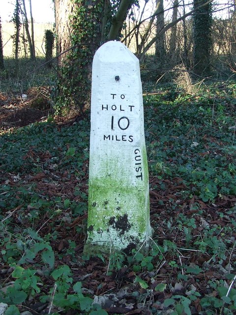
B1110 road

The B1110 runs for about 19 miles (31 km) between Holt and Dereham, and is entirely within the county of Norfolk. The road is a link between the A148 and...
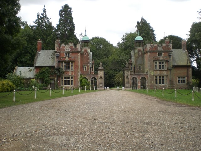
Sennowe Hall

Sennowe Hall (also known as Sennowe Park) is a large country house and estate located near the village of Guist in Norfolk, England. The clock tower, the...
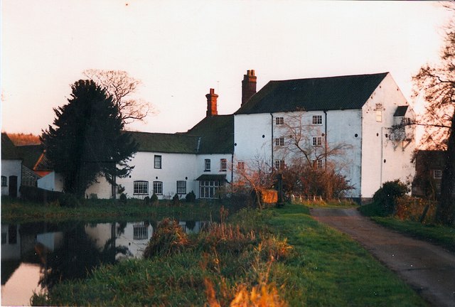
Bintry Watermill

Bintry Watermill is located on the River Wensum, about a mile (2 km) west of the village of Bintree in the English county of Norfolk. The watermill is...

Twyford, Norfolk

Twyford is a hamlet and civil parish in the English county of Norfolk. It is situated on the A1067 road, some 12 km (7.5 mi) south-east of the town of...

Wood Norton, Norfolk

Wood Norton is a village and civil parish in the English county of Norfolk. It is located 10 km (6.2 mi) east of Fakenham and 30 km (19 mi) north-west...

Bexfield

Bexfield is a village near Foulsham in Norfolk, England.

Stibbard

Stibbard is a village and civil parish in the English county of Norfolk. The village is 19.3 miles (31.1 km) south-west of Cromer, 21.2 miles (34.1 km...

Nearby Amenities

Located within 500m of 52.794523,0.96147266
Bus Stop
Post Office, adj
Naptan AtcoCode: 2900G151
Naptan Bearing: W
Naptan CommonName: Post Office
Naptan Indicator: adj
Naptan Landmark: Bus Shelter
Naptan Locality: Guist
Naptan NaptanCode: nfoatdtg
Naptan Street: Norwich Road
Naptan Verified: no
Source: naptan_import
Lat/Long: 52.7907014/0.962382
Bus Stop
Malthouse Lane, opp
Bench: no
Naptan AtcoCode: 2900G153
Naptan Bearing: E
Naptan BusStopType: CUS
Naptan CommonName: Malthouse Lane
Naptan Indicator: opp
Naptan Landmark: Bus Shelter
Naptan Locality: Guist
Naptan NaptanCode: nfoatdtm
Naptan Street: Norwich Road
Shelter: no
Source: naptan_import;survey
Lat/Long: 52.7905842/0.9629357
Guist
Place: hamlet
Lat/Long: 52.7914764/0.9622652
Entrance: main
Lat/Long: 52.7908585/0.9649765
Give Way
Lat/Long: 52.7906158/0.9601797
Give Way
Lat/Long: 52.7912349/0.9616459
Stop
Lat/Long: 52.7909739/0.9610879
Post Office
Guist Post Office
Addr City: Dereham
Addr Postcode: NR20 5AJ
Addr Street: Norwich Road
Addr Village: Guist
Alt Website: http://www.guistgeneralstore.co.uk/the-post-offce/
Brand: Post Office
Brand Wikidata: Q1783168
Indoor: yes
Opening Hours: Mo-Fr 08:30-16:15; Sa 09:30-14:30; Su off
Ref Pol Id: 11216
Source: OS_OpenData_VectorMapLocal;website
Source Addr: pol_branch_list_2018-02
Website: https://www.postoffice.co.uk/branch-finder/2801361/guist
Lat/Long: 52.7903195/0.9632067
Post Box
Collection Times: Mo-Fr 16:30; Sa 11:00
Operator: Royal Mail
Post Box Type: wall
Ref: NR20 2060
Royal Cypher: EIIR
Royal Cypher Wikidata: Q33102113
Lat/Long: 52.7903509/0.9632131
Give Way
Lat/Long: 52.7913433/0.9601209
Give Way
Lat/Long: 52.79092/0.9618281
Bench
Backrest: yes
Material: wood
Seats: 3
Lat/Long: 52.7908146/0.9648938
Bench
Backrest: yes
Material: wood
Seats: 3
Lat/Long: 52.7913052/0.9620574
The data included in this document is from www.openstreetmap.org. The data is made available under ODbL.

Have you been to Guist Hill?

Leave your review of Guist Hill below (or comments, questions and feedback).