Guist Common

Downs, Moorland in Norfolk Breckland

England

Guist Common

Former Railway Line See <a href="https://www.geograph.org.uk/photo/1893579">TF9823 : Trackbed North of County School</a> for a summer view.
Former Railway Line Credit: Ashley Dace

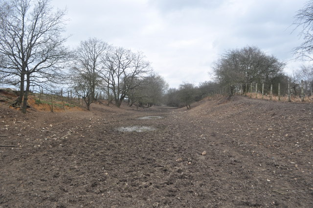
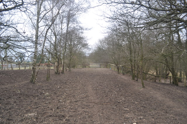
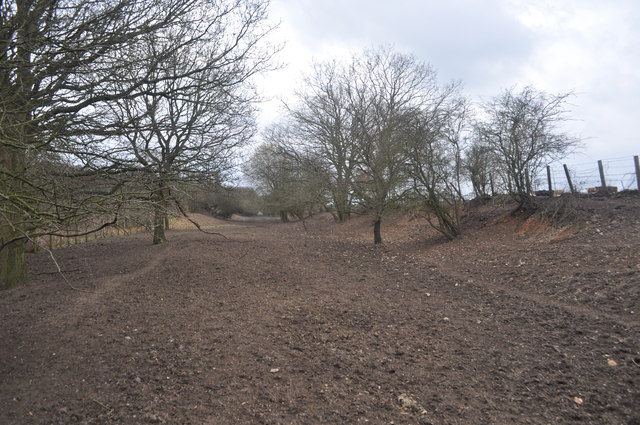
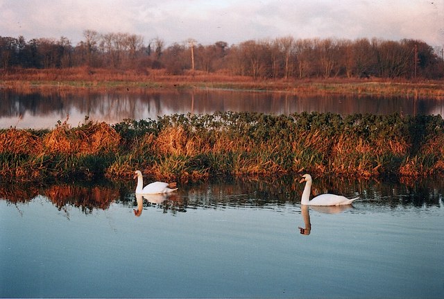
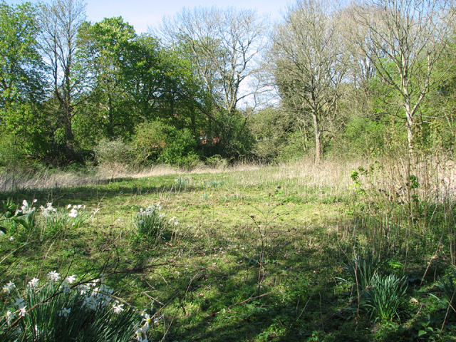
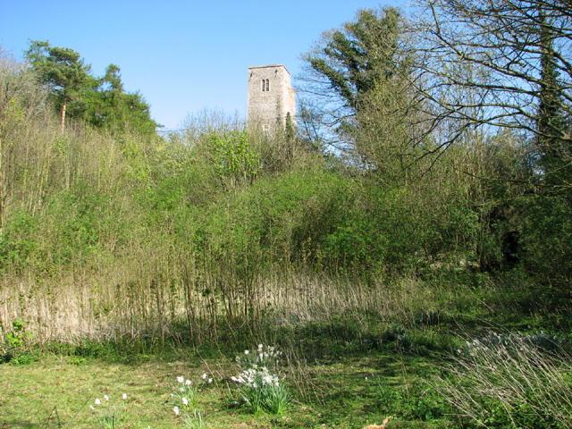
Guist Common is a picturesque area located in Norfolk, England. Covering approximately 200 acres, it is primarily composed of downs and moorland, offering a diverse and stunning landscape for visitors to explore. The common is nestled within a rural setting, surrounded by charming villages and rolling countryside.

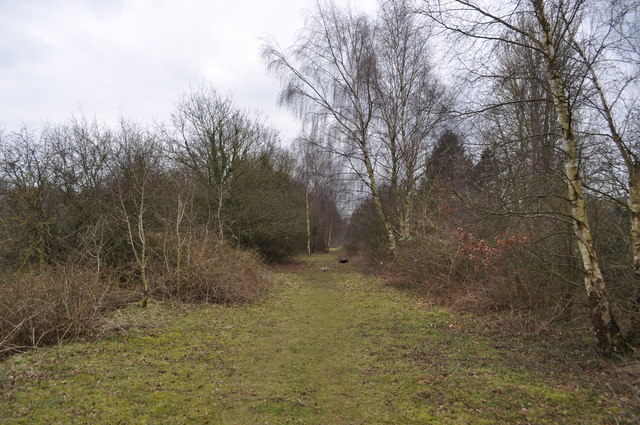
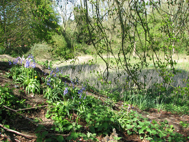
The downs, characterized by their gently sloping hills, are covered in a vibrant carpet of lush grasses and wildflowers. This creates a beautiful backdrop for leisurely walks and picnics, attracting both locals and tourists alike. The moorland, on the other hand, consists of open expanses of heather and gorse, providing a habitat for a variety of bird species and other wildlife.

Guist Common is renowned for its tranquility and natural beauty, making it a popular spot for nature enthusiasts and photographers. The area boasts several footpaths and bridleways that wind through the landscape, allowing visitors to immerse themselves in the peaceful surroundings.

Aside from its natural attractions, Guist Common also offers recreational facilities, including a children's play area and a picnic site. These amenities make it an ideal destination for families looking to spend quality time outdoors.

Overall, Guist Common is a hidden gem in Norfolk, offering a peaceful retreat from bustling city life. Its downs and moorland provide a stunning backdrop for outdoor activities and a chance to connect with nature in an idyllic setting.

If you have any feedback on the listing, please let us know in the comments section below.
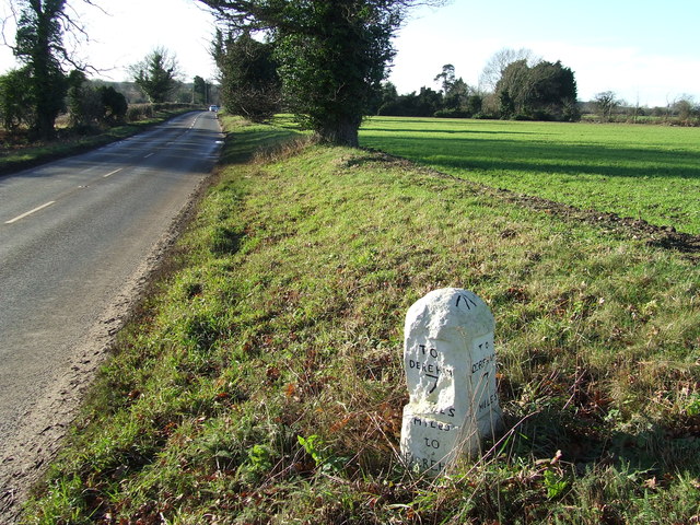
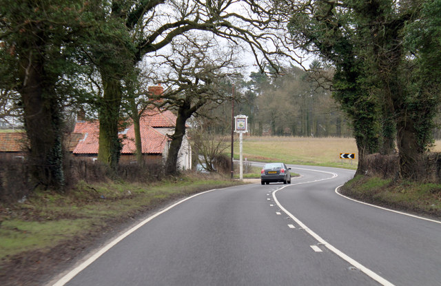
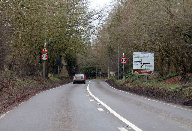
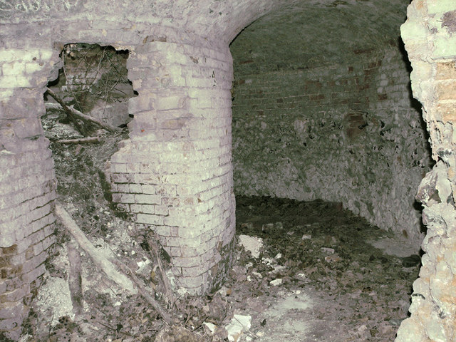
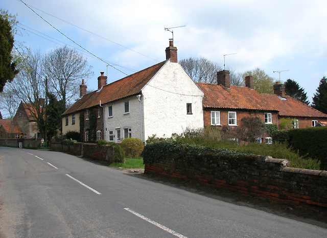
Guist Common Images

Images are sourced within 2km of 52.786627/0.95862217 or Grid Reference TF9925. Thanks to Geograph Open Source API. All images are credited.

Former Railway Line See <a href="https://www.geograph.org.uk/photo/1893579">TF9823 : Trackbed North of County School</a> for a summer view.
Former Railway Line
Railway Trackbed See <a href="https://www.geograph.org.uk/photo/1893520">TF9823 : Trackbed north of County School</a> for a summer view.
Railway Trackbed
Railway Trackbed A look at the ex trackbed north of County School. This is now farmland but a footpath runs through. 
See <a href="https://www.geograph.org.uk/photo/1893537">TF9823 : Trackbed north of County School</a>
Railway Trackbed
A look at the ex trackbed north of County School. This is now farmland but a footpath runs through. See TF9823 : Trackbed north of County School
Railway Trackbed The trackbed north of County School to Fakenham Gas Museum (including M&GN trackbed) is in private hands but protected from development. The major obstacle being Great Ryburgh maltings, being built on the trackbed.
Railway Trackbed
The trackbed north of County School to Fakenham Gas Museum (including M&GN trackbed) is in private hands but protected from development. The major obstacle being Great Ryburgh maltings, being built on the trackbed.
Bintry Mill on the River Wensum
River Wensum and floodplain above Bintry Mill
Old Milestone Old milestone on the B1110 at Guist, Norfolk. For overall view see <a title="https://www.geograph.org.uk/photo/3793140" href="https://www.geograph.org.uk/photo/3793140">Link</a>
Old Milestone
Old milestone on the B1110 at Guist, Norfolk. For overall view see Link
To Dereham 8 Old milestone on the B1110 at Guist, Norfolk. For close up view see <a title="https://www.geograph.org.uk/photo/3793138" href="https://www.geograph.org.uk/photo/3793138">Link</a>
To Dereham 8
Old milestone on the B1110 at Guist, Norfolk. For close up view see Link
Old Milestone Old milestone on the B1110 near to Guist, Norfolk. For overall view see <a title="https://www.geograph.org.uk/photo/3793143" href="https://www.geograph.org.uk/photo/3793143">Link</a>
Old Milestone
Old milestone on the B1110 near to Guist, Norfolk. For overall view see Link
To Dereham 7 Old milestone on the B1110 near to Guist, Norfolk. For close up view see <a title="https://www.geograph.org.uk/photo/3793142" href="https://www.geograph.org.uk/photo/3793142">Link</a>
To Dereham 7
Old milestone on the B1110 near to Guist, Norfolk. For close up view see Link
A1067 past The Ordnance Arms
A1067 at Guist Junction with B1110 ahead.
A1067 at Guist
Junction with B1110 ahead.
Bluebells growing in disused chalk pit, Guist For a wider view of this location see > <a title="https://www.geograph.org.uk/photo/3934997" href="https://www.geograph.org.uk/photo/3934997">Link</a>.
Bluebells growing in disused chalk pit, Guist
For a wider view of this location see > Link.
Disused chalk pit, Guist
Disused chalk pit, Guist The tower of St Andrew's church > <a title="https://www.geograph.org.uk/photo/2123760" href="https://www.geograph.org.uk/photo/2123760">Link</a> (in adjacent grid square) can be seen peeking over the shrubs growing along the edge of the pit.
Disused chalk pit, Guist
The tower of St Andrew's church > Link (in adjacent grid square) can be seen peeking over the shrubs growing along the edge of the pit.
Old lime kiln hiding behind young trees This disused lime kiln > <a title="https://www.geograph.org.uk/photo/3935012" href="https://www.geograph.org.uk/photo/3935012">Link</a> was built between 1814 and 1846. In 1836 Robert Whistler is recorded as a lime burner at Guist and in 1854 William Mallon, victualler at the Swan Inn, is also recorded as a lime burner.  Presumably both men worked at this kiln which is of an unusual type with a circular kiln and a funnel-shaped pot. The kiln is situated to one side of a former lime pit and short tunnel leads into it. The entrance from the pit is formed of flint faced with brick. Inside, the lime chutes remain, some still with little piles of residue, and there may be other recesses in the passage face of the pot. The site is shown as pits on a local map dating from 1785; it is first shown mentioning the kiln on a Tithe map from 1846 and still working by 1885 as shown on 6ins OS map.
Old lime kiln hiding behind young trees
This disused lime kiln > Link was built between 1814 and 1846. In 1836 Robert Whistler is recorded as a lime burner at Guist and in 1854 William Mallon, victualler at the Swan Inn, is also recorded as a lime burner. Presumably both men worked at this kiln which is of an unusual type with a circular kiln and a funnel-shaped pot. The kiln is situated to one side of a former lime pit and short tunnel leads into it. The entrance from the pit is formed of flint faced with brick. Inside, the lime chutes remain, some still with little piles of residue, and there may be other recesses in the passage face of the pot. The site is shown as pits on a local map dating from 1785; it is first shown mentioning the kiln on a Tithe map from 1846 and still working by 1885 as shown on 6ins OS map.
Entrance to old lime kiln This disused lime kiln > <a title="https://www.geograph.org.uk/photo/3935012" href="https://www.geograph.org.uk/photo/3935012">Link</a> was built between 1814 and 1846. In 1836 Robert Whistler is recorded as a lime burner at Guist and in 1854 William Mallon, victualler at the Swan Inn, is also recorded as a lime burner.  Presumably both men worked at this kiln which is of an unusual type with a circular kiln and a funnel-shaped pot. The kiln is situated to one side of a former lime pit and short tunnel leads into it. The entrance from the pit is formed of flint faced with brick. Inside, the lime chutes remain, some still with little piles of residue, and there may be other recesses in the passage face of the pot. The site is shown as pits on a local map dating from 1785; it is first shown mentioning the kiln on a Tithe map from 1846 and still working by 1885 as shown on 6ins OS map.
Entrance to old lime kiln
This disused lime kiln > Link was built between 1814 and 1846. In 1836 Robert Whistler is recorded as a lime burner at Guist and in 1854 William Mallon, victualler at the Swan Inn, is also recorded as a lime burner. Presumably both men worked at this kiln which is of an unusual type with a circular kiln and a funnel-shaped pot. The kiln is situated to one side of a former lime pit and short tunnel leads into it. The entrance from the pit is formed of flint faced with brick. Inside, the lime chutes remain, some still with little piles of residue, and there may be other recesses in the passage face of the pot. The site is shown as pits on a local map dating from 1785; it is first shown mentioning the kiln on a Tithe map from 1846 and still working by 1885 as shown on 6ins OS map.
Disused lime kiln - interior This disused lime kiln > <a title="https://www.geograph.org.uk/photo/3935009" href="https://www.geograph.org.uk/photo/3935009">Link</a> was built between 1814 and 1846. In 1836 Robert Whistler is recorded as a lime burner at Guist and in 1854 William Mallon, victualler at the Swan Inn, is also recorded as a lime burner.  Presumably both men worked at this kiln which is of an unusual type with a circular kiln and a funnel-shaped pot. The kiln is situated to one side of a former lime pit and short tunnel leads into it. The entrance from the pit is formed of flint faced with brick. Inside, the lime chutes remain, some still with little piles of residue, and there may be other recesses in the passage face of the pot. The site is shown as pits on a local map dating from 1785; it is first shown mentioning the kiln on a Tithe map from 1846 and still working by 1885 as shown on 6ins OS map.
Disused lime kiln - interior
This disused lime kiln > Link was built between 1814 and 1846. In 1836 Robert Whistler is recorded as a lime burner at Guist and in 1854 William Mallon, victualler at the Swan Inn, is also recorded as a lime burner. Presumably both men worked at this kiln which is of an unusual type with a circular kiln and a funnel-shaped pot. The kiln is situated to one side of a former lime pit and short tunnel leads into it. The entrance from the pit is formed of flint faced with brick. Inside, the lime chutes remain, some still with little piles of residue, and there may be other recesses in the passage face of the pot. The site is shown as pits on a local map dating from 1785; it is first shown mentioning the kiln on a Tithe map from 1846 and still working by 1885 as shown on 6ins OS map.
Show me another place!

Guist Common is located at Grid Ref: TF9925 (Lat: 52.786627, Lng: 0.95862217)

Administrative County: Norfolk

District: Breckland

Police Authority: Norfolk

What 3 Words

///voltages.fairy.lake. Near Foulsham, Norfolk

Related Wikis

Guist

Guist () is a village and civil parish in the English county of Norfolk. It covers an area of 6.80 km2 (2.63 sq mi) and had a population of 242 in 102...
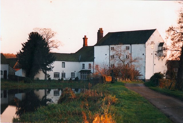
Bintry Watermill

Bintry Watermill is located on the River Wensum, about a mile (2 km) west of the village of Bintree in the English county of Norfolk. The watermill is...
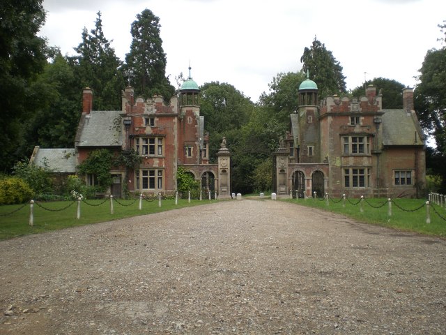
Sennowe Hall

Sennowe Hall (also known as Sennowe Park) is a large country house and estate located near the village of Guist in Norfolk, England. The clock tower, the...
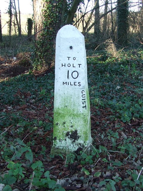
B1110 road

The B1110 runs for about 19 miles (31 km) between Holt and Dereham, and is entirely within the county of Norfolk. The road is a link between the A148 and...

Twyford, Norfolk

Twyford is a hamlet and civil parish in the English county of Norfolk. It is situated on the A1067 road, some 12 km (7.5 mi) south-east of the town of...

Bexfield

Bexfield is a village near Foulsham in Norfolk, England.
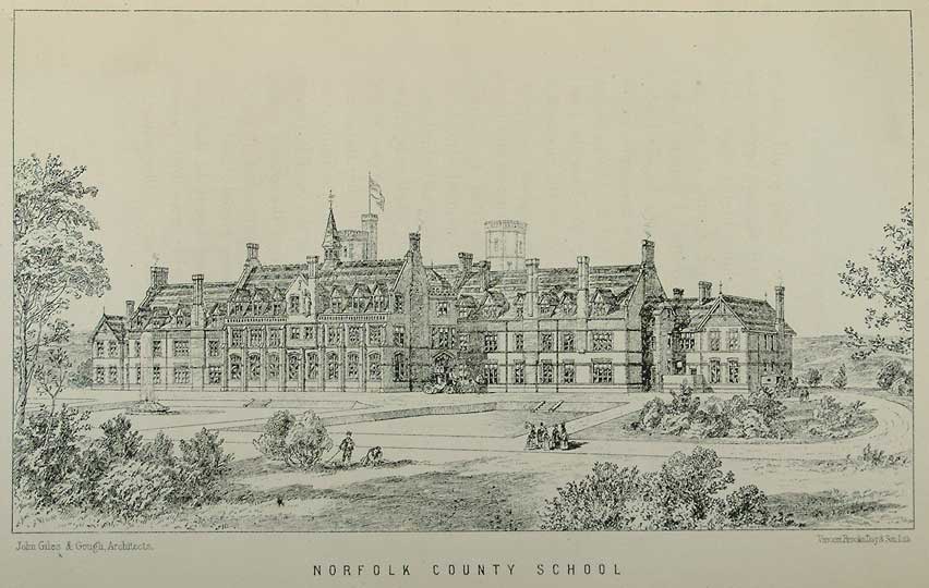
Watts Naval School

Watts Naval School was originally the Norfolk County School, a boarding school set up to serve the educational needs of the 'sons of farmers and artisans...

County School railway station

County School railway station is on the Mid-Norfolk Railway in Norfolk, England; it will serve the villages of North Elmham and Guist once services resume...

Nearby Amenities

Located within 500m of 52.786627,0.95862217
Council Houses, adj
Naptan AtcoCode: 2900G152
Naptan Bearing: S
Naptan BusStopType: CUS
Naptan CommonName: Council Houses
Naptan Indicator: adj
Naptan Landmark: Council Houses
Naptan Locality: Guist
Naptan NaptanCode: nfoatdtj
Naptan Street: Bridge Road
Naptan Verified: no
Source: naptan_import
Lat/Long: 52.7883638/0.9594789
Council Houses, opp
Naptan AtcoCode: 2900G154
Naptan Bearing: N
Naptan BusStopType: CUS
Naptan CommonName: Council Houses
Naptan Indicator: opp
Naptan Landmark: Council Houses
Naptan Locality: Guist
Naptan NaptanCode: nfoatdtp
Naptan Street: Bridge Road
Naptan Verified: no
Source: naptan_import
Lat/Long: 52.7883503/0.9593
Give Way
Lat/Long: 52.7906158/0.9601797
Power: pole
Lat/Long: 52.7895972/0.9639779
The data included in this document is from www.openstreetmap.org. The data is made available under ODbL.

Have you been to Guist Common?

Leave your review of Guist Common below (or comments, questions and feedback).