Guist

Settlement in Norfolk Breckland

England

Guist

Bintry Mill on the River Wensum
Bintry Mill on the River Wensum Credit: David Leeming

Guist is a small village located in the county of Norfolk, England. Situated in the East of England region, it lies approximately 17 miles north-west of the city of Norwich. The village is nestled in the picturesque Wensum Valley, offering a charming rural setting with a population of around 300 residents.

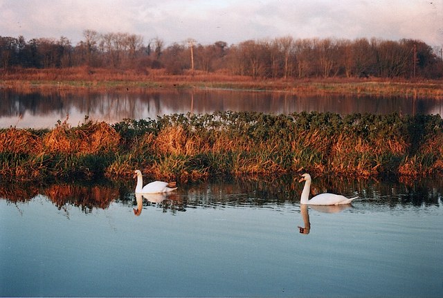
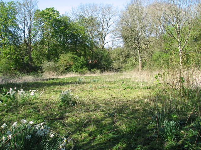
Guist is known for its idyllic countryside, which attracts visitors seeking tranquility and natural beauty. The village is surrounded by rolling hills, farmland, and meandering rivers, providing ample opportunities for outdoor activities such as walking, cycling, and fishing. The nearby Guist Lakes are particularly popular among anglers.

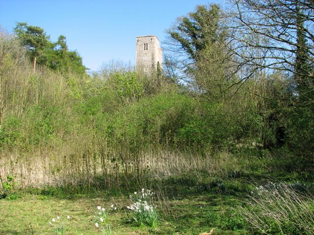
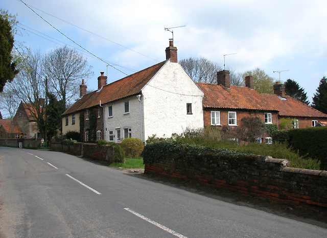
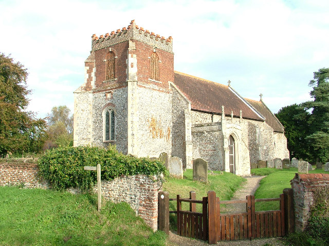
The village itself boasts a delightful mix of traditional and modern architecture, with historic cottages and farmhouses blending seamlessly with more contemporary buildings. The local parish church, St. Andrew's, is a notable feature of Guist. Dating back to the 14th century, it adds to the village's historical charm.

While Guist may be small in size, it is not lacking in community spirit. The village hosts various events throughout the year, including fairs, festivals, and local gatherings that bring residents together. Additionally, there are a few amenities available to locals and visitors, including a village hall, a school, and a pub.

Overall, Guist offers a peaceful retreat from the hustle and bustle of city life, providing a serene environment and a strong sense of community for its residents and visitors alike.

If you have any feedback on the listing, please let us know in the comments section below.
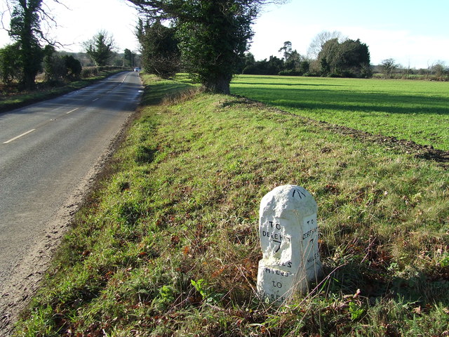
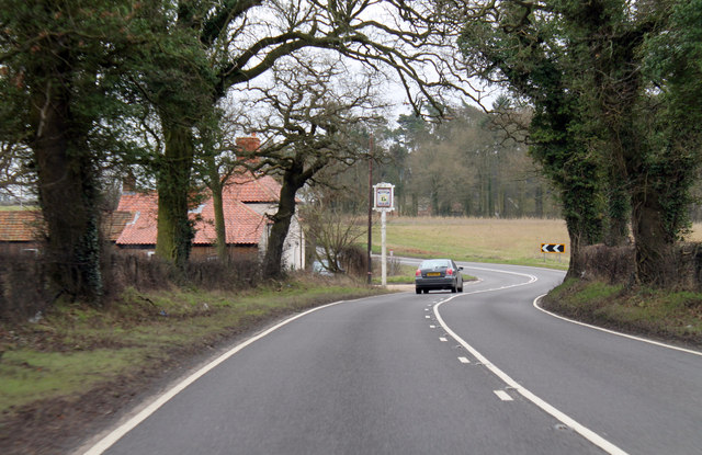
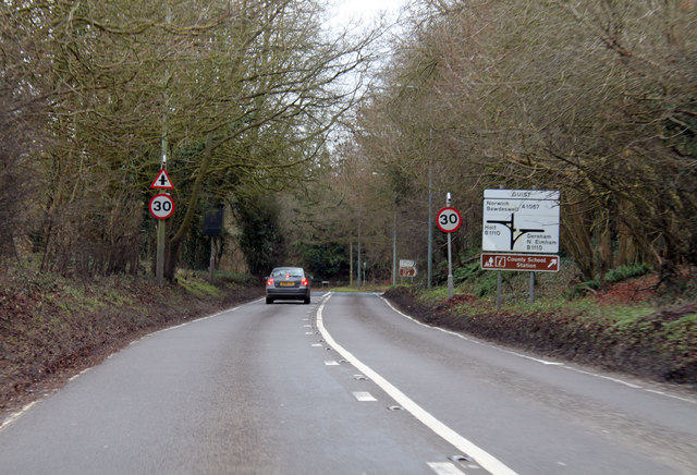
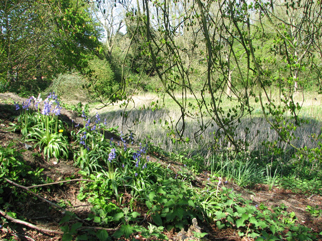
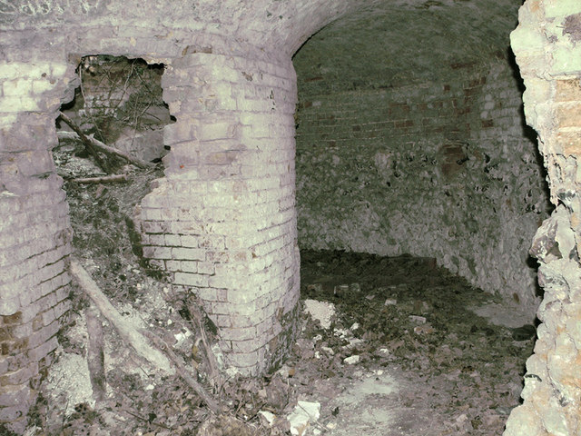
Guist Images

Images are sourced within 2km of 52.791187/0.961743 or Grid Reference TF9925. Thanks to Geograph Open Source API. All images are credited.

Bintry Mill on the River Wensum
River Wensum and floodplain above Bintry Mill
Old Milestone Old milestone on the B1110 at Guist, Norfolk. For overall view see <a title="https://www.geograph.org.uk/photo/3793140" href="https://www.geograph.org.uk/photo/3793140">Link</a>
Old Milestone
Old milestone on the B1110 at Guist, Norfolk. For overall view see Link
To Dereham 8 Old milestone on the B1110 at Guist, Norfolk. For close up view see <a title="https://www.geograph.org.uk/photo/3793138" href="https://www.geograph.org.uk/photo/3793138">Link</a>
To Dereham 8
Old milestone on the B1110 at Guist, Norfolk. For close up view see Link
Old Milestone Old milestone on the B1110 near to Guist, Norfolk. For overall view see <a title="https://www.geograph.org.uk/photo/3793143" href="https://www.geograph.org.uk/photo/3793143">Link</a>
Old Milestone
Old milestone on the B1110 near to Guist, Norfolk. For overall view see Link
To Dereham 7 Old milestone on the B1110 near to Guist, Norfolk. For close up view see <a title="https://www.geograph.org.uk/photo/3793142" href="https://www.geograph.org.uk/photo/3793142">Link</a>
To Dereham 7
Old milestone on the B1110 near to Guist, Norfolk. For close up view see Link
A1067 past The Ordnance Arms
A1067 at Guist Junction with B1110 ahead.
A1067 at Guist
Junction with B1110 ahead.
Bluebells growing in disused chalk pit, Guist For a wider view of this location see > <a title="https://www.geograph.org.uk/photo/3934997" href="https://www.geograph.org.uk/photo/3934997">Link</a>.
Bluebells growing in disused chalk pit, Guist
For a wider view of this location see > Link.
Disused chalk pit, Guist
Disused chalk pit, Guist The tower of St Andrew's church > <a title="https://www.geograph.org.uk/photo/2123760" href="https://www.geograph.org.uk/photo/2123760">Link</a> (in adjacent grid square) can be seen peeking over the shrubs growing along the edge of the pit.
Disused chalk pit, Guist
The tower of St Andrew's church > Link (in adjacent grid square) can be seen peeking over the shrubs growing along the edge of the pit.
Old lime kiln hiding behind young trees This disused lime kiln > <a title="https://www.geograph.org.uk/photo/3935012" href="https://www.geograph.org.uk/photo/3935012">Link</a> was built between 1814 and 1846. In 1836 Robert Whistler is recorded as a lime burner at Guist and in 1854 William Mallon, victualler at the Swan Inn, is also recorded as a lime burner.  Presumably both men worked at this kiln which is of an unusual type with a circular kiln and a funnel-shaped pot. The kiln is situated to one side of a former lime pit and short tunnel leads into it. The entrance from the pit is formed of flint faced with brick. Inside, the lime chutes remain, some still with little piles of residue, and there may be other recesses in the passage face of the pot. The site is shown as pits on a local map dating from 1785; it is first shown mentioning the kiln on a Tithe map from 1846 and still working by 1885 as shown on 6ins OS map.
Old lime kiln hiding behind young trees
This disused lime kiln > Link was built between 1814 and 1846. In 1836 Robert Whistler is recorded as a lime burner at Guist and in 1854 William Mallon, victualler at the Swan Inn, is also recorded as a lime burner. Presumably both men worked at this kiln which is of an unusual type with a circular kiln and a funnel-shaped pot. The kiln is situated to one side of a former lime pit and short tunnel leads into it. The entrance from the pit is formed of flint faced with brick. Inside, the lime chutes remain, some still with little piles of residue, and there may be other recesses in the passage face of the pot. The site is shown as pits on a local map dating from 1785; it is first shown mentioning the kiln on a Tithe map from 1846 and still working by 1885 as shown on 6ins OS map.
Entrance to old lime kiln This disused lime kiln > <a title="https://www.geograph.org.uk/photo/3935012" href="https://www.geograph.org.uk/photo/3935012">Link</a> was built between 1814 and 1846. In 1836 Robert Whistler is recorded as a lime burner at Guist and in 1854 William Mallon, victualler at the Swan Inn, is also recorded as a lime burner.  Presumably both men worked at this kiln which is of an unusual type with a circular kiln and a funnel-shaped pot. The kiln is situated to one side of a former lime pit and short tunnel leads into it. The entrance from the pit is formed of flint faced with brick. Inside, the lime chutes remain, some still with little piles of residue, and there may be other recesses in the passage face of the pot. The site is shown as pits on a local map dating from 1785; it is first shown mentioning the kiln on a Tithe map from 1846 and still working by 1885 as shown on 6ins OS map.
Entrance to old lime kiln
This disused lime kiln > Link was built between 1814 and 1846. In 1836 Robert Whistler is recorded as a lime burner at Guist and in 1854 William Mallon, victualler at the Swan Inn, is also recorded as a lime burner. Presumably both men worked at this kiln which is of an unusual type with a circular kiln and a funnel-shaped pot. The kiln is situated to one side of a former lime pit and short tunnel leads into it. The entrance from the pit is formed of flint faced with brick. Inside, the lime chutes remain, some still with little piles of residue, and there may be other recesses in the passage face of the pot. The site is shown as pits on a local map dating from 1785; it is first shown mentioning the kiln on a Tithe map from 1846 and still working by 1885 as shown on 6ins OS map.
Disused lime kiln - interior This disused lime kiln > <a title="https://www.geograph.org.uk/photo/3935009" href="https://www.geograph.org.uk/photo/3935009">Link</a> was built between 1814 and 1846. In 1836 Robert Whistler is recorded as a lime burner at Guist and in 1854 William Mallon, victualler at the Swan Inn, is also recorded as a lime burner.  Presumably both men worked at this kiln which is of an unusual type with a circular kiln and a funnel-shaped pot. The kiln is situated to one side of a former lime pit and short tunnel leads into it. The entrance from the pit is formed of flint faced with brick. Inside, the lime chutes remain, some still with little piles of residue, and there may be other recesses in the passage face of the pot. The site is shown as pits on a local map dating from 1785; it is first shown mentioning the kiln on a Tithe map from 1846 and still working by 1885 as shown on 6ins OS map.
Disused lime kiln - interior
This disused lime kiln > Link was built between 1814 and 1846. In 1836 Robert Whistler is recorded as a lime burner at Guist and in 1854 William Mallon, victualler at the Swan Inn, is also recorded as a lime burner. Presumably both men worked at this kiln which is of an unusual type with a circular kiln and a funnel-shaped pot. The kiln is situated to one side of a former lime pit and short tunnel leads into it. The entrance from the pit is formed of flint faced with brick. Inside, the lime chutes remain, some still with little piles of residue, and there may be other recesses in the passage face of the pot. The site is shown as pits on a local map dating from 1785; it is first shown mentioning the kiln on a Tithe map from 1846 and still working by 1885 as shown on 6ins OS map.
Disused lime kiln - view from above This disused lime kiln > <a title="https://www.geograph.org.uk/photo/3935009" href="https://www.geograph.org.uk/photo/3935009">Link</a> was built between 1814 and 1846. In 1836 Robert Whistler is recorded as a lime burner at Guist and in 1854 William Mallon, victualler at the Swan Inn, is also recorded as a lime burner.  Presumably both men worked at this kiln which is of an unusual type with a circular kiln and a funnel-shaped pot. The kiln is situated to one side of a former lime pit and short tunnel leads into it. The entrance from the pit is formed of flint faced with brick. Inside, the lime chutes remain, some still with little piles of residue, and there may be other recesses in the passage face of the pot. The site is shown as pits on a local map dating from 1785; it is first shown mentioning the kiln on a Tithe map from 1846 and still working by 1885 as shown on 6ins OS map.
Disused lime kiln - view from above
This disused lime kiln > Link was built between 1814 and 1846. In 1836 Robert Whistler is recorded as a lime burner at Guist and in 1854 William Mallon, victualler at the Swan Inn, is also recorded as a lime burner. Presumably both men worked at this kiln which is of an unusual type with a circular kiln and a funnel-shaped pot. The kiln is situated to one side of a former lime pit and short tunnel leads into it. The entrance from the pit is formed of flint faced with brick. Inside, the lime chutes remain, some still with little piles of residue, and there may be other recesses in the passage face of the pot. The site is shown as pits on a local map dating from 1785; it is first shown mentioning the kiln on a Tithe map from 1846 and still working by 1885 as shown on 6ins OS map.
Disused lime kiln - view from the entrance This disused lime kiln > <a title="https://www.geograph.org.uk/photo/3935009" href="https://www.geograph.org.uk/photo/3935009">Link</a> was built between 1814 and 1846. In 1836 Robert Whistler is recorded as a lime burner at Guist and in 1854 William Mallon, victualler at the Swan Inn, is also recorded as a lime burner.  Presumably both men worked at this kiln which is of an unusual type with a circular kiln and a funnel-shaped pot. The kiln is situated to one side of a former lime pit and short tunnel leads into it. The entrance from the pit is formed of flint faced with brick. Inside, the lime chutes remain, some still with little piles of residue, and there may be other recesses in the passage face of the pot. The site is shown as pits on a local map dating from 1785; it is first shown mentioning the kiln on a Tithe map from 1846 and still working by 1885 as shown on 6ins OS map.
Disused lime kiln - view from the entrance
This disused lime kiln > Link was built between 1814 and 1846. In 1836 Robert Whistler is recorded as a lime burner at Guist and in 1854 William Mallon, victualler at the Swan Inn, is also recorded as a lime burner. Presumably both men worked at this kiln which is of an unusual type with a circular kiln and a funnel-shaped pot. The kiln is situated to one side of a former lime pit and short tunnel leads into it. The entrance from the pit is formed of flint faced with brick. Inside, the lime chutes remain, some still with little piles of residue, and there may be other recesses in the passage face of the pot. The site is shown as pits on a local map dating from 1785; it is first shown mentioning the kiln on a Tithe map from 1846 and still working by 1885 as shown on 6ins OS map.
Show me another place!

Guist is located at Grid Ref: TF9925 (Lat: 52.791187, Lng: 0.961743)

Administrative County: Norfolk

District: Breckland

Police Authority: Norfolk

What 3 Words

///tone.warms.reputable. Near Foulsham, Norfolk

Related Wikis

Guist

Guist () is a village and civil parish in the English county of Norfolk. It covers an area of 6.80 km2 (2.63 sq mi) and had a population of 242 in 102...
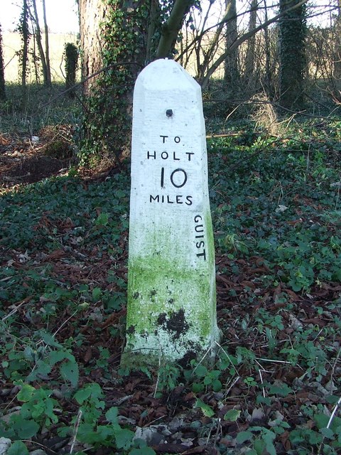
B1110 road

The B1110 runs for about 19 miles (31 km) between Holt and Dereham, and is entirely within the county of Norfolk. The road is a link between the A148 and...
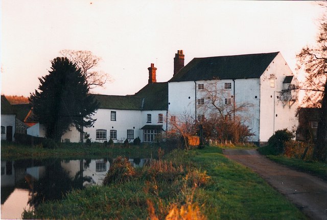
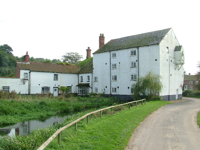
Bintry Watermill

Bintry Watermill is located on the River Wensum, about a mile (2 km) west of the village of Bintree in the English county of Norfolk. The watermill is...
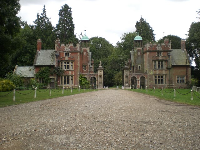
Sennowe Hall

Sennowe Hall (also known as Sennowe Park) is a large country house and estate located near the village of Guist in Norfolk, England. The clock tower, the...

Twyford, Norfolk

Twyford is a hamlet and civil parish in the English county of Norfolk. It is situated on the A1067 road, some 12 km (7.5 mi) south-east of the town of...

Bexfield

Bexfield is a village near Foulsham in Norfolk, England.

Wood Norton, Norfolk

Wood Norton is a village and civil parish in the English county of Norfolk. It is located 10 km (6.2 mi) east of Fakenham and 30 km (19 mi) north-west...

Bintree

Bintree is a village and civil parish in Norfolk, England, about nine miles (14 km) south-east of Fakenham. According to the 2001 census it had a population...

Nearby Amenities

Located within 500m of 52.791187,0.961743
Bus Stop
Post Office, adj
Naptan AtcoCode: 2900G151
Naptan Bearing: W
Naptan CommonName: Post Office
Naptan Indicator: adj
Naptan Landmark: Bus Shelter
Naptan Locality: Guist
Naptan NaptanCode: nfoatdtg
Naptan Street: Norwich Road
Naptan Verified: no
Source: naptan_import
Lat/Long: 52.7907014/0.962382
Council Houses, adj
Naptan AtcoCode: 2900G152
Naptan Bearing: S
Naptan BusStopType: CUS
Naptan CommonName: Council Houses
Naptan Indicator: adj
Naptan Landmark: Council Houses
Naptan Locality: Guist
Naptan NaptanCode: nfoatdtj
Naptan Street: Bridge Road
Naptan Verified: no
Source: naptan_import
Lat/Long: 52.7883638/0.9594789
Bus Stop
Malthouse Lane, opp
Bench: no
Naptan AtcoCode: 2900G153
Naptan Bearing: E
Naptan BusStopType: CUS
Naptan CommonName: Malthouse Lane
Naptan Indicator: opp
Naptan Landmark: Bus Shelter
Naptan Locality: Guist
Naptan NaptanCode: nfoatdtm
Naptan Street: Norwich Road
Shelter: no
Source: naptan_import;survey
Lat/Long: 52.7905842/0.9629357
Council Houses, opp
Naptan AtcoCode: 2900G154
Naptan Bearing: N
Naptan BusStopType: CUS
Naptan CommonName: Council Houses
Naptan Indicator: opp
Naptan Landmark: Council Houses
Naptan Locality: Guist
Naptan NaptanCode: nfoatdtp
Naptan Street: Bridge Road
Naptan Verified: no
Source: naptan_import
Lat/Long: 52.7883503/0.9593
Guist
Place: hamlet
Lat/Long: 52.7914764/0.9622652
Barrier: stile
Foot: yes
Note: Broken, no step.
Lat/Long: 52.7905446/0.9655713
Entrance: main
Lat/Long: 52.7908585/0.9649765
Give Way
Lat/Long: 52.7906158/0.9601797
Give Way
Lat/Long: 52.7912349/0.9616459
Stop
Lat/Long: 52.7909739/0.9610879
Crossing
Crossing: unmarked
Crossing Island: no
Lat/Long: 52.7904555/0.9666051
Post Office
Guist Post Office
Addr City: Dereham
Addr Postcode: NR20 5AJ
Addr Street: Norwich Road
Addr Village: Guist
Alt Website: http://www.guistgeneralstore.co.uk/the-post-offce/
Brand: Post Office
Brand Wikidata: Q1783168
Indoor: yes
Opening Hours: Mo-Fr 08:30-16:15; Sa 09:30-14:30; Su off
Ref Pol Id: 11216
Source: OS_OpenData_VectorMapLocal;website
Source Addr: pol_branch_list_2018-02
Website: https://www.postoffice.co.uk/branch-finder/2801361/guist
Lat/Long: 52.7903195/0.9632067
Post Box
Collection Times: Mo-Fr 16:30; Sa 11:00
Operator: Royal Mail
Post Box Type: wall
Ref: NR20 2060
Royal Cypher: EIIR
Royal Cypher Wikidata: Q33102113
Lat/Long: 52.7903509/0.9632131
Historic: memorial
Memorial: war_memorial
Lat/Long: 52.7905575/0.9653646
Power: pole
Lat/Long: 52.7894415/0.967387
Power: pole
Lat/Long: 52.7895972/0.9639779
Power: pole
Lat/Long: 52.7895145/0.9657401
Give Way
Lat/Long: 52.7913433/0.9601209
Give Way
Lat/Long: 52.79092/0.9618281
Guist
Colour: white;black
Direction: W
Material: metal
Traffic Sign: city_limit
Lat/Long: 52.790358/0.9662309
Bench
Backrest: yes
Material: wood
Seats: 3
Lat/Long: 52.7908146/0.9648938
Bench
Backrest: yes
Material: wood
Seats: 3
Lat/Long: 52.7913052/0.9620574
The data included in this document is from www.openstreetmap.org. The data is made available under ODbL.

Have you been to Guist?

Leave your review of Guist below (or comments, questions and feedback).