Congel Hill

Hill, Mountain in Nottinghamshire Gedling

England

Congel Hill

The outflow from Papplewick Dam Built to feed water to power a number of cotton mills along this section of the Leen valley.
The outflow from Papplewick Dam Credit: David Lally

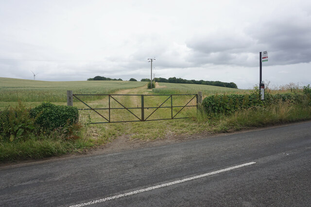
Congel Hill, located in Nottinghamshire, England, is a prominent hill that offers scenic views and recreational opportunities for visitors. Rising to an elevation of approximately 255 meters (837 feet), it is classified as a hill rather than a mountain due to its moderate height.

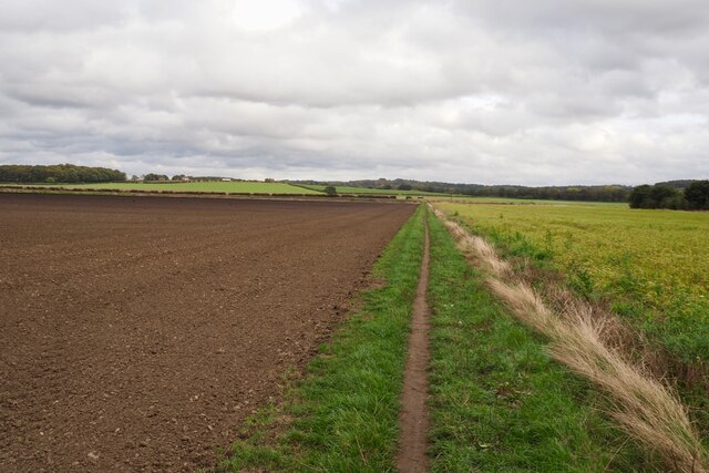
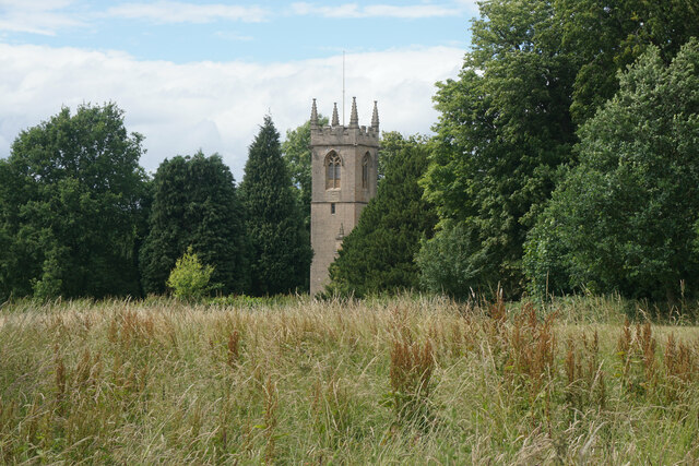
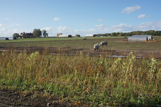
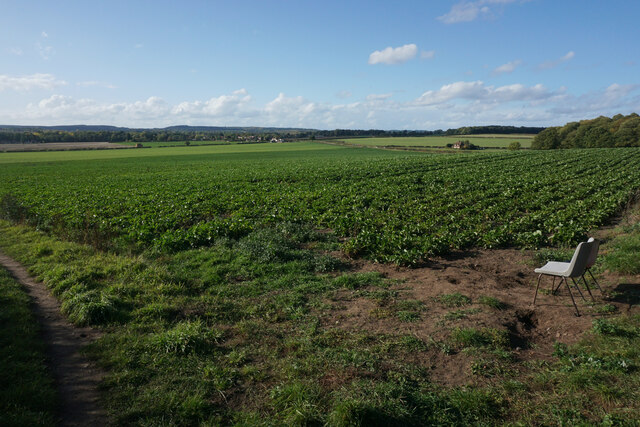
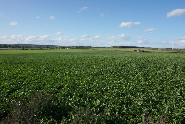
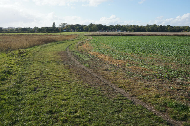
Situated in the southeastern part of Nottinghamshire, Congel Hill is part of the wider Nottinghamshire and Derbyshire Peak District. The hill is covered in lush greenery, consisting mainly of grasslands and scattered trees, which create a picturesque landscape.

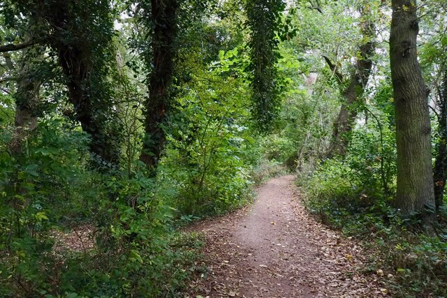
Congel Hill is a popular destination for hikers, nature enthusiasts, and photographers who seek to capture the stunning vistas it offers. The summit of the hill provides panoramic views of the surrounding countryside, including the nearby towns and villages.

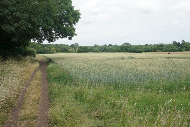
The hill is easily accessible, with several walking paths and trails leading to the summit. These trails are well-maintained, making it suitable for both experienced hikers and those seeking a leisurely stroll. Along the way, visitors can enjoy the diverse flora and fauna that thrive in this area, adding to the charm of the hill.

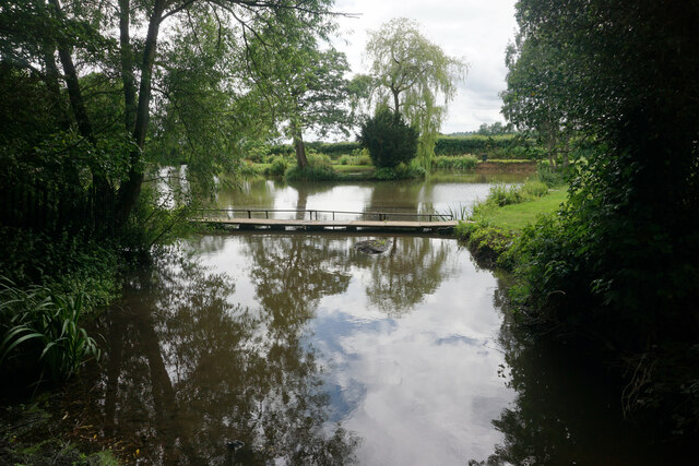
Additionally, Congel Hill is home to a variety of wildlife species, including birds, small mammals, and insects. Birdwatchers can often spot different species, especially during the spring and summer months when the hill is alive with the sounds of chirping birds.

Overall, Congel Hill offers a tranquil escape from the bustling city life, providing an opportunity to connect with nature and enjoy the beauty of the Nottinghamshire countryside.

If you have any feedback on the listing, please let us know in the comments section below.
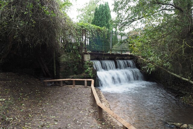
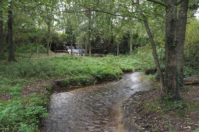
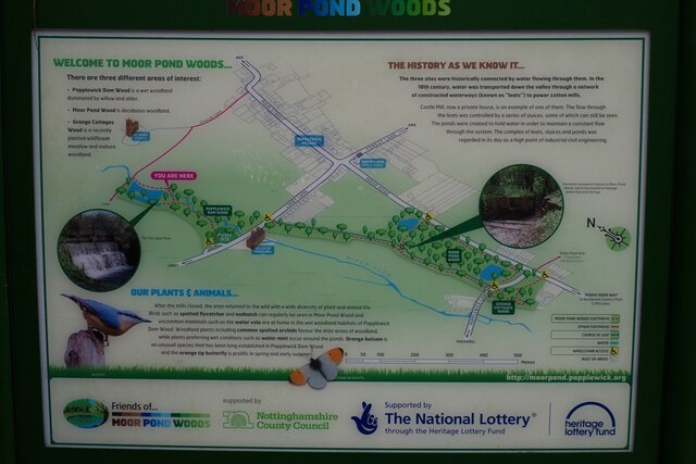
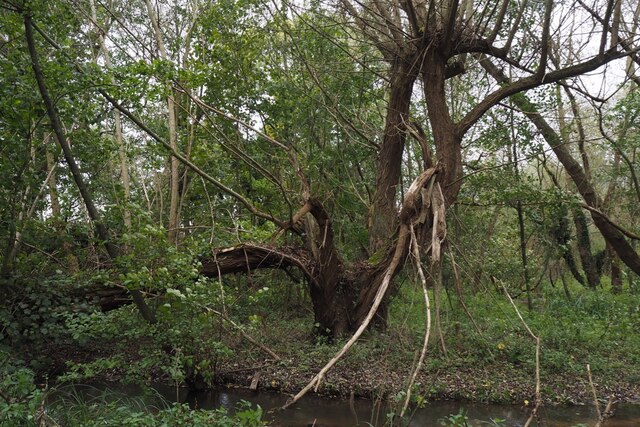
Congel Hill Images

Images are sourced within 2km of 53.043063/-1.1784801 or Grid Reference SK5549. Thanks to Geograph Open Source API. All images are credited.

The outflow from Papplewick Dam Built to feed water to power a number of cotton mills along this section of the Leen valley.
The outflow from Papplewick Dam
Built to feed water to power a number of cotton mills along this section of the Leen valley.
The River Leen With the outflow from Papplewick dam just upstream
The River Leen
With the outflow from Papplewick dam just upstream
Information board for Moor Pond Woods
A well-cracked crack willow On the banks of the River Leen in Papplewick Dam Wood.
A well-cracked crack willow
On the banks of the River Leen in Papplewick Dam Wood.
Wooded path near Castle Mill Part of the Papplewick Trail.
Wooded path near Castle Mill
Part of the Papplewick Trail.
Footpath on Papplewick Moor
Blocked culvert At the southern end of the Papplewick Trail, this excavated culvert entrance presumably would have carried the mill races under Moor Road?
Blocked culvert
At the southern end of the Papplewick Trail, this excavated culvert entrance presumably would have carried the mill races under Moor Road?
An interesting keystone In the arch of <a href="https://www.geograph.org.uk/photo/7005278">SK5450 : Blocked culvert</a>.  Possibly a Green Man representation?
An interesting keystone
In the arch of SK5450 : Blocked culvert. Possibly a Green Man representation?
Robin Hood Way, west of Seven Mile Wood, Papplewick
Bus stop in Papplewick The farm track behind leads up to King Edward's Plantation.
Bus stop in Papplewick
The farm track behind leads up to King Edward's Plantation.
St James' Church, Papplewick As viewed from a footpath which passes to the south.
St James' Church, Papplewick
As viewed from a footpath which passes to the south.
Pond on the River Leen
Footpath to Papplewick The path crosses a wheat field which is edged by Church Plantation.
Footpath to Papplewick
The path crosses a wheat field which is edged by Church Plantation.
Outdoor-reared pork by Stanker Hill Farm As seen from the Robin Hood Way.
Outdoor-reared pork by Stanker Hill Farm
As seen from the Robin Hood Way.
Farmland below Raceground Hill A brief glimpse from the Robin Hood Way, seen across the former railway which serviced Calverton Colliery.
Farmland below Raceground Hill
A brief glimpse from the Robin Hood Way, seen across the former railway which serviced Calverton Colliery.
Farmland on Papplewick Moor A crop of beet is in the foreground. I presume the plastic chairs are for the benefit of the farm workers.
Farmland on Papplewick Moor
A crop of beet is in the foreground. I presume the plastic chairs are for the benefit of the farm workers.
Beet field on Papplewick Moor Wide open spaces seen from the Robin Hood Way.
Beet field on Papplewick Moor
Wide open spaces seen from the Robin Hood Way.
Robin Hood Way near Papplewick The houses ahead are the first of Hucknall and the Nottingham conurbation.
Robin Hood Way near Papplewick
The houses ahead are the first of Hucknall and the Nottingham conurbation.
Show me another place!

Congel Hill is located at Grid Ref: SK5549 (Lat: 53.043063, Lng: -1.1784801)

Administrative County: Nottinghamshire

District: Gedling

Police Authority: Nottinghamshire

What 3 Words

///seagulls.tequila.constants. Near Hucknall, Nottinghamshire

Related Wikis

Papplewick

Papplewick is a village and civil parish in Nottinghamshire, England, 7.5 miles (12 km) north of Nottingham and 6 miles (10 km) south of Mansfield. It...

Hucknall station

Hucknall station, also formerly known as Hucknall Byron station, is a railway station and tram stop in Hucknall, Nottinghamshire, England. It is located...

Hucknall Town railway station

Hucknall Town railway station was a railway station on the Great Northern Railway's Nottingham to Shirebrook line. It served the market town of Hucknall...

Whyburn

The Whyburn (known locally as Town Brook, and by the UK Government as Baker Lane Brook) is the main watercourse flowing through the town of Hucknall in...

Butler's Hill railway station

Butler's Hill railway station was a former station on the Great Northern Railway's Nottingham to Shirebrook line.The station should not be confused with...

Hucknall Sixth Form Centre

The Hucknall Sixth Form Centre is a coeducational sixth form centre located in Hucknall, Nottinghamshire, England.It opened in September 2016 and is home...

Butler's Hill tram stop

Butler's Hill is a tram stop on the Nottingham Express Transit network, serving the suburb of Butler's Hill, Ashfield in Nottinghamshire, England. The...

Hucknall

Hucknall (), formerly Hucknall Torkard (), is a market town in the Ashfield district of Nottinghamshire, England. It lies 7 miles (11 km) north of Nottingham...

Nearby Amenities

Located within 500m of 53.043063,-1.1784801
Bus Stop
Moor Road
Bus: yes
Naptan AtcoCode: 3300GE0035
Naptan Bearing: SE
Naptan CommonName: Moor Road
Naptan Indicator: o/s 269
Naptan NaptanCode: ntsdmgdp
Naptan Notes: none
Naptan Street: Moor Road
Naptan Verified: yes
Public Transport: platform
Source: naptan_import
Lat/Long: 53.0420949/-1.1804402
Bus Stop
Moor Road
Bus: yes
Naptan AtcoCode: 3300GE0036
Naptan Bearing: NW
Naptan CommonName: Moor Road
Naptan Indicator: opp 267
Naptan NaptanCode: ntsdmgdt
Naptan Notes: none
Naptan Street: Moor Road
Naptan Verified: yes
Public Transport: platform
Source: naptan_import
Lat/Long: 53.0422587/-1.1807354
Bus Stop
Grangemoor
Bus: yes
Local Ref: GE0037
Naptan AtcoCode: 3300GE0037
Naptan Bearing: S
Naptan CommonName: Grangemoor
Naptan Crossing: Grangemoor
Naptan Indicator: opp
Naptan NaptanCode: ntsdmgdw
Naptan Notes: none
Naptan Street: Moor Road
Naptan Verified: yes
Public Transport: platform
Shelter: no
Source: naptan_import
Lat/Long: 53.0462286/-1.1815254
Bus Stop
Grangemoor
Bus: yes
Local Ref: GE0038
Naptan AtcoCode: 3300GE0038
Naptan Bearing: N
Naptan CommonName: Grangemoor
Naptan Crossing: Grangemoor
Naptan Indicator: adj
Naptan NaptanCode: ntsdmgja
Naptan Notes: none
Naptan Street: Moor Road
Naptan Verified: yes
Public Transport: platform
Source: naptan_import
Lat/Long: 53.0461307/-1.1816615
Turning Circle
Lat/Long: 53.0453877/-1.1822893
Traffic Calming: rumble_strip
Lat/Long: 53.0435574/-1.1843338
Direction: SW
Generator Method: photovoltaic
Generator Output Electricity: yes
Generator Solar Modules: 16
Generator Source: solar
Generator Type: solar_photovoltaic_panel
Location: roof
Power: generator
Lat/Long: 53.0443241/-1.1856634
Direction: SE
Generator Method: photovoltaic
Generator Output Electricity: yes
Generator Solar Modules: 15
Generator Source: solar
Generator Type: solar_photovoltaic_panel
Location: roof
Power: generator
Lat/Long: 53.0444475/-1.1854434
Direction: SE
Generator Method: photovoltaic
Generator Output Electricity: yes
Generator Solar Modules: 15
Generator Source: solar
Generator Type: solar_photovoltaic_panel
Location: roof
Power: generator
Lat/Long: 53.0445326/-1.1853435
Direction: SE
Generator Method: photovoltaic
Generator Output Electricity: yes
Generator Solar Modules: 15
Generator Source: solar
Generator Type: solar_photovoltaic_panel
Location: roof
Power: generator
Lat/Long: 53.0445693/-1.1853019
Direction: SSE
Generator Method: photovoltaic
Generator Output Electricity: yes
Generator Solar Modules: 18
Generator Source: solar
Generator Type: solar_photovoltaic_panel
Location: roof
Power: generator
Lat/Long: 53.0447461/-1.1847877
Generator Method: photovoltaic
Generator Output Electricity: yes
Generator Source: solar
Generator Type: solar_photovoltaic_panel
Location: roof
Power: generator
Lat/Long: 53.0428212/-1.1801646
Power: pole
Lat/Long: 53.0432853/-1.1767052
Power: pole
Lat/Long: 53.0431651/-1.1785291
Power: pole
Lat/Long: 53.0429442/-1.1799292
Power: pole
Lat/Long: 53.0428297/-1.1809391
Power: pole
Lat/Long: 53.040289/-1.1830969
Power: pole
Lat/Long: 53.0390585/-1.1817478
Power: pole
Lat/Long: 53.0396044/-1.1776172
Power: pole
Lat/Long: 53.0400108/-1.1779283
Power: pole
Lat/Long: 53.0405002/-1.1782877
Power: pole
Lat/Long: 53.0409969/-1.1786512
Power: pole
Lat/Long: 53.0414291/-1.1789703
Power: pole
Lat/Long: 53.042158/-1.1757685
Power: pole
Lat/Long: 53.0440379/-1.1762647
Power: pole
Lat/Long: 53.0446817/-1.1765778
Power: pole
Lat/Long: 53.0467796/-1.1785546
Power: pole
Lat/Long: 53.0464538/-1.1772966
Access: no
Barrier: swing_gate
Swing Gate Type: single
Lat/Long: 53.0441663/-1.1855686
Generator Method: photovoltaic
Generator Output Electricity: yes
Generator Source: solar
Generator Type: solar_photovoltaic_panel
Location: roof
Power: generator
Lat/Long: 53.0437521/-1.185702
Waste Basket
Lat/Long: 53.0433901/-1.184092
Generator Method: photovoltaic
Generator Output Electricity: yes
Generator Source: solar
Generator Type: solar_photovoltaic_panel
Location: roof
Power: generator
Lat/Long: 53.0455569/-1.1828609
Fixme: continue
Lat/Long: 53.0420613/-1.1722943
Power: pole
Lat/Long: 53.0406776/-1.1751938
Power: pole
Lat/Long: 53.0396092/-1.1739023
Power: pole
Lat/Long: 53.0398148/-1.1750047
Power: pole
Lat/Long: 53.0399648/-1.1758335
The data included in this document is from www.openstreetmap.org. The data is made available under ODbL.

Have you been to Congel Hill?

Leave your review of Congel Hill below (or comments, questions and feedback).