Barkston

Settlement in Lincolnshire South Kesteven

England

Barkston

Bridge on Sand Lane Carrying the East Coast Main Line north of Grantham.
Bridge on Sand Lane Credit: Tim Heaton

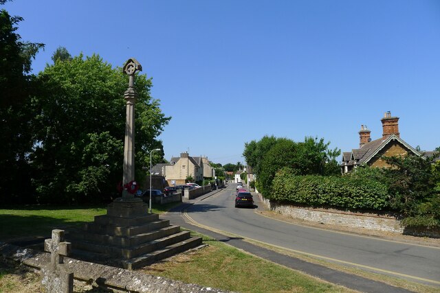
Barkston is a quaint village located in the county of Lincolnshire, England. Situated approximately 4 miles east of the bustling town of Grantham, Barkston offers a peaceful and picturesque setting for its residents and visitors alike.

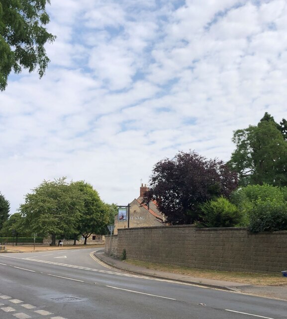
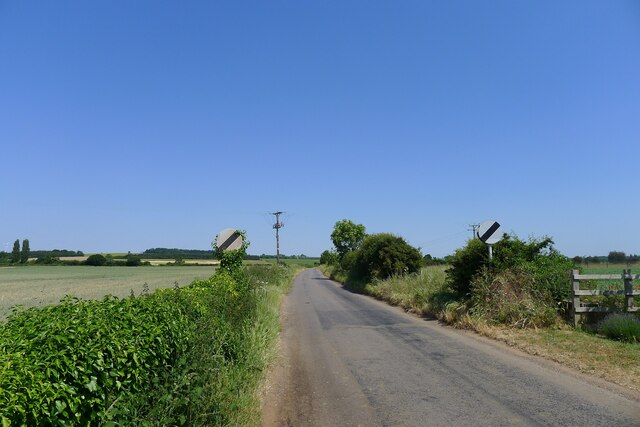
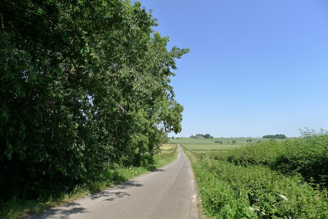
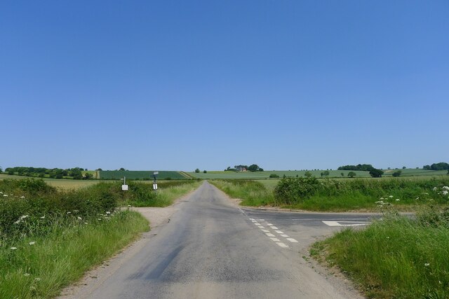
The village is characterized by its charming countryside surroundings, with rolling hills, green fields, and meandering country lanes. Barkston is known for its thriving agricultural community, with several farms dotting the landscape. The village is also home to a small but close-knit population, fostering a strong sense of community spirit.

In terms of amenities, Barkston boasts a few local businesses, including a village shop, a post office, and a cozy pub where locals gather for a pint and a chat. For those seeking recreational activities, there is a well-maintained cricket ground and a children's playground.

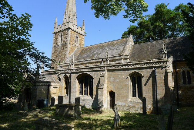
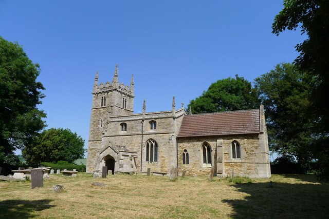
History enthusiasts will find Barkston intriguing, as the village dates back to medieval times. St. Nicholas Church, a beautiful Grade I listed building, stands proudly in the heart of the village, showcasing exquisite architectural features and a rich history.

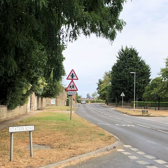
Transportation in Barkston is facilitated by a well-connected road network, with easy access to the A1 road and the nearby town of Grantham, which offers further amenities and railway connections to major cities like London and Nottingham.

Overall, Barkston is a charming and idyllic village, offering a peaceful retreat from the hustle and bustle of city life, while still providing convenient access to nearby towns and amenities.

If you have any feedback on the listing, please let us know in the comments section below.
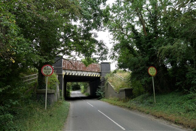
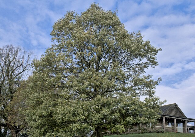
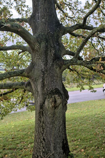
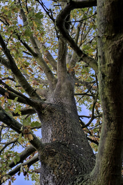
Barkston Images

Images are sourced within 2km of 52.96659/-0.61473338 or Grid Reference SK9341. Thanks to Geograph Open Source API. All images are credited.

Bridge on Sand Lane Carrying the East Coast Main Line north of Grantham.
Bridge on Sand Lane
Carrying the East Coast Main Line north of Grantham.
Heath Lane approaching Minnet's Wood Running towards the edge of the escarpment of Jurassic Lincolnshire Limestone
Heath Lane approaching Minnet's Wood
Running towards the edge of the escarpment of Jurassic Lincolnshire Limestone
North Lodge at the top of Minnett's Hill Once part of the former Syston Park estate. The hill drops down the Jurassic limestone escarpment towards the River Witham.
North Lodge at the top of Minnett's Hill
Once part of the former Syston Park estate. The hill drops down the Jurassic limestone escarpment towards the River Witham.
Turkey Oak Quercus cerris, the Turkey Oak was introduced in 1700.
Turkey Oak
Quercus cerris, the Turkey Oak was introduced in 1700.
Quercus cerris The trunk of the tree seen in <a href="https://www.geograph.org.uk/photo/7339767">SK9340 : Turkey Oak</a>.
Quercus cerris
The trunk of the tree seen in SK9340 : Turkey Oak.
Always look up The crown and upper parts of the tree seen in <a href="https://www.geograph.org.uk/photo/7339767">SK9340 : Turkey Oak</a>.
Always look up
The crown and upper parts of the tree seen in SK9340 : Turkey Oak.
Quercus cerris, Turkey Oak The bark of the tree seen in <a href="https://www.geograph.org.uk/photo/7339767">SK9340 : Turkey Oak</a> and <a href="https://www.geograph.org.uk/photo/7339769">SK9340 : Quercus cerris</a>.
Quercus cerris, Turkey Oak
The bark of the tree seen in SK9340 : Turkey Oak and SK9340 : Quercus cerris.
Stag Inn, Barkston At the junction of Church Street and the A607
Stag Inn, Barkston
At the junction of Church Street and the A607
The main road through Barkston
Church of St Nicholas, Barkston Listed Grade I. "Norman to Perpendicular church. Mainly of 12th century date, of which tower with 14th century spire and south arcade remain, with 14th and 15th century alterations" <span class="nowrap"><a title="https://heritage-explorer.lincolnshire.gov.uk/Monument/MLI30411" rel="nofollow ugc noopener" href="https://heritage-explorer.lincolnshire.gov.uk/Monument/MLI30411">Link</a><img style="margin-left:2px;" alt="External link" title="External link - shift click to open in new window" src="https://s1.geograph.org.uk/img/external.png" width="10" height="10"/></span>
Church of St Nicholas, Barkston
Listed Grade I. "Norman to Perpendicular church. Mainly of 12th century date, of which tower with 14th century spire and south arcade remain, with 14th and 15th century alterations" LinkExternal link
War Memorial and Church Street, Barkston The memorial commemorates ten men of Barkston who fell in the 1st World War, and the one man who died in the 2nd World War <span class="nowrap"><a title="http://www.roll-of-honour.com/Lincolnshire/Barkston.html" rel="nofollow ugc noopener" href="http://www.roll-of-honour.com/Lincolnshire/Barkston.html">Link</a><img style="margin-left:2px;" alt="External link" title="External link - shift click to open in new window" src="https://s1.geograph.org.uk/img/external.png" width="10" height="10"/></span>
War Memorial and Church Street, Barkston
The memorial commemorates ten men of Barkston who fell in the 1st World War, and the one man who died in the 2nd World War LinkExternal link
Service station on the A607 through Barkston The Londis brand is now part of Tescos
Service station on the A607 through Barkston
The Londis brand is now part of Tescos
Hough Road leading north from Barkston Start of a pleasant cycle run towards Hough-on-the-Hill
Hough Road leading north from Barkston
Start of a pleasant cycle run towards Hough-on-the-Hill
Hough Lane Level Crossing Crossing the 'Poacher Line' running from Grantham to Skegness via Sleaford and Boston. The crossing is signed Hough Lane, OS map calls this Hough Road
Hough Lane Level Crossing
Crossing the 'Poacher Line' running from Grantham to Skegness via Sleaford and Boston. The crossing is signed Hough Lane, OS map calls this Hough Road
Hough Road from the north side of Grove Plantations
Church of St Wilfred, Honington Listed Grade I, from the 11th century.
Church of St Wilfred, Honington
Listed Grade I, from the 11th century.
Main Street leaving the south side of Honington
Frinkley Lane crossing Hough Road The Viking Way comes down Hough Road from the north (ahead), and turns left along Frinkley Lane
Frinkley Lane crossing Hough Road
The Viking Way comes down Hough Road from the north (ahead), and turns left along Frinkley Lane
Show me another place!

Barkston is located at Grid Ref: SK9341 (Lat: 52.96659, Lng: -0.61473338)

Division: Parts of Kesteven

Administrative County: Lincolnshire

District: South Kesteven

Police Authority: Lincolnshire

What 3 Words

///surround.civic.convinces. Near Great Gonerby, Lincolnshire

Related Wikis

Barkston

Barkston is an English village and civil parish in the South Kesteven district of Lincolnshire. The parish population was 497 at the 2001 census and 493...

Syston, Lincolnshire

Syston is a village and civil parish in the South Kesteven district of Lincolnshire, England. The population of the civil parish was 162 at the 2011 census...

Barkston railway station

Barkston railway station is a former station serving the village of Barkston, Lincolnshire. It was on the Great Northern Railway main line near to the...

Honington railway station

Honington railway station was a station in the village of Honington, Lincolnshire. It was located on junction with the line Grantham and Lincoln railway...

Honington, Lincolnshire

Honington is an English village and civil parish in the South Kesteven district of Lincolnshire. It lies just north of the junction between the A153 and...

Belton, South Kesteven

Belton is a village in the civil parish of Belton and Manthorpe, in the South Kesteven district of Lincolnshire, England. It is situated on the A607 road...

St Peter and St Paul's Church, Belton

The Church of St Peter and St Paul, Belton, South Kesteven, Lincolnshire is a functioning parish church and a Grade I listed building. Since the 17th century...

Belton House Boathouse

The Boathouse on Boathouse Pond, Belton House, Belton, Lincolnshire was designed by Anthony Salvin in 1838–1839. It is a Grade II listed building. ��2...

Nearby Amenities

Located within 500m of 52.96659,-0.61473338
Barkston
Is In: Lincolnshire, England, UK
Place: village
Lat/Long: 52.9648418/-0.6153062
Bus Stop
Playing Field
Bus: yes
Naptan AtcoCode: 270000008410
Naptan Bearing: SW
Naptan CommonName: Playing Field
Naptan Indicator: adj
Naptan Landmark: Playing Field
Naptan NaptanCode: lingpwgp
Naptan Street: Honington Road
Naptan Verified: no
Public Transport: platform
Source: naptan_import
Lat/Long: 52.9674888/-0.6112819
Bus Stop
Playing Field
Bus: yes
Naptan AtcoCode: 270000008411
Naptan Bearing: NE
Naptan CommonName: Playing Field
Naptan Indicator: opp
Naptan Landmark: Playing Field
Naptan NaptanCode: lingpwgt
Naptan Street: Honington Road
Naptan Verified: no
Public Transport: platform
Source: naptan_import
Lat/Long: 52.9675357/-0.6114442
Bus Stop
Primary School
Bus: yes
Naptan AtcoCode: 270000008412
Naptan Bearing: E
Naptan CommonName: Primary School
Naptan Indicator: opp
Naptan Landmark: Primary School
Naptan NaptanCode: lingpwgw
Naptan Street: Church Street
Naptan Verified: no
Public Transport: platform
Source: naptan_import
Lat/Long: 52.9629987/-0.6140165
Bus Stop
Primary School
Bus: yes
Naptan AtcoCode: 270000008413
Naptan Bearing: W
Naptan CommonName: Primary School
Naptan Indicator: o/s
Naptan Landmark: Primary School
Naptan NaptanCode: lingpwja
Naptan Street: Church Street
Naptan Verified: no
Public Transport: platform
Source: naptan_import
Lat/Long: 52.9629233/-0.6137211
Bus Stop
The Stags PH
Bus: yes
Naptan AtcoCode: 270000008414
Naptan Bearing: NE
Naptan CommonName: The Stags PH
Naptan Indicator: opp
Naptan Landmark: The Stags PH
Naptan NaptanCode: lingpwjd
Naptan Street: Church Street
Naptan Verified: no
Public Transport: platform
Source: naptan_import
Lat/Long: 52.9626778/-0.6160966
Bus Stop
The Stags PH
Bus: yes
Naptan AtcoCode: 2700LBTG0421
Naptan Bearing: SW
Naptan CommonName: The Stags PH
Naptan Indicator: adj
Naptan Landmark: The Stags PH
Naptan NaptanCode: linadpdw
Naptan Street: Church Street
Naptan Verified: no
Public Transport: platform
Source: naptan_import
Lat/Long: 52.9626056/-0.6161038
Barkston Grange
Alt Name: The Grange
Place: farm
Source: Bing
Lat/Long: 52.9653201/-0.6181818
Generator Method: photovoltaic
Generator Output Electricity: yes
Generator Source: solar
Generator Type: solar_photovoltaic_panel
Location: roof
Power: generator
Lat/Long: 52.9674245/-0.6140891
Generator Method: photovoltaic
Generator Output Electricity: yes
Generator Source: solar
Generator Type: solar_photovoltaic_panel
Location: roof
Power: generator
Lat/Long: 52.9669402/-0.6123725
Generator Method: photovoltaic
Generator Output Electricity: yes
Generator Source: solar
Generator Type: solar_photovoltaic_panel
Location: roof
Power: generator
Lat/Long: 52.9662394/-0.6144445
Generator Method: photovoltaic
Generator Output Electricity: yes
Generator Source: solar
Generator Type: solar_photovoltaic_panel
Location: roof
Power: generator
Lat/Long: 52.9631489/-0.614474
Generator Method: photovoltaic
Generator Output Electricity: yes
Generator Source: solar
Generator Type: solar_photovoltaic_panel
Location: roof
Power: generator
Lat/Long: 52.9631506/-0.6144311
Generator Method: photovoltaic
Generator Output Electricity: yes
Generator Source: solar
Generator Type: solar_photovoltaic_panel
Location: roof
Power: generator
Lat/Long: 52.9638049/-0.6132295
Generator Method: photovoltaic
Generator Output Electricity: yes
Generator Source: solar
Generator Type: solar_photovoltaic_panel
Location: roof
Power: generator
Lat/Long: 52.9627014/-0.6151017
Generator Method: photovoltaic
Generator Output Electricity: yes
Generator Source: solar
Generator Type: solar_photovoltaic_panel
Location: roof
Power: generator
Lat/Long: 52.9626837/-0.6151821
Generator Method: photovoltaic
Generator Output Electricity: yes
Generator Source: solar
Generator Type: solar_photovoltaic_panel
Location: roof
Power: generator
Lat/Long: 52.963716/-0.618555
Generator Method: photovoltaic
Generator Output Electricity: yes
Generator Source: solar
Generator Type: solar_photovoltaic_panel
Location: roof
Power: generator
Lat/Long: 52.9640642/-0.6193208
Generator Method: photovoltaic
Generator Output Electricity: yes
Generator Source: solar
Generator Type: solar_photovoltaic_panel
Location: roof
Power: generator
Lat/Long: 52.9635612/-0.6179314
Turning Loop
Lat/Long: 52.9628522/-0.6178753
Kelling House Bed and Breakfast
Addr City: Barkston
Addr Housenumber: 17
Addr Postcode: NG32 2NL
Addr Street: West Street
Fhrs Authority: South Kesteven
Fhrs Id: 237881
Fhrs Local Authority Id: 10843
Tourism: guest_house
Lat/Long: 52.9636732/-0.6184208
Defibrillator
Emergency: defibrillator
Lat/Long: 52.9627554/-0.613971
Pub
The Stag Inn
Addr City: Barkston
Addr Postcode: NG32 2NB
Addr Street: Church Street
Fhrs Authority: South Kesteven
Fhrs Id: 237989
Fhrs Local Authority Id: 3765
Lat/Long: 52.9625035/-0.6161249
The data included in this document is from www.openstreetmap.org. The data is made available under ODbL.

Have you been to Barkston?

Leave your review of Barkston below (or comments, questions and feedback).