Delf Hill

Hill, Mountain in Yorkshire

England

Delf Hill

Weirs in Ogden Clough First of a series of weirs going upstream
Weirs in Ogden Clough Credit: Kevin Waterhouse

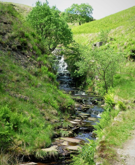
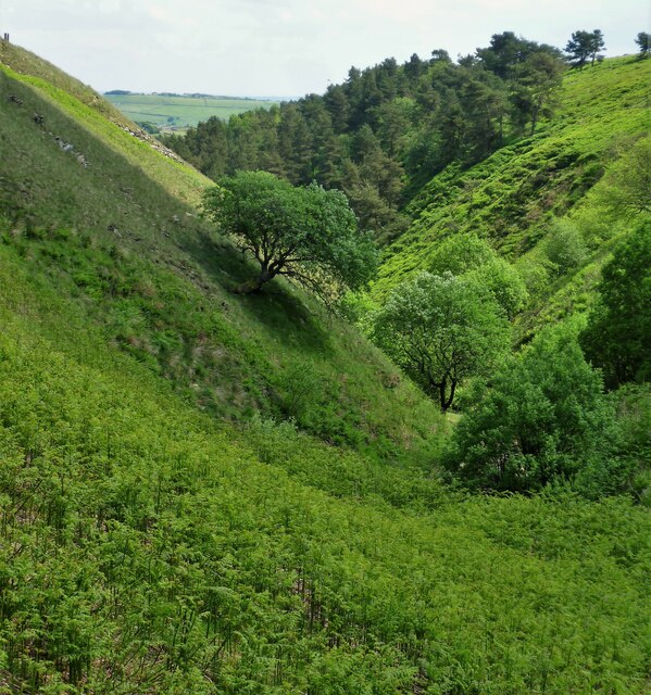
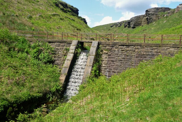
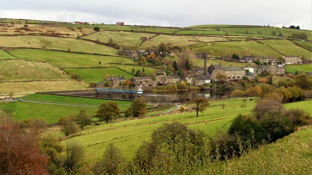
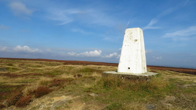
Delf Hill is a notable geographical feature located in the county of Yorkshire, England. Situated in the picturesque region of the Yorkshire Dales, it is categorized as a hill rather than a mountain, with an elevation of approximately 432 meters (1,417 feet). The hill lies within the Yorkshire Dales National Park, which is renowned for its stunning landscapes and rich natural heritage.

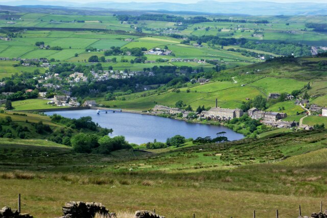
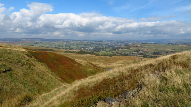
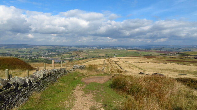
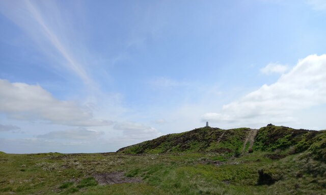
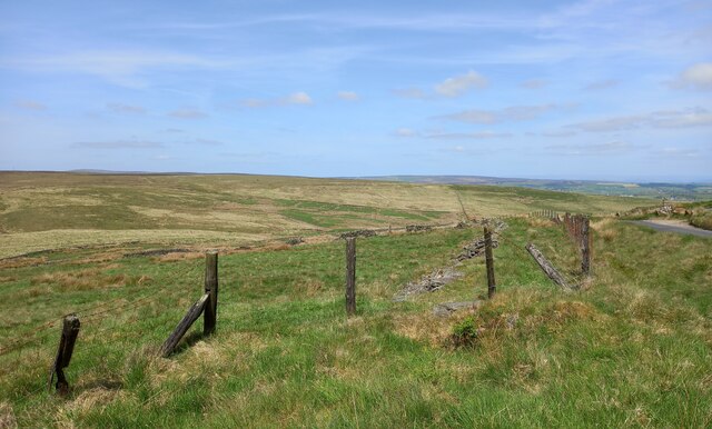
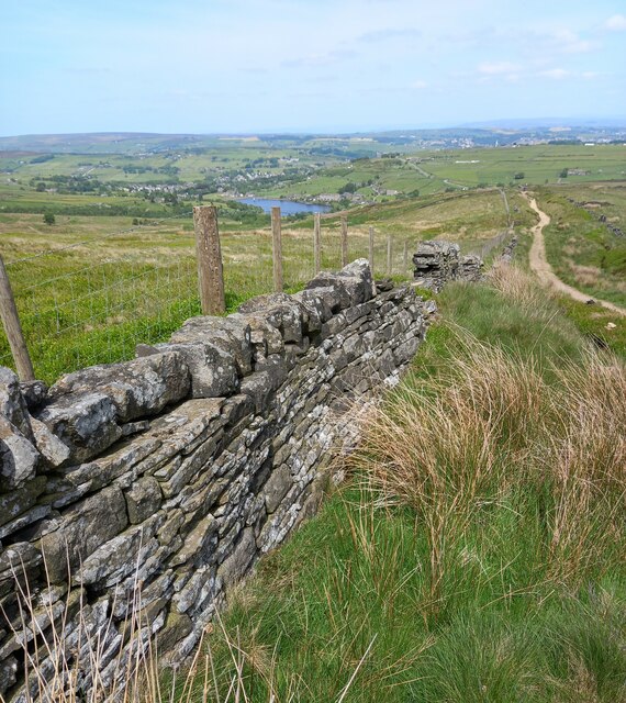
Delf Hill stands as an impressive landmark, attracting both locals and visitors alike. Its distinct shape and prominent position make it easily recognizable from the surrounding area. The hill is characterized by its gentle slopes, which are covered in lush green vegetation during the summer months. Its summit offers panoramic views of the surrounding countryside, providing a breathtaking vista that stretches as far as the eye can see.

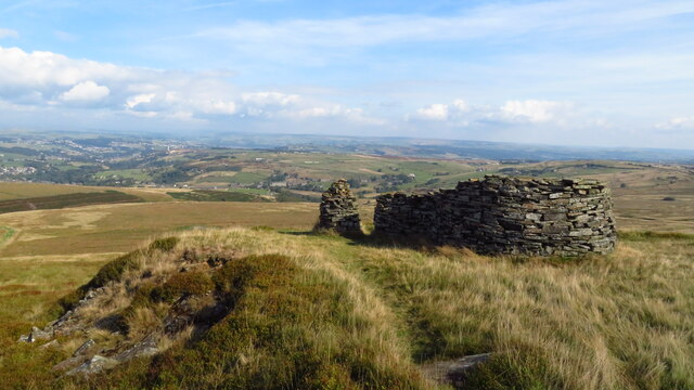
The name "Delf Hill" is believed to have originated from the Old Norse word "delfr," meaning a hollow or excavation. This is likely due to the presence of an ancient quarry that was once active on the hill. The quarry, which is now disused, has left behind visible scars on the hillside, adding to its unique character and historical significance.

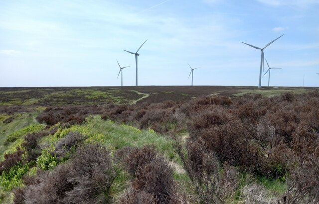
Delf Hill is a popular destination for hikers, nature enthusiasts, and photographers. Its tranquil surroundings and diverse wildlife make it an ideal spot for exploring and immersing oneself in nature. The hill is also home to a variety of plant species, including heather, bracken, and wildflowers, which add vibrant colors to the landscape throughout the year.

Overall, Delf Hill is a cherished natural treasure in Yorkshire, offering a blend of natural beauty, historical value, and recreational opportunities for all who visit.

If you have any feedback on the listing, please let us know in the comments section below.
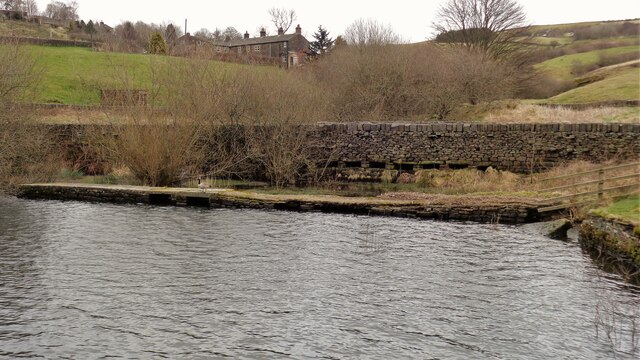
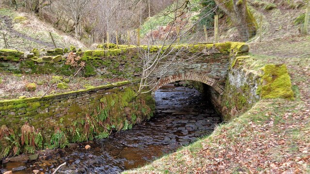
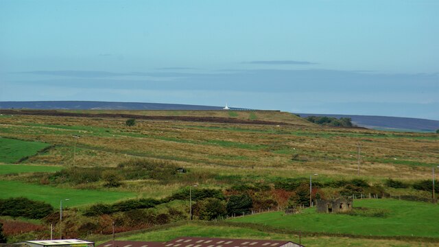
Delf Hill Images

Images are sourced within 2km of 53.796544/-1.9279431 or Grid Reference SE0433. Thanks to Geograph Open Source API. All images are credited.

Weirs in Ogden Clough First of a series of weirs going upstream
Weirs in Ogden Clough
First of a series of weirs going upstream
Ogden Clough from near Waterworks Cascade/Footbridge View down the clough
Ogden Clough from near Waterworks Cascade/Footbridge
View down the clough
Top Weir/Footbridge in Ogden Clough Waterworks weir & footbridge
Top Weir/Footbridge in Ogden Clough
Waterworks weir & footbridge
Leeming from Hambleton Top View from top of Hambleton Lane
Leeming from Hambleton Top
View from top of Hambleton Lane
Thornton Moor Reservoir View to the valve tower from the top of Hambleton Lane
Thornton Moor Reservoir
View to the valve tower from the top of Hambleton Lane
Leeming Reservoir Viewed from near Great Hill House Farm, Oxenhope
Leeming Reservoir
Viewed from near Great Hill House Farm, Oxenhope
Dol Clough feed into Leeming Reservoir A walled track and a what is marked as footbridge at the east end of the reservoir appear to serve as weirs to a settlement pond. The 'footbridge' does not bridge the reservoir, it is more like a long jetty
Dol Clough feed into Leeming Reservoir
A walled track and a what is marked as footbridge at the east end of the reservoir appear to serve as weirs to a settlement pond. The 'footbridge' does not bridge the reservoir, it is more like a long jetty
Bridge over Leeming Reservoir Feed This feed is from Stony Hill and Harden Cloughs. The bridge is used now by the Bronte Way
Bridge over Leeming Reservoir Feed
This feed is from Stony Hill and Harden Cloughs. The bridge is used now by the Bronte Way
Thornton Moor Zoom view from Soil Hill with the A629 road in a cutting with only the lamp-posts visible. The white valve tower roof of Thornton Moor Reservoir is on the skyline
Thornton Moor
Zoom view from Soil Hill with the A629 road in a cutting with only the lamp-posts visible. The white valve tower roof of Thornton Moor Reservoir is on the skyline
Trig Point at Nab Hill, Oxenhope Moor
Stanza Stones sculptures at Nab Rough, Oxenhope Moor
Great Clough, on Nab Hill
Path running north on Hambleton Lane above Sawood
Hollin Hill Trig Point, Oxenhope Moor
Nab Hill, Oxenhope Moor According to the OS benchmark database there was a benchmark cut into a gatepost at this location. The field entrance and the gatepost have gone.
Nab Hill, Oxenhope Moor
According to the OS benchmark database there was a benchmark cut into a gatepost at this location. The field entrance and the gatepost have gone.
Hambleton Lane and Leeming Reservoir According to the 1908 map there was a benchmark at this location, on the west side of the lane and possibly cut into the wall. Nothing was found.
Hambleton Lane and Leeming Reservoir
According to the 1908 map there was a benchmark at this location, on the west side of the lane and possibly cut into the wall. Nothing was found.
Wind Turbines on Thornton Moor According to the OS benchmark database there is a rivet benchmark cut into a rock at this location, on the west side of the footpath. Nothing was found.
Wind Turbines on Thornton Moor
According to the OS benchmark database there is a rivet benchmark cut into a rock at this location, on the west side of the footpath. Nothing was found.
Drystone wall on Thornton Moor According to the OS benchmark database there is a benchmark cut into the east face of the wall. Nothing was found.
Drystone wall on Thornton Moor
According to the OS benchmark database there is a benchmark cut into the east face of the wall. Nothing was found.
Show me another place!

Delf Hill is located at Grid Ref: SE0433 (Lat: 53.796544, Lng: -1.9279431)

Division: West Riding

Unitary Authority: Bradford

Police Authority: West Yorkshire

What 3 Words

///conquests.nuggets.unfilled. Near Denholme, West Yorkshire

Related Wikis

Denholme

Denholme is a town and civil parish in the Bradford Metropolitan Borough, West Yorkshire, England. It is 8 miles (13 km) west of Bradford, 7 miles (11...

Worth Valley

Worth Valley is a ward in the City of Bradford Metropolitan District Council, West Yorkshire. The population of the ward taken at the 2011 Census was 14...

Oxenhope

Oxenhope is a village and civil parish near Keighley in the metropolitan borough of Bradford, West Yorkshire, England. It was historically part of the...

Ovenden Moor Wind Farm

Ovenden Moor Wind Farm is a wind powered electricity generating site in England. Ovenden Moor is located north of Halifax and west of Bradford in West...

Nearby Amenities

Located within 500m of 53.796544,-1.9279431
Barrier: kissing_gate
Lat/Long: 53.7924744/-1.9296403
Natural: spring
Lat/Long: 53.797153/-1.9316089
Natural: spring
Source: local knowledge
Lat/Long: 53.7998508/-1.9271122
Barrier: stile
Lat/Long: 53.7992077/-1.932148
Barrier: stile
Stile: stepover
Lat/Long: 53.7940622/-1.9327994
The data included in this document is from www.openstreetmap.org. The data is made available under ODbL.

Have you been to Delf Hill?

Leave your review of Delf Hill below (or comments, questions and feedback).