High Brown Knoll

Hill, Mountain in Yorkshire

England

High Brown Knoll

Helliwell Wood Farmhouse In Crimsworth Dean
Helliwell Wood Farmhouse Credit: Kevin Waterhouse

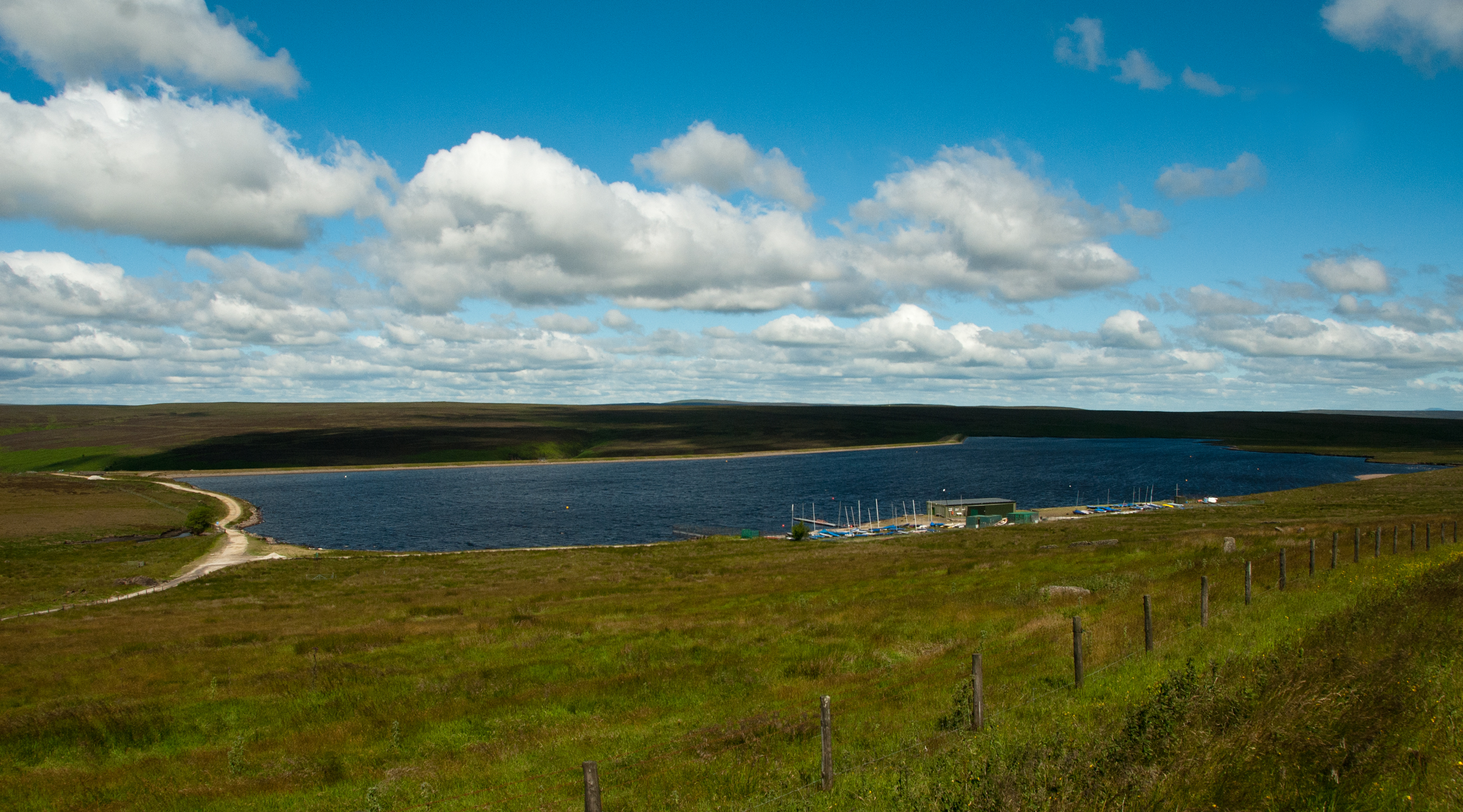
High Brown Knoll is a prominent hill located in the county of Yorkshire, England. Situated in the southern part of the Yorkshire Dales National Park, it is part of the Pennine Range and stands at an elevation of 1,778 feet (542 meters) above sea level. The hill is renowned for its stunning panoramic views of the surrounding countryside and is a popular destination among hikers and nature enthusiasts.

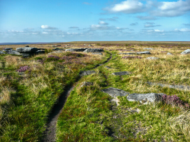
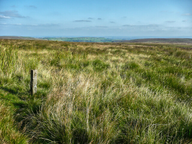
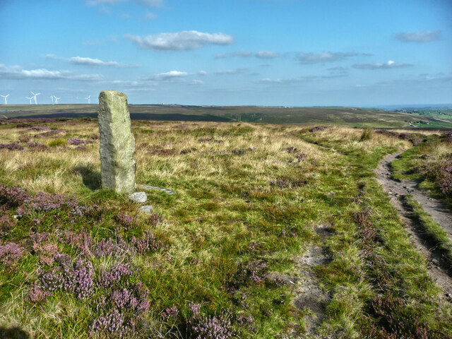
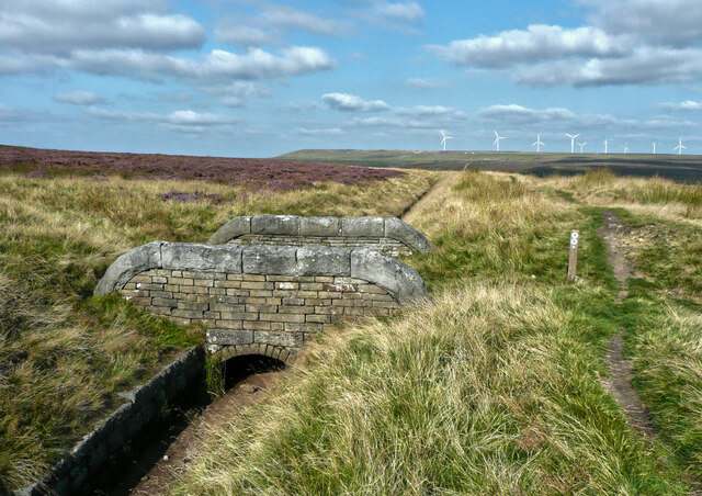
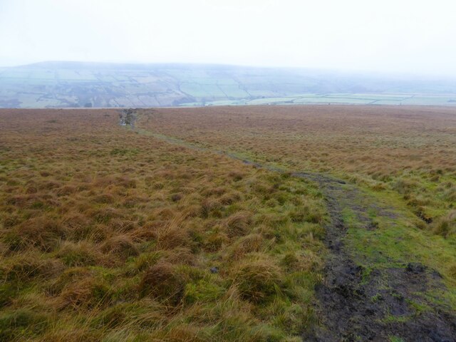
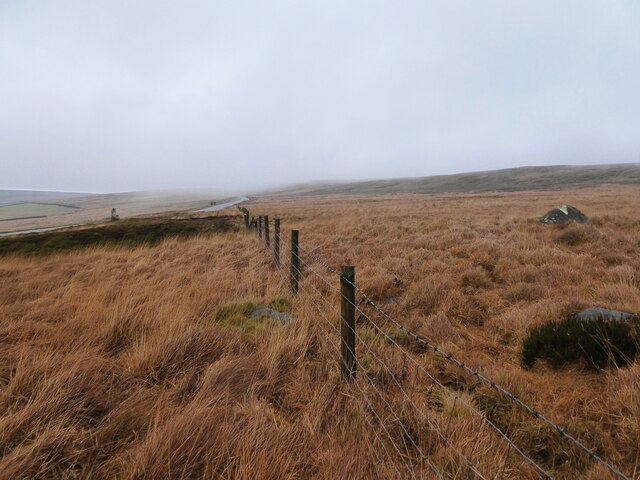
High Brown Knoll is characterized by its rugged terrain, featuring a mixture of grassy slopes, rocky outcrops, and peat bogs. The hill is predominantly covered in heather, creating a beautiful purple hue that blankets the landscape during the summer months. The area is also home to a diverse range of flora and fauna, including various species of birds, mammals, and wildflowers.

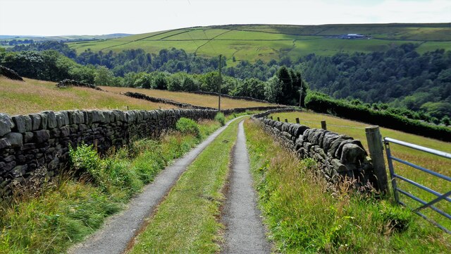
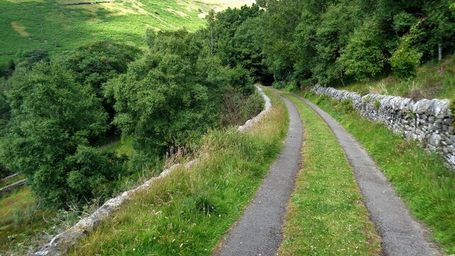
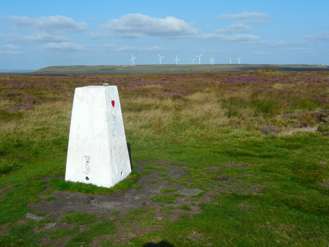
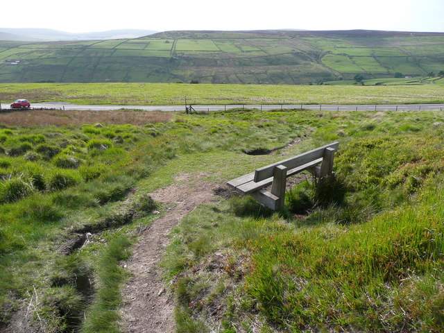
Visitors to High Brown Knoll can access the hill via several footpaths and trails that crisscross the area. One popular route starts from the nearby village of Haworth and takes hikers through picturesque moorland and past ancient stone walls, providing a glimpse into the region's rich history and heritage. At the summit, there is a trig point, offering a perfect spot to rest and take in the breathtaking vistas of the surrounding Yorkshire countryside.

High Brown Knoll is not only a natural beauty but also holds historical significance. It was the site of a Bronze Age burial mound, known as a cairn, which was excavated in the late 19th century. The cairn contained various artifacts, including flint tools and pottery fragments, providing valuable insights into the lives of the people who lived in the area thousands of years ago.

Overall, High Brown Knoll is a captivating destination that combines natural beauty, breathtaking views, and historical intrigue, making it a must-visit location for outdoor enthusiasts and those seeking an escape into the Yorkshire countryside.

If you have any feedback on the listing, please let us know in the comments section below.

High Brown Knoll Images

Images are sourced within 2km of 53.770617/-1.9873399 or Grid Reference SE0030. Thanks to Geograph Open Source API. All images are credited.

Helliwell Wood Farmhouse In Crimsworth Dean
Helliwell Wood Farmhouse
In Crimsworth Dean
Barker Cote Farmhouse Converted to residential
Barker Cote Farmhouse
Converted to residential
Small Shaw Lane Descending into Crimsworth Dean and approaching the first of two hairpin bends to reach the valley bottom
Small Shaw Lane
Descending into Crimsworth Dean and approaching the first of two hairpin bends to reach the valley bottom
Small Shaw Lane Descending into Crimsworth Dean and approaching the second of two hairpin bends to reach the valley bottom
Small Shaw Lane
Descending into Crimsworth Dean and approaching the second of two hairpin bends to reach the valley bottom
Triangulation pillar on High Brown Knoll, Wadsworth The pillar has had a new coat of paint and been given a simple decoration - a red heart. The wind farm on Ovenden Moor is in the distance.
Triangulation pillar on High Brown Knoll, Wadsworth
The pillar has had a new coat of paint and been given a simple decoration - a red heart. The wind farm on Ovenden Moor is in the distance.
Rocks on the summit of High Brown Knoll, Wadsworth It is difficult to decide exactly where the summit is, but the top of the large rock on the left is a likely contender.  This rock looks huge from the triangulation pillar. This is on the present route of Limers Gate; the bridleway, which is now an indistinct narrow path marked by waymark posts, meets it a little way to the north.
Rocks on the summit of High Brown Knoll, Wadsworth
It is difficult to decide exactly where the summit is, but the top of the large rock on the left is a likely contender. This rock looks huge from the triangulation pillar. This is on the present route of Limers Gate; the bridleway, which is now an indistinct narrow path marked by waymark posts, meets it a little way to the north.
Waymark post on the Limers Gate bridleway, Wadsworth This is one of a series of posts on the route of the bridleway, which is now an indistinct path as the main track is now via Wadsworth Lowe (boundary stone) and the triangulation pillar.
Waymark post on the Limers Gate bridleway, Wadsworth
This is one of a series of posts on the route of the bridleway, which is now an indistinct path as the main track is now via Wadsworth Lowe (boundary stone) and the triangulation pillar.
Wadsworth Lowe This standing stone is on the boundary between Wadsworth and Midgley, and is on the present main route of Limers Gate, an old packhorse track, which forks right here. The path to the left is shown on the 1:25000 map as going ENE to the catchment drain.
Wadsworth Lowe
This standing stone is on the boundary between Wadsworth and Midgley, and is on the present main route of Limers Gate, an old packhorse track, which forks right here. The path to the left is shown on the 1:25000 map as going ENE to the catchment drain.
Footbridge over a catchment drain, Midgley This is near the head of the drain, which feeds Warley Moor Reservoir. There is a path along the eastern bank of the drain, and according to the 1:25000 map one parallel to the western bank.
Footbridge over a catchment drain, Midgley
This is near the head of the drain, which feeds Warley Moor Reservoir. There is a path along the eastern bank of the drain, and according to the 1:25000 map one parallel to the western bank.
Castle Carr Estate remains The gatehouse tower is in the centre of this view from the path between the two lodges to the estate. The estate is in Luddenden Dean
Castle Carr Estate remains
The gatehouse tower is in the centre of this view from the path between the two lodges to the estate. The estate is in Luddenden Dean
Castle Carr fountain in operation The gravity-operated fountain is on private land and only operates on a few advertised occasions. Depending which source you consult, it is the second or third highest such fountain in England, with a water jet height quoted as between 100 and 150 feet (c.30-45 metres) . See also <a href="https://www.geograph.org.uk/photo/19883">SE0230 : Fountain, Castle Carr</a>. The fountains were part of a wider landscape of water gardens by John Hogg, c.1870, but mostly now derelict.
Castle Carr fountain in operation
The gravity-operated fountain is on private land and only operates on a few advertised occasions. Depending which source you consult, it is the second or third highest such fountain in England, with a water jet height quoted as between 100 and 150 feet (c.30-45 metres) . See also SE0230 : Fountain, Castle Carr. The fountains were part of a wider landscape of water gardens by John Hogg, c.1870, but mostly now derelict.
Valve chamber for Castle Carr reservoir The octagonal structure, bearing the name of Halifax Corporation Water Works, "Luddenden Valley Extensions" and the date 1870, probably contains valves controlling the fountain immediately below it which was fed from the reservoir immediately above <a href="https://www.geograph.org.uk/photo/1950514">SE0230 : Water Installation at Castle Carr</a>. The larger fountain a little lower down the dean <a href="https://www.geograph.org.uk/photo/7634762">SE0230 : Castle Carr fountain in operation</a> needs a greater head of water and is probably fed from one of the higher reservoirs. The fountains were part of a wider landscape of water gardens by John Hogg but mostly now derelict.
Valve chamber for Castle Carr reservoir
The octagonal structure, bearing the name of Halifax Corporation Water Works, "Luddenden Valley Extensions" and the date 1870, probably contains valves controlling the fountain immediately below it which was fed from the reservoir immediately above SE0230 : Water Installation at Castle Carr. The larger fountain a little lower down the dean SE0230 : Castle Carr fountain in operation needs a greater head of water and is probably fed from one of the higher reservoirs. The fountains were part of a wider landscape of water gardens by John Hogg but mostly now derelict.
Limers Gate The bridleway descending off Naze Hill towards the A6033 Hebden Bridge Road
Limers Gate
The bridleway descending off Naze Hill towards the A6033 Hebden Bridge Road
Robin Delph Flat Rough moorland rising up to Clattering Edge from a disused quarry. There is a gate behind the camera through the fence line in this open access land.
Robin Delph Flat
Rough moorland rising up to Clattering Edge from a disused quarry. There is a gate behind the camera through the fence line in this open access land.
Seat on Limers Gate Overlooking the junction with the A6033 and the Crimsworth Dean valley.
Seat on Limers Gate
Overlooking the junction with the A6033 and the Crimsworth Dean valley.
Waterfall and bridge at Lumb Hole
Gate and stile on Limers Gate, above Crimsworth Dean The A6033 is out of sight, just beyond the gate. This is an ancient packhorse route leading from Lumb Bridge up to High Brown Knoll, and down into Luddenden Dean. Given there is perfectly good bridle gate here, the stile alongside seems superfluous.
Gate and stile on Limers Gate, above Crimsworth Dean
The A6033 is out of sight, just beyond the gate. This is an ancient packhorse route leading from Lumb Bridge up to High Brown Knoll, and down into Luddenden Dean. Given there is perfectly good bridle gate here, the stile alongside seems superfluous.
Gate on Limers Gate, Crimsworth Dean  This is an ancient packhorse route leading from Lumb Bridge up to High Brown Knoll, and down into Luddenden Dean. The section leading up to the gate, running alongside the field boundary is Gib Lane
Gate on Limers Gate, Crimsworth Dean
This is an ancient packhorse route leading from Lumb Bridge up to High Brown Knoll, and down into Luddenden Dean. The section leading up to the gate, running alongside the field boundary is Gib Lane
Show me another place!

High Brown Knoll is located at Grid Ref: SE0030 (Lat: 53.770617, Lng: -1.9873399)

Division: West Riding

Unitary Authority: Calderdale

Police Authority: West Yorkshire

What 3 Words

///earphones.backward.unhappily. Near Hebden Bridge, West Yorkshire

Related Wikis

Wainsgate Baptist Church

Wainsgate Baptist Church is a redundant chapel standing in an elevated position above the town of Hebden Bridge, West Yorkshire, England (grid reference...

Chiserley

Chiserley is a hamlet located on a hilltop near the town of Hebden Bridge, in the county of West Yorkshire, England. The Hamlet falls within the Calder...

Old Town, West Yorkshire

Old Town is a village in Calderdale, West Yorkshire, England. It is situated on a hilltop above Hebden Bridge and across the Hebden valley from Heptonstall...

Wadsworth, West Yorkshire

Wadsworth is a civil parish in the Metropolitan Borough of Calderdale in West Yorkshire, England. It has a population of 1,456, increasing to 1,603 at...

Warley Moor Reservoir

Warley Moor Reservoir, also known as Fly Flatts Reservoir, is a drinking water reservoir in West Yorkshire, England, owned and operated by Yorkshire Water...

Hepton Rural District

Hepton was a rural district in the West Riding of Yorkshire, England, from 1894 to 1974. The district included four civil parishes: Heptonstall, Blackshaw...

Birchcliffe Baptist Church

Birchcliffe Baptist Church is a redundant Baptist chapel in the town of Hebden Bridge, West Yorkshire, England. It was founded by Daniel Taylor in 1764...

Ovenden Moor Wind Farm

Ovenden Moor Wind Farm is a wind powered electricity generating site in England. Ovenden Moor is located north of Halifax and west of Bradford in West...

Nearby Amenities

Located within 500m of 53.770617,-1.9873399
High Brown Knoll
Ele: 443
Natural: peak
Source: survey - gps altitude
Lat/Long: 53.7698565/-1.9870532
Hoyning Stone
Historic: boundary_stone
Lat/Long: 53.769365/-1.9847485
Man Made: survey_point
Lat/Long: 53.769845/-1.9870927
The data included in this document is from www.openstreetmap.org. The data is made available under ODbL.

Have you been to High Brown Knoll?

Leave your review of High Brown Knoll below (or comments, questions and feedback).