Aberdeen Flat

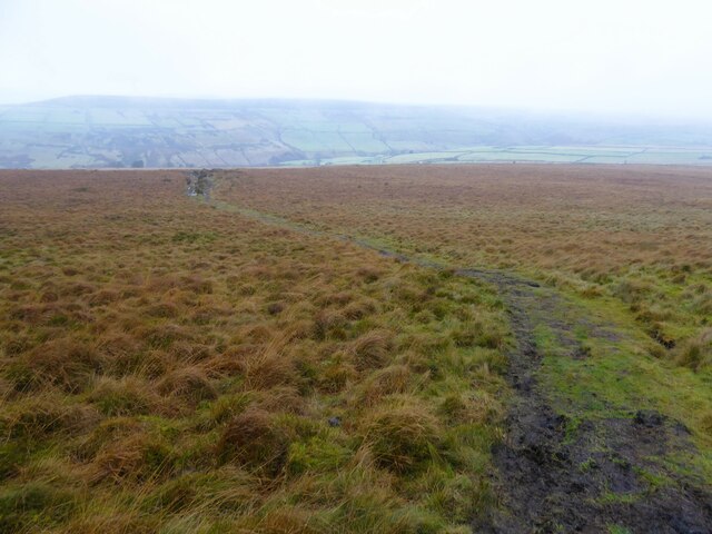
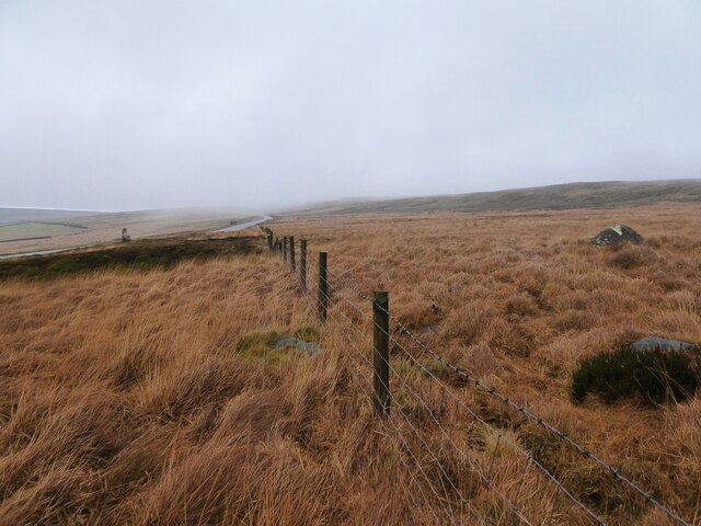
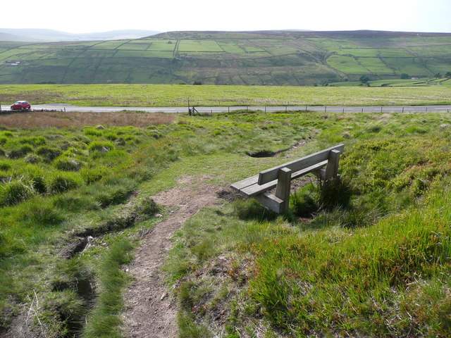
Downs, Moorland in Yorkshire

England

Aberdeen Flat

Abel Cross A pair of wayside marker stones on the slopes above Crimsworth Dean
Abel Cross Credit: Kevin Waterhouse

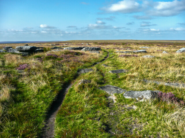
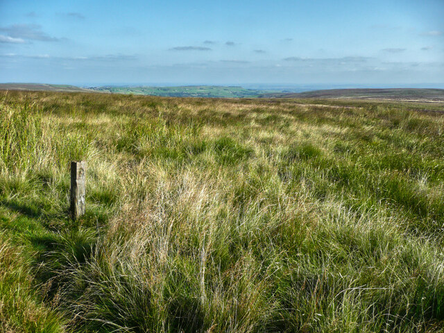
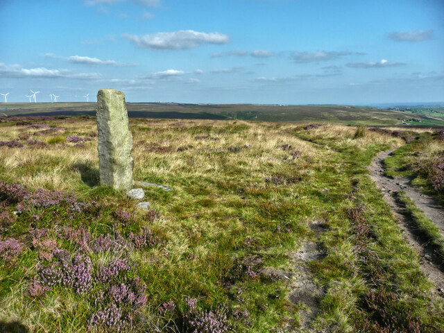
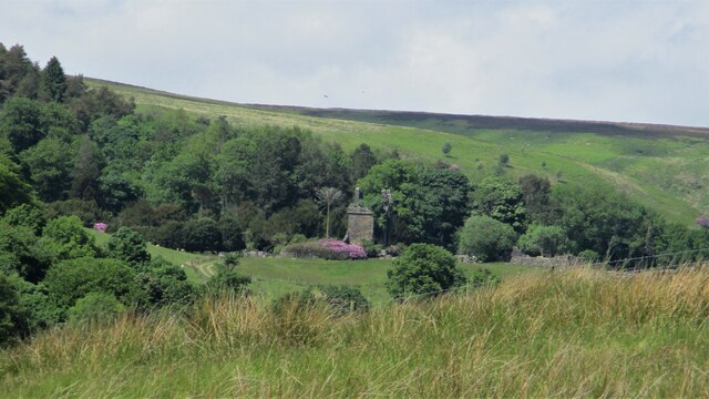
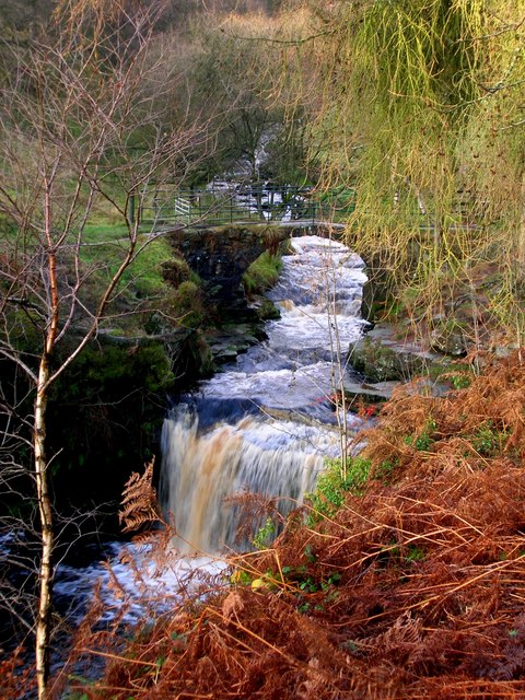
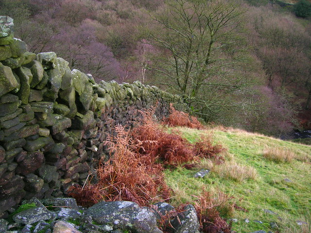
Aberdeen Flat, located in Yorkshire, England, is a picturesque area known for its stunning landscapes and diverse natural features. Situated amidst the Yorkshire Downs and Moorland, this region offers a unique combination of rolling hills, heather-covered moors, and lush green valleys.

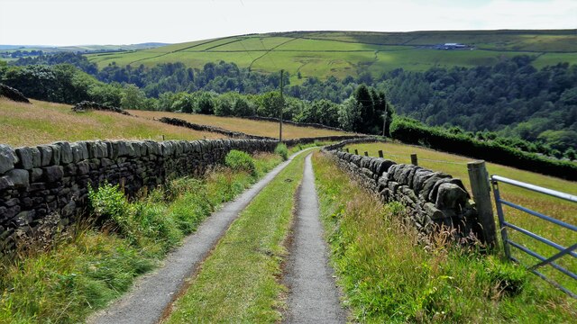
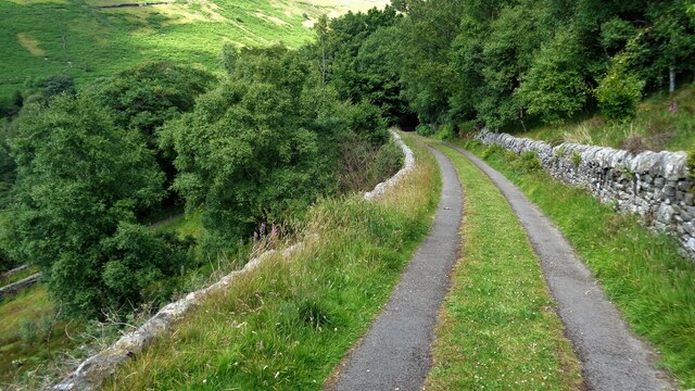
The area is renowned for its captivating beauty, attracting tourists and nature enthusiasts from around the world. The Yorkshire Downs, with their gently undulating hills, provide a scenic backdrop, while the Moorland offers a rugged and wild appeal. Visitors can enjoy long walks and hikes, taking in the breathtaking views of the surrounding countryside.

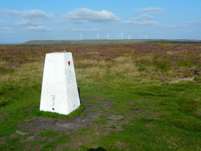
Aberdeen Flat is famous for its vibrant wildlife and rich biodiversity. The moorlands are home to various species of birds, including grouse, curlews, and lapwings, making it a haven for birdwatchers. The area also boasts an abundance of flora, with vibrant heather carpets covering the moors during the summer months.

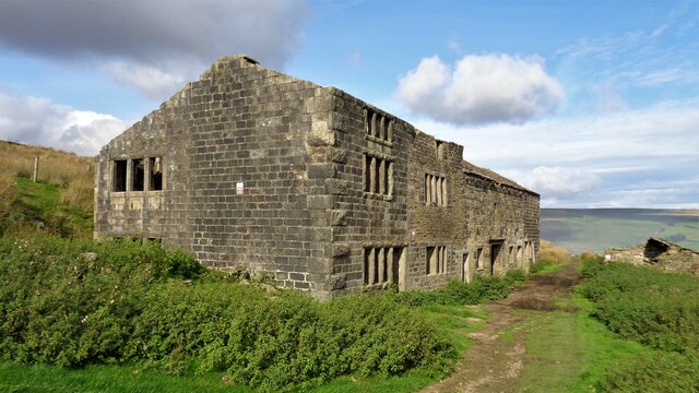
The region's history is deeply intertwined with agriculture, with many traditional farms dotting the landscape. The farming practices in Aberdeen Flat reflect the heritage and traditions of the area, contributing to the preservation of the rural way of life.

For those seeking a peaceful retreat, Aberdeen Flat offers a tranquil escape from the bustle of city life. The quaint villages and small market towns in the vicinity provide a glimpse into the local culture, with charming cottages, friendly locals, and cozy traditional pubs.

In summary, Aberdeen Flat in Yorkshire is a captivating destination, offering a harmonious blend of natural beauty, wildlife, and rural charm. Whether exploring the hills, immersing oneself in the moorland, or simply enjoying the peaceful countryside, this region promises a memorable experience for all who venture here.

If you have any feedback on the listing, please let us know in the comments section below.

Aberdeen Flat Images

Images are sourced within 2km of 53.767723/-1.9987644 or Grid Reference SE0030. Thanks to Geograph Open Source API. All images are credited.

Abel Cross A pair of wayside marker stones on the slopes above Crimsworth Dean
Abel Cross
A pair of wayside marker stones on the slopes above Crimsworth Dean
Helliwell Wood Farmhouse In Crimsworth Dean
Helliwell Wood Farmhouse
In Crimsworth Dean
Barker Cote Farmhouse Converted to residential
Barker Cote Farmhouse
Converted to residential
Aqueduct in Crimsworth Dean The aqueduct connects a dam on the west side of Bridge Clough with one on the east. These dams connect with ones lower down the valley and all appeared to service Midgehole Dye Works
Aqueduct in Crimsworth Dean
The aqueduct connects a dam on the west side of Bridge Clough with one on the east. These dams connect with ones lower down the valley and all appeared to service Midgehole Dye Works
Nook Farmhouse Named Nook on modern OS maps but originally Upper Sunny Bank Farmhouse with a lower Sunny Bank nearby
Nook Farmhouse
Named Nook on modern OS maps but originally Upper Sunny Bank Farmhouse with a lower Sunny Bank nearby
Small Shaw Lane Descending into Crimsworth Dean and approaching the first of two hairpin bends to reach the valley bottom
Small Shaw Lane
Descending into Crimsworth Dean and approaching the first of two hairpin bends to reach the valley bottom
Small Shaw Lane Descending into Crimsworth Dean and approaching the second of two hairpin bends to reach the valley bottom
Small Shaw Lane
Descending into Crimsworth Dean and approaching the second of two hairpin bends to reach the valley bottom
Triangulation pillar on High Brown Knoll, Wadsworth The pillar has had a new coat of paint and been given a simple decoration - a red heart. The wind farm on Ovenden Moor is in the distance.
Triangulation pillar on High Brown Knoll, Wadsworth
The pillar has had a new coat of paint and been given a simple decoration - a red heart. The wind farm on Ovenden Moor is in the distance.
Rocks on the summit of High Brown Knoll, Wadsworth It is difficult to decide exactly where the summit is, but the top of the large rock on the left is a likely contender.  This rock looks huge from the triangulation pillar. This is on the present route of Limers Gate; the bridleway, which is now an indistinct narrow path marked by waymark posts, meets it a little way to the north.
Rocks on the summit of High Brown Knoll, Wadsworth
It is difficult to decide exactly where the summit is, but the top of the large rock on the left is a likely contender. This rock looks huge from the triangulation pillar. This is on the present route of Limers Gate; the bridleway, which is now an indistinct narrow path marked by waymark posts, meets it a little way to the north.
Waymark post on the Limers Gate bridleway, Wadsworth This is one of a series of posts on the route of the bridleway, which is now an indistinct path as the main track is now via Wadsworth Lowe (boundary stone) and the triangulation pillar.
Waymark post on the Limers Gate bridleway, Wadsworth
This is one of a series of posts on the route of the bridleway, which is now an indistinct path as the main track is now via Wadsworth Lowe (boundary stone) and the triangulation pillar.
Wadsworth Lowe This standing stone is on the boundary between Wadsworth and Midgley, and is on the present main route of Limers Gate, an old packhorse track, which forks right here. The path to the left is shown on the 1:25000 map as going ENE to the catchment drain.
Wadsworth Lowe
This standing stone is on the boundary between Wadsworth and Midgley, and is on the present main route of Limers Gate, an old packhorse track, which forks right here. The path to the left is shown on the 1:25000 map as going ENE to the catchment drain.
Footbridge over a catchment drain, Midgley This is near the head of the drain, which feeds Warley Moor Reservoir. There is a path along the eastern bank of the drain, and according to the 1:25000 map one parallel to the western bank.
Footbridge over a catchment drain, Midgley
This is near the head of the drain, which feeds Warley Moor Reservoir. There is a path along the eastern bank of the drain, and according to the 1:25000 map one parallel to the western bank.
Castle Carr Estate remains The gatehouse tower is in the centre of this view from the path between the two lodges to the estate. The estate is in Luddenden Dean
Castle Carr Estate remains
The gatehouse tower is in the centre of this view from the path between the two lodges to the estate. The estate is in Luddenden Dean
Limers Gate The bridleway descending off Naze Hill towards the A6033 Hebden Bridge Road
Limers Gate
The bridleway descending off Naze Hill towards the A6033 Hebden Bridge Road
Robin Delph Flat Rough moorland rising up to Clattering Edge from a disused quarry. There is a gate behind the camera through the fence line in this open access land.
Robin Delph Flat
Rough moorland rising up to Clattering Edge from a disused quarry. There is a gate behind the camera through the fence line in this open access land.
Seat on Limers Gate Overlooking the junction with the A6033 and the Crimsworth Dean valley.
Seat on Limers Gate
Overlooking the junction with the A6033 and the Crimsworth Dean valley.
Waterfall and bridge at Lumb Hole
Drystone wall in Crimsworth Dean
Show me another place!

Aberdeen Flat is located at Grid Ref: SE0030 (Lat: 53.767723, Lng: -1.9987644)

Division: West Riding

Unitary Authority: Calderdale

Police Authority: West Yorkshire

What 3 Words

///flask.defining.series. Near Hebden Bridge, West Yorkshire

Related Wikis

Wainsgate Baptist Church

Wainsgate Baptist Church is a redundant chapel standing in an elevated position above the town of Hebden Bridge, West Yorkshire, England (grid reference...

Chiserley

Chiserley is a hamlet located on a hilltop near the town of Hebden Bridge, in the county of West Yorkshire, England. The Hamlet falls within the Calder...

Old Town, West Yorkshire

Old Town is a village in Calderdale, West Yorkshire, England. It is situated on a hilltop above Hebden Bridge and across the Hebden valley from Heptonstall...

Wadsworth, West Yorkshire

Wadsworth is a civil parish in the Metropolitan Borough of Calderdale in West Yorkshire, England. It has a population of 1,456, increasing to 1,603 at...

Hepton Rural District

Hepton was a rural district in the West Riding of Yorkshire, England, from 1894 to 1974. The district included four civil parishes: Heptonstall, Blackshaw...

Birchcliffe Baptist Church

Birchcliffe Baptist Church is a redundant Baptist chapel in the town of Hebden Bridge, West Yorkshire, England. It was founded by Daniel Taylor in 1764...

Hardcastle Crags

Hardcastle Crags is a wooded Pennine valley in West Yorkshire, England, owned by the National Trust. Historically part of the West Riding of Yorkshire...

Hebden Royd

Hebden Royd is a civil parish in the Metropolitan Borough of Calderdale in West Yorkshire, England. According to the 2001 census it had a population of...

Nearby Amenities

Located within 500m of 53.767723,-1.9987644
Place: farm
Lat/Long: 53.7652814/-2.0011835
Barrier: stile
Lat/Long: 53.7655564/-1.9993718
Barrier: stile
Lat/Long: 53.7672085/-1.9951327
Power: pole
Lat/Long: 53.7647243/-2.0038269
Power: pole
Lat/Long: 53.7651783/-2.0027085
Power: pole
Lat/Long: 53.765671/-2.0015345
The data included in this document is from www.openstreetmap.org. The data is made available under ODbL.

Have you been to Aberdeen Flat?

Leave your review of Aberdeen Flat below (or comments, questions and feedback).