Kenovay

Settlement in Argyllshire

Scotland

Kenovay

Tràigh Bheag East side of Balephetrish Bay, Tiree
Tràigh Bheag Credit: Richard Webb

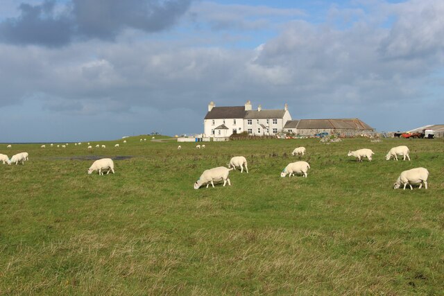
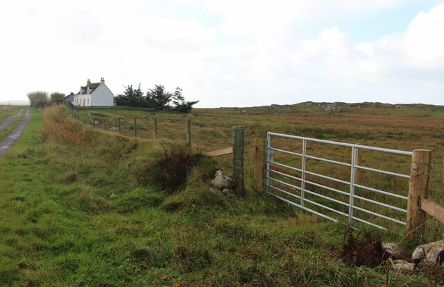
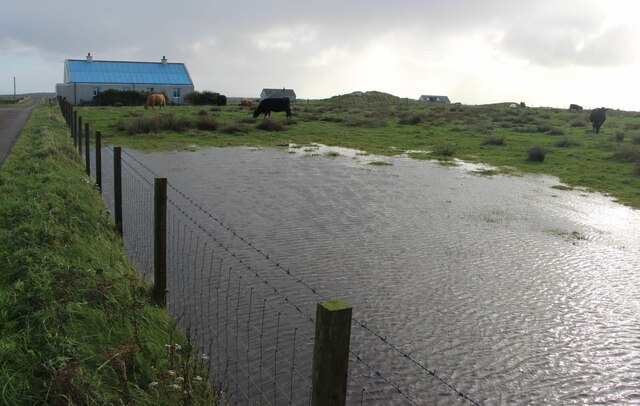
Kenovay is a small village located in Argyllshire, a historic county in the western part of Scotland. Situated on the Isle of Tiree, which is part of the Inner Hebrides, Kenovay is known for its picturesque landscape and its close proximity to the stunning coastline.

With a population of around 100 residents, Kenovay is a tightly-knit community that exudes a sense of tranquility and charm. The village is characterized by traditional Scottish architecture, with quaint cottages and stone buildings scattered throughout the area.

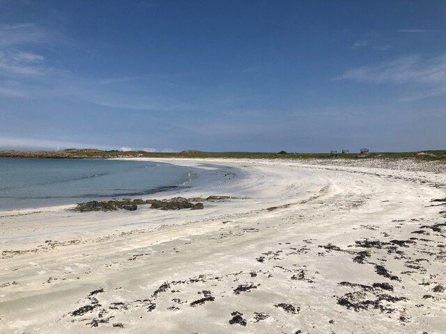
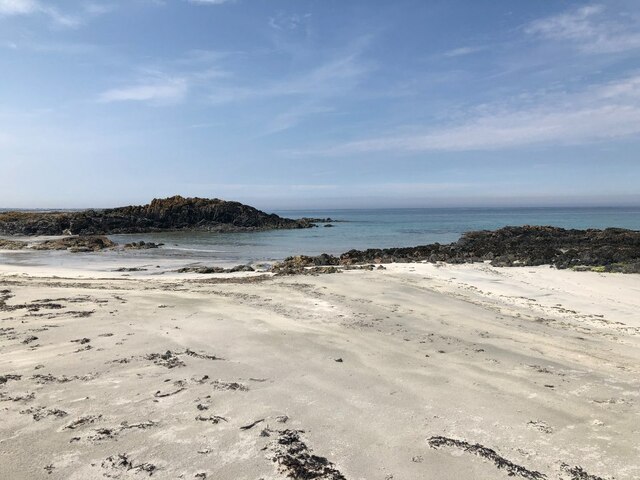
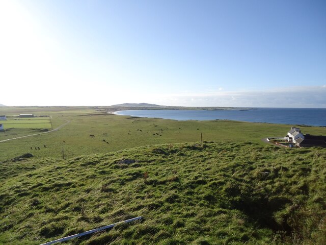
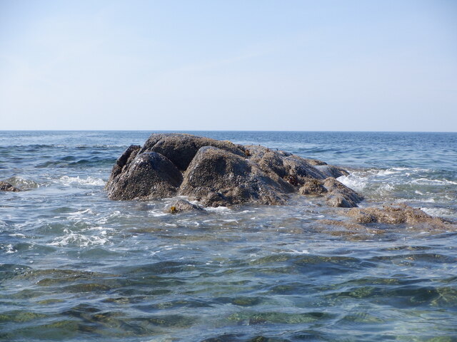
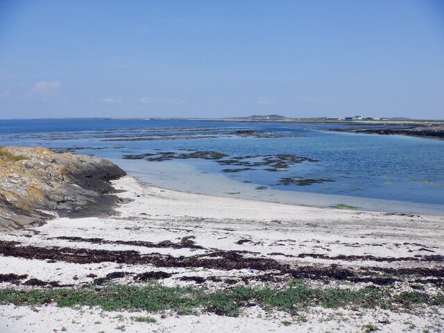
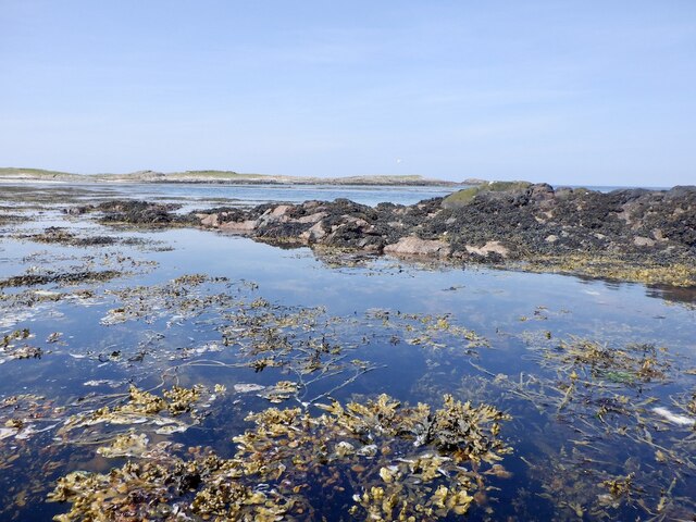
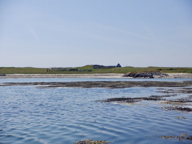
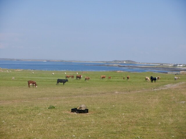
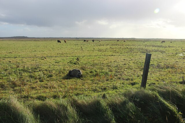
The surrounding natural beauty of Kenovay is truly captivating. The village is surrounded by rolling hills and vast open spaces, making it a haven for outdoor enthusiasts. The nearby coastline boasts breathtaking sandy beaches, such as Balephuil Beach and Soroby Beach, which are popular spots for swimming and water sports.

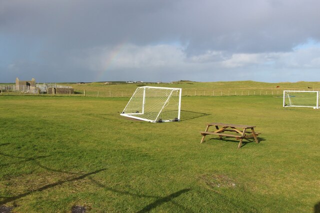
Despite its small size, Kenovay offers a range of amenities for its residents and visitors. There is a local shop and a post office that cater to the daily needs of the community. Additionally, the village is home to a primary school, ensuring that education is readily accessible for families in the area.

Kenovay is well-connected to other parts of the Isle of Tiree, with regular bus services providing transportation links to nearby towns and villages. The village's close proximity to the ferry terminal at Scarinish allows for easy access to the mainland and other Scottish islands.

In summary, Kenovay is a charming village in Argyllshire that offers a peaceful and picturesque setting, surrounded by stunning natural beauty. It provides a tight-knit community, essential amenities, and easy access to the wider region, making it an appealing place to both reside and visit.

If you have any feedback on the listing, please let us know in the comments section below.
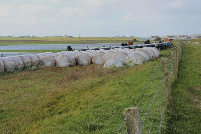
Kenovay Images

Images are sourced within 2km of 56.519093/-6.886973 or Grid Reference NL9947. Thanks to Geograph Open Source API. All images are credited.

Tràigh Bheag East side of Balephetrish Bay, Tiree
Tràigh Bheag
East side of Balephetrish Bay, Tiree
Tràigh Bheag
Tràigh Bheag
From the summit of Balephetrish Hill, Tiree Central and eastern Tiree is very flat, and this hill, though only 36m high, gives an extensive view. In the distance, about 6km away, is Beinn Hough, which at only 119m is the second highest hill on Tiree.
From the summit of Balephetrish Hill, Tiree
Central and eastern Tiree is very flat, and this hill, though only 36m high, gives an extensive view. In the distance, about 6km away, is Beinn Hough, which at only 119m is the second highest hill on Tiree.
Tràigh Bheag, Balephetrish
Crops harvested and baled at Balephetrish
Balephetrish, a farm on north Tiree
Wrack, Port Fada High water, this area dries at low tide.
Wrack, Port Fada
High water, this area dries at low tide.
Sgeir Fada Very little of the skerry emerges from a neap high water. Another rock nearby was also dry.
Sgeir Fada
Very little of the skerry emerges from a neap high water. Another rock nearby was also dry.
Beach at Port Fada Near high water.
Beach at Port Fada
Near high water.
Port Fada Rocks and seaweed near high water. Most of the square dries.
Port Fada
Rocks and seaweed near high water. Most of the square dries.
Beach, Port Fada
Beach, Port Fada
Cattle near Ainshval North coast of Tiree.
Cattle near Ainshval
North coast of Tiree.
A playing field at Tiree High School
A burn draining moorland bogs at Cornaigbeg
House at Cornaigbeg
House at Cornaigbeg
Trees on Tiree As many as you are likely to find.
Trees on Tiree
As many as you are likely to find.
After the downpour A flooded field.
After the downpour
A flooded field.
Tiree aerodrome, the perimeter
Show me another place!

Kenovay is located at Grid Ref: NL9947 (Lat: 56.519093, Lng: -6.886973)

Unitary Authority: Argyll and Bute

Police Authority: Argyll and West Dunbartonshire

What 3 Words

///harp.focal.incensed. Near Scarinish, Argyll & Bute

Related Wikis

Tiree Airport

Tiree Airport (Scottish Gaelic: Port-adhair Thiriodh) (IATA: TRE, ICAO: EGPU) is located 2.5 nautical miles (4.6 km; 2.9 mi) north northeast of Balemartine...

Tiree Music Festival

Tiree Music Festival is a Scottish folk music festival held annually on the Island of Tiree in the Inner Hebrides. The festival was founded in 2010 by...

Tiree

Tiree (; Scottish Gaelic: Tiriodh, pronounced [ˈtʲʰiɾʲəɣ]) is the most westerly island in the Inner Hebrides of Scotland. The low-lying island, southwest...

Dun Mor Vaul

Dun Mor Vaul (or simply Dun Mor; Scottish Gaelic: Dùn Mòr) is an iron-age broch located on the north coast of the island of Tiree, in Scotland. ��2�...

Nearby Amenities

Located within 500m of 56.519093,-6.886973
Source: PGS
Lat/Long: 56.5233833/-6.8877007
Source: PGS
Lat/Long: 56.5229366/-6.887954
Source: PGS
Lat/Long: 56.5225228/-6.8879043
Source: PGS
Lat/Long: 56.5222077/-6.888072
Source: PGS
Lat/Long: 56.5211056/-6.887883
Source: PGS
Lat/Long: 56.5206869/-6.887493
Source: PGS
Lat/Long: 56.519439/-6.8869994
Source: PGS
Lat/Long: 56.5192322/-6.8868994
Source: PGS
Lat/Long: 56.5189814/-6.8863549
Source: PGS
Lat/Long: 56.5186053/-6.8851723
Source: PGS
Lat/Long: 56.5183637/-6.8840408
Source: PGS
Lat/Long: 56.5182531/-6.8832445
Source: PGS
Lat/Long: 56.5181598/-6.882368
Source: PGS
Lat/Long: 56.5180759/-6.8812629
Source: PGS
Lat/Long: 56.5180388/-6.8798899
Passing Place
Lat/Long: 56.5196762/-6.8882675
Passing Place
Lat/Long: 56.5183184/-6.8848834
Passing Place
Lat/Long: 56.5178984/-6.8815905
Barrier: cattle_grid
Lat/Long: 56.5184798/-6.885451
Passing Place
Lat/Long: 56.515816/-6.8863512
Source: OS_OpenData_StreetView
Lat/Long: 56.5182158/-6.8948211
Post Box
Collection Times: Mo-Sa 07:15
Operator: Royal Mail
Post Box Type: lamp
Ref: PA77 108
Royal Cypher: scottish_crown
Lat/Long: 56.51905/-6.8870037
Passing Place
Lat/Long: 56.5198743/-6.8928265
Passing Place
Lat/Long: 56.5196184/-6.8910118
Passing Place
Lat/Long: 56.5178512/-6.879532
Power: pole
Lat/Long: 56.5169384/-6.8805447
Power: pole
Lat/Long: 56.5168704/-6.8818885
Power: pole
Lat/Long: 56.5168112/-6.8832618
Power: pole
Lat/Long: 56.5167668/-6.8843186
Power: pole
Lat/Long: 56.516092/-6.8848202
Power: pole
Lat/Long: 56.5226681/-6.8908465
Power: pole
Lat/Long: 56.5223233/-6.8899955
Power: pole
Lat/Long: 56.5219844/-6.8891783
Power: pole
Lat/Long: 56.5217351/-6.8883737
Power: pole
Lat/Long: 56.5212913/-6.8883188
Power: pole
Lat/Long: 56.5221999/-6.8884434
Power: pole
Lat/Long: 56.5227205/-6.8883315
Power: pole
Lat/Long: 56.518548/-6.8869568
Power: pole
Lat/Long: 56.5179643/-6.8867457
Power: pole
Lat/Long: 56.517609/-6.8866654
Power: pole
Lat/Long: 56.5171593/-6.8866021
Power: pole
Lat/Long: 56.5163893/-6.885958
Power: pole
Lat/Long: 56.5175473/-6.879963
Power: pole
Lat/Long: 56.5172991/-6.8807084
Power: pole
Lat/Long: 56.5171559/-6.8811455
Balephetrish East
Capacity: 3
Drinking Water: no
Note: Tiree Croft Site
Power Supply: no
Ref: 5
Surface: grass
Tourism: camp_pitch
Website: https://www.isleoftiree.com/croft-camping
Lat/Long: 56.5177826/-6.8818389
The data included in this document is from www.openstreetmap.org. The data is made available under ODbL.

Have you been to Kenovay?

Leave your review of Kenovay below (or comments, questions and feedback).