West Creech Hill

Hill, Mountain in Dorset

England

West Creech Hill

Tyneham Cap Tyneham Cap viewed from the coast path to the south.  This land is a military range and normally out of bounds.
Tyneham Cap Credit: Philip Halling

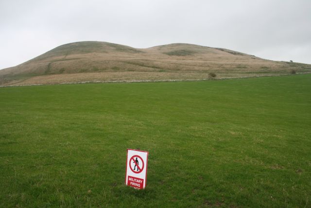
West Creech Hill is a prominent geographical feature located in the county of Dorset, England. Situated within the stunning landscape of the Purbeck Hills, this hill stands at an elevation of approximately 201 meters (659 feet) above sea level. It lies near the village of West Creech, thus deriving its name from the surrounding area.

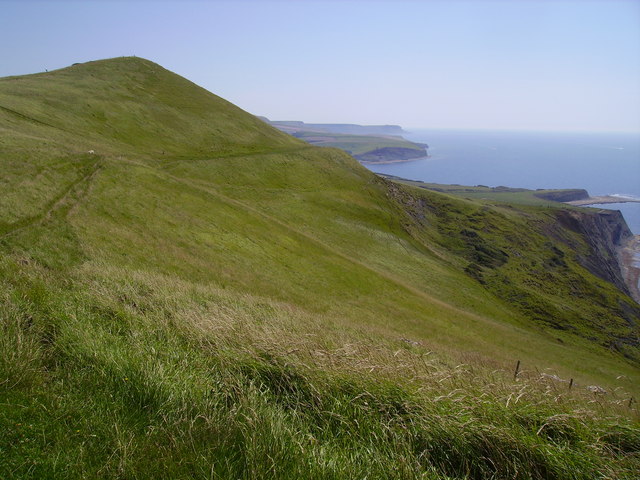
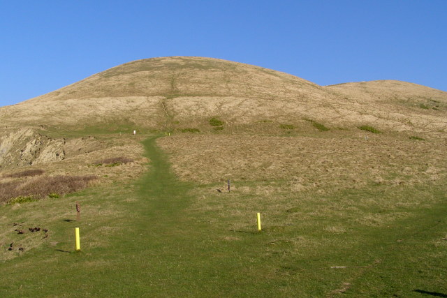
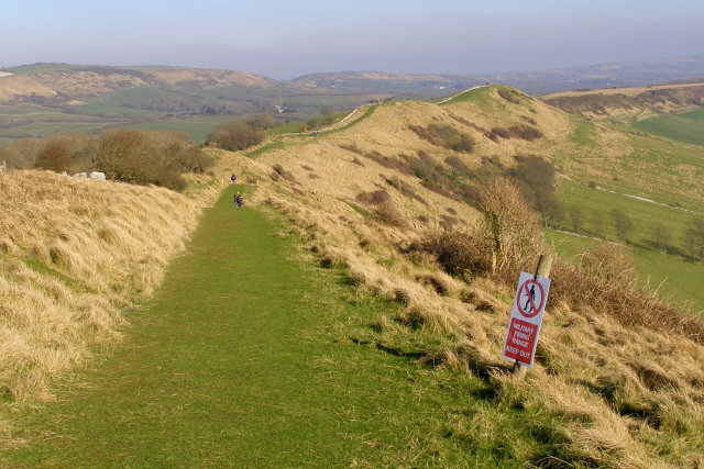
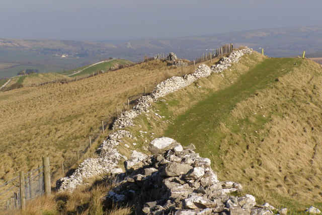
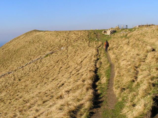
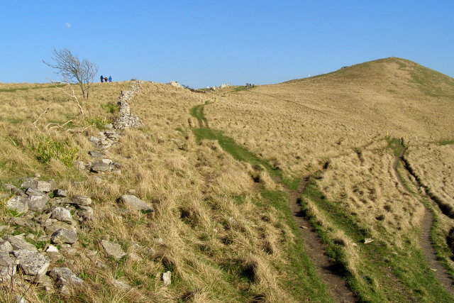
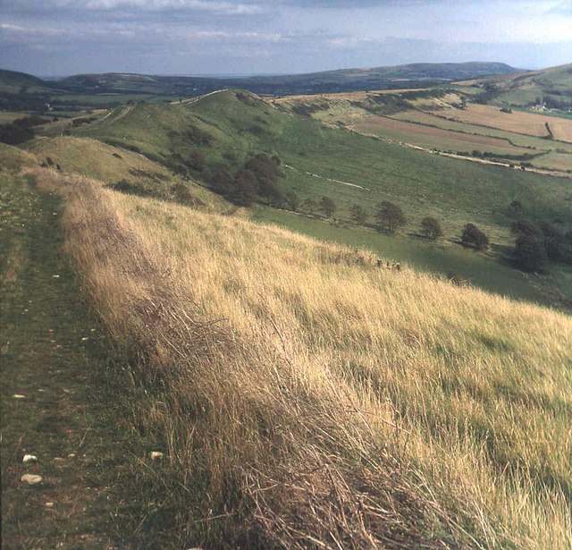
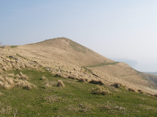
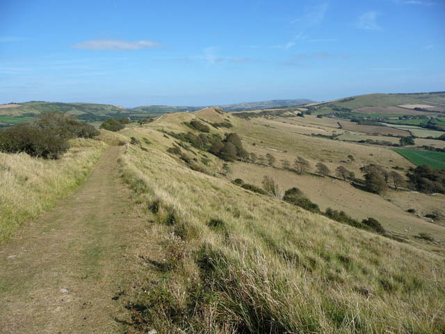
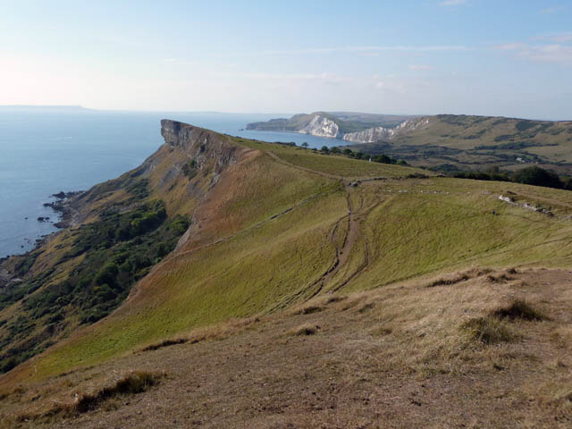
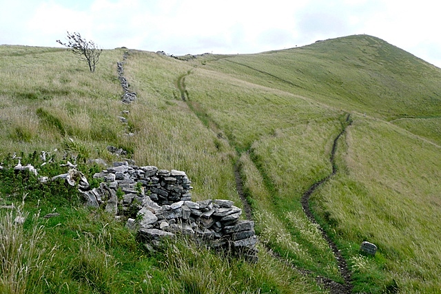
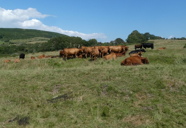
This hill is recognized for its rolling terrain and lush greenery, offering breathtaking panoramic views of the surrounding countryside. Its slopes are covered with a mosaic of vegetation, including grasses, heather, and scattered shrubs, creating a picturesque landscape that attracts both locals and visitors alike.

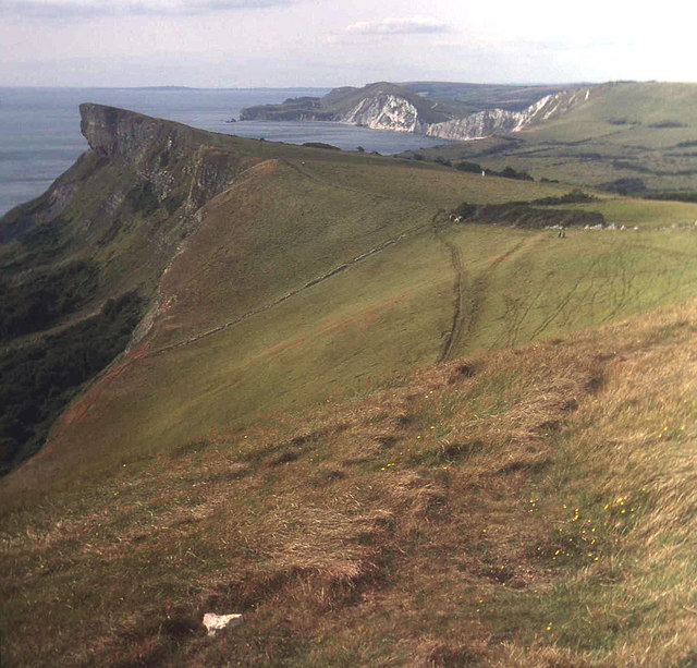
The summit of West Creech Hill offers an excellent vantage point from which to admire the natural beauty of the surrounding area. On a clear day, one can enjoy sweeping vistas of the Dorset coastline, with views extending as far as the Isle of Wight in the distance. The hill is also known for its impressive sunsets, captivating photographers and nature enthusiasts alike.

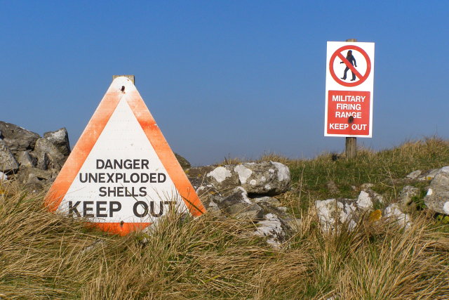
West Creech Hill is a popular destination for outdoor enthusiasts, providing ample opportunities for hiking, walking, and nature exploration. Several well-marked footpaths traverse the hill's slopes, allowing visitors to discover its hidden gems, such as ancient burial mounds and remnants of Iron Age settlements.

This natural landmark serves as a haven for wildlife, with various species of birds, butterflies, and small mammals finding sanctuary in its diverse habitats. It is a protected site, recognized for its ecological importance and contribution to the local biodiversity.

In summary, West Creech Hill is a stunning hill in Dorset, offering visitors a chance to immerse themselves in the natural beauty of the region while enjoying panoramic views and engaging in outdoor activities.

If you have any feedback on the listing, please let us know in the comments section below.

West Creech Hill Images

Images are sourced within 2km of 50.633749/-2.1481037 or Grid Reference SY8981. Thanks to Geograph Open Source API. All images are credited.

Tyneham Cap Tyneham Cap viewed from the coast path to the south.  This land is a military range and normally out of bounds.
Tyneham Cap
Tyneham Cap viewed from the coast path to the south. This land is a military range and normally out of bounds.
Tyneham Cap Taken from the coast path near Hobarrow Bay. The "Ridge Path" runs along the ridge and over these peaks. These paths cross the Lulworth firing ranges and are only open on certain days.
Tyneham Cap
Taken from the coast path near Hobarrow Bay. The "Ridge Path" runs along the ridge and over these peaks. These paths cross the Lulworth firing ranges and are only open on certain days.
Tyneham Cap View of the summit of Tyneham Cap view from the Dorset coast path looking east, with distant view of Kimmeridge bay in distance.
Tyneham Cap
View of the summit of Tyneham Cap view from the Dorset coast path looking east, with distant view of Kimmeridge bay in distance.
Tyneham Cap View north towards Tyneham Cap from the cliff edge above Brandy Bay. The coastal path follows the "Range Walk" up the hill, staying between the yellow marker posts.
Tyneham Cap
View north towards Tyneham Cap from the cliff edge above Brandy Bay. The coastal path follows the "Range Walk" up the hill, staying between the yellow marker posts.
View northeast along the ridge from Tyneham Cap This path is one of the Range Walks, descending along the Purbeck limestone ridge from the heights of Tyneham Cap. In the distance are the Purbeck Hills, a chalk ridge that runs parallel to, and to the north of, the limestone ridge. The notch in the chalk ridge is at Corfe Castle, where the Corfe River cuts through on its way to Poole Harbour.
View northeast along the ridge from Tyneham Cap
This path is one of the Range Walks, descending along the Purbeck limestone ridge from the heights of Tyneham Cap. In the distance are the Purbeck Hills, a chalk ridge that runs parallel to, and to the north of, the limestone ridge. The notch in the chalk ridge is at Corfe Castle, where the Corfe River cuts through on its way to Poole Harbour.
View along the Ridge, Tyneham Cap This drystone wall follows the top of the Purbeck limestone ridge, with one of the Lulworth Range Walks following it on the southern (right) side. In the far distance is the Purbeck Hills chalk ridge, and the ruins of Corfe Castle are just about visible through the haze.
View along the Ridge, Tyneham Cap
This drystone wall follows the top of the Purbeck limestone ridge, with one of the Lulworth Range Walks following it on the southern (right) side. In the far distance is the Purbeck Hills chalk ridge, and the ruins of Corfe Castle are just about visible through the haze.
Warning signs, west of Tyneham Cap These warning signs are typical of those found throughout the Lulworth Range, alongside the waymarked Range Walks. Apparently there have been very few instances of civilians being injured by ordnance on the Lulworth range (something to do with fossil hunters in a quarry) - the Range Walks are checked for hazards by the MOD before they are opened to the public. The gunnery generally goes on to the north of the Purbeck chalk ridge, but there is danger of ricochet in this area to the south.
Warning signs, west of Tyneham Cap
These warning signs are typical of those found throughout the Lulworth Range, alongside the waymarked Range Walks. Apparently there have been very few instances of civilians being injured by ordnance on the Lulworth range (something to do with fossil hunters in a quarry) - the Range Walks are checked for hazards by the MOD before they are opened to the public. The gunnery generally goes on to the north of the Purbeck chalk ridge, but there is danger of ricochet in this area to the south.
Coast path between Tyneham Cap and Gad Cliff This path is one of the Range Walks, and also part of the coastal path. The slope down to the left leads down to the cliffs at the north end of Brandy Bay. Straight ahead is the eastern end of Gad Cliff. The walker is approaching a drystone bench that looks out over Brandy Bay and Long Ebb.
Coast path between Tyneham Cap and Gad Cliff
This path is one of the Range Walks, and also part of the coastal path. The slope down to the left leads down to the cliffs at the north end of Brandy Bay. Straight ahead is the eastern end of Gad Cliff. The walker is approaching a drystone bench that looks out over Brandy Bay and Long Ebb.
Tyneham Cap from the west The Range Walk path splits here, with the left branch climbing up to Tyneham Cap (the pointy hill on the right) and the right branch continuing along the coast of Brandy Bay towards Broad Bench. The three figures on the left are likely to explode at any moment. Above the tree on the left is a waxing gibbous moon.
Tyneham Cap from the west
The Range Walk path splits here, with the left branch climbing up to Tyneham Cap (the pointy hill on the right) and the right branch continuing along the coast of Brandy Bay towards Broad Bench. The three figures on the left are likely to explode at any moment. Above the tree on the left is a waxing gibbous moon.
Ridge path above South Egliston Looking east along the path which follows the gentle curve of the Purbeck stone ridge above Kimmeridge village (just visible on the extreme right). The second curving ridge beyond this one is the Purbeck Hills chalk ridge, ending on the right at Brenscombe Hill and Nine Barrow Down above Corfe and Swanage.
Ridge path above South Egliston
Looking east along the path which follows the gentle curve of the Purbeck stone ridge above Kimmeridge village (just visible on the extreme right). The second curving ridge beyond this one is the Purbeck Hills chalk ridge, ending on the right at Brenscombe Hill and Nine Barrow Down above Corfe and Swanage.
Path junction at Tyneham Cap From near the ridge looking east across the Purbeck stone of Gad Cliff to the chalk cliffs at Wolbarrow Bay. Portland Bill in the distance on the left. Ahead is the meeting of the ridge path (right) and the coast path (coming up from below).
Path junction at Tyneham Cap
From near the ridge looking east across the Purbeck stone of Gad Cliff to the chalk cliffs at Wolbarrow Bay. Portland Bill in the distance on the left. Ahead is the meeting of the ridge path (right) and the coast path (coming up from below).
Tyneham Cap
Tyneham Cap
View along the Purbeck limestone ridge Looking downhill from a point near Tyneham Cap.
View along the Purbeck limestone ridge
Looking downhill from a point near Tyneham Cap.
View towards Gad Cliff and Worbarrow Bay from Tyneham Cap From a distance Gad Cliff seems to hang dramatically over the under-cliff below.
View towards Gad Cliff and Worbarrow Bay from Tyneham Cap
From a distance Gad Cliff seems to hang dramatically over the under-cliff below.
Tyneham Cap A small ridge between the first ascent from the coast and the Tyneham valley behind.  Routes in the area are confusing and tracks proliferate.
Tyneham Cap
A small ridge between the first ascent from the coast and the Tyneham valley behind. Routes in the area are confusing and tracks proliferate.
Cows resting at Tyneham Farm
Approaching the lost village of Tyneham
Inside the shepherd's cottage at Tyneham
Show me another place!

West Creech Hill is located at Grid Ref: SY8981 (Lat: 50.633749, Lng: -2.1481037)

Unitary Authority: Dorset

Police Authority: Dorset

What 3 Words

///spud.include.charge. Near Wareham, Dorset

Related Wikis

Povington Hill

Povington Hill, at 198 metres (650 ft) high, is one of the highest points on the chain of the Purbeck Hills in south Dorset on the southern coast of England...

Povington Priory

Povington Priory was a Benedictine priory in Tyneham, Dorset, England. It was established as an alien priory of the Abbey of Bec. This term could mean...

Steeple, Dorset

Steeple is a hamlet and former civil parish, now in the civil parish of Steeple with Tyneham, in the Purbeck district of the English county of Dorset....

Creech Grange

Creech Grange is a country house in Steeple, south of Wareham in Dorset at the foot of the Purbeck Hills. Historic England designate it as a Grade I listed...

Nearby Amenities

Located within 500m of 50.633749,-2.1481037
Give Way
Direction: forward
Lat/Long: 50.6346664/-2.141285
Give Way
Direction: forward
Lat/Long: 50.6347933/-2.1413326
Give Way
Direction: backward
Lat/Long: 50.634708/-2.141576
West Creech Hill
Ele: 174
Natural: peak
Source: OS OpenData StreetView
Lat/Long: 50.6334489/-2.150212
Crossing: informal
Lat/Long: 50.6334278/-2.1493926
The data included in this document is from www.openstreetmap.org. The data is made available under ODbL.

Have you been to West Creech Hill?

Leave your review of West Creech Hill below (or comments, questions and feedback).