Summer-house Hill

Hill, Mountain in Yorkshire

England

Summer-house Hill

The Pennine Way on Sleightholme Moor
The Pennine Way on Sleightholme Moor Credit: Dave Kelly

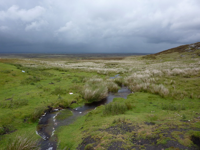
Summer-house Hill is a prominent hill located in the picturesque region of Yorkshire, England. Situated amidst the rolling countryside, it is renowned for its breathtaking natural beauty and panoramic views. With an elevation of approximately 400 meters, it is classified as a hill rather than a mountain, but its imposing presence and commanding position make it a popular destination for outdoor enthusiasts and nature lovers.

The hill gets its name from a small summer house that was once situated on its summit, offering a tranquil retreat for visitors to enjoy the stunning vistas. Although the summer house no longer stands today, the hill itself continues to attract hikers, walkers, and photographers who are drawn to its scenic splendor.

Covered in lush greenery, Summer-house Hill is home to a diverse range of flora and fauna. The surrounding area features a patchwork of fields, woodlands, and meadows, creating a rich and varied ecosystem. Visitors can expect to encounter a variety of wildlife, including birds, butterflies, and small mammals, as they explore the hill and its surroundings.

The hill is accessible via well-maintained footpaths, which wind their way through the enchanting countryside. As visitors ascend, they are rewarded with breathtaking views of the surrounding landscape, including the picturesque Yorkshire Dales and charming villages nestled in the valley below.

Whether it's a leisurely stroll or a challenging hike, Summer-house Hill offers something for everyone. With its natural beauty and captivating vistas, it is a must-visit destination for those seeking a true Yorkshire experience.

If you have any feedback on the listing, please let us know in the comments section below.

Summer-house Hill Images

Images are sourced within 2km of 54.457386/-2.1617108 or Grid Reference NY8906. Thanks to Geograph Open Source API. All images are credited.

The Pennine Way on Sleightholme Moor
Pennine Way in Sleigtholme Moor
Bridleway near the Tan Hill Inn The bridleway takes walkers and riders towards Mirk Fell Edge.
Bridleway near the Tan Hill Inn
The bridleway takes walkers and riders towards Mirk Fell Edge.
Tan Hill Inn This desolate pub, 1732 feet above sea-level and thus the highest in Britain.  The pub was first established to serve the King's Pit, and indeed bore that name itself until the mine closed in 1932.  The nearest village is five miles away.
Tan Hill Inn
This desolate pub, 1732 feet above sea-level and thus the highest in Britain. The pub was first established to serve the King's Pit, and indeed bore that name itself until the mine closed in 1932. The nearest village is five miles away.
Bench Mark, Tan Hill Inn The bench mark is to be found on the south face of the building.  For a view of the inn <a href="https://www.geograph.org.uk/photo/2403237">NY8906 : Tan Hill Inn</a> and for further information on the cut mark and others in the area <span class="nowrap"><a title="http://www.bench-marks.org.uk/bm37902" rel="nofollow ugc noopener" href="http://www.bench-marks.org.uk/bm37902">Link</a><img style="margin-left:2px;" alt="External link" title="External link - shift click to open in new window" src="https://s1.geograph.org.uk/img/external.png" width="10" height="10"/></span>
Bench Mark, Tan Hill Inn
The bench mark is to be found on the south face of the building. For a view of the inn NY8906 : Tan Hill Inn and for further information on the cut mark and others in the area LinkExternal link
Sign for the Tan Hill Inn The pub was first established to serve the King's Pit, and indeed bore that name itself until the mine closed in 1932.  For a wider view of the inn <a href="https://www.geograph.org.uk/photo/2403237">NY8906 : Tan Hill Inn</a>
Sign for the Tan Hill Inn
The pub was first established to serve the King's Pit, and indeed bore that name itself until the mine closed in 1932. For a wider view of the inn NY8906 : Tan Hill Inn
Red Grouse (Lagopus lagopus scoticus) It is reported that about 2,500,000 birds were shot in Britain in 1911 and, although grouse shooting remains popular amongst a certain class, numbers shot have since declined to about 400,000 a year.
Red Grouse (Lagopus lagopus scoticus)
It is reported that about 2,500,000 birds were shot in Britain in 1911 and, although grouse shooting remains popular amongst a certain class, numbers shot have since declined to about 400,000 a year.
Footpath near the Tan Hill Inn The footpath takes walkers to Ravenseat some three miles distant.
Footpath near the Tan Hill Inn
The footpath takes walkers to Ravenseat some three miles distant.
Swaledale sheep near Tan Hill These sheep are well suited to the exposed regions in which they live, the Swaledales are hardy, thick fleeced, able bodied, and bold. The ewes make excellent mothers and are known for being able to rear lambs well, even in adverse conditions. They are of a medium build, with black faces, sometimes marked with white, and both males and females grow curled horns. Their fleeces are thick, straight, and coarse, and are of a uniform white colour. The wool they produce is durable and resilient, and is used for a number of applications.
Swaledale sheep near Tan Hill
These sheep are well suited to the exposed regions in which they live, the Swaledales are hardy, thick fleeced, able bodied, and bold. The ewes make excellent mothers and are known for being able to rear lambs well, even in adverse conditions. They are of a medium build, with black faces, sometimes marked with white, and both males and females grow curled horns. Their fleeces are thick, straight, and coarse, and are of a uniform white colour. The wool they produce is durable and resilient, and is used for a number of applications.
Lambing pen, High Brown Hill The area fenced off appears to be a sheepfold and lambing pen.
Lambing pen, High Brown Hill
The area fenced off appears to be a sheepfold and lambing pen.
Tan Hill Inn Highest public house in Great Britain. <span class="nowrap"><a title="http://www.tanhillinn.com/history-of-tan-hill/10/" rel="nofollow ugc noopener" href="http://www.tanhillinn.com/history-of-tan-hill/10/">Link</a><img style="margin-left:2px;" alt="External link" title="External link - shift click to open in new window" src="https://s1.geograph.org.uk/img/external.png" width="10" height="10"/></span>
Tan Hill Inn
Highest public house in Great Britain. LinkExternal link
It looks good enough to drive a car on Pennine Way heading south from Tan Hill Inn
It looks good enough to drive a car on
Pennine Way heading south from Tan Hill Inn
Long Causeway east of Tan Hill Inn
Tan Hill Inn <span class="nowrap"><a title="http://www.tanhillinn.com/history-of-tan-hill/10/" rel="nofollow ugc noopener" href="http://www.tanhillinn.com/history-of-tan-hill/10/">Link</a><img style="margin-left:2px;" alt="External link" title="External link - shift click to open in new window" src="https://s1.geograph.org.uk/img/external.png" width="10" height="10"/></span>
Tan Hill Inn
Seavy Sike, Tan Hill
Thomas Gill Waterfall After meeting up with Tongue Gill, Thomas Gill flows through a narrow ravine the south side of which is very shaley and unstable.
This is a fine waterfall. A footpath from Tan Hill to Ravenseat follows the southern edge.
Thomas Gill Waterfall
After meeting up with Tongue Gill, Thomas Gill flows through a narrow ravine the south side of which is very shaley and unstable. This is a fine waterfall. A footpath from Tan Hill to Ravenseat follows the southern edge.
A suitable registration This car had a suitable number plate for this well-known pub.
A suitable registration
This car had a suitable number plate for this well-known pub.
Show me another place!

Summer-house Hill is located at Grid Ref: NY8906 (Lat: 54.457386, Lng: -2.1617108)

Division: North Riding

Unitary Authority: County Durham

Police Authority: Durham

What 3 Words

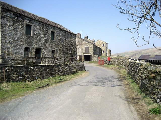
///glass.trimmer.cassettes. Near Bowes, Co. Durham

Nearby Locations

Tan Hill Summer-house Hill

Related Wikis

Tan Hill, North Yorkshire

Tan Hill (NY896067) is a high point on the Pennine Way in the Richmondshire district of North Yorkshire, England. It lies north of Keld in the civil parish...

Walney to Wear and Whitby Cycle Route

The Walney to Wear and Whitby Cycle Route (or W2W) is the name of a cross-country cycle route in Northern England. It runs from Walney Island in Cumbria...

National Cycle Route 70

National Cycle Network (NCN) Route 70 is a Sustrans National Route that runs from Walney Island in Cumbria to Sunderland. The route is fully open and signed...

Rogan's Seat

Rogan's Seat is a remote hill located near East Stonesdale and Gunnerside Gill, in the Yorkshire Dales in England. It is a high expanse of moorland that...

Bowes Moor

Bowes Moor is a Site of Special Scientific Interest in the County Durham district in south-west County Durham, England. It is an extensive area of moorland...

West Stonesdale

West Stonesdale is a hamlet in the Yorkshire Dales, North Yorkshire, England. The secluded village is near Keld to the south, Tan Hill to the north and...

Rey Cross

Rey Cross is the remains of a stone cross at Stainmore. It is also known as Rere Cross and is a Grade II* listed structure and a scheduled monument. It...

Wain Wath Force

Wain Wath Force is a waterfall on the River Swale in the Yorkshire Dales National Park, North Yorkshire, England. The falls are at grid reference NY883015...

Nearby Amenities

Located within 500m of 54.457386,-2.1617108
Barrier: cattle_grid
Lat/Long: 54.4554198/-2.1591536
Clay Hill
Place: locality
Source: Bing
Lat/Long: 54.4564976/-2.1555279
Drygill Head
Place: locality
Source: Bing
Lat/Long: 54.4592551/-2.1649874
Summer-House Hill
Natural: peak
Source: Bing
Lat/Long: 54.45737/-2.1617637
Yard Loup
Place: locality
Source: Bing
Lat/Long: 54.4583868/-2.1687848
Barrier: stile
Lat/Long: 54.4555123/-2.1592681
Abandoned: yes
Historic: mine_shaft
Man Made: mineshaft
Mineral: coal
Lat/Long: 54.4543047/-2.156419
Abandoned: yes
Historic: mine_shaft
Man Made: mineshaft
Mineral: coal
Lat/Long: 54.4544496/-2.165319
Abandoned: yes
Historic: mine_shaft
Man Made: mineshaft
Mineral: coal
Lat/Long: 54.4543654/-2.1660111
Abandoned: yes
Historic: mine_shaft
Man Made: mineshaft
Mineral: coal
Lat/Long: 54.4572609/-2.1653298
Abandoned: yes
Historic: mine_shaft
Man Made: mineshaft
Mineral: coal
Lat/Long: 54.4572578/-2.162712
Give Way
Lat/Long: 54.4555381/-2.1620339
Tan Hill
Ele: 526
Natural: peak
Source: OS OpenData StreetView (April 2016);aerial imagery
Wikidata: Q7682052
Wikipedia: en:Tan Hill, North Yorkshire
Lat/Long: 54.4560423/-2.1611445
Abandoned: yes
Historic: mine_shaft
Man Made: mineshaft
Mineral: coal
Lat/Long: 54.4555068/-2.1647925
Abandoned: yes
Historic: mine_shaft
Man Made: mineshaft
Mineral: coal
Lat/Long: 54.4557157/-2.1655811
Abandoned: yes
Historic: mine_shaft
Man Made: mineshaft
Mineral: coal
Lat/Long: 54.4555037/-2.1628559
Information: guidepost
Tourism: information
Lat/Long: 54.4531284/-2.1638151
The data included in this document is from www.openstreetmap.org. The data is made available under ODbL.

Have you been to Summer-house Hill?

Leave your review of Summer-house Hill below (or comments, questions and feedback).