Bleatapow Hill

Hill, Mountain in Westmorland Eden

England

Bleatapow Hill

Footpath in groove en route for Nine Standards Rigg The path, seen looking to the west - downhill - is one of the main routes to the summit of Nine Standards Rigg and is a variant of the 'Coast to Coast' long distance path.
Footpath in groove en route for Nine Standards Rigg Credit: Trevor Littlewood

Bleatapow Hill is a prominent hill located in the historic county of Westmorland, in the northwestern region of England. Situated in the Lake District National Park, it is a popular destination for hikers and nature enthusiasts, offering breathtaking panoramic views of the surrounding landscape.

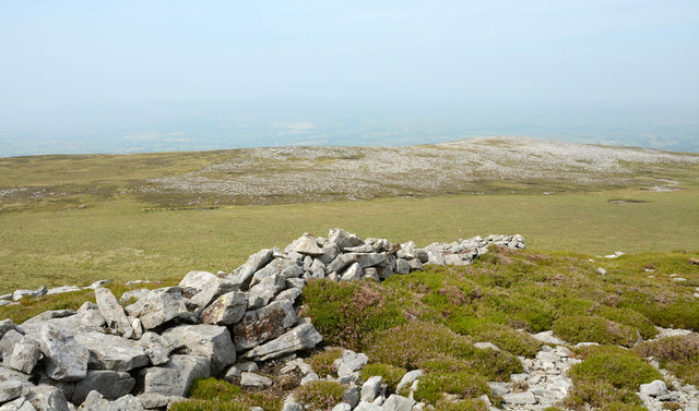
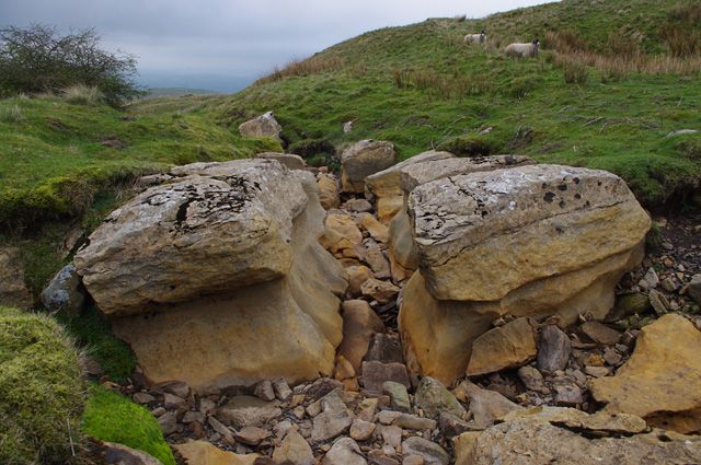
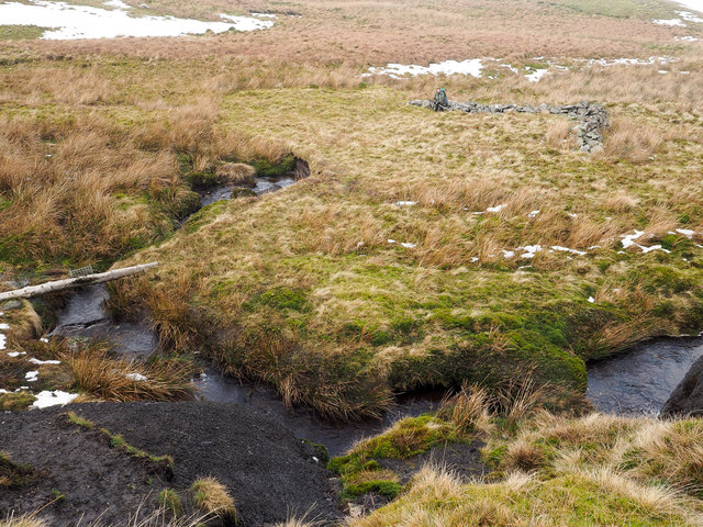
Rising to an elevation of approximately 1,472 feet (449 meters), Bleatapow Hill is a prominent feature of the undulating terrain in the region. Its distinct profile with a rounded summit and gentle slopes covered in lush green vegetation adds to its appeal. The hill is predominantly composed of slate and shale, which contributes to its rugged and rocky terrain.

The ascent to the summit of Bleatapow Hill is relatively moderate, making it accessible to a wide range of visitors. As hikers make their way up, they are treated to stunning vistas of the surrounding Lake District, including views of nearby fells and valleys. On clear days, it is possible to see as far as the Scottish borders to the north.

The hill is also known for its rich biodiversity, with various species of flora and fauna inhabiting its slopes. The lower levels are adorned with heather and bilberry, while the upper reaches are home to hardy grasses and mosses. Birdwatchers may be fortunate enough to spot species such as buzzards, peregrine falcons, and ravens soaring above.

Bleatapow Hill offers a tranquil and picturesque setting for visitors to immerse themselves in the natural beauty of Westmorland. Whether it is for a leisurely stroll or a more challenging hike, this hill provides an unforgettable experience for those seeking to explore the stunning landscape of the Lake District.

If you have any feedback on the listing, please let us know in the comments section below.

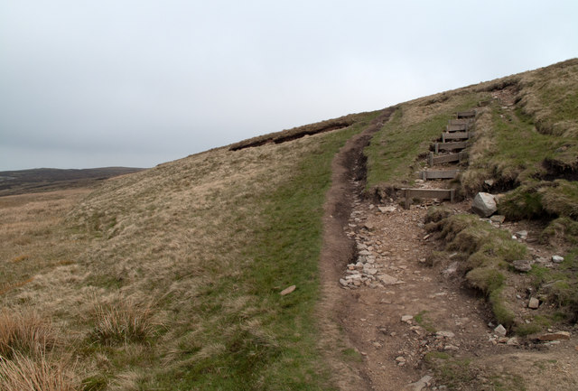
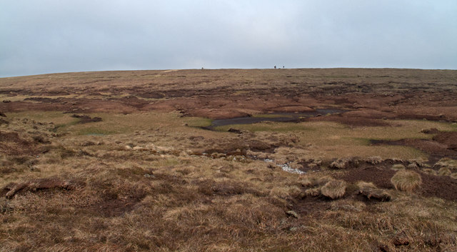
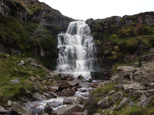
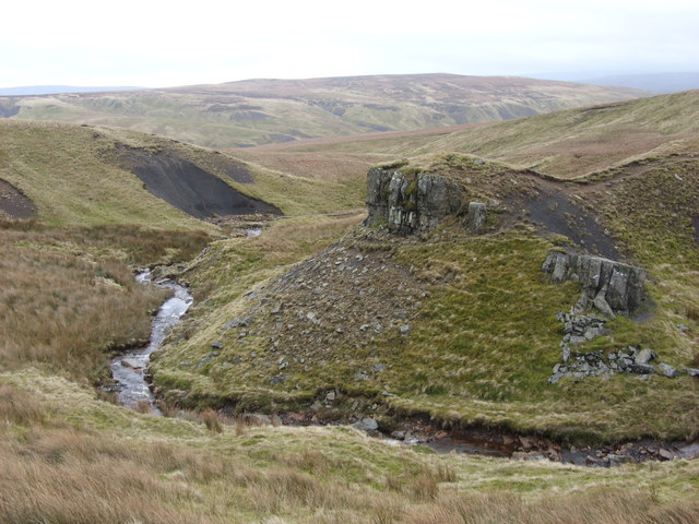
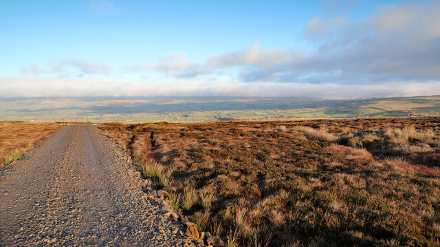
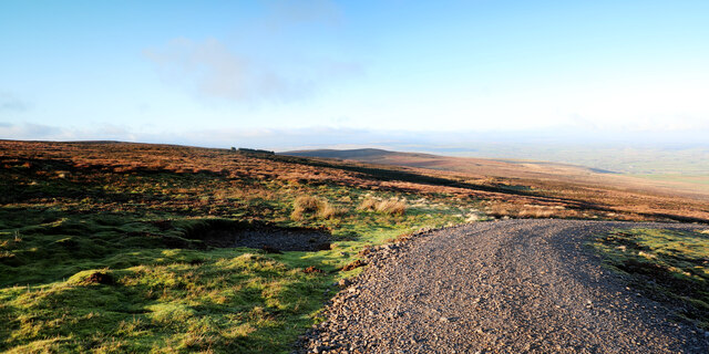
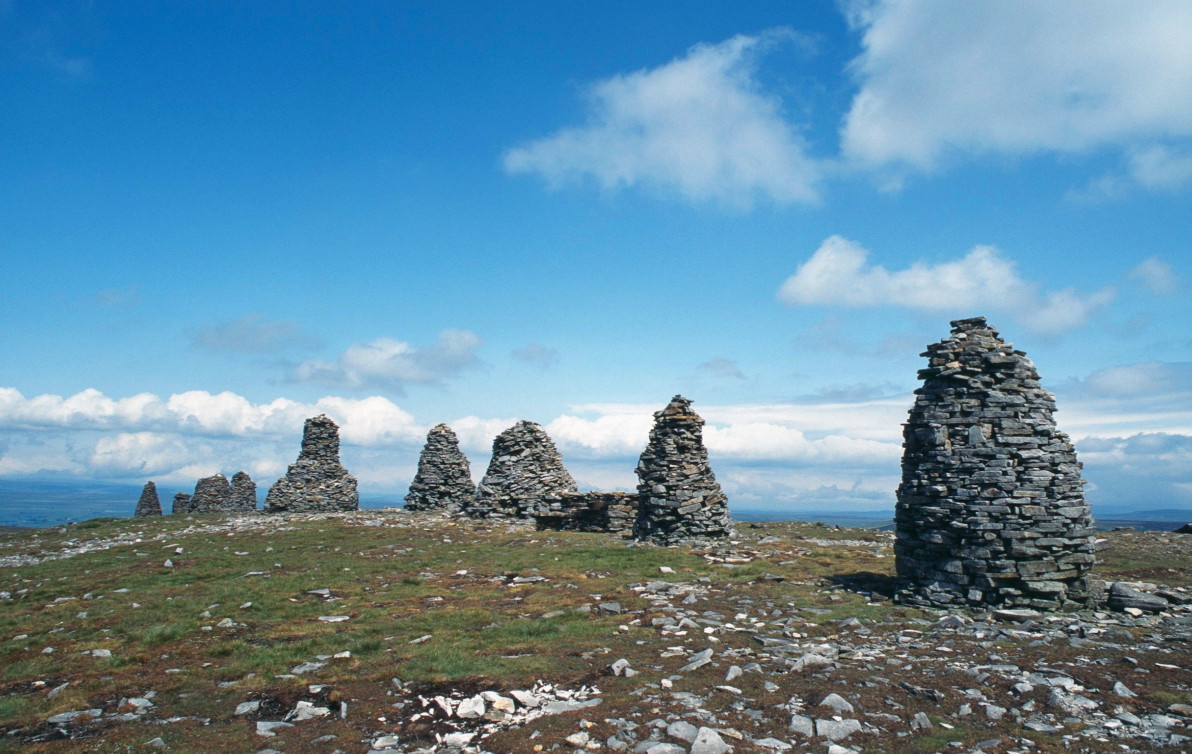
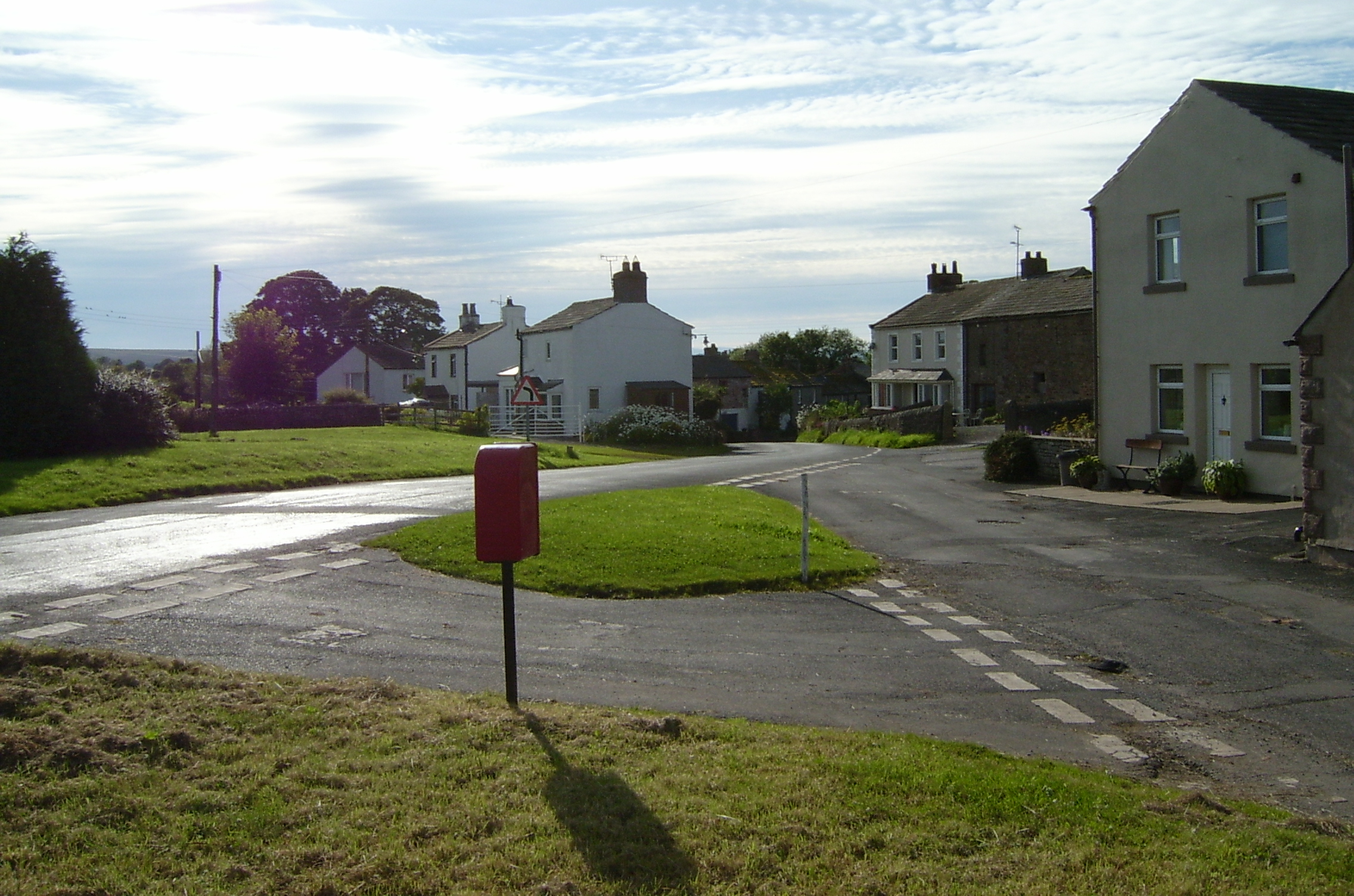
Bleatapow Hill Images

Images are sourced within 2km of 54.462653/-2.2672199 or Grid Reference NY8207. Thanks to Geograph Open Source API. All images are credited.

Footpath in groove en route for Nine Standards Rigg The path, seen looking to the west - downhill - is one of the main routes to the summit of Nine Standards Rigg and is a variant of the 'Coast to Coast' long distance path.
Footpath in groove en route for Nine Standards Rigg
The path, seen looking to the west - downhill - is one of the main routes to the summit of Nine Standards Rigg and is a variant of the 'Coast to Coast' long distance path.
Footpath erosion - Nine Standards Rigg One of the variants of the Coast to Coast path approaches the hill of Nine Standards Rigg by this route. On the steep slope there has presumably been sufficient erosion that wood-retained steps were built and that probably led to some recovery in the grass cover - see to the right of the steps. In time however lack of maintenance has seen the earth eroded from the stepped line which would make climbing and descent awkward; as a consequence, understandably, walkers have walked a line beside the steps causing yet further erosion!
Footpath erosion - Nine Standards Rigg
One of the variants of the Coast to Coast path approaches the hill of Nine Standards Rigg by this route. On the steep slope there has presumably been sufficient erosion that wood-retained steps were built and that probably led to some recovery in the grass cover - see to the right of the steps. In time however lack of maintenance has seen the earth eroded from the stepped line which would make climbing and descent awkward; as a consequence, understandably, walkers have walked a line beside the steps causing yet further erosion!
Peat haggs near Baxton Gill Head An extensive area of peat haggs and bog lies to the south-west of the summit of Nine Standards Rigg; the trig point of the hill is seen on the skyline to the left of a pair of walkers. Following an extended spell of unusually dry weather the crossing of the ground in view was remarkably easy.
Peat haggs near Baxton Gill Head
An extensive area of peat haggs and bog lies to the south-west of the summit of Nine Standards Rigg; the trig point of the hill is seen on the skyline to the left of a pair of walkers. Following an extended spell of unusually dry weather the crossing of the ground in view was remarkably easy.
Bleaberry Force This impressive 30' fall is in Bleaberry Gill North East of Nine Standards Rigg, Cumbria.
Bleaberry Force
This impressive 30' fall is in Bleaberry Gill North East of Nine Standards Rigg, Cumbria.
Backstone Castle Backstone Castle is a rocky outcrop above Backstone Beck. The elaborate name might lead unwary walkers to believe they are heading for some ancient historical site. In reality it is merely a distraction in a vast and bleak moorland setting.
Backstone Castle
Backstone Castle is a rocky outcrop above Backstone Beck. The elaborate name might lead unwary walkers to believe they are heading for some ancient historical site. In reality it is merely a distraction in a vast and bleak moorland setting.
Signpost on Rollinson haggs.
One of the Nine standards. Along the Coast to Coast path.
One of the Nine standards.
Along the Coast to Coast path.
Collapsing wall fragment at old quarry workings on Bastifell Bastifell is a location to the north of Nine Standards Rigg and the Nine Standards can be seen distantly at the right side of the image.
The section of walling is a curiosity seemingly serving no clear purpose other than perhaps as an occasional shelter for those working at the shallow quarry excavations in the vicinity.
Collapsing wall fragment at old quarry workings on Bastifell
Bastifell is a location to the north of Nine Standards Rigg and the Nine Standards can be seen distantly at the right side of the image. The section of walling is a curiosity seemingly serving no clear purpose other than perhaps as an occasional shelter for those working at the shallow quarry excavations in the vicinity.
Scattered rocks and wall fragment on Collin Hill North from Nine Standards high ground descends gradually and mainly is grass covered but some rock is exposed. Gritstone has been quarried on a small scale but in this image and certainly on the distant hill to the north  there's much scattered white rock; limestone surely. The purpose of the short section of dry stone walling is unknown.
Scattered rocks and wall fragment on Collin Hill
North from Nine Standards high ground descends gradually and mainly is grass covered but some rock is exposed. Gritstone has been quarried on a small scale but in this image and certainly on the distant hill to the north there's much scattered white rock; limestone surely. The purpose of the short section of dry stone walling is unknown.
Section of ruined wall on Collin Hill Collin Hill is a minor fearture of the hill country north of Nine Standards and Nine Standards Rigg. The image shows densely scattered white rocks (presumably limestone), on lower ground beyond the stretch of dry stone walling with a bog in between.
Section of ruined wall on Collin Hill
Collin Hill is a minor fearture of the hill country north of Nine Standards and Nine Standards Rigg. The image shows densely scattered white rocks (presumably limestone), on lower ground beyond the stretch of dry stone walling with a bog in between.
Dry stream bed, Reigill A continuation of Faraday Gill, looking downstream.
Dry stream bed, Reigill
A continuation of Faraday Gill, looking downstream.
Footbridge below Nine Standards Rigg Another view of <a href="https://www.geograph.org.uk/photo/2105768">NY8106 : Inadequate Footbridge</a>, when in low cloud.
This concessionary footpath is part of Wainwright's Coast to Coast route.
Footbridge below Nine Standards Rigg
Another view of NY8106 : Inadequate Footbridge, when in low cloud. This concessionary footpath is part of Wainwright's Coast to Coast route.
Cairns on Nine Standards Rigg The 3 northernmost standards in low cloud.
Cairns on Nine Standards Rigg
The 3 northernmost standards in low cloud.
Trig point, Nine Standards Rigg There is no flush bracket, and no obvious sign of one. Perhaps the pillar has been rebuilt. There is a cut bench mark on the stone in the left foreground.
Trig point, Nine Standards Rigg
There is no flush bracket, and no obvious sign of one. Perhaps the pillar has been rebuilt. There is a cut bench mark on the stone in the left foreground.
Shale slope with boulders The steep slope of black shale drops into Brownberhead Beck which drains from the eastern side of Nine Standards. The groove in which the boulders lie has been eroded: presumably loose shale has been lost with the larger rocks originally embedded in the shale, remaining.
Shale slope with boulders
The steep slope of black shale drops into Brownberhead Beck which drains from the eastern side of Nine Standards. The groove in which the boulders lie has been eroded: presumably loose shale has been lost with the larger rocks originally embedded in the shale, remaining.
Unusual section of walling near Brownberhead Beck Brownberhead Beck is the foreground stream. Beyond it a walker is sitting on a curious piece of wall - if that's what it is! There are two stretches, both low, set at a right angle. The location is remote and no purpose behind the construction can be imagined. (The pole across the stream of course has a gin trap mounted on top.)
Unusual section of walling near Brownberhead Beck
Brownberhead Beck is the foreground stream. Beyond it a walker is sitting on a curious piece of wall - if that's what it is! There are two stretches, both low, set at a right angle. The location is remote and no purpose behind the construction can be imagined. (The pole across the stream of course has a gin trap mounted on top.)
Estate track on Peatmoor Hill Even on the most recent online 1:25000 mapping (as of 2022) the estate track is not shown climbing Peatmoor Hill any further than Burntling Hole. However, in reality, as shown on the larger scale map, it provides convenient walking access not only up to High Dolphin Seat, but right up to within half a kilometre of the summit of Nine Standards Rigg, thus avoiding seasonal restrictions and the problems of erosion on the normal routes used by Wainwright's Coast to Coast Walk. This way up doesn't seem to have been "discovered" yet by walkers, maybe because to get to it involves a bit of intricate fiddly driving on single-track, with limited parking. We had the route to ourselves for my sixty fifth birthday...
Estate track on Peatmoor Hill
Even on the most recent online 1:25000 mapping (as of 2022) the estate track is not shown climbing Peatmoor Hill any further than Burntling Hole. However, in reality, as shown on the larger scale map, it provides convenient walking access not only up to High Dolphin Seat, but right up to within half a kilometre of the summit of Nine Standards Rigg, thus avoiding seasonal restrictions and the problems of erosion on the normal routes used by Wainwright's Coast to Coast Walk. This way up doesn't seem to have been "discovered" yet by walkers, maybe because to get to it involves a bit of intricate fiddly driving on single-track, with limited parking. We had the route to ourselves for my sixty fifth birthday...
Estate track on High Dolphin Seat Even on the most recent online 1:25000 mapping (as of 2022) the estate track is not shown climbing Peatmoor Hill any further than Burntling Hole. However, in reality, as shown on the largeer scale map, it provides convenient walking access not only up to High Dolphin Seat, but right up to within half a kilometre of the summit of Nine Standards Rigg, thus avoiding seasonal restrictions and the problems of erosion on the normal routes used by Wainwright's Coast to Coast Walk. The view here looks west to Greenfell Crag and beyond to the Vale of Eden. This way up doesn't seem to have been "discovered" yet by walkers, maybe because to get to it involves a bit of intricate fiddly driving on single-track, with limited parking. We had the route to ourselves for my sixty fifth birthday...
Estate track on High Dolphin Seat
Even on the most recent online 1:25000 mapping (as of 2022) the estate track is not shown climbing Peatmoor Hill any further than Burntling Hole. However, in reality, as shown on the largeer scale map, it provides convenient walking access not only up to High Dolphin Seat, but right up to within half a kilometre of the summit of Nine Standards Rigg, thus avoiding seasonal restrictions and the problems of erosion on the normal routes used by Wainwright's Coast to Coast Walk. The view here looks west to Greenfell Crag and beyond to the Vale of Eden. This way up doesn't seem to have been "discovered" yet by walkers, maybe because to get to it involves a bit of intricate fiddly driving on single-track, with limited parking. We had the route to ourselves for my sixty fifth birthday...
Show me another place!

Bleatapow Hill is located at Grid Ref: NY8207 (Lat: 54.462653, Lng: -2.2672199)

Administrative County: Cumbria

District: Eden

Police Authority: Cumbria

What 3 Words

///froth.disbanded.speakers. Near Kirkby Stephen, Cumbria

Related Wikis

Nearby Amenities

Located within 500m of 54.462653,-2.2672199
Bastifell
Ele: 620
Natural: peak
Lat/Long: 54.4582602/-2.2685794
Peatpot Hill
Ele: 580
Natural: peak
Lat/Long: 54.4655404/-2.2667946
Hunting Stand
Lat/Long: 54.4649025/-2.2629252
Hunting Stand
Lat/Long: 54.4653081/-2.2625088
Hunting Stand
Lat/Long: 54.4656831/-2.2621486
Hunting Stand
Lat/Long: 54.4645166/-2.2633266
Hunting Stand
Lat/Long: 54.4641852/-2.2636304
Hunting Stand
Lat/Long: 54.4637448/-2.2640619
Hunting Stand
Lat/Long: 54.463324/-2.264497
Hunting Stand
Lat/Long: 54.4629424/-2.2648872
Bleatapow Hill
Ele: 600
Natural: peak
Lat/Long: 54.4627415/-2.2667948
Hunting Stand
Lat/Long: 54.4586587/-2.2640975
Hunting Stand
Lat/Long: 54.4590244/-2.2636482
Hunting Stand
Lat/Long: 54.4593923/-2.2632446
Hunting Stand
Lat/Long: 54.4597736/-2.2628134
Hunting Stand
Lat/Long: 54.4602215/-2.2623089
Hunting Stand
Lat/Long: 54.4606454/-2.2618227
The data included in this document is from www.openstreetmap.org. The data is made available under ODbL.

Have you been to Bleatapow Hill?

Leave your review of Bleatapow Hill below (or comments, questions and feedback).