Bastifell

Hill, Mountain in Westmorland Eden

England

Bastifell

Footpath in groove en route for Nine Standards Rigg The path, seen looking to the west - downhill - is one of the main routes to the summit of Nine Standards Rigg and is a variant of the 'Coast to Coast' long distance path.
Footpath in groove en route for Nine Standards Rigg Credit: Trevor Littlewood

Bastifell, located in the county of Westmorland, is a prominent hill or mountain that is widely known for its natural beauty and breathtaking views. Rising to an elevation of 587 meters (1,926 feet), it is a popular destination for hikers, nature enthusiasts, and outdoor adventurers.

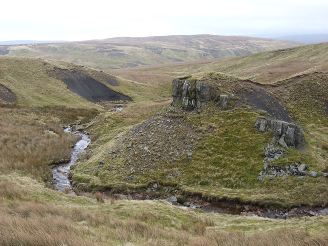
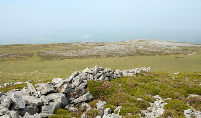
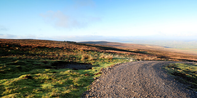
Situated within the Lake District National Park, Bastifell offers stunning vistas of the surrounding landscape, including the picturesque valleys, rolling hills, and tranquil lakes that characterize the region. Its strategic location provides visitors with remarkable panoramic views, allowing them to appreciate the splendor of the surrounding mountains and the vast expanse of the park.

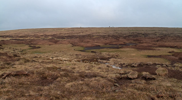
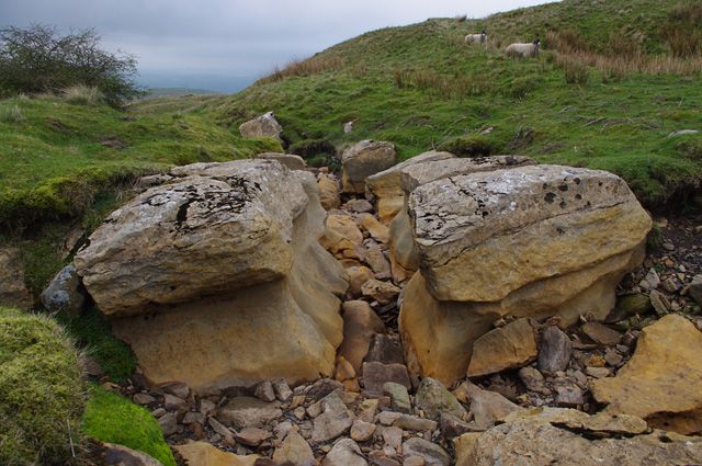
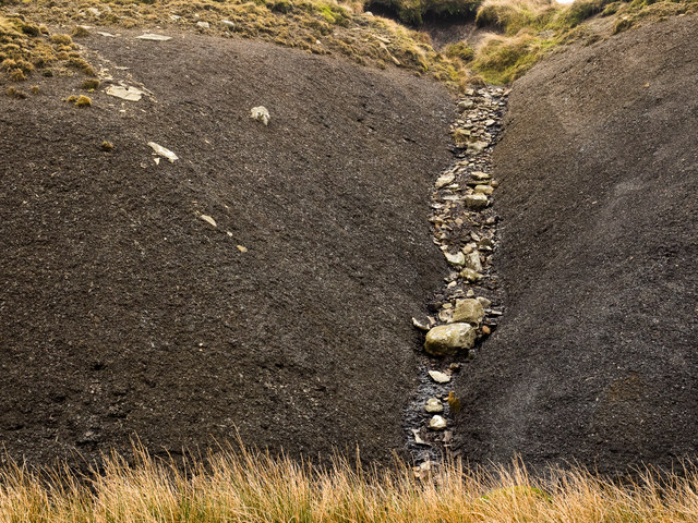
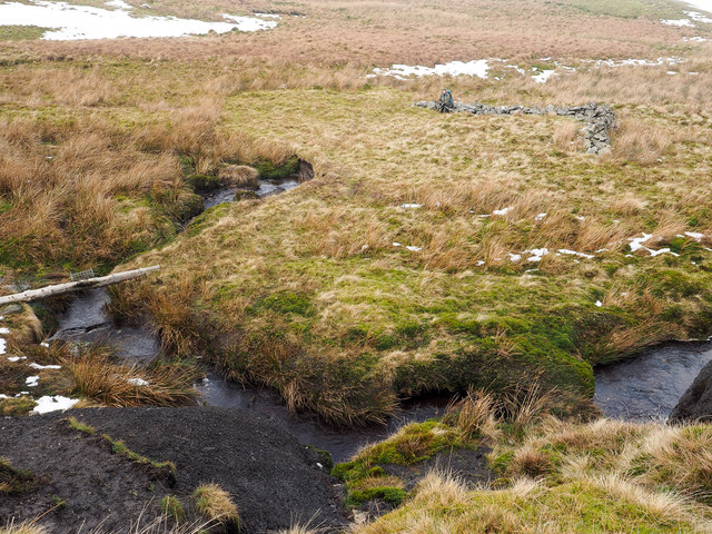
The hill is covered in lush green vegetation, with vibrant wildflowers dotting the landscape during the spring and summer months. The terrain is varied, with rocky outcrops and gentle slopes, making it an ideal destination for both experienced hikers and casual walkers.

Bastifell is also home to a diverse range of wildlife, including various species of birds, mammals, and insects. Birdwatchers often flock to the area to catch glimpses of rare and migratory species that inhabit the hill and its surroundings.

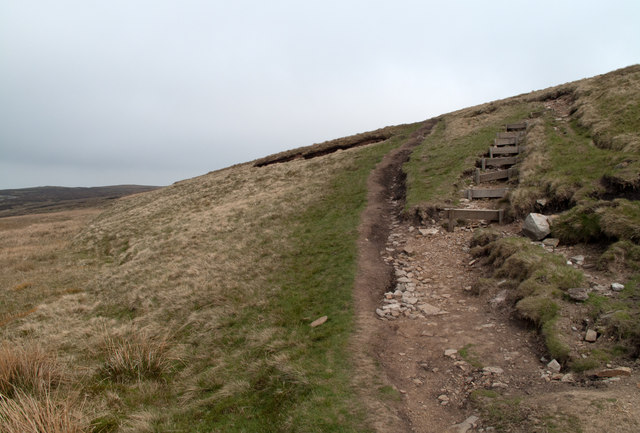
Access to Bastifell is relatively easy, with several well-marked footpaths leading to its summit. Visitors can choose from a range of routes, each offering a unique perspective of the scenery. While the hill can be challenging to climb in certain sections, the effort is always rewarded with awe-inspiring views that make the journey worthwhile.

Overall, Bastifell in Westmorland is a natural gem within the Lake District National Park, offering visitors a chance to immerse themselves in the region's beauty, explore its diverse ecosystems, and experience the tranquility of the countryside.

If you have any feedback on the listing, please let us know in the comments section below.
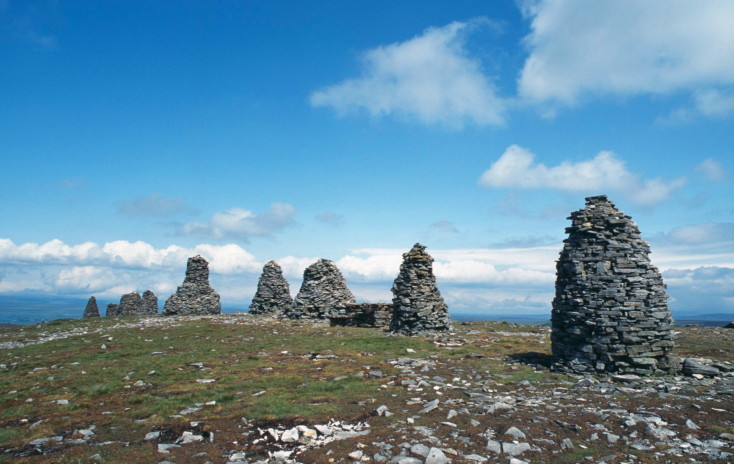
Bastifell Images

Images are sourced within 2km of 54.459015/-2.2706361 or Grid Reference NY8207. Thanks to Geograph Open Source API. All images are credited.

Footpath in groove en route for Nine Standards Rigg The path, seen looking to the west - downhill - is one of the main routes to the summit of Nine Standards Rigg and is a variant of the 'Coast to Coast' long distance path.
Footpath in groove en route for Nine Standards Rigg
The path, seen looking to the west - downhill - is one of the main routes to the summit of Nine Standards Rigg and is a variant of the 'Coast to Coast' long distance path.
Footpath erosion - Nine Standards Rigg One of the variants of the Coast to Coast path approaches the hill of Nine Standards Rigg by this route. On the steep slope there has presumably been sufficient erosion that wood-retained steps were built and that probably led to some recovery in the grass cover - see to the right of the steps. In time however lack of maintenance has seen the earth eroded from the stepped line which would make climbing and descent awkward; as a consequence, understandably, walkers have walked a line beside the steps causing yet further erosion!
Footpath erosion - Nine Standards Rigg
One of the variants of the Coast to Coast path approaches the hill of Nine Standards Rigg by this route. On the steep slope there has presumably been sufficient erosion that wood-retained steps were built and that probably led to some recovery in the grass cover - see to the right of the steps. In time however lack of maintenance has seen the earth eroded from the stepped line which would make climbing and descent awkward; as a consequence, understandably, walkers have walked a line beside the steps causing yet further erosion!
Peat haggs near Baxton Gill Head An extensive area of peat haggs and bog lies to the south-west of the summit of Nine Standards Rigg; the trig point of the hill is seen on the skyline to the left of a pair of walkers. Following an extended spell of unusually dry weather the crossing of the ground in view was remarkably easy.
Peat haggs near Baxton Gill Head
An extensive area of peat haggs and bog lies to the south-west of the summit of Nine Standards Rigg; the trig point of the hill is seen on the skyline to the left of a pair of walkers. Following an extended spell of unusually dry weather the crossing of the ground in view was remarkably easy.
Ruined building on south-western slope of Nine Standards Rigg This ruin, close to a junction of bridleways on the slopes of Nine Standards Rigg is not shown on OS maps at either 1:50 000 or 1:25 000 scales; its original purpose is unknown though there is an old quarry to the east and there could be some connection with that. The hill seen at the left side of the image is Tailbridge Hill.
Ruined building on south-western slope of Nine Standards Rigg
This ruin, close to a junction of bridleways on the slopes of Nine Standards Rigg is not shown on OS maps at either 1:50 000 or 1:25 000 scales; its original purpose is unknown though there is an old quarry to the east and there could be some connection with that. The hill seen at the left side of the image is Tailbridge Hill.
Backstone Castle Backstone Castle is a rocky outcrop above Backstone Beck. The elaborate name might lead unwary walkers to believe they are heading for some ancient historical site. In reality it is merely a distraction in a vast and bleak moorland setting.
Backstone Castle
Backstone Castle is a rocky outcrop above Backstone Beck. The elaborate name might lead unwary walkers to believe they are heading for some ancient historical site. In reality it is merely a distraction in a vast and bleak moorland setting.
Signpost on Rollinson haggs.
One of the Nine standards. Along the Coast to Coast path.
One of the Nine standards.
Along the Coast to Coast path.
Collapsing wall fragment at old quarry workings on Bastifell Bastifell is a location to the north of Nine Standards Rigg and the Nine Standards can be seen distantly at the right side of the image.
The section of walling is a curiosity seemingly serving no clear purpose other than perhaps as an occasional shelter for those working at the shallow quarry excavations in the vicinity.
Collapsing wall fragment at old quarry workings on Bastifell
Bastifell is a location to the north of Nine Standards Rigg and the Nine Standards can be seen distantly at the right side of the image. The section of walling is a curiosity seemingly serving no clear purpose other than perhaps as an occasional shelter for those working at the shallow quarry excavations in the vicinity.
Scattered rocks and wall fragment on Collin Hill North from Nine Standards high ground descends gradually and mainly is grass covered but some rock is exposed. Gritstone has been quarried on a small scale but in this image and certainly on the distant hill to the north  there's much scattered white rock; limestone surely. The purpose of the short section of dry stone walling is unknown.
Scattered rocks and wall fragment on Collin Hill
North from Nine Standards high ground descends gradually and mainly is grass covered but some rock is exposed. Gritstone has been quarried on a small scale but in this image and certainly on the distant hill to the north there's much scattered white rock; limestone surely. The purpose of the short section of dry stone walling is unknown.
Section of ruined wall on Collin Hill Collin Hill is a minor fearture of the hill country north of Nine Standards and Nine Standards Rigg. The image shows densely scattered white rocks (presumably limestone), on lower ground beyond the stretch of dry stone walling with a bog in between.
Section of ruined wall on Collin Hill
Collin Hill is a minor fearture of the hill country north of Nine Standards and Nine Standards Rigg. The image shows densely scattered white rocks (presumably limestone), on lower ground beyond the stretch of dry stone walling with a bog in between.
Dry stream bed, Reigill A continuation of Faraday Gill, looking downstream.
Dry stream bed, Reigill
A continuation of Faraday Gill, looking downstream.
Footbridge below Nine Standards Rigg Another view of <a href="https://www.geograph.org.uk/photo/2105768">NY8106 : Inadequate Footbridge</a>, when in low cloud.
This concessionary footpath is part of Wainwright's Coast to Coast route.
Footbridge below Nine Standards Rigg
Another view of NY8106 : Inadequate Footbridge, when in low cloud. This concessionary footpath is part of Wainwright's Coast to Coast route.
Cairns on Nine Standards Rigg The 3 northernmost standards in low cloud.
Cairns on Nine Standards Rigg
The 3 northernmost standards in low cloud.
Trig point, Nine Standards Rigg There is no flush bracket, and no obvious sign of one. Perhaps the pillar has been rebuilt. There is a cut bench mark on the stone in the left foreground.
Trig point, Nine Standards Rigg
There is no flush bracket, and no obvious sign of one. Perhaps the pillar has been rebuilt. There is a cut bench mark on the stone in the left foreground.
Shale slope with boulders The steep slope of black shale drops into Brownberhead Beck which drains from the eastern side of Nine Standards. The groove in which the boulders lie has been eroded: presumably loose shale has been lost with the larger rocks originally embedded in the shale, remaining.
Shale slope with boulders
The steep slope of black shale drops into Brownberhead Beck which drains from the eastern side of Nine Standards. The groove in which the boulders lie has been eroded: presumably loose shale has been lost with the larger rocks originally embedded in the shale, remaining.
Unusual section of walling near Brownberhead Beck Brownberhead Beck is the foreground stream. Beyond it a walker is sitting on a curious piece of wall - if that's what it is! There are two stretches, both low, set at a right angle. The location is remote and no purpose behind the construction can be imagined. (The pole across the stream of course has a gin trap mounted on top.)
Unusual section of walling near Brownberhead Beck
Brownberhead Beck is the foreground stream. Beyond it a walker is sitting on a curious piece of wall - if that's what it is! There are two stretches, both low, set at a right angle. The location is remote and no purpose behind the construction can be imagined. (The pole across the stream of course has a gin trap mounted on top.)
The Nine Standards in 1989 The Nine Standards (not necessarily all in view), to the north of the toposcope and the summit of Nine Standards Rigg.
The Nine Standards in 1989
The Nine Standards (not necessarily all in view), to the north of the toposcope and the summit of Nine Standards Rigg.
Estate track on High Dolphin Seat Even on the most recent online 1:25000 mapping (as of 2022) the estate track is not shown climbing Peatmoor Hill any further than Burntling Hole. However, in reality, as shown on the largeer scale map, it provides convenient walking access not only up to High Dolphin Seat, but right up to within half a kilometre of the summit of Nine Standards Rigg, thus avoiding seasonal restrictions and the problems of erosion on the normal routes used by Wainwright's Coast to Coast Walk. The view here looks west to Greenfell Crag and beyond to the Vale of Eden. This way up doesn't seem to have been "discovered" yet by walkers, maybe because to get to it involves a bit of intricate fiddly driving on single-track, with limited parking. We had the route to ourselves for my sixty fifth birthday...
Estate track on High Dolphin Seat
Even on the most recent online 1:25000 mapping (as of 2022) the estate track is not shown climbing Peatmoor Hill any further than Burntling Hole. However, in reality, as shown on the largeer scale map, it provides convenient walking access not only up to High Dolphin Seat, but right up to within half a kilometre of the summit of Nine Standards Rigg, thus avoiding seasonal restrictions and the problems of erosion on the normal routes used by Wainwright's Coast to Coast Walk. The view here looks west to Greenfell Crag and beyond to the Vale of Eden. This way up doesn't seem to have been "discovered" yet by walkers, maybe because to get to it involves a bit of intricate fiddly driving on single-track, with limited parking. We had the route to ourselves for my sixty fifth birthday...
Show me another place!

Bastifell is located at Grid Ref: NY8207 (Lat: 54.459015, Lng: -2.2706361)

Administrative County: Cumbria

District: Eden

Police Authority: Cumbria

What 3 Words

///after.awoken.tightrope. Near Kirkby Stephen, Cumbria

Related Wikis

Nine Standards Rigg

Nine Standards Rigg is the summit of Hartley Fell in the Pennine Hills of England. It lies near the boundary between Cumbria and North Yorkshire, a few...

Belah Viaduct

The Belah Viaduct was a railway viaduct on the South Durham and Lancashire Union Railway, crossing the River Belah, in Cumbria, England, about 1 mile...

Hartley Castle

Hartley Castle was a castle near Kirkby Stephen, Cumbria, England. == History == The manor was confiscated circa 1315 from Roger de Clifford and granted...

Hartley, Cumbria

Hartley is a village and civil parish in the Eden district of Cumbria, England. It is about 0.5 miles (0.8 km) east of Kirkby Stephen. The area has many...

Birkdale, North Yorkshire

Birkdale (sometimes written out as Birk Dale) is a dale in the Yorkshire Dales National Park, in North Yorkshire, England. It lies at the far western end...

Nateby, Cumbria

Nateby is a village and civil parish in the Eden district of Cumbria, England. The parish had a population of 110 in 2001, increasing to 120 at the 2011...

Stainmore Railway Company

Stainmore Railway Company is a volunteer-run, non-profit preservation company formed in 2000 with the aim of restoring Kirkby Stephen East railway station...
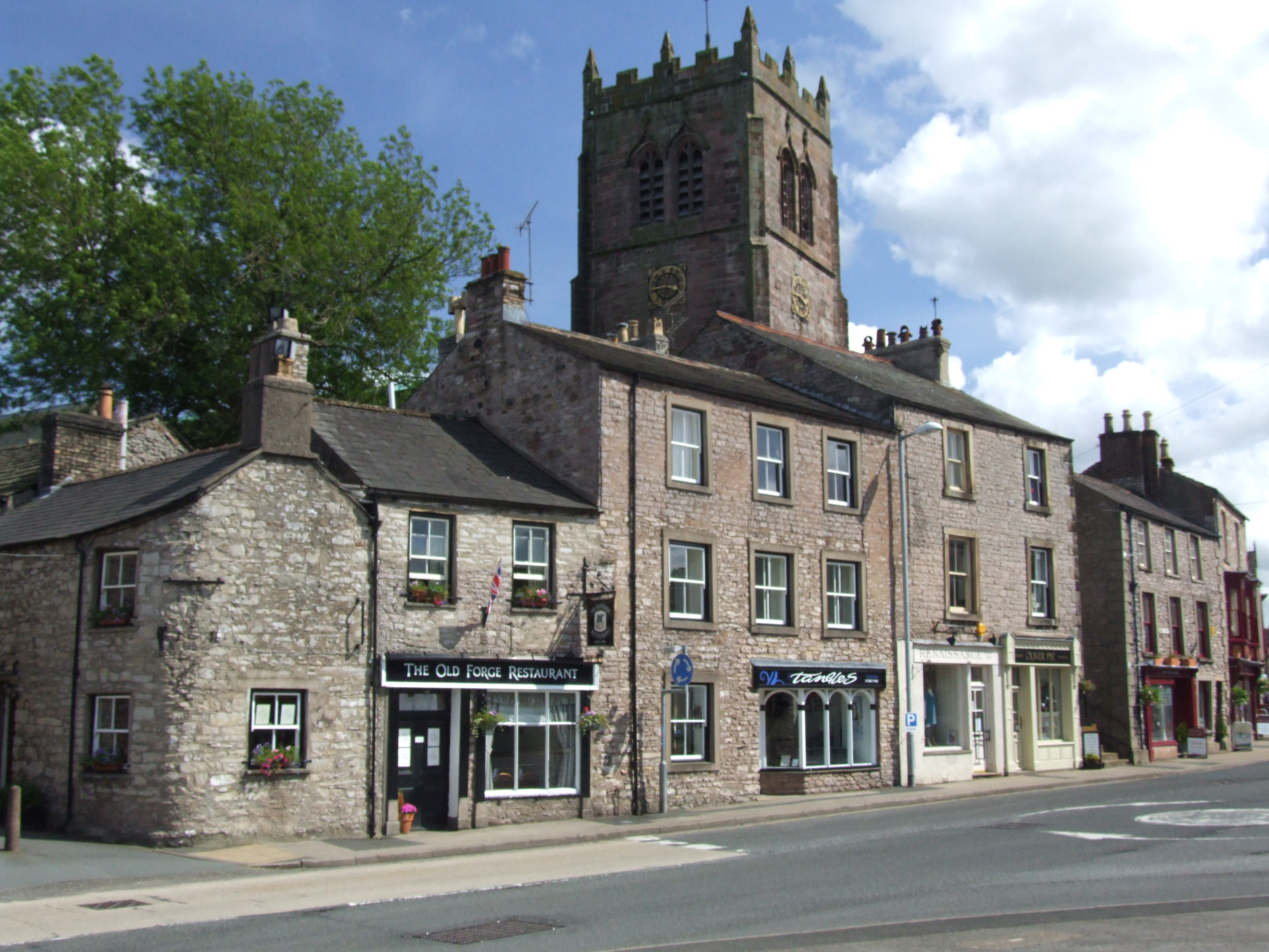
Kirkby Stephen

Kirkby Stephen () is a market town and civil parish in Westmorland and Furness, Cumbria, England. Historically part of Westmorland, it lies on the A685...

Nearby Amenities

Located within 500m of 54.459015,-2.2706361
Man Made: cairn
Lat/Long: 54.4557035/-2.269154
Bastifell
Ele: 620
Natural: peak
Lat/Long: 54.4582602/-2.2685794
Turning Circle
Lat/Long: 54.4567158/-2.2672585
Bleatapow Hill
Ele: 600
Natural: peak
Lat/Long: 54.4627415/-2.2667948
Standards Mire
Place: locality
Lat/Long: 54.4557631/-2.2754326
Hunting Stand
Lat/Long: 54.4586587/-2.2640975
Hunting Stand
Lat/Long: 54.4583268/-2.2644564
Hunting Stand
Lat/Long: 54.4580585/-2.2647744
Hunting Stand
Lat/Long: 54.4577048/-2.2651709
Hunting Stand
Lat/Long: 54.4590244/-2.2636482
Hunting Stand
Lat/Long: 54.4593923/-2.2632446
Fox Crags
Place: locality
Lat/Long: 54.4571682/-2.2636324
Standard Haggs
Place: locality
Lat/Long: 54.4548397/-2.2704795
The data included in this document is from www.openstreetmap.org. The data is made available under ODbL.

Have you been to Bastifell?

Leave your review of Bastifell below (or comments, questions and feedback).