Bields Hill

Hill, Mountain in Westmorland Eden

England

Bields Hill

Footpath in groove en route for Nine Standards Rigg The path, seen looking to the west - downhill - is one of the main routes to the summit of Nine Standards Rigg and is a variant of the 'Coast to Coast' long distance path.
Footpath in groove en route for Nine Standards Rigg Credit: Trevor Littlewood

Bields Hill is a prominent hill located in the county of Westmorland, in the northwestern region of England. It forms part of the larger Pennine range and is known for its picturesque beauty and rich natural heritage. Standing at an elevation of approximately 1,925 feet (587 meters), Bields Hill offers breathtaking panoramic views of the surrounding landscape.

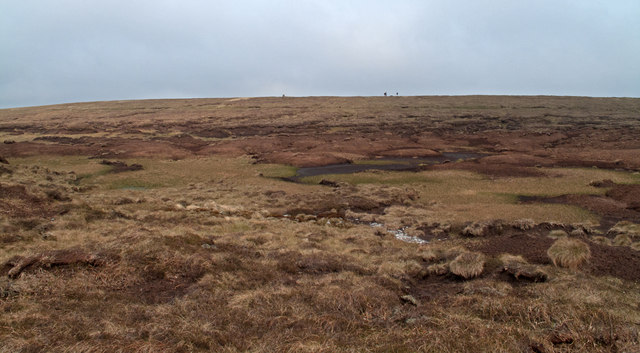
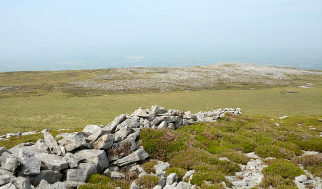
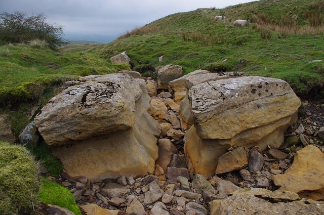
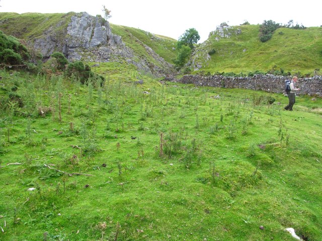
The hill is characterized by its gentle slopes and lush greenery, making it a popular destination for hikers, nature enthusiasts, and photographers. The area is home to a diverse range of flora and fauna, including heather, bracken, and various species of birds and mammals. The rocky outcrops and crags that adorn the hill add an element of ruggedness to its overall appeal.

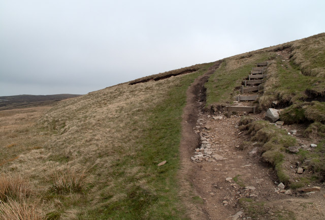
Bields Hill is easily accessible, with several footpaths and trails leading to its summit. The most commonly used route starts from the nearby village of Orton, where visitors can embark on a scenic walk through rolling meadows and woodlands. The ascent to the top is moderate, making it suitable for individuals of varying fitness levels.

Once at the summit, visitors are rewarded with breathtaking views of the surrounding countryside, including the nearby Howgill Fells and the Lake District National Park. On clear days, it is even possible to see as far as the distant Scottish hills.

Overall, Bields Hill in Westmorland offers a serene and tranquil escape for those seeking to immerse themselves in the natural beauty of the English countryside.

If you have any feedback on the listing, please let us know in the comments section below.

Bields Hill Images

Images are sourced within 2km of 54.463325/-2.2760949 or Grid Reference NY8207. Thanks to Geograph Open Source API. All images are credited.
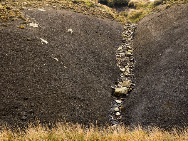
Footpath in groove en route for Nine Standards Rigg The path, seen looking to the west - downhill - is one of the main routes to the summit of Nine Standards Rigg and is a variant of the 'Coast to Coast' long distance path.
Footpath in groove en route for Nine Standards Rigg
The path, seen looking to the west - downhill - is one of the main routes to the summit of Nine Standards Rigg and is a variant of the 'Coast to Coast' long distance path.
Footpath erosion - Nine Standards Rigg One of the variants of the Coast to Coast path approaches the hill of Nine Standards Rigg by this route. On the steep slope there has presumably been sufficient erosion that wood-retained steps were built and that probably led to some recovery in the grass cover - see to the right of the steps. In time however lack of maintenance has seen the earth eroded from the stepped line which would make climbing and descent awkward; as a consequence, understandably, walkers have walked a line beside the steps causing yet further erosion!
Footpath erosion - Nine Standards Rigg
One of the variants of the Coast to Coast path approaches the hill of Nine Standards Rigg by this route. On the steep slope there has presumably been sufficient erosion that wood-retained steps were built and that probably led to some recovery in the grass cover - see to the right of the steps. In time however lack of maintenance has seen the earth eroded from the stepped line which would make climbing and descent awkward; as a consequence, understandably, walkers have walked a line beside the steps causing yet further erosion!
Peat haggs near Baxton Gill Head An extensive area of peat haggs and bog lies to the south-west of the summit of Nine Standards Rigg; the trig point of the hill is seen on the skyline to the left of a pair of walkers. Following an extended spell of unusually dry weather the crossing of the ground in view was remarkably easy.
Peat haggs near Baxton Gill Head
An extensive area of peat haggs and bog lies to the south-west of the summit of Nine Standards Rigg; the trig point of the hill is seen on the skyline to the left of a pair of walkers. Following an extended spell of unusually dry weather the crossing of the ground in view was remarkably easy.
Ruined building on south-western slope of Nine Standards Rigg This ruin, close to a junction of bridleways on the slopes of Nine Standards Rigg is not shown on OS maps at either 1:50 000 or 1:25 000 scales; its original purpose is unknown though there is an old quarry to the east and there could be some connection with that. The hill seen at the left side of the image is Tailbridge Hill.
Ruined building on south-western slope of Nine Standards Rigg
This ruin, close to a junction of bridleways on the slopes of Nine Standards Rigg is not shown on OS maps at either 1:50 000 or 1:25 000 scales; its original purpose is unknown though there is an old quarry to the east and there could be some connection with that. The hill seen at the left side of the image is Tailbridge Hill.
One of the Nine standards. Along the Coast to Coast path.
One of the Nine standards.
Along the Coast to Coast path.
Collapsing wall fragment at old quarry workings on Bastifell Bastifell is a location to the north of Nine Standards Rigg and the Nine Standards can be seen distantly at the right side of the image.
The section of walling is a curiosity seemingly serving no clear purpose other than perhaps as an occasional shelter for those working at the shallow quarry excavations in the vicinity.
Collapsing wall fragment at old quarry workings on Bastifell
Bastifell is a location to the north of Nine Standards Rigg and the Nine Standards can be seen distantly at the right side of the image. The section of walling is a curiosity seemingly serving no clear purpose other than perhaps as an occasional shelter for those working at the shallow quarry excavations in the vicinity.
Scattered rocks and wall fragment on Collin Hill North from Nine Standards high ground descends gradually and mainly is grass covered but some rock is exposed. Gritstone has been quarried on a small scale but in this image and certainly on the distant hill to the north  there's much scattered white rock; limestone surely. The purpose of the short section of dry stone walling is unknown.
Scattered rocks and wall fragment on Collin Hill
North from Nine Standards high ground descends gradually and mainly is grass covered but some rock is exposed. Gritstone has been quarried on a small scale but in this image and certainly on the distant hill to the north there's much scattered white rock; limestone surely. The purpose of the short section of dry stone walling is unknown.
Section of ruined wall on Collin Hill Collin Hill is a minor fearture of the hill country north of Nine Standards and Nine Standards Rigg. The image shows densely scattered white rocks (presumably limestone), on lower ground beyond the stretch of dry stone walling with a bog in between.
Section of ruined wall on Collin Hill
Collin Hill is a minor fearture of the hill country north of Nine Standards and Nine Standards Rigg. The image shows densely scattered white rocks (presumably limestone), on lower ground beyond the stretch of dry stone walling with a bog in between.
Ruined barn, Reigill In the background on the right is Tailbridge Hill.
Ruined barn, Reigill
In the background on the right is Tailbridge Hill.
Dry stream bed, Reigill A continuation of Faraday Gill, looking downstream.
Dry stream bed, Reigill
A continuation of Faraday Gill, looking downstream.
Footbridge below Nine Standards Rigg Another view of <a href="https://www.geograph.org.uk/photo/2105768">NY8106 : Inadequate Footbridge</a>, when in low cloud.
This concessionary footpath is part of Wainwright's Coast to Coast route.
Footbridge below Nine Standards Rigg
Another view of NY8106 : Inadequate Footbridge, when in low cloud. This concessionary footpath is part of Wainwright's Coast to Coast route.
Cairns on Nine Standards Rigg The 3 northernmost standards in low cloud.
Cairns on Nine Standards Rigg
The 3 northernmost standards in low cloud.
Trig point, Nine Standards Rigg There is no flush bracket, and no obvious sign of one. Perhaps the pillar has been rebuilt. There is a cut bench mark on the stone in the left foreground.
Trig point, Nine Standards Rigg
There is no flush bracket, and no obvious sign of one. Perhaps the pillar has been rebuilt. There is a cut bench mark on the stone in the left foreground.
Traces of old industry at Little Longrigg The eye is drawn to the middle distance where there is evidence of some workings on the slopes of Birkett Hill. In the foreground is the crescent shaped outline of an old turf and stone dam, almost certainly used in the 18thC for the purpose of hushing on nearby slopes in the search for galena [lead ore].
Traces of old industry at Little Longrigg
The eye is drawn to the middle distance where there is evidence of some workings on the slopes of Birkett Hill. In the foreground is the crescent shaped outline of an old turf and stone dam, almost certainly used in the 18thC for the purpose of hushing on nearby slopes in the search for galena [lead ore].
Site of Hartley smelt mill This was once the site of a lead smelting mill, although evidence is now hard to find. Records show a single hearth mill here between 1714 & 1777, after which it may have fallen into disuse. Apart from a small area of flattened ground and a few protruding stones, there is little to see, although some of the stones in the wall to the right are dressed and others show signs of heating. This was small scale lead production almost a century earlier than the bigger mills such as Old Gang, Surrender and Grinton over in Swaledale.
Site of Hartley smelt mill
This was once the site of a lead smelting mill, although evidence is now hard to find. Records show a single hearth mill here between 1714 & 1777, after which it may have fallen into disuse. Apart from a small area of flattened ground and a few protruding stones, there is little to see, although some of the stones in the wall to the right are dressed and others show signs of heating. This was small scale lead production almost a century earlier than the bigger mills such as Old Gang, Surrender and Grinton over in Swaledale.
Limestone outcrops by Birkett Hill For those of us used to the relatively flat bedded limestones of the Yorkshire Dales, these outcrops come as something of a surprise as they are steeply angled and in close proximity to both shales and sandstones. The reason must be the nearby northern extension to the Dent fault which runs along the western margins of the central Pennines.
Limestone outcrops by Birkett Hill
For those of us used to the relatively flat bedded limestones of the Yorkshire Dales, these outcrops come as something of a surprise as they are steeply angled and in close proximity to both shales and sandstones. The reason must be the nearby northern extension to the Dent fault which runs along the western margins of the central Pennines.
Shale slope with boulders The steep slope of black shale drops into Brownberhead Beck which drains from the eastern side of Nine Standards. The groove in which the boulders lie has been eroded: presumably loose shale has been lost with the larger rocks originally embedded in the shale, remaining.
Shale slope with boulders
The steep slope of black shale drops into Brownberhead Beck which drains from the eastern side of Nine Standards. The groove in which the boulders lie has been eroded: presumably loose shale has been lost with the larger rocks originally embedded in the shale, remaining.
Estate track on Peatmoor Hill Even on the most recent online 1:25000 mapping (as of 2022) the estate track is not shown climbing Peatmoor Hill any further than Burntling Hole. However, in reality, as shown on the larger scale map, it provides convenient walking access not only up to High Dolphin Seat, but right up to within half a kilometre of the summit of Nine Standards Rigg, thus avoiding seasonal restrictions and the problems of erosion on the normal routes used by Wainwright's Coast to Coast Walk. This way up doesn't seem to have been "discovered" yet by walkers, maybe because to get to it involves a bit of intricate fiddly driving on single-track, with limited parking. We had the route to ourselves for my sixty fifth birthday...
Estate track on Peatmoor Hill
Even on the most recent online 1:25000 mapping (as of 2022) the estate track is not shown climbing Peatmoor Hill any further than Burntling Hole. However, in reality, as shown on the larger scale map, it provides convenient walking access not only up to High Dolphin Seat, but right up to within half a kilometre of the summit of Nine Standards Rigg, thus avoiding seasonal restrictions and the problems of erosion on the normal routes used by Wainwright's Coast to Coast Walk. This way up doesn't seem to have been "discovered" yet by walkers, maybe because to get to it involves a bit of intricate fiddly driving on single-track, with limited parking. We had the route to ourselves for my sixty fifth birthday...
Show me another place!

Bields Hill is located at Grid Ref: NY8207 (Lat: 54.463325, Lng: -2.2760949)

Administrative County: Cumbria

District: Eden

Police Authority: Cumbria

What 3 Words

///sloping.noodle.animator. Near Kirkby Stephen, Cumbria

Related Wikis

Nine Standards Rigg

Nine Standards Rigg is the summit of Hartley Fell in the Pennine Hills of England. It lies near the boundary between Cumbria and North Yorkshire, a few...

Belah Viaduct

The Belah Viaduct was a railway viaduct on the South Durham and Lancashire Union Railway, crossing the River Belah, in Cumbria, England, about 1 mile...

Hartley, Cumbria

Hartley is a village and civil parish in the Eden district of Cumbria, England. It is about 0.5 miles (0.8 km) east of Kirkby Stephen. The area has many...

Hartley Castle

Hartley Castle was a castle near Kirkby Stephen, Cumbria, England. == History == The manor was confiscated circa 1315 from Roger de Clifford and granted...

Nearby Amenities

Located within 500m of 54.463325,-2.2760949
High Greenside
Place: locality
Lat/Long: 54.4632133/-2.2835876
Gruntley Pits
Man Made: mine
Lat/Long: 54.4664575/-2.2799079
Abandoned: yes
Man Made: mineshaft
Lat/Long: 54.4661959/-2.280162
Abandoned: yes
Man Made: mineshaft
Lat/Long: 54.4658787/-2.279887
Abandoned: yes
Man Made: mineshaft
Lat/Long: 54.4667795/-2.2798245
Natural: sinkhole
Lat/Long: 54.4640332/-2.2831763
Abandoned: yes
Historic: mine_shaft
Man Made: mineshaft
Lat/Long: 54.4641395/-2.2788389
Abandoned: yes
Historic: mine_shaft
Man Made: mineshaft
Lat/Long: 54.4640326/-2.2789994
Natural: sinkhole
Lat/Long: 54.4643618/-2.2781458
Abandoned: yes
Historic: mine_shaft
Man Made: mineshaft
Lat/Long: 54.4646827/-2.2778808
Abandoned: yes
Historic: mine_shaft
Man Made: mineshaft
Lat/Long: 54.4648403/-2.2776795
Abandoned: yes
Historic: mine_shaft
Man Made: mineshaft
Lat/Long: 54.4653289/-2.2758858
The data included in this document is from www.openstreetmap.org. The data is made available under ODbL.

Have you been to Bields Hill?

Leave your review of Bields Hill below (or comments, questions and feedback).