Moigns Down

Hill, Mountain in Dorset

England

Moigns Down

Stile by old radar station bunker Also waymarker for coast path
Stile by old radar station bunker Credit: Alan Corby

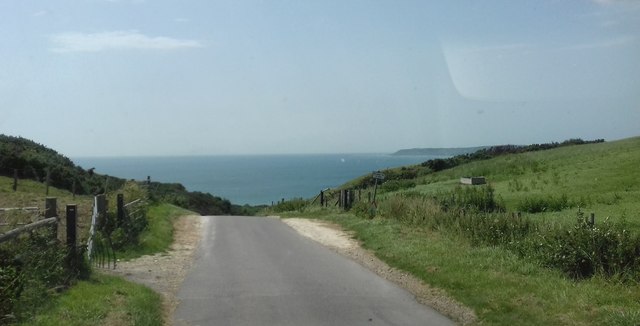
Moigns Down is a prominent hill located in the county of Dorset, England. Situated in an area of outstanding natural beauty, this geographical feature is a popular destination for hikers, nature enthusiasts, and photographers. Standing at an elevation of approximately 190 meters (623 feet), Moigns Down offers breathtaking panoramic views of the surrounding countryside and the English Channel.

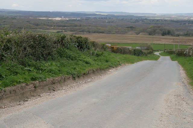
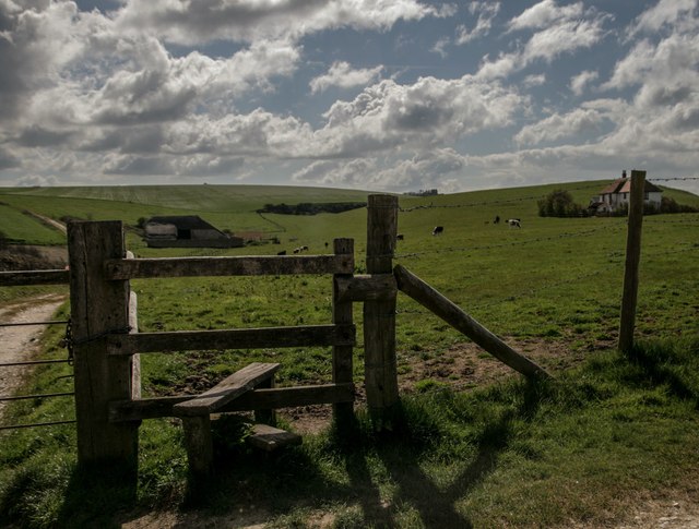
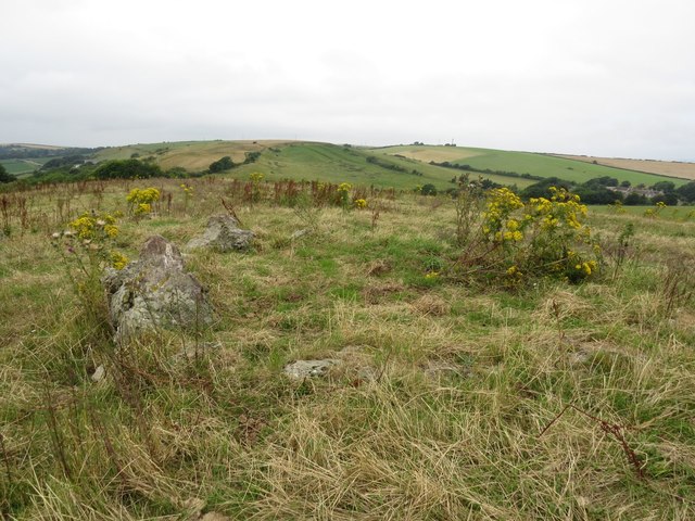
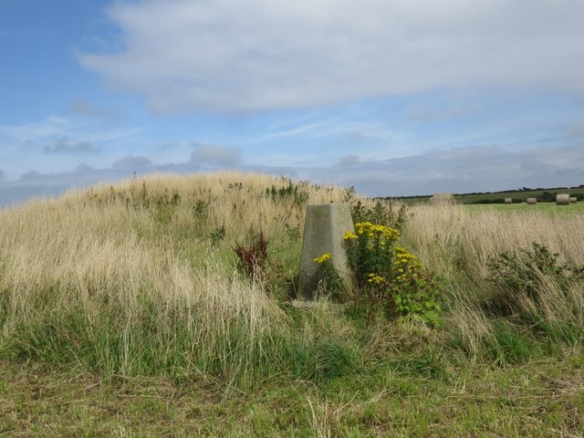
Covered in lush greenery, the hill is characterized by its rolling slopes and rocky outcrops, creating an enchanting landscape that is home to a variety of flora and fauna. The hill is predominantly covered in grassland, interspersed with patches of woodland and hedgerows, providing a diverse habitat for a range of wildlife.

Moigns Down attracts visitors throughout the year due to its rich cultural and historical significance. The area has evidence of human activity dating back to ancient times, with archaeological remains such as burial mounds and earthworks. It is believed that the hill was used as a strategic vantage point during various periods of history, including the Roman and Saxon eras.

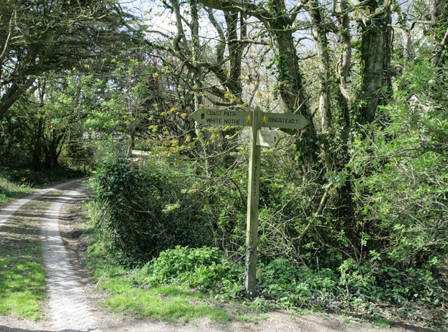
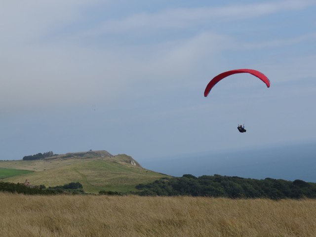
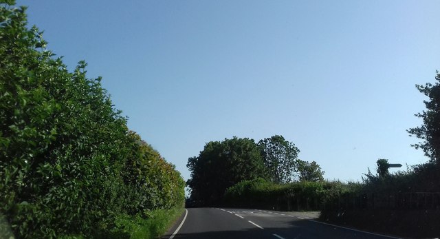
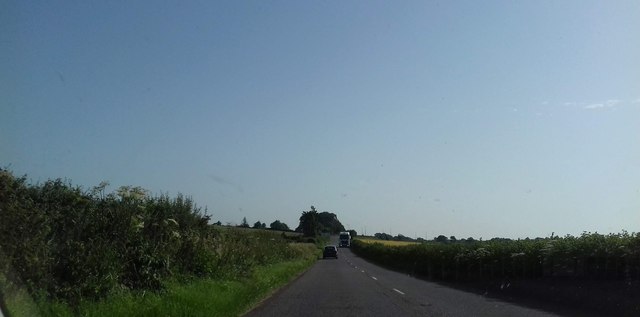
Accessible via a network of footpaths and trails, Moigns Down offers opportunities for outdoor activities such as walking, hiking, and birdwatching. The hill is a designated Site of Special Scientific Interest, reflecting its importance for conservation and biodiversity. Rare and protected species of plants and animals can be found here, including orchids, butterflies, and birds of prey.

Overall, Moigns Down in Dorset is a captivating natural landmark, combining stunning scenery, ancient history, and a haven for wildlife, making it an ideal destination for those seeking to immerse themselves in the beauty of the British countryside.

If you have any feedback on the listing, please let us know in the comments section below.

Moigns Down Images

Images are sourced within 2km of 50.651682/-2.3465884 or Grid Reference SY7583. Thanks to Geograph Open Source API. All images are credited.
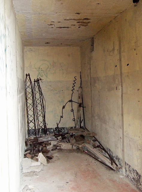
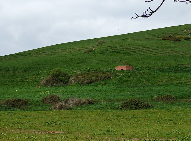
Stile by old radar station bunker Also waymarker for coast path
Stile by old radar station bunker
Also waymarker for coast path
Signpost on South-west Coast Path
Road north of Holworth Owermoigne Down barn roof can just be seen to the left of the road.
Road north of Holworth
Owermoigne Down barn roof can just be seen to the left of the road.
Stile and footpath past Brimstone Bottom Barn
Painted sign at North Holworth Farm
Cottages and letterbox at Holworth
Paraglider at Ringstead car park
Cairn circle on the South Dorset Ridgeway
Moigns Down trigpoint
Defending Dorset: RAF Ringstead Chain Home Radar Station (1) -
Chain Home radar station: DoB ID: e25089

Operational bunker No. 1. This bunker was one of two transmitter blocks for this wartime radar station. It was the first to be encountered during a 6 mile circular walk taking in some of the various extant remains of the technical site of the former RAF Ringstead Chain Home radar station. The station was established after the Battle of Britain in April 1941, comprising several earth covered bunkers housing transmitting and receiving equipment for both Chain Home (CH) and Chain Home Low (CHL) radars, together with a number of their associated aerial arrays - huge structures, some of the supporting towers as high as 350 feet. The domestic site was in the village of Upton where today a few of the buildings (and other remains) can still be seen, with some of them having been refurbished and put to modern use.

After the war the unit continued in operation, remaining in service until as late as 1956 as one of the post-war rotor stations, a direct result of the Cold War with Soviet Russia. The site was also used by a detachment of the USAF 2180 Communications Squadron, who from 1963 onwards operated a tropospheric scatter radio-relay link to Spain. This operated until 1974 when the site was closed, the tropo link decommissioned, and the massive parabolic antennas that had once dominated Ringstead Bay being dismantled and removed. <a title="https://www.geograph.org.uk/photo/5036308" href="https://www.geograph.org.uk/photo/5036308">Link</a>

<a href="https://www.geograph.org.uk/photo/5350834">SY7581 : Defending Dorset: RAF Ringstead Chain Home Radar Station (2)</a>
Defending Dorset: RAF Ringstead Chain Home Radar Station (1)
- Chain Home radar station: DoB ID: e25089 Operational bunker No. 1. This bunker was one of two transmitter blocks for this wartime radar station. It was the first to be encountered during a 6 mile circular walk taking in some of the various extant remains of the technical site of the former RAF Ringstead Chain Home radar station. The station was established after the Battle of Britain in April 1941, comprising several earth covered bunkers housing transmitting and receiving equipment for both Chain Home (CH) and Chain Home Low (CHL) radars, together with a number of their associated aerial arrays - huge structures, some of the supporting towers as high as 350 feet. The domestic site was in the village of Upton where today a few of the buildings (and other remains) can still be seen, with some of them having been refurbished and put to modern use. After the war the unit continued in operation, remaining in service until as late as 1956 as one of the post-war rotor stations, a direct result of the Cold War with Soviet Russia. The site was also used by a detachment of the USAF 2180 Communications Squadron, who from 1963 onwards operated a tropospheric scatter radio-relay link to Spain. This operated until 1974 when the site was closed, the tropo link decommissioned, and the massive parabolic antennas that had once dominated Ringstead Bay being dismantled and removed. Link SY7581 : Defending Dorset: RAF Ringstead Chain Home Radar Station (2)
Defending Dorset: RAF Ringstead Chain Home Radar Station (2) -
Chain Home radar station: DoB ID: e25089

Operational bunker No. 1.

<a href="https://www.geograph.org.uk/photo/5350837">SY7581 : Defending Dorset: RAF Ringstead Chain Home Radar Station (3)</a>
Defending Dorset: RAF Ringstead Chain Home Radar Station (2)
- Chain Home radar station: DoB ID: e25089 Operational bunker No. 1. SY7581 : Defending Dorset: RAF Ringstead Chain Home Radar Station (3)
Defending Dorset: RAF Ringstead Chain Home Radar Station (3) -
Chain Home radar station: DoB ID: e25089

Operational bunker No. 1. antenna feeder cable exits.

<a href="https://www.geograph.org.uk/photo/5350846">SY7581 : Defending Dorset: RAF Ringstead Chain Home Radar Station (4)</a>]
Defending Dorset: RAF Ringstead Chain Home Radar Station (3)
- Chain Home radar station: DoB ID: e25089 Operational bunker No. 1. antenna feeder cable exits. SY7581 : Defending Dorset: RAF Ringstead Chain Home Radar Station (4)]
Defending Dorset: RAF Ringstead Chain Home Radar Station (4) -
Chain Home radar station: DoB ID: e25089

Operational bunker No. 1. In the corner on the right are a pair of WW2 era screw pickets used universally by the military as supports for barbed wire fencing.

<a href="https://www.geograph.org.uk/photo/5350855">SY7581 : Defending Dorset: RAF Ringstead Chain Home Radar Station (5)</a>
Defending Dorset: RAF Ringstead Chain Home Radar Station (4)
- Chain Home radar station: DoB ID: e25089 Operational bunker No. 1. In the corner on the right are a pair of WW2 era screw pickets used universally by the military as supports for barbed wire fencing. SY7581 : Defending Dorset: RAF Ringstead Chain Home Radar Station (5)
Defending Dorset: RAF Ringstead Chain Home Radar Station (5) -
Chain Home radar station: DoB ID: e25089

Operational bunker No. 1. An interpretation panel at the site gives an overview of the Chain Home radar system, and a brief description of RAF Ringstead that includes an artist's impression of the bunker during WW2 when it was operational.

<a href="https://www.geograph.org.uk/photo/5350870">SY7581 : Defending Dorset: RAF Ringstead Chain Home Radar Station (6)</a>
Defending Dorset: RAF Ringstead Chain Home Radar Station (5)
- Chain Home radar station: DoB ID: e25089 Operational bunker No. 1. An interpretation panel at the site gives an overview of the Chain Home radar system, and a brief description of RAF Ringstead that includes an artist's impression of the bunker during WW2 when it was operational. SY7581 : Defending Dorset: RAF Ringstead Chain Home Radar Station (6)
Defending Dorset: RAF Ringstead Chain Home Radar Station (7) -
Chain Home radar station: DoB ID: e25089
Pillbox (Variant): DoB ID S0000111

Having turned away from the coast temporarily and moved inland, high up on the hillside a lone pillbox is encountered having commanding views over the approach from the valley below, as well as an overall view over the whole site.

<a href="https://www.geograph.org.uk/photo/5350902">SY7481 : Defending Dorset: RAF Ringstead Chain Home Radar Station (8)</a>
Defending Dorset: RAF Ringstead Chain Home Radar Station (7)
- Chain Home radar station: DoB ID: e25089 Pillbox (Variant): DoB ID S0000111 Having turned away from the coast temporarily and moved inland, high up on the hillside a lone pillbox is encountered having commanding views over the approach from the valley below, as well as an overall view over the whole site. SY7481 : Defending Dorset: RAF Ringstead Chain Home Radar Station (8)
A353 in Poxwell A353 heading through Poxwell and towards Warmwell Cross Roundabout
A353 in Poxwell
A353 heading through Poxwell and towards Warmwell Cross Roundabout
A353 heading towards Warmwell Cross Roundabout Warmwell Cross Roundabout is at the end of this road
A353 heading towards Warmwell Cross Roundabout
Warmwell Cross Roundabout is at the end of this road
Road down to Ringstead This road heads down to Ringstead
Road down to Ringstead
This road heads down to Ringstead
Show me another place!

Moigns Down is located at Grid Ref: SY7583 (Lat: 50.651682, Lng: -2.3465884)

Unitary Authority: Dorset

Police Authority: Dorset

What 3 Words

///distract.organic.retaliate. Near Overcombe, Dorset

Related Wikis

St John's Church, Poxwell

St John's Church was a Church of England church in Poxwell, Dorset, England. It was built in 1867–68 as a replacement to an earlier church and was demolished...

Poxwell

Poxwell (; sometimes written Pokeswell) is a hamlet and civil parish in the county of Dorset in southwest England. It is located 6 miles (9.7 km) east...
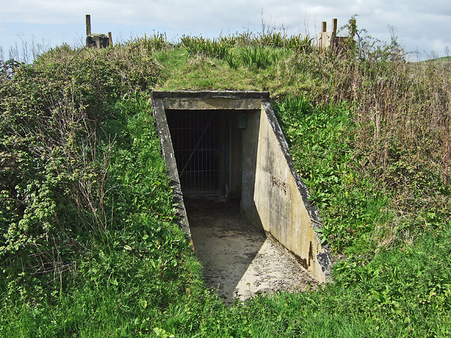
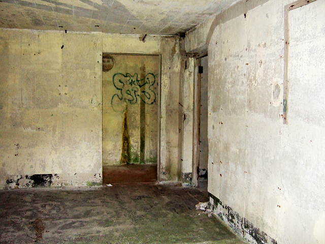
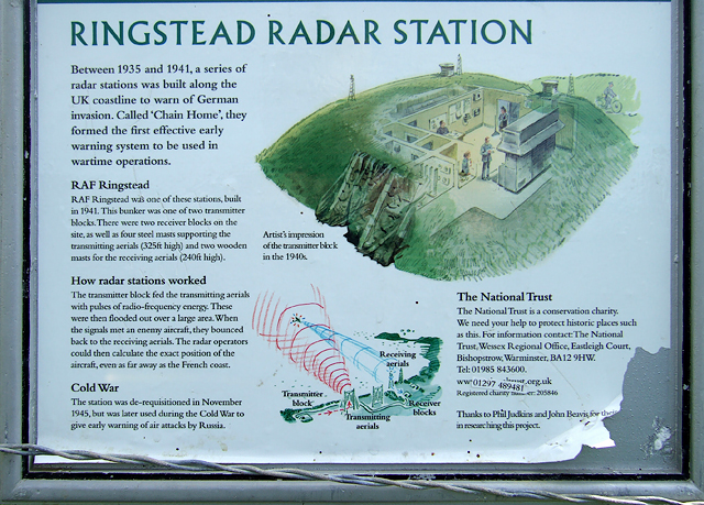
RAF Ringstead

RAF Ringstead is a former Royal Air Force radar station at Ringstead Bay, Dorset, England. It is notable for having served three separate functions: first...

St Catherine-by-the-Sea, Holworth

St Catherine-by-the-Sea is a Church of England church in Holworth, Dorset, England. The small wooden church, which forms part of the Watercombe Benefice...

Nearby Amenities

Located within 500m of 50.651682,-2.3465884
The data included in this document is from www.openstreetmap.org. The data is made available under ODbL.

Have you been to Moigns Down?

Leave your review of Moigns Down below (or comments, questions and feedback).