Crag Hill

Hill, Mountain in Westmorland Eden

England

Crag Hill

Moorland by Wasdale Beck From the A6 as it descends from Shap
Moorland by Wasdale Beck Credit: Eirian Evans

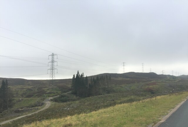
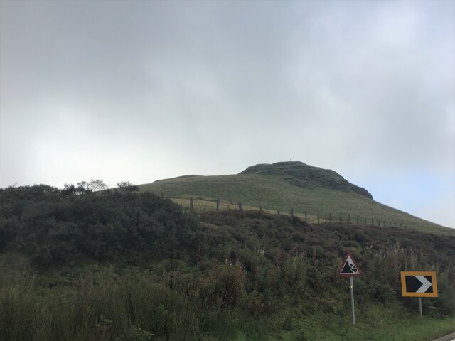
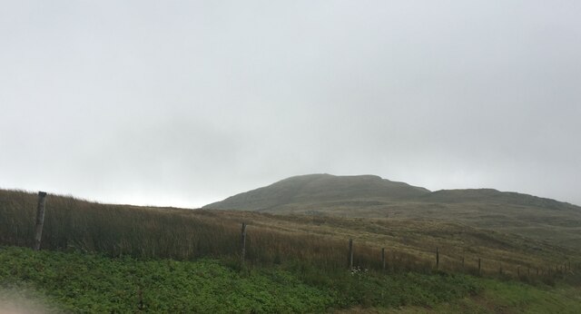
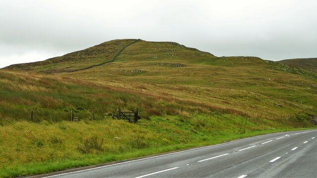
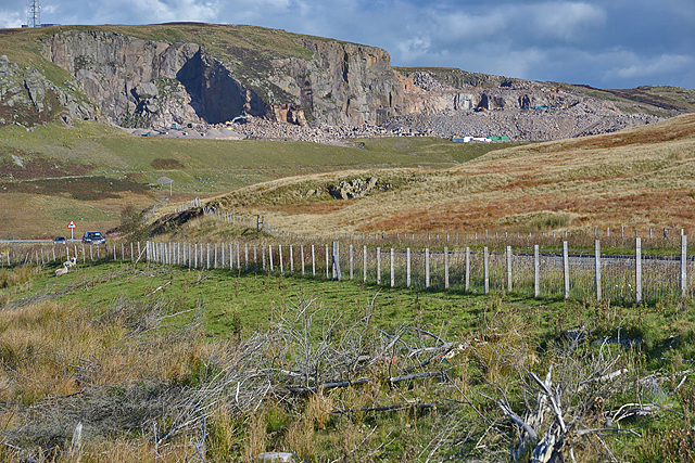
Crag Hill, also known as Eel Crag, is a prominent hill located in the Lake District National Park in Cumbria, England. Standing at an elevation of 839 meters (2,753 feet), it is one of the highest peaks in the region and offers breathtaking views of the surrounding landscape.

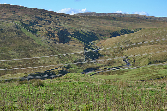
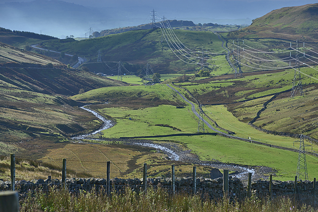
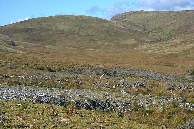
Situated in the Western Fells, Crag Hill is part of a ridge that runs between the valleys of Coledale and Buttermere. It is commonly climbed as part of the Coledale Horseshoe, a popular circular walk that includes several other peaks in the area.

The summit of Crag Hill is marked by a cairn, providing a great spot for hikers to rest and take in the panoramic vistas. On a clear day, one can admire the stunning scenery of the Lake District, with sweeping views of nearby peaks such as Grasmoor, Grisedale Pike, and Causey Pike.

The terrain leading up to Crag Hill is rugged and steep, with rocky outcrops and scree slopes, making it a challenging but rewarding ascent for experienced hikers. The route can be accessed from various starting points, including Braithwaite, Keswick, and Buttermere.

Crag Hill is known for its diverse wildlife, with the chance to spot red deer, birds of prey, and even the occasional glimpse of a golden eagle. The hill also holds historical significance, as evidence of ancient mining operations can be found in the surrounding area.

Overall, Crag Hill is a remarkable natural landmark that attracts outdoor enthusiasts, providing an exhilarating hiking experience and stunning vistas of the Lake District's unrivaled beauty.

If you have any feedback on the listing, please let us know in the comments section below.

Crag Hill Images

Images are sourced within 2km of 54.454379/-2.6680617 or Grid Reference NY5606. Thanks to Geograph Open Source API. All images are credited.

Moorland by Wasdale Beck From the A6 as it descends from Shap
Moorland by Wasdale Beck
From the A6 as it descends from Shap
Packhorse Hill On a drover's route from Salterworth to Shap
Packhorse Hill
On a drover's route from Salterworth to Shap
Crookdale Crag At 1404ft, Crookdale Crag is in the Eastern Fells
Crookdale Crag
At 1404ft, Crookdale Crag is in the Eastern Fells
Shap Pink Quarry Granite quarry above the M6.
Shap Pink Quarry
Granite quarry above the M6.
Crookdale Crag Towering above the A6 road
Crookdale Crag
Towering above the A6 road
View up Crookdale Somewhat ruined by the number of power lines.
View up Crookdale
Somewhat ruined by the number of power lines.
View down Crookdale On an improving morning as rain creeps away.
View down Crookdale
On an improving morning as rain creeps away.
Forestry clearfell and Wasdale This is the eastern Wasdale, not to be compared with the western one.
Forestry clearfell and Wasdale
This is the eastern Wasdale, not to be compared with the western one.
View towards Shap Pink Quarry With the A6 in the foreground.
View towards Shap Pink Quarry
With the A6 in the foreground.
Electricity transmission poles
A6 looking north, Crookdale The A6 is one of the main historic north south roads in England. At 299 miles long it is the fourth longest road in the country. It currently runs from Luton in Bedfordshire to Carlisle in Cumbria, although it formerly started at a junction with the A1 at Barnet.
Wikipedia: <span class="nowrap"><a title="http://en.wikipedia.org/wiki/A6_road_(England)" rel="nofollow ugc noopener" href="http://en.wikipedia.org/wiki/A6_road_(England)">Link</a><img style="margin-left:2px;" alt="External link" title="External link - shift click to open in new window" src="https://s1.geograph.org.uk/img/external.png" width="10" height="10"/></span> 
See also <span class="nowrap"><a title="http://www.sabre-roads.org.uk/wiki/index.php?title=A6" rel="nofollow ugc noopener" href="http://www.sabre-roads.org.uk/wiki/index.php?title=A6">Link</a><img style="margin-left:2px;" alt="External link" title="External link - shift click to open in new window" src="https://s1.geograph.org.uk/img/external.png" width="10" height="10"/></span> for more route detail.
A6 looking north, Crookdale
The A6 is one of the main historic north south roads in England. At 299 miles long it is the fourth longest road in the country. It currently runs from Luton in Bedfordshire to Carlisle in Cumbria, although it formerly started at a junction with the A1 at Barnet. Wikipedia: LinkExternal link See also LinkExternal link for more route detail.
Rocky outcrop beside the A6, Crookdale The A6 is one of the main historic north south roads in England. At 299 miles long it is the fourth longest road in the country. It currently runs from Luton in Bedfordshire to Carlisle in Cumbria, although it formerly started at a junction with the A1 at Barnet.
Wikipedia: <span class="nowrap"><a title="http://en.wikipedia.org/wiki/A6_road_(England)" rel="nofollow ugc noopener" href="http://en.wikipedia.org/wiki/A6_road_(England)">Link</a><img style="margin-left:2px;" alt="External link" title="External link - shift click to open in new window" src="https://s1.geograph.org.uk/img/external.png" width="10" height="10"/></span> 
See also <span class="nowrap"><a title="http://www.sabre-roads.org.uk/wiki/index.php?title=A6" rel="nofollow ugc noopener" href="http://www.sabre-roads.org.uk/wiki/index.php?title=A6">Link</a><img style="margin-left:2px;" alt="External link" title="External link - shift click to open in new window" src="https://s1.geograph.org.uk/img/external.png" width="10" height="10"/></span> for more route detail.
Rocky outcrop beside the A6, Crookdale
The A6 is one of the main historic north south roads in England. At 299 miles long it is the fourth longest road in the country. It currently runs from Luton in Bedfordshire to Carlisle in Cumbria, although it formerly started at a junction with the A1 at Barnet. Wikipedia: LinkExternal link See also LinkExternal link for more route detail.
Uphill towards Shap Heading north on the A6.
Uphill towards Shap
Heading north on the A6.
Bridleway off the A6 The A6 is one of the main historic north south roads in England. At 299 miles long it is the fourth longest road in the country. It currently runs from Luton in Bedfordshire to Carlisle in Cumbria, although it formerly started at a junction with the A1 at Barnet.
Wikipedia: <span class="nowrap"><a title="http://en.wikipedia.org/wiki/A6_road_(England)" rel="nofollow ugc noopener" href="http://en.wikipedia.org/wiki/A6_road_(England)">Link</a><img style="margin-left:2px;" alt="External link" title="External link - shift click to open in new window" src="https://s1.geograph.org.uk/img/external.png" width="10" height="10"/></span> 
See also <span class="nowrap"><a title="http://www.sabre-roads.org.uk/wiki/index.php?title=A6" rel="nofollow ugc noopener" href="http://www.sabre-roads.org.uk/wiki/index.php?title=A6">Link</a><img style="margin-left:2px;" alt="External link" title="External link - shift click to open in new window" src="https://s1.geograph.org.uk/img/external.png" width="10" height="10"/></span> for more route detail.
Bridleway off the A6
The A6 is one of the main historic north south roads in England. At 299 miles long it is the fourth longest road in the country. It currently runs from Luton in Bedfordshire to Carlisle in Cumbria, although it formerly started at a junction with the A1 at Barnet. Wikipedia: LinkExternal link See also LinkExternal link for more route detail.
Uphill towards Shap Heading north on the A6.
Uphill towards Shap
Heading north on the A6.
Moorland, Demings Moss East of the A6.
Moorland, Demings Moss
East of the A6.
Former telephone trunk repeater station beside the A6 See <a href="https://www.geograph.org.uk/photo/114286">NY5506 : Former Telecom Substation at Shap Summit</a> for a closer view.
Former telephone trunk repeater station beside the A6
A6 looking north Towards Shap.
A6 looking north
Towards Shap.
Show me another place!

Crag Hill is located at Grid Ref: NY5606 (Lat: 54.454379, Lng: -2.6680617)

Administrative County: Cumbria

District: Eden

Police Authority: Cumbria

What 3 Words

///final.caressing.rags. Near Shap, Cumbria

Related Wikis

Birkbeck Fells

Birkbeck Fells is a township located in part of the parishes of Crosby Ravensworth, Orton and Shap in the historic county of Westmorland. It is a large...

Bretherdale Head

Bretherdale Head is a hamlet in Cumbria, England. Meaning "Valley of the Brother", it was referred to as Britherdal in the 12th century. == References ==

Wasdale Horseshoe

The Wasdale Horseshoe is a group of hills on the eastern fringe of the English Lake District, to the west of the A6, south of Shap, Cumbria. They surround...

Scout Green

Scout Green is a hamlet and small area of farm land near the village of Tebay in Cumbria, England. == History == It is best known among railway enthusiasts...

Greenholme

Greenholme is a hamlet in Cumbria, England.The Greenholme Gala and Agricultural Show is held there annually.Greenholme Bridge crosses the Birk Beck in...

Crookdale Horseshoe

The Crookdale Horseshoe is a group of hills on the eastern edge of the English Lake District, in Cumbria, west of the A6 road. They are the subject of...

Borrowdale, Westmorland

Borrowdale is a valley in the English Lake District. It is located in the county of Westmorland, and is sometimes referred to as Westmorland Borrowdale...

Tebay Services

Tebay Services are motorway service stations on the M6 motorway in the Westmorland and Furness district of Cumbria, England. The northbound opened in 1972...

Nearby Amenities

Located within 500m of 54.454379,-2.6680617
Ele: 401.4
Is In Country Code: GB
Man Made: cairn
Natural: peak
Source: NPE
Lat/Long: 54.4542777/-2.6683348
The data included in this document is from www.openstreetmap.org. The data is made available under ODbL.

Have you been to Crag Hill?

Leave your review of Crag Hill below (or comments, questions and feedback).