Arnside Knott

Hill, Mountain in Westmorland South Lakeland

England

Arnside Knott

Arnside Knott Wood Gateways to a gentle woodland walk
Arnside Knott Wood Credit: Andrew Shannon

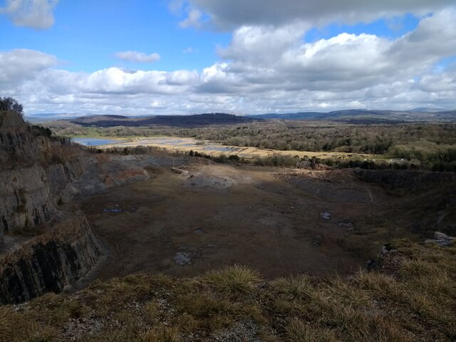
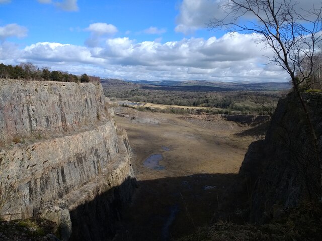
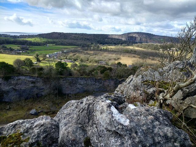
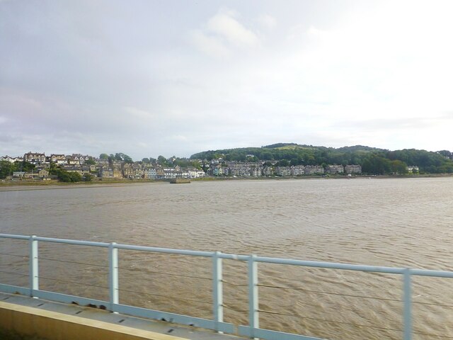
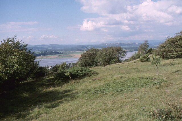
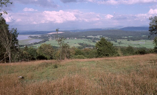
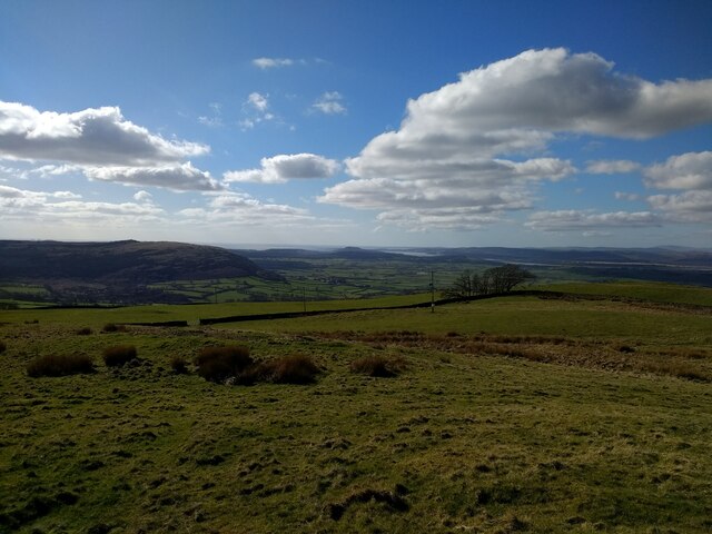
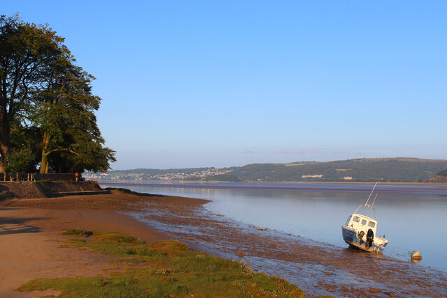
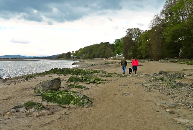
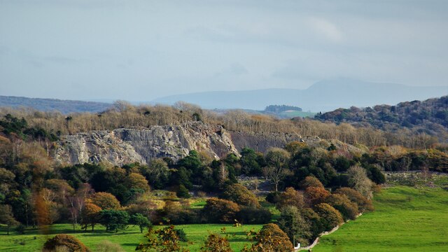
Arnside Knott is a prominent limestone hill located in Westmorland, a historic county in the northwestern part of England. Rising to a height of 159 meters (522 feet), it offers stunning panoramic views of the surrounding countryside, including the Kent Estuary, Morecambe Bay, and the Lake District National Park.

This hill is known for its rich biodiversity, making it a popular destination for nature enthusiasts and hikers. Its slopes are covered with a diverse range of habitats, including woodlands, grasslands, and limestone pavement. These habitats support a variety of plant and animal species, some of which are rare and protected. Visitors may spot wildflowers such as bird's-foot trefoil, rock rose, and cowslip, as well as a range of bird species such as buzzards, kestrels, and peregrine falcons.

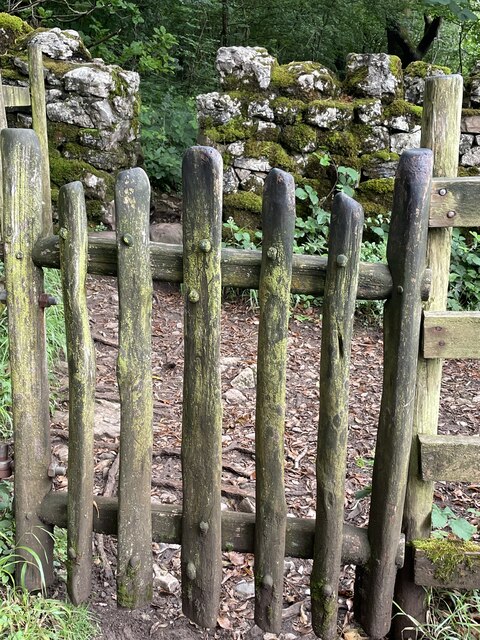
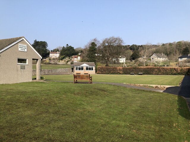
Arnside Knott is also home to several walking trails, including the circular Arnside Knott Woodland Walk, which takes visitors through ancient woodlands and offers breathtaking views of the estuary. Another popular route is the Arnside Knott and Silverdale Circular, which allows hikers to explore the neighboring Silverdale area.

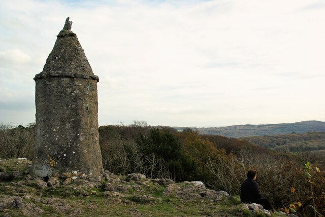
Aside from its natural beauty, Arnside Knott has historical significance as well. It is believed to have been a site of human settlement since prehistoric times, with evidence of ancient hill forts and burial mounds found in the area.

Overall, Arnside Knott is a picturesque hill that offers a wealth of natural beauty, stunning views, and historical interest, making it a must-visit destination for anyone exploring the Westmorland region.

If you have any feedback on the listing, please let us know in the comments section below.

Arnside Knott Images

Images are sourced within 2km of 54.190213/-2.8351942 or Grid Reference SD4577. Thanks to Geograph Open Source API. All images are credited.

Arnside Knott Wood Gateways to a gentle woodland walk
Arnside Knott Wood
Gateways to a gentle woodland walk
Middlebarrow Quarry
Middlebarrow Quarry
Middlebarrow Quarry
Middlebarrow Quarry
Arnside Tower
Arnside Tower
View towards Middlebarrow from the high point of Trowbarrow quarry
River Kent River Kent viewed from the Kent Viaduct. Arnside town in distance
River Kent
River Kent viewed from the Kent Viaduct. Arnside town in distance
The Kent Estuary near Grubbins Wood A late afternoon view of the Kent Estuary on New Year's Day 2022 after the hordes had headed back to Arnside.

This photograph was taken during the Coronavirus (COVID-19) pandemic of 2020/21/22.
The Kent Estuary near Grubbins Wood
A late afternoon view of the Kent Estuary on New Year's Day 2022 after the hordes had headed back to Arnside. This photograph was taken during the Coronavirus (COVID-19) pandemic of 2020/21/22.
Arnside Knott Looking north-northeast over the Kent Estuary. Part of the Kent Viaduct is visible behind the trees in the centre.

Arnside Knott is a National Trust property renowned for its wildlife on this important limestone outcrop.

Position within the square uncertain.
Arnside Knott
Looking north-northeast over the Kent Estuary. Part of the Kent Viaduct is visible behind the trees in the centre. Arnside Knott is a National Trust property renowned for its wildlife on this important limestone outcrop. Position within the square uncertain.
Arnside Knott Looking northeast towards Storth and Sandside Quarry.

Arnside Knott is a National Trust property renowned for its wildlife on this important limestone outcrop.

Position within the square uncertain.
Arnside Knott
Looking northeast towards Storth and Sandside Quarry. Arnside Knott is a National Trust property renowned for its wildlife on this important limestone outcrop. Position within the square uncertain.
View towards Silverdale from Scout Hill
The Pepper Pot Stone folly tower built to commemorate the Golden Jubilee of Queen Victoria in 1887.
The Pepper Pot
Stone folly tower built to commemorate the Golden Jubilee of Queen Victoria in 1887.
Silverdale Bowling Club
Arnside Promenade Coast at Arnside.
Arnside Promenade
Coast at Arnside.
Beachwood House Right down there on the foreshore of the Kent Estuary.
Beachwood House
Right down there on the foreshore of the Kent Estuary.
A quick foreshore walk The deteriorating weather discouraged walkers from going very far from Arnside on this late-April afternoon.
A quick foreshore walk
The deteriorating weather discouraged walkers from going very far from Arnside on this late-April afternoon.
Middlebarrow Quarry From Eaves Wood
Middlebarrow Quarry
From Eaves Wood
Jubilee Memorial (The Pepper Pot) On Castlebarrow Head
Jubilee Memorial (The Pepper Pot)
On Castlebarrow Head
Arnside Tower View from east of the fortified house
Arnside Tower
View from east of the fortified house
Show me another place!

Arnside Knott is located at Grid Ref: SD4577 (Lat: 54.190213, Lng: -2.8351942)

Administrative County: Cumbria

District: South Lakeland

Police Authority: Cumbria

What 3 Words

///haunt.picturing.stylists. Near Arnside, Cumbria

Related Wikis

Arnside Knott

Arnside Knott is a hill with a summit elevation of 159 metres (522 ft), near Arnside, Cumbria, England. Although it is in South Lakeland district it is...
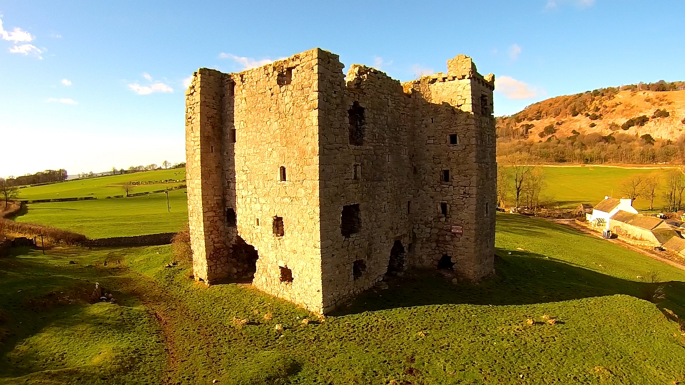
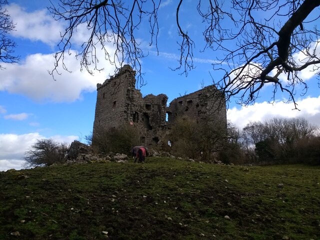
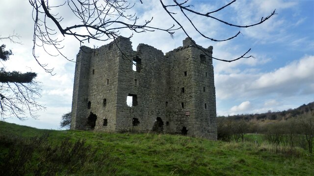
Arnside Tower

Arnside Tower is a late-medieval tower house (or Pele tower) between Arnside and Silverdale immediately to the south of Arnside Knott in Cumbria, England...

Arnside

Arnside is a village and civil parish in Cumbria, historically part of Westmorland, near the border with Lancashire, England. The Lake District National...

Arnside Bore

The Arnside Bore is a tidal bore on the estuary of the River Kent in England, United Kingdom.The bore occurs at high tides, especially spring tides, where...

Far Arnside

Far Arnside is a hamlet in Arnside civil parish in the South Lakeland district, Cumbria, England. == Location == It is located near the large villages...

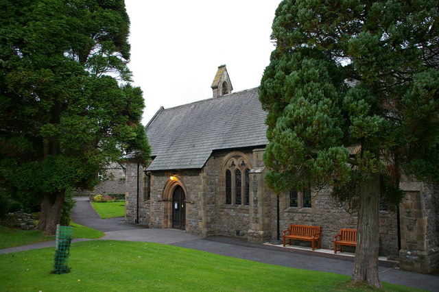
St James' Church, Arnside

St James' Church is in the village of Arnside, Cumbria, England. It is an active Anglican parish church in the deanery of Kendal, the archdeaconry of...

Limestone Link (Cumbria)

The Limestone Link is a waymarked footpath in South Lakeland, Cumbria, England, connecting Arnside and Kirkby Lonsdale, a distance of 13 miles (21 km)...

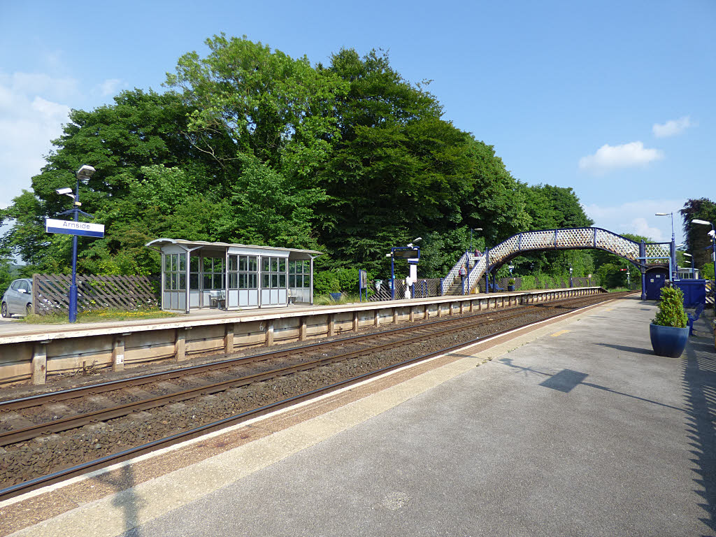
Arnside railway station

Arnside is a railway station on the Furness Line, which runs between Barrow-in-Furness and Lancaster. The station, situated 12+1⁄4 miles (20 km) north...

Nearby Amenities

Located within 500m of 54.190213,-2.8351942
Arnside Knott
Ele: 159
Image: https://www.geograph.org.uk/photo/4559805
Man Made: survey_point
Natural: peak
Note: Marilyn
Ref: S5406
Tpuk Ref: TP0889
Triangulation Point: yes
Wikidata: Q697500
Wikipedia: en:Arnside Knott
Lat/Long: 54.1902271/-2.8351902
Red Hills
Is In: South Lakeland, Cumbria, England, UK
Place: locality
Source: NPE; survey
Lat/Long: 54.1924616/-2.8358759
Turning Circle
Lat/Long: 54.1921401/-2.8310476
Barrier: stile
Lat/Long: 54.1899271/-2.8295993
Parking
Lat/Long: 54.1886541/-2.8312894
Barrier: kissing_gate
Lat/Long: 54.1943711/-2.8349322
Bench
Lat/Long: 54.1890182/-2.8393099
Bench
Lat/Long: 54.1879808/-2.8417386
Bench
Material: wood
Lat/Long: 54.1901277/-2.8365512
Bench
Lat/Long: 54.193985/-2.8335042
Bench
Lat/Long: 54.1905972/-2.8371682
Bench
Lat/Long: 54.1912874/-2.8358905
Image: https://www.geograph.org.uk/photo/6326329
Tourism: viewpoint
Lat/Long: 54.1892906/-2.8416663
The data included in this document is from www.openstreetmap.org. The data is made available under ODbL.

Have you been to Arnside Knott?

Leave your review of Arnside Knott below (or comments, questions and feedback).