Llanblethian Hill

Hill, Mountain in Glamorgan

Wales

Llanblethian Hill

Cowbridge The Bear Hotel Cowbridge
Cowbridge Credit: Colin Prosser

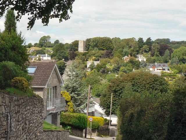
Llanblethian Hill, located in the county of Glamorgan in South Wales, is a prominent hill/mountain that stands approximately 227 meters (745 feet) tall. It is situated near the village of Llanblethian, which is about 1.6 kilometers (1 mile) southeast of the town of Cowbridge.

Llanblethian Hill is a well-known landmark in the area, offering breathtaking panoramic views of the surrounding countryside. Its location provides visitors with the opportunity to enjoy stunning vistas over the Vale of Glamorgan and even glimpse the Bristol Channel on clear days.

The hill is a popular destination for outdoor enthusiasts, attracting hikers, walkers, and nature lovers. It is crisscrossed by a network of footpaths and trails, allowing visitors to explore its diverse landscape, which includes lush green meadows, wooded areas, and rocky outcrops. The variety of habitats found on Llanblethian Hill supports a rich array of flora and fauna, making it a haven for wildlife.

Llanblethian Hill also holds historical significance. At its summit, there are remnants of an Iron Age hillfort, which dates back over 2,000 years. These ancient earthworks give a glimpse into the hill's past and provide an interesting insight into the region's history.

Overall, Llanblethian Hill is a picturesque and historically significant natural landmark in Glamorgan. Its accessibility, stunning views, and ecological importance make it a popular destination for both locals and tourists seeking a tranquil escape into nature.

If you have any feedback on the listing, please let us know in the comments section below.

Llanblethian Hill Images

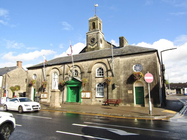
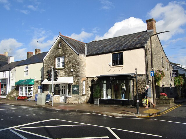
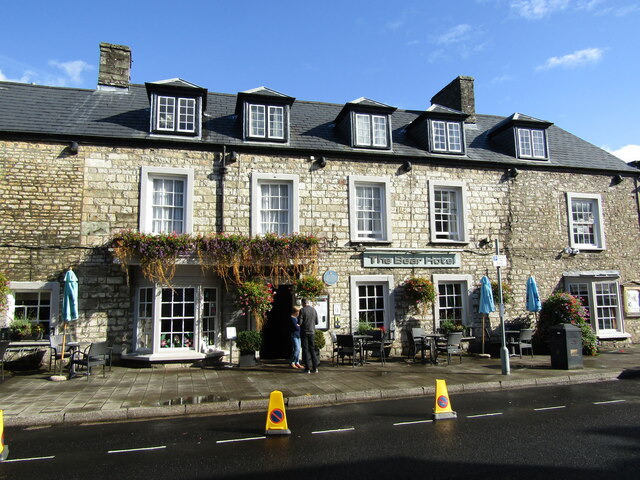
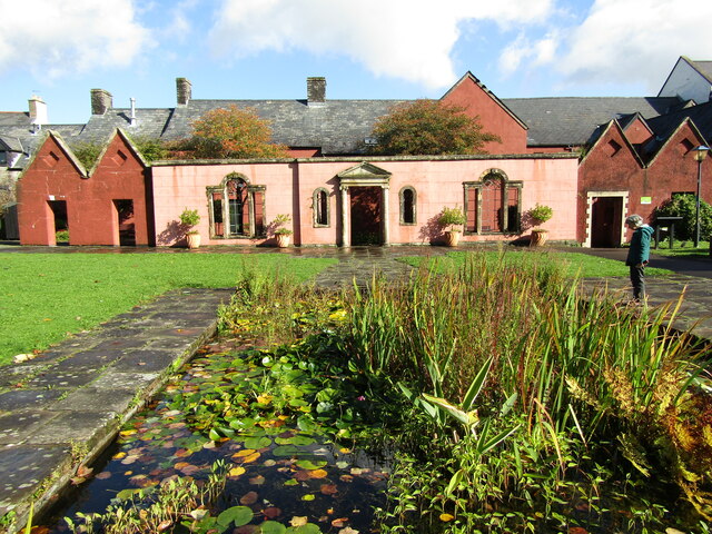
Images are sourced within 2km of 51.458611/-3.4643429 or Grid Reference SS9874. Thanks to Geograph Open Source API. All images are credited.

Cowbridge The Bear Hotel Cowbridge
Cowbridge
The Bear Hotel Cowbridge
Cowbridge - Horse and Groom High Street pub, adjacent to the Town Hall, and set in a stone-built Victorian block (1891).
Cowbridge - Horse and Groom
High Street pub, adjacent to the Town Hall, and set in a stone-built Victorian block (1891).
Cowbridge - Town Hall The building is a former House of Correction and was converted to a town hall in 1830, then enlarged in 1895.
<span class="nowrap"><a title="www.cowbridge-tc.gov.uk" rel="nofollow ugc noopener" href="http://www.cowbridge-tc.gov.uk">Link</a><img style="margin-left:2px;" alt="External link" title="External link - shift click to open in new window" src="https://s1.geograph.org.uk/img/external.png" width="10" height="10"/></span>
Cowbridge - Town Hall
The building is a former House of Correction and was converted to a town hall in 1830, then enlarged in 1895. LinkExternal link
Cowbridge - High Street Historic building now housing the "tipsy Kitchen" cafe and the E91 clothes shop.
<span class="nowrap"><a title="www.cowbridge-tc.gov.uk" rel="nofollow ugc noopener" href="http://www.cowbridge-tc.gov.uk">Link</a><img style="margin-left:2px;" alt="External link" title="External link - shift click to open in new window" src="https://s1.geograph.org.uk/img/external.png" width="10" height="10"/></span>
Cowbridge - High Street
Historic building now housing the "tipsy Kitchen" cafe and the E91 clothes shop. LinkExternal link
Cowbridge - High Street A mix of building fronts and gables on Cowbridge's historic High Street.
<span class="nowrap"><a title="www.cowbridge-tc.gov.uk" rel="nofollow ugc noopener" href="http://www.cowbridge-tc.gov.uk">Link</a><img style="margin-left:2px;" alt="External link" title="External link - shift click to open in new window" src="https://s1.geograph.org.uk/img/external.png" width="10" height="10"/></span>
Cowbridge - High Street
A mix of building fronts and gables on Cowbridge's historic High Street. LinkExternal link
Cowbridge - High Street Historic gabled buildings now housing Arthur John & Co (hardware store) and Tallia (clothes shop).
<span class="nowrap"><a title="www.cowbridge-tc.gov.uk" rel="nofollow ugc noopener" href="http://www.cowbridge-tc.gov.uk">Link</a><img style="margin-left:2px;" alt="External link" title="External link - shift click to open in new window" src="https://s1.geograph.org.uk/img/external.png" width="10" height="10"/></span>
Cowbridge - High Street
Historic gabled buildings now housing Arthur John & Co (hardware store) and Tallia (clothes shop). LinkExternal link
Cowbridge - Vale of Glamorgan Historic High Street inn in the eponymous Vale of Glamorgan. Within the fabric is now a dogs grooming business - and have a hair of the dog next door?
<span class="nowrap"><a title="www.cowbridge-tc.gov.uk" rel="nofollow ugc noopener" href="http://www.cowbridge-tc.gov.uk">Link</a><img style="margin-left:2px;" alt="External link" title="External link - shift click to open in new window" src="https://s1.geograph.org.uk/img/external.png" width="10" height="10"/></span>
Cowbridge - Vale of Glamorgan
Historic High Street inn in the eponymous Vale of Glamorgan. Within the fabric is now a dogs grooming business - and have a hair of the dog next door? LinkExternal link
Cowbridge - Vale of Glamorgan Inn Vintage wall sign advertising Hancock's Beer, a Cardiff brewer bought by Brains in 1999.
Cowbridge - Vale of Glamorgan Inn
Vintage wall sign advertising Hancock's Beer, a Cardiff brewer bought by Brains in 1999.
Cowbridge - The Bear Hotel Historic inn on Cowbridge's High Street.
<span class="nowrap"><a title="www.cowbridge-tc.gov.uk" rel="nofollow ugc noopener" href="http://www.cowbridge-tc.gov.uk">Link</a><img style="margin-left:2px;" alt="External link" title="External link - shift click to open in new window" src="https://s1.geograph.org.uk/img/external.png" width="10" height="10"/></span>
Cowbridge - The Bear Hotel
Historic inn on Cowbridge's High Street. LinkExternal link
Cowbridge - High Street Historic building, attractively clad with ivy.
<span class="nowrap"><a title="www.cowbridge-tc.gov.uk" rel="nofollow ugc noopener" href="http://www.cowbridge-tc.gov.uk">Link</a><img style="margin-left:2px;" alt="External link" title="External link - shift click to open in new window" src="https://s1.geograph.org.uk/img/external.png" width="10" height="10"/></span>
Cowbridge - High Street
Historic building, attractively clad with ivy. LinkExternal link
Cowbridge - Old Hall Grounds Medieval building located within historic Roman and Town Wall bounds.
<span class="nowrap"><a title="www.oldhallgardens.org" rel="nofollow ugc noopener" href="http://www.oldhallgardens.org">Link</a><img style="margin-left:2px;" alt="External link" title="External link - shift click to open in new window" src="https://s1.geograph.org.uk/img/external.png" width="10" height="10"/></span>
Cowbridge - Old Hall Grounds
Medieval building located within historic Roman and Town Wall bounds. LinkExternal link
Cowbridge - Physic Garden Classical style temple within Cowbridge's historic herbal medicine garden.
<span class="nowrap"><a title="www.cowbridgephysicgarden.org" rel="nofollow ugc noopener" href="http://www.cowbridgephysicgarden.org">Link</a><img style="margin-left:2px;" alt="External link" title="External link - shift click to open in new window" src="https://s1.geograph.org.uk/img/external.png" width="10" height="10"/></span>
Cowbridge - Physic Garden
Classical style temple within Cowbridge's historic herbal medicine garden. LinkExternal link
Cowbridge - Physic Garden Espalier apples within Cowbridge's historic herbal medicine garden.
<span class="nowrap"><a title="www.cowbridgephysicgarden.org" rel="nofollow ugc noopener" href="http://www.cowbridgephysicgarden.org">Link</a><img style="margin-left:2px;" alt="External link" title="External link - shift click to open in new window" src="https://s1.geograph.org.uk/img/external.png" width="10" height="10"/></span>
Cowbridge - Physic Garden
Espalier apples within Cowbridge's historic herbal medicine garden. LinkExternal link
Cowbridge - Font "The font is of early Norman design and is carved from a single block of local Sutton stone".
<span class="nowrap"><a title="www.cowbridgeparish.com" rel="nofollow ugc noopener" href="http://www.cowbridgeparish.com">Link</a><img style="margin-left:2px;" alt="External link" title="External link - shift click to open in new window" src="https://s1.geograph.org.uk/img/external.png" width="10" height="10"/></span>
Cowbridge - Font
"The font is of early Norman design and is carved from a single block of local Sutton stone". LinkExternal link
Cowbridge - Royal British Legion Flags Within the historic Holy Cross Church.
<span class="nowrap"><a title="www.cowbridgeparish.com" rel="nofollow ugc noopener" href="http://www.cowbridgeparish.com">Link</a><img style="margin-left:2px;" alt="External link" title="External link - shift click to open in new window" src="https://s1.geograph.org.uk/img/external.png" width="10" height="10"/></span>
Cowbridge - Royal British Legion Flags
Within the historic Holy Cross Church. LinkExternal link
Cowbridge - Town Hall Square Historic water pump just off Cowbridge's High Street.
Cowbridge - Town Hall Square
Historic water pump just off Cowbridge's High Street.
Cowbridge - Town Hall Square Historic gabled stone building now housing a garden centre and a Chinese takeaway business.
Cowbridge - Town Hall Square
Historic gabled stone building now housing a garden centre and a Chinese takeaway business.
Cowbridge - War Memorial Memorial statue outside the Town Hall on Cowbridge's High Street.
<span class="nowrap"><a title="www.cowbridge-tc.gov.uk" rel="nofollow ugc noopener" href="http://www.cowbridge-tc.gov.uk">Link</a><img style="margin-left:2px;" alt="External link" title="External link - shift click to open in new window" src="https://s1.geograph.org.uk/img/external.png" width="10" height="10"/></span>
Cowbridge - War Memorial
Memorial statue outside the Town Hall on Cowbridge's High Street. LinkExternal link
Show me another place!

Llanblethian Hill is located at Grid Ref: SS9874 (Lat: 51.458611, Lng: -3.4643429)

Unitary Authority: The Vale of Glamorgan

Police Authority: South Wales

What 3 Words

///detained.stumble.modifies. Near Cowbridge, Vale of Glamorgan

Related Wikis

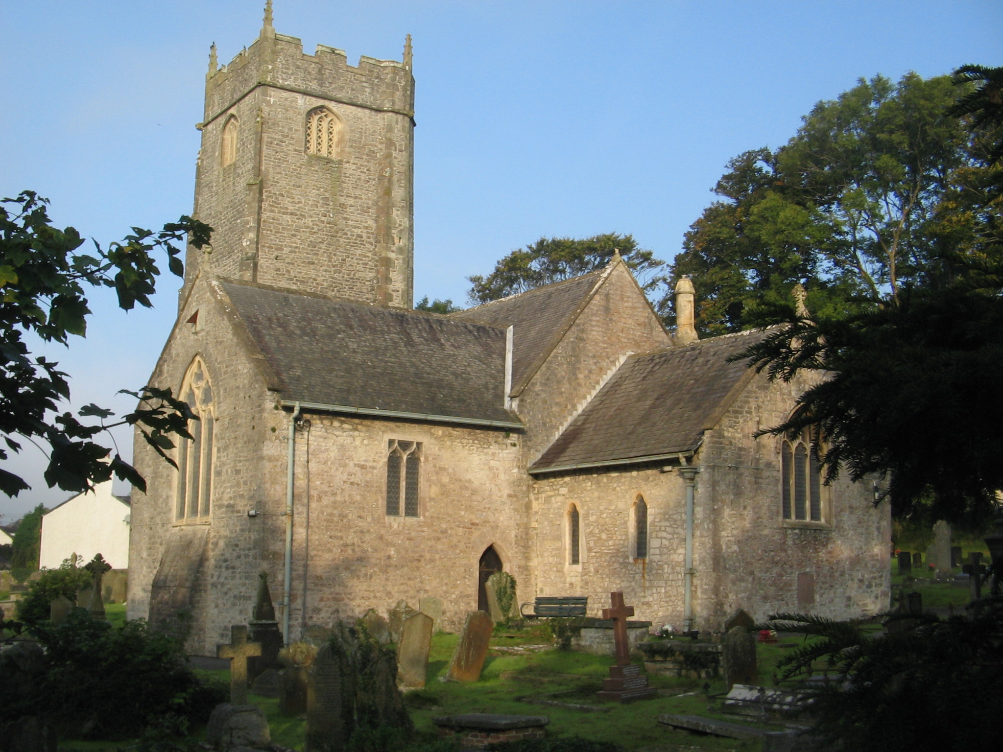
Church of St John the Baptist, Llanblethian

The Church of St John the Baptist is a medieval church in Llanblethian in the Vale of Glamorgan, south Wales. Believed to have been built in the 12th century...

Llanblethian

Llanblethian (Welsh: Llanfleiddian) is a village in the Vale of Glamorgan in Wales which sits upon the River Thaw. It makes up part of the community of...
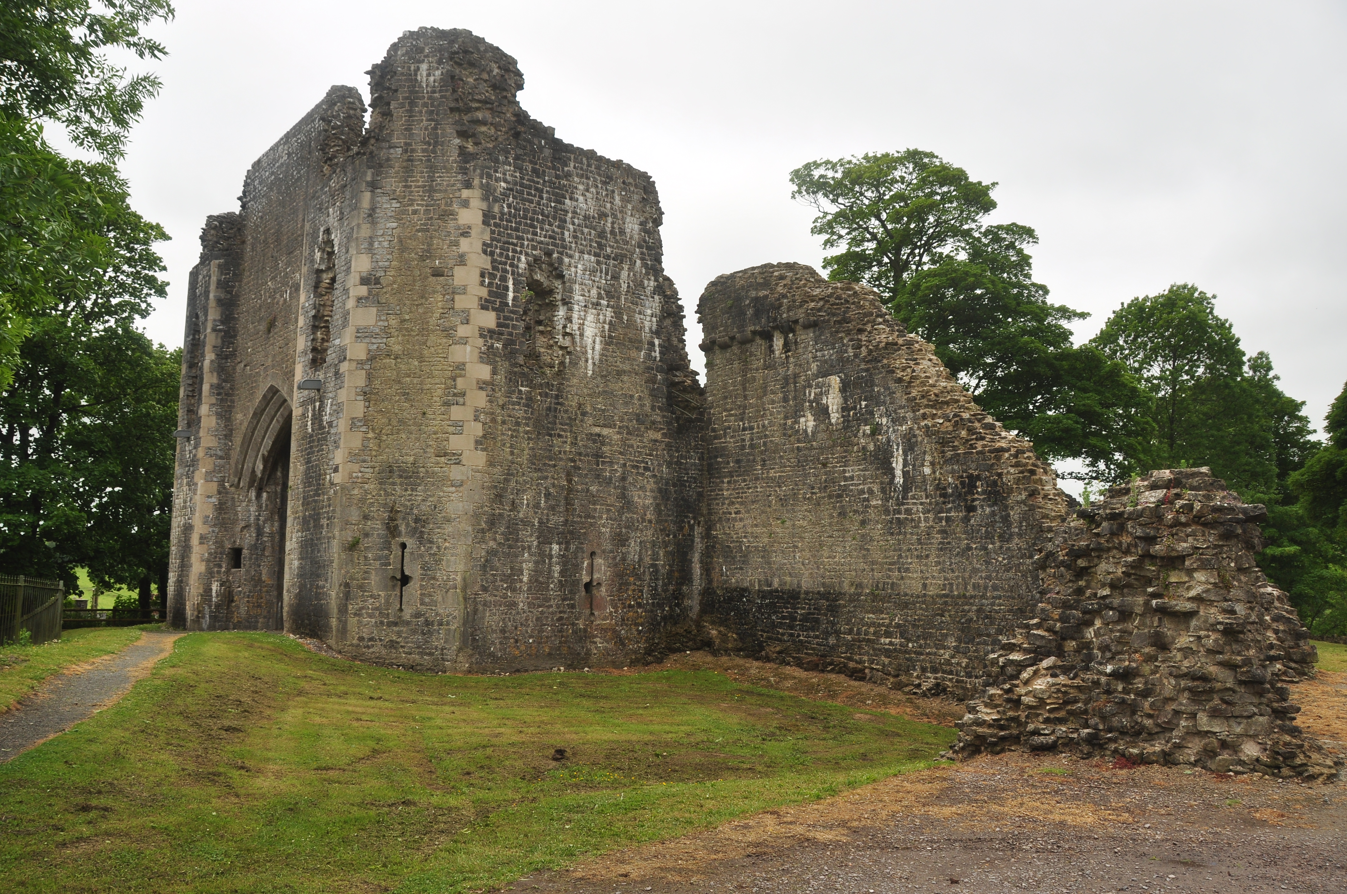
St Quintins Castle

St Quintins Castle (also known as St Quentins Castle and Llanblethian Castle, Welsh: Castell Llanfleiddan) is a castle located in the village of Llanblethian...
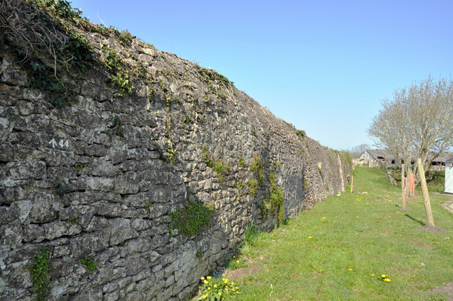
Cowbridge town wall

Cowbridge town wall is a Grade II*-listed medieval wall in the small market town of Cowbridge in the Vale of Glamorgan, south Wales. The walls were built...

Nearby Amenities

Located within 500m of 51.458611,-3.4643429
Pub
The Cross Inn
Addr Postcode: CF71 7JF
Addr Street: Church Road
Fhrs Id: 1193765
Source Addr Postcode: FHRS Open Data
Wikidata: Q80859317
Lat/Long: 51.4580557/-3.4701499
Llanblethian
Is In: Cowbridge, South Glamorgan, Wales
Name Cy: Llanfleiddan
Place: suburb
Wikidata: Q13129633
Lat/Long: 51.4552429/-3.460437
Created By: Potlatch 0.10b
Historic: memorial
Memorial: obelisk
Lat/Long: 51.4556971/-3.4613694
Turning Circle
Lat/Long: 51.4608998/-3.4590512
Turning Circle
Lat/Long: 51.4603078/-3.4593578
Turning Circle
Lat/Long: 51.459734/-3.4598562
Turning Loop
Lat/Long: 51.4629073/-3.4628987
Turning Circle
Lat/Long: 51.4624524/-3.4610622
Turning Circle
Lat/Long: 51.4565174/-3.4638552
Turning Circle
Lat/Long: 51.4550393/-3.4632384
Noexit: yes
Lat/Long: 51.4569746/-3.4626036
Noexit: yes
Lat/Long: 51.4567215/-3.4629586
Noexit: yes
Lat/Long: 51.4598566/-3.4604944
Crossing
Crossing: unmarked
Crossing Island: yes
Kerb: lowered
Tactile Paving: yes
Lat/Long: 51.461434/-3.4680869
Crossing
Crossing: unmarked
Crossing Island: yes
Kerb: lowered
Tactile Paving: yes
Lat/Long: 51.4598614/-3.4681123
Crossing
Crossing: unmarked
Crossing Island: no
Crossing Markings: no
Kerb: lowered
Tactile Paving: yes
Lat/Long: 51.4602692/-3.4663233
Crossing
Crossing: unmarked
Crossing Island: no
Kerb: lowered
Tactile Paving: yes
Lat/Long: 51.4609945/-3.466562
Crossing
Crossing: unmarked
Crossing Island: no
Crossing Markings: no
Kerb: lowered
Tactile Paving: yes
Lat/Long: 51.4603821/-3.4662416
Crossing
Crossing: unmarked
Crossing Island: no
Kerb: lowered
Tactile Paving: yes
Lat/Long: 51.4609369/-3.4677824
Barrier: cycle_barrier
Foot: yes
Lat/Long: 51.4615176/-3.4679608
Traffic Signals
Crossing: traffic_signals
Note: Estimated location
Lat/Long: 51.4608449/-3.4632926
Entrance: main
Lat/Long: 51.4560366/-3.4621699
Barrier: kissing_gate
Lat/Long: 51.4593016/-3.4618762
Barrier: stile
Material: stone
Stile: stepover
Lat/Long: 51.460748/-3.4632468
Noexit: yes
Lat/Long: 51.4561672/-3.4590082
Bus Stop
Llanfrynach Drive
Bus: yes
Departures Board: realtime
Public Transport: platform
Shelter: yes
Lat/Long: 51.4619457/-3.4682743
Noexit: yes
Lat/Long: 51.4600125/-3.4590658
Direction: 95
Generator Method: photovoltaic
Generator Output Electricity: yes
Generator Solar Modules: 5
Generator Source: solar
Generator Type: solar_photovoltaic_panel
Location: roof
Power: generator
Lat/Long: 51.4628981/-3.4633062
Direction: 95
Generator Method: photovoltaic
Generator Output Electricity: yes
Generator Solar Modules: 5
Generator Source: solar
Generator Type: solar_photovoltaic_panel
Location: roof
Power: generator
Lat/Long: 51.4629591/-3.4632914
Direction: 170
Generator Method: photovoltaic
Generator Output Electricity: yes
Generator Solar Modules: 8
Generator Source: solar
Generator Type: solar_photovoltaic_panel
Location: roof
Power: generator
Lat/Long: 51.4570611/-3.4627375
Direction: 175
Generator Method: photovoltaic
Generator Output Electricity: yes
Generator Solar Modules: 9
Generator Source: solar
Generator Type: solar_photovoltaic_panel
Location: roof
Power: generator
Lat/Long: 51.4570095/-3.4627211
Direction: 235
Generator Method: photovoltaic
Generator Output Electricity: yes
Generator Solar Modules: 16
Generator Source: solar
Generator Type: solar_photovoltaic_panel
Location: roof
Power: generator
Lat/Long: 51.4563197/-3.4635271
Direction: 195
Generator Method: photovoltaic
Generator Output Electricity: yes
Generator Solar Modules: 12
Generator Source: solar
Generator Type: solar_photovoltaic_panel
Location: roof
Power: generator
Lat/Long: 51.4559474/-3.464195
Direction: 165
Generator Method: photovoltaic
Generator Output Electricity: yes
Generator Solar Modules: 14
Generator Source: solar
Generator Type: solar_photovoltaic_panel
Location: roof
Power: generator
Lat/Long: 51.4549425/-3.4618226
Direction: 165
Generator Method: photovoltaic
Generator Output Electricity: yes
Generator Solar Modules: 20
Generator Source: solar
Generator Type: solar_photovoltaic_panel
Location: roof
Power: generator
Lat/Long: 51.455442/-3.4622118
Bus Stop
Llantwit Major Rd
Bench: yes
Bus: yes
Naptan AtcoCode: 5720WDB48445
Naptan NaptanCode: vglmamd
Public Transport: platform
Shelter: yes
Lat/Long: 51.4611103/-3.4621926
Bus Stop
Llantwit Major Road
Bench: yes
Bus: yes
Public Transport: platform
Shelter: yes
Lat/Long: 51.4611183/-3.4625728
Parking
Access: yes
Capacity: 3
Fee: no
Parking: layby
Lat/Long: 51.4595784/-3.4667908
Crossing
Crossing: unmarked
Crossing Island: no
Crossing Markings: no
Kerb: lowered
Tactile Paving: yes
Lat/Long: 51.4622477/-3.4607214
Crossing
Crossing: unmarked
Crossing Island: no
Crossing Markings: no
Kerb: lowered
Tactile Paving: yes
Lat/Long: 51.4618771/-3.4605762
Crossing
Crossing: unmarked
Crossing Island: no
Crossing Markings: no
Kerb: lowered
Tactile Paving: yes
Lat/Long: 51.462161/-3.4604429
Post Box
Collection Times: Mo-Fr 09:00; Sa 07:00
Operator: Royal Mail
Post Box Mounting: pier
Post Box Type: lamp
Ref: CF71 67D
Royal Cypher: EIIR
Royal Cypher Wikidata: Q33102113
Lat/Long: 51.4622175/-3.460427
Barrier: kissing_gate
Lat/Long: 51.4610989/-3.461547
Noexit: yes
Lat/Long: 51.4620685/-3.4654496
Crossing
Lat/Long: 51.462336/-3.4658919
Noexit: yes
Lat/Long: 51.4617829/-3.4644421
The data included in this document is from www.openstreetmap.org. The data is made available under ODbL.

Have you been to Llanblethian Hill?

Leave your review of Llanblethian Hill below (or comments, questions and feedback).