St Quentin's Castle, Llanblethian

Heritage Site in Glamorgan

Wales

St Quentin's Castle, Llanblethian

Cowbridge The Bear Hotel Cowbridge
Cowbridge Credit: Colin Prosser

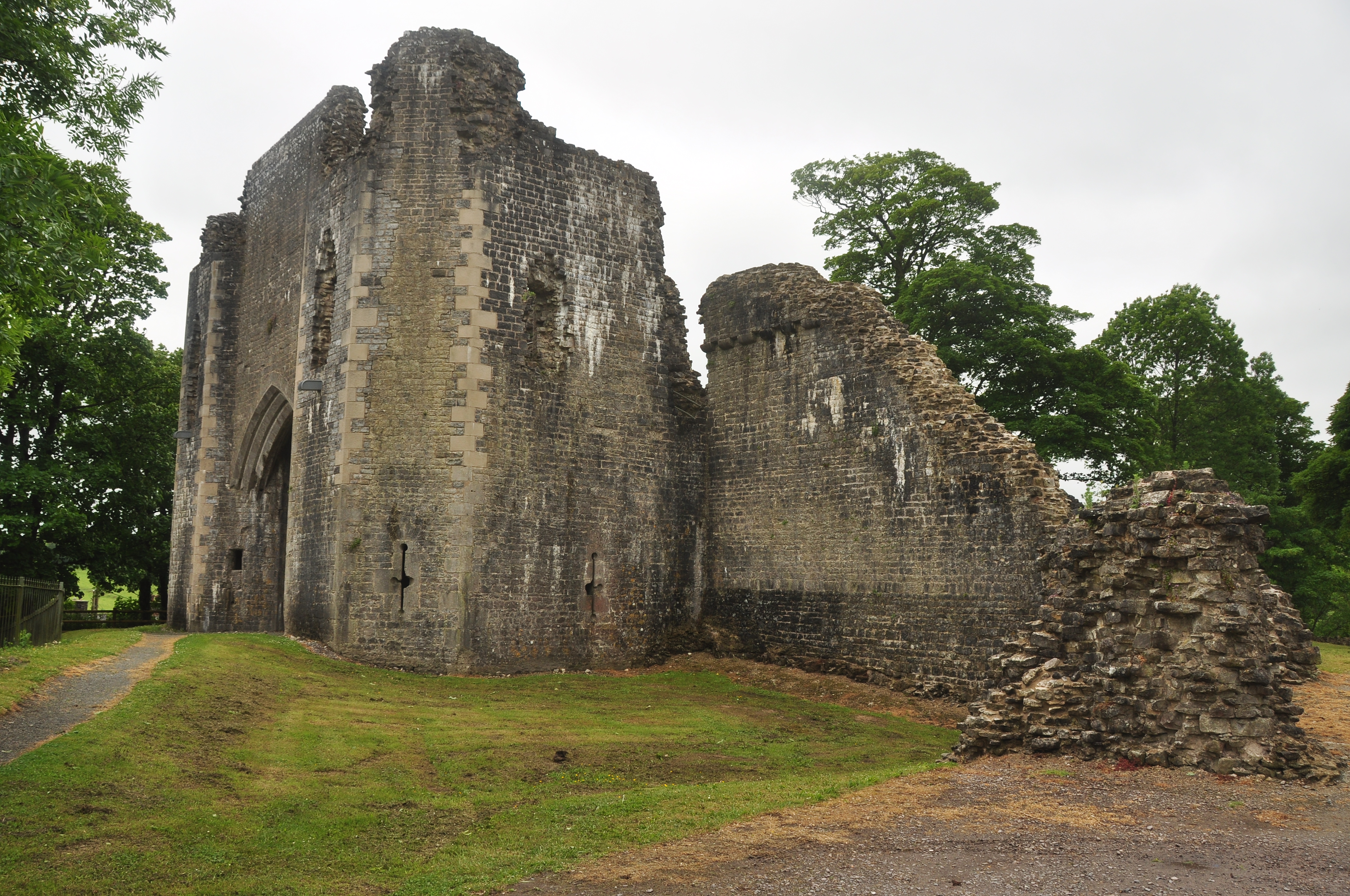
St Quentin's Castle, located in Llanblethian, Glamorgan, is a medieval castle that holds significant historical and architectural importance. Built in the 12th century, it stands as a testament to the rich heritage of Wales.

The castle is situated on a small hill overlooking the village of Llanblethian. It was originally constructed as a motte-and-bailey castle, with a large mound (motte) and an enclosed courtyard (bailey). Over the centuries, it has undergone various modifications and expansions.

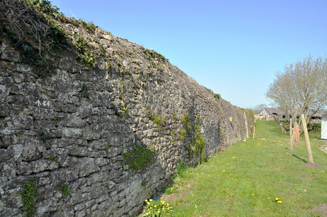
The castle's main structure consists of a rectangular stone keep, surrounded by a curtain wall with four corner towers. The keep features narrow arrow-slits and a stone staircase leading to the upper floors. The curtain wall is punctuated with battlements, providing a defensive advantage during times of conflict.

The castle's strategic location allowed it to control the nearby river crossing and serve as a stronghold for the lords of Glamorgan. It played a crucial role in the conflicts between the Welsh and English during the Middle Ages.

Today, St Quentin's Castle stands as a well-preserved example of medieval architecture. Visitors can explore the ruins and imagine the castle's former glory. The site offers stunning views of the surrounding countryside, making it a popular destination for tourists and history enthusiasts alike.

St Quentin's Castle is a designated heritage site, protected by law to ensure its preservation for future generations. Its historical significance and architectural beauty make it an important cultural landmark in Glamorgan.

If you have any feedback on the listing, please let us know in the comments section below.

St Quentin's Castle, Llanblethian Images

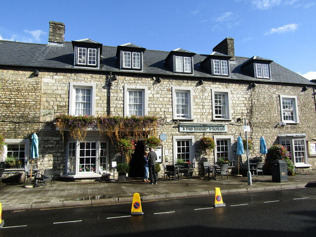
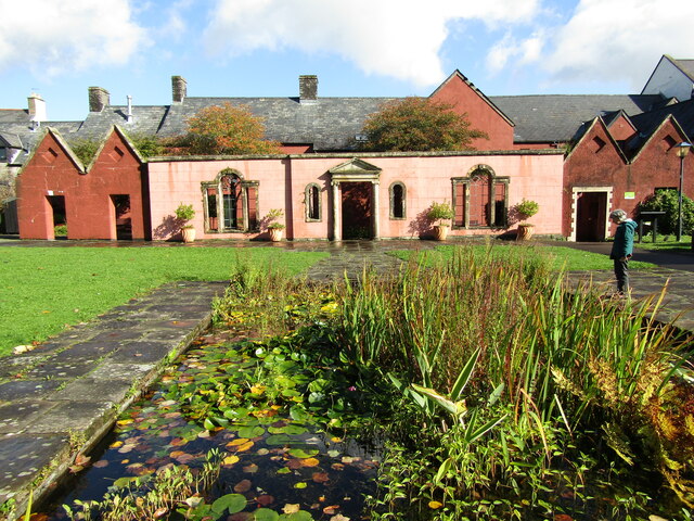
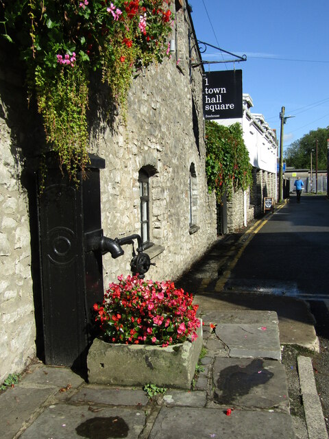
Images are sourced within 2km of 51.4576/-3.4564 or Grid Reference SS9874. Thanks to Geograph Open Source API. All images are credited.

Cowbridge The Bear Hotel Cowbridge
Cowbridge
The Bear Hotel Cowbridge
Cowbridge - Horse and Groom High Street pub, adjacent to the Town Hall, and set in a stone-built Victorian block (1891).
Cowbridge - Horse and Groom
High Street pub, adjacent to the Town Hall, and set in a stone-built Victorian block (1891).
Cowbridge - Town Hall The building is a former House of Correction and was converted to a town hall in 1830, then enlarged in 1895.
<span class="nowrap"><a title="www.cowbridge-tc.gov.uk" rel="nofollow ugc noopener" href="http://www.cowbridge-tc.gov.uk">Link</a><img style="margin-left:2px;" alt="External link" title="External link - shift click to open in new window" src="https://s1.geograph.org.uk/img/external.png" width="10" height="10"/></span>
Cowbridge - Town Hall
The building is a former House of Correction and was converted to a town hall in 1830, then enlarged in 1895. LinkExternal link
Cowbridge - High Street Historic building now housing the "tipsy Kitchen" cafe and the E91 clothes shop.
<span class="nowrap"><a title="www.cowbridge-tc.gov.uk" rel="nofollow ugc noopener" href="http://www.cowbridge-tc.gov.uk">Link</a><img style="margin-left:2px;" alt="External link" title="External link - shift click to open in new window" src="https://s1.geograph.org.uk/img/external.png" width="10" height="10"/></span>
Cowbridge - High Street
Historic building now housing the "tipsy Kitchen" cafe and the E91 clothes shop. LinkExternal link
Cowbridge - High Street A mix of building fronts and gables on Cowbridge's historic High Street.
<span class="nowrap"><a title="www.cowbridge-tc.gov.uk" rel="nofollow ugc noopener" href="http://www.cowbridge-tc.gov.uk">Link</a><img style="margin-left:2px;" alt="External link" title="External link - shift click to open in new window" src="https://s1.geograph.org.uk/img/external.png" width="10" height="10"/></span>
Cowbridge - High Street
A mix of building fronts and gables on Cowbridge's historic High Street. LinkExternal link
Cowbridge - High Street Historic gabled buildings now housing Arthur John & Co (hardware store) and Tallia (clothes shop).
<span class="nowrap"><a title="www.cowbridge-tc.gov.uk" rel="nofollow ugc noopener" href="http://www.cowbridge-tc.gov.uk">Link</a><img style="margin-left:2px;" alt="External link" title="External link - shift click to open in new window" src="https://s1.geograph.org.uk/img/external.png" width="10" height="10"/></span>
Cowbridge - High Street
Historic gabled buildings now housing Arthur John & Co (hardware store) and Tallia (clothes shop). LinkExternal link
Cowbridge - Vale of Glamorgan Historic High Street inn in the eponymous Vale of Glamorgan. Within the fabric is now a dogs grooming business - and have a hair of the dog next door?
<span class="nowrap"><a title="www.cowbridge-tc.gov.uk" rel="nofollow ugc noopener" href="http://www.cowbridge-tc.gov.uk">Link</a><img style="margin-left:2px;" alt="External link" title="External link - shift click to open in new window" src="https://s1.geograph.org.uk/img/external.png" width="10" height="10"/></span>
Cowbridge - Vale of Glamorgan
Historic High Street inn in the eponymous Vale of Glamorgan. Within the fabric is now a dogs grooming business - and have a hair of the dog next door? LinkExternal link
Cowbridge - Vale of Glamorgan Inn Vintage wall sign advertising Hancock's Beer, a Cardiff brewer bought by Brains in 1999.
Cowbridge - Vale of Glamorgan Inn
Vintage wall sign advertising Hancock's Beer, a Cardiff brewer bought by Brains in 1999.
Cowbridge - The Bear Hotel Historic inn on Cowbridge's High Street.
<span class="nowrap"><a title="www.cowbridge-tc.gov.uk" rel="nofollow ugc noopener" href="http://www.cowbridge-tc.gov.uk">Link</a><img style="margin-left:2px;" alt="External link" title="External link - shift click to open in new window" src="https://s1.geograph.org.uk/img/external.png" width="10" height="10"/></span>
Cowbridge - The Bear Hotel
Historic inn on Cowbridge's High Street. LinkExternal link
Cowbridge - High Street Historic building, attractively clad with ivy.
<span class="nowrap"><a title="www.cowbridge-tc.gov.uk" rel="nofollow ugc noopener" href="http://www.cowbridge-tc.gov.uk">Link</a><img style="margin-left:2px;" alt="External link" title="External link - shift click to open in new window" src="https://s1.geograph.org.uk/img/external.png" width="10" height="10"/></span>
Cowbridge - High Street
Historic building, attractively clad with ivy. LinkExternal link
Cowbridge - Old Hall Grounds Medieval building located within historic Roman and Town Wall bounds.
<span class="nowrap"><a title="www.oldhallgardens.org" rel="nofollow ugc noopener" href="http://www.oldhallgardens.org">Link</a><img style="margin-left:2px;" alt="External link" title="External link - shift click to open in new window" src="https://s1.geograph.org.uk/img/external.png" width="10" height="10"/></span>
Cowbridge - Old Hall Grounds
Medieval building located within historic Roman and Town Wall bounds. LinkExternal link
Cowbridge - Physic Garden Classical style temple within Cowbridge's historic herbal medicine garden.
<span class="nowrap"><a title="www.cowbridgephysicgarden.org" rel="nofollow ugc noopener" href="http://www.cowbridgephysicgarden.org">Link</a><img style="margin-left:2px;" alt="External link" title="External link - shift click to open in new window" src="https://s1.geograph.org.uk/img/external.png" width="10" height="10"/></span>
Cowbridge - Physic Garden
Classical style temple within Cowbridge's historic herbal medicine garden. LinkExternal link
Cowbridge - Physic Garden Espalier apples within Cowbridge's historic herbal medicine garden.
<span class="nowrap"><a title="www.cowbridgephysicgarden.org" rel="nofollow ugc noopener" href="http://www.cowbridgephysicgarden.org">Link</a><img style="margin-left:2px;" alt="External link" title="External link - shift click to open in new window" src="https://s1.geograph.org.uk/img/external.png" width="10" height="10"/></span>
Cowbridge - Physic Garden
Espalier apples within Cowbridge's historic herbal medicine garden. LinkExternal link
Cowbridge - Font "The font is of early Norman design and is carved from a single block of local Sutton stone".
<span class="nowrap"><a title="www.cowbridgeparish.com" rel="nofollow ugc noopener" href="http://www.cowbridgeparish.com">Link</a><img style="margin-left:2px;" alt="External link" title="External link - shift click to open in new window" src="https://s1.geograph.org.uk/img/external.png" width="10" height="10"/></span>
Cowbridge - Font
"The font is of early Norman design and is carved from a single block of local Sutton stone". LinkExternal link
Cowbridge - Royal British Legion Flags Within the historic Holy Cross Church.
<span class="nowrap"><a title="www.cowbridgeparish.com" rel="nofollow ugc noopener" href="http://www.cowbridgeparish.com">Link</a><img style="margin-left:2px;" alt="External link" title="External link - shift click to open in new window" src="https://s1.geograph.org.uk/img/external.png" width="10" height="10"/></span>
Cowbridge - Royal British Legion Flags
Within the historic Holy Cross Church. LinkExternal link
Cowbridge - Town Hall Square Historic water pump just off Cowbridge's High Street.
Cowbridge - Town Hall Square
Historic water pump just off Cowbridge's High Street.
Cowbridge - Town Hall Square Historic gabled stone building now housing a garden centre and a Chinese takeaway business.
Cowbridge - Town Hall Square
Historic gabled stone building now housing a garden centre and a Chinese takeaway business.
Cowbridge - War Memorial Memorial statue outside the Town Hall on Cowbridge's High Street.
<span class="nowrap"><a title="www.cowbridge-tc.gov.uk" rel="nofollow ugc noopener" href="http://www.cowbridge-tc.gov.uk">Link</a><img style="margin-left:2px;" alt="External link" title="External link - shift click to open in new window" src="https://s1.geograph.org.uk/img/external.png" width="10" height="10"/></span>
Cowbridge - War Memorial
Memorial statue outside the Town Hall on Cowbridge's High Street. LinkExternal link
Show me another place!

St Quentin's Castle, Llanblethian is located at Grid Ref: SS9874 (Lat: 51.4576, Lng: -3.4564)

Unitary Authority: The Vale of Glamorgan

Police Authority: South Wales

What 3 Words

///dribble.situates.loyal. Near Cowbridge, Vale of Glamorgan

Related Wikis

St Quintins Castle

St Quintins Castle (also known as St Quentins Castle and Llanblethian Castle, Welsh: Castell Llanfleiddan) is a castle located in the village of Llanblethian...

Llanblethian

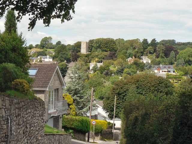
Llanblethian (Welsh: Llanfleiddian) is a village in the Vale of Glamorgan in Wales which sits upon the River Thaw. It makes up part of the community of...

Church of St John the Baptist, Llanblethian

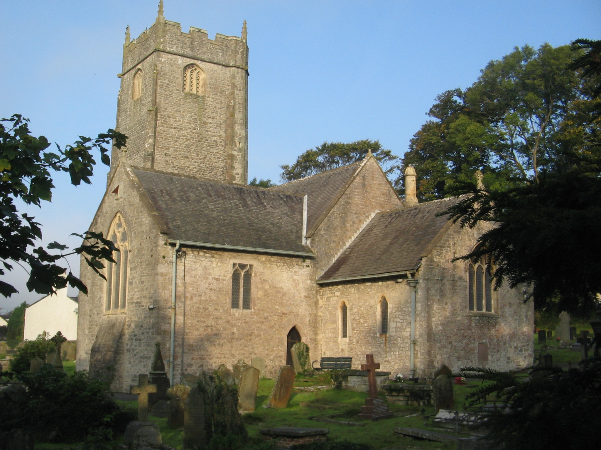
The Church of St John the Baptist is a medieval church in Llanblethian in the Vale of Glamorgan, south Wales. Believed to have been built in the 12th century...

Cowbridge town wall

Cowbridge town wall is a Grade II*-listed medieval wall in the small market town of Cowbridge in the Vale of Glamorgan, south Wales. The walls were built...

Nearby Amenities

Located within 500m of 51.4576,-3.4564
Llanblethian
Is In: Cowbridge, South Glamorgan, Wales
Name Cy: Llanfleiddan
Place: suburb
Wikidata: Q13129633
Lat/Long: 51.4552429/-3.460437
Created By: Potlatch 0.10b
Historic: memorial
Memorial: obelisk
Lat/Long: 51.4556971/-3.4613694
Turning Circle
Lat/Long: 51.4608998/-3.4590512
Turning Circle
Lat/Long: 51.4603078/-3.4593578
Turning Circle
Lat/Long: 51.459734/-3.4598562
Turning Circle
Lat/Long: 51.4614748/-3.4586368
Turning Circle
Lat/Long: 51.46024/-3.4556138
Turning Loop
Lat/Long: 51.4609288/-3.4553433
Turning Loop
Lat/Long: 51.4604091/-3.454536
Turning Circle
Lat/Long: 51.4594683/-3.4517385
Barrier: cycle_barrier
Foot: yes
Lat/Long: 51.4590198/-3.449946
Barrier: cycle_barrier
Foot: yes
Lat/Long: 51.4600135/-3.4546845
Turning Circle
Lat/Long: 51.461322/-3.4560612
Barrier: kissing_gate
Foot: yes
Lat/Long: 51.4617883/-3.4548193
Fixme: footpath
Lat/Long: 51.4616245/-3.4580863
Barrier: kissing_gate
Foot: yes
Lat/Long: 51.4567392/-3.4570577
Barrier: kissing_gate
Foot: yes
Lat/Long: 51.4591178/-3.4541796
Noexit: yes
Lat/Long: 51.459/-3.4534568
Noexit: yes
Lat/Long: 51.4594152/-3.4515068
Noexit: yes
Lat/Long: 51.4587249/-3.4529774
Noexit: yes
Lat/Long: 51.4569746/-3.4626036
Noexit: yes
Lat/Long: 51.4567215/-3.4629586
Noexit: yes
Lat/Long: 51.4598566/-3.4604944
Entrance: main
Lat/Long: 51.4560366/-3.4621699
Barrier: kissing_gate
Lat/Long: 51.4593016/-3.4618762
Noexit: yes
Lat/Long: 51.4606001/-3.4533522
Entrance: main
Lat/Long: 51.4605582/-3.4529187
Noexit: yes
Lat/Long: 51.4605567/-3.4527956
Post Box
Operator: Royal Mail
Post Box Type: lamp
Ref: CF71 26
Lat/Long: 51.4605491/-3.452471
Noexit: yes
Lat/Long: 51.4600762/-3.4549816
Noexit: yes
Lat/Long: 51.4561672/-3.4590082
Noexit: yes
Lat/Long: 51.4603876/-3.451528
Noexit: yes
Lat/Long: 51.4600125/-3.4590658
Post Box
Collection Times: Mo-Fr 09:00; Sa 07:00
Operator: Royal Mail
Post Box Mounting: stone_wall
Post Box Type: wall
Ref: CF71 211D
Royal Cypher: EVIIR
Royal Cypher Wikidata: Q33102324
Lat/Long: 51.4547774/-3.4597412
Leisure: playground
Lat/Long: 51.4552362/-3.4585556
Telephone
Defibrillator
Booth: K6
Covered: booth
Defibrillator Location: inside old red phone box in Llanblethian
Emergency: defibrillator
Listed Status: Grade II
Man Made: telephone_box
Lat/Long: 51.4546289/-3.4579185
Historic: water_pump
Lat/Long: 51.4546159/-3.457952
Bench
Lat/Long: 51.4546043/-3.4579818
Direction: WSW
Generator Method: photovoltaic
Generator Output Electricity: yes
Generator Solar Modules: 16
Generator Source: solar
Generator Type: solar_photovoltaic_panel
Location: roof
Power: generator
Lat/Long: 51.4606565/-3.4545421
Direction: SSE
Generator Method: photovoltaic
Generator Output Electricity: yes
Generator Solar Modules: 14
Generator Source: solar
Generator Type: solar_photovoltaic_panel
Location: roof
Power: generator
Lat/Long: 51.4609076/-3.455691
Direction: 145
Generator Method: photovoltaic
Generator Output Electricity: yes
Generator Solar Modules: 14
Generator Source: solar
Generator Type: solar_photovoltaic_panel
Location: roof
Power: generator
Lat/Long: 51.4603227/-3.4569624
Direction: 235
Generator Method: photovoltaic
Generator Output Electricity: yes
Generator Solar Modules: 20
Generator Source: solar
Generator Type: solar_photovoltaic_panel
Location: roof
Power: generator
Lat/Long: 51.4598412/-3.4549816
Direction: 125
Generator Method: photovoltaic
Generator Output Electricity: yes
Generator Solar Modules: 16
Generator Source: solar
Generator Type: solar_photovoltaic_panel
Location: roof
Power: generator
Lat/Long: 51.4585211/-3.4528747
Direction: SSE
Generator Method: photovoltaic
Generator Output Electricity: yes
Generator Solar Modules: 16
Generator Source: solar
Generator Type: solar_photovoltaic_panel
Location: roof
Power: generator
Lat/Long: 51.4574783/-3.4520674
Direction: 170
Generator Method: photovoltaic
Generator Output Electricity: yes
Generator Solar Modules: 18
Generator Source: solar
Generator Type: solar_photovoltaic_panel
Location: roof
Power: generator
Lat/Long: 51.457724/-3.4520949
Direction: 170
Generator Method: photovoltaic
Generator Output Electricity: yes
Generator Solar Modules: 8
Generator Source: solar
Generator Type: solar_photovoltaic_panel
Location: roof
Power: generator
Lat/Long: 51.4570611/-3.4627375
Direction: 175
Generator Method: photovoltaic
Generator Output Electricity: yes
Generator Solar Modules: 9
Generator Source: solar
Generator Type: solar_photovoltaic_panel
Location: roof
Power: generator
Lat/Long: 51.4570095/-3.4627211
Direction: 165
Generator Method: photovoltaic
Generator Output Electricity: yes
Generator Solar Modules: 14
Generator Source: solar
Generator Type: solar_photovoltaic_panel
Location: roof
Power: generator
Lat/Long: 51.4549425/-3.4618226
Direction: 165
Generator Method: photovoltaic
Generator Output Electricity: yes
Generator Solar Modules: 20
Generator Source: solar
Generator Type: solar_photovoltaic_panel
Location: roof
Power: generator
Lat/Long: 51.455442/-3.4622118
Direction: WSW
Generator Method: photovoltaic
Generator Output Electricity: yes
Generator Solar Modules: 16
Generator Source: solar
Generator Type: solar_photovoltaic_panel
Location: roof
Power: generator
Lat/Long: 51.4533636/-3.4585007
Direction: 145
Generator Method: photovoltaic
Generator Output Electricity: yes
Generator Solar Modules: 22
Generator Source: solar
Generator Type: solar_photovoltaic_panel
Location: roof
Power: generator
Lat/Long: 51.4547423/-3.45713
Direction: 145
Generator Method: photovoltaic
Generator Output Electricity: yes
Generator Solar Modules: 16
Generator Source: solar
Generator Type: solar_photovoltaic_panel
Location: roof
Power: generator
Lat/Long: 51.4546625/-3.4573118
Give Way
Direction: backward
Lat/Long: 51.457701/-3.4499221
Post Box
Collection Times: Mo-Fr 09:00; Sa 07:00
Operator: Royal Mail
Post Box Mounting: stone_wall
Post Box Type: lamp
Ref: CF71 95D
Royal Cypher: GVIR
Royal Cypher Wikidata: Q33102169
Lat/Long: 51.4572301/-3.4504341
Noexit: yes
Lat/Long: 51.4602634/-3.452294
The data included in this document is from www.openstreetmap.org. The data is made available under ODbL.

Have you been to St Quentin's Castle, Llanblethian?

Leave your review of St Quentin's Castle, Llanblethian below (or comments, questions and feedback).