Bryniau

Hill, Mountain in Caernarfonshire

Wales

Bryniau

A typical road bridge over the A55, near Bangor An Eastbound view, showing the snow-covered mountains of Snowdonia ahead. This section of the A55 makes up the Bangor Bypass and opened in 1983.
A typical road bridge over the A55, near Bangor Credit: Oliver Mills

Bryniau is a prominent hill/mountain located in Caernarfonshire, a historic county in northwest Wales. Situated near the town of Caernarfon, Bryniau offers breathtaking views and a range of outdoor activities for nature enthusiasts.

Rising to a height of approximately 1,200 feet (366 meters), Bryniau stands as an impressive landmark in the region. Its distinct geographical features include steep slopes, rocky outcrops, and a lush green landscape that is characteristic of the Welsh countryside. The summit provides a panoramic view of the surrounding area, including the Snowdonia National Park and the Menai Strait.

The hill/mountain is a popular destination for hikers and climbers, with several well-marked trails catering to varying levels of difficulty. The paths meander through heather-clad slopes and offer a chance to encounter diverse flora and fauna. Visitors can spot a variety of bird species, including red kites and peregrine falcons, as well as small mammals such as rabbits and foxes.

Bryniau also holds historical significance, as it is believed to have served as a defense point during ancient times. Ruins of an Iron Age hillfort can still be seen on its slopes, providing a glimpse into the region's past.

Overall, Bryniau is a captivating destination for those seeking natural beauty, outdoor adventure, and a glimpse into Wales' rich history.

If you have any feedback on the listing, please let us know in the comments section below.
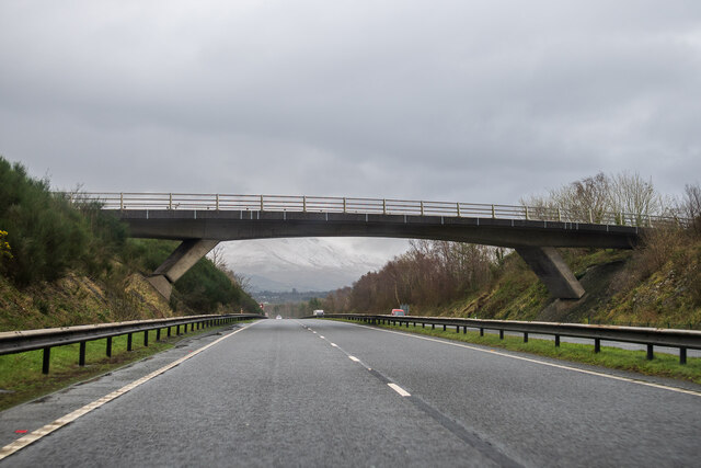
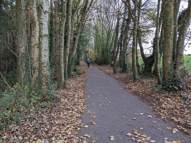
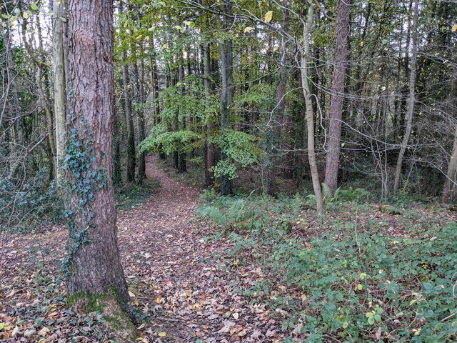
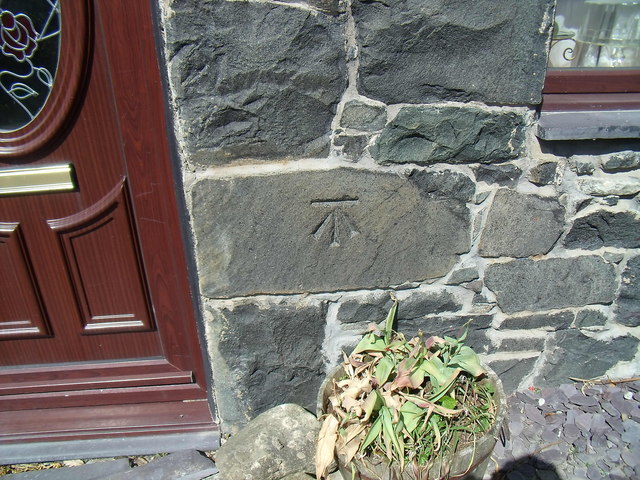
Bryniau Images

Images are sourced within 2km of 53.218156/-4.1297579 or Grid Reference SH5771. Thanks to Geograph Open Source API. All images are credited.

A typical road bridge over the A55, near Bangor An Eastbound view, showing the snow-covered mountains of Snowdonia ahead. This section of the A55 makes up the Bangor Bypass and opened in 1983.
A typical road bridge over the A55, near Bangor
An Eastbound view, showing the snow-covered mountains of Snowdonia ahead. This section of the A55 makes up the Bangor Bypass and opened in 1983.
Eddie Stobart truck, Bangor
A good biking surface on Lôn Las Ogwen
The last of the leaves in the woodland Next to Lôn Las Ogwen.
The last of the leaves in the woodland
Next to Lôn Las Ogwen.
Benchmark at  Four Alls, Pant-caerhun This benchmark is located on SE face of Four Alls in Pant-caerhun & it is shown in the current Ordnance Survey database at a height of 85.7890m above the Newlyn datum.
Benchmark at Four Alls, Pant-caerhun
This benchmark is located on SE face of Four Alls in Pant-caerhun & it is shown in the current Ordnance Survey database at a height of 85.7890m above the Newlyn datum.
A5 to Bangor The A5 is a major trunk road that runs 260 miles from London to Holyhead. It follows the course of an old Roman Road (Watling Street).
Wikipedia: <span class="nowrap"><a title="http://en.wikipedia.org/wiki/A5_road_(Great_Britain)" rel="nofollow ugc noopener" href="http://en.wikipedia.org/wiki/A5_road_(Great_Britain)">Link</a><img style="margin-left:2px;" alt="External link" title="External link - shift click to open in new window" src="https://s1.geograph.org.uk/img/external.png" width="10" height="10"/></span>
A5 to Bangor
The A5 is a major trunk road that runs 260 miles from London to Holyhead. It follows the course of an old Roman Road (Watling Street). Wikipedia: LinkExternal link
A5 The A5 is a major trunk road that runs 260 miles from London to Holyhead. It follows the course of an old Roman Road (Watling Street).
Wikipedia: <span class="nowrap"><a title="http://en.wikipedia.org/wiki/A5_road_(Great_Britain)" rel="nofollow ugc noopener" href="http://en.wikipedia.org/wiki/A5_road_(Great_Britain)">Link</a><img style="margin-left:2px;" alt="External link" title="External link - shift click to open in new window" src="https://s1.geograph.org.uk/img/external.png" width="10" height="10"/></span>
A5
The A5 is a major trunk road that runs 260 miles from London to Holyhead. It follows the course of an old Roman Road (Watling Street). Wikipedia: LinkExternal link
Ordnance Survey Cut Mark This OS cut mark can be found on the front of Four Alls Pant Caerhun. It marks a point 85.789m above mean sea level.
Ordnance Survey Cut Mark
This OS cut mark can be found on the front of Four Alls Pant Caerhun. It marks a point 85.789m above mean sea level.
The A55 heading east
The A55 runs under a bridge near Caerhun
Commercial edge Retail and catering on the edge of Bangor, adjacent to the supermarket development. Previously, this was a little-known back-road into the hilly hinterland of the town.
Commercial edge
Retail and catering on the edge of Bangor, adjacent to the supermarket development. Previously, this was a little-known back-road into the hilly hinterland of the town.
Bridge over the North Wales Expressway near to Glasinfryn The A55, also known as the North Wales Expressway (Gwibffordd Gogledd Cymru), is the major road in North Wales running for 88 miles between Chester and Holyhead via Conwy and Bangor. 

The A55 is a very high quality road, much of it rebuilt since the 1970s in response to traffic problems in Colwyn Bay, Colwyn and Llandudno caused by traffic having to pass through town centres on totally unsuitable streets, (especially in Conwy where lorries often scraped their paintwork as they passed through 12th century arches in the town's walls), leading to the construction of an east-west expressway bypassing the urban centres. It is a dual carriageway primary route for its entire length with the exception of the point where it crosses the Britannia Bridge over the Menai Strait. All of its junctions are grade separated except for two roundabouts; one east of Penmaenmawr and one in Llanfairfechan. The road originally ran from Chester to Bangor but was extended parallel to the A5 across Anglesey right into Holyhead Docks in 2001.

<span class="nowrap"><a title="http://www.sabre-roads.org.uk/wiki/index.php?title=A55" rel="nofollow ugc noopener" href="http://www.sabre-roads.org.uk/wiki/index.php?title=A55">Link</a><img style="margin-left:2px;" alt="External link" title="External link - shift click to open in new window" src="https://s1.geograph.org.uk/img/external.png" width="10" height="10"/></span>  SABRE
Bridge over the North Wales Expressway near to Glasinfryn
The A55, also known as the North Wales Expressway (Gwibffordd Gogledd Cymru), is the major road in North Wales running for 88 miles between Chester and Holyhead via Conwy and Bangor. The A55 is a very high quality road, much of it rebuilt since the 1970s in response to traffic problems in Colwyn Bay, Colwyn and Llandudno caused by traffic having to pass through town centres on totally unsuitable streets, (especially in Conwy where lorries often scraped their paintwork as they passed through 12th century arches in the town's walls), leading to the construction of an east-west expressway bypassing the urban centres. It is a dual carriageway primary route for its entire length with the exception of the point where it crosses the Britannia Bridge over the Menai Strait. All of its junctions are grade separated except for two roundabouts; one east of Penmaenmawr and one in Llanfairfechan. The road originally ran from Chester to Bangor but was extended parallel to the A5 across Anglesey right into Holyhead Docks in 2001. LinkExternal link SABRE
Bridge over the A55 near Glasinfryn The A55, also known as the North Wales Expressway (Gwibffordd Gogledd Cymru), is the major road in North Wales running for 88 miles between Chester and Holyhead via Conwy and Bangor. 

The A55 is a very high quality road, much of it rebuilt since the 1970s in response to traffic problems in Colwyn Bay, Colwyn and Llandudno caused by traffic having to pass through town centres on totally unsuitable streets, (especially in Conwy where lorries often scraped their paintwork as they passed through 12th century arches in the town's walls), leading to the construction of an east-west expressway bypassing the urban centres. It is a dual carriageway primary route for its entire length with the exception of the point where it crosses the Britannia Bridge over the Menai Strait. All of its junctions are grade separated except for two roundabouts; one east of Penmaenmawr and one in Llanfairfechan. The road originally ran from Chester to Bangor but was extended parallel to the A5 across Anglesey right into Holyhead Docks in 2001.

<span class="nowrap"><a title="http://www.sabre-roads.org.uk/wiki/index.php?title=A55" rel="nofollow ugc noopener" href="http://www.sabre-roads.org.uk/wiki/index.php?title=A55">Link</a><img style="margin-left:2px;" alt="External link" title="External link - shift click to open in new window" src="https://s1.geograph.org.uk/img/external.png" width="10" height="10"/></span>  SABRE
Bridge over the A55 near Glasinfryn
The A55, also known as the North Wales Expressway (Gwibffordd Gogledd Cymru), is the major road in North Wales running for 88 miles between Chester and Holyhead via Conwy and Bangor. The A55 is a very high quality road, much of it rebuilt since the 1970s in response to traffic problems in Colwyn Bay, Colwyn and Llandudno caused by traffic having to pass through town centres on totally unsuitable streets, (especially in Conwy where lorries often scraped their paintwork as they passed through 12th century arches in the town's walls), leading to the construction of an east-west expressway bypassing the urban centres. It is a dual carriageway primary route for its entire length with the exception of the point where it crosses the Britannia Bridge over the Menai Strait. All of its junctions are grade separated except for two roundabouts; one east of Penmaenmawr and one in Llanfairfechan. The road originally ran from Chester to Bangor but was extended parallel to the A5 across Anglesey right into Holyhead Docks in 2001. LinkExternal link SABRE
Westbound A55 near Glasinfryn The A55, also known as the North Wales Expressway (Gwibffordd Gogledd Cymru), is the major road in North Wales running for 88 miles between Chester and Holyhead via Conwy and Bangor. 

The A55 is a very high quality road, much of it rebuilt since the 1970s in response to traffic problems in Colwyn Bay, Colwyn and Llandudno caused by traffic having to pass through town centres on totally unsuitable streets, (especially in Conwy where lorries often scraped their paintwork as they passed through 12th century arches in the town's walls), leading to the construction of an east-west expressway bypassing the urban centres. It is a dual carriageway primary route for its entire length with the exception of the point where it crosses the Britannia Bridge over the Menai Strait. All of its junctions are grade separated except for two roundabouts; one east of Penmaenmawr and one in Llanfairfechan. The road originally ran from Chester to Bangor but was extended parallel to the A5 across Anglesey right into Holyhead Docks in 2001.

<span class="nowrap"><a title="http://www.sabre-roads.org.uk/wiki/index.php?title=A55" rel="nofollow ugc noopener" href="http://www.sabre-roads.org.uk/wiki/index.php?title=A55">Link</a><img style="margin-left:2px;" alt="External link" title="External link - shift click to open in new window" src="https://s1.geograph.org.uk/img/external.png" width="10" height="10"/></span>  SABRE
Westbound A55 near Glasinfryn
The A55, also known as the North Wales Expressway (Gwibffordd Gogledd Cymru), is the major road in North Wales running for 88 miles between Chester and Holyhead via Conwy and Bangor. The A55 is a very high quality road, much of it rebuilt since the 1970s in response to traffic problems in Colwyn Bay, Colwyn and Llandudno caused by traffic having to pass through town centres on totally unsuitable streets, (especially in Conwy where lorries often scraped their paintwork as they passed through 12th century arches in the town's walls), leading to the construction of an east-west expressway bypassing the urban centres. It is a dual carriageway primary route for its entire length with the exception of the point where it crosses the Britannia Bridge over the Menai Strait. All of its junctions are grade separated except for two roundabouts; one east of Penmaenmawr and one in Llanfairfechan. The road originally ran from Chester to Bangor but was extended parallel to the A5 across Anglesey right into Holyhead Docks in 2001. LinkExternal link SABRE
A55 North Wales Expressway heading west
A55 near Penhower Isaf
Disused Railway Bridge Near Glasinfryn It carried the Bangor-Bethesda branch line over a lane.
Disused Railway Bridge Near Glasinfryn
It carried the Bangor-Bethesda branch line over a lane.
Agricultural Building, Perfeddgoed
Show me another place!

Bryniau is located at Grid Ref: SH5771 (Lat: 53.218156, Lng: -4.1297579)

Unitary Authority: Gwynedd

Police Authority: North Wales

What 3 Words

///hazy.truly.stuns. Near Bangor, Gwynedd

Related Wikis

Minffordd Hospital

Minffordd Hospital (Welsh: Ysbyty Minffordd) was a health facility in Bangor, Gwynedd, Wales. It was managed by the Betsi Cadwaladr University Health Board...

Hendre (Bangor electoral ward)

Hendre is one of eight electoral wards in the city of Bangor, Gwynedd, Wales. The ward covers part of the city south of the city centre, including West...

Bangor railway station (Wales)

Bangor railway station serves the city of Bangor, Gwynedd; it is operated by Transport for Wales. The station, which is 24+3⁄4 miles (40 km) east of Holyhead...

Farrar Road Stadium

Farrar Road Stadium was a multi-purpose stadium in Bangor, Wales. The site of the ground is now covered by an Asda supermarket. From 1920, the year it...

Nearby Amenities

Located within 500m of 53.218156,-4.1297579
Barrier: kissing_gate
Lat/Long: 53.2175801/-4.1323406
Minffordd
Is In: Wales
Is In Country: United Kingdom
Is In County: Gwynedd
Place: hamlet
Lat/Long: 53.2147144/-4.1320165
Power: tower
Lat/Long: 53.2150162/-4.1271132
Power: tower
Lat/Long: 53.2157595/-4.1289004
Location Transition: yes
Power: tower
Lat/Long: 53.2162087/-4.130342
Bryniau Bach Cottage
Place: locality
Lat/Long: 53.2208929/-4.1263276
Power: pole
Lat/Long: 53.2139347/-4.1272478
Power: pole
Lat/Long: 53.2145736/-4.128327
Power: tower
Lat/Long: 53.2156171/-4.1327411
Power: pole
Lat/Long: 53.2147777/-4.13091
Power: pole
Lat/Long: 53.2153623/-4.130851
Location Transition: yes
Power: pole
Lat/Long: 53.2160675/-4.1313888
Power: pole
Lat/Long: 53.2140067/-4.1309959
Railway: switch
Lat/Long: 53.2219535/-4.1329065
Railway: switch
Lat/Long: 53.2219285/-4.1326761
Power: tower
Lat/Long: 53.2162872/-4.1314478
Power: pole
Lat/Long: 53.2160608/-4.1310747
Power: pole
Lat/Long: 53.2156501/-4.1302987
Power: pole
Lat/Long: 53.2151612/-4.1294033
Bryniau
Description: OS trig pillar
Ele: 117.536
Man Made: survey_point
Note: Accurate location import for imagery offset calibration. Please do not move.
Ref: S7304
Source: Ordnance Survey (OGL)
Survey Point: pillar
Tpuk Ref: TP1740
Lat/Long: 53.2181735/-4.129772
Power: pole
Lat/Long: 53.2145782/-4.1268843
Power: pole
Lat/Long: 53.214938/-4.1276863
Power: pole
Lat/Long: 53.2153234/-4.1285741
Power: pole
Lat/Long: 53.2161634/-4.1306783
Give Way
Direction: backward
Lat/Long: 53.2165518/-4.1316403
The data included in this document is from www.openstreetmap.org. The data is made available under ODbL.

Have you been to Bryniau?

Leave your review of Bryniau below (or comments, questions and feedback).