West End

Settlement in Caernarfonshire

Wales

West End

Eddie Stobart truck, Bangor
Eddie Stobart truck, Bangor Credit: Meirion

West End is a picturesque village located in the historic county of Caernarfonshire, Wales. Situated on the western banks of the River Seiont, it lies on the outskirts of the town of Caernarfon. The village is renowned for its stunning natural beauty, with the nearby Snowdonia National Park providing a breathtaking backdrop of mountainous landscapes.

West End is a small community with a population of around 500 residents. The village primarily consists of traditional stone-built houses, adding to its charming character. It offers a peaceful and idyllic setting, attracting visitors seeking tranquility and a retreat from the hustle and bustle of urban life.

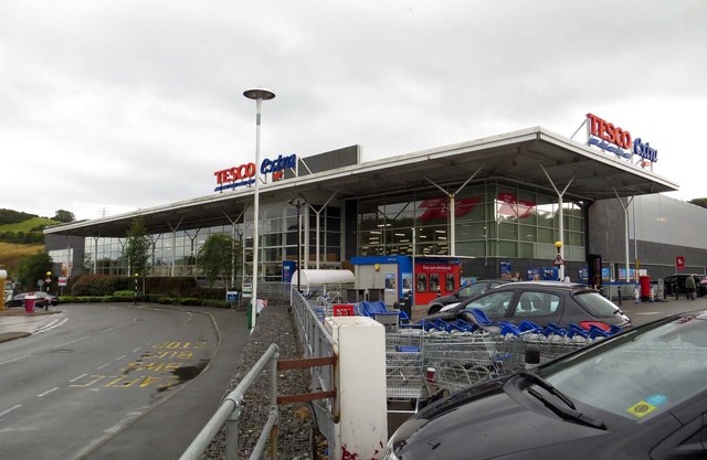
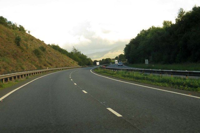
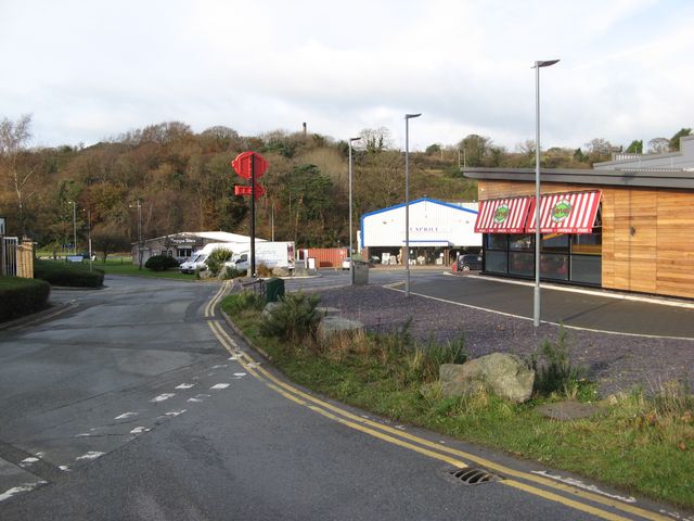
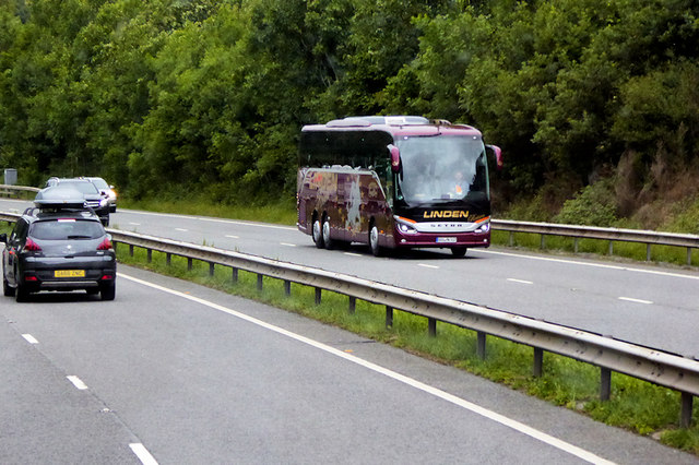
The village benefits from its proximity to Caernarfon, a bustling town that provides essential amenities such as schools, shops, and healthcare facilities. Additionally, West End boasts excellent transport links, with regular bus services connecting it to nearby towns and villages.

Outdoor enthusiasts will find West End to be a haven for activities such as hiking, cycling, and fishing. The surrounding area offers numerous trails and paths, allowing visitors to explore the stunning countryside. The nearby River Seiont is a popular spot for anglers seeking to catch salmon and trout.

West End also has a rich historical heritage, with attractions such as Caernarfon Castle within easy reach. This magnificent medieval fortress, recognized as a UNESCO World Heritage site, showcases the region's history and attracts thousands of tourists each year.

In summary, West End is a charming village nestled in the natural beauty of Caernarfonshire. It provides a peaceful retreat while offering easy access to essential amenities and outdoor activities, making it an ideal destination for both residents and visitors alike.

If you have any feedback on the listing, please let us know in the comments section below.
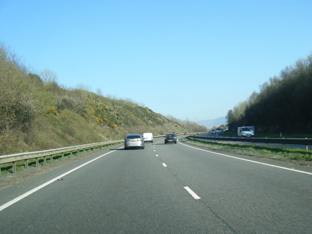
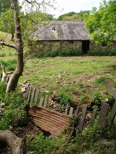
West End Images

Images are sourced within 2km of 53.220845/-4.1382651 or Grid Reference SH5771. Thanks to Geograph Open Source API. All images are credited.

Eddie Stobart truck, Bangor
Eddie Stobart tanker, Bangor kathleen Amy H5953 PF19 WDK
Eddie Stobart tanker, Bangor
kathleen Amy H5953 PF19 WDK
An underpass below the A55
A4087 just south of Tesco roundabout Tesco Extra Bangor on right
A4087 just south of Tesco roundabout
Tesco Extra Bangor on right
Tesco Extra store Bangor
Tesco Extra in Bangor
The A55 heading east
Commercial edge Retail and catering on the edge of Bangor, adjacent to the supermarket development. Previously, this was a little-known back-road into the hilly hinterland of the town.
Commercial edge
Retail and catering on the edge of Bangor, adjacent to the supermarket development. Previously, this was a little-known back-road into the hilly hinterland of the town.
Tourist Coach on the North Wales Expressway near Glasinfryn The A55, also known as the North Wales Expressway (Gwibffordd Gogledd Cymru), is the major road in North Wales running for 88 miles between Chester and Holyhead via Conwy and Bangor. 

The A55 is a very high quality road, much of it rebuilt since the 1970s in response to traffic problems in Colwyn Bay, Colwyn and Llandudno caused by traffic having to pass through town centres on totally unsuitable streets, (especially in Conwy where lorries often scraped their paintwork as they passed through 12th century arches in the town's walls), leading to the construction of an east-west expressway bypassing the urban centres. It is a dual carriageway primary route for its entire length with the exception of the point where it crosses the Britannia Bridge over the Menai Strait. All of its junctions are grade separated except for two roundabouts; one east of Penmaenmawr and one in Llanfairfechan. The road originally ran from Chester to Bangor but was extended parallel to the A5 across Anglesey right into Holyhead Docks in 2001.

<span class="nowrap"><a title="http://www.sabre-roads.org.uk/wiki/index.php?title=A55" rel="nofollow ugc noopener" href="http://www.sabre-roads.org.uk/wiki/index.php?title=A55">Link</a><img style="margin-left:2px;" alt="External link" title="External link - shift click to open in new window" src="https://s1.geograph.org.uk/img/external.png" width="10" height="10"/></span>  SABRE
Tourist Coach on the North Wales Expressway near Glasinfryn
The A55, also known as the North Wales Expressway (Gwibffordd Gogledd Cymru), is the major road in North Wales running for 88 miles between Chester and Holyhead via Conwy and Bangor. The A55 is a very high quality road, much of it rebuilt since the 1970s in response to traffic problems in Colwyn Bay, Colwyn and Llandudno caused by traffic having to pass through town centres on totally unsuitable streets, (especially in Conwy where lorries often scraped their paintwork as they passed through 12th century arches in the town's walls), leading to the construction of an east-west expressway bypassing the urban centres. It is a dual carriageway primary route for its entire length with the exception of the point where it crosses the Britannia Bridge over the Menai Strait. All of its junctions are grade separated except for two roundabouts; one east of Penmaenmawr and one in Llanfairfechan. The road originally ran from Chester to Bangor but was extended parallel to the A5 across Anglesey right into Holyhead Docks in 2001. LinkExternal link SABRE
A55 North Wales Expressway heading west
Agricultural Building, Perfeddgoed
A tiled shop doorway on the High Street, Bangor
"G" access cover on the High Street, Bangor "G" for gas?
"G" access cover on the High Street, Bangor
"G" for gas?
Sluice valve marker on Garth Road, Bangor
Worn hydrant sign with sticker on Garth Road, Bangor
Sluice valve marker on Garth Road, Bangor
Fire switch on the High Street, Bangor
Show me another place!

West End is located at Grid Ref: SH5771 (Lat: 53.220845, Lng: -4.1382651)

Unitary Authority: Gwynedd

Police Authority: North Wales

What 3 Words

///nibbled.cushy.patting. Near Bangor, Gwynedd

Related Wikis

Bangor railway station (Wales)

Bangor railway station serves the city of Bangor, Gwynedd; it is operated by Transport for Wales. The station, which is 24+3⁄4 miles (40 km) east of Holyhead...

Grŵp Llandrillo Menai

Grŵp Llandrillo Menai (GLlM) is an umbrella organisation overseeing the operation of three member colleges in North Wales: Coleg Llandrillo, Coleg Menai...

Ysgol Tryfan

Ysgol Tryfan is a bilingual (Welsh - English) comprehensive school for pupils aged 11–18, situated in Bangor, Gwynedd. 471 pupils were enrolled at the...

Hendre (Bangor electoral ward)

Hendre is one of eight electoral wards in the city of Bangor, Gwynedd, Wales. The ward covers part of the city south of the city centre, including West...

Farrar Road Stadium

Farrar Road Stadium was a multi-purpose stadium in Bangor, Wales. The site of the ground is now covered by an Asda supermarket. From 1920, the year it...

Minffordd Hospital

Minffordd Hospital (Welsh: Ysbyty Minffordd) was a health facility in Bangor, Gwynedd, Wales. It was managed by the Betsi Cadwaladr University Health Board...

Bala-Bangor Theological Seminary

Bala-Bangor was a theological seminary belonging to the Welsh Independents (Undeb yr Annibynwyr Cymraeg), an association of Welsh congregationalists....

Glyder (electoral ward)

Glyder is an electoral ward in the city of Bangor, Gwynedd, Wales, electing councillors to the city council and Gwynedd Council. == Description == The...

Nearby Amenities

Located within 500m of 53.220845,-4.1382651
Mini Roundabout
Direction: clockwise
Lat/Long: 53.2183735/-4.1399145
Mini Roundabout
Direction: clockwise
Lat/Long: 53.2210001/-4.1363535
Traffic Signals
Traffic Signals: signal
Traffic Signals Direction: forward
Lat/Long: 53.2230051/-4.1352411
Telephone
Booth: KX100
Covered: booth
Lat/Long: 53.2231701/-4.1353248
Garden Hotel
Addr City: Bangor
Addr Housenumber: 1-3
Addr Postcode: LL57 1DQ
Addr Street: Stryd Fawr
Addr Street En: High Street
Stars: 3
Tourism: hotel
Website: http://gardenhotel.co.uk/
Lat/Long: 53.2226486/-4.133309
Bus Stop
Bangor Railway Station
Bench: yes
Bin: yes
Bus: yes
Local Ref: H
Naptan AtcoCode: 5400AWF80913
Naptan NaptanCode: gwnamgp
Public Transport: platform
Shelter: yes
Lat/Long: 53.2234619/-4.13543
Post Box
Post Box Design: type_k
Post Box Type: pillar
Royal Cypher: EIIR
Royal Cypher Wikidata: Q33102113
Lat/Long: 53.2212954/-4.1385151
Post Box
Collection Times: Mo-Fr 09:00; Sa 07:00
Operator: Royal Mail
Operator Wikidata: Q638098
Post Box Type: wall
Ref: LL57 240
Royal Cypher: EVIIR
Royal Cypher Wikidata: Q33102324
Lat/Long: 53.2234262/-4.1429747
Bus Stop
Upper Bangor Leisure Centre
Bus: yes
Public Transport: platform
Shelter: no
Lat/Long: 53.224313/-4.1402933
Bus Stop
Llys Tryfan
Bus: yes
Public Transport: platform
Lat/Long: 53.2252835/-4.138395
Bus Stop
Bangor Railway Station
Bench: yes
Bin: yes
Bus: yes
Local Ref: J
Public Transport: platform
Shelter: yes
Lat/Long: 53.2233916/-4.1348626
Shop: laundry
Lat/Long: 53.2184279/-4.1397639
Pub
The Union
Wikidata: Q80857585
Lat/Long: 53.2182729/-4.1397619
Bus Stop
Bus: yes
Public Transport: platform
Shelter: yes
Lat/Long: 53.2191085/-4.1394061
Bus Stop
Bus: yes
Public Transport: platform
Lat/Long: 53.2191915/-4.1390981
Bus Stop
Bus: yes
Public Transport: platform
Lat/Long: 53.2214424/-4.1357172
Bus Stop
Bench: no
Bin: no
Bus: yes
Public Transport: platform
Shelter: yes
Tactile Paving: no
Lat/Long: 53.219032/-4.1438981
Turning Circle
Lat/Long: 53.2203115/-4.1380926
Post Box
Collection Times: Mo-Fr 09:00; Sa 07:00
Operator: Royal Mail
Operator Wikidata: Q638098
Post Box Type: pillar
Ref: LL57 5
Royal Cypher: VR
Royal Cypher Wikidata: Q33102356
Lat/Long: 53.2177478/-4.1401801
Glanadda
Is In: Bangor
Is In Country: United Kingdom
Is In County: Gwynedd
Place: suburb
Lat/Long: 53.2179496/-4.1392206
Noexit: yes
Lat/Long: 53.2179186/-4.1393904
Noexit: yes
Lat/Long: 53.2179466/-4.1393626
Barrier: entrance
Lat/Long: 53.219354/-4.1413797
Fast Food
Domino's
Addr City: Bangor
Addr Country: GB
Addr Postcode: LL57 1NP
Addr Street: Stryd Fawr
Addr Street En: High Street
Brand: Domino's
Brand Wikidata: Q839466
Brand Wikipedia: en:Domino's Pizza
Contact Website: https://www.dominos.co.uk/pizza-near-me/bangor/2-high-street
Cuisine: pizza
Delivery: yes
Diet Vegan: yes
Diet Vegetarian: yes
Fhrs Id: 83397
Fhrs Local Authority Id: 20403
Takeaway: yes
Lat/Long: 53.2225203/-4.1327047
Bicycle Parking
Bicycle Parking: lockers
Capacity: 12
Lat/Long: 53.2230023/-4.1363691
Barrier: lift_gate
Bicycle: no
Foot: yes
Lat/Long: 53.2245384/-4.1340153
Crossing
Lat/Long: 53.2225674/-4.1332618
Crossing
Check Date Crossing: 2022-07-15
Crossing: uncontrolled
Crossing Ref: zebra
Tactile Paving: no
Lat/Long: 53.2228958/-4.1355314
Traffic Signals
Traffic Signals: signal
Traffic Signals Direction: forward
Lat/Long: 53.2230468/-4.1349618
Johnson
Shop: newsagent
Lat/Long: 53.2212991/-4.1360237
Crossing
Crossing: traffic_signals
Crossing Ref: puffin
Lat/Long: 53.2212758/-4.135868
Telephone
Booth: KX100
Covered: booth
Lat/Long: 53.2223384/-4.1334388
Elevator
Lat/Long: 53.2226426/-4.135969
Cafe
Snowdon Buffet & Bar
Addr City: Bangor
Addr Housename: Gorsaf Drenau Bangor
Addr Postcode: LL57 1LZ
Addr Street: Ffordd Yr Orsaf
Check Date: 2024-03-02
Diet Vegan: no
Diet Vegetarian: yes
Fhrs Id: 61877
Fhrs Local Authority Id: 1363
Shop: kiosk
Lat/Long: 53.2226008/-4.1348194
Room: waiting
Lat/Long: 53.2226328/-4.13494
Toilets
Changing Table: no
Fee: no
Wheelchair: yes
Lat/Long: 53.222657/-4.1350402
Elevator
Lat/Long: 53.2228406/-4.135827
Entrance: yes
Lat/Long: 53.2230586/-4.135682
Railway: buffer_stop
Lat/Long: 53.2217937/-4.1371534
Railway: buffer_stop
Lat/Long: 53.2226044/-4.1362564
Railway: switch
Lat/Long: 53.2232209/-4.1381197
Railway: switch
Lat/Long: 53.2232903/-4.1383879
Shop: funeral_directors
Lat/Long: 53.2223686/-4.133146
Vending Machine
Check Date: 2022-07-15
Indoor: yes
Vending: public_transport_tickets
Lat/Long: 53.2225324/-4.1357341
Bicycle Parking
Bicycle Parking: stands
Capacity: 6
Check Date: 2022-11-19
Covered: no
Supervised: no
Lat/Long: 53.2225952/-4.1325996
Vending Machine
Vending: public_transport_tickets
Lat/Long: 53.2229865/-4.1356591
Ticket Office
Lat/Long: 53.2230003/-4.1355701
Railway: buffer_stop
Lat/Long: 53.2225419/-4.1360104
Railway: buffer_stop
Lat/Long: 53.2226192/-4.1371025
Railway: buffer_stop
Lat/Long: 53.2225674/-4.1359884
Railway: switch
Lat/Long: 53.2232079/-4.1381536
Railway: switch
Lat/Long: 53.2219535/-4.1329065
Railway: switch
Lat/Long: 53.2219285/-4.1326761
Railway: switch
Lat/Long: 53.2234831/-4.1389482
Railway: switch
Lat/Long: 53.223368/-4.1384208
Railway: switch
Lat/Long: 53.2232863/-4.1379634
Crossing
Crossing: traffic_signals
Lat/Long: 53.2179796/-4.1401112
Traffic Calming: cushion
Lat/Long: 53.2186017/-4.1404788
Barrier: cycle_barrier
Lat/Long: 53.2183031/-4.1439307
Traffic Calming: bump
Lat/Long: 53.2188331/-4.141474
Hafanedd
Building: house
Lat/Long: 53.2240857/-4.133287
B&M
Brand: B&M
Brand Wikidata: Q4836931
Brand Wikipedia: en:B&M
Contact Website: https://www.bmstores.co.uk/stores/st-davids-bangor-342
Shop: variety_store
Lat/Long: 53.2176774/-4.1423415
Fitness First
Brand: Fitness First
Brand Wikidata: Q127120
Leisure: fitness_centre
Lat/Long: 53.2173876/-4.1425124
Mini Roundabout
Direction: clockwise
Source: Bing
Lat/Long: 53.2188643/-4.144432
Railway: switch
Lat/Long: 53.22336/-4.1382931
Railway: switch
Lat/Long: 53.2234438/-4.1387681
Bangor
Internet Access: no
Naptan AtcoCode: 9100BANGOR
Network: National Rail
Network Website: https://www.nationalrail.co.uk/stations/bng/
Network Wikidata: Q26334
Operator: Transport for Wales Rail
Operator En: Transport for Wales
Operator Website: https://tfw.wales/places/stations/bangor-gwynedd
Operator Wikidata: Q104878180
Platforms: 2
Public Transport: station
Railway: station
Ref Crs: BNG
Source: local knowledge;Wikipedia
Start Date: 1848-05-01
Train: yes
Wheelchair: yes
Wikidata: Q1902478
Wikipedia: en:Bangor railway station (Wales)
Lat/Long: 53.2226448/-4.135518
Post Box
Addr Housename: Bangor Station.
Collection Times: Mo-Fr 09:00; Sa 07:00
Description: Post box on Bangor station, platform 1.
Operator: Royal Mail
Operator Wikidata: Q638098
Post Box Type: pillar
Ref: LL57 1
Royal Cypher: EIIR
Royal Cypher Wikidata: Q33102113
Lat/Long: 53.2228253/-4.1356411
Power: substation
Lat/Long: 53.218703/-4.140568
Power: substation
Lat/Long: 53.222426/-4.140251
Power: substation
Lat/Long: 53.219475/-4.143508
Power: substation
Lat/Long: 53.221285/-4.138453
Power: substation
Lat/Long: 53.224539/-4.141934
Bus: yes
Public Transport: stop_position
Lat/Long: 53.223677/-4.1327088
Bus Stop
Bus: yes
Public Transport: platform
Lat/Long: 53.2237131/-4.1326513
Bangor Railway Station
Bus: yes
Local Ref: H
Public Transport: stop_position
Lat/Long: 53.2234878/-4.1353226
Bangor Railway Station
Bus: yes
Local Ref: J
Public Transport: stop_position
Lat/Long: 53.2233625/-4.1348148
Llys Tryfan
Bus: yes
Public Transport: stop_position
Lat/Long: 53.2253324/-4.1384678
Bus Stop
Upper Bangor Leisure Centre
Bus: yes
Naptan AtcoCode: 5400GYX17374
Naptan NaptanCode: gwnpmam
Public Transport: platform
Shelter: no
Lat/Long: 53.2244684/-4.1403083
Upper Bangor Leisure Centre
Bus: yes
Public Transport: stop_position
Lat/Long: 53.2243566/-4.1403604
Bus Stop
Coleg Menai
Bench: yes
Bin: yes
Bus: yes
Check Date Shelter: 2023-03-05
Public Transport: platform
Shelter: yes
Lat/Long: 53.2230998/-4.1434254
Coleg Menai
Bus: yes
Public Transport: stop_position
Lat/Long: 53.2231823/-4.1433748
Bus: yes
Public Transport: stop_position
Lat/Long: 53.2190946/-4.1393686
Bus: yes
Public Transport: stop_position
Lat/Long: 53.2213916/-4.1356328
Crossing
Button Operated: yes
Crossing: traffic_signals
Kerb: lowered
Tactile Paving: yes
Traffic Signals Vibration: yes
Lat/Long: 53.223126/-4.1349956
Crossing
Button Operated: yes
Crossing: traffic_signals
Kerb: lowered
Tactile Paving: yes
Traffic Signals Vibration: yes
Lat/Long: 53.2233131/-4.1349283
Crossing
Button Operated: yes
Crossing: traffic_signals
Kerb: lowered
Tactile Paving: yes
Traffic Signals Vibration: yes
Lat/Long: 53.2233244/-4.135218
Direction: SE
Generator Method: photovoltaic
Generator Output Electricity: yes
Generator Solar Modules: 9
Generator Source: solar
Generator Type: solar_photovoltaic_panel
Location: roof
Power: generator
Lat/Long: 53.2219559/-4.144974
Bus Stop
Coleg Menai
Bench: no
Bin: no
Bus: yes
Naptan AtcoCode: 5400AWP26395
Naptan NaptanCode: gwnpjwp
Public Transport: platform
Shelter: no
Lat/Long: 53.2230783/-4.1436934
Restaurant
Garden Restaurant
Addr City: Bangor
Addr Housenumber: 1-3
Addr Postcode: LL57 1DQ
Addr Street: Stryd Fawr
Addr Street En: High Street
Cuisine: chinese
Diet Vegetarian: yes
Fhrs Id: 125286
Fhrs Local Authority Id: 5379
Lat/Long: 53.2226548/-4.1333914
Bangor mass vaccination centre
Addr City: Bangor
Addr Housename: Canolfan Brailsford
Addr Postcode: LL57 2EH
Addr Street: Ffordd Ffriddoedd
Email: bcu.info@wales.nhs.uk
Healthcare: vaccination_centre
Healthcare Speciality: vaccination
Name Cy: Canolfan Brechu Torfol Bangor
Opening Hours: Mo-Su 08:00-18:00
Operator: Betsi Cadwaladr University Health Board
Phone: +44 3000 840 004
Vaccination: covid19
Website: https://bcuhb.nhs.wales/covid-19/covid-19-vaccination-information/vaccination-information/local-information-and-faqs/
Lat/Long: 53.224897/-4.1414287
Direction: NW
Generator Method: photovoltaic
Generator Output Electricity: yes
Generator Solar Modules: 6
Generator Source: solar
Generator Type: solar_photovoltaic_panel
Location: roof
Power: generator
Lat/Long: 53.2219813/-4.1450191
Direction: SSW
Generator Method: photovoltaic
Generator Output Electricity: yes
Generator Solar Modules: 9
Generator Source: solar
Generator Type: solar_photovoltaic_panel
Location: roof
Power: generator
Lat/Long: 53.2246251/-4.1386807
Direction: SSW
Generator Method: photovoltaic
Generator Output Electricity: yes
Generator Solar Modules: 8
Generator Source: solar
Generator Type: solar_photovoltaic_panel
Location: roof
Power: generator
Lat/Long: 53.2245721/-4.1387172
Direction: SSW
Generator Method: photovoltaic
Generator Output Electricity: yes
Generator Solar Modules: 14
Generator Source: solar
Generator Type: solar_photovoltaic_panel
Location: roof
Power: generator
Lat/Long: 53.2244886/-4.1388148
Direction: SSE
Generator Method: photovoltaic
Generator Output Electricity: yes
Generator Solar Modules: 9
Generator Source: solar
Generator Type: solar_photovoltaic_panel
Location: roof
Power: generator
Lat/Long: 53.2211145/-4.1364427
Direction: ESE
Generator Method: photovoltaic
Generator Output Electricity: yes
Generator Solar Modules: 11
Generator Source: solar
Generator Type: solar_photovoltaic_panel
Location: roof
Power: generator
Lat/Long: 53.2185685/-4.1433987
Direction: 215
Generator Method: photovoltaic
Generator Output Electricity: yes
Generator Solar Modules: 16
Generator Source: solar
Generator Type: solar_photovoltaic_panel
Location: roof
Power: generator
Lat/Long: 53.2188855/-4.1433501
Telephone
Booth: KX100
Covered: booth
Lat/Long: 53.2231676/-4.1353468
Entrance: yes
Lat/Long: 53.2228357/-4.1355068
Entrance: yes
Lat/Long: 53.2229879/-4.1356421
Telephone
Booth: K6
Check Date: 2024-03-02
Covered: booth
Indoor: no
Listed Status: Grade II
Lat/Long: 53.2225891/-4.1349026
Bench
Backrest: yes
Material: wood
Lat/Long: 53.2227137/-4.1352512
Bench
Backrest: yes
Material: wood
Lat/Long: 53.2226997/-4.1351932
Bench
Backrest: yes
Material: wood
Lat/Long: 53.2227275/-4.1353082
Bench
Backrest: yes
Material: wood
Lat/Long: 53.2227415/-4.1353665
Bench
Backrest: yes
Material: wood
Lat/Long: 53.2227558/-4.1354258
Bench
Backrest: yes
Material: wood
Lat/Long: 53.2227702/-4.1354853
Benchmark: yes
Direction: 95
Historic: milestone
Inscription: Holyhead 24 Mona 11 Bangor 1
Man Made: survey_point
Survey Point Structure: cut
Lat/Long: 53.224658/-4.1355526
Tourism: information
Lat/Long: 53.2231931/-4.1353142
Defibrillator
Emergency: defibrillator
Indoor: no
Lat/Long: 53.2227666/-4.135698
Benchmark: yes
Direction: 100
Man Made: survey_point
Mapillary: 989377338407799
Survey Date: 2022-06-13
Survey Point Purpose: both
Survey Point Structure: cut
Lat/Long: 53.223025/-4.1352887
Crossing
Button Operated: yes
Crossing: traffic_signals
Kerb: lowered
Tactile Paving: yes
Traffic Signals Vibration: yes
Lat/Long: 53.2231209/-4.1353293
Taxi
Lat/Long: 53.2229234/-4.1356914
Taxi
Lat/Long: 53.2229575/-4.1358563
Taxi
Lat/Long: 53.2229695/-4.1359348
Bench
Backrest: yes
Lat/Long: 53.2226067/-4.1349715
Toilets
Access: yes
Drinking Water: yes
Fee: no
Toilets Hands Drying: electric_hand_dryer
Toilets Handwashing: yes
Toilets Paper Supplied: yes
Toilets Position: seated;urinal
Wheelchair: yes
Lat/Long: 53.2226446/-4.1349891
Waste Basket
Lat/Long: 53.2225893/-4.1349879
Benchmark: yes
Direction: 300
Historic: yes
Level: 0
Man Made: survey_point
Survey Point Purpose: both
Survey Point Structure: cut
Lat/Long: 53.2221989/-4.1337437
Bus Station
Station
Bus: yes
Public Transport: station
Lat/Long: 53.2231263/-4.1357426
Defibrillator
Emergency: defibrillator
Lat/Long: 53.223723/-4.1329882
Go Outdoors
Brand: Go Outdoors
Brand Wikidata: Q75293941
Shop: outdoor
Lat/Long: 53.2174057/-4.1426033
Traffic Signals
Traffic Signals: pedestrian_crossing
Traffic Signals Direction: forward
Lat/Long: 53.2213014/-4.1358192
Traffic Signals
Traffic Signals: pedestrian_crossing
Traffic Signals Direction: backward
Lat/Long: 53.221246/-4.1359172
Crossing
Button Operated: yes
Crossing: traffic_signals
Kerb: lowered
Tactile Paving: yes
Traffic Signals Vibration: yes
Lat/Long: 53.2230435/-4.1352441
Cycleway: asl
Direction: forward
Lat/Long: 53.2233536/-4.1352436
Traffic Signals
Traffic Signals: signal
Traffic Signals Direction: forward
Lat/Long: 53.2233989/-4.1352784
Crossing
Button Operated: yes
Crossing: traffic_signals
Kerb: lowered
Tactile Paving: yes
Traffic Signals Vibration: yes
Lat/Long: 53.2231125/-4.135058
Cycleway: asl
Direction: forward
Lat/Long: 53.2230796/-4.1350146
Cycleway: asl
Direction: forward
Lat/Long: 53.2230934/-4.1349816
Give Way
Direction: forward
Lat/Long: 53.2241585/-4.133657
Crossing
Crossing: unmarked
Kerb: lowered
Tactile Paving: yes
Lat/Long: 53.2241087/-4.1337863
Crossing
Lat/Long: 53.2240204/-4.1336496
Give Way
Direction: forward
Lat/Long: 53.2240131/-4.1335312
Crossing
Lat/Long: 53.2241025/-4.1334968
Crossing
Crossing: unmarked
Kerb: lowered
Tactile Paving: yes
Lat/Long: 53.2241615/-4.1337255
Crossing
Crossing: unmarked
Kerb: lowered
Tactile Paving: yes
Lat/Long: 53.2241011/-4.1336895
Cycleway: asl
Direction: forward
Lat/Long: 53.2225718/-4.1331858
Traffic Signals
Traffic Signals: signal
Traffic Signals Direction: forward
Lat/Long: 53.2225195/-4.1331538
Crossing
Lat/Long: 53.2225037/-4.133358
Traffic Signals
Traffic Signals: signal
Traffic Signals Direction: forward
Lat/Long: 53.2225749/-4.1331096
Traffic Signals
Traffic Signals: signal
Traffic Signals Direction: backward
Lat/Long: 53.2223922/-4.1334572
Railway: buffer_stop
Lat/Long: 53.2227545/-4.1370423
Post Box
Collection Times: Mo-Fr 09:00; Sa 07:00
Operator: Royal Mail
Operator Wikidata: Q638098
Post Box Type: pillar
Ref: LL57 6D
Royal Cypher: GR
Lat/Long: 53.2210498/-4.1366677
The data included in this document is from www.openstreetmap.org. The data is made available under ODbL.

Have you been to West End?

Leave your review of West End below (or comments, questions and feedback).