Endcliffe Crescent

Settlement in Yorkshire

England

Endcliffe Crescent

The sign of The Prince of Wales
The sign of The Prince of Wales Credit: David Lally

Endcliffe Crescent is a charming residential street located in the vibrant city of Sheffield, Yorkshire, England. Situated in the scenic Endcliffe Park area, the crescent offers a perfect blend of tranquility and accessibility.

Lined with picturesque Victorian and Edwardian houses, Endcliffe Crescent exudes a distinct charm and character. The architecture showcases a mix of red-brick terraces and larger detached properties, creating a diverse and attractive streetscape. Many of the houses have been lovingly maintained, retaining their original period features, while others have been thoughtfully renovated to meet modern standards.

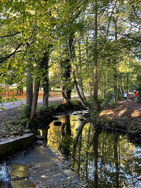
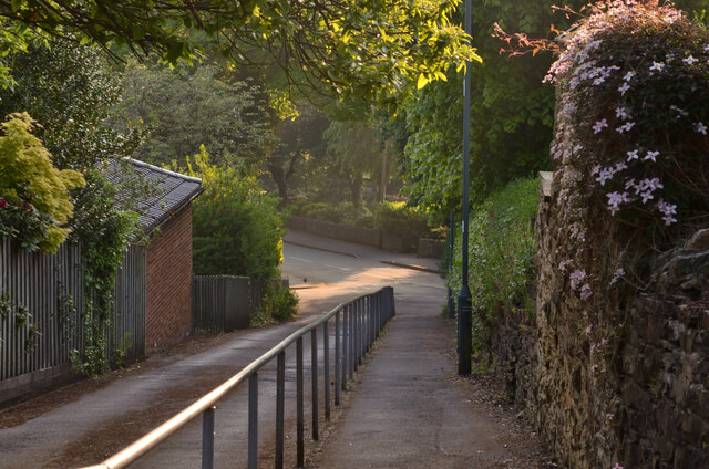
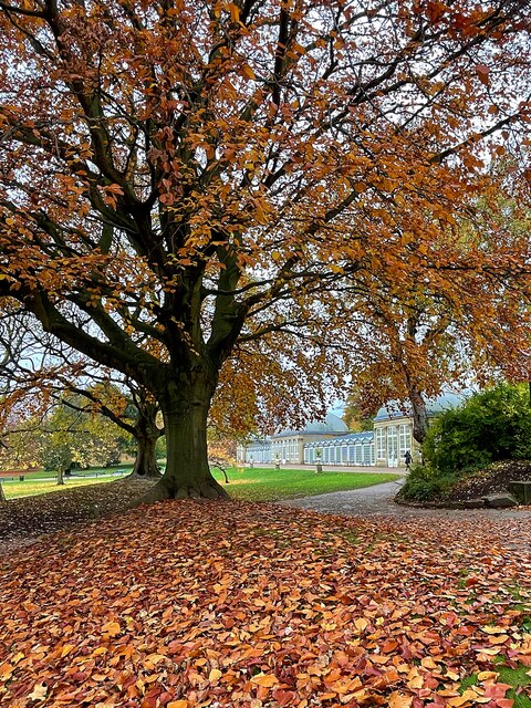
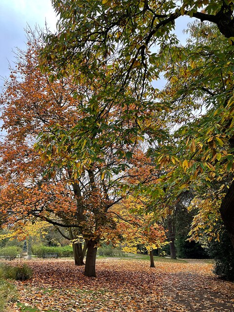
The street's location is one of its main attractions. With Endcliffe Park just a stone's throw away, residents can enjoy the lush greenery, mature trees, and peaceful atmosphere of this popular recreational space. The park offers vast open spaces for leisurely strolls, sports facilities, and a children's playground, making it an ideal spot for families and outdoor enthusiasts.

The crescent also benefits from excellent transport links, with regular bus services connecting it to Sheffield city center and other surrounding areas. Additionally, several schools and universities are within easy reach, making it an appealing location for families and students alike.

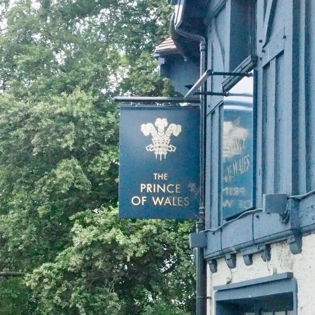
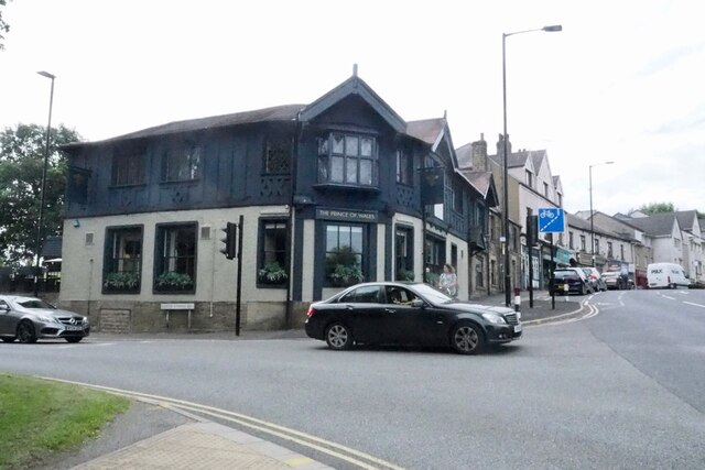
Local amenities are conveniently located nearby, with a range of shops, cafes, and restaurants available in the vicinity. The vibrant Ecclesall Road, renowned for its independent boutiques and eateries, is just a short walk away, providing residents with a plethora of options for dining and shopping.

Overall, Endcliffe Crescent offers a delightful combination of peaceful surroundings, architectural beauty, and convenient access to amenities, making it a sought-after residential location in Yorkshire.

If you have any feedback on the listing, please let us know in the comments section below.

Endcliffe Crescent Images

Images are sourced within 2km of 53.373959/-1.506892 or Grid Reference SK3286. Thanks to Geograph Open Source API. All images are credited.

The sign of The Prince of Wales
The Prince of Wales
The Prince of Wales
Lansdowne Meadow With the Keating tower block beyond
Lansdowne Meadow
With the Keating tower block beyond
View to Cemetery Road Baptist Church Looking across Lansdowne Meadow
View to Cemetery Road Baptist Church
Looking across Lansdowne Meadow
Brown bear in The Botanical Gardens Just one of many bears in the Bears of Sheffield arts/charity citywide initiative (2021). All the bears are modelled upon the original steel bear located in the bear pit - also in The Botanical Gardens. See <a title="https://www.geograph.org.uk/photo/2055296" href="https://www.geograph.org.uk/photo/2055296">Link</a>
Brown bear in The Botanical Gardens
Just one of many bears in the Bears of Sheffield arts/charity citywide initiative (2021). All the bears are modelled upon the original steel bear located in the bear pit - also in The Botanical Gardens. See Link
View towards Ranmoor from Nether Green, Sheffield Taken from Carr Bank Lane. Ranmoor Church steeple can be seen centre-left and the Hallamshire Hospital is the large building on the centre-right skyline.
View towards Ranmoor from Nether Green, Sheffield
Taken from Carr Bank Lane. Ranmoor Church steeple can be seen centre-left and the Hallamshire Hospital is the large building on the centre-right skyline.
The start of the Ten10Ten run in Endcliffe Park This 10k trail run was first held on the 10th of October 2010, hence the funny name. This is a view of the start and finish area after the course was set up but before many of the 1300+ runners had arrived.
The start of the Ten10Ten run in Endcliffe Park
This 10k trail run was first held on the 10th of October 2010, hence the funny name. This is a view of the start and finish area after the course was set up but before many of the 1300+ runners had arrived.
A sunny Autumn morning in Endcliffe Park
A sunny morning in Endcliffe Park
Autumn colour reflected in Mill Dam One of two former mill ponds in Endcliffe Park this fed the Holme Wheel which operated from the mid 18th to the late 19th century.
Autumn colour reflected in Mill Dam
One of two former mill ponds in Endcliffe Park this fed the Holme Wheel which operated from the mid 18th to the late 19th century.
Trail runners in Endcliffe Park The runners are taking part in the Ten10Ten trail run which is held annually on the nearest Sunday to the 10th October.
Trail runners in Endcliffe Park
The runners are taking part in the Ten10Ten trail run which is held annually on the nearest Sunday to the 10th October.
Shops on Fulwood Road, Broomhill, Sheffield
Ecclesall Road South, Sheffield
Alleyway in Brincliffe, Sheffield Early on a quiet summer morning.
Alleyway in Brincliffe, Sheffield
Early on a quiet summer morning.
Autumn colour in Sheffield Botanical Gardens The glass pavilions framed by the leaves of a beech tree.
Autumn colour in Sheffield Botanical Gardens
The glass pavilions framed by the leaves of a beech tree.
Beech tree in Sheffield Botanical Gardens
Autumn colour in Sheffield Botanical Gardens
The Octagon Centre: University of Sheffield
Show me another place!

Endcliffe Crescent is located at Grid Ref: SK3286 (Lat: 53.373959, Lng: -1.506892)

Division: West Riding

Unitary Authority: Sheffield

Police Authority: South Yorkshire

What 3 Words

///undulation.keen.inspector. Near Sheffield, South Yorkshire

Related Wikis

Birkdale School

Birkdale School is a Christian independent school for pupils aged 4–18, in the city of Sheffield, South Yorkshire in England. Founded by Maurice Asterley...

Sorby Research Institute

The Sorby Research Institute was a research facility that operated in the UK during and immediately after the Second World War in Sheffield, England....

Hallam Towers

Hallam Towers is a fifteen-storey, 48 metres (157 ft) apartment building completed in 2022 in the Broomhill area of Sheffield, South Yorkshire, England...

Westbourne School

Westbourne School for Boys and girls is an independent school for boys and girls aged 3–16 years old. It is located in the Broomhill area of south Sheffield...

Nearby Amenities

Located within 500m of 53.373959,-1.506892
Crossing
Button Operated: yes
Crossing: traffic_signals
Crossing Island: no
Tactile Paving: yes
Traffic Signals Sound: yes
Lat/Long: 53.3757765/-1.5063452
Post Box
Collection Times: Mo-Fr 09:00; Sa 07:00
Post Box Type: pillar
Ref: S10 99
Royal Cypher: EIIR
Royal Cypher Wikidata: Q33102113
Lat/Long: 53.3767013/-1.5088372
Created By: osm2go v0.6-8debian1
Lat/Long: 53.3766545/-1.5015879
Broomhill
Is In: South Yorkshire, England, UK
Place: suburb
Lat/Long: 53.3772474/-1.5033587
Endcliffe
Is In: South Yorkshire, England, UK
Place: suburb
Lat/Long: 53.3711536/-1.5063207
Barrier: lift_gate
Lat/Long: 53.3730906/-1.5058653
Turning Circle
Source: Bing
Lat/Long: 53.3717214/-1.5024333
Traffic Calming: table
Lat/Long: 53.3752908/-1.502166
Turning Circle
Lat/Long: 53.3733317/-1.5119466
Created By: osm2go v0.6-8debian1
Lat/Long: 53.3743019/-1.5070047
Created By: osm2go v0.6-8debian1
Lat/Long: 53.3741036/-1.5076875
Created By: osm2go v0.6-8debian1
Lat/Long: 53.3733748/-1.5088912
Post Box
Collection Times: Mo-Fr 09:00; Sa 07:00
Post Box Type: pillar
Postal Code: S10
Ref: S10 143
Royal Cypher: VR
Royal Cypher Wikidata: Q33102356
Lat/Long: 53.375288/-1.5015699
Bus Stop
Fulwood Road/Endcliffe Vale Road
Bench: yes
Bin: yes
Bus: yes
Lit: yes
Naptan AtcoCode: 370021134
Naptan Bearing: NE
Naptan CommonName: Fulwood Road/Endcliffe Vale Road
Naptan Indicator: 21134
Naptan Landmark: Ranmoor Church
Naptan PlusbusZoneRef: ROTHCEN
Naptan Street: Fulwood Road
Naptan Verified: yes
Public Transport: platform
Shelter: yes
Source: naptan_import
Tactile Paving: yes
Lat/Long: 53.3738364/-1.5137017
Bus Stop
Fulwood Road/Shore Lane
Bus: yes
Naptan AtcoCode: 370021135
Naptan Bearing: SW
Naptan CommonName: Fulwood Road/Shore Lane
Naptan Indicator: 21135
Naptan Landmark: 21135
Naptan PlusbusZoneRef: ROTHCEN
Naptan Street: Fulwood Road
Naptan Verified: no
Public Transport: platform
Source: naptan_import
Lat/Long: 53.3744694/-1.5102373
Bus Stop
Fulwood Road/Shore Lane
Bus: yes
Naptan AtcoCode: 370021136
Naptan Bearing: NE
Naptan CommonName: Fulwood Road/Shore Lane
Naptan Indicator: 21136
Naptan Landmark: 21136
Naptan PlusbusZoneRef: ROTHCEN
Naptan Street: Fulwood Road
Naptan Verified: no
Public Transport: platform
Source: naptan_import
Lat/Long: 53.3747813/-1.5095723
Bus Stop
Fulwood Road/Endcliffe Crescent
Bench: no
Bin: no
Bus: yes
Naptan AtcoCode: 370021137
Naptan Bearing: SW
Naptan CommonName: Fulwood Road/Endcliffe Crescent
Naptan Indicator: 21137
Naptan Landmark: 21137
Naptan PlusbusZoneRef: ROTHCEN
Naptan Street: Fulwood Road
Naptan Verified: no
Public Transport: platform
Shelter: no
Source: naptan_import
Lat/Long: 53.3754634/-1.5071294
Bus Stop
Fulwood Road/Endcliffe Crescent
Bench: yes
Bin: no
Bus: yes
Naptan AtcoCode: 370021138
Naptan Bearing: NE
Naptan CommonName: Fulwood Road/Endcliffe Crescent
Naptan Indicator: 21138
Naptan Landmark: 21138
Naptan PlusbusZoneRef: ROTHCEN
Naptan Street: Fulwood Road
Naptan Verified: no
Public Transport: platform
Shelter: yes
Source: naptan_import
Lat/Long: 53.3756068/-1.5070225
Bus Stop
Manchester Road/Tapton House Road
Bench: no
Bin: yes
Bus: yes
Naptan AtcoCode: 370021139
Naptan Bearing: W
Naptan CommonName: Manchester Road/Tapton House Road
Naptan Indicator: 21139
Naptan Landmark: KELSAL MOUNT
Naptan PlusbusZoneRef: ROTHCEN
Naptan Street: Manchester Road
Naptan Verified: no
Public Transport: platform
Shelter: no
Source: naptan_import
Lat/Long: 53.3766585/-1.509205
Bus Stop
Manchester Road/Tapton House Road
Bench: yes
Bin: yes
Bus: yes
Naptan AtcoCode: 370021140
Naptan Bearing: E
Naptan CommonName: Manchester Road/Tapton House Road
Naptan Indicator: 21140
Naptan Landmark: Opposite Kestral Mount
Naptan PlusbusZoneRef: ROTHCEN
Naptan Street: Manchester Road
Naptan Verified: no
Public Transport: platform
Shelter: yes
Source: naptan_import
Tactile Paving: yes
Lat/Long: 53.3768392/-1.5094284
Bus Stop
Fulwood Road/Manchester Road BH7
Bus: yes
Naptan AtcoCode: 370020764
Naptan Bearing: NE
Naptan CommonName: Fulwood Road/Manchester Road BH7
Naptan Indicator: 20764
Naptan Landmark: OPPOSITE SHOPPING AREA
Naptan PlusbusZoneRef: ROTHCEN
Naptan Street: Fulwood Road
Naptan Verified: no
Public Transport: platform
Source: naptan_import
Lat/Long: 53.3768148/-1.5035361
Bus Stop
Brocco Bank/Westbourne Road
Alt Name: Brocco Bank/Westbourne Road
Bench: yes
Bin: no
Bus: yes
Naptan AltCommonName: Brocco Bank/Westbourne Road
Naptan AtcoCode: 370020770
Naptan Bearing: N
Naptan CommonName: Brocco Bank/Westbourne Road
Naptan Indicator: 20770
Naptan Landmark: Opposite Botanical Gardens
Naptan PlusbusZoneRef: ROTHCEN
Naptan Street: Brocco Bank
Naptan Verified: no
Public Transport: platform
Shelter: yes
Source: naptan_import
Tactile Paving: yes
Lat/Long: 53.3721063/-1.5006978
Bus Stop
Glossop Road/Ashgate Road BH6
Bus: yes
Naptan AtcoCode: 370020773
Naptan Bearing: NW
Naptan CommonName: Glossop Road/Ashdell Road BH6
Naptan Indicator: 20773
Naptan Landmark: 20773
Naptan PlusbusZoneRef: ROTHCEN
Naptan Street: Glossop Road
Naptan Verified: no
Public Transport: platform
Source: naptan_import
Lat/Long: 53.3769622/-1.5014089
Bus Stop
Manchester Road/Lawson Road
Alt Name: Manchester Road/Lawson Road
Bench: no
Bin: no
Bus: yes
Naptan AltCommonName: Manchester Road/Lawson Road
Naptan AtcoCode: 370020777
Naptan Bearing: W
Naptan CommonName: Manchester Road/Lawson Road
Naptan Indicator: 20777
Naptan Landmark: 20777
Naptan PlusbusZoneRef: ROTHCEN
Naptan Street: Manchester Road
Naptan Verified: no
Public Transport: platform
Shelter: no
Source: naptan_import
Tactile Paving: no
Lat/Long: 53.3765689/-1.5045549
Bus Stop
Fulwood Road/Manchester Road
Bus: yes
Naptan AtcoCode: 370020778
Naptan Bearing: SW
Naptan CommonName: Fulwood Road/Manchester Road
Naptan Indicator: 20778
Naptan Landmark: Opposite Police Station
Naptan PlusbusZoneRef: ROTHCEN
Naptan Street: Fulwood Road
Naptan Verified: no
Public Transport: platform
Source: naptan_import
Lat/Long: 53.3761818/-1.5047911
Bus Stop
Endcliffe Vale Road/Woodvale Road
Bus: yes
Naptan AtcoCode: 370027231
Naptan Bearing: N
Naptan CommonName: Endcliffe Vale Road/Woodvale Road
Naptan Indicator: 27231
Naptan Landmark: Hallam Chase
Naptan PlusbusZoneRef: ROTHCEN
Naptan Street: Endcliffe Vale Road
Naptan Verified: no
Public Transport: platform
Source: naptan_import
Lat/Long: 53.3722882/-1.5109838
Bus Stop
Endcliffe Vale Road/Endcliffe Hall Avenue
Bus: yes
Naptan AtcoCode: 370027232
Naptan Bearing: N
Naptan CommonName: Endcliffe Vale Road/Endcliffe Hall Avenue
Naptan Indicator: 27232
Naptan Landmark: 27232
Naptan PlusbusZoneRef: ROTHCEN
Naptan Street: Endcliffe Vale Road
Naptan Verified: no
Public Transport: platform
Source: naptan_import
Lat/Long: 53.3720809/-1.5108659
Bus Stop
Endcliffe Vale Road/Endcliffe Rise Road
Bus: yes
Naptan AtcoCode: 370027233
Naptan Bearing: N
Naptan CommonName: Endcliffe Vale Road/Endcliffe Rise Road
Naptan Indicator: 27233
Naptan Landmark: 27233
Naptan PlusbusZoneRef: ROTHCEN
Naptan Street: Endcliffe Vale Road
Naptan Verified: no
Public Transport: platform
Source: naptan_import
Lat/Long: 53.371127/-1.5040682
Bus Stop
Endcliffe Vale Road/Oakholme Road
Bus: yes
Naptan AtcoCode: 370027234
Naptan Bearing: N
Naptan CommonName: Endcliffe Vale Road/Oakholme Road
Naptan Indicator: 27234
Naptan Landmark: 27234
Naptan PlusbusZoneRef: ROTHCEN
Naptan Street: Endcliffe Vale Road
Naptan Verified: no
Public Transport: platform
Source: naptan_import
Lat/Long: 53.3712594/-1.5034805
Bus Stop
Endcliffe Vale Road/The Glade
Alt Name: Endcliffe Vale Road/The Glade
Bus: yes
Naptan AltCommonName: Endcliffe Vale Road/The Glade
Naptan AtcoCode: 370027235
Naptan Bearing: N
Naptan CommonName: Endcliffe Vale Road/The Glade
Naptan Indicator: 27235
Naptan Landmark: 27235
Naptan PlusbusZoneRef: ROTHCEN
Naptan Street: Endcliffe Vale Road
Naptan Verified: no
Public Transport: platform
Source: naptan_import
Lat/Long: 53.3709619/-1.5083559
Bus Stop
Endcliffe Vale Road/The Glen
Alt Name: Endcliffe Vale Road/The Glen
Bench: no
Bin: no
Bus: yes
Lit: no
Naptan AltCommonName: Endcliffe Vale Road/The Glen
Naptan AtcoCode: 370027236
Naptan Bearing: N
Naptan CommonName: Endcliffe Vale Road/The Glen
Naptan Indicator: 27236
Naptan Landmark: 27236
Naptan PlusbusZoneRef: ROTHCEN
Naptan Street: Endcliffe Vale Road
Naptan Verified: no
Public Transport: platform
Shelter: no
Source: naptan_import
Tactile Paving: no
Lat/Long: 53.3709159/-1.5066351
Crossing
Crossing: traffic_signals
Crossing Ref: pelican
Lat/Long: 53.3738422/-1.5132265
Crossing
Crossing: zebra
Crossing Island: yes
Kerb: lowered
Tactile Paving: yes
Lat/Long: 53.3724214/-1.5001638
Bicycle Parking
Bicycle Parking: stands
Capacity: 4
Check Date: 2023-11-20
Covered: no
Lat/Long: 53.3777125/-1.5031841
Post Box
Collection Times: Mo-Fr 09:00; Sa 07:00
Post Box Type: pillar
Ref: S11 14
Royal Cypher: GR
Royal Cypher Wikidata: Q33102273
Lat/Long: 53.3714232/-1.5013454
Barrier: lift_gate
Lat/Long: 53.372036/-1.5102812
Turning Circle
Source: Bing
Lat/Long: 53.3718225/-1.5011867
Barrier: lift_gate
Foot: yes
Vehicle: private
Lat/Long: 53.3749835/-1.5125079
Vending Machine
Check Date: 2023-06-28
Lat/Long: 53.3727796/-1.5069222
Post Box
Collection Times: Mo-Fr 17:00; Sa 12:00
Operator: Royal Mail
Operator Wikidata: Q638098
Post Box Type: pillar
Ref: S10 19
Royal Cypher: EIIR
Royal Cypher Wikidata: Q33102113
Source: survey
Lat/Long: 53.3768337/-1.5030683
Post Box
Collection Times: Mo-Fr 17:00; Sa 12:00
Note: Neither of these two is a franked-mail-only - both are normal
Operator: Royal Mail
Operator Wikidata: Q638098
Post Box Type: pillar
Ref: S10 1019
Royal Cypher: GR
Royal Cypher Wikidata: Q33102273
Source: survey
Lat/Long: 53.3768432/-1.5030395
Grit Bin
Lat/Long: 53.3707064/-1.5086279
Disused Amenity: post_box
Post Box Type: wall
Royal Cypher: VR
Lat/Long: 53.3708482/-1.506341
Grit Bin
Lat/Long: 53.3708771/-1.5072149
Grit Bin
Operator: Sheffield City Council
Operator Type: government
Operator Wikidata: Q7492609
Seasonal: no
Lat/Long: 53.37103/-1.5086725
Bench
Lat/Long: 53.3714115/-1.5050648
Bench
Lat/Long: 53.3714328/-1.5050693
Bench
Lat/Long: 53.3714541/-1.505076
Fountain
Lat/Long: 53.371637/-1.5075737
Bench
Lat/Long: 53.3718504/-1.5070891
Bench
Lat/Long: 53.371862/-1.5071419
Churro Statue
Tourism: artwork
Lat/Long: 53.3719388/-1.5075544
Entrance: yes
Lat/Long: 53.3726212/-1.5076048
Atm
Lat/Long: 53.3726501/-1.5077086
Washpoint
Dry Cleaning: no
Email: service@washco.co.uk
Opening Hours: 24/7
Operator: Washco
Payment Apple Pay: yes
Payment Cash: no
Payment Contactless: yes
Payment Credit Cards: yes
Payment Debit Cards: yes
Payment Google Pay: yes
Phone: +448000546546
Self Service: yes
Shop: laundry
Website: https://www.washpoint.uk/
Lat/Long: 53.3727497/-1.5069798
Entrance: yes
Lat/Long: 53.3728307/-1.5069472
Traffic Calming: table
Lat/Long: 53.3751767/-1.5015898
Traffic Calming: table
Lat/Long: 53.3755215/-1.5025705
Barrier: entrance
Width: 4
Lat/Long: 53.3745357/-1.5003063
Crossing
Crossing: zebra
Kerb: lowered
Tactile Paving: yes
Lat/Long: 53.3723721/-1.5005558
Post Box
Collection Times: Mo-Fr 09:00; Sa 07:00
Post Box Type: wall
Ref: S10 44
Royal Cypher: GR
Royal Cypher Wikidata: Q33102273
Lat/Long: 53.3747666/-1.5059745
Post Box
Collection Times: Mo-Fr 09:00; Sa 07:00
Post Box Type: wall
Ref: S10 76D
Royal Cypher: VR
Royal Cypher Wikidata: Q33102356
Lat/Long: 53.3738893/-1.5133057
Defibrillator
Access: yes
Check Date: 2023-03-09
Defibrillator Location: Behind reception desk. Available 24/7
Emergency: defibrillator
Indoor: yes
Opening Hours: 24/7
Lat/Long: 53.3728203/-1.5070226
Defibrillator
Access: yes
Check Date: 2023-03-09
Defibrillator Location: Beside reception desk. Available 24/7
Emergency: defibrillator
Indoor: yes
Opening Hours: 24/7
Lat/Long: 53.3742618/-1.5137381
Entrance: yes
Lat/Long: 53.3742767/-1.5136819
Telephone
Booth: KXPlus
Covered: booth
Lat/Long: 53.3737854/-1.5138821
Barrier: bollard
Bollard: fixed
Lat/Long: 53.3718833/-1.5005031
Bench
Lat/Long: 53.374983/-1.5034492
Bench
Lat/Long: 53.3747585/-1.5038541
Parcel Locker
Amazon Hub Locker
Brand: Amazon Hub
Brand Wikidata: Q16974764
Operator: Amazon
Lat/Long: 53.3773752/-1.5020492
Atm
Check Date: 2023-11-20
Lat/Long: 53.3773146/-1.5020369
Street Lamp
Sewer Gas Destructor Lamp
Historic: yes
Lamp Type: sewer_gas_destructor_lamp
Listed Status: Grade II
Source: Historic England
Source Website: https://historicengland.org.uk/listing/the-list/list-entry/1246474
Wikidata: Q7458240
Wikipedia: en:Sewer gas destructor lamp
Lat/Long: 53.3751509/-1.5015962
Crossing
Button Operated: yes
Crossing: traffic_signals
Crossing Island: no
Kerb: lowered
Tactile Paving: yes
Lat/Long: 53.3771419/-1.5018214
Crossing
Button Operated: yes
Crossing: traffic_signals
Crossing Island: no
Kerb: flush
Tactile Paving: yes
Lat/Long: 53.3772367/-1.5018181
Brocco Bank/Westbourne Road
Bus: yes
Public Transport: stop_position
Lat/Long: 53.3720938/-1.5005326
Endcliffe Vale Road/Endcliffe Rise Road
Bus: yes
Public Transport: stop_position
Lat/Long: 53.3711497/-1.5040742
Endcliffe Vale Road/Oakholme Road
Bus: yes
Public Transport: stop_position
Lat/Long: 53.371221/-1.5034618
Endcliffe Vale Road/The Glen
Bus: yes
Public Transport: stop_position
Lat/Long: 53.3709012/-1.5066366
Endcliffe Vale Road/Endcliffe Hall Avenue
Bus: yes
Public Transport: stop_position
Lat/Long: 53.372092/-1.5108367
Endcliffe Vale Road/Woodvale Road
Bus: yes
Public Transport: stop_position
Lat/Long: 53.3722653/-1.5110551
Glossop Road/Ashgate Road BH6
Bus: yes
Public Transport: stop_position
Lat/Long: 53.3770079/-1.5013802
Fulwood Road/Manchester Road BH7
Bus: yes
Public Transport: stop_position
Lat/Long: 53.376716/-1.5034614
Fulwood Road/Manchester Road
Bus: yes
Public Transport: stop_position
Lat/Long: 53.3762545/-1.5048447
Manchester Road/Lawson Road
Bus: yes
Public Transport: stop_position
Lat/Long: 53.3766349/-1.5045705
Fulwood Road/Endcliffe Crescent
Bus: yes
Public Transport: stop_position
Lat/Long: 53.3755136/-1.5071484
Fulwood Road/Endcliffe Crescent
Bus: yes
Public Transport: stop_position
Lat/Long: 53.3755674/-1.5069899
Fulwood Road/Shore Lane
Bus: yes
Public Transport: stop_position
Lat/Long: 53.3747263/-1.5095336
Fulwood Road/Shore Lane
Bus: yes
Public Transport: stop_position
Lat/Long: 53.3745022/-1.5102622
Fulwood Road/Endcliffe Vale Road
Bus: yes
Public Transport: stop_position
Lat/Long: 53.3737855/-1.5136675
Manchester Road/Tapton House Road
Bus: yes
Public Transport: stop_position
Lat/Long: 53.376764/-1.5094423
Manchester Road/Tapton House Road
Bus: yes
Public Transport: stop_position
Lat/Long: 53.3767593/-1.5092085
Laundry Service: no
Self Service: yes
Shop: laundry
Lat/Long: 53.3737396/-1.5030336
Shop: laundry
Lat/Long: 53.3728434/-1.5033635
Endcliffe Vale Road/The Glade
Bus: yes
Public Transport: stop_position
Lat/Long: 53.3709996/-1.5083166
Elevator
Lat/Long: 53.3773487/-1.5020927
Traffic Signals
Crossing: no
Traffic Signals Direction: backward
Lat/Long: 53.3757537/-1.5064144
Traffic Signals
Crossing: no
Traffic Signals Direction: forward
Lat/Long: 53.3757969/-1.5062756
Crossing
Button Operated: yes
Crossing: traffic_signals
Crossing Island: no
Tactile Paving: yes
Lat/Long: 53.3765074/-1.5040594
Crossing
Button Operated: yes
Crossing: traffic_signals
Crossing Island: no
Tactile Paving: yes
Lat/Long: 53.3766214/-1.5041017
Give Way
Lat/Long: 53.3766862/-1.5038616
Traffic Signals
Crossing: no
Traffic Signals Direction: forward
Lat/Long: 53.3766218/-1.5041734
Traffic Signals
Crossing: no
Traffic Signals Direction: backward
Lat/Long: 53.3766538/-1.5036605
Cycleway: asl
Direction: backward
Lat/Long: 53.376485/-1.5041265
Traffic Signals
Crossing: no
Traffic Signals Direction: backward
Lat/Long: 53.3764622/-1.5041989
Crossing
Crossing: unmarked
Crossing Island: no
Tactile Paving: yes
Lat/Long: 53.37715/-1.5023908
Crossing
Crossing: unmarked
Crossing Island: no
Tactile Paving: yes
Lat/Long: 53.3771174/-1.5025324
Traffic Signals
Crossing: no
Traffic Signals Direction: forward
Lat/Long: 53.377075/-1.502375
Traffic Signals
Crossing: no
Traffic Signals Direction: backward
Lat/Long: 53.3772526/-1.5017715
Traffic Signals
Crossing: no
Traffic Signals Direction: forward
Lat/Long: 53.3772202/-1.5018721
Traffic Signals
Crossing: no
Traffic Signals Direction: backward
Lat/Long: 53.3771302/-1.5017702
Traffic Signals
Crossing: no
Lat/Long: 53.3771766/-1.5024924
Direction: 50
Man Made: surveillance
Surveillance: public
Surveillance Type: ALPR
Surveillance Zone: traffic
Lat/Long: 53.3768103/-1.5029649
Direction: 220
Man Made: surveillance
Surveillance: public
Surveillance Type: ALPR
Surveillance Zone: traffic
Lat/Long: 53.3770744/-1.5026721
Grit Bin
Operator: Sheffield City Council
Operator Type: government
Operator Wikidata: Q7492609
Seasonal: no
Lat/Long: 53.3754103/-1.5137629
Grit Bin
Operator: Sheffield City Council
Operator Type: government
Operator Wikidata: Q7492609
Seasonal: no
Lat/Long: 53.3744926/-1.500471
Grit Bin
Operator: Sheffield City Council
Operator Type: government
Operator Wikidata: Q7492609
Seasonal: no
Lat/Long: 53.3752715/-1.5040393
Grit Bin
Operator: Sheffield City Council
Operator Type: government
Operator Wikidata: Q7492609
Seasonal: no
Lat/Long: 53.3756926/-1.5058833
Grit Bin
Operator: Sheffield City Council
Operator Type: government
Operator Wikidata: Q7492609
Seasonal: no
Lat/Long: 53.3779635/-1.5051206
Grit Bin
Operator: Sheffield City Council
Operator Type: government
Operator Wikidata: Q7492609
Seasonal: no
Lat/Long: 53.3744912/-1.5044542
Grit Bin
Operator: Sheffield City Council
Operator Type: government
Operator Wikidata: Q7492609
Seasonal: no
Lat/Long: 53.3768876/-1.5079439
Grit Bin
Operator: Sheffield City Council
Operator Type: government
Operator Wikidata: Q7492609
Seasonal: no
Lat/Long: 53.3783716/-1.5081524
Grit Bin
Operator: Sheffield City Council
Operator Type: government
Operator Wikidata: Q7492609
Seasonal: no
Lat/Long: 53.3750461/-1.5017271
Grit Bin
Operator: Sheffield City Council
Operator Type: government
Operator Wikidata: Q7492609
Seasonal: no
Lat/Long: 53.3761944/-1.5033372
Grit Bin
Operator: Sheffield City Council
Operator Type: government
Operator Wikidata: Q7492609
Seasonal: no
Lat/Long: 53.3713443/-1.5020859
Grit Bin
Operator: Sheffield City Council
Operator Type: government
Operator Wikidata: Q7492609
Seasonal: no
Lat/Long: 53.3767149/-1.5053154
Grit Bin
Operator: Sheffield City Council
Operator Type: government
Operator Wikidata: Q7492609
Seasonal: no
Lat/Long: 53.3770795/-1.5043491
Grit Bin
Operator: Sheffield City Council
Operator Type: government
Operator Wikidata: Q7492609
Seasonal: no
Lat/Long: 53.3772348/-1.502784
Post Box
Collection Times: Mo-Fr 09:00; Sa 07:00
Location: 53.37093 -1.50654
Post Box Type: lamp
Ref: S10 133
Royal Cypher: EIIR
Royal Cypher Wikidata: Q33102113
Lat/Long: 53.3709644/-1.5065351
Entrance: main
Lat/Long: 53.3777902/-1.5030419
Lennon Flag -- Collective Wish-Making
Start Date: 2023
Tourism: artwork
Lat/Long: 53.3776906/-1.5031428
Defibrillator
Access: yes
Defibrillator Location: To the right of gate to school
Emergency: defibrillator
Indoor: no
Locked: yes
Opening Hours: 24/7
Lat/Long: 53.3753697/-1.5014754
The data included in this document is from www.openstreetmap.org. The data is made available under ODbL.

Have you been to Endcliffe Crescent?

Leave your review of Endcliffe Crescent below (or comments, questions and feedback).