Beinn Bheag Dheas

Hill, Mountain in Inverness-shire

Scotland

Beinn Bheag Dheas
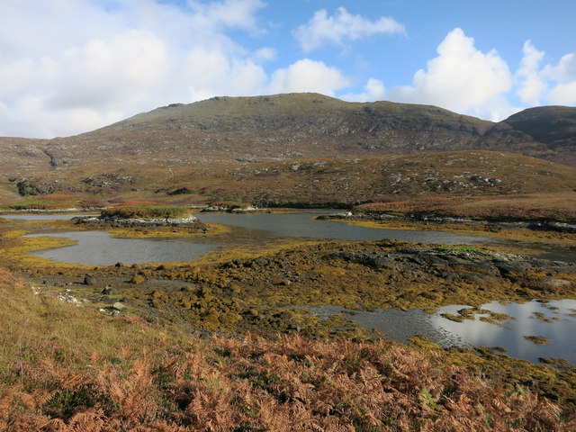
Sloc Dubh Looking towards Beinn Mhor.
Sloc Dubh Credit: Hugh Venables

The requested URL returned error: 429 Too Many Requests

If you have any feedback on the listing, please let us know in the comments section below.

Beinn Bheag Dheas Images

Images are sourced within 2km of 57.237289/-7.327019 or Grid Reference NF7828. Thanks to Geograph Open Source API. All images are credited.
Sloc Dubh Looking towards Beinn Mhor.
Sloc Dubh
Looking towards Beinn Mhor.
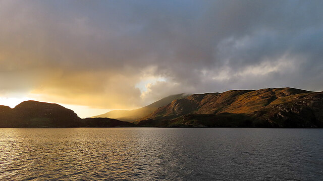
Evening Sunshine After some gloomy weather, the setting sun broke through the clouds for a short fine spell.
Evening Sunshine
After some gloomy weather, the setting sun broke through the clouds for a short fine spell.
Rubha nan Sruthan The peninsula on the north side of the narrowest part of Loch Aineort.
Rubha nan Sruthan
The peninsula on the north side of the narrowest part of Loch Aineort.
Loch Aineort Looking to Eilean an Easbuig.
Loch Aineort
Looking to Eilean an Easbuig.
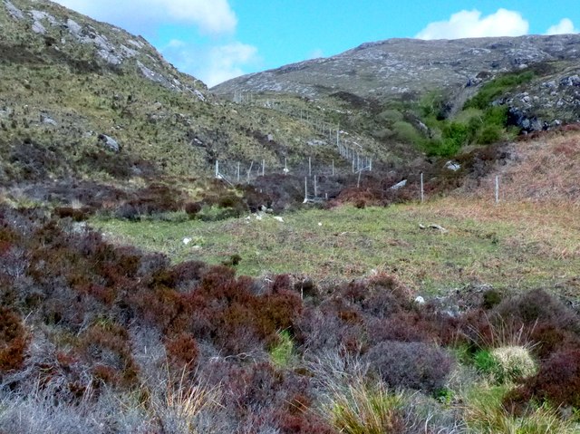
Estate boundary fence Just inshore from Loch Aineort.
Estate boundary fence
Just inshore from Loch Aineort.
Loch Aineort
Loch Aineort
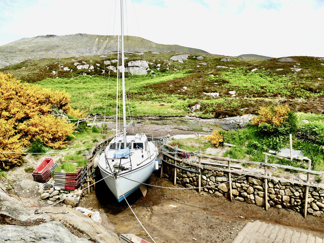
Loch Aineort's hidden harbour This tiny harbour on Loch Aineort, South Uist, is not much wider than a single car garage. Maybe this is why it escaped the OS cartographers! I haven't been able to find it on any map including all the scales available on MAGIC.  It does, however, show up clearly on Google Earth.
Loch Aineort's hidden harbour
This tiny harbour on Loch Aineort, South Uist, is not much wider than a single car garage. Maybe this is why it escaped the OS cartographers! I haven't been able to find it on any map including all the scales available on MAGIC. It does, however, show up clearly on Google Earth.
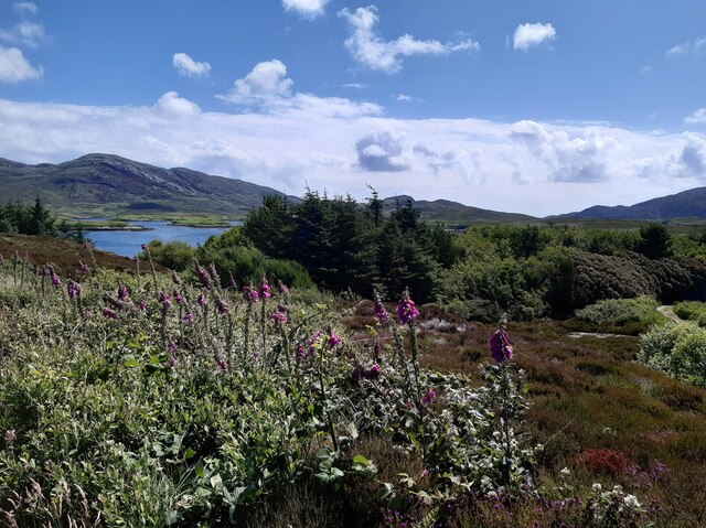
Small woodland above Loch Aineort
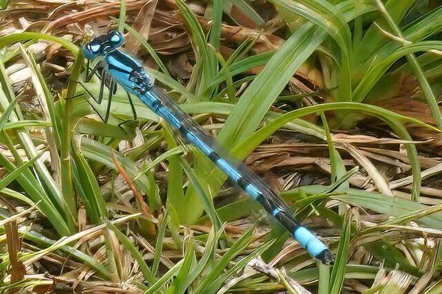
Damsel fly
Damsel fly
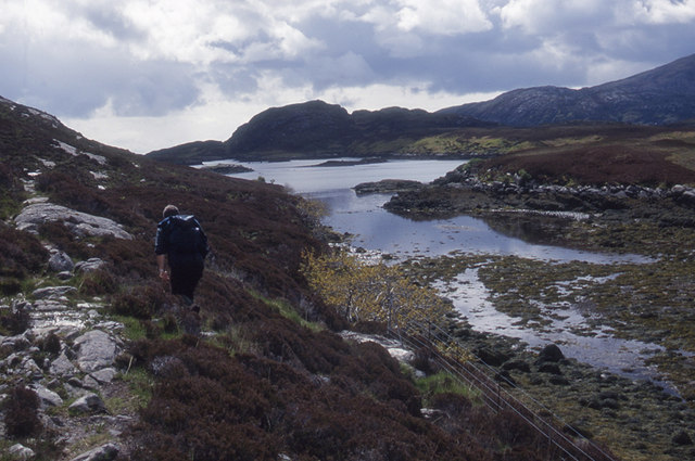
Path along the Sloc Dubh The path leaves the lochside to climb steeply up to Bealach Crosgard on Ben More
Path along the Sloc Dubh
The path leaves the lochside to climb steeply up to Bealach Crosgard on Ben More
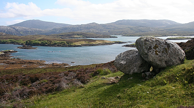
Sloc Dubh and Loch Aineort The nearest stretch of water is an almost landlocked arm of Loch Aineort, linked only by the narrow inlet just to the left of the two erratics perched on the hillside. The distant hills are Stulabhal and Airneabhal, with the lower peak of Beinn Ailean in between.
Sloc Dubh and Loch Aineort
The nearest stretch of water is an almost landlocked arm of Loch Aineort, linked only by the narrow inlet just to the left of the two erratics perched on the hillside. The distant hills are Stulabhal and Airneabhal, with the lower peak of Beinn Ailean in between.
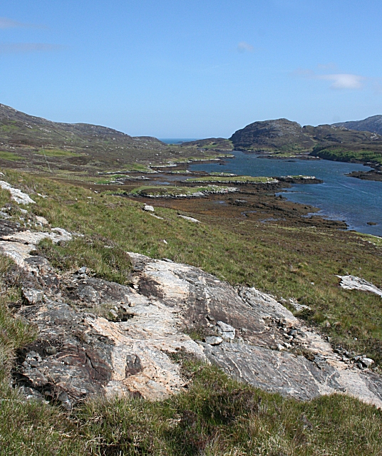
Lewisian Gneiss The ice-smoothed rocks above sloc Dubh contain pale grey gneiss intruded by dark mafic dykes, all reworked in the Laxfordian deformations.
Lewisian Gneiss
The ice-smoothed rocks above sloc Dubh contain pale grey gneiss intruded by dark mafic dykes, all reworked in the Laxfordian deformations.
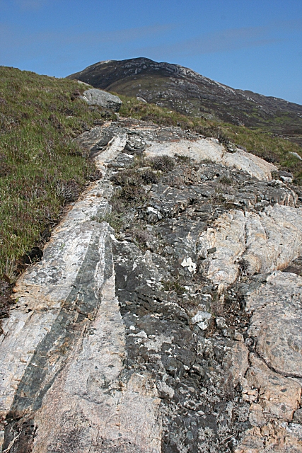
Lewisian Gneiss An outcrop of pale gneiss striped with dark mafic intrusions on the slopes above Sloc Dubh.
Lewisian Gneiss
An outcrop of pale gneiss striped with dark mafic intrusions on the slopes above Sloc Dubh.
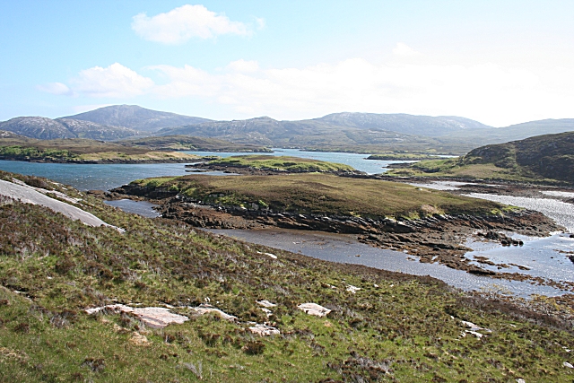
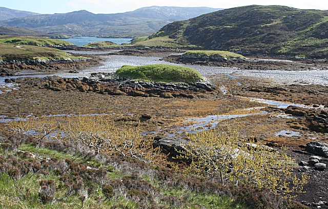
Sloc Dubh These islands in the northern part of Sloc Dubh are tidal, cut off only when the tide is high. Stulabhal and Airneabhal are in the background, beyond Loch Aineort.
Sloc Dubh
These islands in the northern part of Sloc Dubh are tidal, cut off only when the tide is high. Stulabhal and Airneabhal are in the background, beyond Loch Aineort.
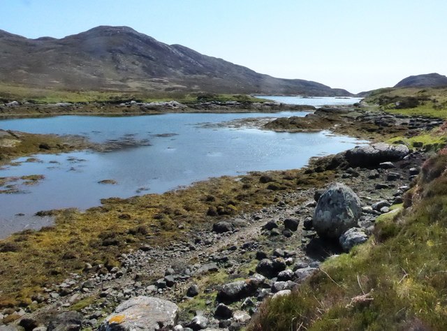
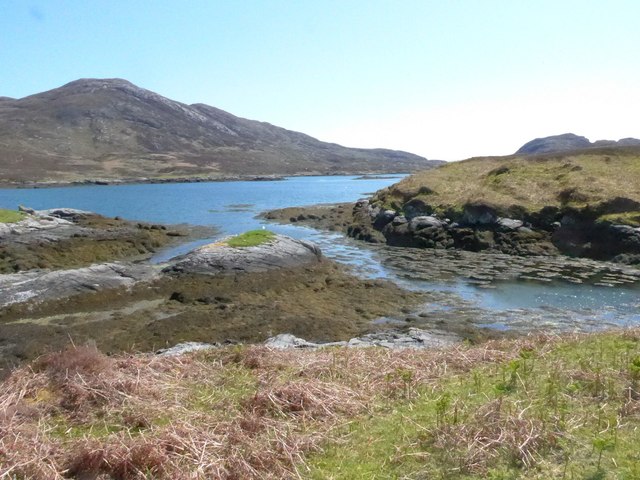
Sloc Dubh The falling tide exposes brown seaweed and mud around the tidal islets at the north end of Sloc Dubh.
Sloc Dubh
The falling tide exposes brown seaweed and mud around the tidal islets at the north end of Sloc Dubh.
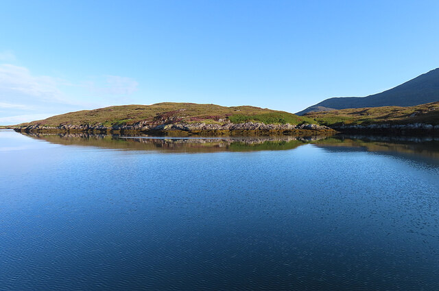
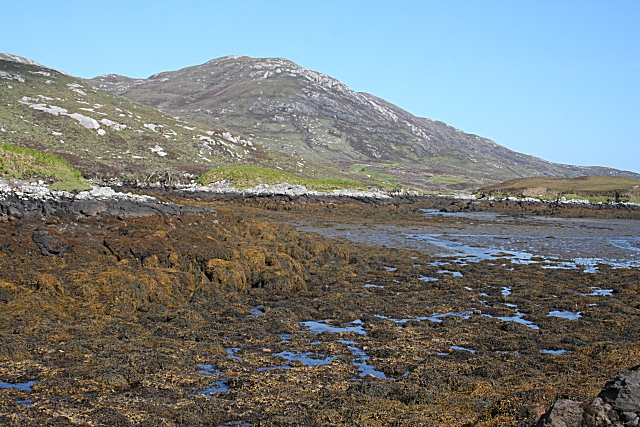
Looking Towards Beinn na Tobha The tide has left the seaweed-covered boulders in Sloc Dubh high and dry, though there is just enough water left to reflect the blue of the sky. Beinn na Tobha, in the next square, dominates the scene.
Looking Towards Beinn na Tobha
The tide has left the seaweed-covered boulders in Sloc Dubh high and dry, though there is just enough water left to reflect the blue of the sky. Beinn na Tobha, in the next square, dominates the scene.
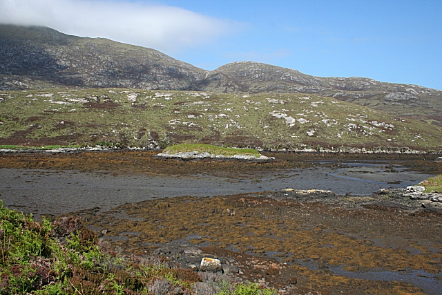
Sloc Dubh and  Beinn nan Caorach Sloc Dubh, in the foreground, and the low ridge immediately above it are all in square, but the hills beyond are not. Beinn nan Caorach is the low hill in the centre, with Bealach Crosgard separating it from Beinn Mhòr, the summit of which is hidden in the cloud.
Sloc Dubh and Beinn nan Caorach
Sloc Dubh, in the foreground, and the low ridge immediately above it are all in square, but the hills beyond are not. Beinn nan Caorach is the low hill in the centre, with Bealach Crosgard separating it from Beinn Mhòr, the summit of which is hidden in the cloud.
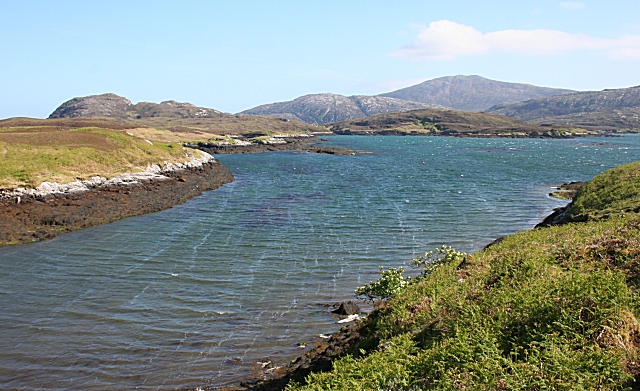
Loch Aineort The surface of the water reveals that a strong southerly wind is blowing. The land at left is Eilean an Easbuig, and ahead is Rubha nan Struthan, the point of the peninsula which separates Sloc Dubh from the open sea in that direction. The hill is Stulabhal.
Loch Aineort
The surface of the water reveals that a strong southerly wind is blowing. The land at left is Eilean an Easbuig, and ahead is Rubha nan Struthan, the point of the peninsula which separates Sloc Dubh from the open sea in that direction. The hill is Stulabhal.
Show me another place!

Beinn Bheag Dheas is located at Grid Ref: NF7828 (Lat: 57.237289, Lng: -7.327019)

Unitary Authority: Na h-Eileanan an Iar

Police Authority: Highlands and Islands

What 3 Words

///bolsters.wizard.poets. Near Lochboisdale, Na h-Eileanan Siar

Related Wikis

Beinn Mhòr (South Uist)

Beinn Mhòr is a mountain on the island of South Uist in the Outer Hebrides of Scotland. With a height of 620 metres (2,034 ft), it is the highest point...

South Uist

South Uist (Scottish Gaelic: Uibhist a Deas, [ˈɯ.ɪʃtʲ ə ˈtʲes̪] ; Scots: Sooth Uist) is the second-largest island of the Outer Hebrides in Scotland. At...

Bornish

Bornish (Scottish Gaelic: Bòrnais) is a village and community council area on South Uist in the Outer Hebrides, Scotland. Bornish is also within the civil...

Milton (South Uist)

Milton (Scottish Gaelic: Geàrraidh Bhailteas) is the name of a tack or tenant farm on the island of South Uist in the Outer Hebrides, Scotland. It was...

Nearby Amenities

Located within 500m of 57.237289,-7.327019
Beinn Bheag Dheas
Ele: 167
Natural: peak
Lat/Long: 57.2366998/-7.3274946
The data included in this document is from www.openstreetmap.org. The data is made available under ODbL.

Have you been to Beinn Bheag Dheas?

Leave your review of Beinn Bheag Dheas below (or comments, questions and feedback).