Rubha na Mèine

Coastal Feature, Headland, Point in Inverness-shire

Scotland

Rubha na Mèine

Sloc Dubh Looking towards Beinn Mhor.
Sloc Dubh Credit: Hugh Venables

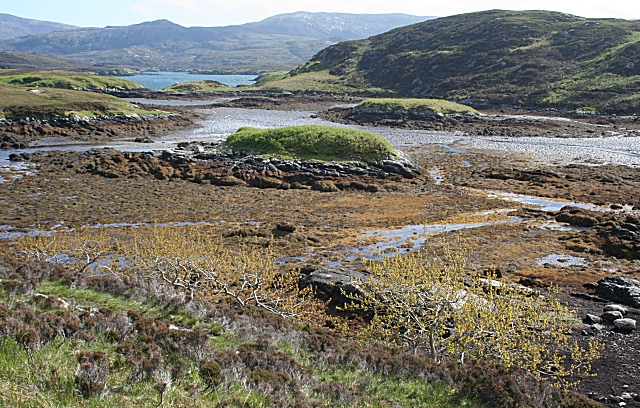
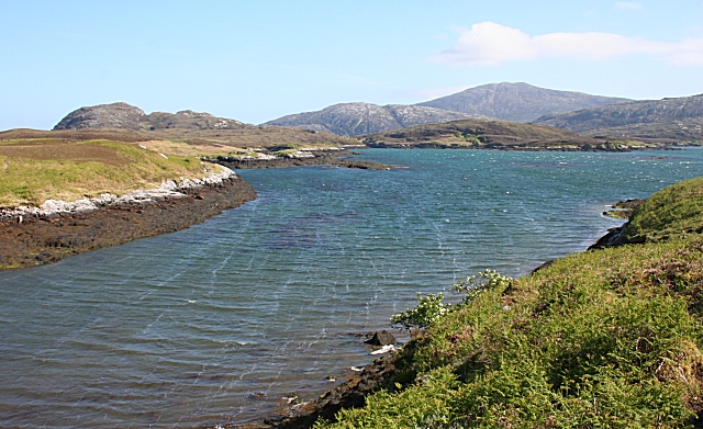
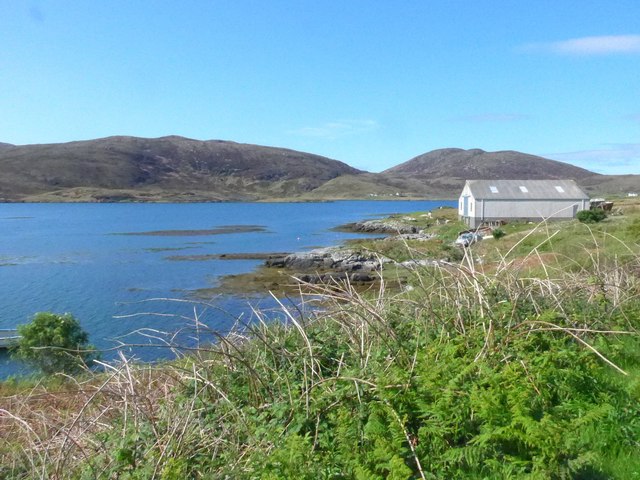
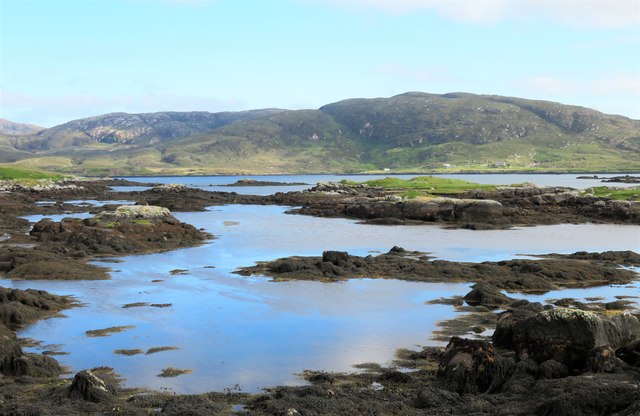
Rubha na Mèine is a prominent headland located in Inverness-shire, Scotland. It is situated on the northern coast of the Moray Firth, near the village of Ardersier. The headland is known for its rugged cliffs, which rise steeply from the sea, providing stunning views of the surrounding coastline.

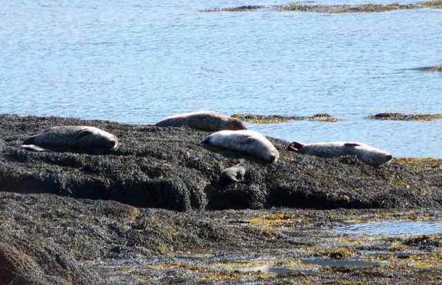
Rubha na Mèine is a popular destination for hikers and nature enthusiasts, who come to explore the dramatic landscape and observe the diverse wildlife that inhabits the area. The headland is home to a variety of bird species, including gannets, puffins, and guillemots, making it a prime spot for birdwatching.

In addition to its natural beauty, Rubha na Mèine also has a rich history. The headland is dotted with ancient ruins and archaeological sites, including a 6th-century chapel dedicated to St. Mary. Visitors can explore these historical remnants while taking in the breathtaking views of the Moray Firth and beyond.

Overall, Rubha na Mèine is a must-visit destination for those seeking a mix of natural beauty, wildlife, and history along the stunning coastline of Inverness-shire.

If you have any feedback on the listing, please let us know in the comments section below.

Rubha na Mèine Images

Images are sourced within 2km of 57.231853/-7.3357082 or Grid Reference NF7828. Thanks to Geograph Open Source API. All images are credited.
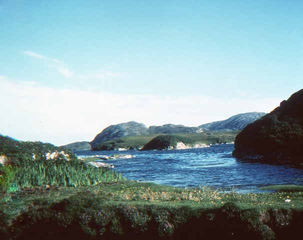
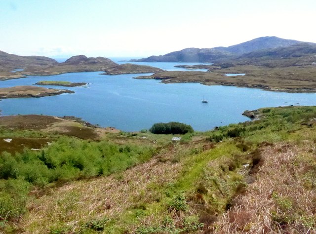
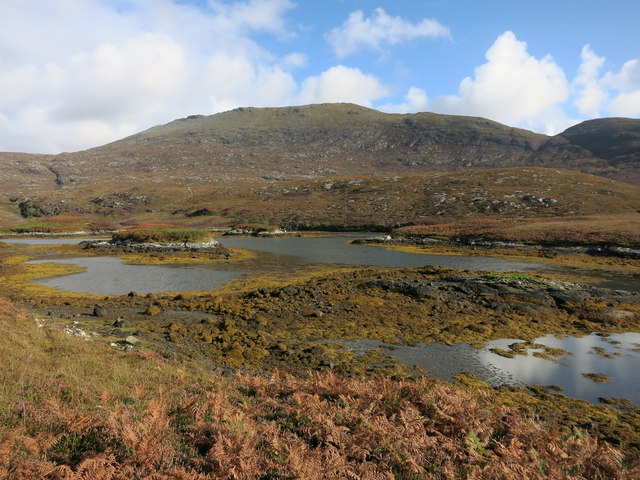
Sloc Dubh Looking towards Beinn Mhor.
Sloc Dubh
Looking towards Beinn Mhor.
Loch Aineort Looking to Eilean an Easbuig.
Loch Aineort
Looking to Eilean an Easbuig.
Loch Aineort's hidden harbour This tiny harbour on Loch Aineort, South Uist, is not much wider than a single car garage. Maybe this is why it escaped the OS cartographers! I haven't been able to find it on any map including all the scales available on MAGIC.  It does, however, show up clearly on Google Earth.
Loch Aineort's hidden harbour
This tiny harbour on Loch Aineort, South Uist, is not much wider than a single car garage. Maybe this is why it escaped the OS cartographers! I haven't been able to find it on any map including all the scales available on MAGIC. It does, however, show up clearly on Google Earth.
Small woodland above Loch Aineort
Damsel fly
Damsel fly
Sloc Dubh The falling tide exposes brown seaweed and mud around the tidal islets at the north end of Sloc Dubh.
Sloc Dubh
The falling tide exposes brown seaweed and mud around the tidal islets at the north end of Sloc Dubh.
Loch Aineort The surface of the water reveals that a strong southerly wind is blowing. The land at left is Eilean an Easbuig, and ahead is Rubha nan Struthan, the point of the peninsula which separates Sloc Dubh from the open sea in that direction. The hill is Stulabhal.
Loch Aineort
The surface of the water reveals that a strong southerly wind is blowing. The land at left is Eilean an Easbuig, and ahead is Rubha nan Struthan, the point of the peninsula which separates Sloc Dubh from the open sea in that direction. The hill is Stulabhal.
The northern most tip of Sloc Dubh A small burn flows into the loch at this point, the lowest part of the photo is the bank of the burn. The Schools Hebridean Society <span class="nowrap"><a title="http://www.schools-hebridean-society.co.uk" rel="nofollow ugc noopener" href="http://www.schools-hebridean-society.co.uk">Link</a><img style="margin-left:2px;" alt="External link" title="External link - shift click to open in new window" src="https://s1.geograph.org.uk/img/external.png" width="10" height="10"/></span> used the flat land just behind the photographer's position for a campsite.
The northern most tip of Sloc Dubh
A small burn flows into the loch at this point, the lowest part of the photo is the bank of the burn. The Schools Hebridean Society LinkExternal link used the flat land just behind the photographer's position for a campsite.
View of Sloc Dubh and Loch Aineort Taken from the lower slopes of Beinn na Tobha. Taken during the Schools Hebridean Society <span class="nowrap"><a title="http://www.schools-hebridean-society.co.uk" rel="nofollow ugc noopener" href="http://www.schools-hebridean-society.co.uk">Link</a><img style="margin-left:2px;" alt="External link" title="External link - shift click to open in new window" src="https://s1.geograph.org.uk/img/external.png" width="10" height="10"/></span> expedition to South Uist. The camp was situated on flat ground just below Loch nam Faoileann on the far right of the photo.
View of Sloc Dubh and Loch Aineort
Taken from the lower slopes of Beinn na Tobha. Taken during the Schools Hebridean Society LinkExternal link expedition to South Uist. The camp was situated on flat ground just below Loch nam Faoileann on the far right of the photo.
Loch Aineort
Loch Aineort
Loch Aineort And a nice ketch safely anchored in this well sheltered spot.
Loch Aineort
And a nice ketch safely anchored in this well sheltered spot.
The Allt Bholagair descends a small gully
Loch Aineort in all its complexity Out there is the sea (The Sea of the Hebrides).  Loch Aineort makes an excellent and well sheltered anchorage for yachts.
Loch Aineort in all its complexity
Out there is the sea (The Sea of the Hebrides). Loch Aineort makes an excellent and well sheltered anchorage for yachts.
The path to Bagh Lathach The owner of this croft has done a superb job in constructing a series of good paths, picnic and rest areas etc, and has also planted a wide variety of native and exotic plants. This is the main path that leads from the road end towards Bagh Lathach.
The path to Bagh Lathach
The owner of this croft has done a superb job in constructing a series of good paths, picnic and rest areas etc, and has also planted a wide variety of native and exotic plants. This is the main path that leads from the road end towards Bagh Lathach.
View towards Beinn Mhor Taken from the tiny 'harbour' in a corner of Loch Aineort with the southern flanks of Beinn Mhor rising steeply in the background. This was an unusual afternoon for weather conditions, for while much of the island was rather grey and misty, the mountains broke up the cloud and made Loch Aineort a sun trap.
View towards Beinn Mhor
Taken from the tiny 'harbour' in a corner of Loch Aineort with the southern flanks of Beinn Mhor rising steeply in the background. This was an unusual afternoon for weather conditions, for while much of the island was rather grey and misty, the mountains broke up the cloud and made Loch Aineort a sun trap.
Afternoon snooze time Grey seals saving energy on a rocky reef in Loch Aineort.
Afternoon snooze time
Grey seals saving energy on a rocky reef in Loch Aineort.
Small boats, Loch Aineort Loch Aineort runs halfway across South Uist with a sheltered entrance from the Minch. The view is across the loch towards Stulabhal [374m] which is the highest of the hills in this shot.
Small boats, Loch Aineort
Loch Aineort runs halfway across South Uist with a sheltered entrance from the Minch. The view is across the loch towards Stulabhal [374m] which is the highest of the hills in this shot.
Looking out into Loch Aineort The view near the head of the sea loch looking towards where it begins to widen.
Looking out into Loch Aineort
The view near the head of the sea loch looking towards where it begins to widen.
Show me another place!

Rubha na Mèine is located at Grid Ref: NF7828 (Lat: 57.231853, Lng: -7.3357082)

Unitary Authority: Na h-Eileanan an Iar

Police Authority: Highlands and Islands

What 3 Words

///thudded.wool.estimated. Near Lochboisdale, Na h-Eileanan Siar

Related Wikis

Beinn Mhòr (South Uist)

Beinn Mhòr is a mountain on the island of South Uist in the Outer Hebrides of Scotland. With a height of 620 metres (2,034 ft), it is the highest point...

South Uist

South Uist (Scottish Gaelic: Uibhist a Deas, [ˈɯ.ɪʃtʲ ə ˈtʲes̪] ; Scots: Sooth Uist) is the second-largest island of the Outer Hebrides in Scotland. At...

Milton (South Uist)

Milton (Scottish Gaelic: Geàrraidh Bhailteas) is the name of a tack or tenant farm on the island of South Uist in the Outer Hebrides, Scotland. It was...

Bornish

Bornish (Scottish Gaelic: Bòrnais) is a village and community council area on South Uist in the Outer Hebrides, Scotland. Bornish is also within the civil...

Nearby Amenities

Located within 500m of 57.231853,-7.3357082
Passing Place
Lat/Long: 57.2350612/-7.3390222
Passing Place
Lat/Long: 57.2324421/-7.3339686
Generator Method: wind_turbine
Generator Output Electricity: small_installation
Generator Source: wind
Generator Type: horizontal_axis
Power: generator
Lat/Long: 57.2320415/-7.3303054
Power: pole
Lat/Long: 57.2353403/-7.3385572
Power: pole
Lat/Long: 57.2347568/-7.3380235
Power: pole
Lat/Long: 57.233827/-7.3378398
Power: pole
Lat/Long: 57.2344251/-7.3379537
Power: pole
Lat/Long: 57.2356343/-7.3389234
Power: pole
Lat/Long: 57.2328118/-7.3307975
Power: pole
Lat/Long: 57.2343316/-7.3371731
Power: pole
Lat/Long: 57.2335303/-7.3337211
Power: pole
Lat/Long: 57.2331892/-7.3323103
The data included in this document is from www.openstreetmap.org. The data is made available under ODbL.

Have you been to Rubha na Mèine?

Leave your review of Rubha na Mèine below (or comments, questions and feedback).