Duckpit Fen

Downs, Moorland in Huntingdonshire Huntingdonshire

England

Duckpit Fen

Cyclists on the B1043 One of several groups I encountered in a very short space of time.
Cyclists on the B1043 Credit: Jonathan Thacker

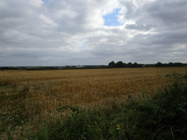
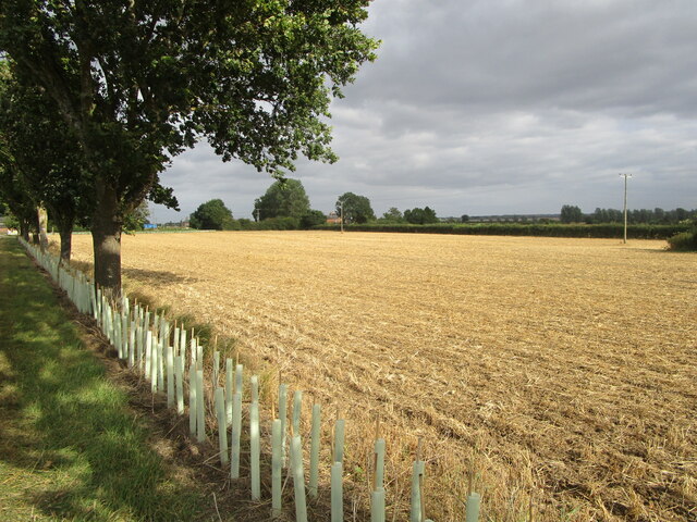
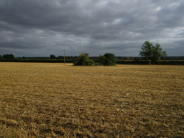
Duckpit Fen, located in Huntingdonshire, England, is a unique natural area that encompasses downs and moorland. Covering a vast expanse, this picturesque landscape is renowned for its diverse flora and fauna.

The downs, characterized by their rolling hills and chalky soil, provide a stunning backdrop to the fen. This area is home to a variety of plant species, including wildflowers such as harebells, orchids, and cowslips. The downs also offer a habitat for small mammals like rabbits and hares, while birds such as skylarks and kestrels soar overhead.

Adjacent to the downs, the moorland adds further diversity to the ecosystem. It is characterized by its wet and boggy terrain, providing a perfect environment for unique plant species such as sphagnum moss and heather. This habitat attracts a wide range of birdlife, including curlews, snipes, and lapwings, which can be seen nesting and foraging in the area.

Furthermore, Duckpit Fen is an important site for conservation efforts, as it supports several rare and endangered species. The fen provides a breeding ground for the great crested newt, a protected amphibian species, and also hosts a population of water voles, which are also in decline across the country.

Visitors to Duckpit Fen can enjoy the tranquility of the natural surroundings, as well as engage in activities such as birdwatching, hiking, and nature photography. With its diverse ecosystems and rich biodiversity, Duckpit Fen offers a fascinating glimpse into the natural heritage of Huntingdonshire.

If you have any feedback on the listing, please let us know in the comments section below.

Duckpit Fen Images

Images are sourced within 2km of 52.447791/-0.25251376 or Grid Reference TL1884. Thanks to Geograph Open Source API. All images are credited.

Cyclists on the B1043 One of several groups I encountered in a very short space of time.
Cyclists on the B1043
One of several groups I encountered in a very short space of time.
Wheat field off Cook's Lane
Stubble field and new hedge Near Bruce's Castle Farm.
Several hundred metres of new hedging has been planted in this area.
Stubble field and new hedge
Near Bruce's Castle Farm. Several hundred metres of new hedging has been planted in this area.
Stubble fields and dry drain near Gault Hill Farm The very edge of the Fens.
Stubble fields and dry drain near Gault Hill Farm
The very edge of the Fens.
Stubble field near Ivy Farm Looking towards the East Coast Main Line.
Stubble field near Ivy Farm
Looking towards the East Coast Main Line.
Gates to Conington House and footpath to the church Probably date from the early seventeenth century.
Gates to Conington House and footpath to the church
Probably date from the early seventeenth century.
Isolated barn, Conington A footpath between the village and church runs alongside on the right.
Isolated barn, Conington
A footpath between the village and church runs alongside on the right.
Woodland north of Conington
Former taxiway, RAF Glatton RAF Glatton opened as a USAF base in 1943. It closed in 1948 <span class="nowrap"><a title="https://en.wikipedia.org/wiki/RAF_Glatton" rel="nofollow ugc noopener" href="https://en.wikipedia.org/wiki/RAF_Glatton">Link</a><img style="margin-left:2px;" alt="External link" title="External link - shift click to open in new window" src="https://s1.geograph.org.uk/img/external.png" width="10" height="10"/></span>
Despite its short life it has had a major impact on the surroundings of Conington with many roads clearly having originally been part of the base. Concrete beneath the tarmac is the giveaway.
Former taxiway, RAF Glatton
RAF Glatton opened as a USAF base in 1943. It closed in 1948 LinkExternal link Despite its short life it has had a major impact on the surroundings of Conington with many roads clearly having originally been part of the base. Concrete beneath the tarmac is the giveaway.
Track beside the railway An access track for Network Rail.
Track beside the railway
An access track for Network Rail.
All Saints, Conington The bell tower bathed in evening sunlight, just after finished a 3 hour peal on the bells here.
All Saints, Conington
The bell tower bathed in evening sunlight, just after finished a 3 hour peal on the bells here.
All Saints, Conington  My favourite church judging by how many photos I've taken of this place over the years plus the many I added to this site 8 odd years ago!

14th Century building with memorials inside dedicated to the Cotton family who rebuilt it in 1500.
All Saints, Conington
My favourite church judging by how many photos I've taken of this place over the years plus the many I added to this site 8 odd years ago! 14th Century building with memorials inside dedicated to the Cotton family who rebuilt it in 1500.
Conington, All Saints
Stubble field near Bruce's Castle Farm The bushes in the field hide a small pond.
Stubble field near Bruce's Castle Farm
The bushes in the field hide a small pond.
Harrowed field and small plantation near Bruce's Castle Farm
Crease Road and Bruce's Castle Farm New hedges have been planted alongside the road.
Crease Road and Bruce's Castle Farm
New hedges have been planted alongside the road.
Prepared field and Gault Hill Farm Hill is relative in this flat landscape.
Prepared field and Gault Hill Farm
Hill is relative in this flat landscape.
Lane near Ivy Farm Looking towards Ivy Farm.
Lane near Ivy Farm
Looking towards Ivy Farm.
Show me another place!

Duckpit Fen is located at Grid Ref: TL1884 (Lat: 52.447791, Lng: -0.25251376)

Administrative County: Cambridgeshire

District: Huntingdonshire

Police Authority: Cambridgeshire

What 3 Words

///ruling.jazz.transit. Near Sawtry, Cambridgeshire

Related Wikis

Connington South rail crash

The Connington South rail crash occurred on 5 March 1967 on the East Coast Main Line near the village of Conington, Huntingdonshire, England. Five passengers...

Conington Castle

Conington Castle was a 16th-century house in Conington, Huntingdonshire, England, built for Sir Robert Cotton. It was demolished in 1956 by the then owner...

All Saints Church, Conington

All Saints Church is a redundant Anglican church in the village of Conington in the Huntingdonshire district of Cambridgeshire, England. It is recorded...

Middle Level Navigations

The Middle Level Navigations are a network of waterways in England, primarily used for land drainage, which lie in The Fens between the Rivers Nene and...

Nearby Amenities

Located within 500m of 52.447791,-0.25251376
The data included in this document is from www.openstreetmap.org. The data is made available under ODbL.

Have you been to Duckpit Fen?

Leave your review of Duckpit Fen below (or comments, questions and feedback).