Ryepeck Meadow

Downs, Moorland in Middlesex Spelthorne

England

Ryepeck Meadow

Shepperton Lock
Shepperton Lock Credit: Alex McGregor

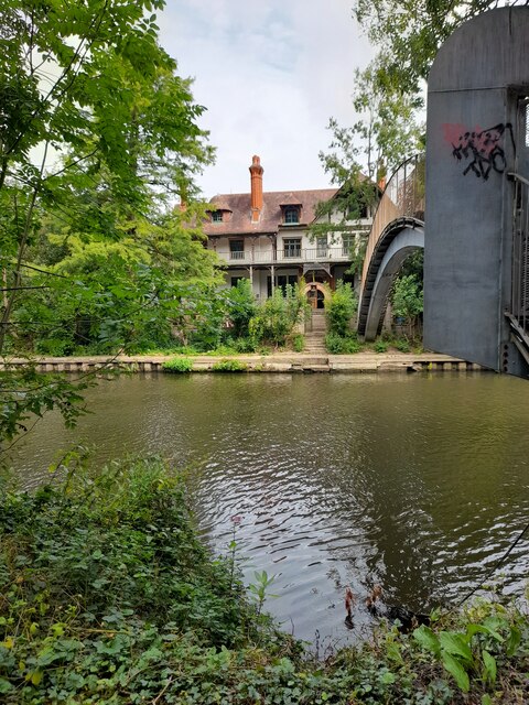
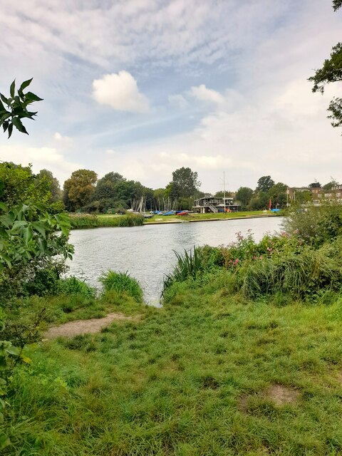
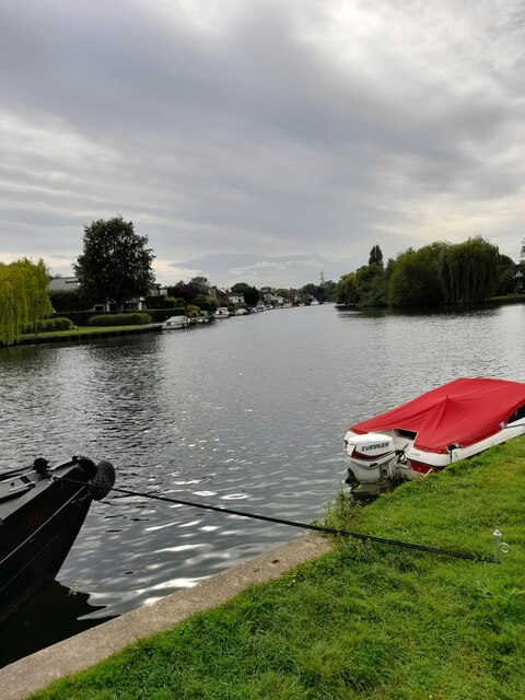
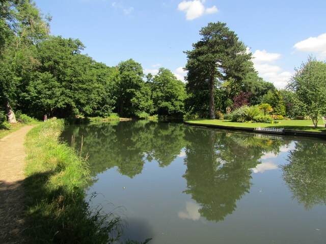
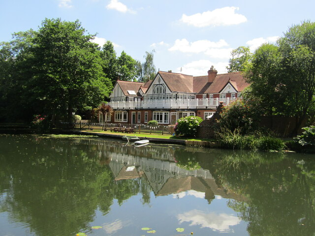
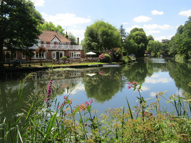
Ryepeck Meadow is a picturesque natural reserve located in the county of Middlesex, England. Nestled amidst the scenic landscape of the Downs and Moorland, this expansive meadow spans over several acres, offering visitors a tranquil retreat from the hustle and bustle of city life.

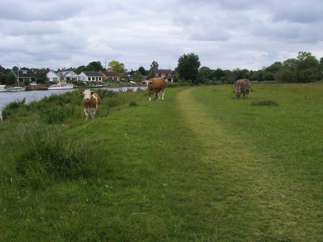
The meadow is characterized by its lush greenery, dotted with a diverse array of wildflowers and native plant species. As visitors explore the area, they can witness the rich biodiversity that thrives within its borders. The meadow is home to a variety of wildlife, including rabbits, squirrels, and an array of bird species that can be spotted soaring through the sky or nesting in the surrounding trees.

Walking trails wind through the meadow, providing visitors with the opportunity to immerse themselves in the natural beauty of the landscape. These well-maintained paths allow for leisurely strolls or invigorating hikes, catering to individuals of all fitness levels.

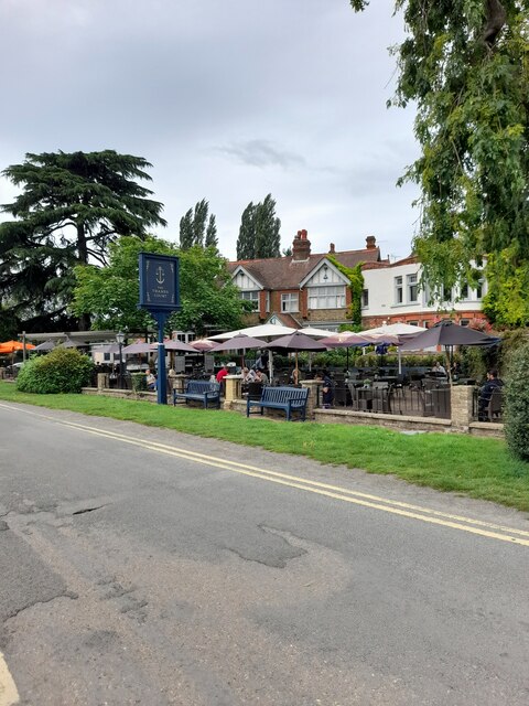
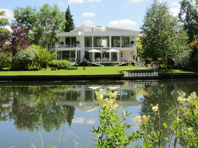
In addition to its natural appeal, Ryepeck Meadow also boasts several amenities for visitors. Picnic areas are scattered throughout the meadow, providing the perfect spot for a leisurely lunch or a family gathering. Benches are strategically placed along the walking paths, offering weary explorers a place to rest and take in the breathtaking scenery.

Ryepeck Meadow serves as a cherished recreational space for the local community, attracting nature enthusiasts, families, and avid photographers alike. Its tranquil ambiance and diverse ecosystem make it an ideal destination for those seeking solace in the beauty of nature.

If you have any feedback on the listing, please let us know in the comments section below.

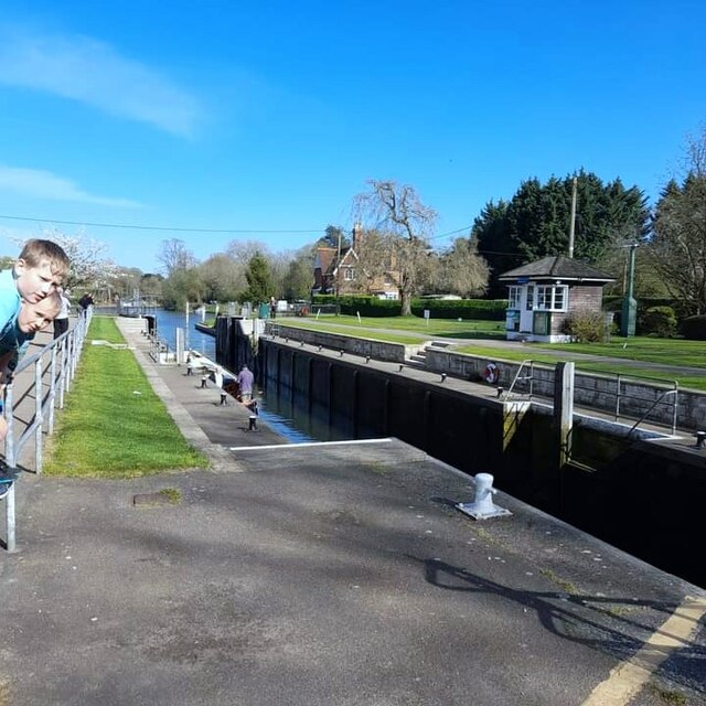
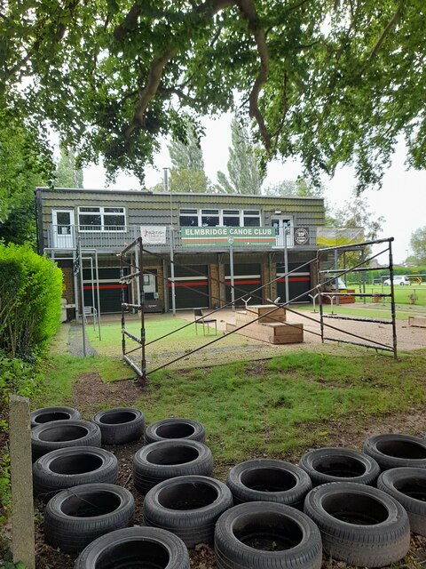
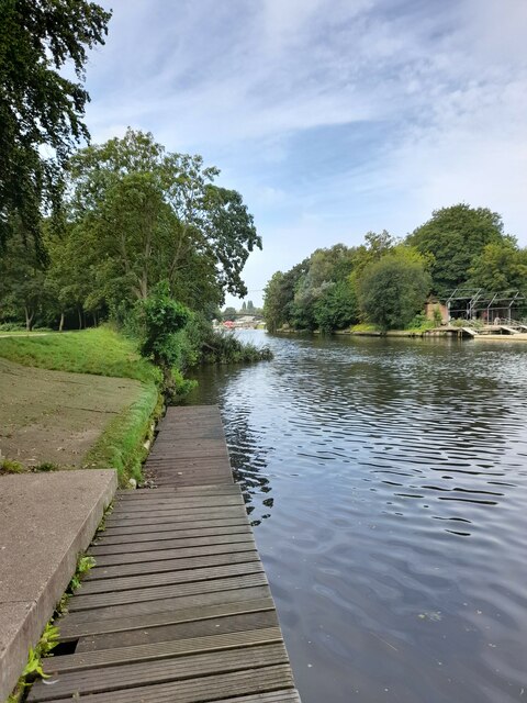
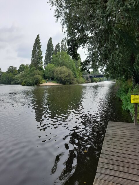
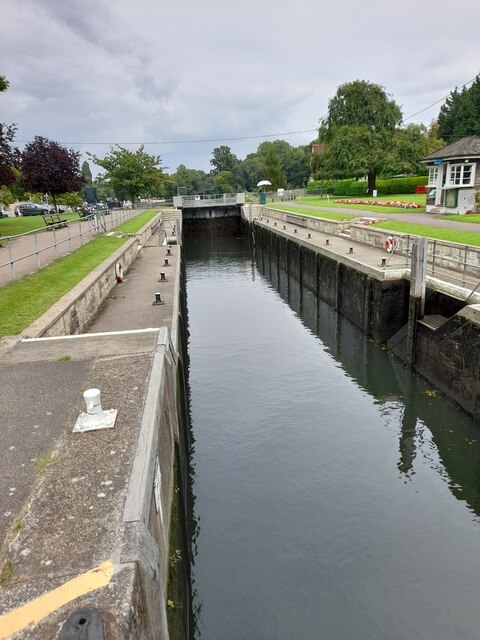
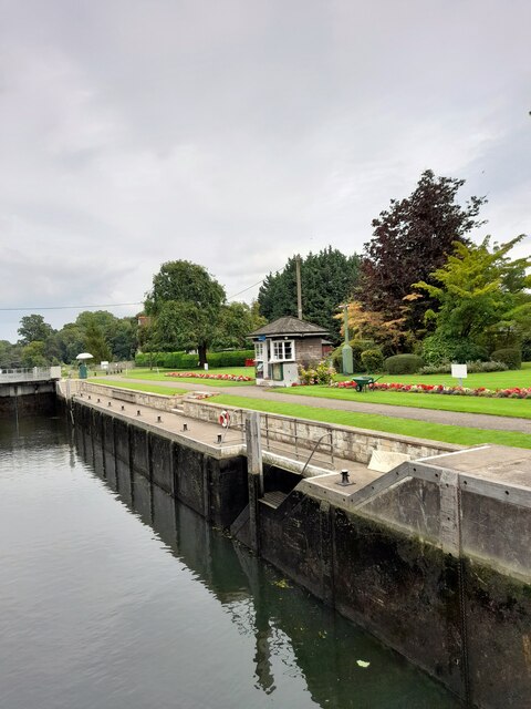
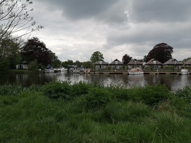
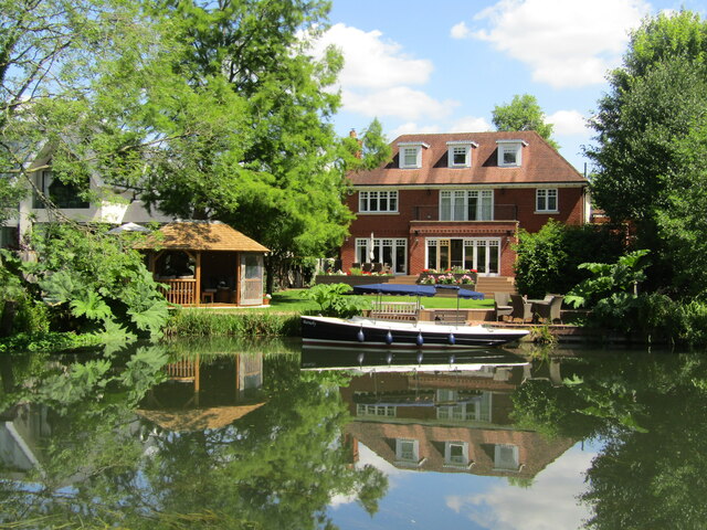
Ryepeck Meadow Images

Images are sourced within 2km of 51.38994/-0.47470012 or Grid Reference TQ0666. Thanks to Geograph Open Source API. All images are credited.

Shepperton Lock
Shepperton Lock
Elmbridge Canoe Club
River Thames
River Thames
River Thames
River Thames
D'Oyly Carte
D'Oyly Carte
Desborough Sailing Club
The Thames Court
The Thames Court
River Thames
River Thames
Shepperton Lock
Shepperton Lock
Shepperton Lock
Shepperton Lock
Entrance to Bates Wharf The entrance to Bates Wharf Marina, looking across the River Thames from a convenient bench
Entrance to Bates Wharf
The entrance to Bates Wharf Marina, looking across the River Thames from a convenient bench
Weybridge - River Wey Navigation Select housing with private moorings line the waterside.
<span class="nowrap"><a title="www.weyriver.co.uk" rel="nofollow ugc noopener" href="http://www.weyriver.co.uk">Link</a><img style="margin-left:2px;" alt="External link" title="External link - shift click to open in new window" src="https://s1.geograph.org.uk/img/external.png" width="10" height="10"/></span>
Weybridge - River Wey Navigation
Select housing with private moorings line the waterside. LinkExternal link
Weybridge - River Wey Navigation The towpath on the northernmost reach of the River Wey Navigation passes an exclusive residential area of Weybridge.
<span class="nowrap"><a title="www.weyriver.co.uk" rel="nofollow ugc noopener" href="http://www.weyriver.co.uk">Link</a><img style="margin-left:2px;" alt="External link" title="External link - shift click to open in new window" src="https://s1.geograph.org.uk/img/external.png" width="10" height="10"/></span>
Weybridge - River Wey Navigation
The towpath on the northernmost reach of the River Wey Navigation passes an exclusive residential area of Weybridge. LinkExternal link
Weybridge - River Wey Navigation Sylvan stretch between the Thames and Town Locks at Weybridge.
<span class="nowrap"><a title="www.weyriver.co.uk" rel="nofollow ugc noopener" href="http://www.weyriver.co.uk">Link</a><img style="margin-left:2px;" alt="External link" title="External link - shift click to open in new window" src="https://s1.geograph.org.uk/img/external.png" width="10" height="10"/></span>
Weybridge - River Wey Navigation
Sylvan stretch between the Thames and Town Locks at Weybridge. LinkExternal link
Weybridge - River Wey Navigation "Little Venice" comes to mind with the mooring poles awaiting a gondola.
<span class="nowrap"><a title="www.weyriver.co.uk" rel="nofollow ugc noopener" href="http://www.weyriver.co.uk">Link</a><img style="margin-left:2px;" alt="External link" title="External link - shift click to open in new window" src="https://s1.geograph.org.uk/img/external.png" width="10" height="10"/></span>
Weybridge - River Wey Navigation
"Little Venice" comes to mind with the mooring poles awaiting a gondola. LinkExternal link
Weybridge - River Wey Navigation Mooring and select housing in an upmarket riparian Weybridge.
<span class="nowrap"><a title="www.weyriver.co.uk" rel="nofollow ugc noopener" href="http://www.weyriver.co.uk">Link</a><img style="margin-left:2px;" alt="External link" title="External link - shift click to open in new window" src="https://s1.geograph.org.uk/img/external.png" width="10" height="10"/></span>
Weybridge - River Wey Navigation
Mooring and select housing in an upmarket riparian Weybridge. LinkExternal link
Weybridge - River Wey Navigation Select homes line the eastern bank between Thames and Town Locks.
<span class="nowrap"><a title="www.weyriver.co.uk" rel="nofollow ugc noopener" href="http://www.weyriver.co.uk">Link</a><img style="margin-left:2px;" alt="External link" title="External link - shift click to open in new window" src="https://s1.geograph.org.uk/img/external.png" width="10" height="10"/></span>
Weybridge - River Wey Navigation
Select homes line the eastern bank between Thames and Town Locks. LinkExternal link
Show me another place!

Ryepeck Meadow is located at Grid Ref: TQ0666 (Lat: 51.38994, Lng: -0.47470012)

Administrative County: Surrey

District: Spelthorne

Police Authority: Surrey

What 3 Words

///badly.round.insert. Near Shepperton, Surrey

Related Wikis

Dumsey Meadow

Dumsey Meadow is a 9.6-hectare (24-acre) biological Site of Special Scientific Interest between Chertsey and Shepperton in Surrey.It is the only piece...

Chertsey Meads

Chertsey Meads is a 41-hectare (100-acre) Local Nature Reserve east of Chertsey in Surrey. It is owned and managed by Runnymede Borough Council.This is...
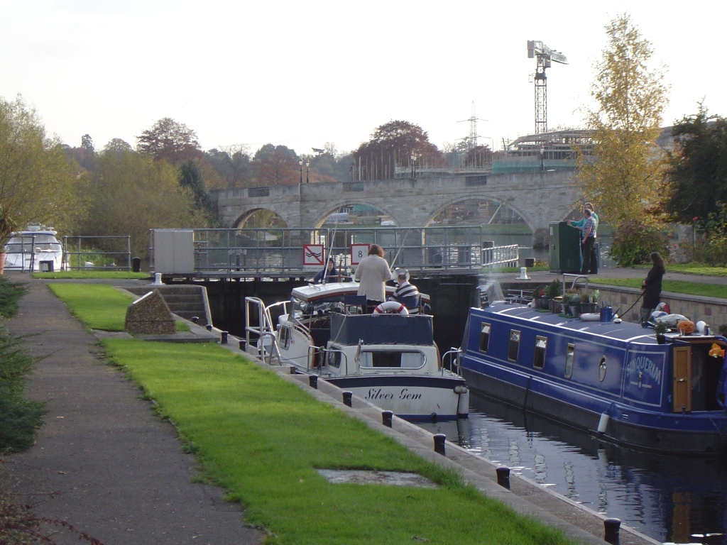
Chertsey Lock

Chertsey Lock is a lock on the River Thames in England, against the left bank, an area of Green Belt including Laleham Park, the largest public park in...
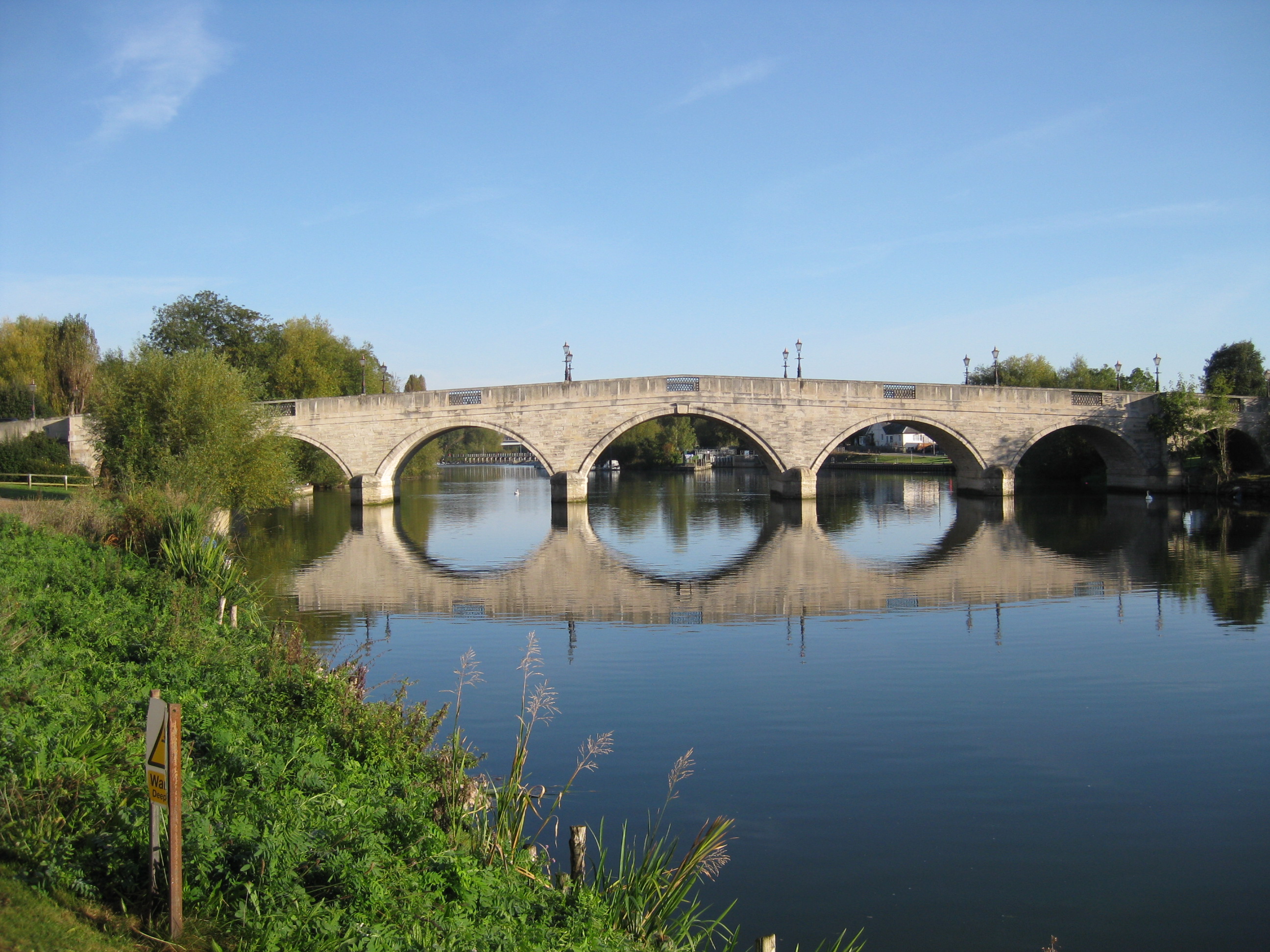
Chertsey Bridge

Chertsey Bridge is a road bridge across the River Thames in England, connecting Chertsey to low-lying riverside meadows in Laleham, Surrey. It is 550 yards...

Nearby Amenities

Located within 500m of 51.38994,-0.47470012
Power: tower
Lat/Long: 51.3910454/-0.4811563
HB
Created By: xybot
Source: GPS waypoint
Lat/Long: 51.389198/-0.474268
PRV
Created By: xybot
Source: GPS waypoint
Lat/Long: 51.390149/-0.47597
Power: tower
Ref: PY
Source: GPS waypoint
Lat/Long: 51.3892354/-0.4799697
Power: tower
Ref: ZC129
Lat/Long: 51.3878141/-0.4741417
Power: tower
Lat/Long: 51.3910792/-0.4763272
Power: tower
Lat/Long: 51.3934038/-0.477898
Power: transformer
Lat/Long: 51.3909246/-0.4808808
Power: tower
Lat/Long: 51.3869643/-0.4784763
Bus Stop
Old Littleton Lane
Naptan AtcoCode: 40004402031A
Naptan Bearing: NE
Naptan CommonName: Old Littleton Lane
Naptan Indicator: Just Before
Naptan Landmark: Old Littleton Lane
Naptan NaptanCode: surdgdgm
Naptan Street: Chertsey Bridge Road
Naptan Verified: no
Public Transport: platform
Source: naptan_import
Lat/Long: 51.390244/-0.4810915
Bus Stop
Old Littleton Lane
Naptan AtcoCode: 40004402031B
Naptan Bearing: SW
Naptan CommonName: Old Littleton Lane
Naptan Indicator: Just after
Naptan Landmark: Old Littleton Lane
Naptan NaptanCode: surdgdgp
Naptan Street: Chertsey Bridge Road
Naptan Verified: no
Public Transport: platform
Source: naptan_import
Lat/Long: 51.3899517/-0.481447
Bus Stop
Range Villas
Bench: no
Bin: no
Lit: yes
Naptan AtcoCode: 40004402032A
Naptan Bearing: E
Naptan CommonName: Range Villas
Naptan Indicator: Just Before
Naptan Landmark: Range Villas
Naptan NaptanCode: surdgdgt
Naptan Street: Chertsey Road
Naptan Verified: no
Public Transport: platform
Shelter: no
Source: naptan_import
Tactile Paving: no
Lat/Long: 51.390849/-0.4761763
Bus Stop
Range Villas
Bench: no
Bin: no
Lit: yes
Naptan AtcoCode: 40004402032B
Naptan Bearing: W
Naptan CommonName: Range Villas
Naptan Indicator: Just after
Naptan Landmark: Range Villas
Naptan NaptanCode: surdgdjm
Naptan Street: Chertsey Road
Naptan Verified: no
Public Transport: platform
Shelter: no
Source: naptan_import
Tactile Paving: no
Lat/Long: 51.3907633/-0.4767903
Bus Stop
Dockett Eddy Lane
Naptan AtcoCode: 40004402033A
Naptan Bearing: E
Naptan CommonName: Dockett Eddy Lane
Naptan Indicator: Opp
Naptan Landmark: Dockett Eddy Lane
Naptan NaptanCode: surdgdjp
Naptan Street: Chertsey Road
Naptan Verified: no
Public Transport: platform
Source: naptan_import
Lat/Long: 51.3900422/-0.4700245
Bus Stop
Dockett Eddy Lane
Naptan AtcoCode: 40004402033B
Naptan Bearing: W
Naptan CommonName: Dockett Eddy Lane
Naptan Indicator: adj
Naptan Landmark: Dockett Eddy Lane
Naptan NaptanCode: surdgdpj
Naptan Street: Chertsey Road
Naptan Verified: no
Public Transport: platform
Source: naptan_import
Lat/Long: 51.3898853/-0.4687819
Crossing
Bicycle: yes
Crossing Island: yes
Kerb: lowered
Sloped Curb: yes
Lat/Long: 51.3910531/-0.4792706
Crossing
Bicycle: yes
Crossing Island: yes
Kerb: lowered
Sloped Curb: yes
Lat/Long: 51.3910585/-0.4793442
Tourism: viewpoint
Lat/Long: 51.3873886/-0.4799885
Turning Circle
Lat/Long: 51.3875764/-0.4731875
Power: transformer
Lat/Long: 51.3909203/-0.4807538
Crossing
Bicycle: yes
Crossing Island: yes
Kerb: lowered
Lat/Long: 51.3905094/-0.4802666
Crossing
Bicycle: yes
Crossing: unmarked
Kerb: lowered
Sloped Curb: yes
Lat/Long: 51.3904887/-0.4804791
Crossing
Bicycle: yes
Crossing: unmarked
Kerb: lowered
Sloped Curb: yes
Lat/Long: 51.3906516/-0.4801156
Post Box
Lat/Long: 51.3899305/-0.4691555
The Range
Addr City: Shepperton
Addr Housename: The Range
Addr Postcode: TW17 9NT
Addr Street: Dockett Eddy Lane
Lat/Long: 51.3874257/-0.4701409
Power: pole
Lat/Long: 51.3864366/-0.4720514
Bench
Lat/Long: 51.3872719/-0.4803112
Leisure: picnic_table
Lat/Long: 51.3873313/-0.4800376
Leisure: picnic_table
Lat/Long: 51.3873355/-0.4801114
Leisure: picnic_table
Lat/Long: 51.3874058/-0.4800417
Leisure: picnic_table
Lat/Long: 51.3874075/-0.4799263
Leisure: picnic_table
Lat/Long: 51.3876535/-0.4798485
Leisure: picnic_table
Source: GPS survey
Lat/Long: 51.3877665/-0.4797734
Leisure: picnic_table
Source: GPS survey
Lat/Long: 51.3879096/-0.4796286
Barrier: bollard
Lat/Long: 51.3867722/-0.4790076
Information: board
Source: GPS survey
Tourism: information
Lat/Long: 51.3867831/-0.4789896
Bench
Backrest: yes
Lat/Long: 51.3881958/-0.479233
Life Ring
Emergency: life_ring
Lat/Long: 51.3892026/-0.4754283
Life Ring
Emergency: life_ring
Lat/Long: 51.3894495/-0.4758453
Life Ring
Emergency: life_ring
Lat/Long: 51.3880318/-0.4735373
Bench
Backrest: yes
Lat/Long: 51.3894537/-0.4746155
Bench
Backrest: yes
Lat/Long: 51.3905391/-0.4769692
Barrier: kissing_gate
Lat/Long: 51.3900423/-0.4793031
Bench
Backrest: yes
Lat/Long: 51.390078/-0.4757756
Bench
Backrest: yes
Lat/Long: 51.3903441/-0.4763523
Information: board
Tourism: information
Lat/Long: 51.3900211/-0.4794127
Information: board
Tourism: information
Lat/Long: 51.3883841/-0.480507
Power: transformer
Lat/Long: 51.3910421/-0.4808638
Barrier: stile
Material: metal
Stile: stepover
Lat/Long: 51.3905105/-0.4799818
The data included in this document is from www.openstreetmap.org. The data is made available under ODbL.

Have you been to Ryepeck Meadow?

Leave your review of Ryepeck Meadow below (or comments, questions and feedback).