Valley Park

Downs, Moorland in Yorkshire Scarborough

England

Valley Park

Scarborough - South Sands
Scarborough - South Sands Credit: Colin Park

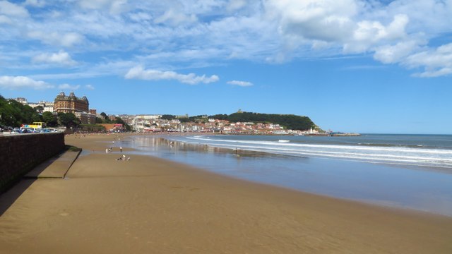
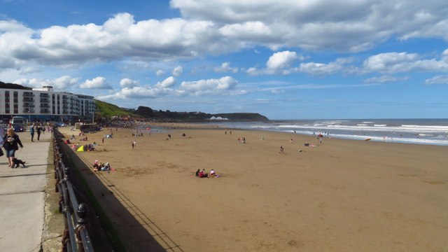
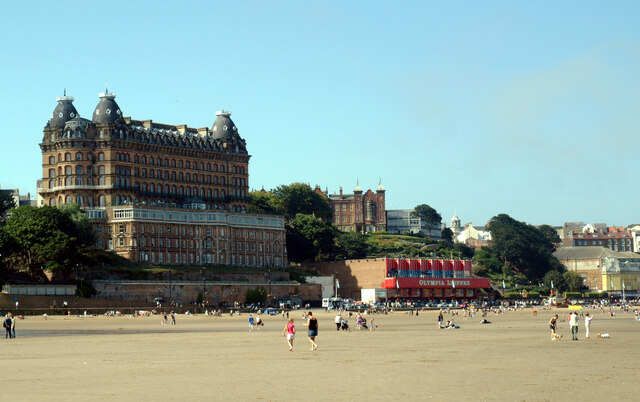
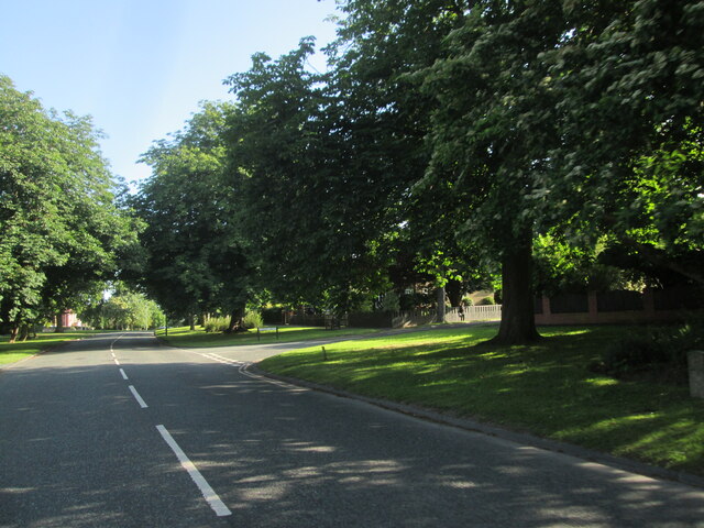
Valley Park is a picturesque area located in Yorkshire, England. Nestled between the Downs and Moorland, it offers a unique blend of natural beauty and rural charm. The landscape of Valley Park is characterized by rolling hills, lush green meadows, and meandering streams, making it an idyllic destination for nature lovers.

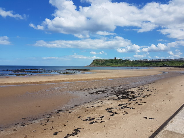
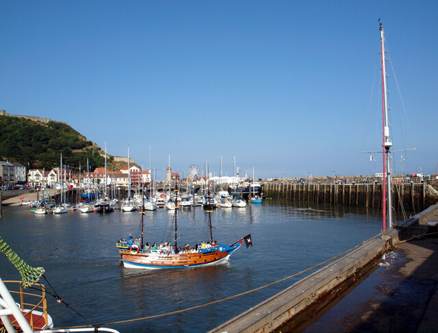
The Downs in Valley Park provide stunning panoramic views of the surrounding countryside. Visitors can enjoy leisurely walks along the well-maintained trails, taking in the fresh air and admiring the diverse flora and fauna that thrive in this region. The Downs also offer fantastic opportunities for birdwatching, with a variety of species calling this area their home.

On the other side, the Moorland in Valley Park showcases a rugged and wild terrain. Its vast expanses of heather-covered hills create a stunning backdrop for outdoor activities such as hiking and mountain biking. The Moorland is also home to numerous species of wildlife, including deer and birds of prey, adding to the area's natural allure.

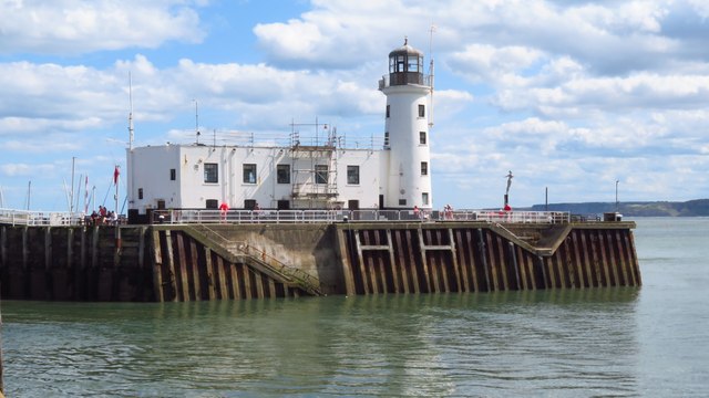
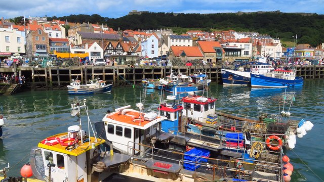
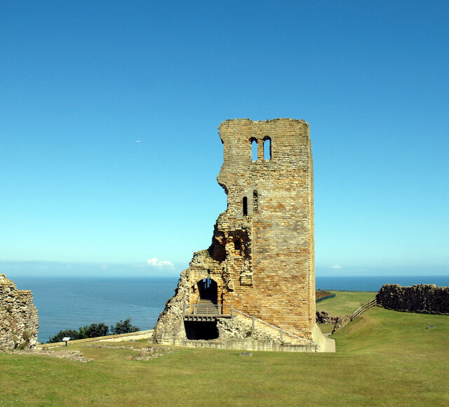
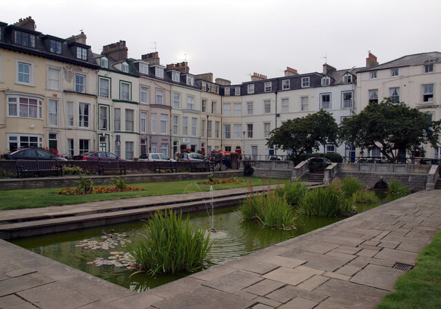
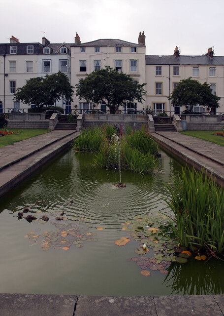
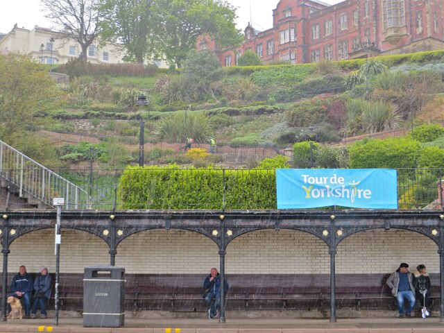
Valley Park is not only a haven for nature enthusiasts but also boasts a rich historical and cultural heritage. The area is dotted with charming villages and historic landmarks, such as ancient stone circles and medieval castles. Visitors can delve into the region's past by exploring these sites and learning about the stories they hold.

In conclusion, Valley Park in Yorkshire offers a diverse and captivating experience for visitors. Whether it's the tranquility of the Downs or the rugged beauty of the Moorland, this area provides a perfect escape from the hustle and bustle of city life.

If you have any feedback on the listing, please let us know in the comments section below.

Valley Park Images

Images are sourced within 2km of 54.277689/-0.40180606 or Grid Reference TA0488. Thanks to Geograph Open Source API. All images are credited.

Scarborough - South Sands
Scarborough - South Sands and Lifeboat Station
Scarborough Lighthouse
Scarborough Old Harbour
Scarborough - North Sands
A Dreary morning in Scarborough Huntriss Row.
A Dreary morning in Scarborough
Huntriss Row.
Looking towards Scarborough Castle
Scarborough Castle The Castle was originally built in Norman times on a promontory above what we now know as Scarborough. The site, with its fairly level top, commanding views over the harbour and defence potential, had attracted settlements since Iron Age times, and was used by the Romans as a signal station. It is now in the care of English Heritage and open to the public (for a fee) during daylight hours. 

For a more detailed description of the history and archaeology of the site, see the Wikipedia entry <span class="nowrap"><a title="https://en.wikipedia.org/wiki/Scarborough_Castle" rel="nofollow ugc noopener" href="https://en.wikipedia.org/wiki/Scarborough_Castle">Link</a><img style="margin-left:2px;" alt="External link" title="External link - shift click to open in new window" src="https://s1.geograph.org.uk/img/external.png" width="10" height="10"/></span> or the official description as a Scheduled Ancient Monument <span class="nowrap"><a title="https://www.historicengland.org.uk/listing/the-list/list-entry/1011374" rel="nofollow ugc noopener" href="https://www.historicengland.org.uk/listing/the-list/list-entry/1011374">Link</a><img style="margin-left:2px;" alt="External link" title="External link - shift click to open in new window" src="https://s1.geograph.org.uk/img/external.png" width="10" height="10"/></span>
Scarborough Castle
The Castle was originally built in Norman times on a promontory above what we now know as Scarborough. The site, with its fairly level top, commanding views over the harbour and defence potential, had attracted settlements since Iron Age times, and was used by the Romans as a signal station. It is now in the care of English Heritage and open to the public (for a fee) during daylight hours. For a more detailed description of the history and archaeology of the site, see the Wikipedia entry LinkExternal link or the official description as a Scheduled Ancient Monument LinkExternal link
View towards North bay from Scarborough Castle The Castle was originally built in Norman times on a promontory above what we now know as Scarborough. The site, with its fairly level top, commanding views over the harbour and defence potential, had attracted settlements since Iron Age times, and was used by the Romans as a signal station. It is now in the care of English Heritage and open to the public (for a fee) during daylight hours. 

For a more detailed description of the history and archaeology of the site, see the Wikipedia entry <span class="nowrap"><a title="https://en.wikipedia.org/wiki/Scarborough_Castle" rel="nofollow ugc noopener" href="https://en.wikipedia.org/wiki/Scarborough_Castle">Link</a><img style="margin-left:2px;" alt="External link" title="External link - shift click to open in new window" src="https://s1.geograph.org.uk/img/external.png" width="10" height="10"/></span> or the official description as a Scheduled Ancient Monument <span class="nowrap"><a title="https://www.historicengland.org.uk/listing/the-list/list-entry/1011374" rel="nofollow ugc noopener" href="https://www.historicengland.org.uk/listing/the-list/list-entry/1011374">Link</a><img style="margin-left:2px;" alt="External link" title="External link - shift click to open in new window" src="https://s1.geograph.org.uk/img/external.png" width="10" height="10"/></span>
View towards North bay from Scarborough Castle
The Castle was originally built in Norman times on a promontory above what we now know as Scarborough. The site, with its fairly level top, commanding views over the harbour and defence potential, had attracted settlements since Iron Age times, and was used by the Romans as a signal station. It is now in the care of English Heritage and open to the public (for a fee) during daylight hours. For a more detailed description of the history and archaeology of the site, see the Wikipedia entry LinkExternal link or the official description as a Scheduled Ancient Monument LinkExternal link
Scarborough seen from the harbour Scarborough Castle lies along the top of the headland.
Scarborough seen from the harbour
Scarborough Castle lies along the top of the headland.
Scarborough seen from the South Bay The Grand Hotel is on the left.
Scarborough seen from the South Bay
The Grand Hotel is on the left.
View from the Spa Bridge, Scarborough
The Grand Hotel, Scarborough A large hotel in Scarborough, England, overlooking the town's South Bay. 
The hotel was designed by the Hull architect Cuthbert Brodrick, and  completed in 1867. It was at the time one of the largest hotels in the world.
The building is designed around the theme of time: four towers to represent the seasons, 12 floors for the months of the year, 52 chimneys symbolise the weeks, and originally there were 365 bedrooms, one for each day of the year. The hotel itself is in the shape of a 'V' in honour of Queen Victoria.
Originally used by wealthy clients in Victorian times it now caters more for the budget end of the market, being popular with coach trips.
It is a Grade II* listed building and owned by Britannia Hotels who have invested in a £7 million refurbishment.
The Grand Hotel, Scarborough
A large hotel in Scarborough, England, overlooking the town's South Bay. The hotel was designed by the Hull architect Cuthbert Brodrick, and completed in 1867. It was at the time one of the largest hotels in the world. The building is designed around the theme of time: four towers to represent the seasons, 12 floors for the months of the year, 52 chimneys symbolise the weeks, and originally there were 365 bedrooms, one for each day of the year. The hotel itself is in the shape of a 'V' in honour of Queen Victoria. Originally used by wealthy clients in Victorian times it now caters more for the budget end of the market, being popular with coach trips. It is a Grade II* listed building and owned by Britannia Hotels who have invested in a £7 million refurbishment.
Pirate ship, Scarborough
West Square, Scarborough
Pond, West Square, Scarborough
A  tree  lined  Stepney  Drive Junction with Stepney Grove on the right
A tree lined Stepney Drive
Junction with Stepney Grove on the right
Sea-front shelter Proving its value in a not-so-rare Scarborough downpour.
Sea-front shelter
Proving its value in a not-so-rare Scarborough downpour.
Show me another place!

Valley Park is located at Grid Ref: TA0488 (Lat: 54.277689, Lng: -0.40180606)

Division: North Riding

Administrative County: North Yorkshire

District: Scarborough

Police Authority: North Yorkshire

What 3 Words

///sings.hooked.cycles. Near Scarborough, North Yorkshire

Related Wikis

Valley Bridge

Valley Bridge is a road bridge in Scarborough, North Yorkshire, England. It spans Ramsdale and was built in 1865.It was first built as Lendal Bridge, York...

Scarborough Art Gallery

Scarborough Art Gallery is an art gallery in the English town of Scarborough. It is housed in a Grade II* Italianate villa in Scarborough’s Crescent, designed...

Crown Spa Hotel

The Crown Spa Hotel (formerly the Crown Hotel) is a large hotel in Scarborough, North Yorkshire, England, overlooking the town's South Bay. Built in 1844...

Borough of Scarborough

The Borough of Scarborough () was a non-metropolitan district with borough status in North Yorkshire, England. In addition to the town of Scarborough,...

Brunswick Shopping Centre

The Brunswick Shopping Centre, with over 30 shops, is in the centre of Scarborough, North Yorkshire, England. It was built on the site of a former Debenhams...

Cliff Bridge, Scarborough

The Cliff Bridge, previously known as the Spa Bridge, is a footbridge in Scarborough, North Yorkshire, England. Spanning the valley from St Nicholas Cliff...

Rotunda Museum

The Rotunda Museum is one of the oldest purpose-built museums still in use in the United Kingdom. The curved grade II* listed building was constructed...

Scarborough railway station

Scarborough, formerly Scarborough Central, is a Grade II listed railway station serving the seaside town of Scarborough, North Yorkshire. It lies 42 miles...

Related Videos

Scarborough, August Bank Holiday, Walking tour, 4K, #asmr

Embark on a captivating virtual journey through the vibrant streets of Scarborough during the pinnacle of its annual glory – the ...

SCARBOROUGH | Full seafront tour of holiday seaside town Scarborough England

SCARBOROUGH | Full seafront tour of Scarborough UK. We visit the holiday seaside town of Scarborough in North Yorkshire for ...

SCARBOROUGH | Exploring the holiday seaside town of Scarborough England

Scarborough is a holiday seaside town located between Whitby and Filey on the North Yorkshire coast of England.

SCARBOROUGH ENGLAND | The best holiday seaside town in the UK?

We take a walk along the beach and seafront in Scarborough North Yorkshire, England. This holiday destination has everything ...

Nearby Amenities

Located within 500m of 54.277689,-0.40180606
Source: PGS
Lat/Long: 54.2746016/-0.3967022
Source: PGS
Lat/Long: 54.2750413/-0.3967745
Source: PGS
Lat/Long: 54.2755507/-0.396865
Source: PGS
Lat/Long: 54.275593/-0.3968865
Source: PGS
Lat/Long: 54.2767392/-0.3971121
Source: PGS
Lat/Long: 54.2769806/-0.3976
Source: PGS
Lat/Long: 54.2770553/-0.3976301
Source: PGS
Lat/Long: 54.2780043/-0.397736
Source: PGS
Lat/Long: 54.2788515/-0.3978286
Source: PGS
Lat/Long: 54.279458/-0.3976509
Source: PGS
Lat/Long: 54.2800553/-0.3973034
Scarborough
Alt Name Zh: 斯卡布罗
Is In: UK,England,Yorkshire,North Yorkshire,resort towns
Name Ru: Скарборо
Name Zh: 斯卡伯勒
Place: town
Population: 61749
Wikidata: Q743521
Wikipedia: en:Scarborough, North Yorkshire
Lat/Long: 54.2820009/-0.4011868
Traffic Signals
Lat/Long: 54.2805187/-0.4051452
Traffic Signals
Lat/Long: 54.2804508/-0.4052888
Scarborough, adjacent to Aquarium Top Stop Y
Bus: yes
Naptan Bearing: NESW
Operator: NYCC
Public Transport: stop_position
Ref: 32006551
Shelter: yes
Lat/Long: 54.2789452/-0.3990659
Traffic Signals
Lat/Long: 54.2793733/-0.4040061
Traffic Signals
Traffic Signals: signal
Lat/Long: 54.2732889/-0.4010179
Scarborough
Naptan AtcoCode: 9100SCARBRO
Network: National Rail
Network Website: https://www.nationalrail.co.uk/stations/sca/
Network Wikidata: Q26334
Operator: First Transpennine Express
Public Transport: station
Railway: station
Ref Crs: SCA
Toilets Wheelchair: yes
Train: yes
Wheelchair: yes
Wikidata: Q2394227
Wikipedia: en:Scarborough railway station
Lat/Long: 54.2799474/-0.4056223
Barrier: lift_gate
Lat/Long: 54.2779645/-0.4052431
Parking
Created By: Potlatch 0.5a
Lat/Long: 54.2807781/-0.4016979
Barrier: bollard
Lat/Long: 54.2812547/-0.4018113
Mini Roundabout
Lat/Long: 54.2811999/-0.4017452
Source: survey
Lat/Long: 54.2765573/-0.3976346
Parking
South Bay Underground
Layer: -1
Parking: underground
Lat/Long: 54.27882/-0.3986992
Post Box
Brand: Royal Mail
Brand Wikidata: Q638098
Collection Times: Mo-Fr 16:30; Sa 13:20
Note: location approx. inside shopping centre
Operator: Royal Mail
Operator Wikidata: Q638098
Ref: YO11 191
Source: survey
Lat/Long: 54.281013/-0.402544
Bus Stop
Bus: yes
Public Transport: platform
Lat/Long: 54.2813086/-0.3990368
Restaurant
Cafe Fish
Lat/Long: 54.2800089/-0.4025798
Bicycle Parking
Capacity: 6
Lat/Long: 54.2799977/-0.3981717
Bicycle Parking
Bicycle Parking: stands
Capacity: 6
Check Date: 2023-10-16
Covered: no
Lat/Long: 54.2810469/-0.3998294
Bus Stop
Scarborough West Square Stop (T)
Bench: yes
Bin: yes
Bus: yes
Naptan AtcoCode: 3200YNA01220
Naptan Bearing: NESW
Naptan NaptanCode: 32001220
Operator: NYCC
Public Transport: platform
Ref: 32001220
Shelter: no
Lat/Long: 54.2800038/-0.4058241
Bus Stop
Scarborough West Square Stop (V)
Bench: yes
Bus: yes
Naptan AtcoCode: 3200YNB00627
Naptan Bearing: NE
Naptan NaptanCode: 32000627
Operator: NYCC
Public Transport: platform
Ref: 32000627
Shelter: yes
Lat/Long: 54.2799464/-0.4063533
Entrance: main
Lat/Long: 54.2804962/-0.40555
Funicular: yes
Public Transport: stop_position
Lat/Long: 54.280828/-0.3971771
Disused Railway: station
Lat/Long: 54.279785/-0.3982363
Funicular: yes
Public Transport: stop_position
Lat/Long: 54.2809713/-0.3982385
Disused Railway: station
Lat/Long: 54.2796354/-0.3980703
Pharmacy
Boots
Addr City: Scarborough
Addr Postcode: YO11 2NP
Addr Street: York Place
Brand: Boots
Brand Wikidata: Q6123139
Brand Wikipedia: en:Boots UK
Dispensing: yes
Healthcare: pharmacy
Note: In the Castle Health Centre
Wheelchair: limited
Lat/Long: 54.2807476/-0.4034775
Library
Scarborough Library
Addr City: Scarborough
Addr Postcode: YO11 2NN
Addr Street: Vernon Road
Toilets Wheelchair: yes
Wheelchair: yes
Lat/Long: 54.2811629/-0.4013224
Railway: buffer_stop
Lat/Long: 54.2793829/-0.406253
Taxi
Check Date: 2023-09-10
Wheelchair: yes
Lat/Long: 54.2799733/-0.4055572
Railway: buffer_stop
Lat/Long: 54.2794424/-0.4060491
Railway: switch
Lat/Long: 54.2781863/-0.4071245
Railway: switch
Lat/Long: 54.2777289/-0.4077393
Railway: switch
Lat/Long: 54.2765965/-0.4089207
Railway: switch
Lat/Long: 54.277434/-0.4079722
Railway: buffer_stop
Lat/Long: 54.2799195/-0.4049125
Railway: switch
Lat/Long: 54.2764716/-0.4091728
Railway: switch
Lat/Long: 54.277435/-0.4080512
Railway: buffer_stop
Lat/Long: 54.2798142/-0.404838
Railway: buffer_stop
Lat/Long: 54.2798913/-0.404883
Railway: switch
Lat/Long: 54.2767957/-0.4086265
Railway: buffer_stop
Lat/Long: 54.2772248/-0.408125
Post Box
Brand: Royal Mail
Brand Wikidata: Q638098
Collection Times: Mo-Fr 16:00; Sa 13:15
Operator: Royal Mail
Operator Wikidata: Q638098
Post Box Apertures: 2
Post Box Design: type_c
Post Box Type: pillar
Ref: YO11 2;YO11 1002
Royal Cypher: EIIR
Royal Cypher Wikidata: Q33102113
Lat/Long: 54.2807993/-0.4046601
Bench
Lat/Long: 54.2792105/-0.3989314
Bench
Lat/Long: 54.2792406/-0.3988633
Entrance: yes
Lat/Long: 54.2793269/-0.3991823
Entrance: yes
Lat/Long: 54.2793545/-0.399207
Disused Railway: station
Lat/Long: 54.2796511/-0.3980268
Disused Railway: station
Lat/Long: 54.2797992/-0.398196
Entrance: main
Lat/Long: 54.28083/-0.397086
Funicular: yes
Public Transport: stop_position
Lat/Long: 54.2808484/-0.3971671
Funicular: yes
Public Transport: stop_position
Lat/Long: 54.2809988/-0.3982242
Telephone
Booth: KX200
Operator: BT
Operator Wikidata: Q593786
Lat/Long: 54.2810096/-0.4067349
Crossing
Crossing: traffic_signals
Crossing Ref: puffin
Tactile Paving: yes
Lat/Long: 54.2811597/-0.4065334
Crossing
Crossing: traffic_signals
Crossing Ref: puffin
Tactile Paving: yes
Lat/Long: 54.2812085/-0.4064428
Post Box
Brand: Royal Mail
Brand Wikidata: Q638098
Operator: Royal Mail
Operator Wikidata: Q638098
Post Box Type: pillar
Ref: YO12 8
Royal Cypher: GR
Royal Cypher Wikidata: Q33102273
Lat/Long: 54.2782863/-0.4091451
Barry Denton
Office: architect
Website: https://www.dentonanddenton.com/
Lat/Long: 54.2792199/-0.4069593
Belinda Denton
Office: building_surveyor
Website: https://www.dentonanddenton.com/
Lat/Long: 54.2792003/-0.4069982
The Victoria Hotel
Addr City: Scarborough
Addr Housenumber: 79
Addr Postcode: YO11 1TP
Addr Street: Westborough
Note: Located in same building as 'Old Vic' pub
Tourism: hotel
Lat/Long: 54.2797624/-0.4067257
Recycling
Note: Mixed glass
Recycling Glass: yes
Recycling Type: container
Lat/Long: 54.2795003/-0.4065773
Crossing
Button Operated: yes
Crossing: traffic_signals
Crossing Island: yes
Crossing Ref: pelican
Kerb: lowered
Tactile Paving: yes
Traffic Signals Sound: no
Traffic Signals Vibration: yes
Lat/Long: 54.2803759/-0.4054145
Telephone
Booth: K6
Covered: booth
Listed Status: Grade II
Operator: BT
Operator Wikidata: Q593786
Lat/Long: 54.2804018/-0.4056488
Crossing
Crossing: traffic_signals
Crossing Ref: pelican
Lat/Long: 54.2805188/-0.4049123
Crossing
Check Date Crossing: 2023-11-16
Crossing: traffic_signals
Crossing Ref: pelican
Tactile Paving: yes
Lat/Long: 54.2805646/-0.4050262
Crossing
Check Date Crossing: 2023-11-16
Crossing: traffic_signals
Crossing Ref: pelican
Tactile Paving: yes
Lat/Long: 54.2805845/-0.4055307
Crossing
Check Date Crossing: 2023-11-16
Crossing: traffic_signals
Crossing Ref: pelican
Lat/Long: 54.2805847/-0.4052759
Traffic Signals
Lat/Long: 54.2806609/-0.4047236
Bicycle Parking
Bicycle Parking: stands
Capacity: 12
Covered: no
Lat/Long: 54.2806715/-0.4048221
Bench
Lat/Long: 54.2806784/-0.4051133
Bus Stop
Westborough
Bench: yes
Bin: yes
Bus: yes
Lit: yes
Naptan AtcoCode: 3200YNA01166
Naptan NaptanCode: 32001166
Public Transport: platform
Shelter: yes
Tactile Paving: no
Lat/Long: 54.2806966/-0.4043326
Bus Stop
Bus: yes
Naptan AtcoCode: 3200YNA01165
Naptan NaptanCode: 32001165
Public Transport: platform
Shelter: yes
Lat/Long: 54.2807593/-0.4041778
Telephone
Booth: KX100
Covered: booth
Operator: BT
Operator Wikidata: Q593786
Lat/Long: 54.2807888/-0.4047031
Bus Stop
Bench: yes
Bus: yes
Naptan AtcoCode: 3200YNA01163
Naptan NaptanCode: 32001163
Public Transport: platform
Shelter: yes
Lat/Long: 54.2808146/-0.4040268
Thomas Cook
Brand: Thomas Cook
Brand Wikidata: Q2141800
Brand Wikipedia: en:Thomas Cook Group
Shop: travel_agency
Lat/Long: 54.2807366/-0.4039226
Bus Stop
Bus: yes
Naptan AtcoCode: 3200YNA04870
Naptan NaptanCode: 32004870
Public Transport: platform
Shelter: yes
Lat/Long: 54.2804073/-0.4027817
Bus Stop
Bus: yes
Naptan AtcoCode: 3200YNA04869
Naptan NaptanCode: 32004869
Public Transport: platform
Shelter: yes
Lat/Long: 54.2804917/-0.4028776
Bus Stop
Bus: yes
Naptan AtcoCode: 3200YNA04868
Naptan NaptanCode: 32004868
Public Transport: platform
Shelter: yes
Lat/Long: 54.2806366/-0.4030632
Cafe
Lat/Long: 54.2806449/-0.4033544
Tourist Information Centre
Information: office
Tourism: information
Lat/Long: 54.2809023/-0.4024875
Bicycle Parking
Bicycle Parking: stands
Covered: no
Lat/Long: 54.2811586/-0.4032166
Telephone
Booth: KX100
Operator: BT
Operator Wikidata: Q593786
Lat/Long: 54.2812167/-0.4030393
Camera Mount: building
Camera Type: dome
Man Made: surveillance
Surveillance Type: camera
Lat/Long: 54.2813469/-0.4025305
Information: map
Map Type: street
Tourism: information
Lat/Long: 54.2813917/-0.4024322
Bench
Backrest: yes
Lat/Long: 54.2814552/-0.4026633
Bicycle Parking
Bicycle Parking: stands
Lat/Long: 54.2814617/-0.4022129
Telephone
Booth: KX100
Operator: BT
Operator Wikidata: Q593786
Lat/Long: 54.2817728/-0.4017173
Telephone
Booth: KX100
Operator: BT
Operator Wikidata: Q593786
Lat/Long: 54.2821772/-0.4023363
Bench
Backrest: yes
Lat/Long: 54.2820606/-0.4012597
Bench
Backrest: yes
Lat/Long: 54.2820798/-0.4012028
Telephone
Booth: KX100
Operator: BT
Operator Wikidata: Q593786
Lat/Long: 54.2821374/-0.4008981
Camera Mount: roof
Camera Type: panning
Man Made: surveillance
Surveillance: outdoor
Surveillance Type: camera
Lat/Long: 54.282167/-0.4010747
Information: map
Tourism: information
Lat/Long: 54.2812217/-0.3984011
Blue Plaque: Thomas Hinderwell
Erected By: Scarborough and District Civic Society
Historic: memorial
Inscription: Thomas Hinderwell 1744-1825 Historian and Philanthropist was born in a house on this site
Memorial: plaque
Openplaques Id: 29899
Lat/Long: 54.2809611/-0.3986201
Walker Landray Ltd
Website: https://www.andrewcowen.com/management.html
Lat/Long: 54.281107/-0.3994444
Bus Stop
Bus: yes
Public Transport: platform
Shelter: no
Lat/Long: 54.2810638/-0.3993631
Bar
Farrer's Bar & Brasserie
Email: Farrers.Brasserie@siv.org.uk
Opening Hours: Mo-Sa 09:00-22:30; Su 09:00-19:00
Phone: +44 1723 357800
Website: https://farrersbar.co.uk/
Wheelchair: yes
Lat/Long: 54.2760126/-0.3972324
Ice Cream
Luxury Dairy Ice Cream
Level: 0
Lat/Long: 54.2764017/-0.3974238
Newsagents
Level: 0
Shop: newsagent
Lat/Long: 54.2764971/-0.3974464
Cafe
Sun Court Café
Lat/Long: 54.275267/-0.39725
The Beachcomber Kiosk
Layer: -1
Note: Accessed from the footway, the roundabout is above the shop. Shutters were down at time of survey, perhaps is only open seasonally
Shop: kiosk
Lat/Long: 54.279308/-0.397767
Level: 0
Shop: gift
Lat/Long: 54.2762224/-0.3973806
Telephone
Booth: KX100
Operator: BT
Operator Wikidata: Q593786
Lat/Long: 54.2766065/-0.3974607
Grit Bin
Lat/Long: 54.2766083/-0.3974808
Life Ring
Emergency: life_ring
Lat/Long: 54.2766114/-0.3975029
Bench
Backrest: yes
Lat/Long: 54.281275/-0.4000219
Bench
Backrest: yes
Lat/Long: 54.2812987/-0.400054
Clock
Display: analog
Support: wall_mounted
Lat/Long: 54.2813481/-0.3999775
Bench
Backrest: yes
Lat/Long: 54.2814343/-0.4001401
Bench
Backrest: yes
Lat/Long: 54.281459/-0.4001598
Fixme: Continues, signed "Leading to Vernon Road (Library)"
Lat/Long: 54.2815359/-0.4009375
Bench
Backrest: yes
Lat/Long: 54.2816178/-0.4003392
Bench
Backrest: yes
Lat/Long: 54.2816403/-0.4003692
Post Box
Brand: Royal Mail
Brand Wikidata: Q638098
Collection Times: Mo-Fr 09:00; Sa 07:00
Operator: Royal Mail
Operator Wikidata: Q638098
Post Box Type: pillar
Ref: YO11 73
Royal Cypher: EVIIR
Royal Cypher Wikidata: Q33102324
Lat/Long: 54.2817008/-0.4005645
Nightclub
Studio 1 Nightclub
Lat/Long: 54.2818485/-0.400512
Bench
Backrest: yes
Lat/Long: 54.2817436/-0.4005707
Bench
Backrest: yes
Lat/Long: 54.2818106/-0.4006472
Bench
Backrest: yes
Lat/Long: 54.2818305/-0.4006707
Bench
Backrest: no
Lat/Long: 54.2808236/-0.3994777
Telephone
Booth: KX100
Operator: BT
Operator Wikidata: Q593786
Lat/Long: 54.2808378/-0.3998667
Bar
Biederbecke's
Lat/Long: 54.2798301/-0.4025631
Sarah's Salon
Addr City: Scarborough
Addr Housenumber: 14
Addr Postcode: YO11 2PF
Addr Street: Valley Bridge Parade
Shop: hairdresser
Lat/Long: 54.2788537/-0.4035326
Pub
Highlander Hotel
Addr City: Scarborough
Addr Housenumber: 15-16
Addr Postcode: YO11 2AF
Addr Street: Esplanade
Real Ale: yes
Website: https://www.highlanderhotelscarborough.co.uk/
Lat/Long: 54.2762526/-0.3995914
Cafe
Eat Me Cafe
Lat/Long: 54.2804552/-0.4065447
The Redcliff hotel
Addr City: Scarborough
Addr Housenumber: 18
Addr Postcode: YO11 2AL
Addr Street: Prince of Wales Terrace
Phone: +44 1723 372310
Tourism: hotel
Website: www.theredcliffehotel.com
Lat/Long: 54.273572/-0.4007366
Bench
Backrest: yes
Lat/Long: 54.274092/-0.3978025
Bench
Backrest: yes
Lat/Long: 54.2741484/-0.3978267
Post Box
Post Box Type: pillar
Ref: YO11 4
Royal Cypher: GR
Royal Cypher Wikidata: Q33102273
Lat/Long: 54.2775385/-0.3989144
Bench
Backrest: yes
Lat/Long: 54.2774085/-0.3986377
Bench
Backrest: yes
Lat/Long: 54.2774436/-0.3986208
Bench
Backrest: yes
Lat/Long: 54.2773752/-0.3986562
Bench
Backrest: yes
Lat/Long: 54.2774814/-0.3986069
Bench
Backrest: yes
Lat/Long: 54.2775308/-0.3986007
Bench
Backrest: yes
Lat/Long: 54.277351/-0.3986762
Bench
Backrest: yes
Lat/Long: 54.2773294/-0.3986886
Bench
Backrest: yes
Lat/Long: 54.277306/-0.3986993
Bench
Backrest: yes
Lat/Long: 54.2772844/-0.398707
Waste Basket
Lat/Long: 54.2742071/-0.397844
Bench
Backrest: yes
Lat/Long: 54.274327/-0.3978928
Bench
Backrest: yes
Lat/Long: 54.2743905/-0.3979152
Bench
Backrest: yes
Lat/Long: 54.2744421/-0.3979315
Bench
Backrest: yes
Lat/Long: 54.2744896/-0.3979589
Bench
Backrest: yes
Lat/Long: 54.2743602/-0.3979081
Bench
Backrest: yes
Lat/Long: 54.2744166/-0.3979223
Bench
Lat/Long: 54.2744659/-0.3979457
Bench
Backrest: yes
Lat/Long: 54.2745181/-0.3979711
Bench
Backrest: yes
Lat/Long: 54.2745442/-0.3979914
Bench
Backrest: yes
Lat/Long: 54.2745709/-0.3980189
Bench
Backrest: yes
Lat/Long: 54.2797343/-0.3977864
Bench
Backrest: yes
Lat/Long: 54.2796889/-0.3978118
Bench
Backrest: yes
Lat/Long: 54.2797734/-0.3977661
Bench
Backrest: yes
Lat/Long: 54.279815/-0.3977458
Bench
Backrest: yes
Lat/Long: 54.2798529/-0.3977234
Waste Basket
Lat/Long: 54.2800346/-0.397343
Waste Basket
Lat/Long: 54.2801573/-0.3975111
Bench
Backrest: yes
Lat/Long: 54.2802745/-0.3974458
Bench
Backrest: yes
Lat/Long: 54.2803686/-0.3973921
Bus Stop
Bench: yes
Bus: yes
Covered: yes
Public Transport: platform
Shelter: no
Lat/Long: 54.2804395/-0.3973313
Bench
Backrest: yes
Lat/Long: 54.2745976/-0.3980361
Waste Basket
Lat/Long: 54.2751016/-0.39845
Bench
Backrest: yes
Lat/Long: 54.275764/-0.3988518
Bench
Backrest: yes
Lat/Long: 54.2759025/-0.3989458
Bench
Backrest: yes
Lat/Long: 54.2758413/-0.3989042
Waste Basket
Lat/Long: 54.2759772/-0.398992
Bench
Backrest: yes
Lat/Long: 54.2768991/-0.3989888
Bench
Backrest: yes
Lat/Long: 54.2769311/-0.3989562
Bench
Backrest: yes
Lat/Long: 54.2769572/-0.3989258
Bench
Backrest: yes
Lat/Long: 54.2769893/-0.3988912
Parking
Parking: lane
Lat/Long: 54.2808934/-0.3968247
Waste Basket
Check Date: 2024-04-12
Lat/Long: 54.2811429/-0.3968854
Stepney Hill Farm
Shop: butcher
Lat/Long: 54.273255/-0.403079
Fast Food
Pizza Hut Delivery
Addr City: Scarborough
Addr Street: Ramshill Road
Brand: Pizza Hut Delivery
Brand Wikidata: Q107293079
Cuisine: pizza
Delivery: yes
Takeaway: only
Lat/Long: 54.2734275/-0.4030967
Cafe
Ramshill Fisheries
Addr City: Scarborough
Addr Street: Ramshill Road
Lat/Long: 54.2734885/-0.403079
Ramshill Cleaners
Addr City: Scarborough
Addr Housenumber: 19
Addr Postcode: YO11 2LN
Addr Street: Ramshill Road
Phone: +44 1723 377198
Shop: dry_cleaning
Website: https://www.ramshillcleaners.co.uk
Lat/Long: 54.2735412/-0.4030737
Poppy's
Addr City: Scarborough
Addr Street: Ramshill Road
Shop: hairdresser
Lat/Long: 54.2735898/-0.4030684
Pharmacy
Aston Pharmacy
Addr City: Scarborough
Addr Housenumber: 15
Addr Postcode: YO11 2LN
Addr Street: Ramshill Road
Healthcare: pharmacy
Phone: +44 1723 360039
Toilets Wheelchair: no
Website: https://www.astonpharmacy.co.uk/
Wheelchair: yes
Lat/Long: 54.2736683/-0.4030577
Pharmacy
Delivery Chemist
Addr City: Scarborough
Addr Housenumber: 13
Addr Postcode: YO11 2LN
Addr Street: Ramshill Road
Healthcare: pharmacy
Lat/Long: 54.273907/-0.4029905
Crossing
Button Operated: yes
Crossing: traffic_signals
Crossing Island: no
Crossing Ref: pelican
Tactile Paving: yes
Traffic Signals Sound: no
Traffic Signals Vibration: yes
Lat/Long: 54.2739635/-0.4027662
Fast Food
Flames
Addr City: Scarborough
Addr Street: Ramshill Road
Lat/Long: 54.2739628/-0.4029763
Nightclub
Bacchus
Addr City: Scarborough
Addr Housenumber: 7a
Addr Postcode: YO11 2LN
Addr Street: Ramshill Road
Phone: +44 1723 373689
Toilets Wheelchair: no
Website: www.bacchus-scarborough.co.uk
Wheelchair: limited
Lat/Long: 54.2740744/-0.4029622
Cafe
The Coffee Cup
Addr City: Scarborough
Addr Street: Ramshill Road
Outdoor Seating: yes
Lat/Long: 54.274123/-0.4029516
Costcutter Express
Addr City: Scarborough
Addr Housenumber: 3
Addr Street: Ramshill Road
Brand: Costcutter Express
Brand Wikidata: Q5175072
Shop: convenience
Lat/Long: 54.2742325/-0.4029126
TWC
Addr City: Scarborough
Addr Street: Ramshill Road
Shop: carpet
Lat/Long: 54.2743131/-0.4028755
Bus Stop
Weaponness St Andrew's Church (S-bound)
Bench: no
Bin: no
Bus: yes
Lit: yes
Naptan AtcoCode: 3200YNA00816
Naptan Bearing: S
Naptan NaptanCode: 32000816
Operator: NYCC
Public Transport: platform
Ref: 32000816
Shelter: yes
Tactile Paving: no
Lat/Long: 54.2742538/-0.402523
Angie Salon De Beaute
Addr City: Scarborough
Addr Street: Ramshill Road
Check Date Opening Hours: 2023-05-17
Opening Hours Signed: no
Shop: beauty
Lat/Long: 54.2743033/-0.4023728
Bus Stop
Weaponness St Andrew's Church (N-bound)
Bench: yes
Bin: yes
Bus: yes
Lit: yes
Naptan AtcoCode: 3200YNA00817
Naptan Bearing: NESW
Naptan NaptanCode: 32000817
Operator: NYCC
Public Transport: platform
Ref: 32000817
Shelter: yes
Tactile Paving: no
Lat/Long: 54.2742224/-0.4027672
Waste Basket
Check Date: 2023-05-17
Lat/Long: 54.2741936/-0.4027734
Charity Shop
Addr City: Scarborough
Addr Street: Ramshill Road
Shop: yes
Lat/Long: 54.2742044/-0.402416
Clinic
South Cliff Chiropody
Addr City: Scarborough
Addr Housenumber: 30
Addr Postcode: YO11 2QG
Addr Street: Ramshill Road
Check Date Opening Hours: 2023-05-17
Clinic: chiropody
Healthcare: clinic
Opening Hours Signed: no
Lat/Long: 54.2740605/-0.4025762
Signature Hair
Addr City: Scarborough
Addr Street: Ramshill Road
Check Date Opening Hours: 2023-05-17
Female: yes
Opening Hours Signed: no
Phone: +44 1723 363630
Shop: hairdresser
Lat/Long: 54.2740083/-0.4025977
Fast Food
Toni's
Addr City: Scarborough
Addr Street: Ramshill Road
Check Date Opening Hours: 2023-05-17
Cuisine: pizza
Opening Hours Signed: no
Lat/Long: 54.2739417/-0.4026193
Groomingtails
Addr City: Scarborough
Addr Street: Ramshill Road
Check Date Opening Hours: 2023-05-17
Opening Hours Signed: no
Shop: pet_grooming
Lat/Long: 54.2738931/-0.4026285
Cliff Garage
Addr City: Scarborough
Addr Housenumber: 44
Addr Postcode: YO11 2QG
Addr Street: Ramshill Road
Check Date Opening Hours: 2023-05-17
Opening Hours Signed: no
Phone: +44 1723 500451
Shop: car_repair
Website: https://cliffgarage.co.uk/
Lat/Long: 54.273787/-0.4025762
Clinic
The Ramshill Clinic
Addr City: Scarborough
Addr Housenumber: 46
Addr Postcode: YO11 2QG
Addr Street: Ramshill Road
Check Date Opening Hours: 2023-05-17
Clinic: physiotherapy
Healthcare: clinic
Opening Hours Signed: no
Lat/Long: 54.2736852/-0.4026574
Quayside Properties
Addr City: Scarborough
Addr Street: Ramshill Road
Office: estate_agent
Lat/Long: 54.2736294/-0.4026539
Cooplands
Addr City: Scarborough
Addr Street: Ramshill Road
Branch: Bakers
Brand: Cooplands
Brand Wikidata: Q5167971
Check Date Opening Hours: 2023-05-17
Opening Hours Signed: no
Shop: bakery
Lat/Long: 54.2736105/-0.4026623
Arosa
Addr City: Scarborough
Addr Street: Ramshill Road
Shop: confectionery
Lat/Long: 54.2735805/-0.4026669
Charity Shop
Addr City: Scarborough
Addr Street: Ramshill Road
Shop: charity
Lat/Long: 54.2735423/-0.4026716
Alfred Hedges
Addr City: Scarborough
Addr Street: Ramshill Road
Shop: yes
Lat/Long: 54.273496/-0.4026763
Cockills Lighting
Addr City: Scarborough
Addr Street: Ramshill Road
Shop: yes
Lat/Long: 54.2734161/-0.4026748
Place Of Worship
Christian Science Reading Rooms
Addr City: Scarborough
Addr Street: Ramshill Road
Religion: christian
Lat/Long: 54.2732442/-0.4026724
Post Box
Brand: Royal Mail
Brand Wikidata: Q638098
Operator: Royal Mail
Operator Wikidata: Q638098
Post Box Type: pillar
Ref: YO11 16D
Royal Cypher: EIIR
Royal Cypher Wikidata: Q33102113
Lat/Long: 54.2755712/-0.4066445
The Grosvenor
Addr City: Scarborough
Addr Housenumber: 51
Addr Postcode: YO11 2LZ
Addr Street: Grosvenor Road
Tourism: hotel
Lat/Long: 54.2756911/-0.4059933
Post Box
Post Box Type: pillar
Ref: YO11 31D
Royal Cypher: VR
Royal Cypher Wikidata: Q33102356
Lat/Long: 54.2761368/-0.4030193
Post Box
Collection Times: Mo-Fr 09:00; Sa 07:00
Post Box Type: pillar
Ref: YO11 21D
Royal Cypher: VR
Royal Cypher Wikidata: Q33102356
Lat/Long: 54.2752234/-0.3999334
Telephone
Booth: KX100
Check Date: 2023-06-27
Covered: booth
Lat/Long: 54.27525/-0.3999066
Cafe
Francis
Lat/Long: 54.2748928/-0.399666
Vintage
Shop: antiques
Lat/Long: 54.274856/-0.3996376
Post Box
Post Box Type: lamp
Ref: YO11 101D
Royal Cypher: EIIR
Royal Cypher Wikidata: Q33102113
Lat/Long: 54.2764554/-0.3973211
Post Box
Post Box Type: pillar
Ref: YO11 194
Royal Cypher: EIIR
Royal Cypher Wikidata: Q33102113
Lat/Long: 54.2781778/-0.4053666
Post Box
Collection Times: Mo-Fr 09:00; Sa 07:00
Post Box Type: pillar
Ref: YO11 20D
Royal Cypher: VR
Royal Cypher Wikidata: Q33102356
Lat/Long: 54.2772427/-0.4079061
Post Box
Post Box Type: pillar
Ref: YO11 28
Royal Cypher: EIIR
Royal Cypher Wikidata: Q33102113
Lat/Long: 54.2796607/-0.4085386
Post Box
Post Box Type: pillar
Ref: YO11 19
Royal Cypher: EIIR
Royal Cypher Wikidata: Q33102113
Lat/Long: 54.2798498/-0.4022859
Post Box
Post Box Type: pillar
Ref: YO11 18
Royal Cypher: EIIR
Royal Cypher Wikidata: Q33102113
Lat/Long: 54.2807486/-0.3986619
Bench
Source: Survey
Lat/Long: 54.2799498/-0.3982546
Bench
Source: Survey
Lat/Long: 54.2800281/-0.3982438
Bench
Source: Survey
Lat/Long: 54.280108/-0.3982599
Premier Inn
Addr City: Scarborough
Addr Postcode: YO11 2EN
Addr Street: Falconers Road
Brand: Premier Inn
Brand Wikidata: Q2108626
Internet Access: wlan
Internet Access Fee: customers
Internet Access Operator: Virgin Media
Internet Access Ssid: Premier Inn Free Wi-Fi
Tourism: hotel
Website: https://www.premierinn.com/
Lat/Long: 54.2808022/-0.4007336
Scarborough
Length: 186
Local Ref: 3
Public Transport: stop_position
Railway: stop
Train: yes
Lat/Long: 54.2797231/-0.4052969
Cycleway: asl
Lat/Long: 54.2767221/-0.4027637
Traffic Signals
Traffic Signals: signal
Traffic Signals Direction: backward
Lat/Long: 54.276456/-0.4026866
Entrance: main
Lat/Long: 54.2799436/-0.4054051
Vending Machine
Check Date: 2023-11-16
Vending: drinks;food
Lat/Long: 54.2797782/-0.4054655
Cafe
Pumpkin
Brand: Pumpkin
Brand Wikidata: Q27825961
Brand Wikipedia: en:Pumpkin Café Shop
Cuisine: coffee_shop
Opening Hours: Mo-Fr 06:15-18:00; Sa 07:00-18:00; Su 09:00-16:00
Takeaway: yes
Wheelchair: yes
Lat/Long: 54.2800449/-0.4052
Vending Machine
Check Date: 2023-11-16
Payment Coins: yes
Payment Debit Cards: yes
Payment Notes: yes
Vending: public_transport_tickets
Lat/Long: 54.279732/-0.4056399
Scarborough
Length: 293
Local Ref: 1
Public Transport: stop_position
Railway: stop
Train: yes
Lat/Long: 54.2790906/-0.4065375
Scarborough
Length: 177
Local Ref: 2
Public Transport: stop_position
Railway: stop
Train: yes
Lat/Long: 54.2792398/-0.4062323
Scarborough
Length: 152
Local Ref: 4
Public Transport: stop_position
Railway: stop
Train: yes
Lat/Long: 54.2797037/-0.4052515
Scarborough
Length: 149
Local Ref: 5
Public Transport: stop_position
Railway: stop
Train: yes
Lat/Long: 54.2796421/-0.4051691
Vending Machine
Vending: parking_tickets
Lat/Long: 54.2764771/-0.3971788
The Poulter Hotel
Addr City: Scarborough
Addr Housenumber: 20
Addr Postcode: YO11 1TW
Addr Street: West Square
Toilets Wheelchair: no
Tourism: guest_house
Website: https://www.thepoulterhotel.co.uk/
Wheelchair: no
Lat/Long: 54.2799755/-0.4071093
Red Lea hotel
Addr City: Scarborough
Addr Postcode: YO11 2AJ
Addr Street: Prince of Wales Terrace
Email: info@redleahotel.co.uk
Phone: +44 1723 362431
Tourism: hotel
Website: https://redleahotel.co.uk/
Lat/Long: 54.2743437/-0.3987837
Telephone
Booth: K6
Covered: booth
Listed Status: Grade II
Operator: BT
Operator Wikidata: Q593786
Lat/Long: 54.2804194/-0.4056254
Bus Stop
Bus: yes
Public Transport: platform
Lat/Long: 54.2767761/-0.397286
Nicholsons Lettings
Addr City: Scarborough
Addr Housenumber: 4
Addr Postcode: YO11 2PF
Addr Street: Valley Bridge Parade
Check Date: 2019-01-22
Not Brand Wikidata: Q113130666
Shop: yes
Lat/Long: 54.2791908/-0.4037067
Thorpe & Co Solicitors
Addr City: Scarborough
Addr Housenumber: 17
Addr Postcode: YO11 2JX
Addr Street: Valley Bridge Parade
Shop: yes
Lat/Long: 54.2785405/-0.4033672
Sports Direct
Brand: Sports Direct
Brand Wikidata: Q7579661
Brand Wikipedia: en:SportsDirect.com
Shop: sports
Lat/Long: 54.2802336/-0.4043135
Bench
Lat/Long: 54.2740231/-0.3988473
Bench
Lat/Long: 54.2740599/-0.3987526
Bench
Lat/Long: 54.2740909/-0.3986586
Bench
Lat/Long: 54.2741259/-0.398562
Addr City: Scarborough
Addr Housenumber: 7
Addr Street: Prince of Wales Terrace
Lat/Long: 54.2741847/-0.3991301
Addr City: Scarborough
Addr Housenumber: 19
Addr Street: Prince of Wales Terrace
Lat/Long: 54.2734807/-0.4009794
Addr City: Scarborough
Addr Housenumber: 20
Addr Street: Prince of Wales Terrace
Lat/Long: 54.2733258/-0.4013905
Ashburton Hotel
Addr City: Scarborough
Addr Housenumber: 43
Addr Postcode: YO11 2LX
Addr Street: Valley Road
Tourism: hotel
Lat/Long: 54.2751419/-0.4080964
Addr City: Scarborough
Addr Housenumber: 1
Addr Street: Valley Road
Lat/Long: 54.2766239/-0.4055535
Addr City: Scarborough
Addr Housenumber: 25
Addr Street: Valley Road
Lat/Long: 54.2756731/-0.4068215
Addr City: Scarborough
Addr Housenumber: 32
Addr Street: Valley Road
Lat/Long: 54.2752609/-0.4064613
Addr City: Scarborough
Addr Housenumber: 21
Addr Street: Grosvenor Road
Lat/Long: 54.2766844/-0.4042509
Addr City: Scarborough
Addr Housenumber: 3
Addr Street: Grosvenor Road
Lat/Long: 54.2762467/-0.4034806
Addr City: Scarborough
Addr Housenumber: 28
Addr Street: Grosvenor Road
Lat/Long: 54.2753859/-0.4061299
Addr City: Scarborough
Addr Housenumber: 6
Addr Street: Grosvenor Road
Lat/Long: 54.2760482/-0.4046113
Addr City: Scarborough
Addr Housenumber: 10
Addr Street: Belmont Road
Lat/Long: 54.2767882/-0.4018141
Addr City: Scarborough
Addr Housenumber: 6
Addr Street: Belmont Road
Lat/Long: 54.2769954/-0.4012451
Addr City: Scarborough
Addr Housenumber: 1
Addr Street: Crown Terrace
Lat/Long: 54.2767348/-0.400516
Addr City: Scarborough
Addr Housenumber: 19
Addr Street: Crown Terrace
Lat/Long: 54.2758205/-0.4014582
Addr City: Scarborough
Addr Housenumber: 1
Addr Street: Albion Road
Lat/Long: 54.2758519/-0.399926
Addr City: Scarborough
Addr Housenumber: 9
Addr Street: Albion Road
Lat/Long: 54.2756146/-0.4006022
Addr City: Scarborough
Addr Housename: Elizabethan Court
Addr Street: Albion Road
Lat/Long: 54.2755326/-0.4008349
Rivelyn Hotel
Addr City: Scarborough
Addr Housenumber: 1
Addr Postcode: YO11 2BJ
Addr Street: Crown Crescent
Tourism: hotel
Lat/Long: 54.2755812/-0.4016549
Addr City: Scarborough
Addr Housenumber: 14
Addr Street: Albion Road
Lat/Long: 54.2753582/-0.4013657
Addr City: Scarborough
Addr Housenumber: 21
Addr Street: Albion Road
Lat/Long: 54.2751397/-0.4019775
Addr City: Scarborough
Addr Housenumber: 5
Addr Street: Crown Crescent
Lat/Long: 54.2758174/-0.4018976
Addr City: Scarborough
Addr Housenumber: 12
Addr Street: Crown Crescent
Lat/Long: 54.2761555/-0.401931
Addr City: Scarborough
Addr Housenumber: 13
Addr Street: Crown Crescent
Lat/Long: 54.2764952/-0.4017854
Addr City: Scarborough
Addr Housenumber: 14
Addr Street: Crown Crescent
Lat/Long: 54.276539/-0.4016484
Addr City: Scarborough
Addr Housenumber: 2
Addr Street: Ramshill Road
Lat/Long: 54.2763733/-0.4021248
Addr City: Scarborough
Addr Housenumber: 24
Addr Street: Ramshill Road
Lat/Long: 54.2750985/-0.40215
Addr City: Scarborough
Addr Housenumber: 22
Addr Street: Ramshill Road
Lat/Long: 54.2752896/-0.4023562
Pub
Hole In The Wall
Addr City: Scarborough
Addr Housenumber: 26
Addr Postcode: YO11 2PS
Addr Street: Vernon Road
Lat/Long: 54.2798604/-0.3997961
Pub
Marley’s
Addr City: Scarborough
Addr Postcode: YO11 2BJ
Addr Street: Crown Crescent
Lat/Long: 54.2755922/-0.4011689
Social Facility
Grosvenor Hall
Addr City: Scarborough
Addr Postcode: YO11 2NA
Addr Street: Grosvenor Road
Social Facility: group_home
Social Facility For: senior
Lat/Long: 54.2760263/-0.4040233
Parking
Access: customers
Parking: surface
Lat/Long: 54.2777111/-0.4054162
Vending Machine
Vending: parking
Lat/Long: 54.2807185/-0.3989868
Pub
Stumble Inn Pub
Addr City: Scarborough
Addr Housenumber: 59
Addr Postcode: YO11 1TS
Addr Street: Westborough
Floor Material: rough_wood
Micropub: yes
Outdoor Seating: yes
Real Ale: 6 or so beers
Wheelchair: limited
Wheelchair Description: Small step at entrance
Lat/Long: 54.2786243/-0.4086943
Atm
Lat/Long: 54.2810801/-0.4039134
Atm
Brand: Nationwide
Brand Wikidata: Q846735
Cash In: yes
Check Date: 2023-06-27
Operator: Nationwide
Operator Wikidata: Q846735
Lat/Long: 54.2806475/-0.4043117
Bank
Nationwide
Brand: Nationwide
Brand Wikidata: Q846735
Brand Wikipedia: en:Nationwide Building Society
Contact Website: https://locations.nationwidebranches.co.uk/scarborough/50-westborough
Opening Hours: Mo,Fr 09:00-16:30; We 10:00-16:30; Sa 09:00-12:00
Lat/Long: 54.2806215/-0.4042832
Atm
Lat/Long: 54.280867/-0.403715
Life Ring
Emergency: life_ring
Lat/Long: 54.2776126/-0.3977289
Life Ring
Emergency: life_ring
Lat/Long: 54.2768406/-0.3973762
Life Ring
Emergency: life_ring
Lat/Long: 54.278097/-0.3977815
Defibrillator
Emergency: defibrillator
Indoor: yes
Lat/Long: 54.2760344/-0.3973252
Bar
Cellars
Lat/Long: 54.2752123/-0.4075139
William Hill
Brand: William Hill
Brand Wikidata: Q4053147
Brand Wikipedia: en:William Hill (bookmaker)
Opening Hours: Mo-Su 08:00-21:30
Shop: bookmaker
Lat/Long: 54.280464/-0.4046556
Fast Food
Mother hubbards
Cuisine: regional
Lat/Long: 54.2806701/-0.4038196
Ryman
Brand: Ryman
Brand Wikidata: Q7385188
Brand Wikipedia: en:Ryman
Shop: stationery
Wheelchair: limited
Lat/Long: 54.2807463/-0.4038777
Bus: yes
Public Transport: stop_position
Lat/Long: 54.28062/-0.4031166
Bus: yes
Public Transport: stop_position
Lat/Long: 54.2803766/-0.4028109
Bus: yes
Public Transport: stop_position
Lat/Long: 54.2804688/-0.4029268
Level: -1
Self Service: yes
Shop: laundry
Lat/Long: 54.2735509/-0.4031641
Dentist
Alma Square Dental Practice
NHS: yes
Addr City: Scarborough
Addr Housenumber: 19
Addr Postcode: YO11 1JR
Addr Street: Alma Square
Healthcare: dentist
Lat/Long: 54.2812041/-0.4054751
Waste Basket
Lat/Long: 54.2810584/-0.4050379
Bench
Lat/Long: 54.2812486/-0.4052875
Bench
Lat/Long: 54.2810851/-0.4048287
Bench
Lat/Long: 54.2810318/-0.4049306
Bench
Lat/Long: 54.2811853/-0.4049601
Doctors
Lawrence House Medical Centre
NHS: yes
Addr City: Scarborough
Addr Housenumber: 1
Addr Postcode: YO11 1UB
Addr Street: Belgrave Crescent
Healthcare: doctor
Lat/Long: 54.2779041/-0.4093434
Entrance: yes
Lat/Long: 54.2778836/-0.4094074
Dentist
Rosewood Dental Clinic
Addr City: Scarborough
Addr Housenumber: 20
Addr Postcode: YO11 2QE
Addr Street: Ramshill Road
Healthcare: dentist
Wheelchair: no
Lat/Long: 54.2753703/-0.4024369
Barrier: bollard
Bollard: fixed
Lat/Long: 54.2787494/-0.3982927
Barrier: bollard
Bollard: fixed
Lat/Long: 54.2797608/-0.3984298
EY Scarborough Bus Garage
Addr Street: Westwood
Depot: bus
Industrial: depot
Landuse: industrial
Website: http://eyms.co.uk
Lat/Long: 54.2788412/-0.4056464
Fix: Presumably continues under trees
Lat/Long: 54.2813384/-0.3975795
Cafe
The Cat’s Pyjamas Bar & Eatery
Lat/Long: 54.2810219/-0.3984726
Cafe
Koda Coffee
Addr Housenumber: 17
Addr Street: Northway
Cuisine: asian;coffee_shop;sandwich
Diet Vegan: yes
Lat/Long: 54.2810406/-0.4058622
Defibrillator
Access: yes
Check Date: 2023-03-10
Defibrillator Location: On Exterior Wall of McDonalds
Emergency: defibrillator
Indoor: no
Lat/Long: 54.2817665/-0.400629
Wood End Gallery
Tourism: gallery
Lat/Long: 54.2783376/-0.4025587
Woodend Creative Workspace
Office: coworking
Lat/Long: 54.278511/-0.4026868
Entrance: yes
Lat/Long: 54.2784796/-0.4024629
Bench
Backrest: yes
Lat/Long: 54.2769648/-0.3987336
Place Of Worship
Kagyu Samye Dzong - Tibetan Buddhist Meditation Centre
Religion: buddhist
Lat/Long: 54.2791009/-0.4012119
Entrance: yes
Lat/Long: 54.2781512/-0.4053658
Noexit: yes
Lat/Long: 54.2767763/-0.4053636
Traffic Signals
Traffic Signals: signal
Traffic Signals Direction: forward
Lat/Long: 54.2766871/-0.4027495
Cycleway: asl
Lat/Long: 54.2764245/-0.4026856
Cycleway: asl
Lat/Long: 54.276724/-0.4023092
Traffic Signals
Traffic Signals: signal
Traffic Signals Direction: forward
Lat/Long: 54.2767004/-0.4023392
Parking Entrance
Lat/Long: 54.2804169/-0.4006977
Bus Stop
Scarborough Railway Station
Bench: yes
Bus: yes
Naptan AtcoCode: 3200YNB00628
Naptan Bearing: NE
Naptan NaptanCode: 32000628
Operator: NYCC
Public Transport: platform
Ref: 32000628
Shelter: yes
Lat/Long: 54.2798722/-0.4064485
Bus Stop
Scarborough West Square Stop (U)
Bench: yes
Bus: yes
Naptan AtcoCode: 3200YNA06580
Naptan Bearing: NESW
Naptan NaptanCode: 32006580
Operator: NYCC
Public Transport: platform
Ref: 32006580
Shelter: no
Lat/Long: 54.2797839/-0.406143
Bus Stop
Scarborough West Square Stop (S)
Bench: yes
Bin: yes
Bus: yes
Naptan AtcoCode: 3200YNA01221
Naptan Bearing: NESW
Naptan NaptanCode: 32001221
Operator: NYCC
Public Transport: platform
Ref: 32001221
Shelter: no
Lat/Long: 54.2801538/-0.4055467
Bus Stop
Scarborough, adjacent to Aquarium Top Stop Y
Bus: yes
Naptan AtcoCode: 3200YNA06551
Naptan Bearing: NESW
Naptan NaptanCode: 32006551
Operator: NYCC
Public Transport: platform
Ref: 32006551
Shelter: yes
Lat/Long: 54.278873/-0.398982
Bus Stop
Scarborough Railway St (V)
Bench: yes
Bus: yes
Naptan Bearing: NE
Operator: NYCC
Public Transport: stop_position
Ref: 32000627
Shelter: yes
Lat/Long: 54.2798889/-0.4061993
Weaponness St Andrew's Church (S-bound)
Bench: no
Bus: yes
Naptan Bearing: S
Operator: NYCC
Public Transport: stop_position
Ref: 32000816
Shelter: yes
Lat/Long: 54.274264/-0.402634
Weaponness St Andrew's Church (N-bound)
Bench: yes
Bus: yes
Naptan Bearing: NESW
Operator: NYCC
Public Transport: stop_position
Ref: 32000817
Shelter: yes
Lat/Long: 54.2742307/-0.4026494
Eclectic
Addr City: Scarborough
Addr Housenumber: 28D
Addr Postcode: YO11 2QF
Addr Street: Ramshill Road
Phone: +44 1723 671406
Shop: gift
Lat/Long: 54.2742181/-0.4024743
Defibrillator
Access: yes
Defibrillator Location: On the wall on platform three near the entrance.
Emergency: defibrillator
Indoor: no
Lat/Long: 54.2798329/-0.4054023
Cafe
Sitwell by Eat Me
Lat/Long: 54.2784364/-0.4023009
Cafe
Lat/Long: 54.2793989/-0.3991588
Pub
Craft
Addr Street: Northway
Floor Material: wood
Real Ale: 4 or so draught beers, lots of craft in fridge
Wheelchair: yes
Wheelchair Description: Flat entrance and flat throughout
Lat/Long: 54.2808398/-0.4055185
Charging Station
Capacity: 4
Operator: InstaVolt
Operator Wikidata: Q111173904
Lat/Long: 54.2799948/-0.4041471
Crossfit Scarborough
Leisure: fitness_centre
Lat/Long: 54.2760965/-0.4001193
Carlton House
Addr City: Scarborough
Addr Housenumber: 1-3
Addr Street: Carlton Terrace
Contact Email: info@whartonproperties.co.uk
Source: survey
Tourism: hotel
Lat/Long: 54.2747226/-0.4001983
Restaurant
Rice & Spice
Cuisine: indian
Source: survey
Takeaway: yes
Lat/Long: 54.2796253/-0.4037531
Crossing
Lat/Long: 54.2734762/-0.4003505
Post Office
Addr City: Scarborough
Addr Country: GB
Addr Housenumber: 106-107
Addr Postcode: YO11 1LD
Addr Street: Westborough
Brand: Post Office
Brand Wikidata: Q1783168
Opening Hours: Mo-Sa 08:30-18:00; Su 10:30-14:30
Operator: WHSmith
Operator Wikidata: Q1548712
Ref Pol Id: 149691
Lat/Long: 54.2818139/-0.4025956
Board Title: Sir Joseph Paxton
Board Type: history
Information: board
Tourism: information
Lat/Long: 54.2748854/-0.397328
The data included in this document is from www.openstreetmap.org. The data is made available under ODbL.

Have you been to Valley Park?

Leave your review of Valley Park below (or comments, questions and feedback).